Tag Archives: Coronation Gulf

The Northwest Passage in 2026

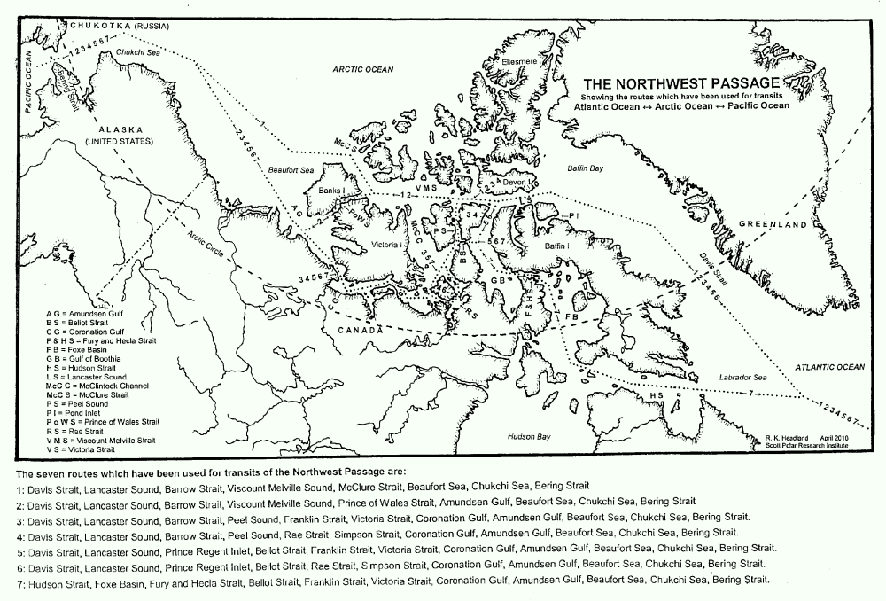
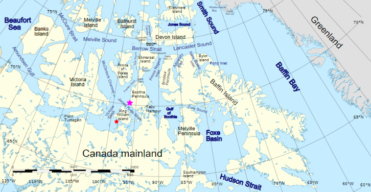
For those of you unfamiliar with the names of the assorted islands and channels of the Canadian Arctic Archipelago here is a map that hopefully helps:
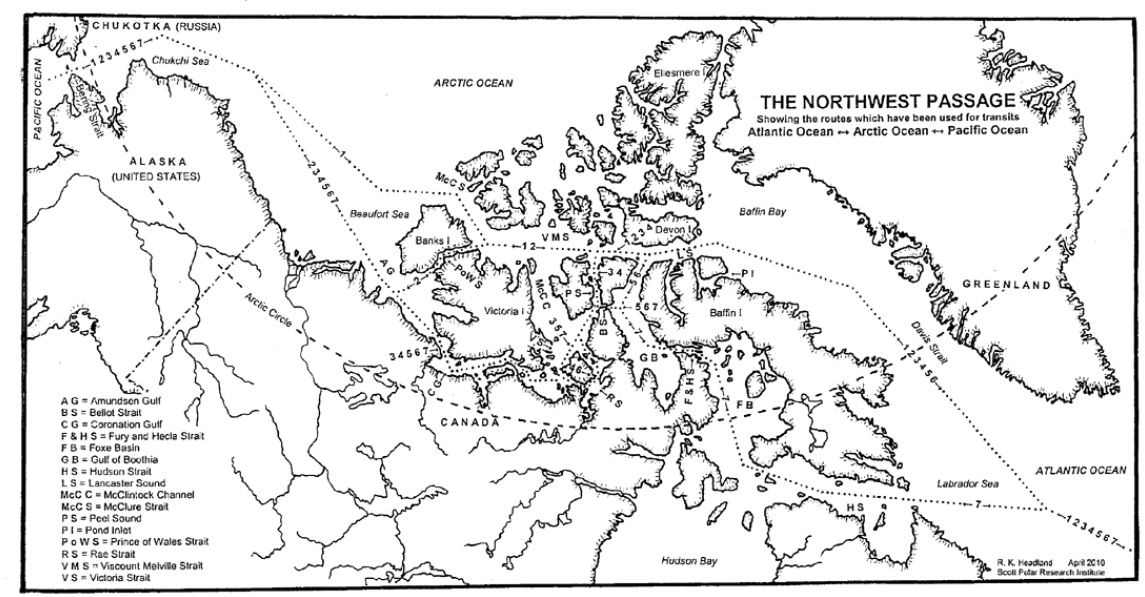
Plus another map detailing the routes through the Canadian Arctic Archipelago that have previously been successfully navigated by vessels large and small:
The sea ice in Lancaster Sound and the Amundsen Gulf is breaking up, and melt ponds are now visible on the fast ice across much of the southern route through the Canadian Arctic Archipelago:
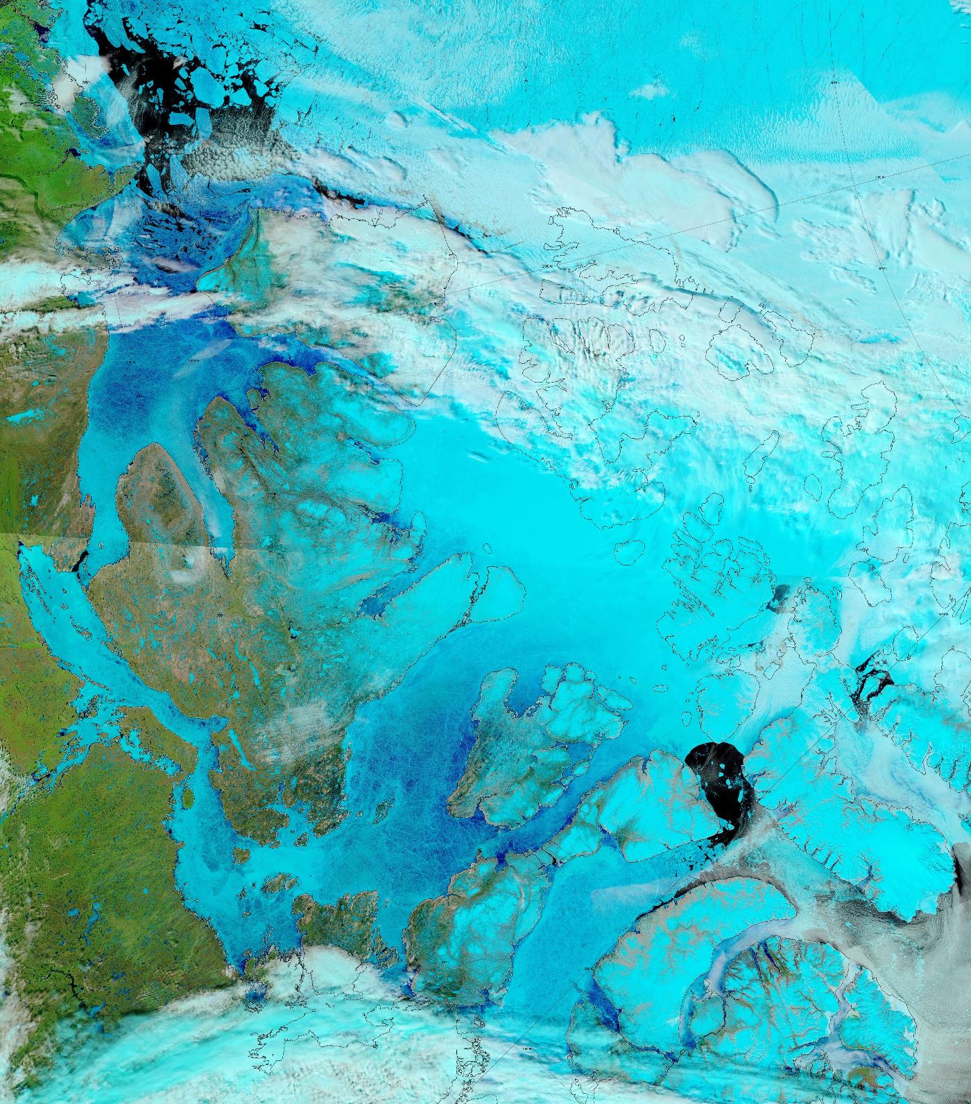
“False colour” image of the Canadian Arctic Archipelago on June 17th from the MODIS instrument on the Terra satellite

The melt ponds previously visible in the Coronation Gulf now appear to have drained:
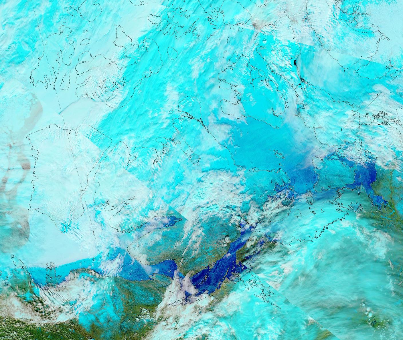
“False colour” image of the Canadian Arctic Archipelago on June 3rd from the MODIS instrument on the Aqua satellite

Looking at 2 dimensional data to begin with, CAA sea ice area is currently in the middle of the AMSR2 era pack:

To get a better feel for what might happen during the coming summer season here too is the state of play in the third dimension, courtesy of the Alfred Wegener Institute’s last combined thickness data of the winter from the Cryosat-2, Sentinel 3 and SMOS satellites:

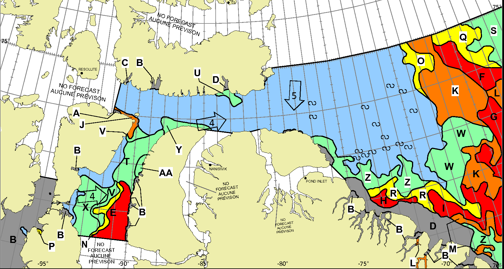
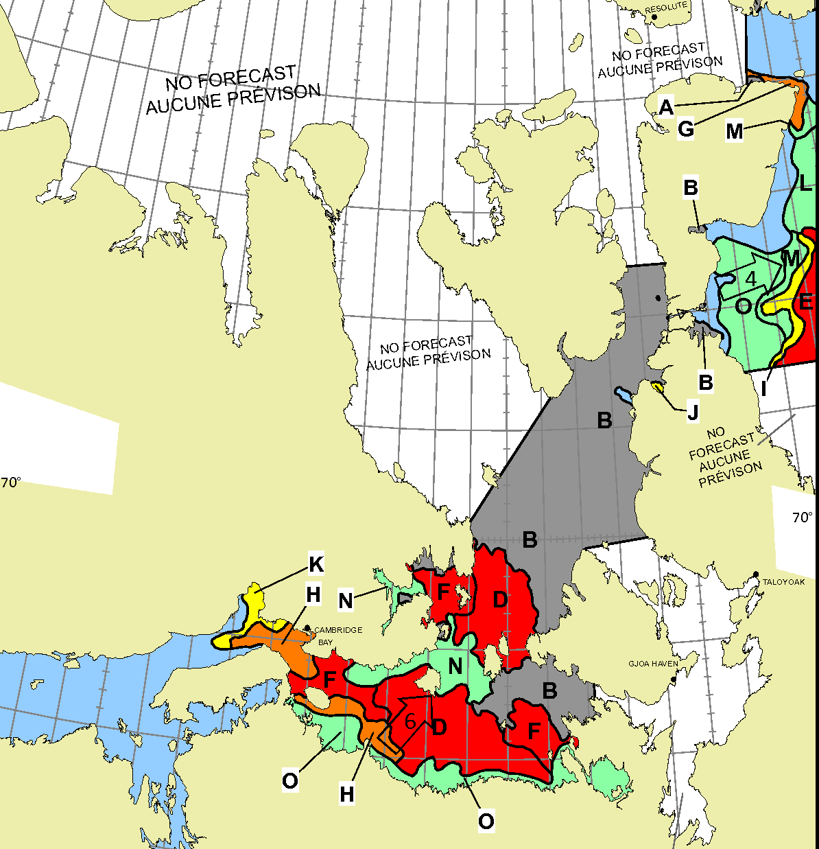
Let’s also take a look at the Canadian Ice Service‘s sea ice “stage of development” charts. Here’s the most recent one for the “Western Arctic”, from June 15th:

There is no old ice anywhere on the southern route, so the stage seems set for the Northwest Passage to open relatively early this summer, with a final “choke point” in the Larsen Sound/Franklin Strait region.

Note that there is a potential fly in the NWP ointment, a recurrence of last year’s winds that blew old ice in the Beaufort Sea close to shore in the Amundsen Gulf during the first half of August!

[Update – July 4th]

The skies over the Canadian Arctic Archipelago were fairly clear yesterday:

“False colour” image of the Canadian Arctic Archipelago on July 3rd from the MODIS instrument on the Aqua satellite

Much of the Coronation Gulf and Lancaster Sound are now free of sea ice. Peel Sound looks as though it will start breaking up in earnest in the not too distant future.

[Update – July 17th]

There was another good view of the CAA from on high yesterday:

“False colour” image of the Canadian Arctic Archipelago on July 3rd from the MODIS instrument on the Aqua satellite

McClure Strait has started to break up, as has the southern half of Peel Sound. From there a hypothetical “small vessel” could hug the coast to Gjoa Haven, then it’s plain sailing all the way to the Amundsen Gulf

Watch this space!

The Northwest Passage in 2024

Some “pleasure craft” are currently heading up the west coast of Greenland en route to the Bering Strait via Lancaster Sound and one of the assorted routes through the Canadian Arctic Archipelago. For those of you unfamiliar with the geography of the Northwest Passage, here are couple of hopefully helpful maps:

Whilst there is still ice blocking the route across Baffin Bay from Greenland, the Canadian Ice Service has already started daily coverage of the heart of the southern route through the Northwest Passage. There’s plenty of open water in Lancaster Sound and low concentration sea ice in Prince Regent Inlet:

Further south there is also open water in the Coronation Gulf, but the fast ice between Peel Sound and King William Island has not yet started breaking up:

This slightly cloudy satellite image of the Canadian Arctic Archipelago also shows that the exit of the northern route via McClure Strait into the Beaufort Sea is already navigable:

Continue reading The Northwest Passage in 2024

Facts About the Arctic in June 2024

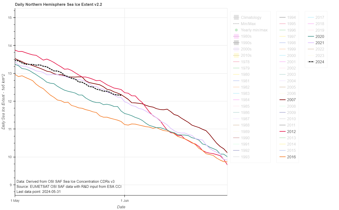
The JAXA/ViSHOP web site is currently down, so here is the current OSI SAF extent graph for the end of May:

2012’s “June cliff” is almost upon us, and if 2024’s current trajectory continues extent will cross above 2012 for the first time since February in a week or so.

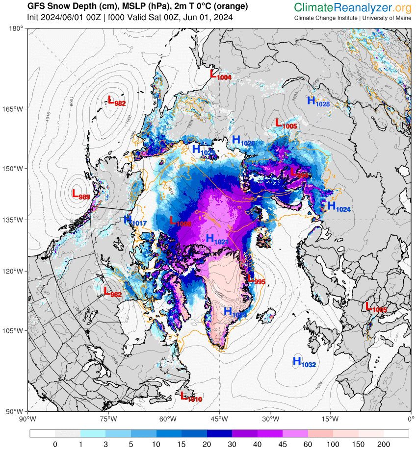
Here’s the GFS model’s current map of snow depth:

Melt ponds are now visible on the ice in the Laptev Sea:

Continue reading Facts About the Arctic in June 2024

Facts About the Arctic in May 2024

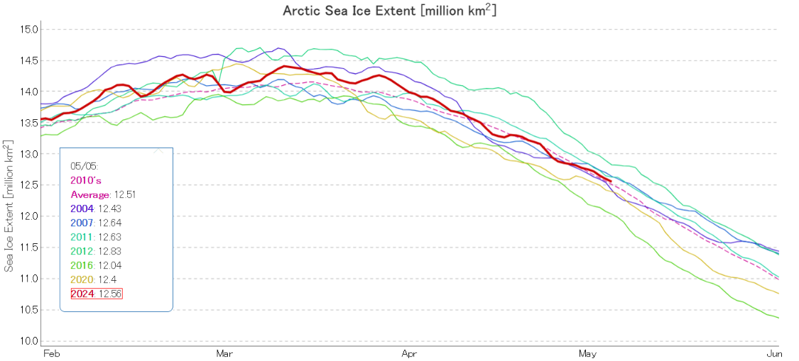
Since a certain “sceptic” has recently been comparing 2024 sea ice extent to “20 years ago”, here’s the current JAXA/ViSHOP extent graph of selected years, including 2004:

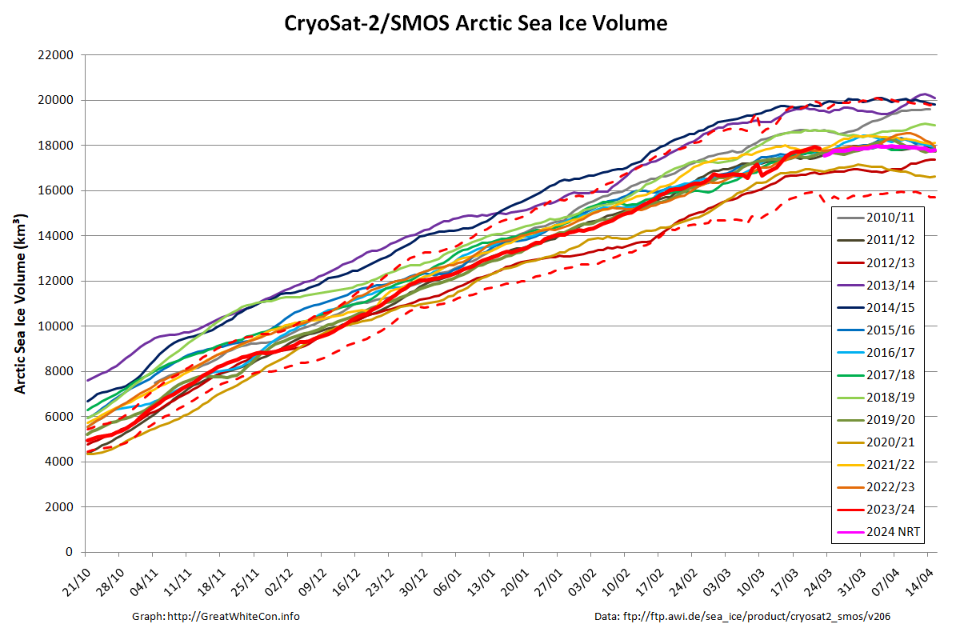
The CryoSat-2/SMOS merged Arctic sea ice volume graph finishes on April 15th, but older data is being reanalysed and here is the latest version:

The gap in the near real time data due to the problem with the SMOS satellite during the first half of March has been filled in, but the result doesn’t look very convincing to say the least!

The PIOMAS gridded thickness data for April 2024 is now available. Here’s the end of month volume graph:

Continue reading Facts About the Arctic in May 2024

The Northwest Passage in 2023

Prompted by a comment by Tom in the June open thread, the time has evidently come to open the 2023 Northwest Passage passage thread. First of all let’s get our bearings with the help of this map of the area:

and another map detailing the routes through Canadian Arctic Archipelago that have previously been successfully traversed:

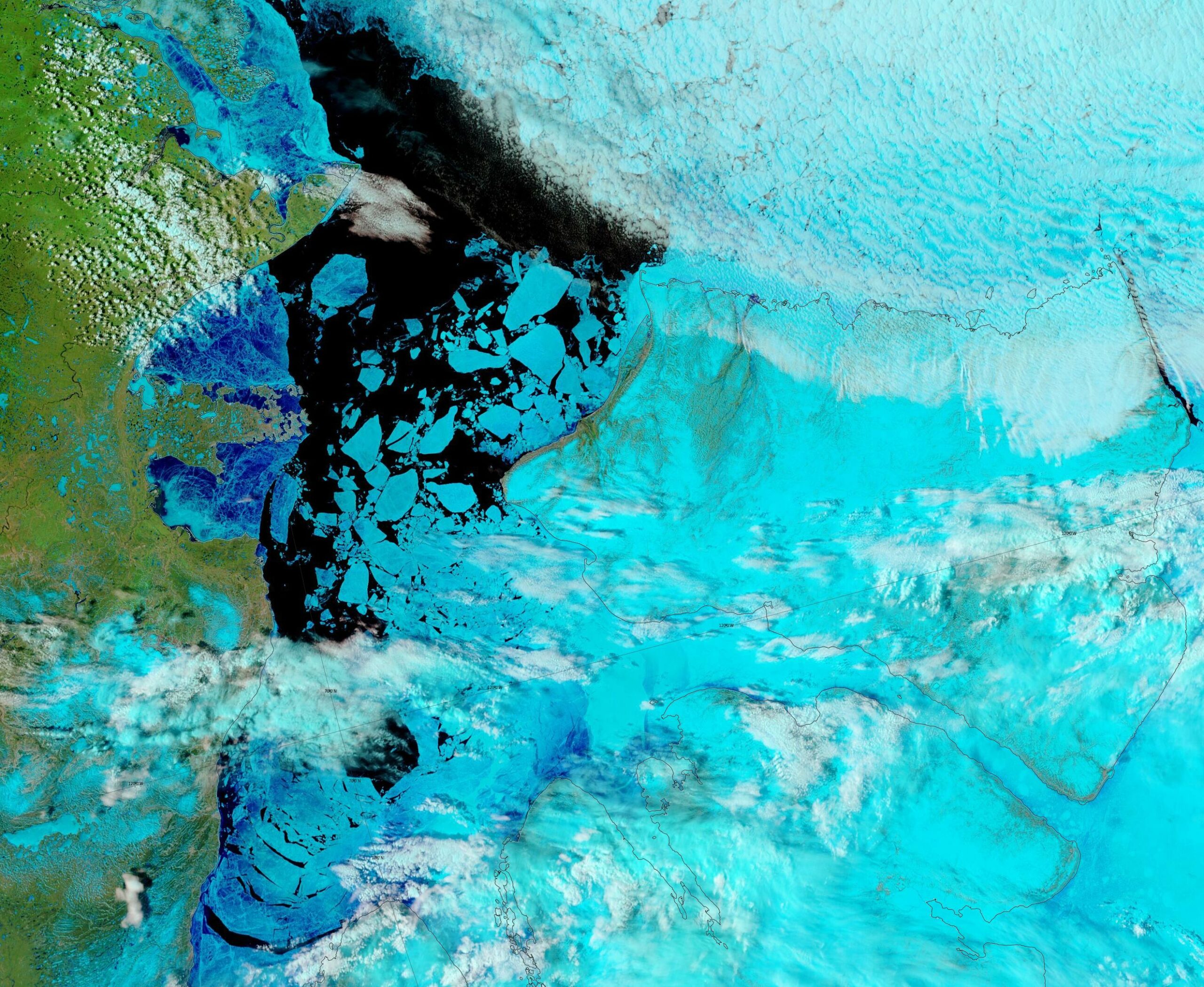
As our starter for ten for 2023, there is already plenty of open water in the Amundsen Gulf, together with plenty of melt ponding on the remaining fast ice in Franklin and Darnley Bays:

“False colour” image of the Amundsen Gulf on June 3rd from the MODIS instrument on the Terra satellite
Continue reading The Northwest Passage in 2023

Facts About the Arctic in May 2023

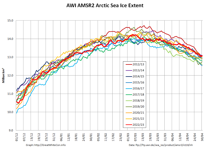
At the beginning of May AWI’s high resolution AMSR2 extent metric is at the top of the historical range:

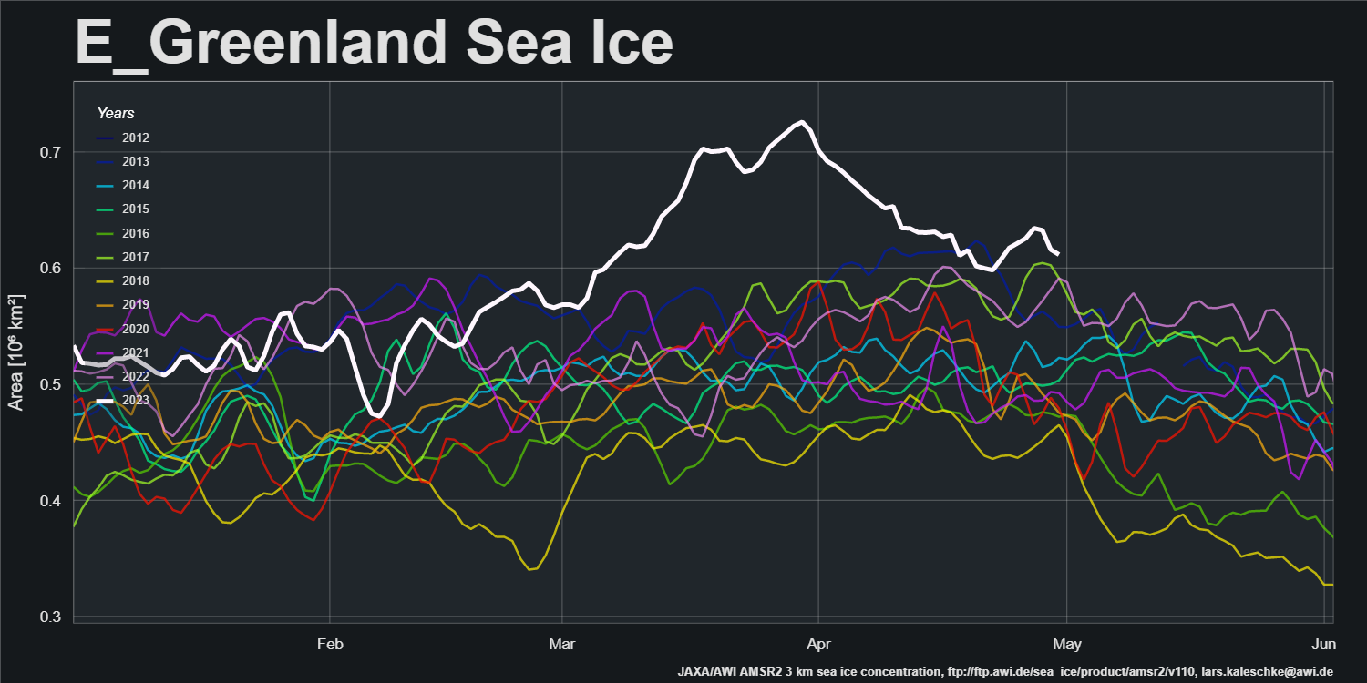
After a period of melt in the East Greenland Sea, export of sea ice from the Central Arctic via the Fram Strait has increased recently:

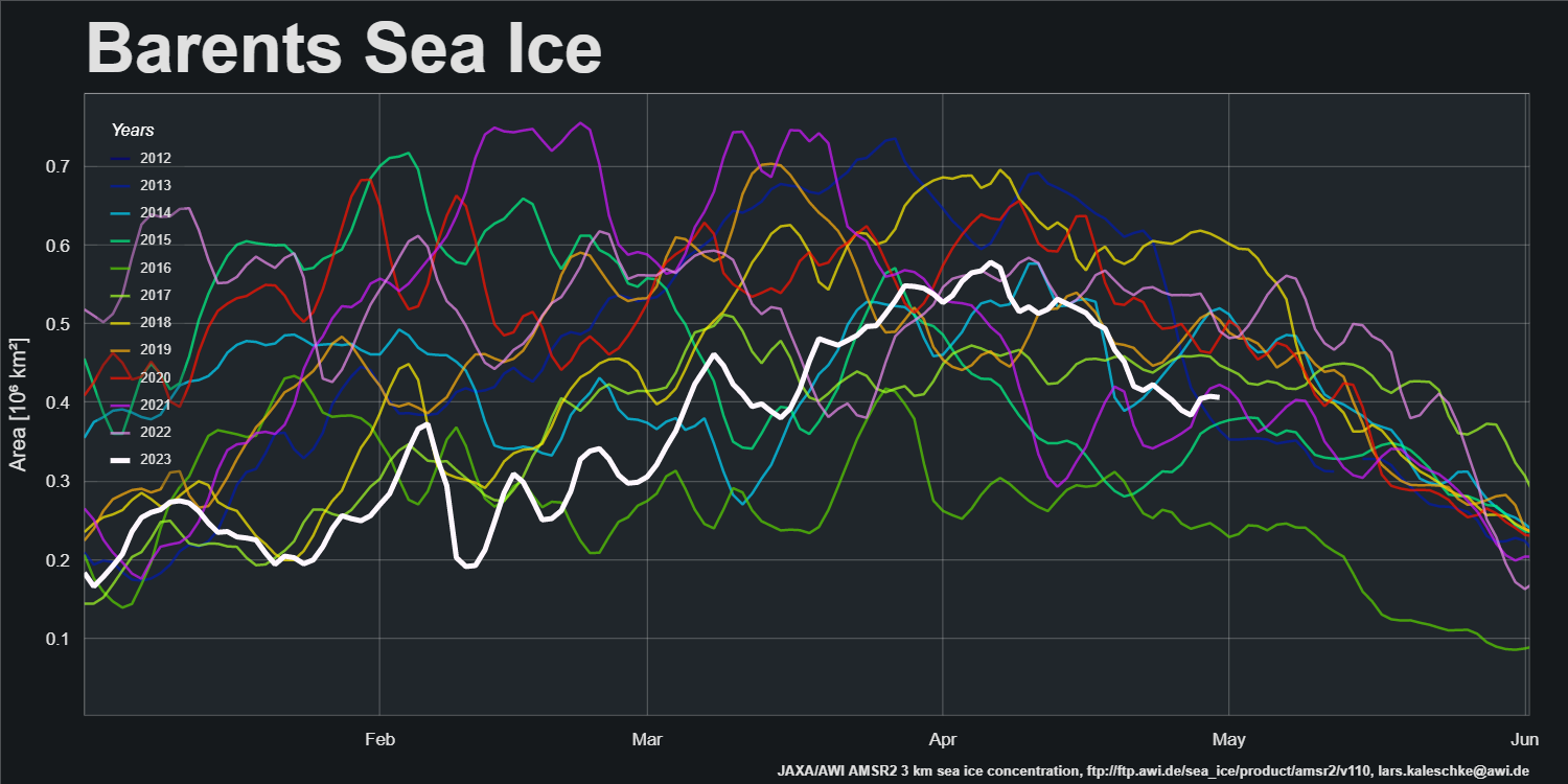
Sea ice area in the Barents Sea peaked in the first week of April and has declined steadily since then:

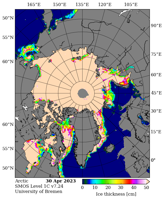
SMOS data is flowing again, and the gaps have been filled. Here’s the final pre melt ponding map of the spring:

It reveals large areas of thin ice that have recently developed in the Kara Sea. Here’s a pseudo colour glimpse of the region through the clouds:

Continue reading Facts About the Arctic in May 2023