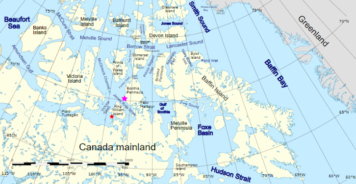
For those of you unfamiliar with the names of the assorted islands and channels of the Canadian Arctic Archipelago here is a map that hopefully helps:
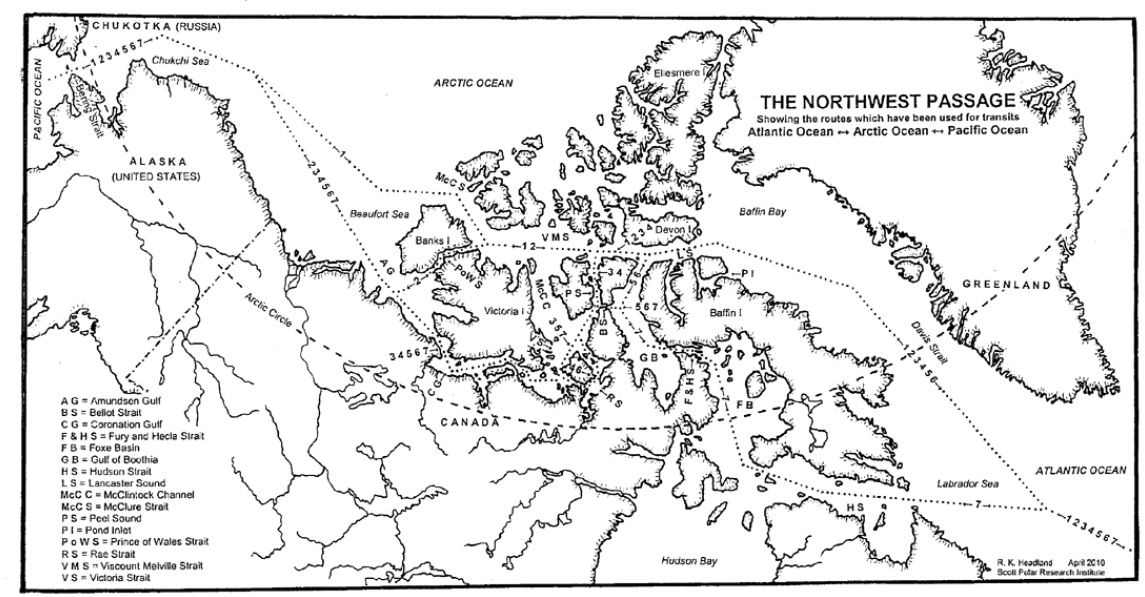
Plus another map detailing the routes through the Canadian Arctic Archipelago that have previously been successfully navigated by vessels large and small:
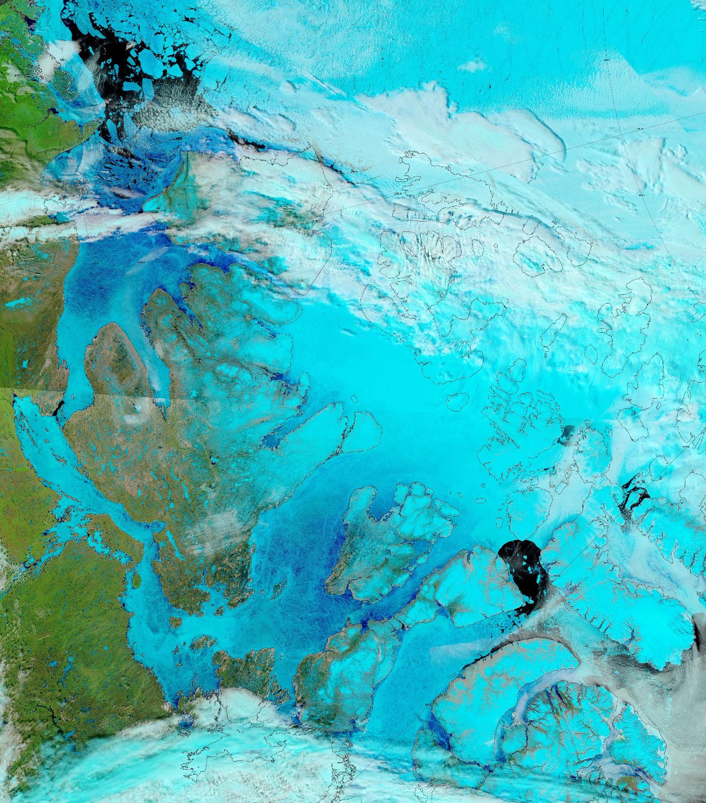
The sea ice in Lancaster Sound and the Amundsen Gulf is breaking up, and melt ponds are now visible on the fast ice across much of the southern route through the Canadian Arctic Archipelago:
“False colour” image of the Canadian Arctic Archipelago on June 17th from the MODIS instrument on the Terra satellite
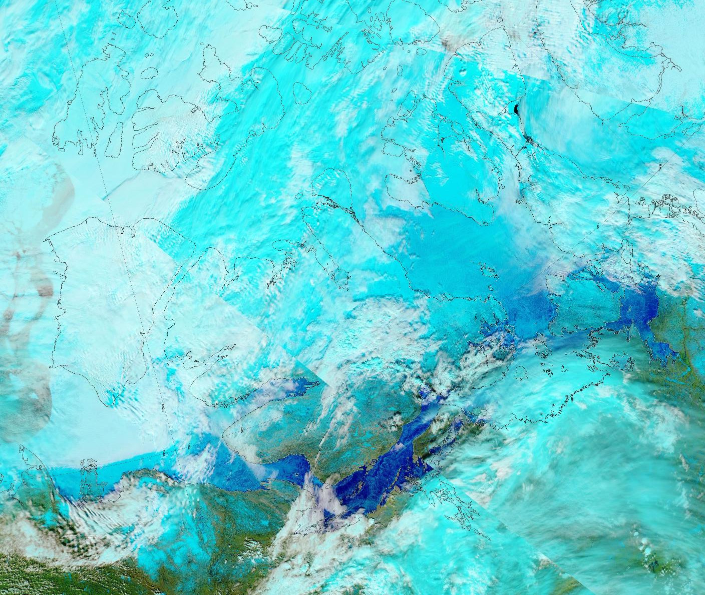
The melt ponds previously visible in the Coronation Gulf now appear to have drained:
“False colour” image of the Canadian Arctic Archipelago on June 3rd from the MODIS instrument on the Aqua satellite
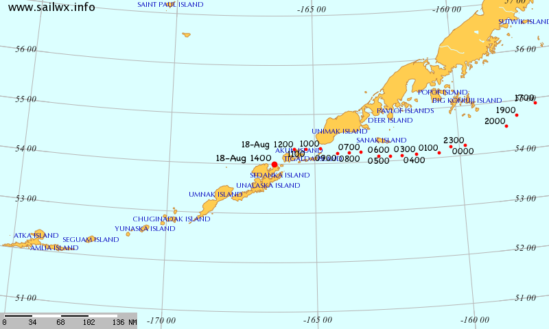
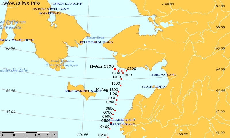
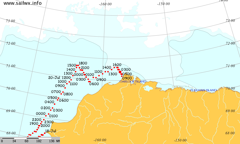
After a voyage through the Northwest Passage untroubled by sea ice in 2016, the cruise liner Crystal Serenity has set sail for the Bering Strait and beyond once again. The SailWX tracking map shows her passing the Aleutian Islands:
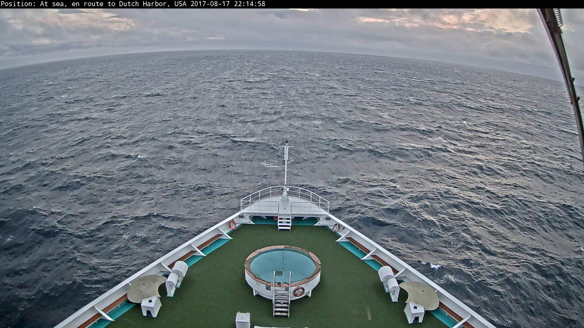
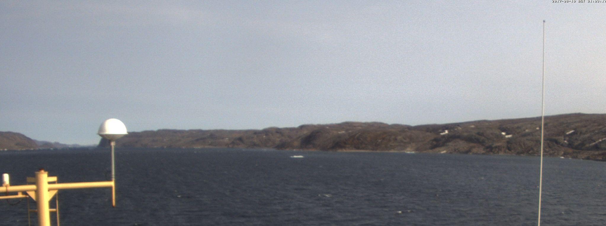
and although there is of course no sea ice to be seen yet her forward facing webcam reveals Dutch Harbor as her next port of call:
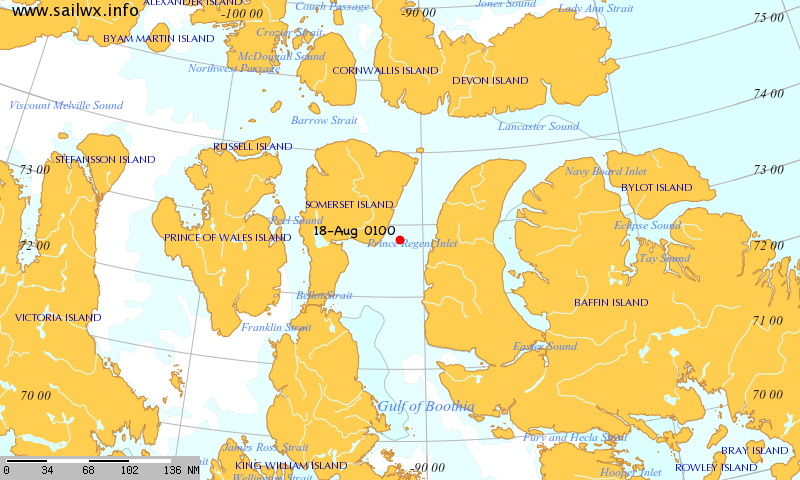
Much like last year, it looks as though the British icebreaker Ernest Shackleton is on its way to assist her:
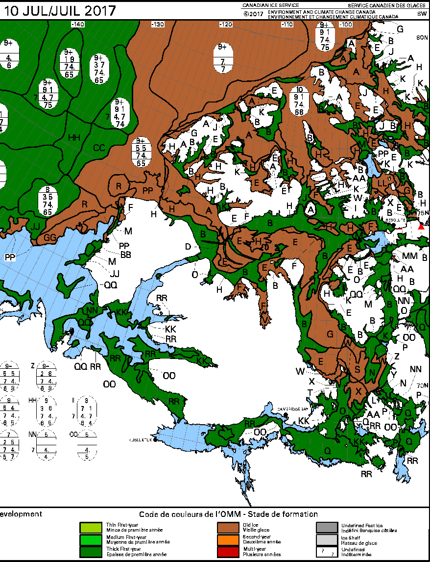
Having an icebreaker in attendance might well prove to be essential this year, since, according to the Canadian Ice Service, Larsen Sound is currently still full of sea ice:
[Edit – August 21th]
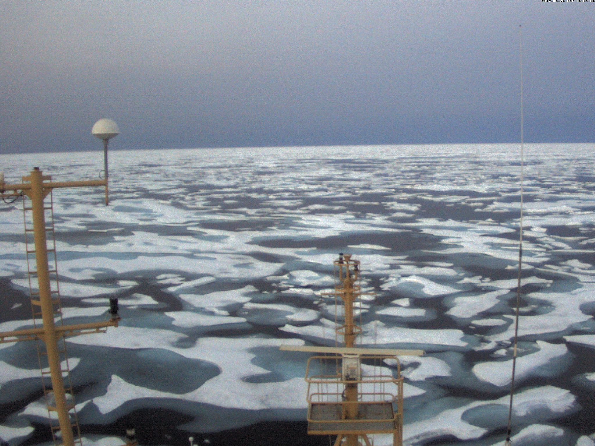
Heading westwards to meet Crystal Serenity, this is what met the RRS Ernest Shackleton in Franklin Strait:
Meanwhile Crystal Serenity is about to pass through the (ice free!) Bering Strait:
[Edit – August 29th]
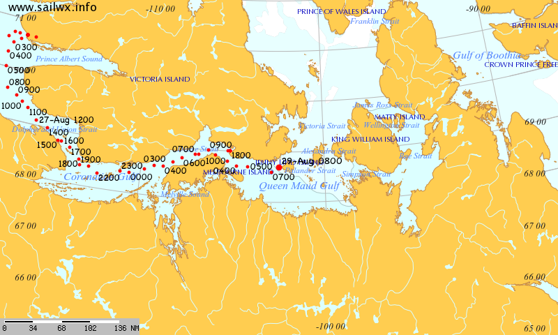
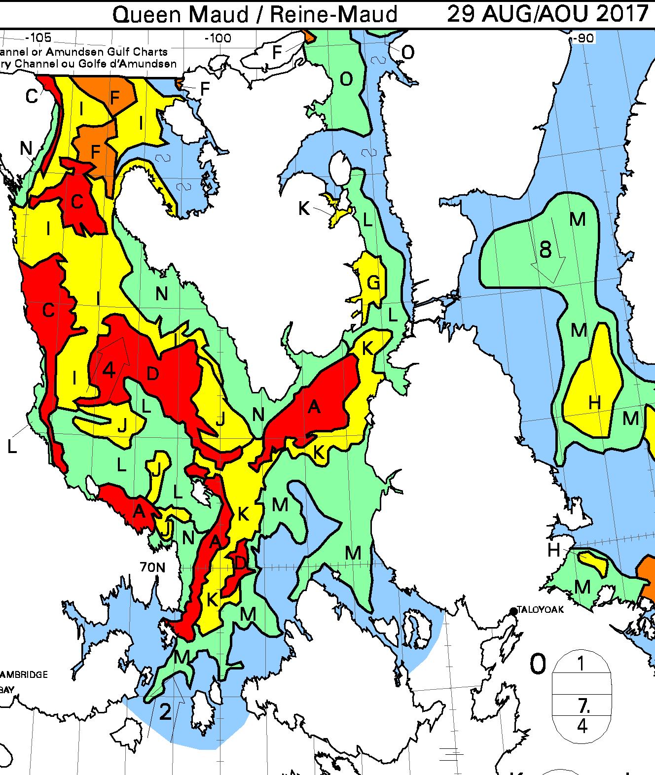
Crystal Serenity is now heading through Queen Maud Gulf:
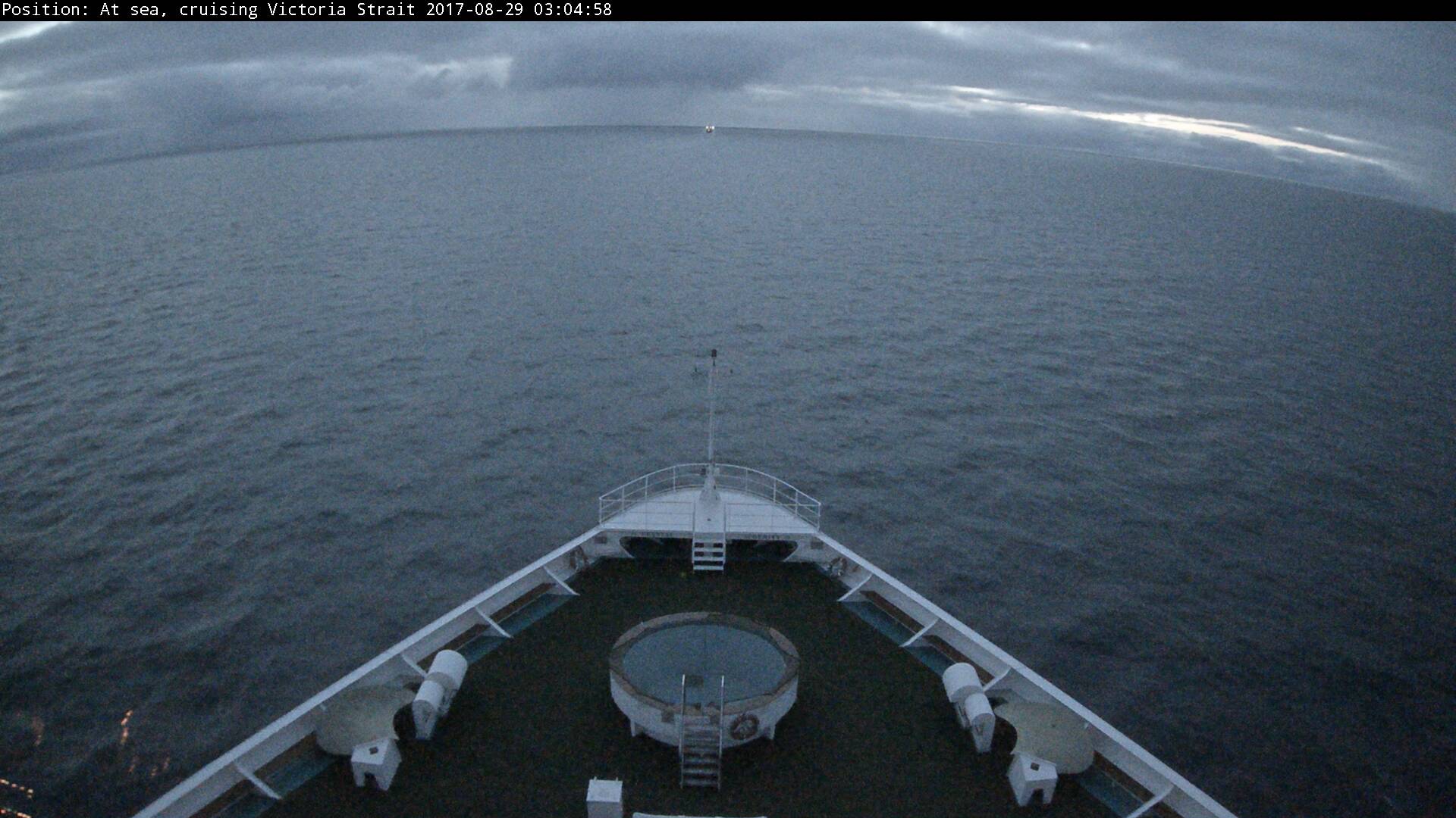
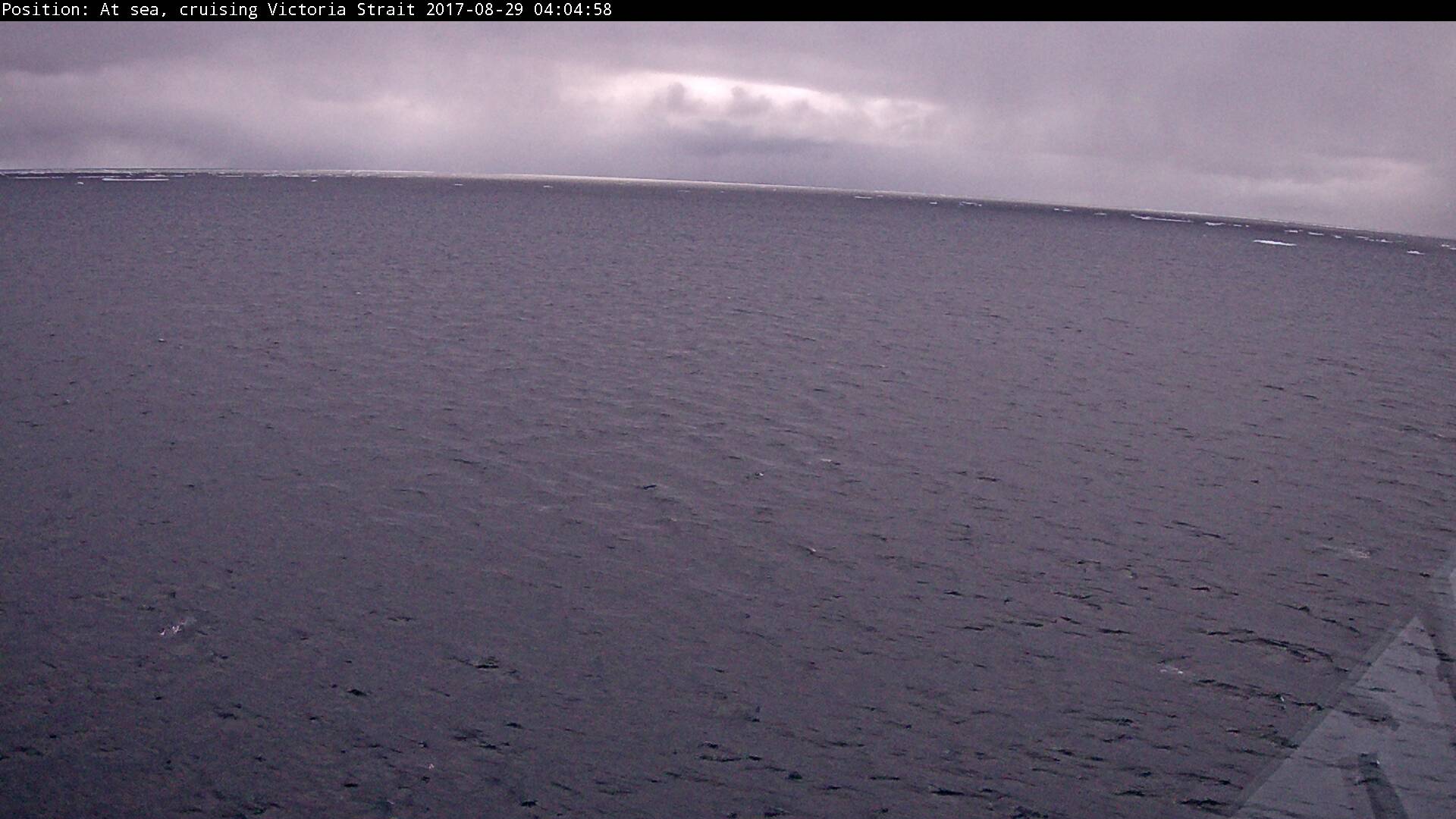
but there is as yet no sign of any sea ice:
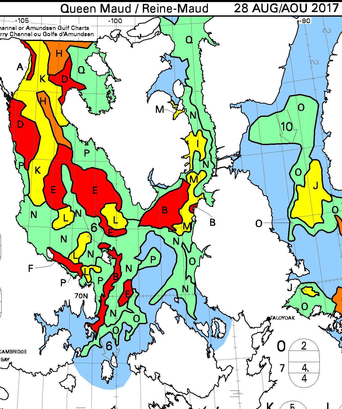
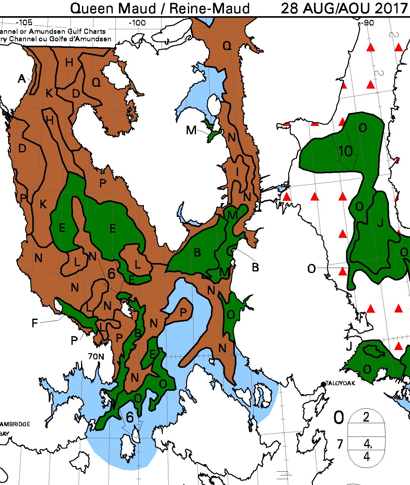
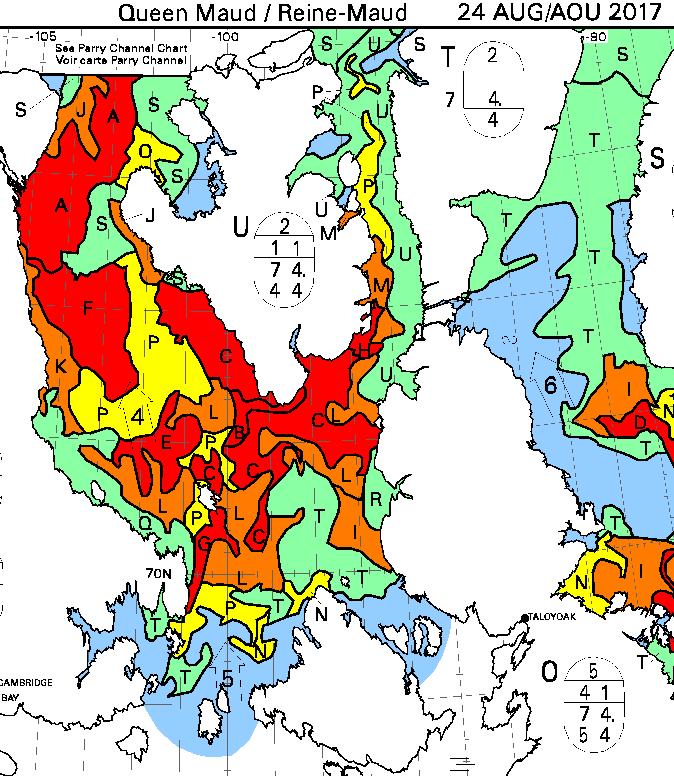
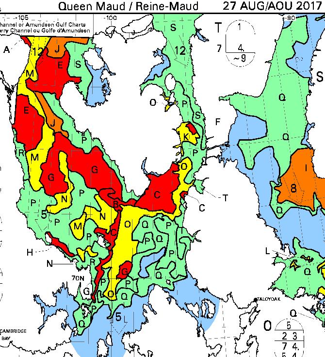
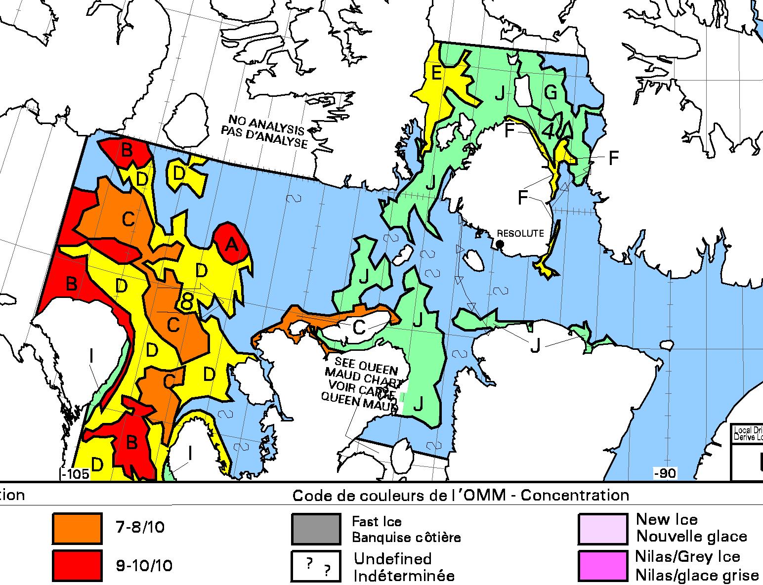
However some should come into view later today. Here are the latest Canadian Ice Service sea ice charts of the area:
[Edit – August 29th 11:30]
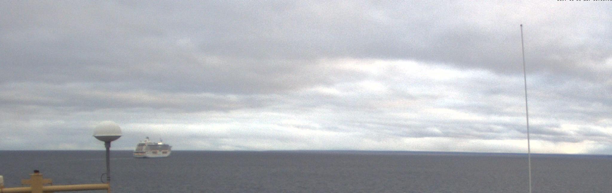
Crystal Serenity has spotted some sea ice!
[Edit – August 29th 17:30]
Crystal Serenity and Ernest Shackleton are well in amongst the ice now, as are the former’s passengers:
[Edit – August 30th]
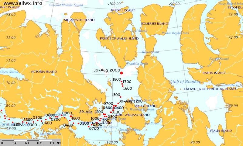
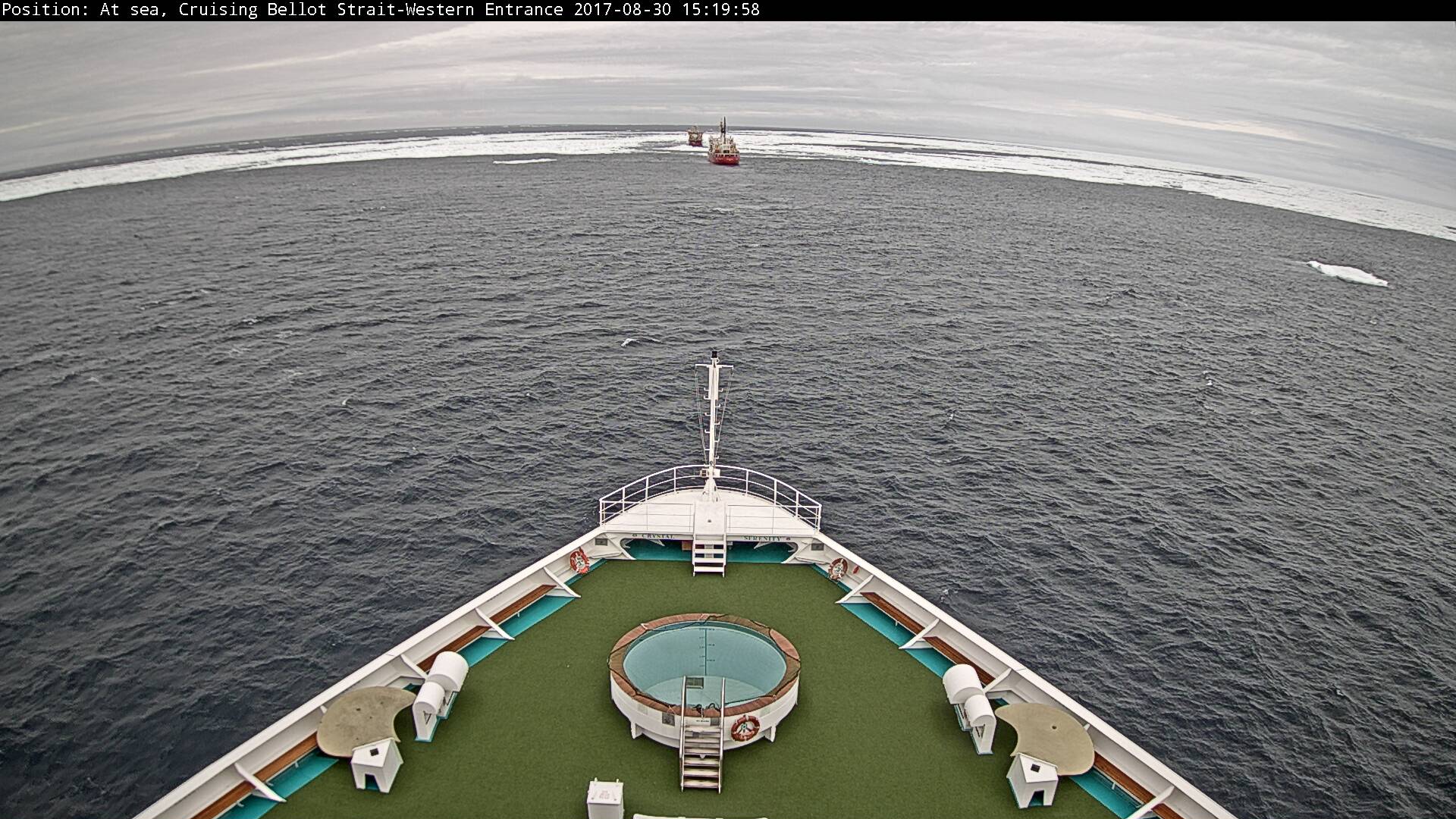
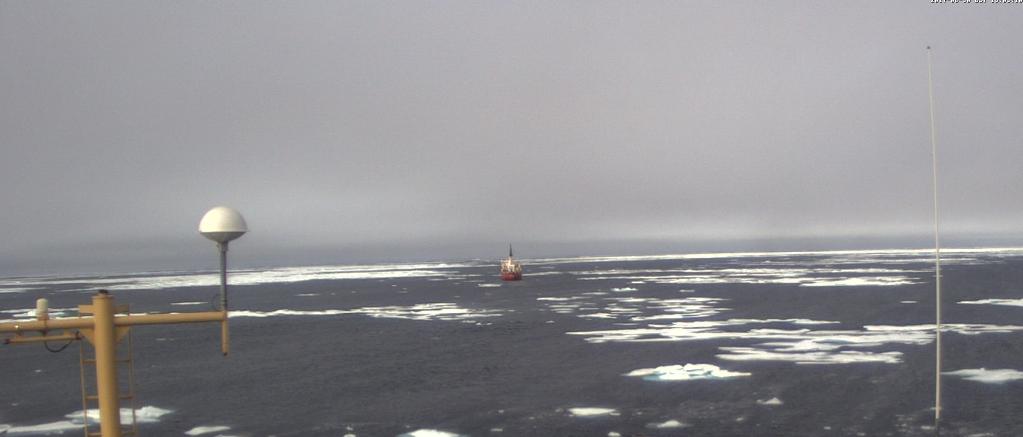
Crystal Serenity is now entering the Franklin Strait in the wake of TWO icebreakers:
The time has come to start speculating about if, and when, the Northwest Passage will become navigable for the host of small vessels eager to traverse it this summer. The west and east entrances are clearing early this year. Lancaster Sound and Prince Regent inlet already reveal only a few area of white amongst the deep blue open water:
NASA Worldview “true-color” image of Lancaster Sound and Prince Regent Inlet on July 8th 2017, derived from the MODIS sensor on the Aqua satellite
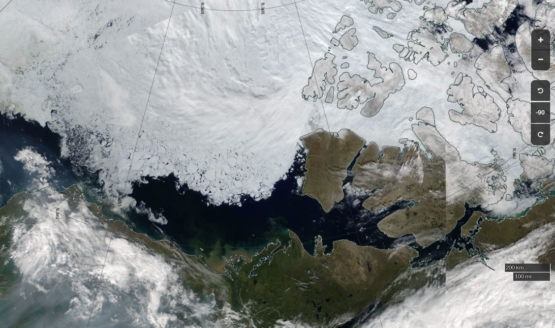
To the west the route is already opening up all the way from the Chukchi Sea to Cambridge Bay:
NASA Worldview “true-color” image of the Beaufort Sea on July 12th 2017, derived from the MODIS sensor on the Terra satellite
The problems on the southern route seem likely to arise in the central section this year, where far more old ice is present this year than in 2016:
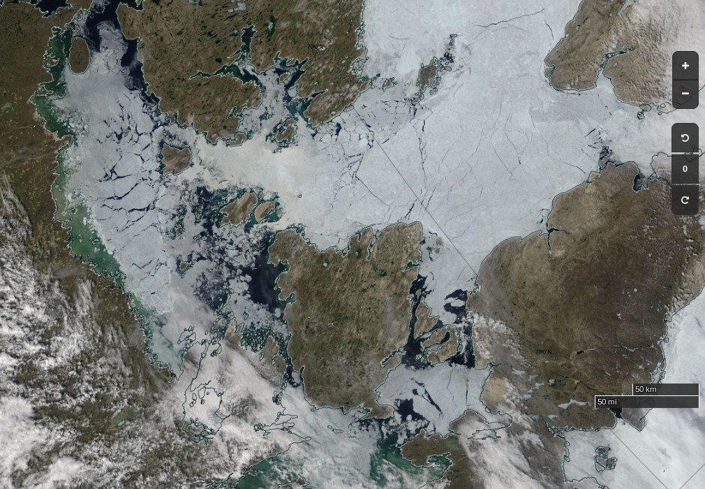
The remaining sea ice in Queen Maud Gulf doesn’t look like it will last long, but the ice in Victoria Strait and Larsen Sound is made of much sterner stuff:
NASA Worldview “true-color” image of Victoria Strait and Larsen Sound on July 10th 2017, derived from the MODIS sensor on the Terra satellite
The cruise liner Crystal Serenity is anticipating navigating those waters once again this year, on August 29th. However much smaller craft are already heading for the Northwest Passage. Celebrate and Alkahest are already sailing north along the west coast of Greenland. Meanwhile Yvan Bourgnon is due to depart Nome, Alaska tomorrow, sailing his catamaran single handed in the opposite direction.
The crew of the Coast Guard Cutter Maple, a 225-foot seagoing buoy tender home ported in Sitka, Alaska, departed [July 12th] on a historic voyage through the Northwest Passage.
This summer marks the 60th anniversary of the three Coast Guard cutters and one Canadian ship that convoyed through the Northwest Passage. The crews of the U.S. Coast Guard Cutters Storis, SPAR and Bramble, along with the crew of the Canadian ice breaker HMCS Labrador, charted, recorded water depths and installed aids to navigation for future shipping lanes from May to September of 1957. All four crews became the first deep-draft ships to sail through the Northwest Passage, which are several passageways through the complex archipelago of the Canadian Arctic.
The crew of the cutter Maple will make a brief logistics stop in Nome, Alaska, to embark an ice navigator on its way to support marine science and scientific research near the Arctic Circle. The cutter will serve as a ship of opportunity to conduct scientific research in support of the Scripps Institution of Oceanography.
The Maple crew will deploy three sonographic buoys that are used to record acoustic sounds of marine mammals. A principal investigator with the University of San Diego embarked aboard the cutter will analyze the data retrieved from the buoys.
The Canadian Coast Guard Ship Sir Wilfrid Laurier will rendezvous with the Maple later this month to provide icebreaking services as the Maple makes it way toward Victoria Strait, Canada. The Maple has a reinforced hull that provides it with limited ice breaking capabilities similar to Coast Guard 225-foot cutters operating on the Great Lakes.
There doesn’t seem to be any up to date tracking information for the Maple, but CCGS Sir Wilfrid Laurier has recently arrived off Utqiaġvik (Barrow as was):
[Edit – August 18th]
Another article by Chris Mooney in the Washington Post includes this image of the eastern entrance to Bellot Strait on August 11th:
According to Chris:
After we’d passed through safely, Claude Lafrance, the ship’s commanding officer, took some time to explain how the strait worked with the help of a navigational chart. In the process, he lent credence to some of the observations made by Larsen over 70 years ago, while also explaining how modern knowledge has made navigating it safe with a proper tidal understanding.
The essence is that depending on when you are in Bellot Strait, the waters can be flowing either westward or eastward at and around high or low tide, respectively. So timing your crossing makes a great deal of difference.
The danger is that if you’re coming from the west (as we were) with the current to your back, you can be moving too fast, and have difficulty steering your vessel as you approach rocks at the end of the strait.
“We always want to go through where it’s more difficult, with the current against you, because it’s a lot easier to control the movement of your ship,” Lafrance said.
Therefore, the two-hour wait was quite intentional: The CCGS Amundsen stayed put until the tide began to shift and the waters to flow back westward, in effect neutralizing the current. Then the ship steamed out easily. “We just passed at the ideal time to go through,” Lafrance said.
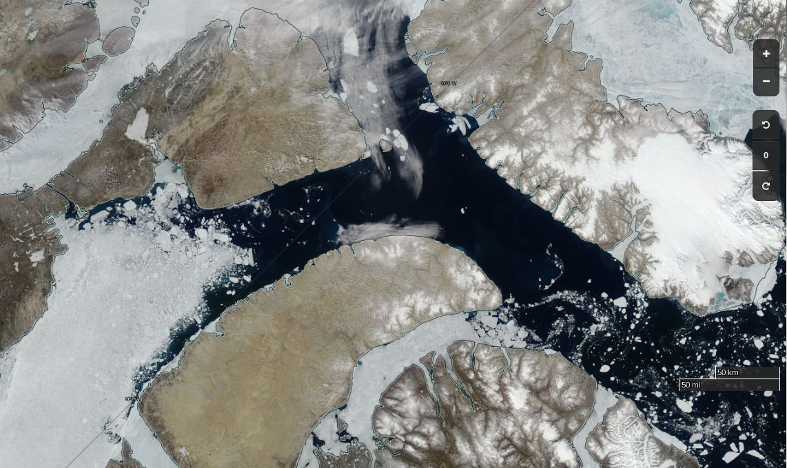
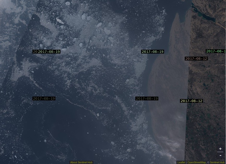
Here’s Sentinel 2A’s view of what he should expect to see in Larsen Sound after emerging at the other end:
[Edit – August 21st]
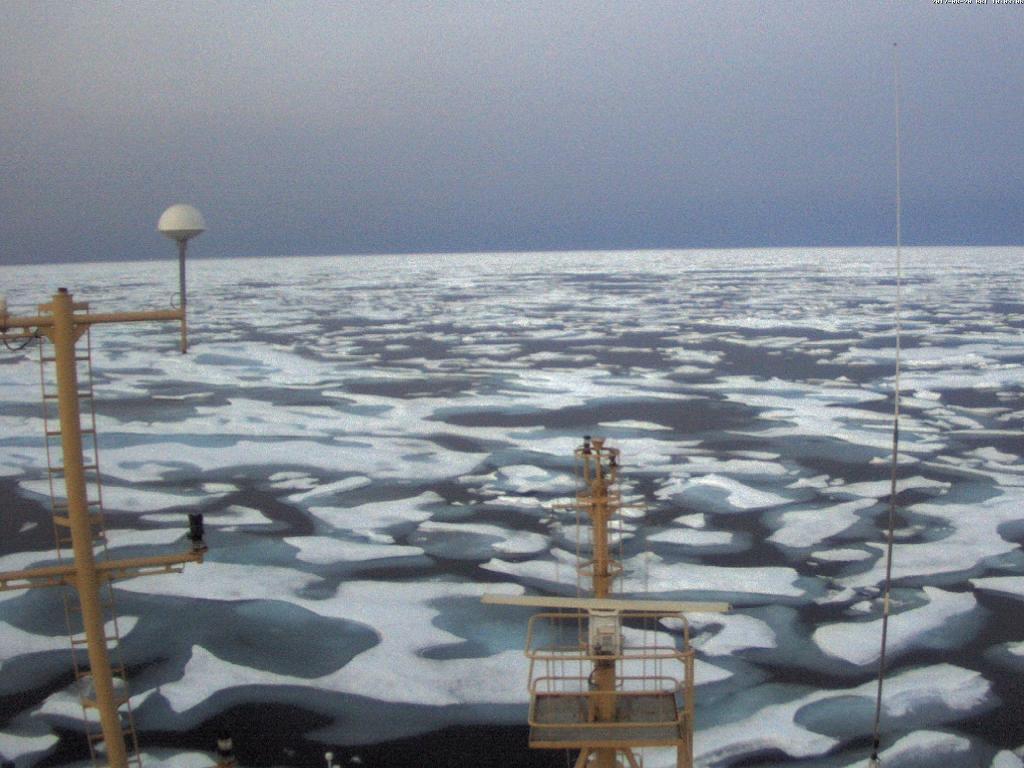
From the RRS Ernest Shackleton in Franklin Strait or thereabouts:
[Edit – August 22nd]
From the C3 expedition, also in the Franklin Strait area by the look of things:
Yesterday, we broke through ice that was two metres thick. Thank you to the Canadian Ice Service for ensuring our safe passage! #CanadaC3pic.twitter.com/2nCgalwPOo
The latest CIS ice chart reveals a circuitous route via McClintock Channel that is ALMOST <= 6/10 concentration. Meanwhile Larsen Sound is still refusing to open up for the imminent arrival of the Crystal Serenity:
[Edit – August 27th]
At long last the CIS concentration map reveals a <= 6/10 concentration path along the entire southern route via Bellot Strait:
[Edit – August 29th]
It is now possible to squeeze through Roald Amundsen’s route through the Northwest Passage without encountering over 6/10 concentration sea ice:
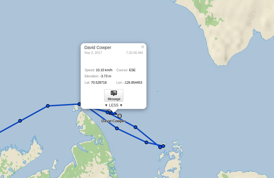
David Scott Cowper sought shelter for Polar Bound in the welcoming arms of Booth Island for a couple of days. Now they’re off again and have taken another close look at Cape Bathurst, but which route will they take now?
[Edit – September 10th]
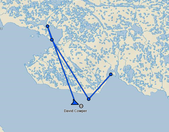
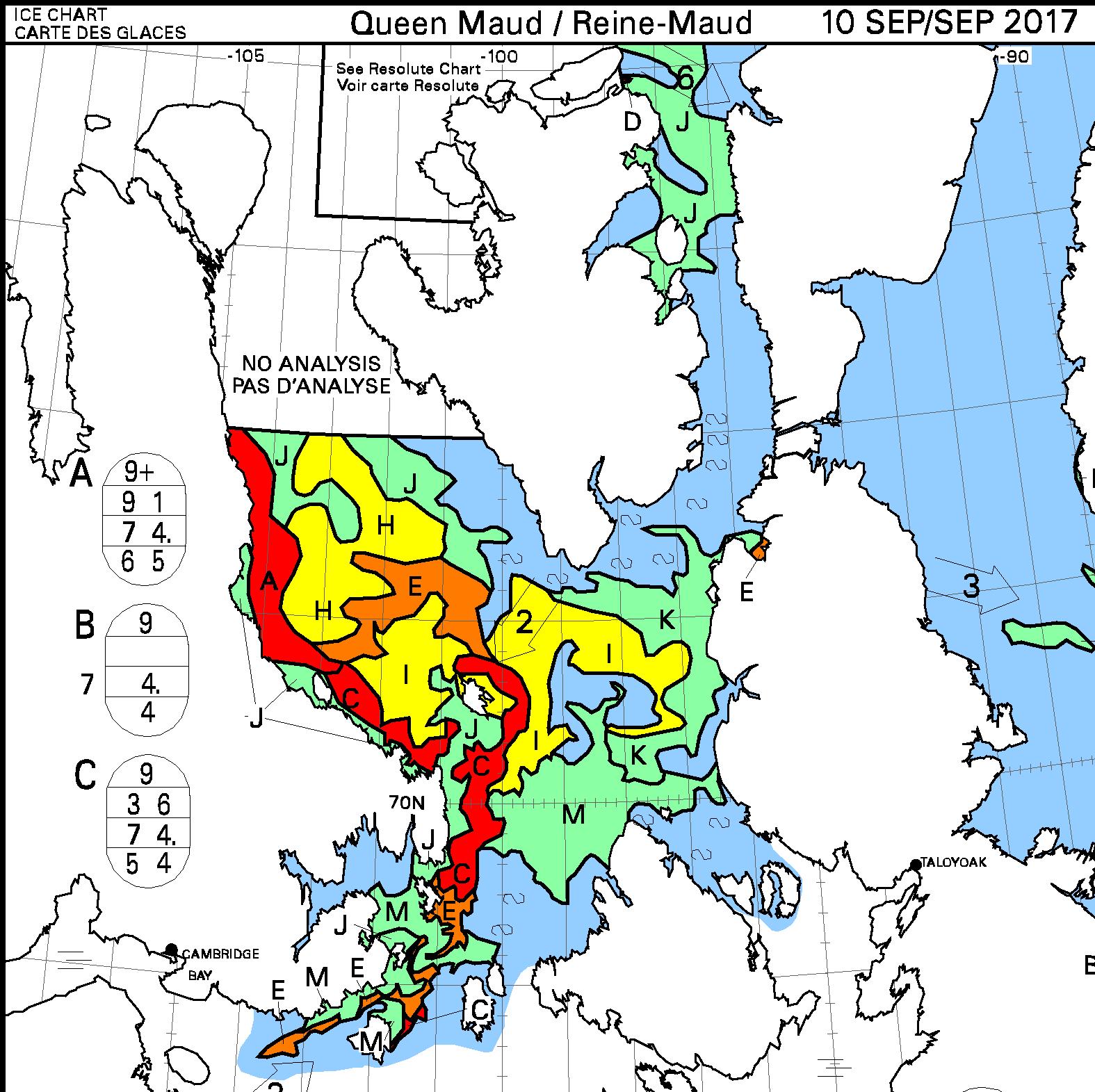
David Scott Cowper has left Cambridge Bay in Polar Bound and is heading east:
here’s what lies ahead of him:
Watch this space!
This website uses cookies to improve your experience. We'll assume you're ok with this, but you can opt-out if you wish. Cookie settingsACCEPT
Privacy & Cookies Policy
Privacy Overview
This website uses cookies to improve your experience while you navigate through the website. Out of these, the cookies that are categorized as necessary are stored on your browser as they are essential for the working of basic functionalities of the website. We also use third-party cookies that help us analyze and understand how you use this website. These cookies will be stored in your browser only with your consent. You also have the option to opt-out of these cookies. But opting out of some of these cookies may affect your browsing experience.
Necessary cookies are absolutely essential for the website to function properly. This category only includes cookies that ensures basic functionalities and security features of the website. These cookies do not store any personal information.
Any cookies that may not be particularly necessary for the website to function and is used specifically to collect user personal data via analytics, ads, other embedded contents are termed as non-necessary cookies. It is mandatory to procure user consent prior to running these cookies on your website.