Monthly Archives: May 2026

Facts About the Arctic in May 2026

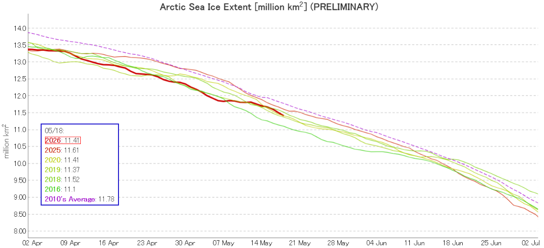
JAXA have updated their visualisations of Arctic sea ice extent data. The “traditional” 2 day average graph is now labelled “preliminary”, and currently shows 2026 in a tie with 2020 for third lowest for the date:

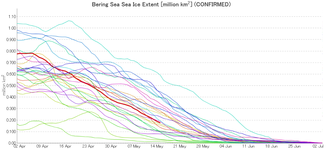
5 day averaged “confirmed” data is also available, including regional graphs. By way of example here’s JAXA’s latest extent graph for the Bering Sea, dated May 15th:

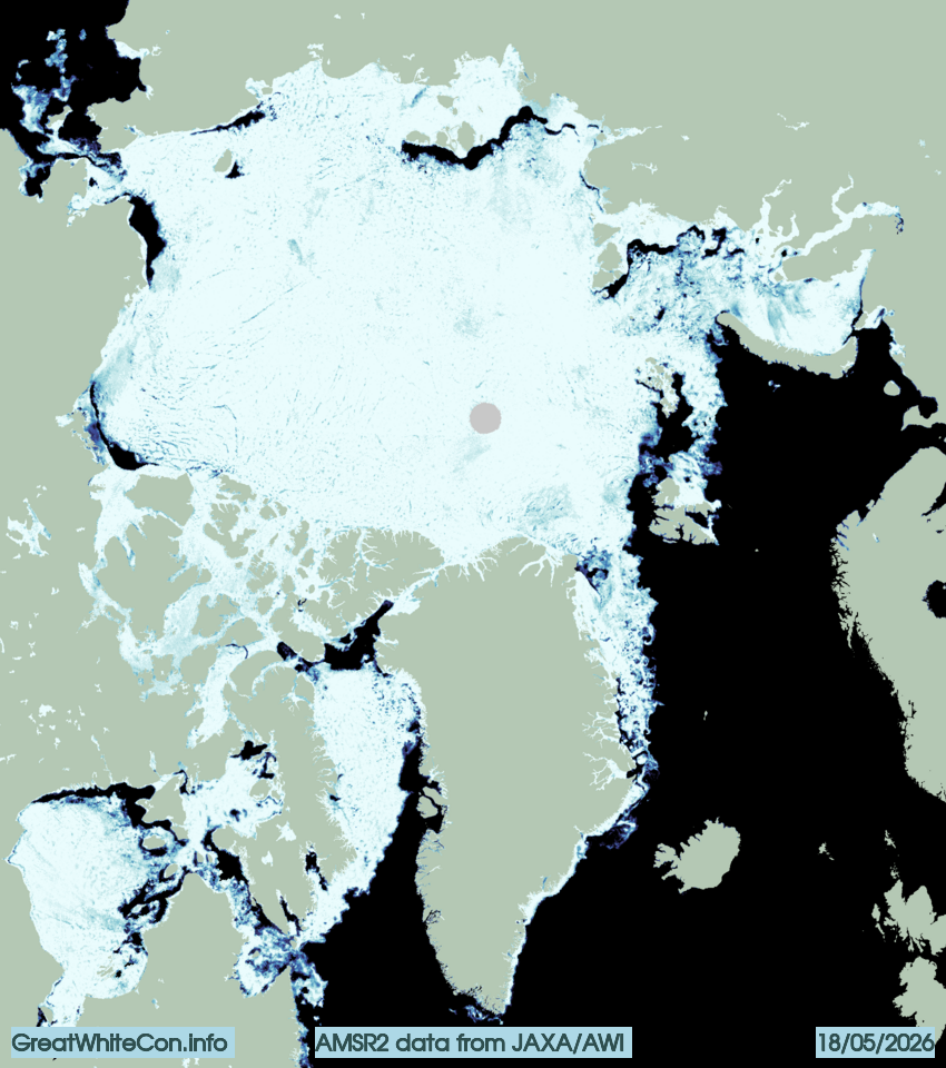
The Alfred Wegener Institute’s sea ice concentration data reveals open water in the Beaufort, Chukchi, East Siberian and Laptev Seas:

In the eastern Beaufort Sea albedo is further reduced by the waters of the Mackenzie River encroaching upon the fast ice off the river delta:

“False colour” image of the Mackenzie Delta on May 17th from the MODIS instrument on the Terra satellite

The monthly summary of atmospheric conditions over the Arctic during April 2026 reveal part of the reason for the open water. A persistent area of high pressure over the Beaufort Sea:

The NSIDC monthly average extent graph for April shows 2026 second lowest behind 2019:

Watch this space!