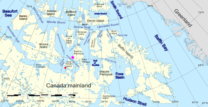
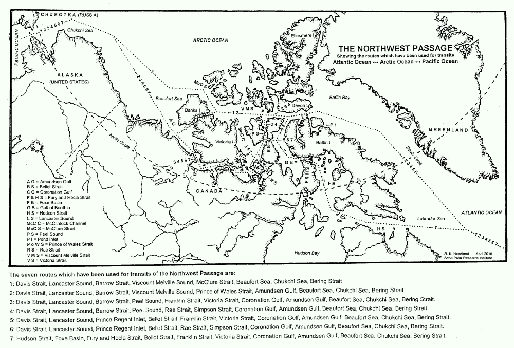
For those of you unfamiliar with the names of the assorted islands and channels of the Canadian Arctic Archipelago here is a map that hopefully helps:
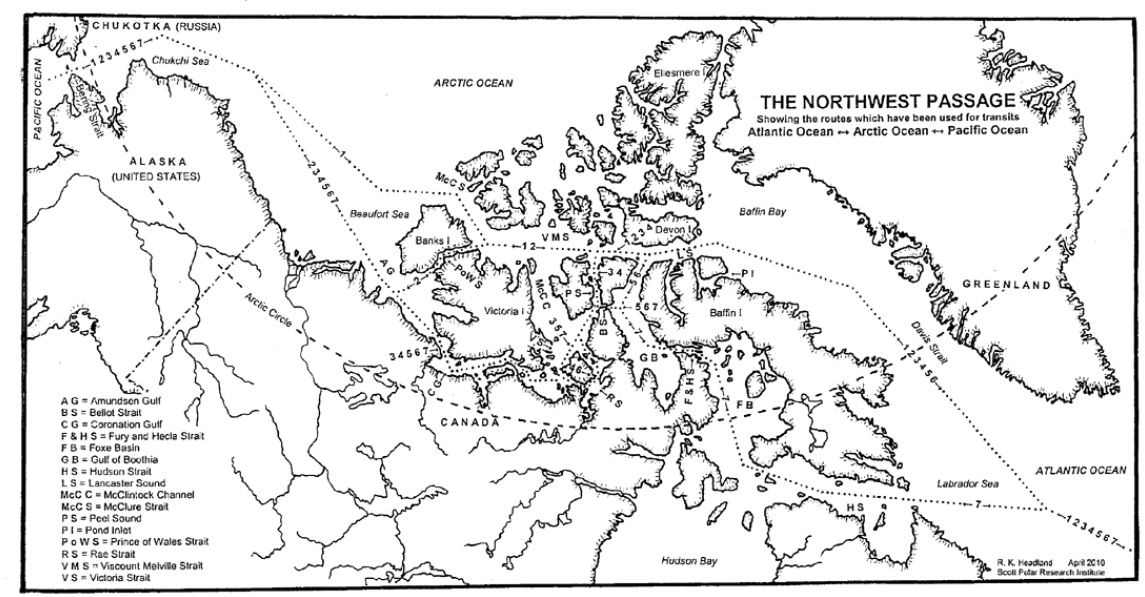
Plus another map detailing the routes through the Canadian Arctic Archipelago that have previously been successfully navigated by vessels large and small:
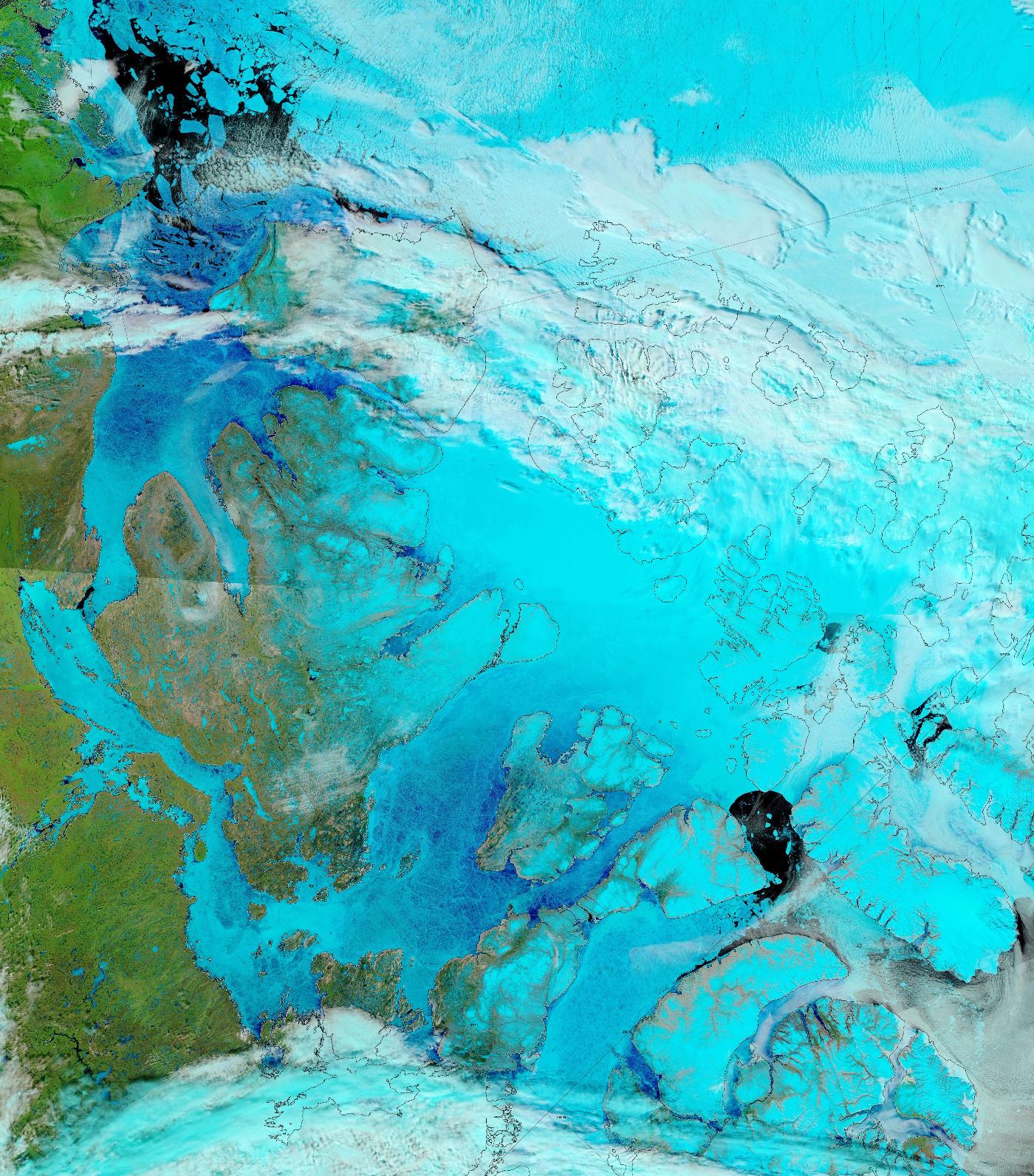
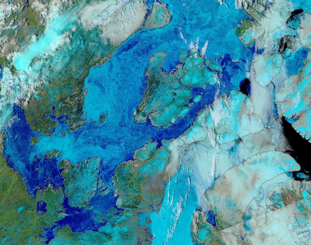
The sea ice in Lancaster Sound and the Amundsen Gulf is breaking up, and melt ponds are now visible on the fast ice across much of the southern route through the Canadian Arctic Archipelago:
“False colour” image of the Canadian Arctic Archipelago on June 17th from the MODIS instrument on the Terra satellite
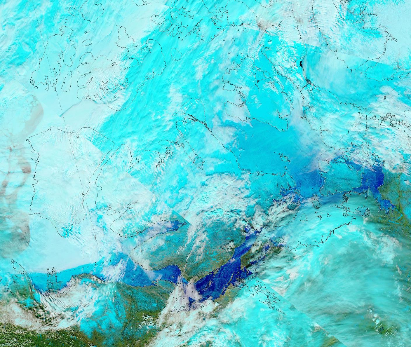
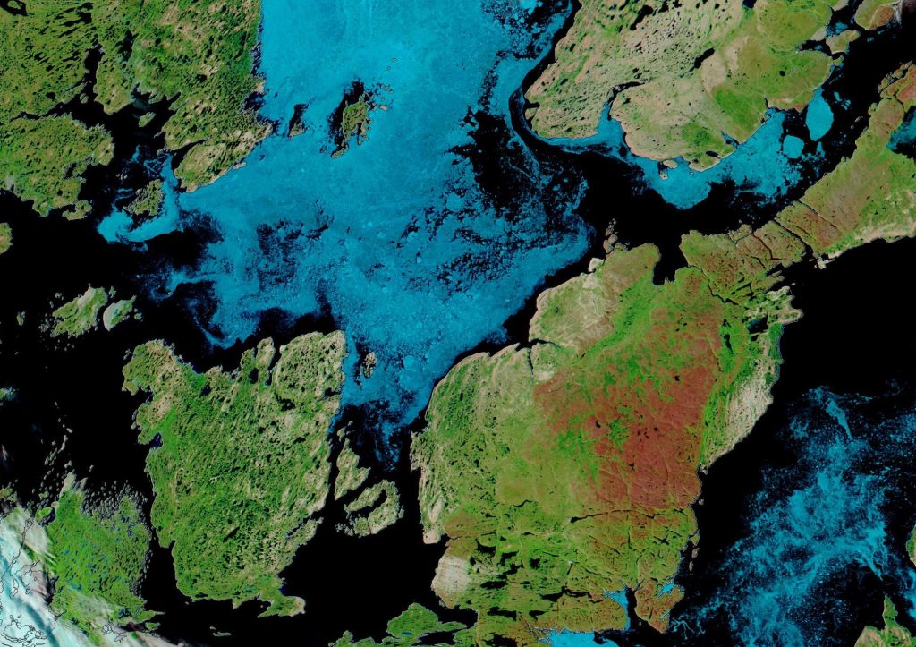
The melt ponds previously visible in the Coronation Gulf now appear to have drained:
“False colour” image of the Canadian Arctic Archipelago on June 3rd from the MODIS instrument on the Aqua satellite
Some “pleasure craft” are currently heading up the west coast of Greenland en route to the Bering Strait via Lancaster Sound and one of the assorted routes through the Canadian Arctic Archipelago. For those of you unfamiliar with the geography of the Northwest Passage, here are couple of hopefully helpful maps:
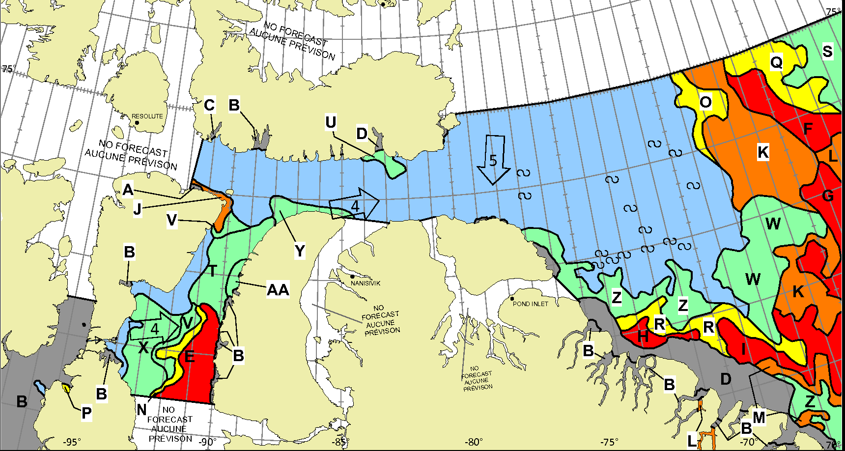
Whilst there is still ice blocking the route across Baffin Bay from Greenland, the Canadian Ice Service has already started daily coverage of the heart of the southern route through the Northwest Passage. There’s plenty of open water in Lancaster Sound and low concentration sea ice in Prince Regent Inlet:
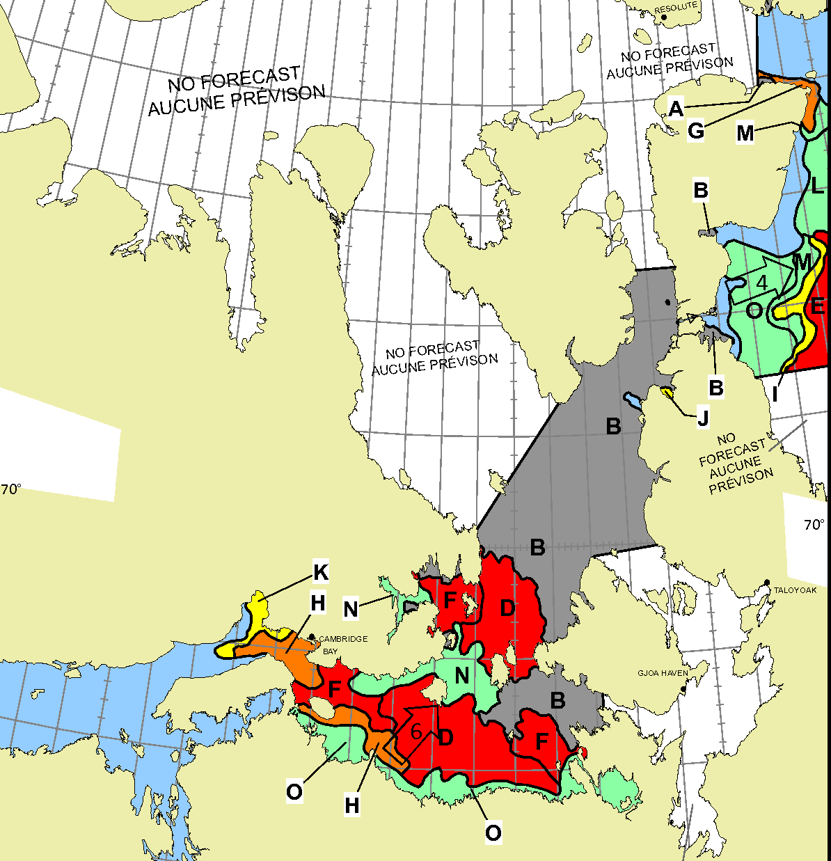
Further south there is also open water in the Coronation Gulf, but the fast ice between Peel Sound and King William Island has not yet started breaking up:
This slightly cloudy satellite image of the Canadian Arctic Archipelago also shows that the exit of the northern route via McClure Strait into the Beaufort Sea is already navigable:
After a quiet couple of years due to the Covid-19 pandemic there are numerous cruises through the Northwest Passage planned for the summer of 2022. Some (very!) small vessels are also currently scheduled to attempt that perilous journey. First of all let’s take a look at a map of the assorted routes through the Canadian Arctic Archipelago:
plus another map which includes a few more place names:
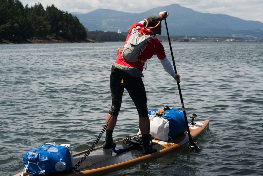
Next comes news of the expeditions planned by a variety of intrepid adventurers. According to Karl Kruger’s web site :
In 2022, Karl will attempt to become the first human to paddle 1,900 miles of the Northwest Passage on a standup paddleboard.
The article at the link is undated, but suggests that Karl initially intended to set off for Pond Inlet from Tuktoyaktuk in July 2019, but postponed the trip until the summer of 2020. By then Covid restrictions were in place, so next month provides the first opportunity for him to attempt the journey once again.
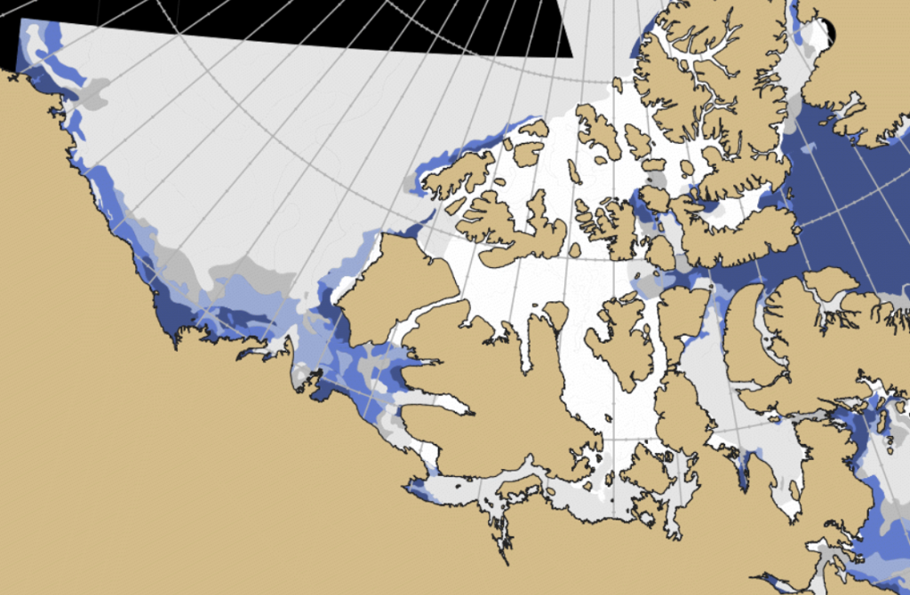
Whilst the Northern Sea Route has opened up early this year, it will be be quite some time before the Northwest Passage follows suit. Nevertheless our old friend Northabout is currently sailing in the direction of Baffin Bay, so now seems as good a time as any to start speculating about the prospects for the Summer of 2020. The passage through Lancaster Sound is already navigable:
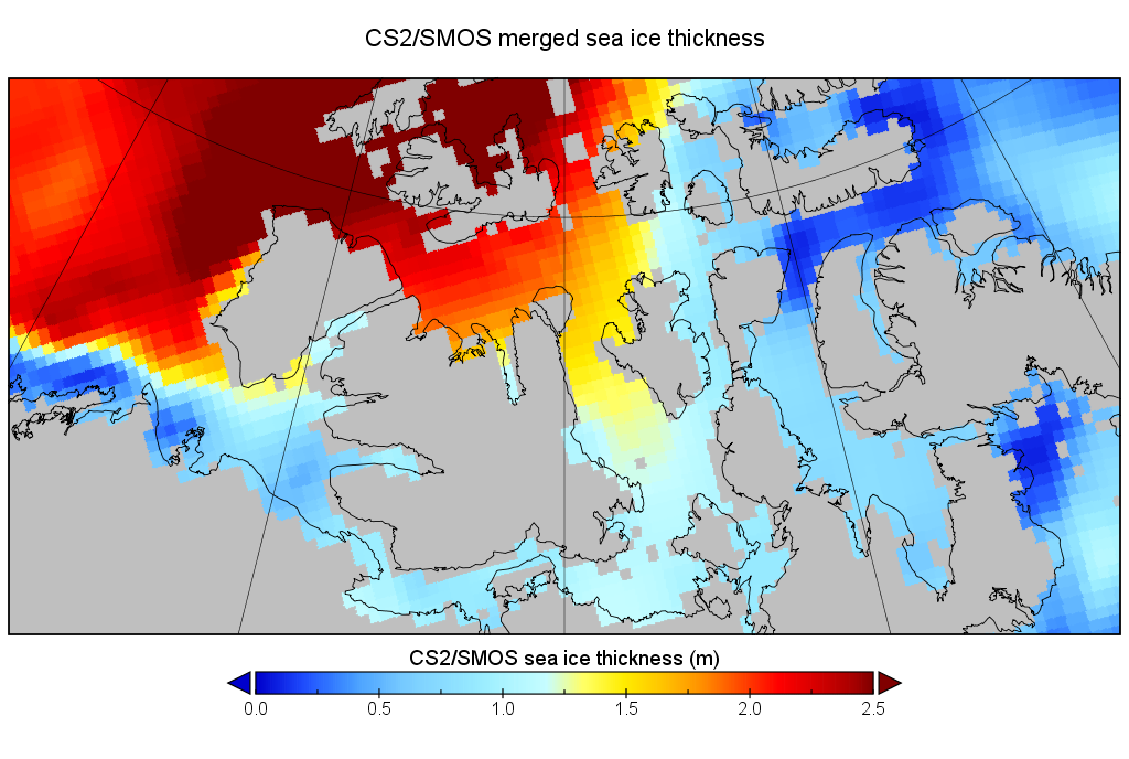
However as the Canadian Ice Service chart also shows, there are still some areas of 7-8/10 concentration along the Beaufort Sea coast en route to the Bering Strait. The central Canadian Arctic Archipelago is solid 9-10/10 at present, but what’s the prognosis? Here’s the final CryoSat-2/SMOS merged thickness map of the winter, from April 15th:
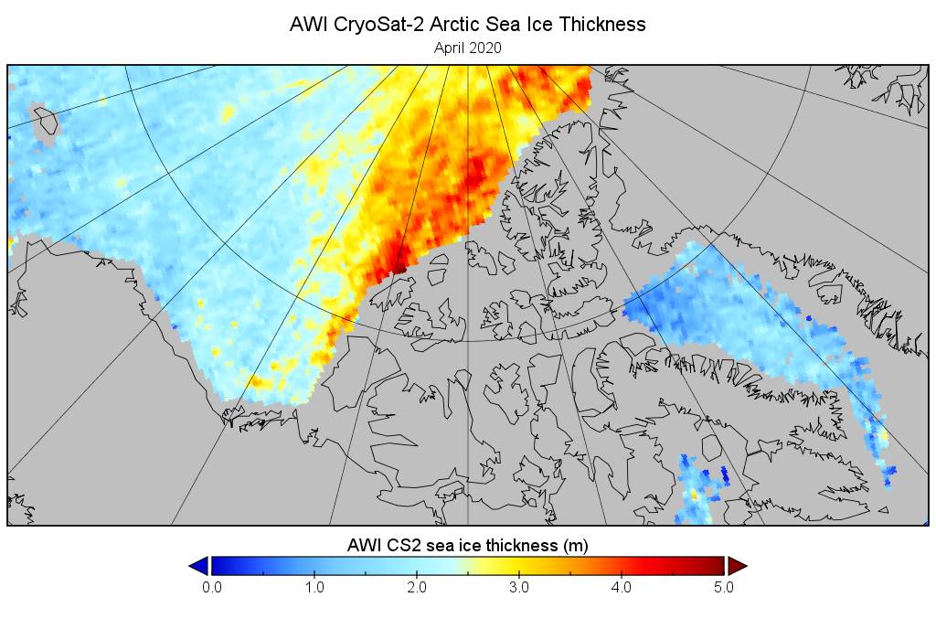
This suggests that the thickest ice on the usual route through the Northwest Passage for small vessels was around 1.2 meters in Larsen Sound. This seemed suspiciously thin to me, so next I tried the underlying Cryosat-2 data from AWI, which revealed this:
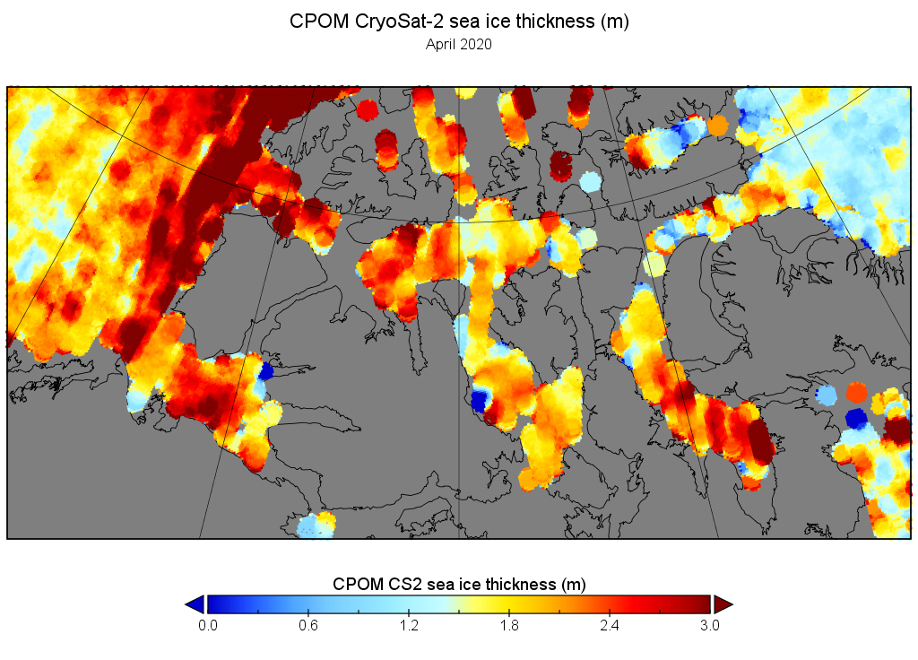
Suspicions confirmed. It looks like AWI are ignoring CS2 data in the CAA for 2020! Here’s how the CPOM Cryosat-2 numbers look for a similar date, which is hopefully nearer the reality:
The CAA was fairly cloud free on June 23rd, and this satellite image shows that surface melt had started across the entire central section of the Northwest Passage:
NASA Worldview “false-color”image of the Canadian Arctic Archipelago on June 23rd 2020, derived from the MODIS sensor on the Terra satellite
All in all it looks to me as though “small vessels” will be able to successfully make it through the Northwest Passage later in the summer of 2020, with thicker ice drifting south into Larsen Sound from the McClintock Channel being a potential bottleneck.
[Edit – August 1st]
Whilst there are certainly some cruise ships planning on voyaging through the Northwest Passage this summer it looks as though there will be very few yachts or other small vessels. According to Transport Canada:
To better protect Arctic communities, pleasure craft are prohibited from operating in Canada’s Arctic coastal waters north of the 60th parallel until October 31, 2020, at the earliest:
to limit any potential interaction with remote and vulnerable coastal communities in consideration of minimal health care infrastructure in these waterways that notably comprise the Northwest Passage as well as the territorial sea of Canada surrounding Nunatsiavut, Nunavik and the Labrador Coast).
to allow the Canadian Coast Guard to focus efforts on essential operations including community resupply ice-breaking, environmental response, and search and rescue.
With this proviso:
In the Canadian Arctic coastal waters, the following measures will not apply to:
Foreign pleasure craft exercising their right of innocent passage within the territorial sea. However, any such transits will be subject to receipt of a 60-day written notice in advance of arrival in Canadian Arctic coastal waters to Transport Canada, and be subject to any conditions the Minister determines necessary to ensure the protection of marine personnel and of local communities (for example, additional insurance, rescue strategy).
[Edit – August 6th]
The skies were clear over the Northwest Passage yesterday, and this is what could be seen from the Aqua satellite:
I don’t know about you, but based on that image I reckon a plucky little yacht like Northabout could just about squeeze past the remaining sea ice along the coast of the Boothia Peninsula?
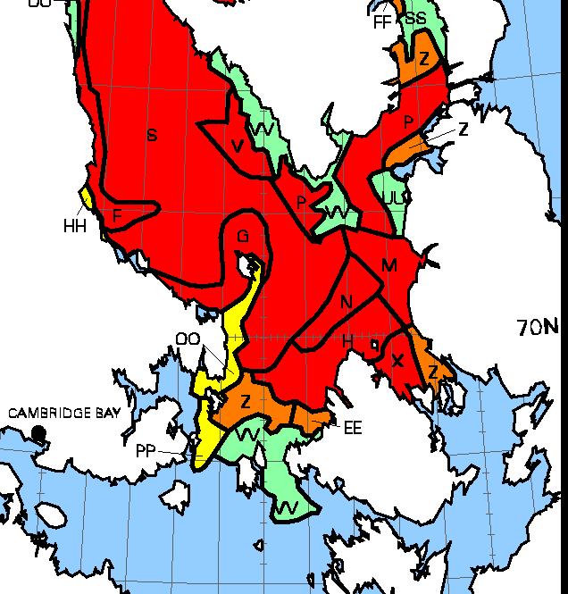
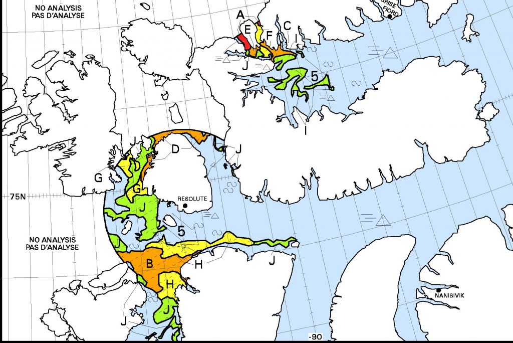
However let’s also take a look at the charts of the Canadian Ice Service shall we? The daily regional maps don’t cover the “squeeze point” yet, but the weekly map dated August 3rd reveals this:
We’re forced to conclude that officially the Northwest Passage isn’t quite “open” yet!
[Edit – August 7th]
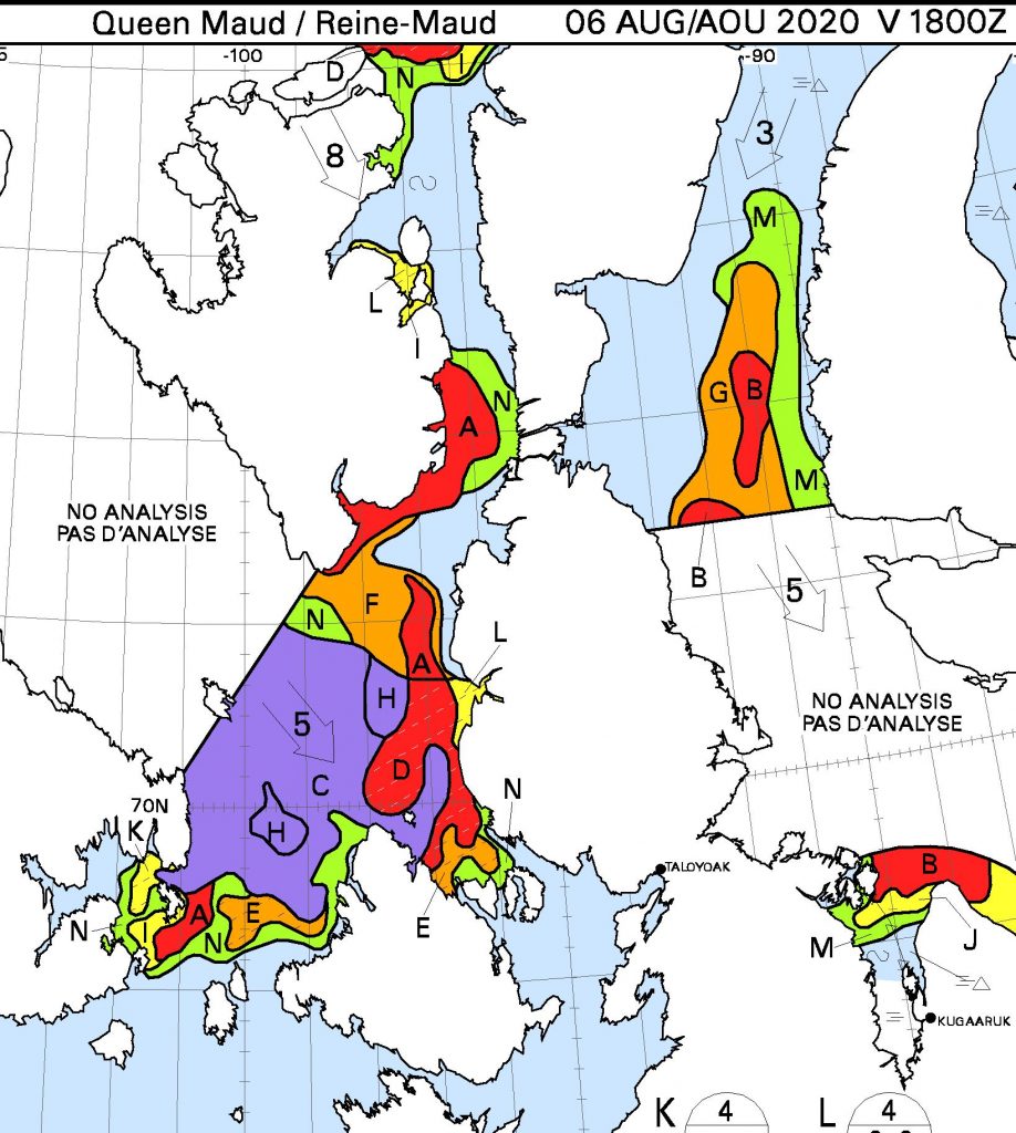
The Canadian Ice Service have extended their daily coverage to the “choke point” we looked at above:
The Northwest Passage is still not “officially” open!
[Edit – August 8th]
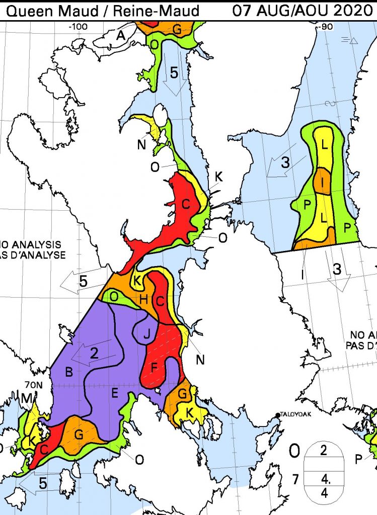
The southern “choke point” is still blocking the way, and winds are currently pushing ice into the north of Peel Sound:
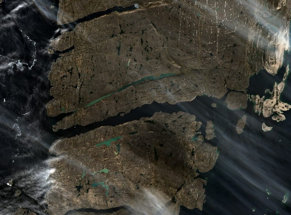
This Sentinel 2 image from August 6th shows the Bellot Strait to be completely clear of ice, so despite that route 6 through the Northwest Passage may well be very open soon.
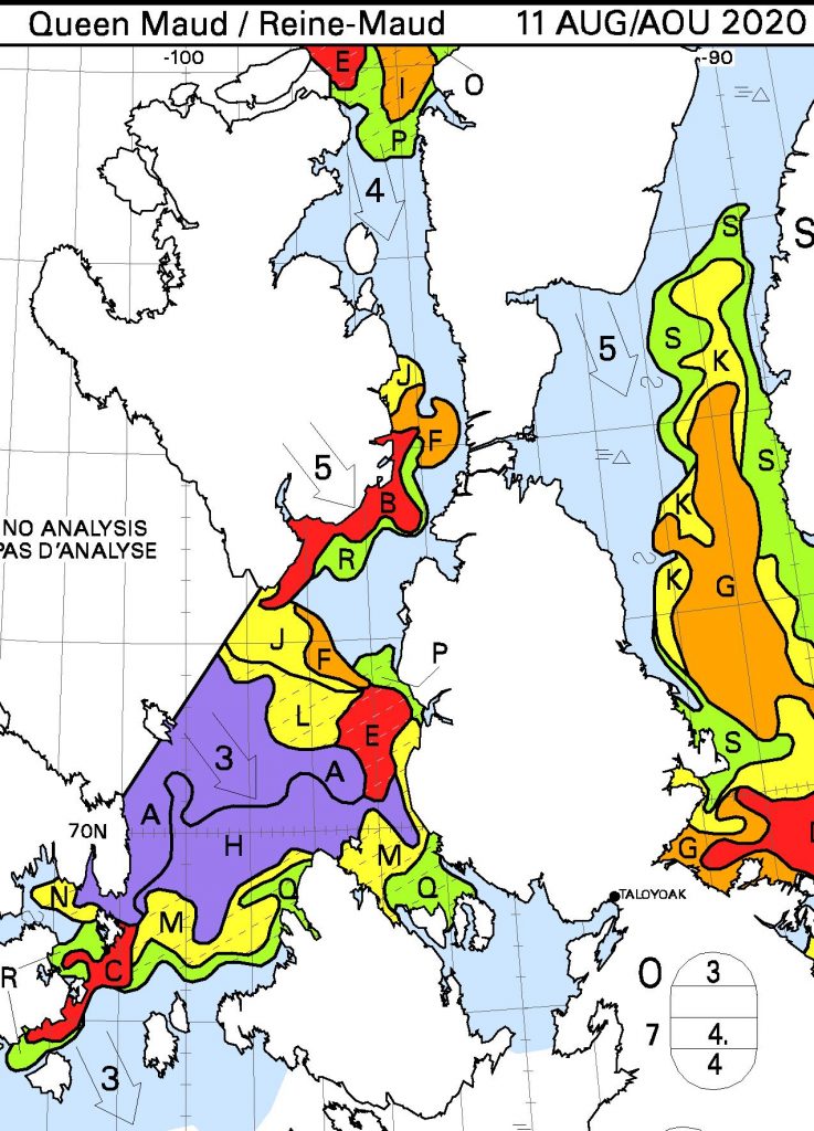
[Edit – August 11th]
Snow White is pleased to announce that she cut the ribbon at the 2020 Northwest Passage route 6 opening ceremony earlier today:
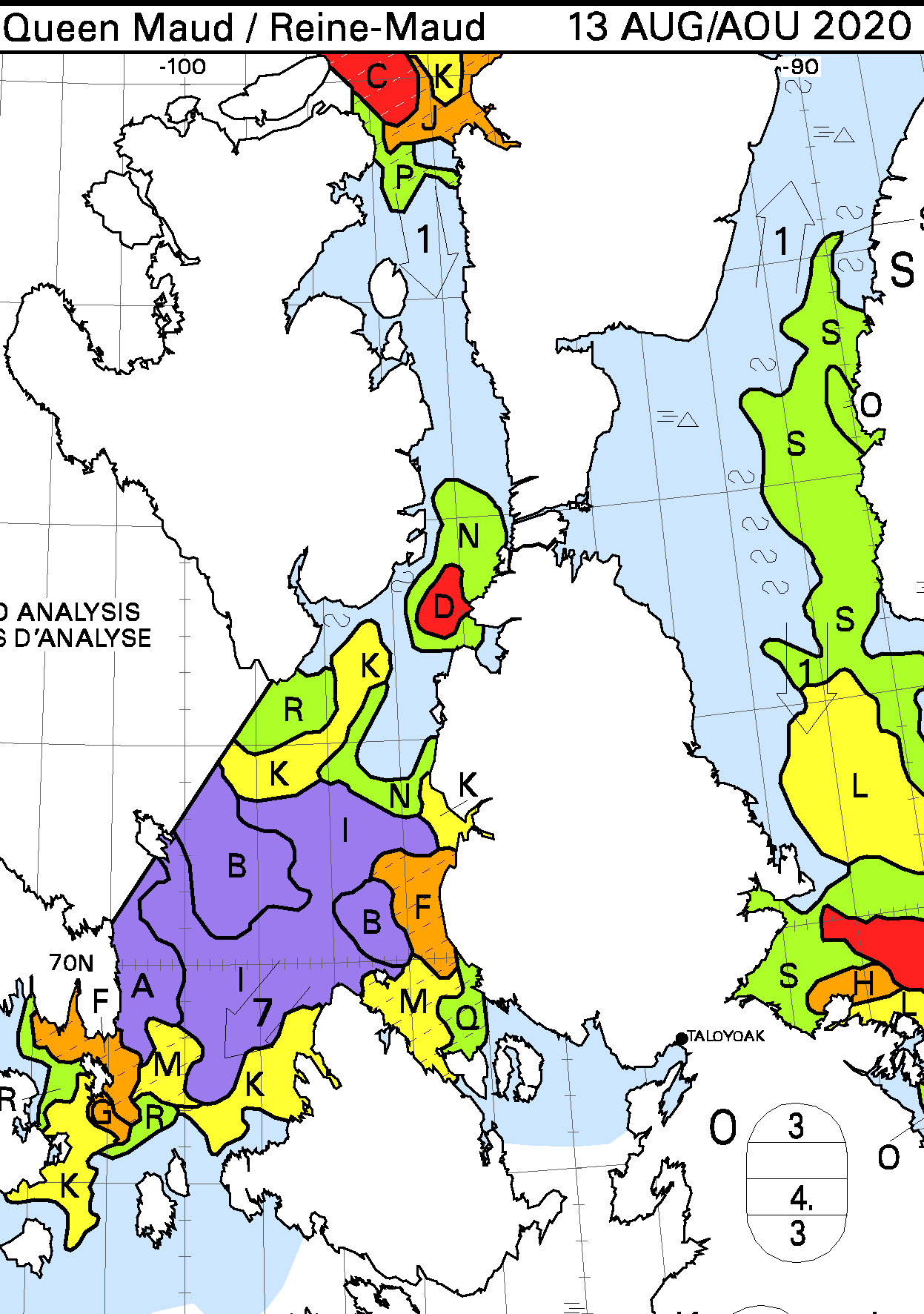
[Edit – August 14th]
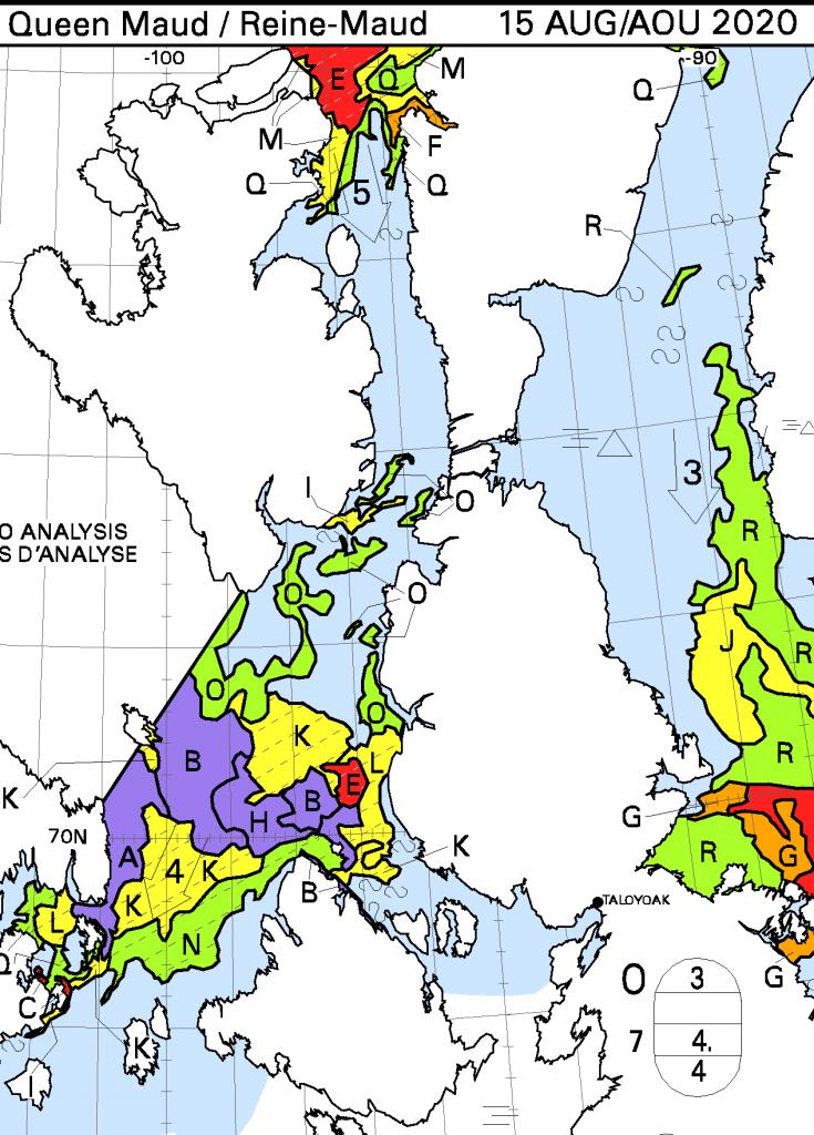
Whilst this is no doubt only temporary, the route along the coast of the Boothia Peninsula is now blocked by an area of 7-8/10 concentration ice:
[Edit – August 16th]
Route 6 is open once again, and it is also now possible to take a circuitous route around the north of both Somerset and King William Islands without encountering anything worse than 6/10 concentration ice:
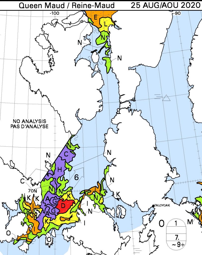
[Edit – August 25th]
As one door opens, another one closes?
[Edit – August 27th]
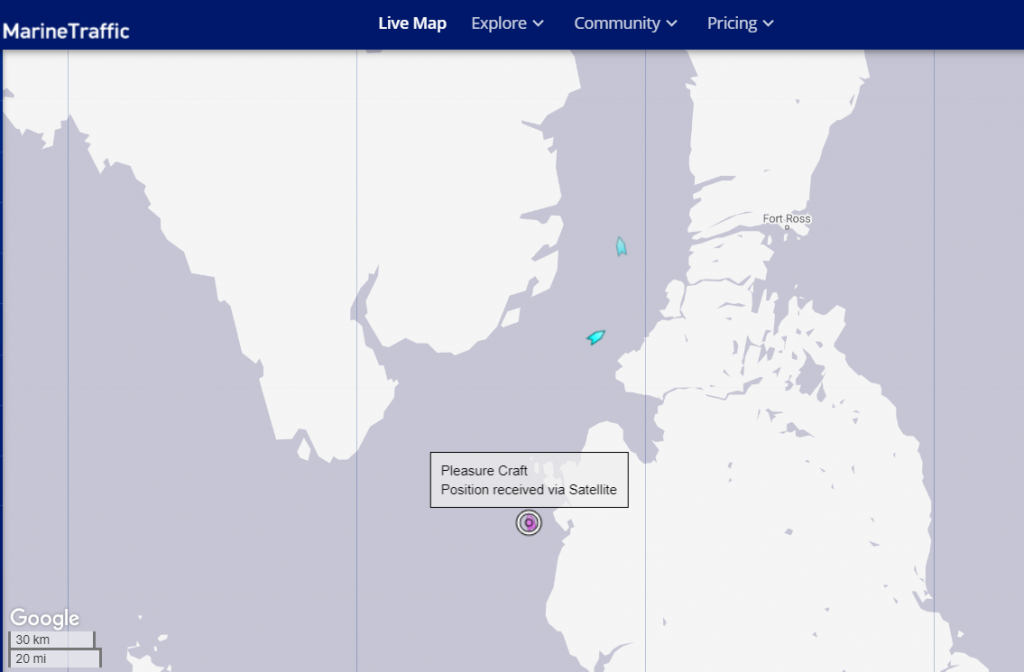
Making one of my periodic visits to MarineTraffic I couldn’t help but notice a “pleasure craft” approaching Bellot Strait!
According to the Canadian government, he has no business being there. But 72-year-old Peter Smith is sailing the Northwest Passage anyway, in violation of COVID-19-related orders prohibiting most foreign yachts from entering Canadian waters.
But according to a Facebook post on Aug. 20, Bobby Klengenberg, a local observer with the Inuit Marine Monitoring Program, spotted Smith’s custom yacht, the Kiwi Roa, off the coast of Cambridge Bay, Nunavut.
Transport Canada confirmed the sighting in an email to CBC News, and said the vessel was told “to depart Canadian waters and not make landfall.”
A spokesperson said the Canadian Coast Guard will “monitor the vessel’s transit out of the region.” If Smith is indeed found to have broken the law, they wrote, the agency “will not hesitate to take appropriate enforcement action,” including penalties of up to $5,000.
Watch this space!
This website uses cookies to improve your experience. We'll assume you're ok with this, but you can opt-out if you wish. Cookie settingsACCEPT
Privacy & Cookies Policy
Privacy Overview
This website uses cookies to improve your experience while you navigate through the website. Out of these, the cookies that are categorized as necessary are stored on your browser as they are essential for the working of basic functionalities of the website. We also use third-party cookies that help us analyze and understand how you use this website. These cookies will be stored in your browser only with your consent. You also have the option to opt-out of these cookies. But opting out of some of these cookies may affect your browsing experience.
Necessary cookies are absolutely essential for the website to function properly. This category only includes cookies that ensures basic functionalities and security features of the website. These cookies do not store any personal information.
Any cookies that may not be particularly necessary for the website to function and is used specifically to collect user personal data via analytics, ads, other embedded contents are termed as non-necessary cookies. It is mandatory to procure user consent prior to running these cookies on your website.