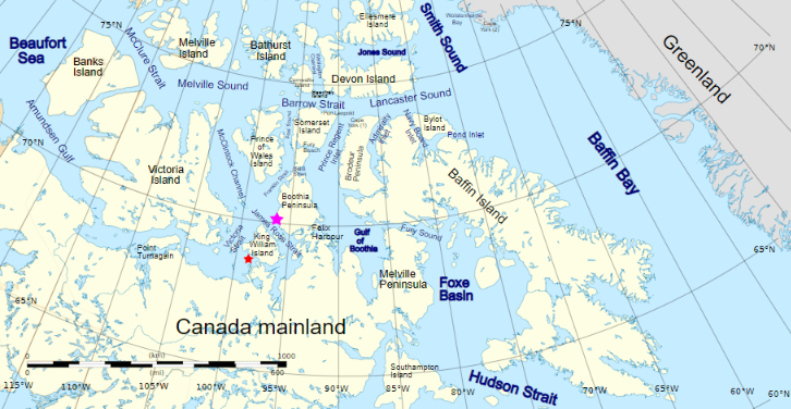
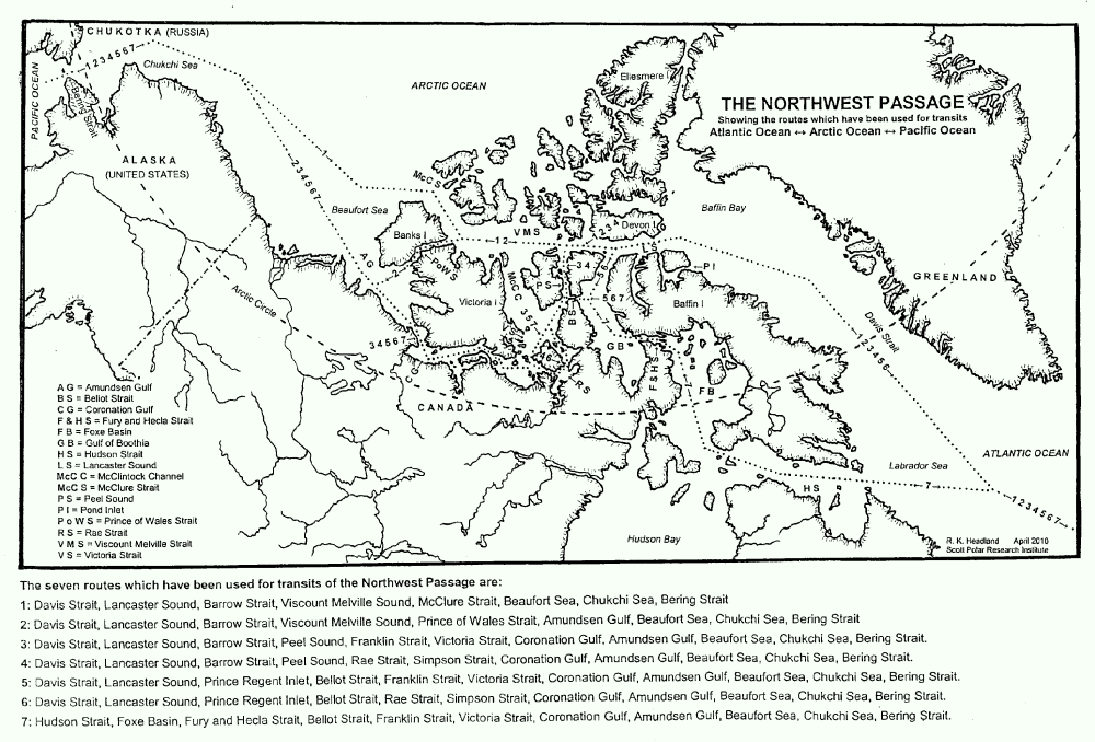
For those of you unfamiliar with the names of the assorted islands and channels of the Canadian Arctic Archipelago here is a map that hopefully helps:
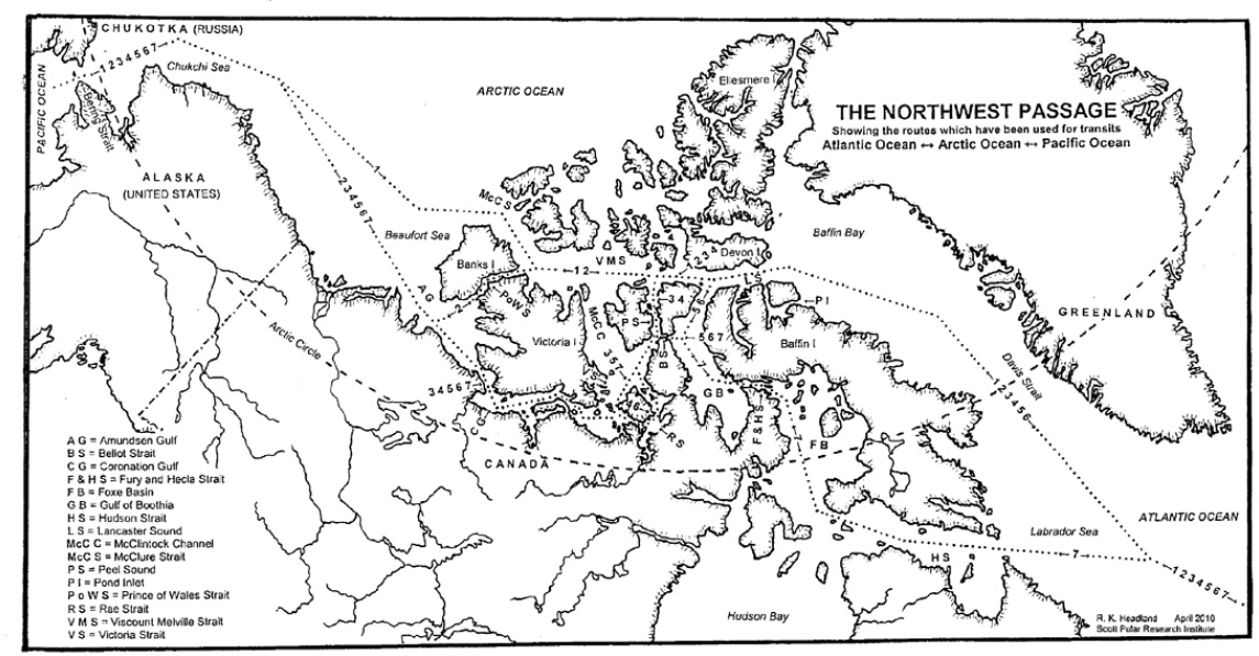
Plus another map detailing the routes through the Canadian Arctic Archipelago that have previously been successfully navigated by vessels large and small:
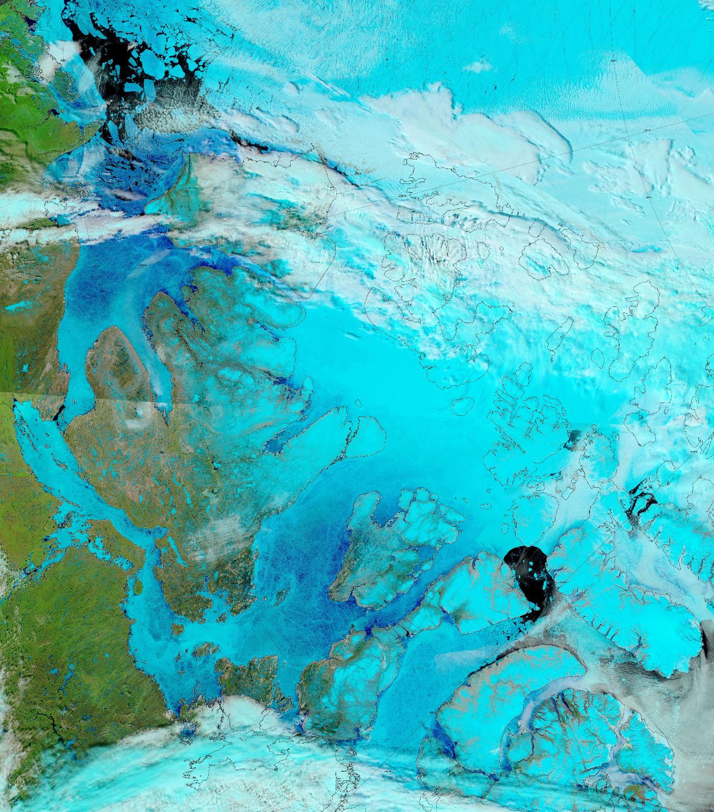
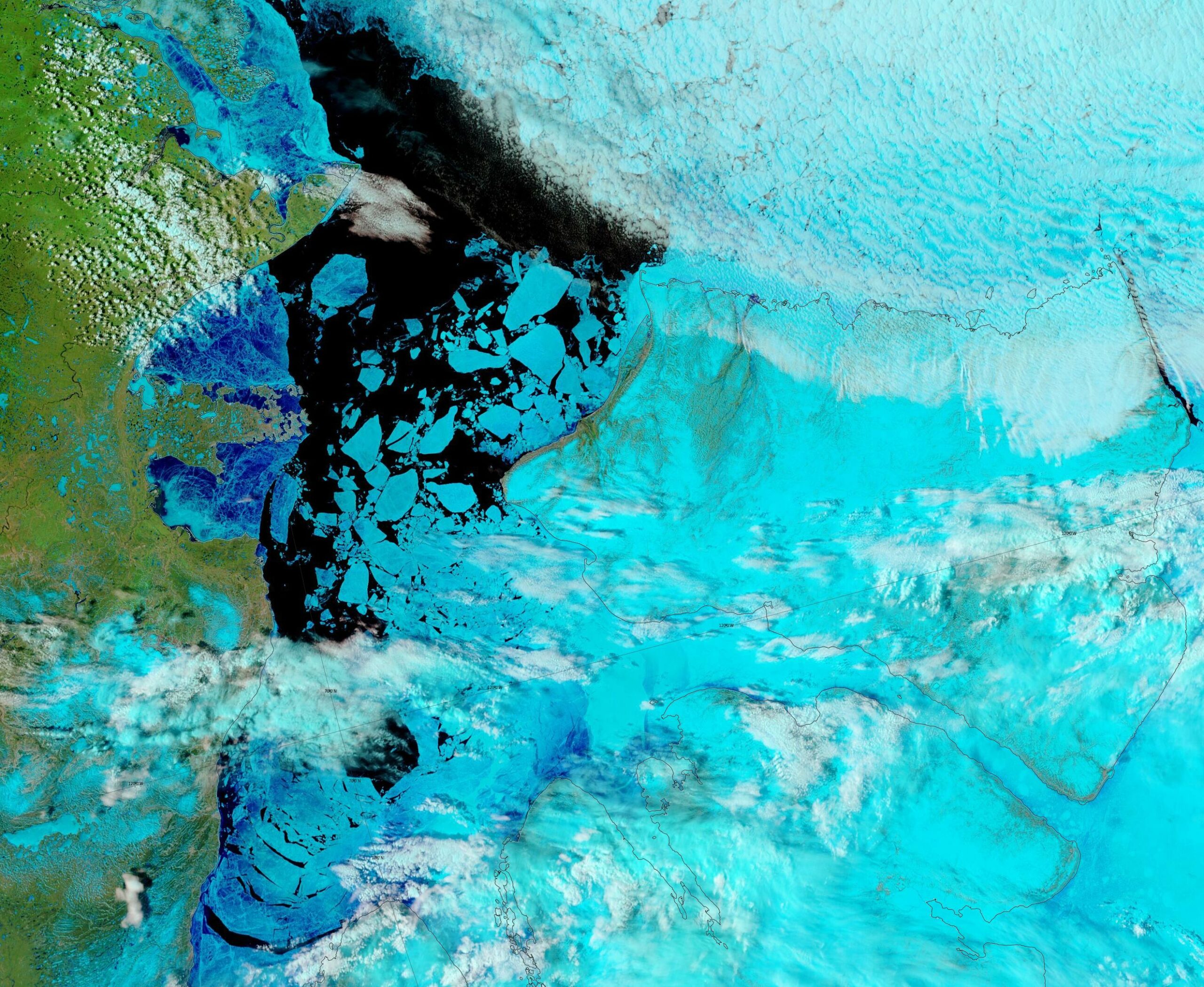
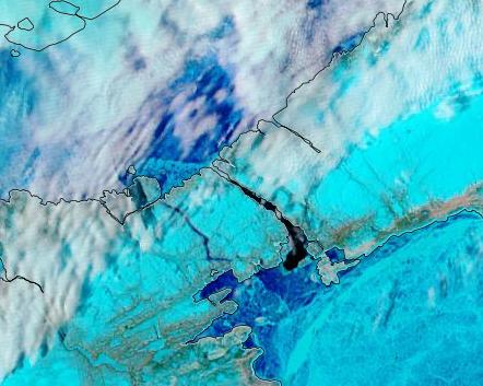
The sea ice in Lancaster Sound and the Amundsen Gulf is breaking up, and melt ponds are now visible on the fast ice across much of the southern route through the Canadian Arctic Archipelago:
“False colour” image of the Canadian Arctic Archipelago on June 17th from the MODIS instrument on the Terra satellite
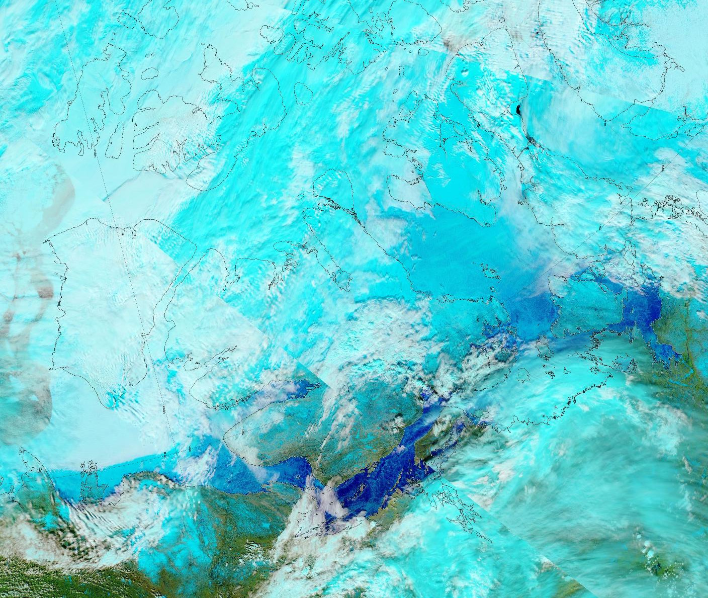
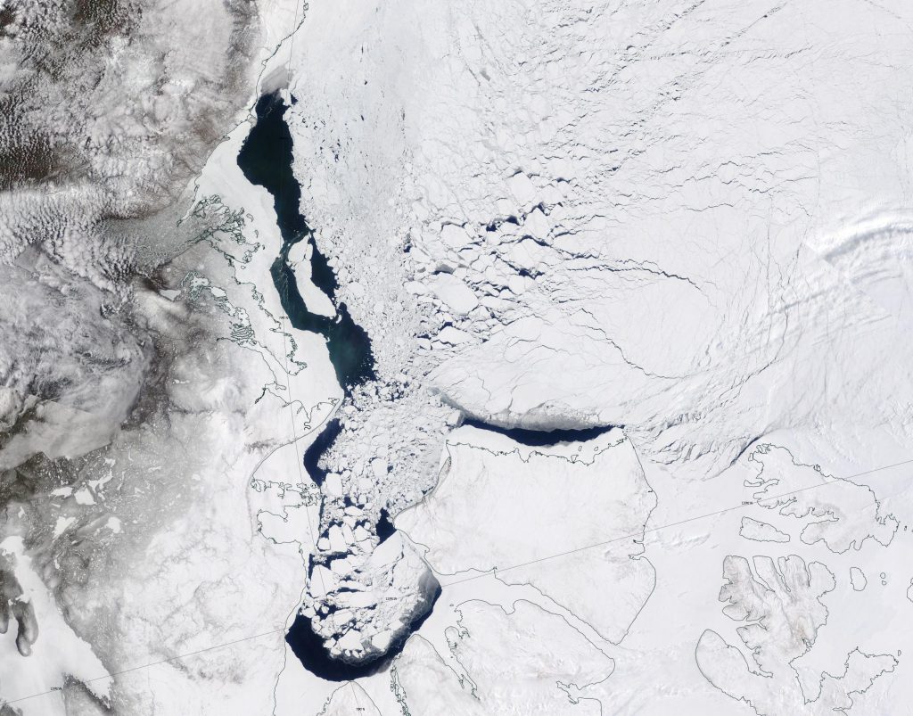
The melt ponds previously visible in the Coronation Gulf now appear to have drained:
“False colour” image of the Canadian Arctic Archipelago on June 3rd from the MODIS instrument on the Aqua satellite
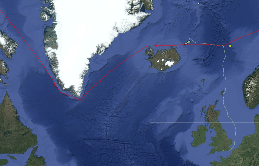
I mentioned the start of Ella Hibbert‘s long voyage in her yacht Yeva over on this year’s Northwest Passage thread. Ella and Yeva have now crossed north of the Arctic Circle near Iceland and have begun their attempt to circumnavigate the Arctic in a single summer by sailing past the north of Iceland in a westerly direction:
I’m opening the 2025 Northwest Passage thread earlier than usual, because of some news you can read if you scroll down. However, let’s first of all get our bearings with the help of this map of the area:
and another map detailing the routes through Canadian Arctic Archipelago that have previously been successfully traversed:
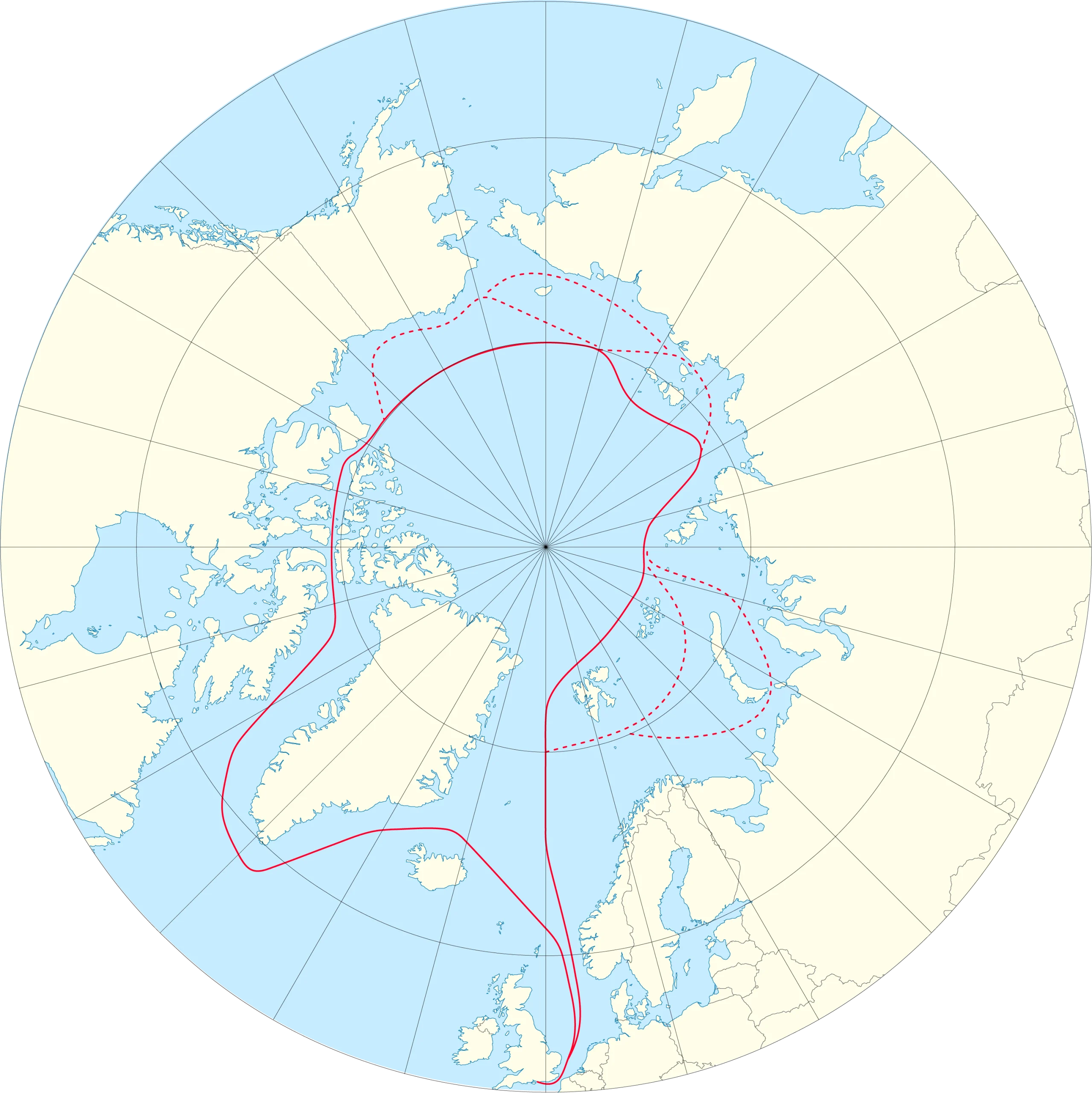
The news I was referring to is that at lunchtime today Ella Hibbert is setting off in her yacht Yeva from Haslar Marina near Portsmouth in southern England for a rather unusual voyage through the Northwest Passage this summer. Here is Ella’s current route plan:
You will note some unusual features. Apparently Ella is intent on taking Route 1 into the Beaufort Sea via McClure Strait. After that she is not heading for the Bering Strait, but is instead taking the route less travelled back to Haslar via the Northern Sea Route. Perhaps even more surprising in this day and age is that Ella has received permission to sail through Russian waters without an ice pilot. She is aiming to complete an entire circumnavigation of the Arctic in a single summer single handed! As Ella puts it, this is “A voyage that should not be possible”:
Ella is hoping to overcome terrifying challenges including icebergs, freezing water and polar bears.
Her journey – which has only recently become possible due to melting polar ice caps – aims to showcase the devastating environmental impact of sea ice decline, both in the Arctic and across the world.
Ella’s voyage also aims to support two charities working tirelessly to protect the Arctic: Polar Bears International and the Ocean Conservancy.
At the end of her voyage, Ella will auction her ship Yeva with proceeds to go to these two charities.
Some “pleasure craft” are currently heading up the west coast of Greenland en route to the Bering Strait via Lancaster Sound and one of the assorted routes through the Canadian Arctic Archipelago. For those of you unfamiliar with the geography of the Northwest Passage, here are couple of hopefully helpful maps:
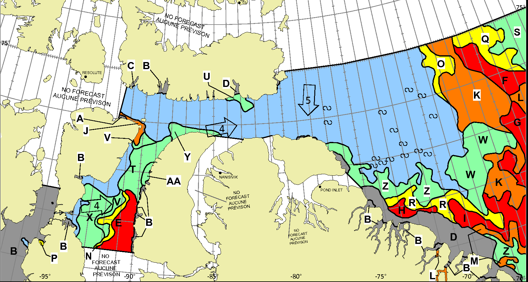
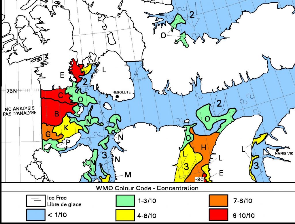
Whilst there is still ice blocking the route across Baffin Bay from Greenland, the Canadian Ice Service has already started daily coverage of the heart of the southern route through the Northwest Passage. There’s plenty of open water in Lancaster Sound and low concentration sea ice in Prince Regent Inlet:
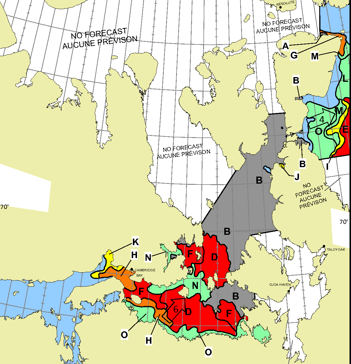
Further south there is also open water in the Coronation Gulf, but the fast ice between Peel Sound and King William Island has not yet started breaking up:
This slightly cloudy satellite image of the Canadian Arctic Archipelago also shows that the exit of the northern route via McClure Strait into the Beaufort Sea is already navigable:
Prompted by a comment by Tom in the June open thread, the time has evidently come to open the 2023 Northwest Passage passage thread. First of all let’s get our bearings with the help of this map of the area:
and another map detailing the routes through Canadian Arctic Archipelago that have previously been successfully traversed:
As our starter for ten for 2023, there is already plenty of open water in the Amundsen Gulf, together with plenty of melt ponding on the remaining fast ice in Franklin and Darnley Bays:
After a quiet couple of years due to the Covid-19 pandemic there are numerous cruises through the Northwest Passage planned for the summer of 2022. Some (very!) small vessels are also currently scheduled to attempt that perilous journey. First of all let’s take a look at a map of the assorted routes through the Canadian Arctic Archipelago:
plus another map which includes a few more place names:
Next comes news of the expeditions planned by a variety of intrepid adventurers. According to Karl Kruger’s web site :
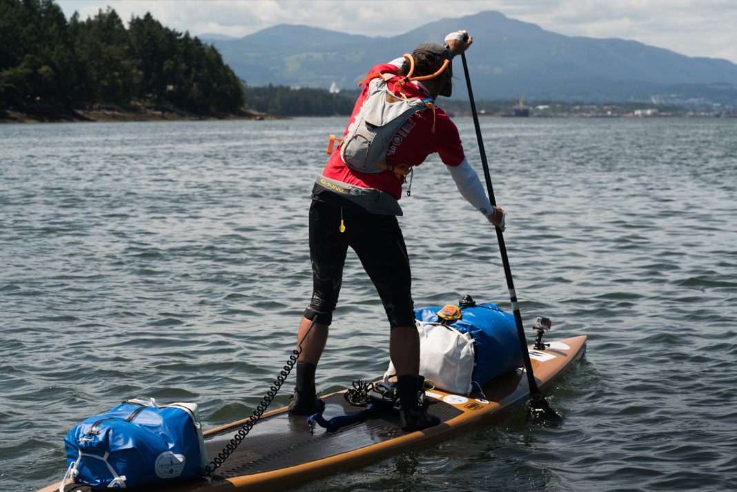
In 2022, Karl will attempt to become the first human to paddle 1,900 miles of the Northwest Passage on a standup paddleboard.
The article at the link is undated, but suggests that Karl initially intended to set off for Pond Inlet from Tuktoyaktuk in July 2019, but postponed the trip until the summer of 2020. By then Covid restrictions were in place, so next month provides the first opportunity for him to attempt the journey once again.
Prompted by a comment on the Northwest Passage thread from last year I’m opening the 2021 equivalent earlier than usual, in part because there’s already a lot going on of interest. First of all let’s get our bearings with the help of this map of the area:
and another map detailing the routes through Canadian Arctic Archipelago that have previously been successfully traversed:
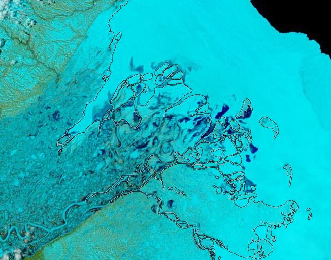
The forecast high pressure has arrived and the skies have cleared over the Beaufort Sea, which reveals that the land-fast ice off the Mackenzie Delta has started breaking up:
In addition the snow has been melting along the valley of the Mackenzie River, and the resulting increased flow at the mouth of the delta is flooding the fast ice:
It is perhaps rather early to start speculating about if, and when, the Northwest Passage will become navigable for the host of small vessels eager to traverse it this summer.
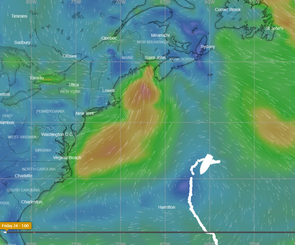
However one such vessel is already en route to the Arctic Circle, so why don’t we take a look at its live tracking map?
Moli (Mo for short) is being piloted singlehandedly by Randall Reeves, who has already circumnavigated Antarctica and is hell bent on circumnavigating America too!
According to Randall’s last but one update he’ll be stopping in St. Johns before heading for the Arctic Circle:
“Have you explained why your first stop is St John’s?” asked a friend recently, “Not New York, Boston, Camden, Lunenberg, Halifax, to name just, well, five?”
It is a good question, and the answer is simple: I never considered going anywhere else because a) St John’s is decidedly on the Figure 8 route and b) it has the required marine facilities and big grocery stores. And did I mention, it’s right on the route?
Actually, I did flirt briefly with the idea of Boston, thinking that goods there would be cheaper and marine facilities, more diverse. And though it does save some 500 miles of sailing on this inbound leg, Boston is so far west that it adds 1,000 miles to the leg up to the Arctic. So, I’ve decided to stick to the most logical stop.
St. John’s is less than a thousand miles north now. In any worthy wind, we’d be there before the end of the month. But when your average speed is 3.9 knots…you don’t do the when-do-we-make-port math.
Interestingly the background to Moli’s live tracking map is from Windy.com.
[Edit – June 10th]
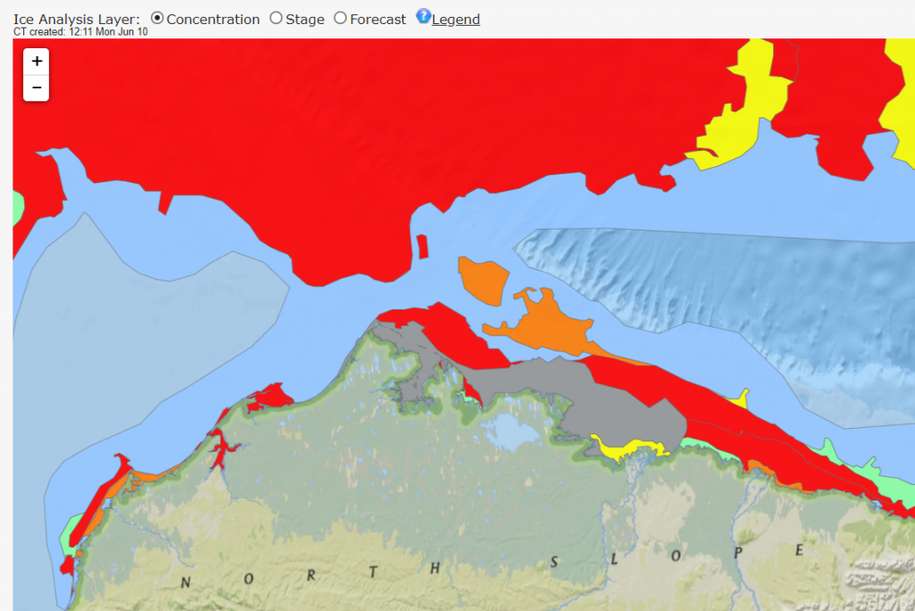
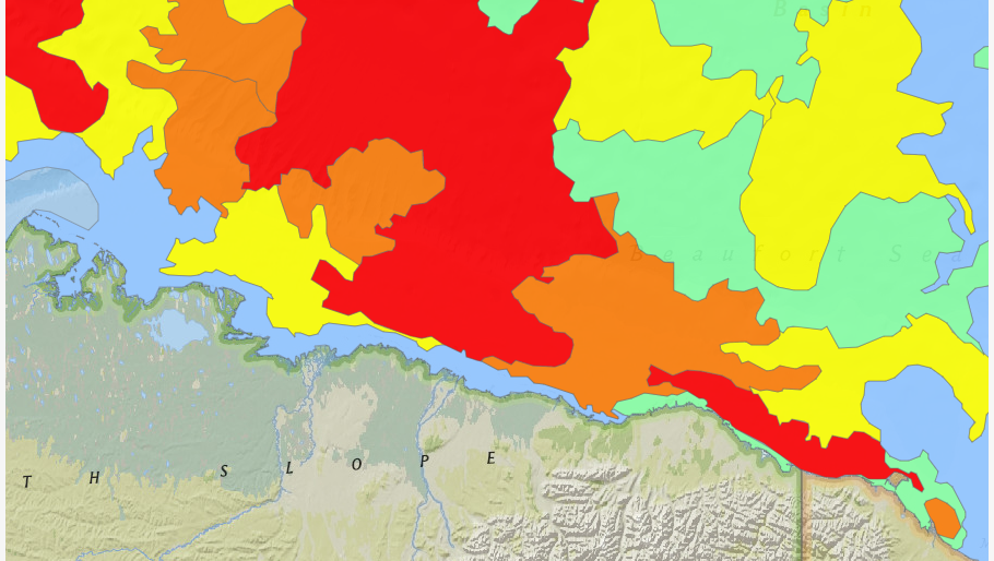
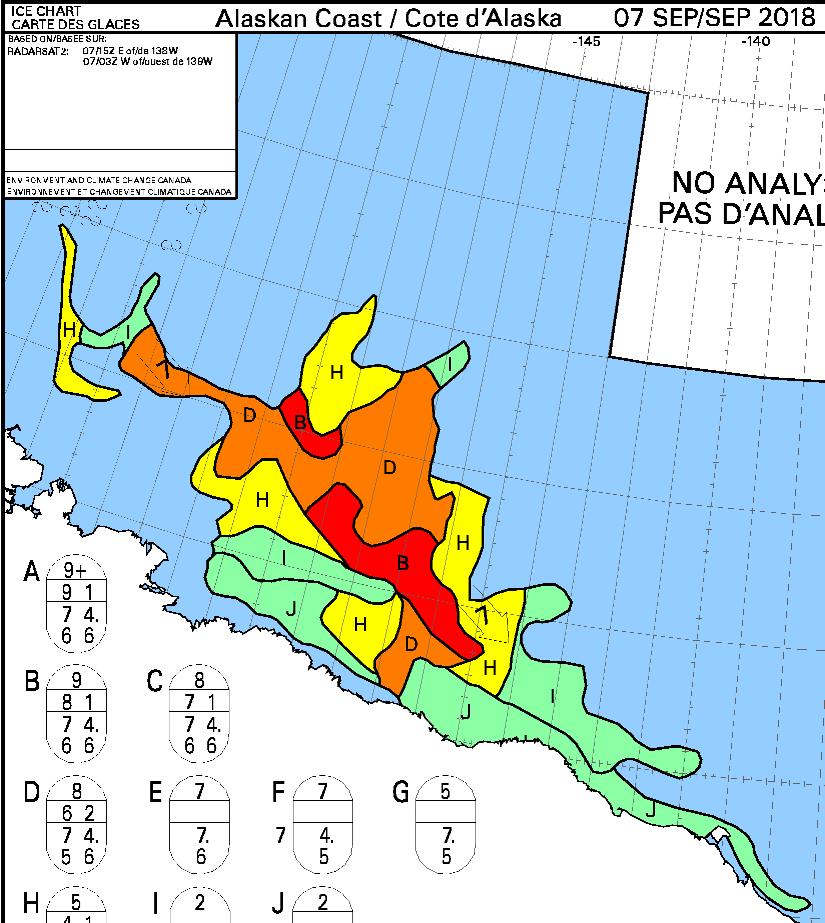
It’s very early in the melting season to be reporting on this event, but any early bird traversing the Northwest Passage from west to east could now sail through open water around Point Barrow, along the Alaskan and Canadian coast and into the Amundsen Gulf. Here’s the latest sea ice concentration chart for Alaskan waters from the US National Weather Service:
Whilst we’re here why don’t we take a look at how Randall is getting along in Moli. According to his latest blog post he is now in Halifax scraping barnacles off Moli’s bottom!
On Friday, June 8, day 245 of the Figure 8 Voyage, I hauled Mo here at the Royal Nova Scotia Yacht Squadron. My expectations were that the bum would be nearly spotless. Instead, we had a new crop of hitchhikers coming in at the base of those older barnacles that remained.
Lessons Learned: “There is no good bottom paint for aluminum boats,” says my friend, fellow cruiser, and aluminum boat builder, Gerd Marggraff. Prior to departure, I had applied three generous coats of a bottom paint known specifically to ward off hard growth, but barnacles are superior beings, able to penetrate even the best defenses.
An early jump. I might have had an easier time of it if I’d dived the hull before the first Cape Horn rounding, when the barnacles were young and few.
In hindsight, I think I could have dived the hull with some success, even when the barnacles had matured into a reef. I found here in the yard that the “hold fast” (the glue that holds the barnacle fast to the hull) was easier to remove with a sharpened spatula than I had thought. It would have been a big job, taking a full day or more–but not impossible.
[Edit – June 15th]
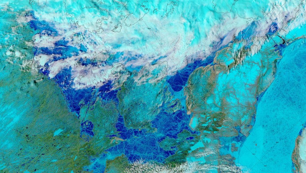
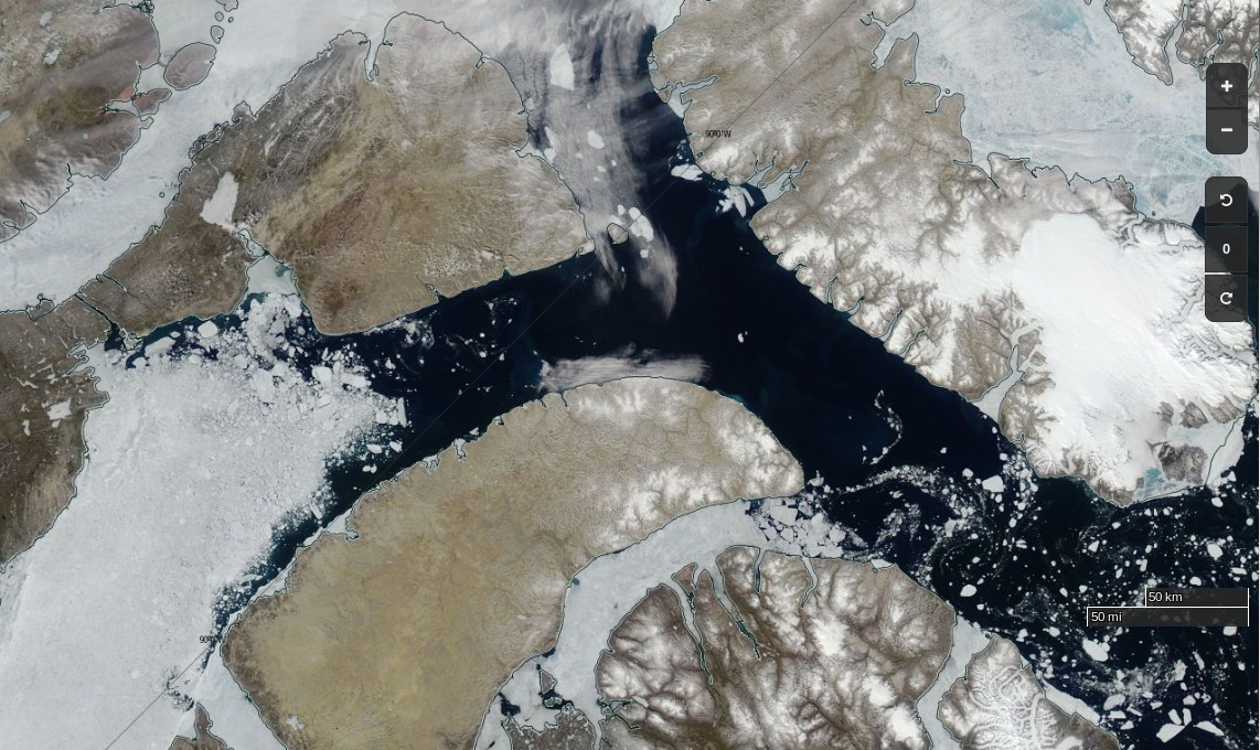
Delving deeper into the Canadian Arctic Archipelago, the clouds have cleared over “Amundsen’s Route” through the Northwest Passage to reveal extensive melt ponding:
NASA Worldview “false-color” image of the Northwest Passage on June 14th 2019, derived from the MODIS sensor on the Terra satellite
Bellot Strait appears to be largely free of sea ice already:
[Edit – August 16th]
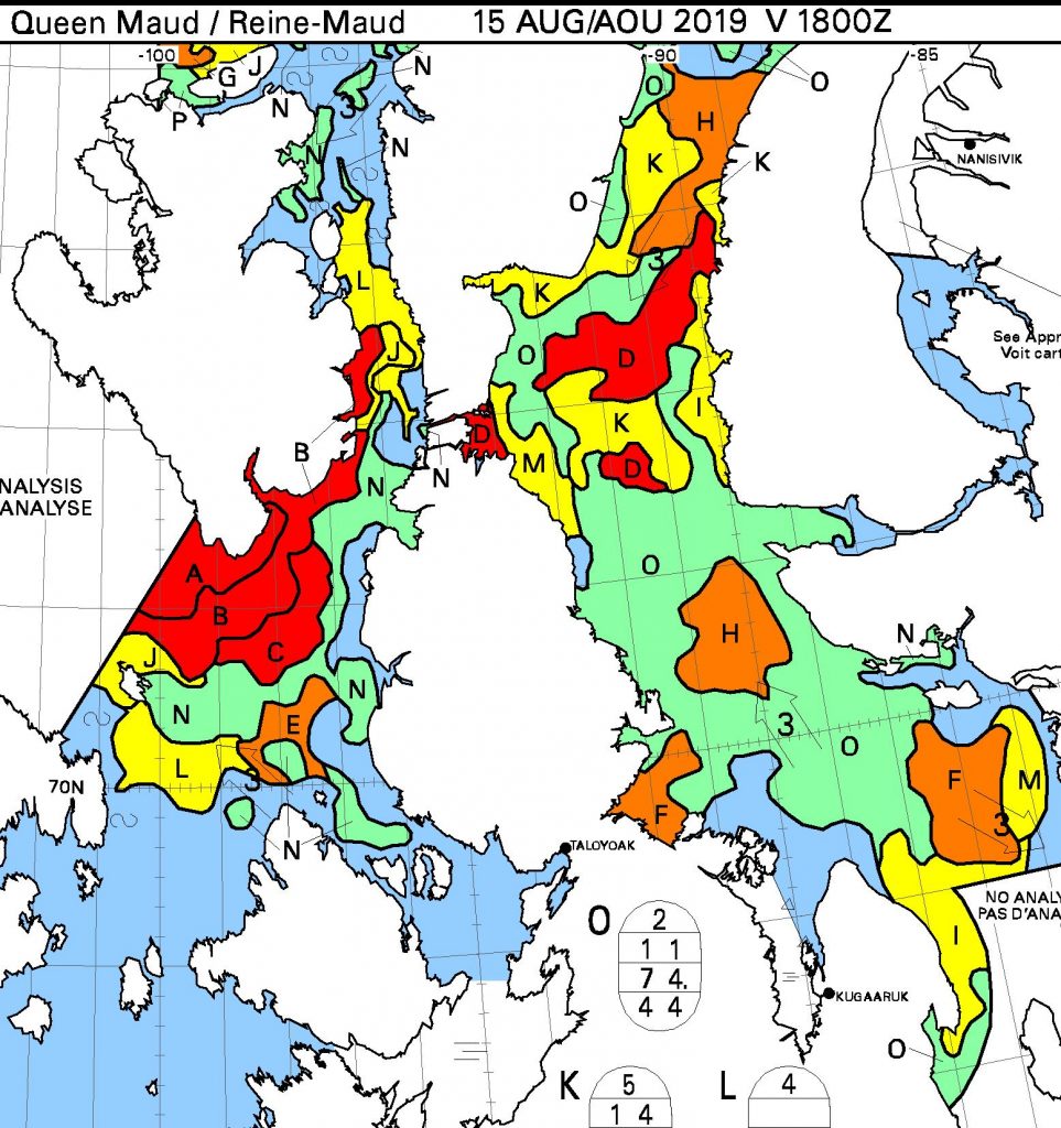
After a tense wait Bellot Strait has recently become blocked by 9/10 concentration sea ice but the southern route through the Northwest Passage via Peel Sound is now open to any vessel willing to cope with 6/10 concentration or less:
The time has come to start speculating about if, and when, the Northwest Passage will become navigable for the host of small vessels eager to traverse it this summer. Almost one month later than in 2017!
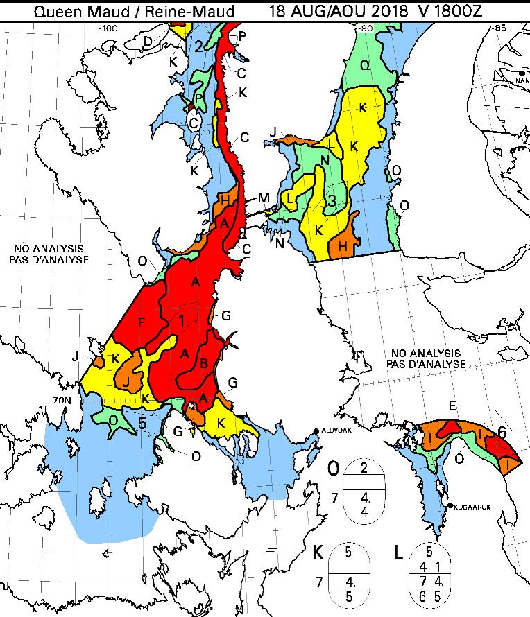
Whilst the eastern and western entrances to the assorted routes through the Canadian Arctic Archipelaga have been empty of sea ice for quite some time, the central section between Bellot Strait and Gjoa Haven and/or Cambridge Bay is still chock a block:
In the east here is a drone’s eye view of Cumming Inlet, courtesy of the Polish team of Michał and Ola Palczyński aboard S/V Crystal:
created by dji camera
It’s not entirely clear when that picture was taken, since according to Michał’s blog:
The waters beyond the Bellot Strait are covered with impassable ice, and the ice in the Beaufort Sea has 90% concentration in some places and reaches up to the shore. In this difficult situation, by 15th August two yachts have already given up and turned back to Greenland (including Blue Peter from our cove).
Here’s what lies ahead of Crystal and her remaining companions, according to the Canadian Ice Service:
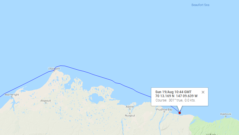
Meanwhile in the Beaufort Sea S/V Dogbark has been battling her way through that “90% concentration” sea ice. Dogbark has now made it as far as Mikkelsen Bay, just past Prudhoe Bay in Alaska:
What does 7/10ths ice mean? We don’t want to know! It is more ice than we want to try and pass, that’s for sure. But the ice charts we look at refer to ice by % of sea coverage, so 7/10ths would look like water mostly covered by large, immovable objects. 5/10ths was as much as we have seen, and we got out of there as fast as we could with some help from our flying eyeball. See Dogbark’s Facebook page for a quick snippet of less dangerous ice.
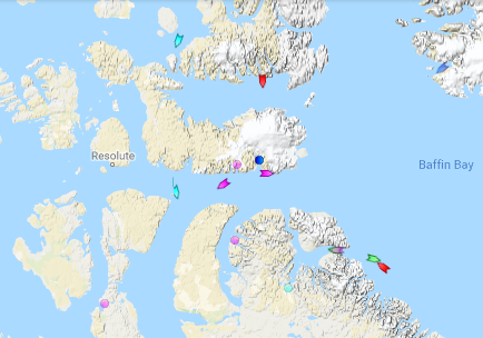
Meanwhile the Canadian icebreaker CCGS Amundsen has sailed past Arctic Bay and Resolute:
I cannot help but wonder what vessels might be closely following in his wake?
[Edit – September 7th]
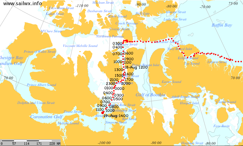
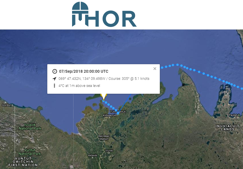
Finally there comes news that a “pleasure craft” has made it through the Canadian Arctic Archipelago from east to west as far as Tuktoyaktuk. I’d been wondering which vessel it was that seemed immobile near the western end of the Bellot Strait on the MarineTraffic maps. This one’s from August 19th:
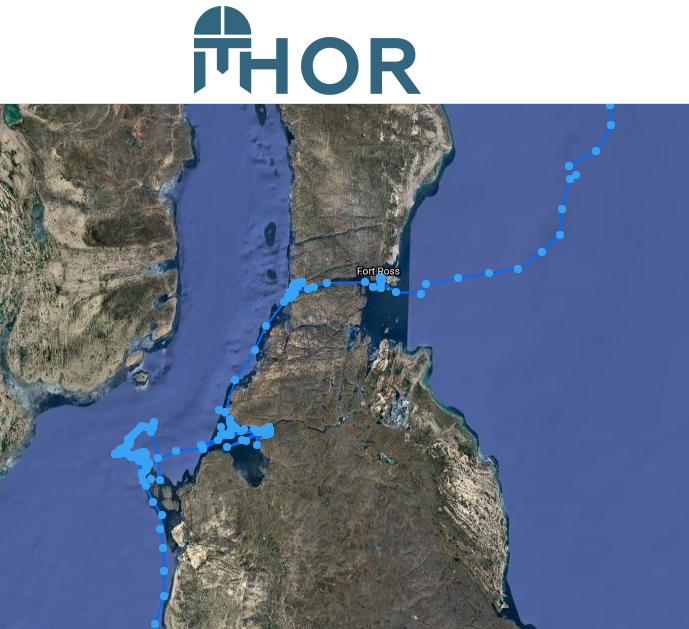
Now I know! Thanks to a heads up on the Arctic Sea Ice Forum I’ve discovered that it’s the S/V Thor. Here’s the tracking map of his efforts to get through all the old ice in the vicinty.
The map reveals that Thor made it through the Bellot Strait on August 6th, but didn’t manage to make significant headway out of the Franklin Strait until August 28th.
The time has come to start speculating about if, and when, the Northwest Passage will become navigable for the host of small vessels eager to traverse it this summer. The west and east entrances are clearing early this year. Lancaster Sound and Prince Regent inlet already reveal only a few area of white amongst the deep blue open water:
NASA Worldview “true-color” image of Lancaster Sound and Prince Regent Inlet on July 8th 2017, derived from the MODIS sensor on the Aqua satellite
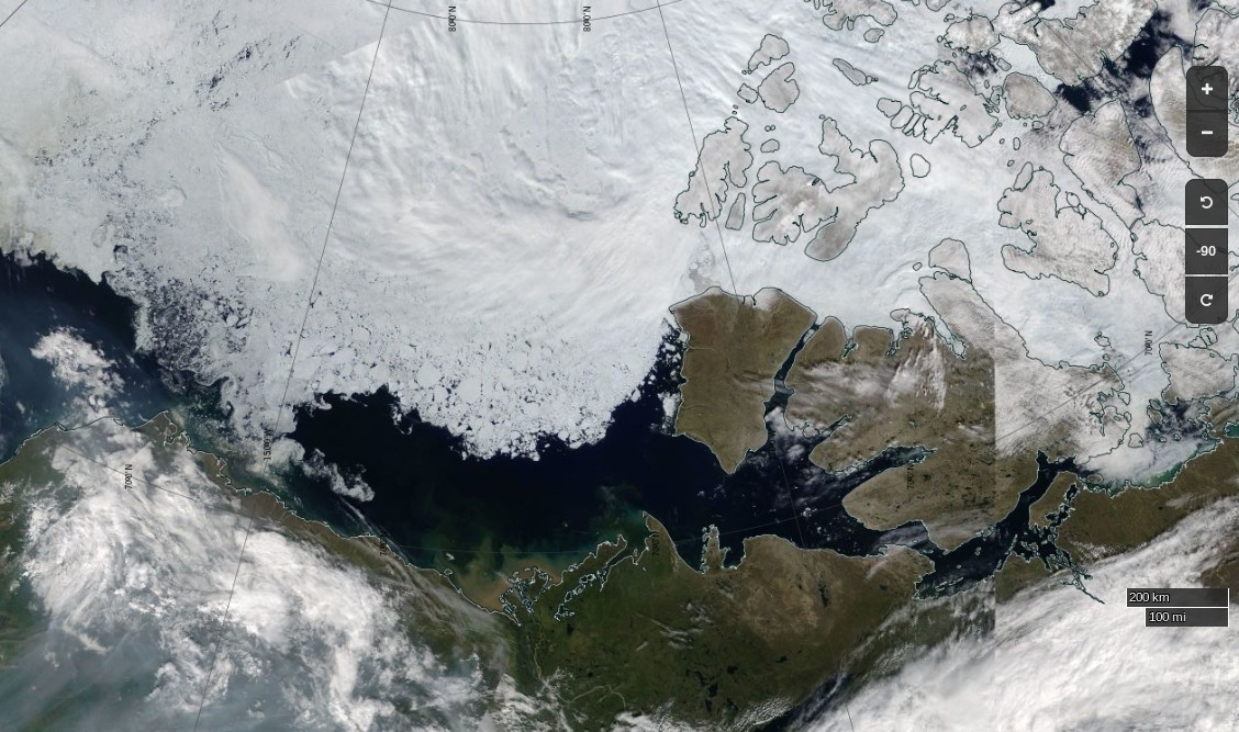
To the west the route is already opening up all the way from the Chukchi Sea to Cambridge Bay:
NASA Worldview “true-color” image of the Beaufort Sea on July 12th 2017, derived from the MODIS sensor on the Terra satellite
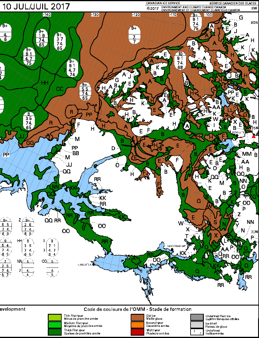
The problems on the southern route seem likely to arise in the central section this year, where far more old ice is present this year than in 2016:
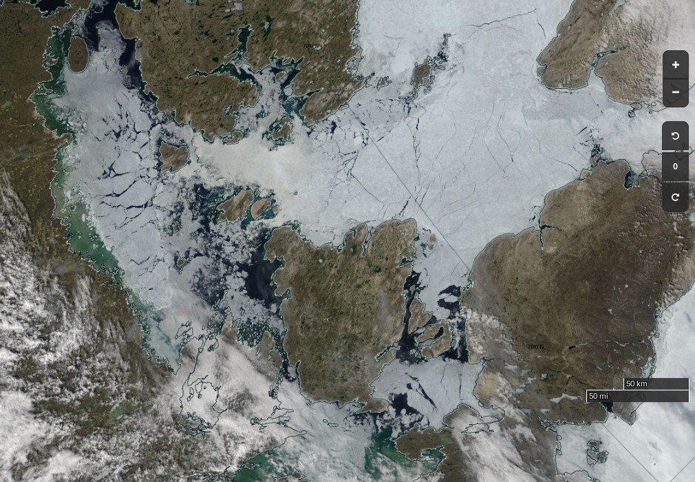
The remaining sea ice in Queen Maud Gulf doesn’t look like it will last long, but the ice in Victoria Strait and Larsen Sound is made of much sterner stuff:
NASA Worldview “true-color” image of Victoria Strait and Larsen Sound on July 10th 2017, derived from the MODIS sensor on the Terra satellite
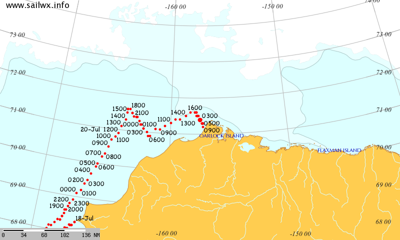
The cruise liner Crystal Serenity is anticipating navigating those waters once again this year, on August 29th. However much smaller craft are already heading for the Northwest Passage. Celebrate and Alkahest are already sailing north along the west coast of Greenland. Meanwhile Yvan Bourgnon is due to depart Nome, Alaska tomorrow, sailing his catamaran single handed in the opposite direction.
The crew of the Coast Guard Cutter Maple, a 225-foot seagoing buoy tender home ported in Sitka, Alaska, departed [July 12th] on a historic voyage through the Northwest Passage.
This summer marks the 60th anniversary of the three Coast Guard cutters and one Canadian ship that convoyed through the Northwest Passage. The crews of the U.S. Coast Guard Cutters Storis, SPAR and Bramble, along with the crew of the Canadian ice breaker HMCS Labrador, charted, recorded water depths and installed aids to navigation for future shipping lanes from May to September of 1957. All four crews became the first deep-draft ships to sail through the Northwest Passage, which are several passageways through the complex archipelago of the Canadian Arctic.
The crew of the cutter Maple will make a brief logistics stop in Nome, Alaska, to embark an ice navigator on its way to support marine science and scientific research near the Arctic Circle. The cutter will serve as a ship of opportunity to conduct scientific research in support of the Scripps Institution of Oceanography.
The Maple crew will deploy three sonographic buoys that are used to record acoustic sounds of marine mammals. A principal investigator with the University of San Diego embarked aboard the cutter will analyze the data retrieved from the buoys.
The Canadian Coast Guard Ship Sir Wilfrid Laurier will rendezvous with the Maple later this month to provide icebreaking services as the Maple makes it way toward Victoria Strait, Canada. The Maple has a reinforced hull that provides it with limited ice breaking capabilities similar to Coast Guard 225-foot cutters operating on the Great Lakes.
There doesn’t seem to be any up to date tracking information for the Maple, but CCGS Sir Wilfrid Laurier has recently arrived off Utqiaġvik (Barrow as was):
[Edit – August 18th]
Another article by Chris Mooney in the Washington Post includes this image of the eastern entrance to Bellot Strait on August 11th:
According to Chris:
After we’d passed through safely, Claude Lafrance, the ship’s commanding officer, took some time to explain how the strait worked with the help of a navigational chart. In the process, he lent credence to some of the observations made by Larsen over 70 years ago, while also explaining how modern knowledge has made navigating it safe with a proper tidal understanding.
The essence is that depending on when you are in Bellot Strait, the waters can be flowing either westward or eastward at and around high or low tide, respectively. So timing your crossing makes a great deal of difference.
The danger is that if you’re coming from the west (as we were) with the current to your back, you can be moving too fast, and have difficulty steering your vessel as you approach rocks at the end of the strait.
“We always want to go through where it’s more difficult, with the current against you, because it’s a lot easier to control the movement of your ship,” Lafrance said.
Therefore, the two-hour wait was quite intentional: The CCGS Amundsen stayed put until the tide began to shift and the waters to flow back westward, in effect neutralizing the current. Then the ship steamed out easily. “We just passed at the ideal time to go through,” Lafrance said.
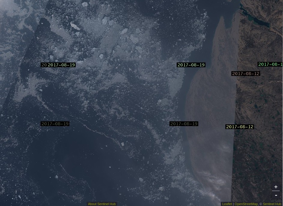
Here’s Sentinel 2A’s view of what he should expect to see in Larsen Sound after emerging at the other end:
[Edit – August 21st]
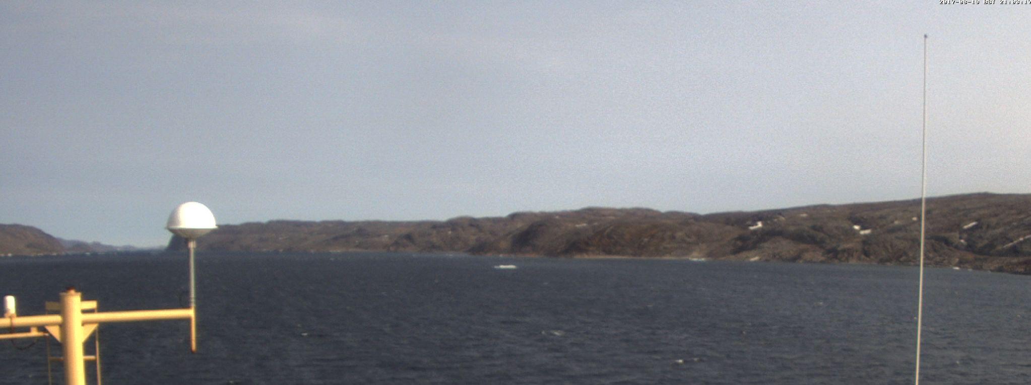
From the RRS Ernest Shackleton in Franklin Strait or thereabouts:
[Edit – August 22nd]
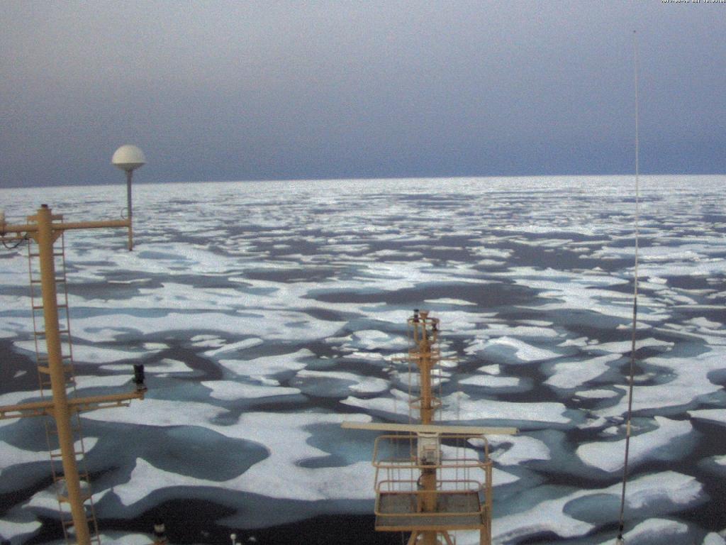
From the C3 expedition, also in the Franklin Strait area by the look of things:
Yesterday, we broke through ice that was two metres thick. Thank you to the Canadian Ice Service for ensuring our safe passage! #CanadaC3pic.twitter.com/2nCgalwPOo
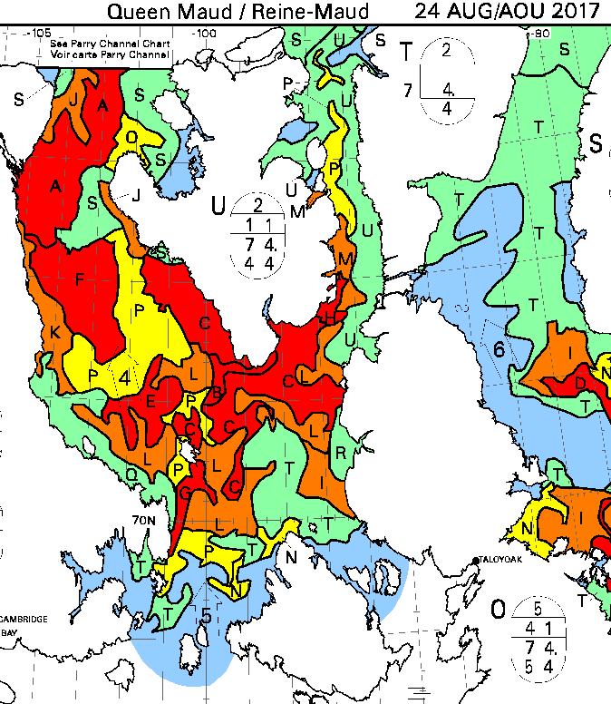
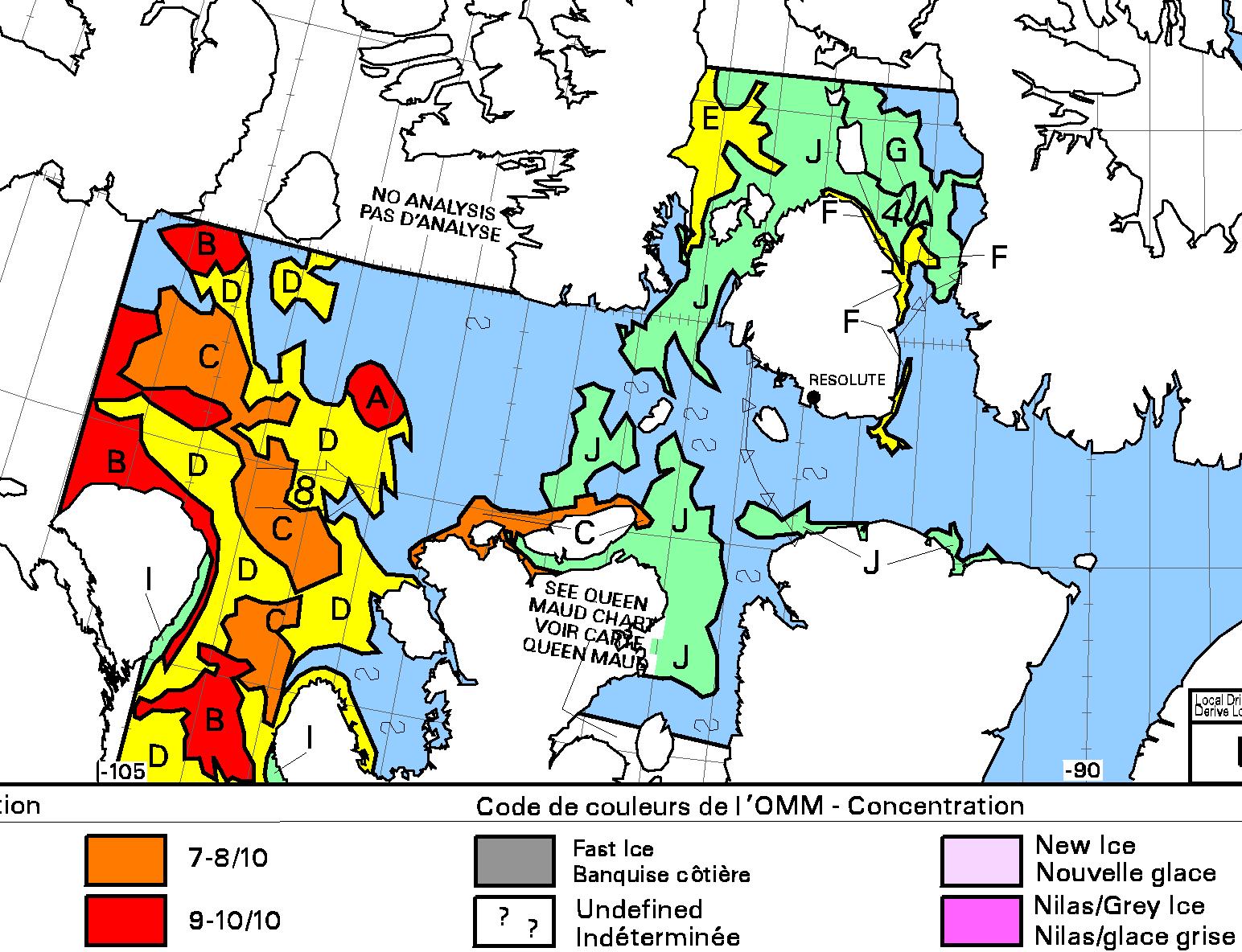
The latest CIS ice chart reveals a circuitous route via McClintock Channel that is ALMOST <= 6/10 concentration. Meanwhile Larsen Sound is still refusing to open up for the imminent arrival of the Crystal Serenity:
[Edit – August 27th]
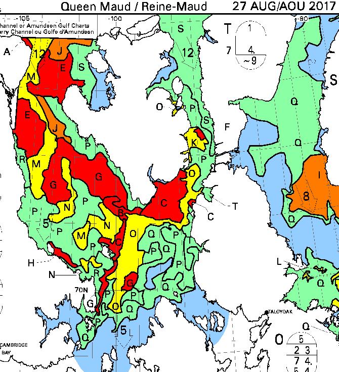
At long last the CIS concentration map reveals a <= 6/10 concentration path along the entire southern route via Bellot Strait:
[Edit – August 29th]
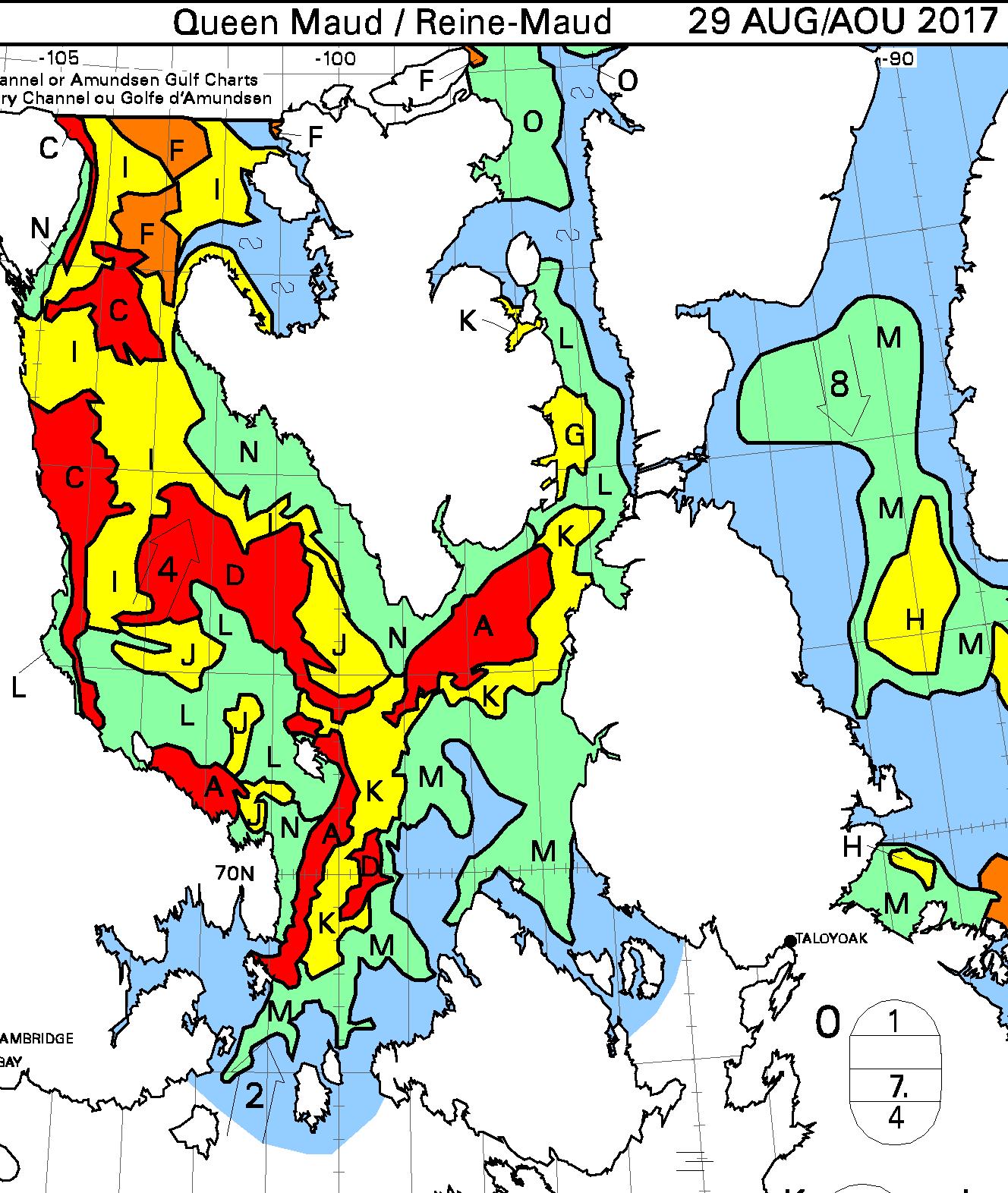
It is now possible to squeeze through Roald Amundsen’s route through the Northwest Passage without encountering over 6/10 concentration sea ice:
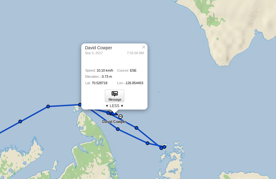
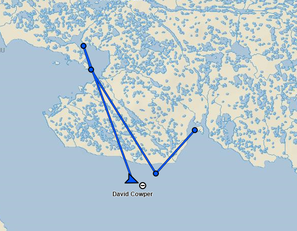
David Scott Cowper sought shelter for Polar Bound in the welcoming arms of Booth Island for a couple of days. Now they’re off again and have taken another close look at Cape Bathurst, but which route will they take now?
[Edit – September 10th]
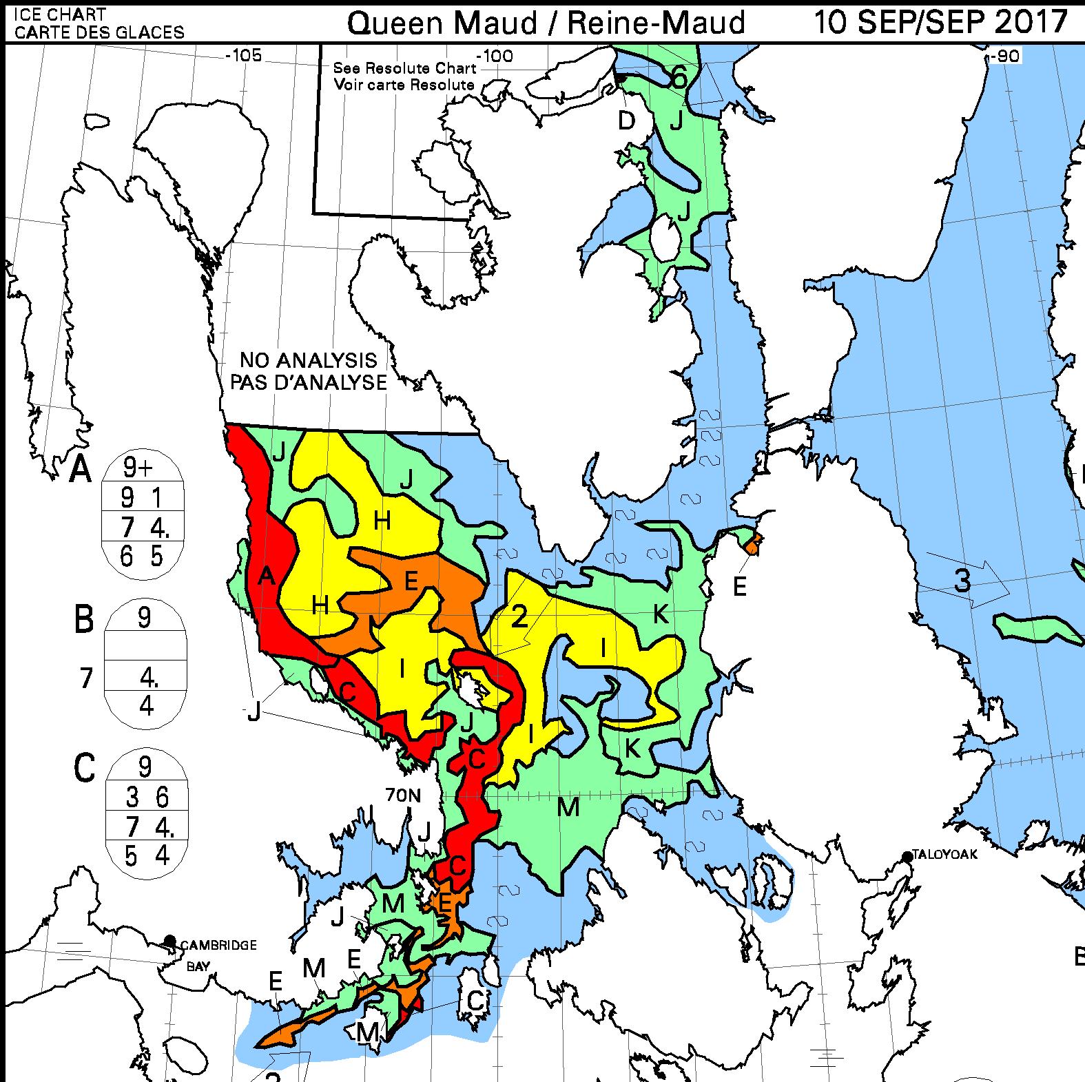
David Scott Cowper has left Cambridge Bay in Polar Bound and is heading east:
here’s what lies ahead of him:
Watch this space!
This website uses cookies to improve your experience. We'll assume you're ok with this, but you can opt-out if you wish. Cookie settingsACCEPT
Privacy & Cookies Policy
Privacy Overview
This website uses cookies to improve your experience while you navigate through the website. Out of these, the cookies that are categorized as necessary are stored on your browser as they are essential for the working of basic functionalities of the website. We also use third-party cookies that help us analyze and understand how you use this website. These cookies will be stored in your browser only with your consent. You also have the option to opt-out of these cookies. But opting out of some of these cookies may affect your browsing experience.
Necessary cookies are absolutely essential for the website to function properly. This category only includes cookies that ensures basic functionalities and security features of the website. These cookies do not store any personal information.
Any cookies that may not be particularly necessary for the website to function and is used specifically to collect user personal data via analytics, ads, other embedded contents are termed as non-necessary cookies. It is mandatory to procure user consent prior to running these cookies on your website.