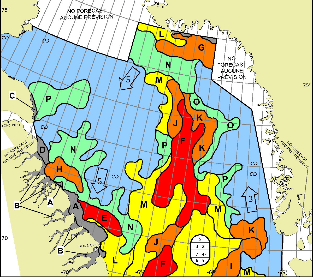
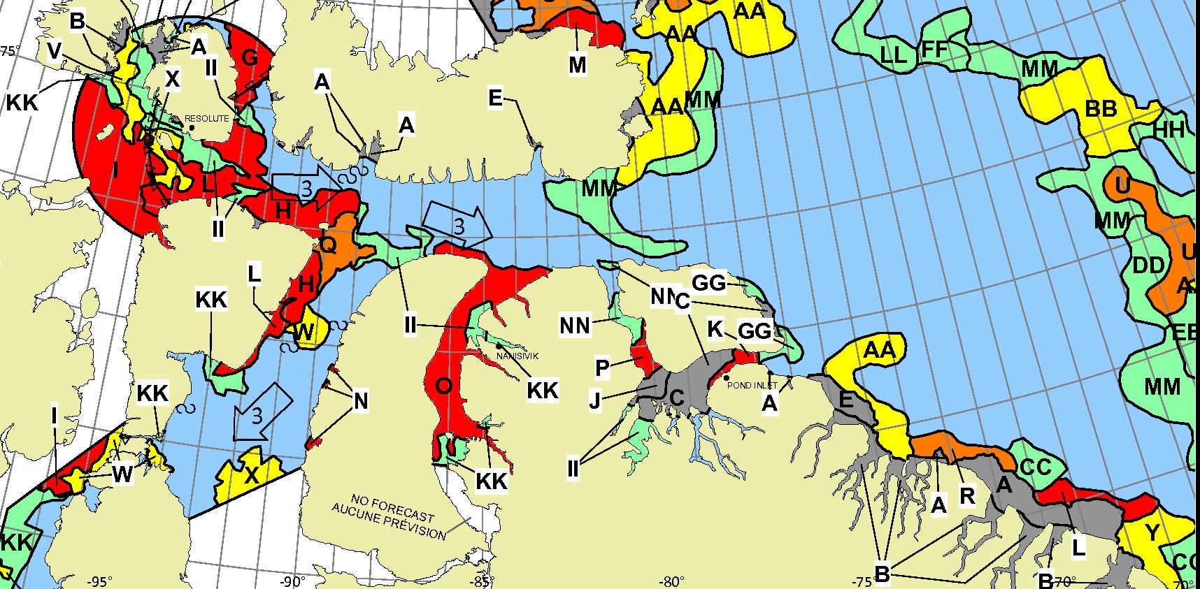
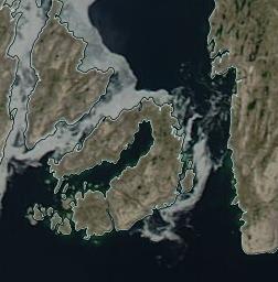
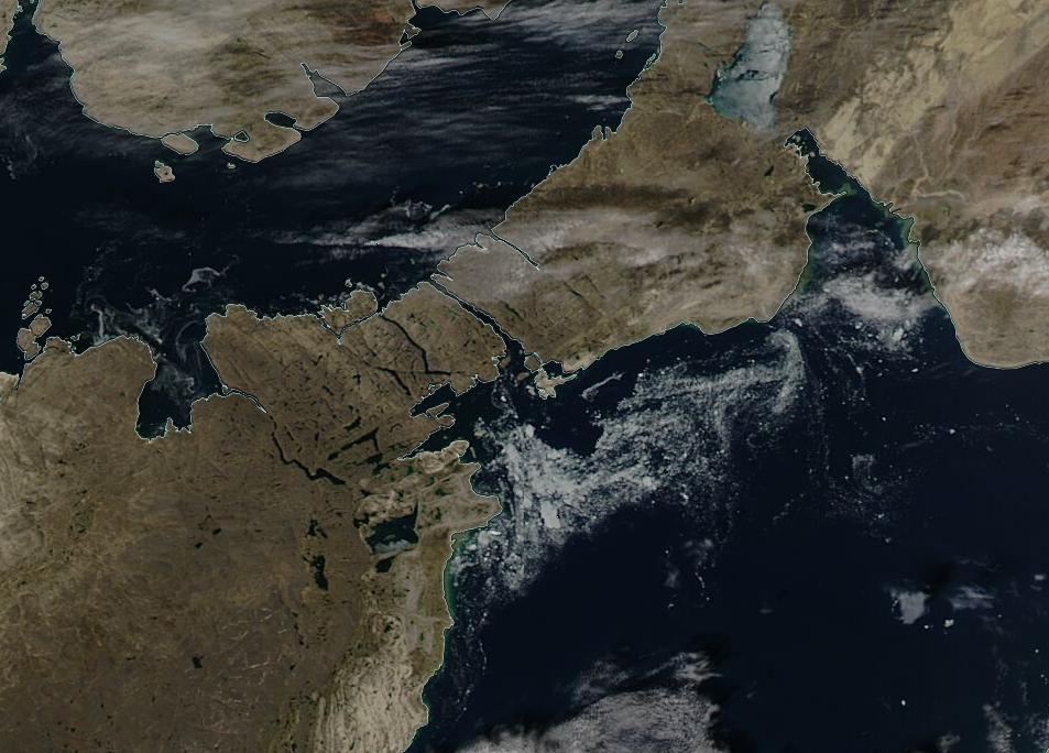
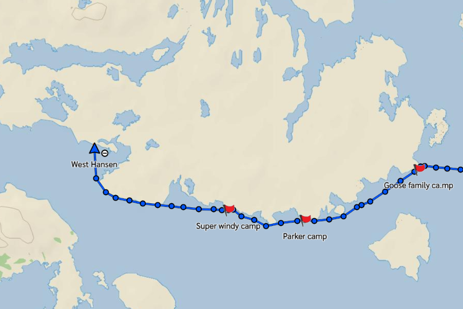
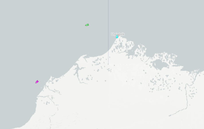
Prompted by a comment by Tom in the June open thread, the time has evidently come to open the 2023 Northwest Passage passage thread. First of all let’s get our bearings with the help of this map of the area:

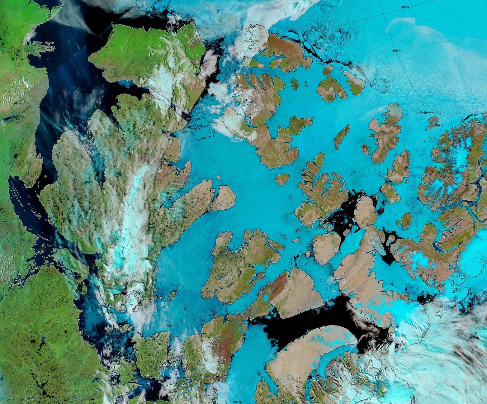
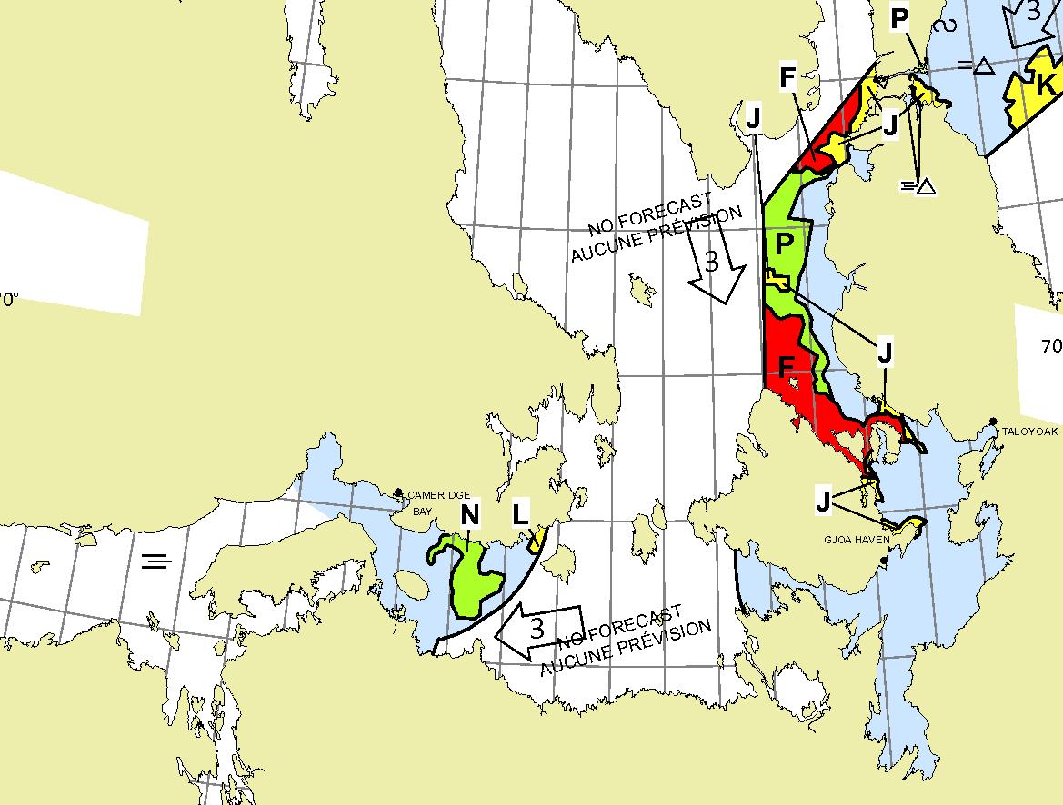
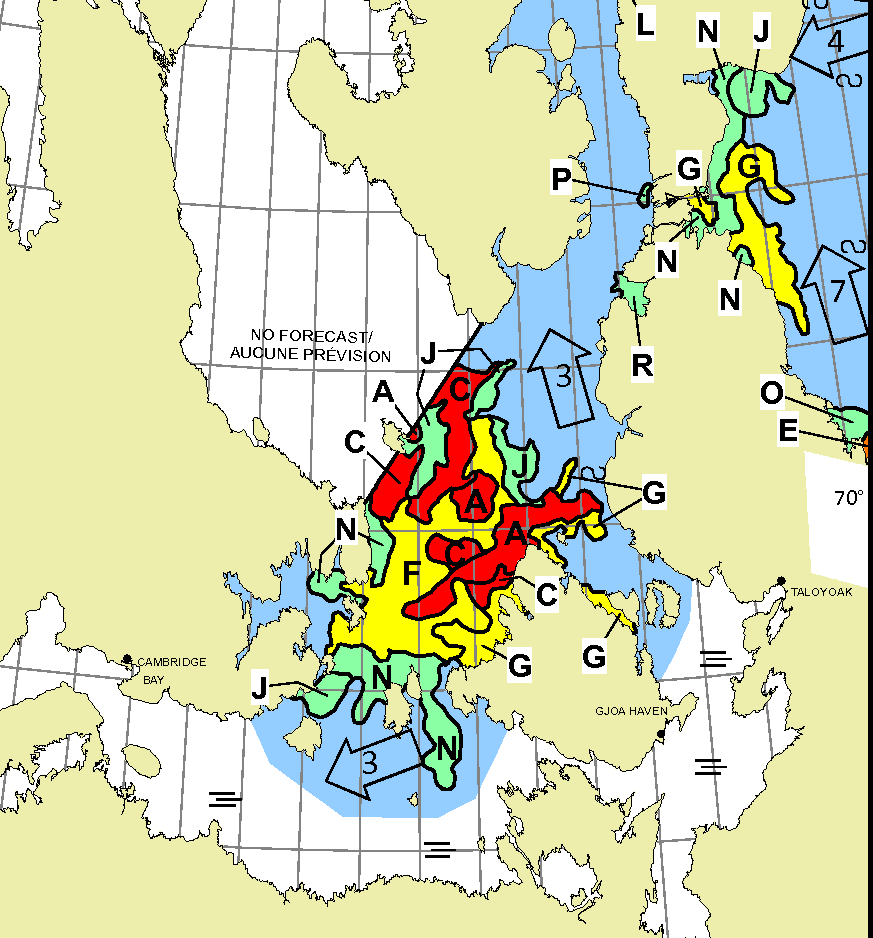
and another map detailing the routes through Canadian Arctic Archipelago that have previously been successfully traversed:

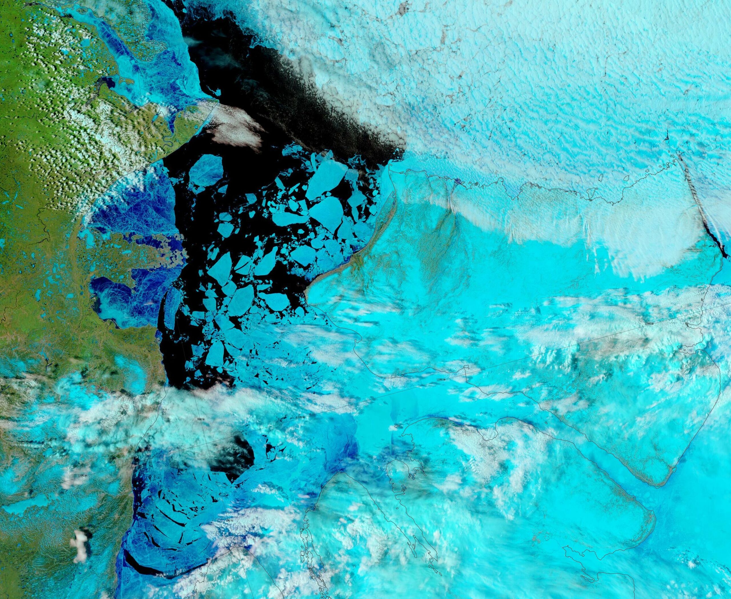
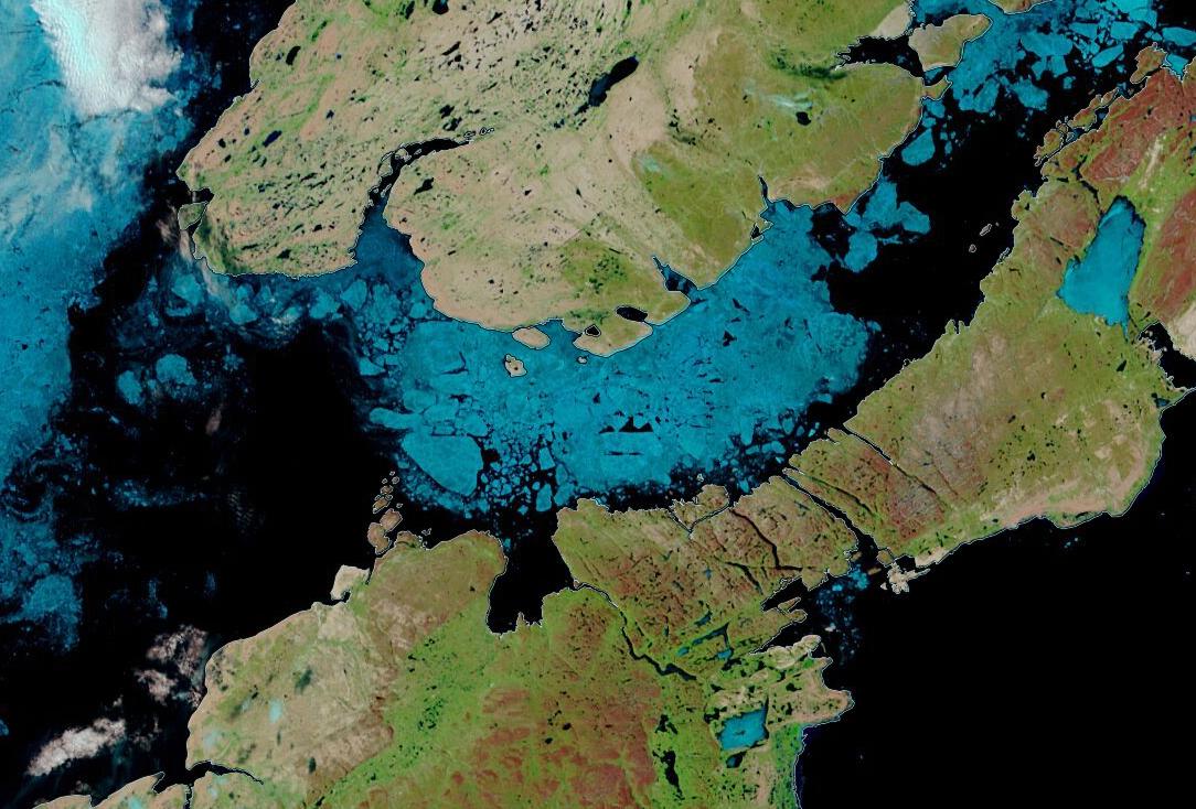
As our starter for ten for 2023, there is already plenty of open water in the Amundsen Gulf, together with plenty of melt ponding on the remaining fast ice in Franklin and Darnley Bays:
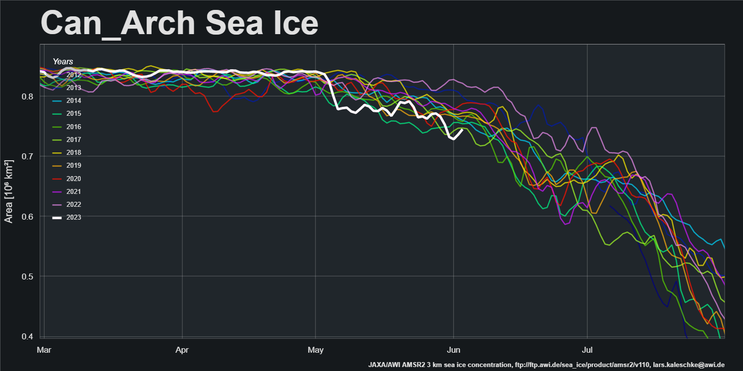
That is reflected in the current Canadian Arctic Archipelago sea ice area graph:
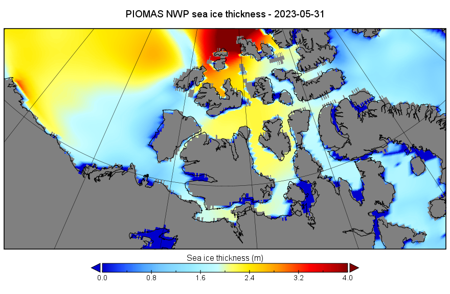
Let’s also take a look at the third dimension. Here’s the PIOMAS gridded thickness map for May 31st:
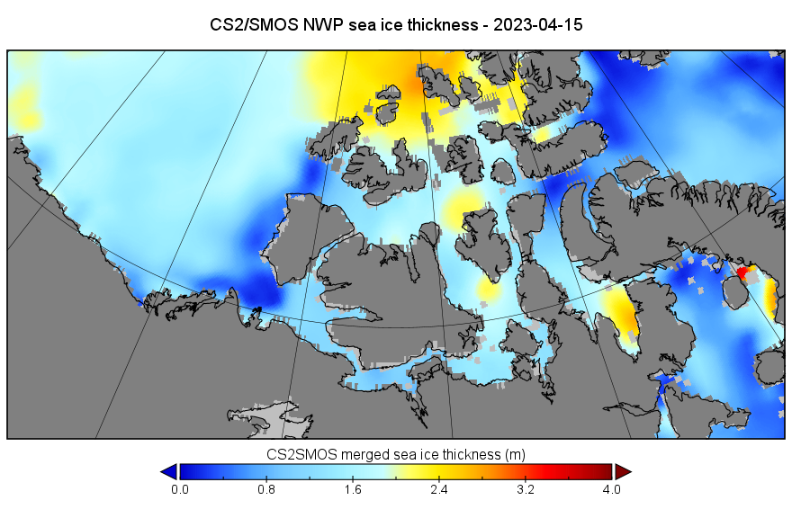
Here too is the last CryoSat-2/SMOS merged thickness map of the winter, from April 15th:
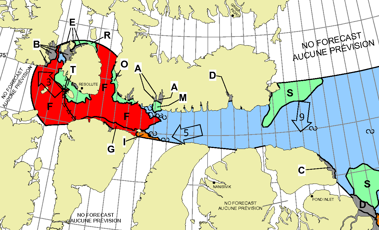
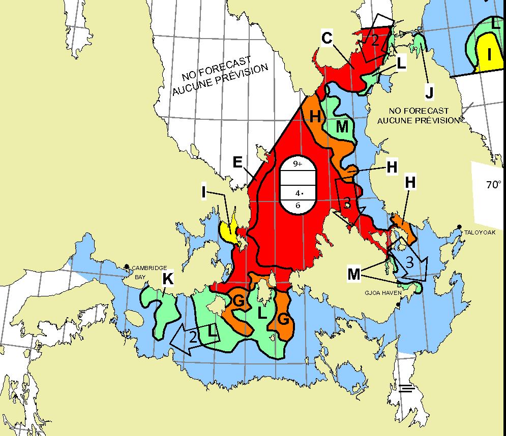
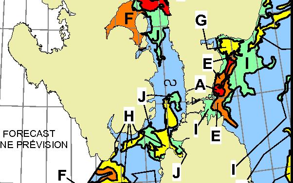
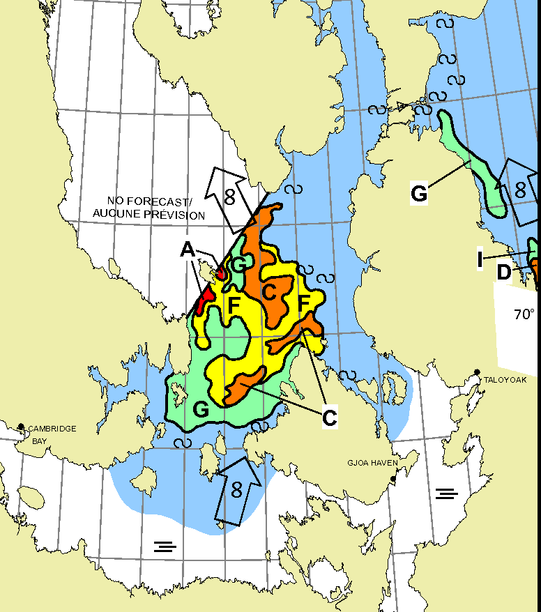
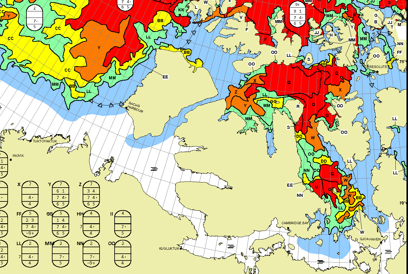
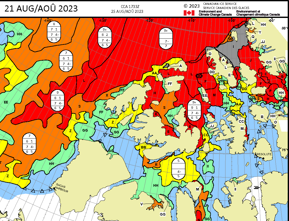
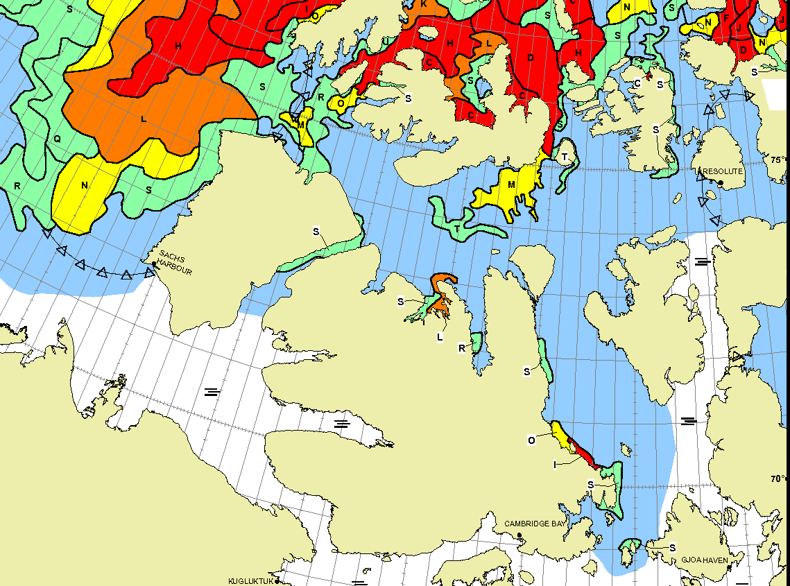
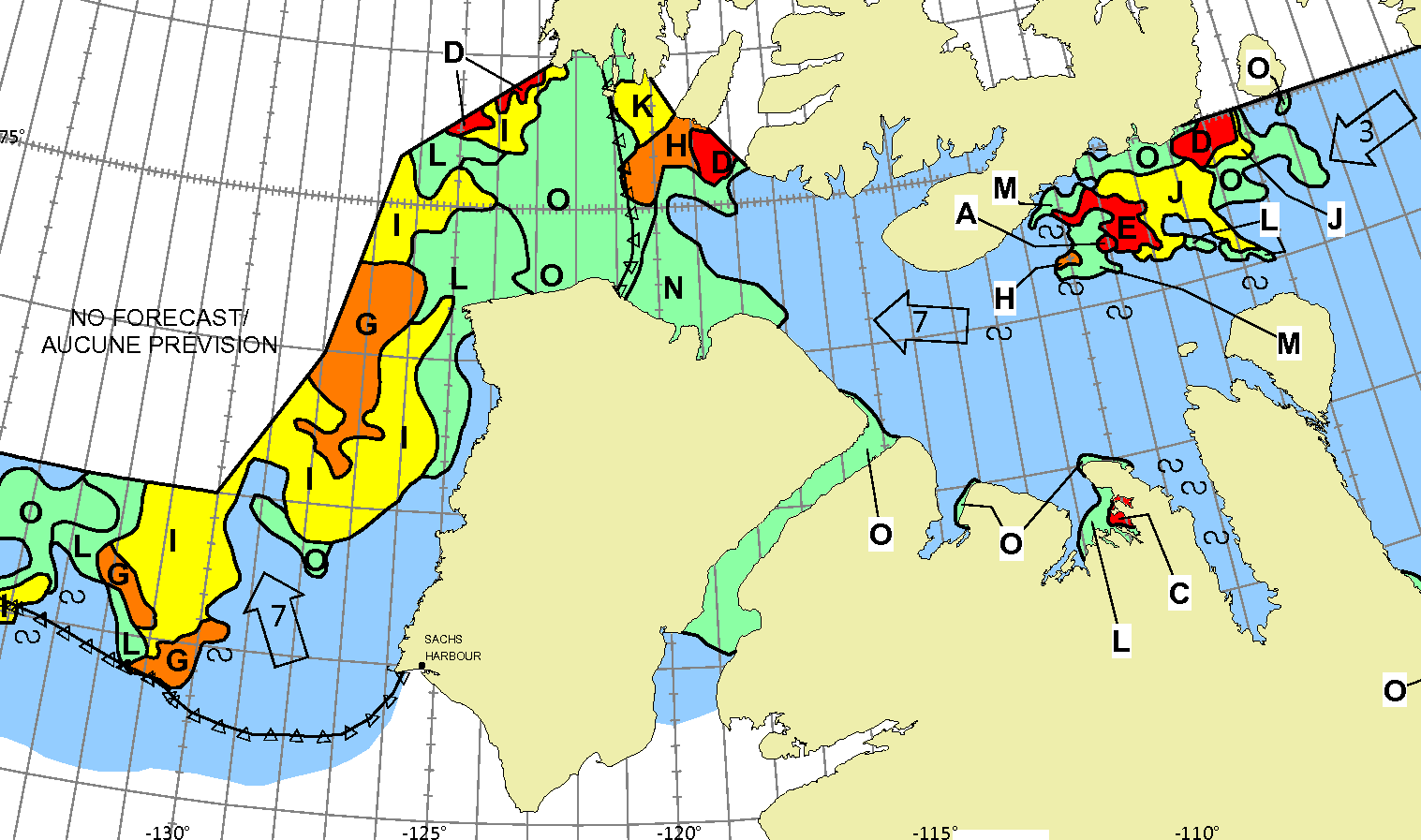
To get a better feel for what might happen during the coming summer season let’s also take a look at the Canadian Ice Service‘s “stage of development” charts. Here’s the most recent one for the “Western Arctic”, from May 29th:
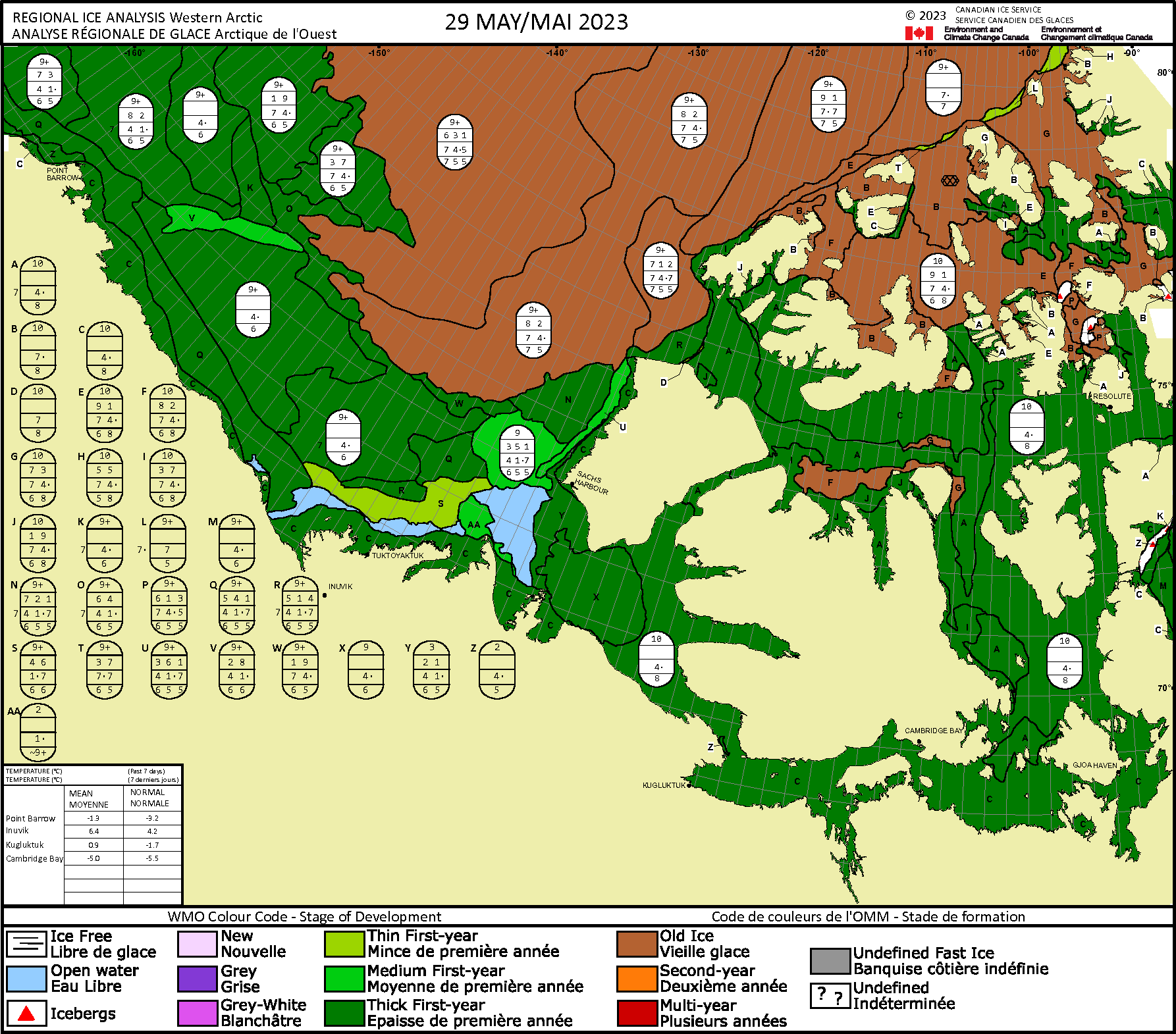
Note that none of the assorted routes through the North West Passage are currently blocked by old ice. Not even Route 1 via McClure Strait!
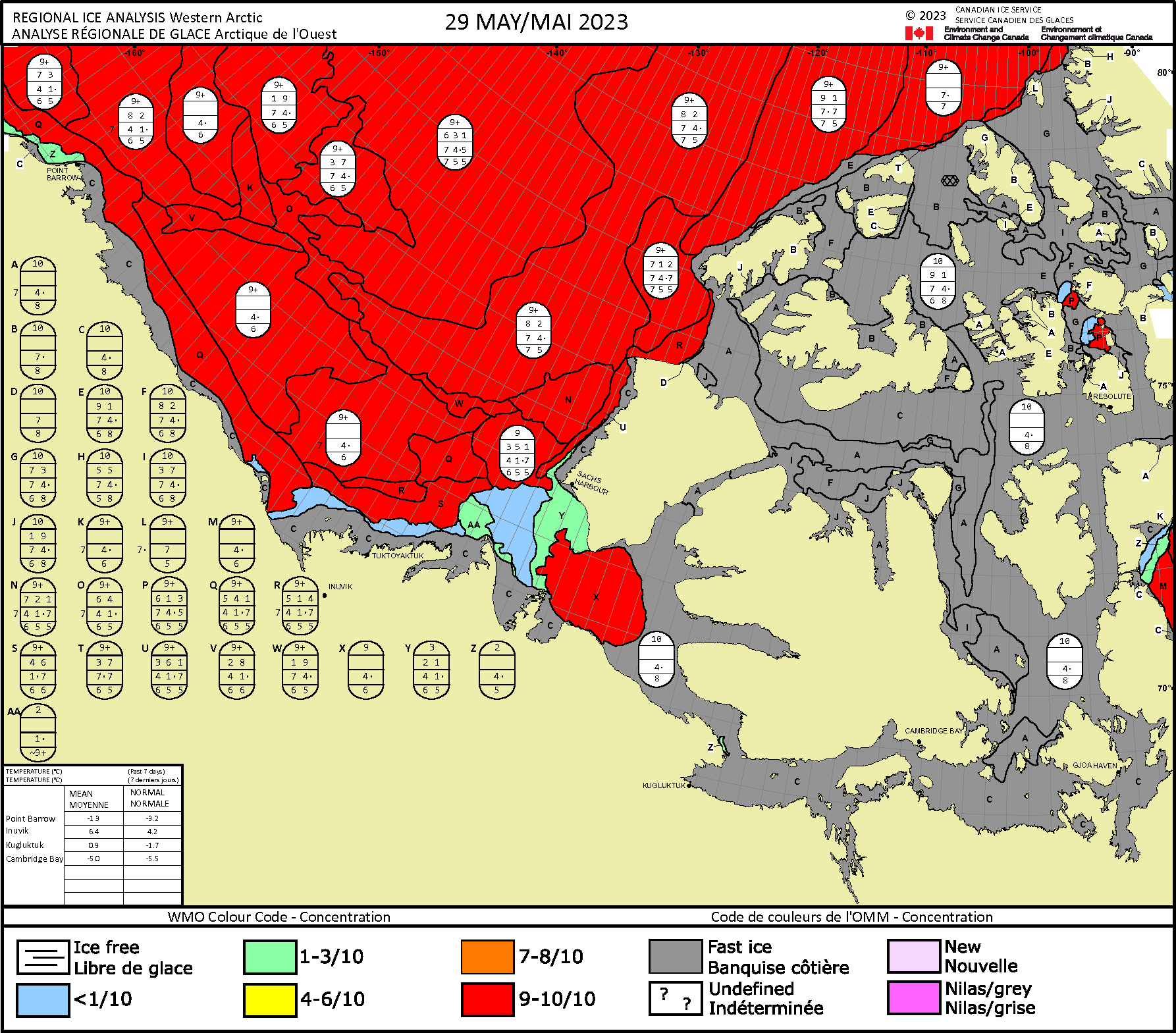
Finally, for the moment at least, here too is the CIS’s sea ice concentration chart:
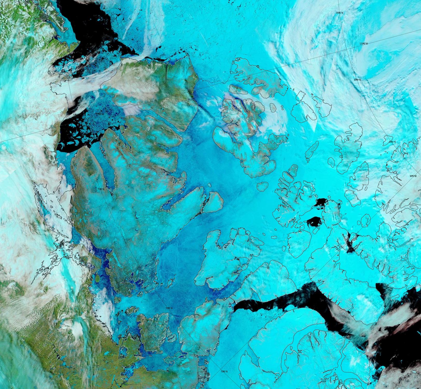
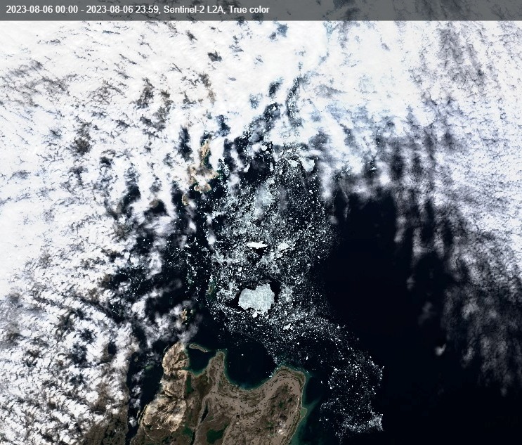
Surface melt is now visible across much of the Canadian Arctic Archipelago:
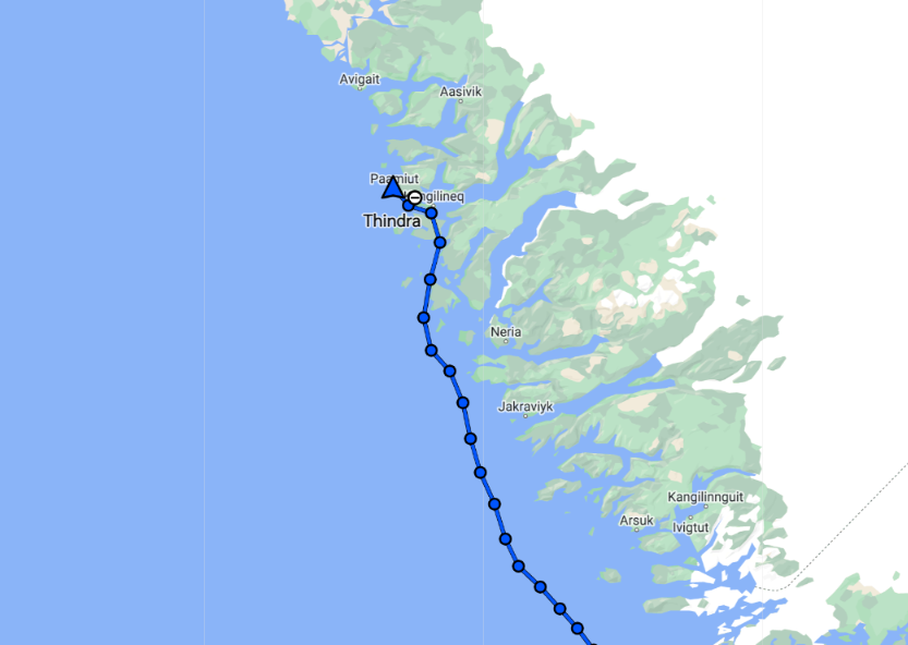
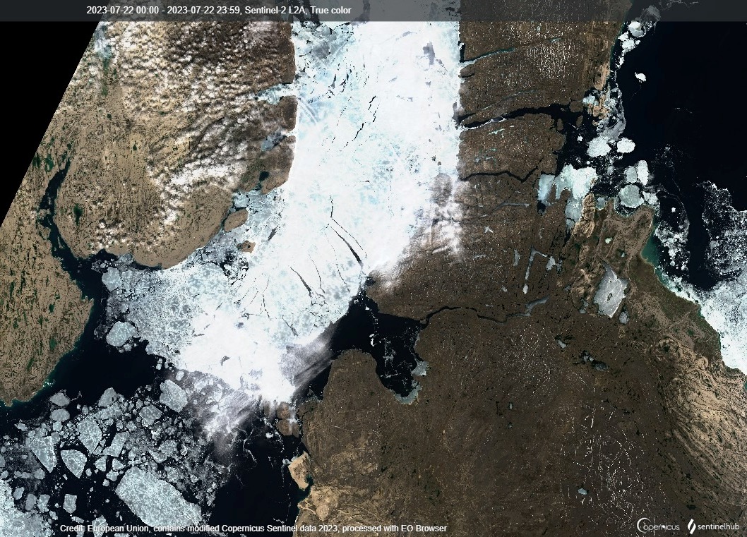
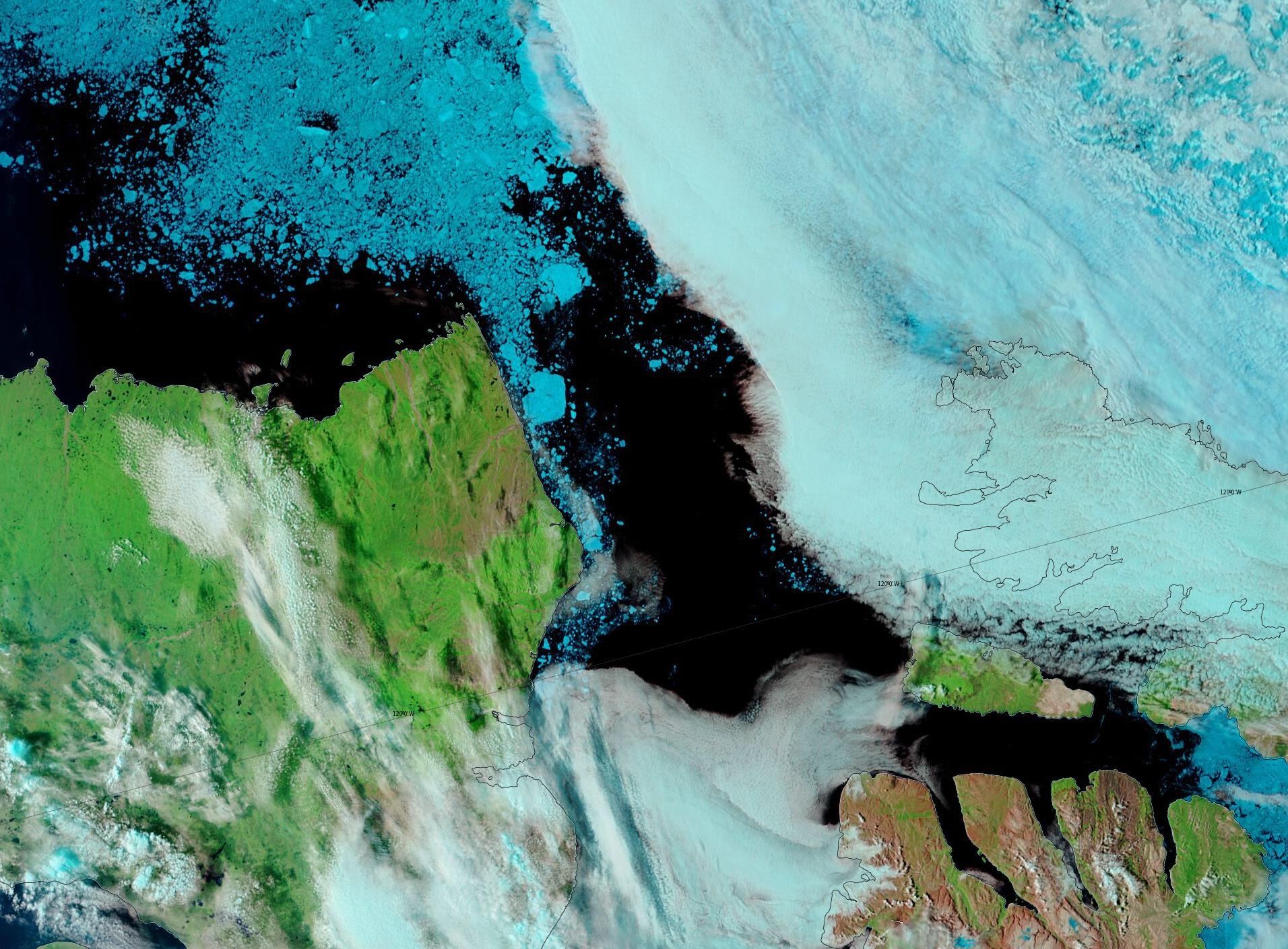
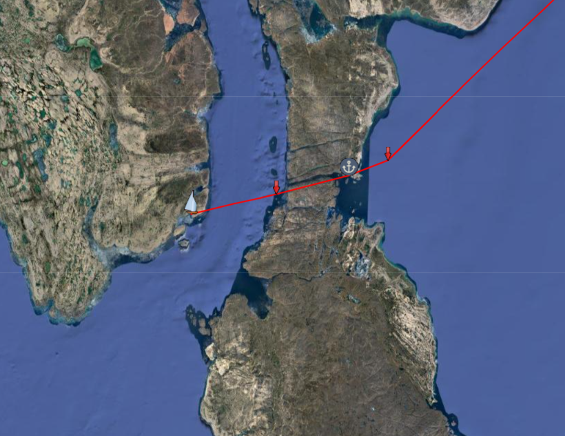
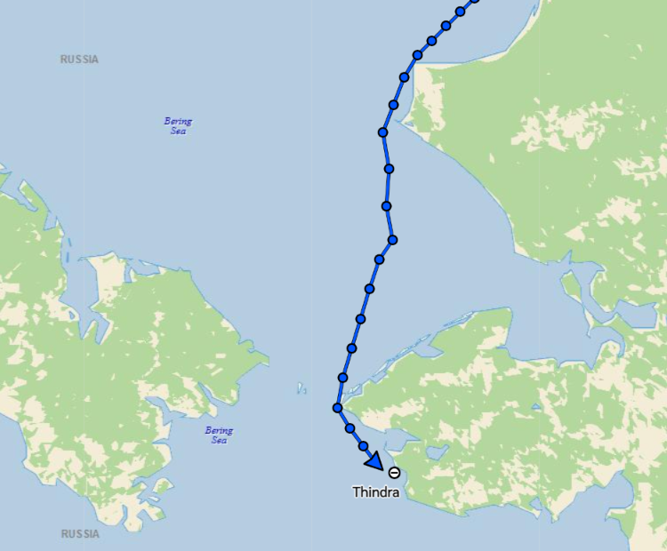
Thanks to the heads up from Sigurd, I’m now tracking SY Thindra on her west to east to west voyage through the Northwest Passage. Thindra is currently hugging the coast of south-west Greenland:
Here’s the Canadian Ice Service’s current chart of the sea ice concentration en route to Lancaster Sound:
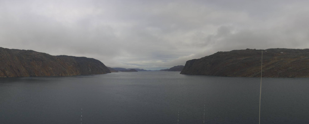
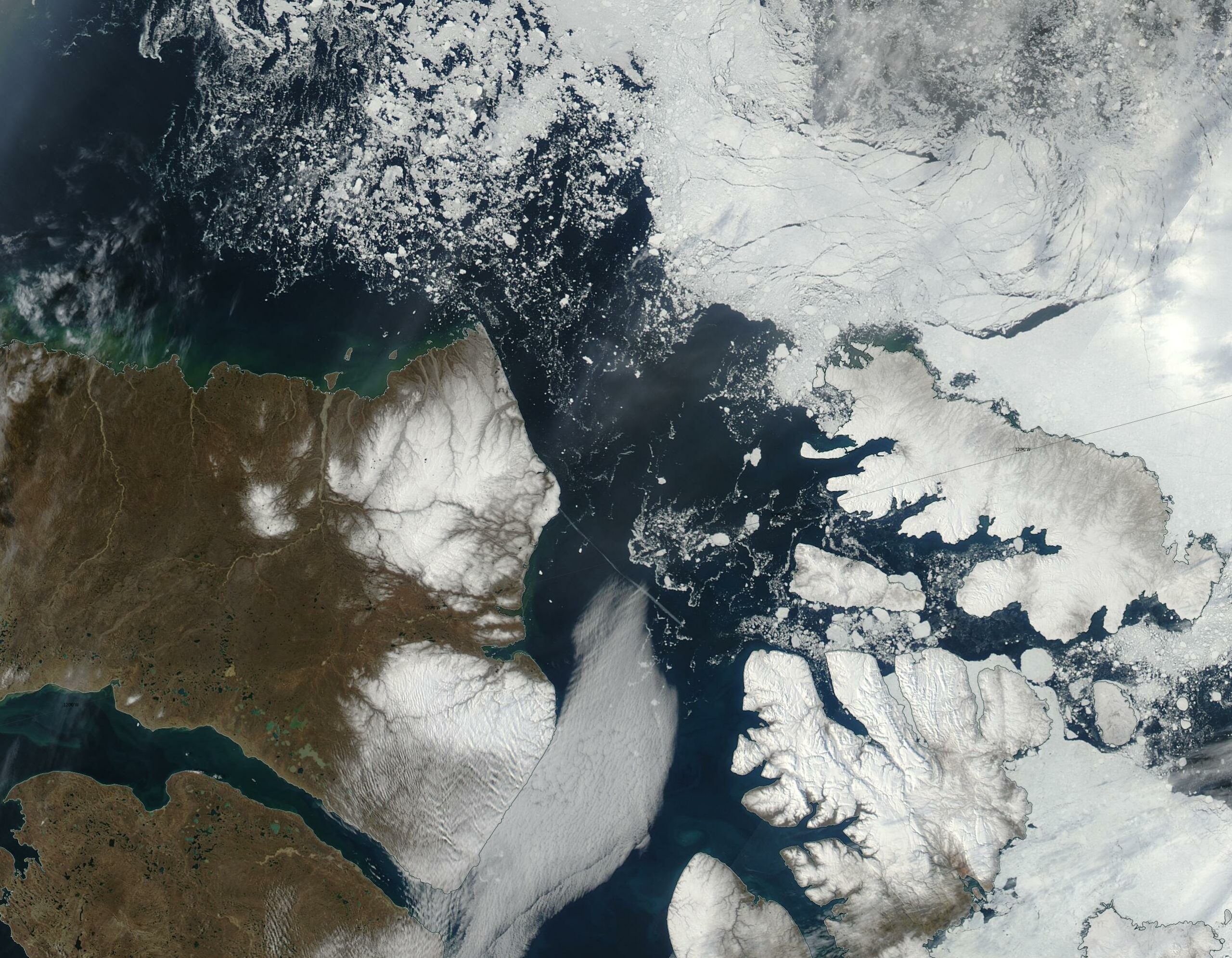
The skies were fairly clear over the Canadian Arctic Archipelago yesterday:
The ice in both McClure and Barrow Straits is breaking up, so it currently seems feasible that route 1 via the Parry Channel will open up later this summer.
[Edit – July 23rd]The Canadian Ice Service has started providing daily sea ice charts of the “Approaches to Resolute”:
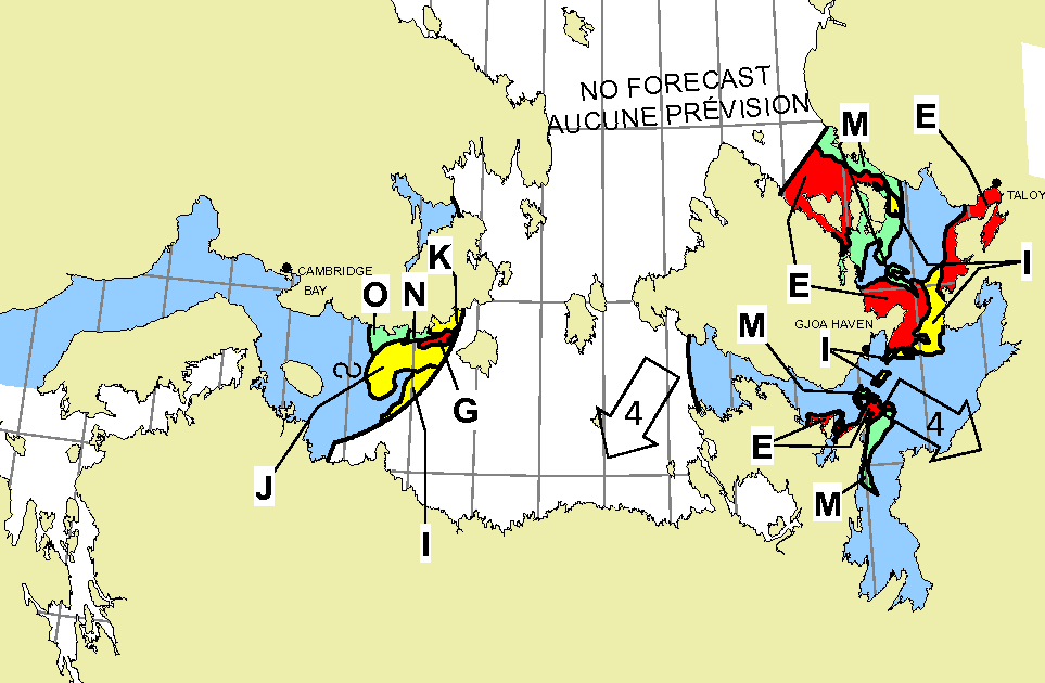
and “Queen Maud”:
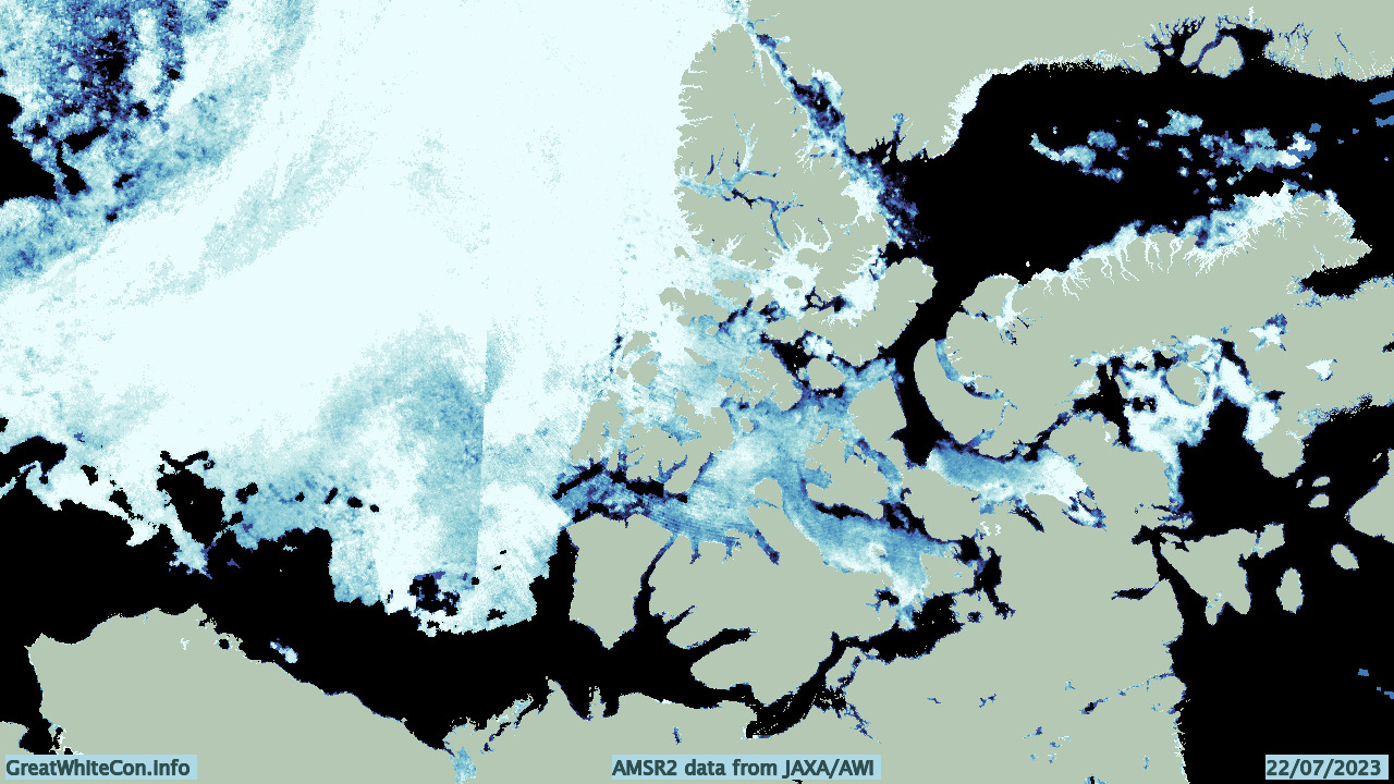
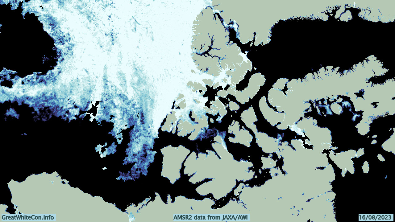
Unfortunately NASA’s Worldview service is suffering problems at the moment, but if AMSR2 is to be believed then suddenly almost the entire southern route through the Northwest Passage is now navigable:
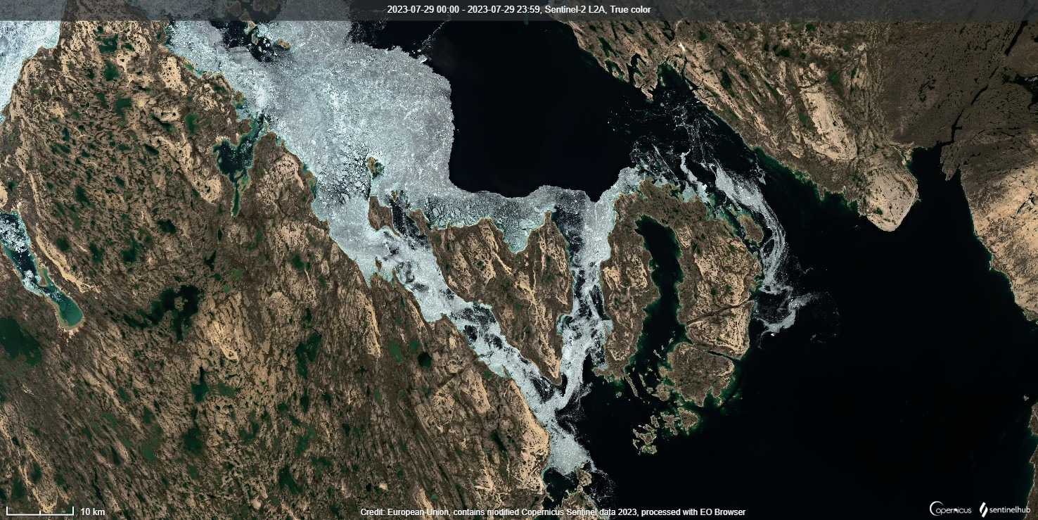
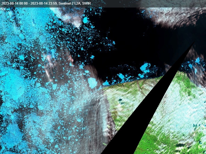
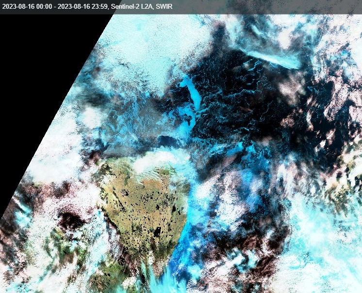
Fortunately in all the circumstances Sentinel 2 took a picture of the remaining high concentration ice in Franklin Strait yesterday:
It currently looks as though route 6 will be open early this year, perhaps even before the end of July?
[Edit – July 25th]Worldview is still down, but thanks to Sentinel 2 here are more recent pictures of the choke points in Franklin Strait:
and James Ross Strait:
It’s a very tight squeeze, and a puff of breeze might change the situation by tomorrow, but according to our habitual <= 6/10 concentration criterion I hereby declare route 6 through the Northwest Passage “open”!
There must have been a bit of a breeze! Note the 8-9/10 concentration ice now blocking the James Ross Strait on the CIS chart for “”Queen Maud”:
Sentinel 2 seems to have skipped that location today, so instead here’s the “true colour” view from Aqua:
P.S. A much more detailed Sentinel 2 image has now arrived:
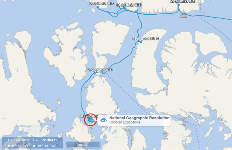
According to the CIS ice charts the Northwest Passage is currently still blocked south of the western entrance to Bellot Strait. Despite that the cruise ship National Geographic Resolution has made it through the Bellot and Franklin Straits and is now negotiating James Ross Strait:
Meanwhile Ocean Endeavour has entered Lancaster Sound.
[Edit – August 4th]Royal Wagenborg’s bulk carrier Alaskaborg has rounded Point Barrow and is now following an icebreaker through the Beaufort Sea:
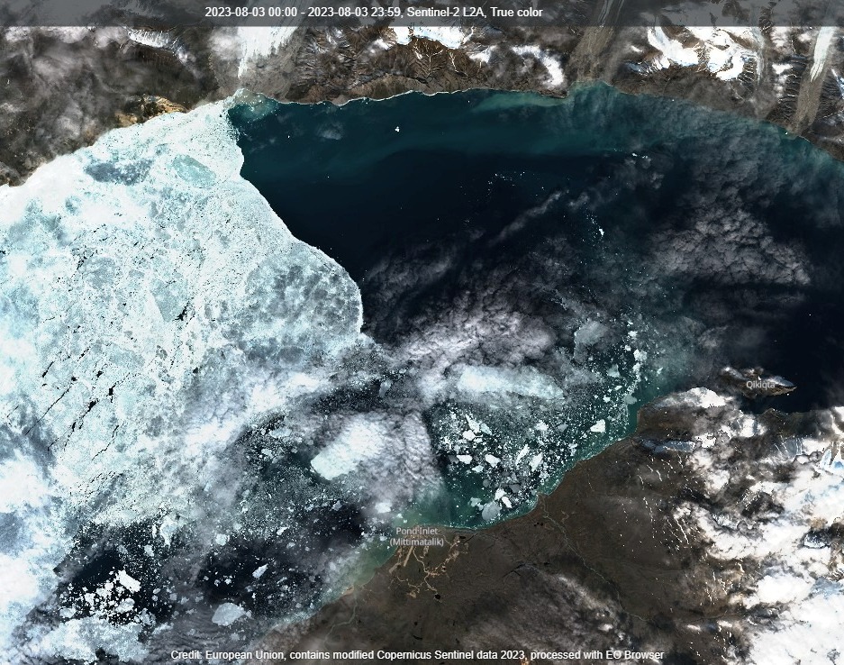
Further east the sea ice in Tasiujaq (Eclipse Sound) is breaking up around Pond Inlet:
Franklin Strait is melting out now, but all of a sudden the eastern entrance to Bellot Strait is “closed” by a small area of 7-8/10 concentration ice:
P.S. Here’s how the area looks from Sentinel 2:
A narrow channel of 1-3/10 ice along has opened up along the coast at the eastern entrance to Bellot Strait:
Here’s the view from on high, courtesy of Aqua/MODIS:
Do you suppose that the Northwest Passage will now remain “open” until much later this summer?
[Edit – August 9th]The captain’s of several “pleasure craft” are evidently of the opinion that the vicinity of the Bellot Strait will be navigable by the time they get there:
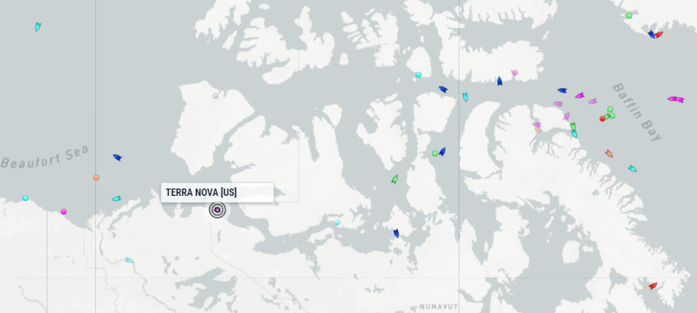
Travelling west to east Terra Nova has almost reached the Coronation Gulf, and Tecla is anchored off Herschel Island.
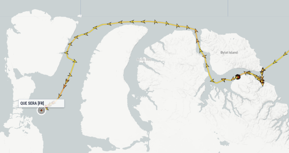
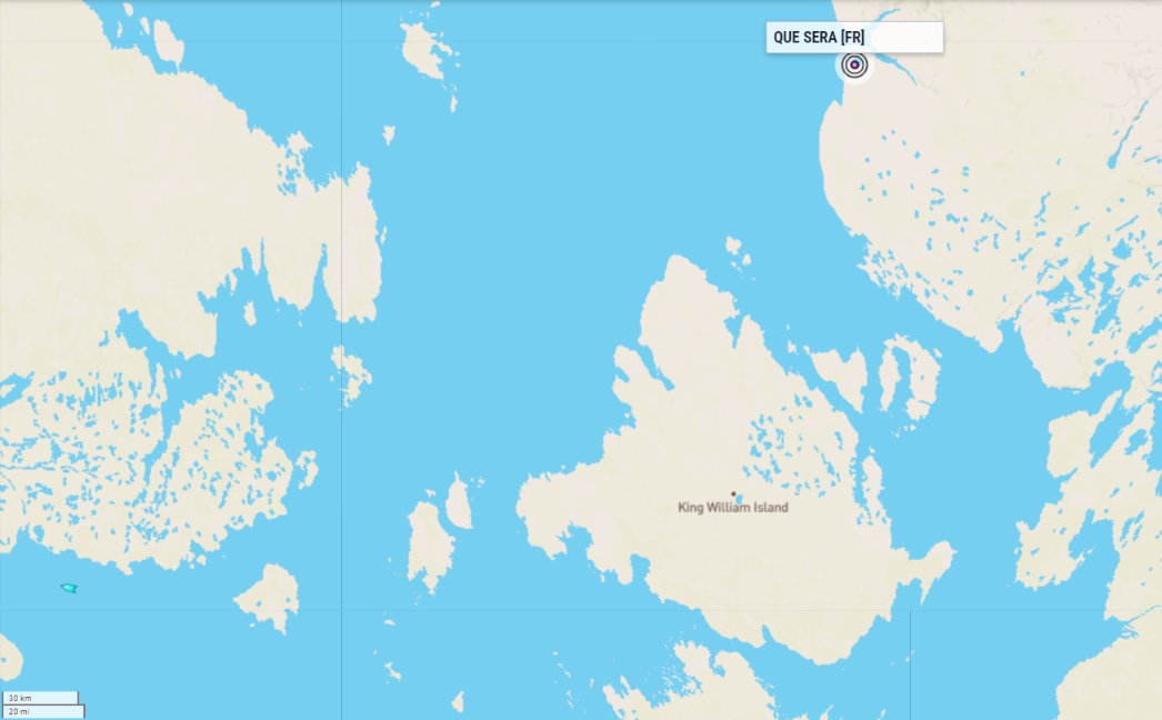
Heading in the other direction Que Sera has passed Pond Inlet and is now in Navy Board Inlet. Meanwhile Caprivi is entering Lancaster Sound.
Nobody is heading for McClure Strait at the moment, but it’s looking increasingly likely that circumnavigating Banks Island will become possible in the not too distant future:
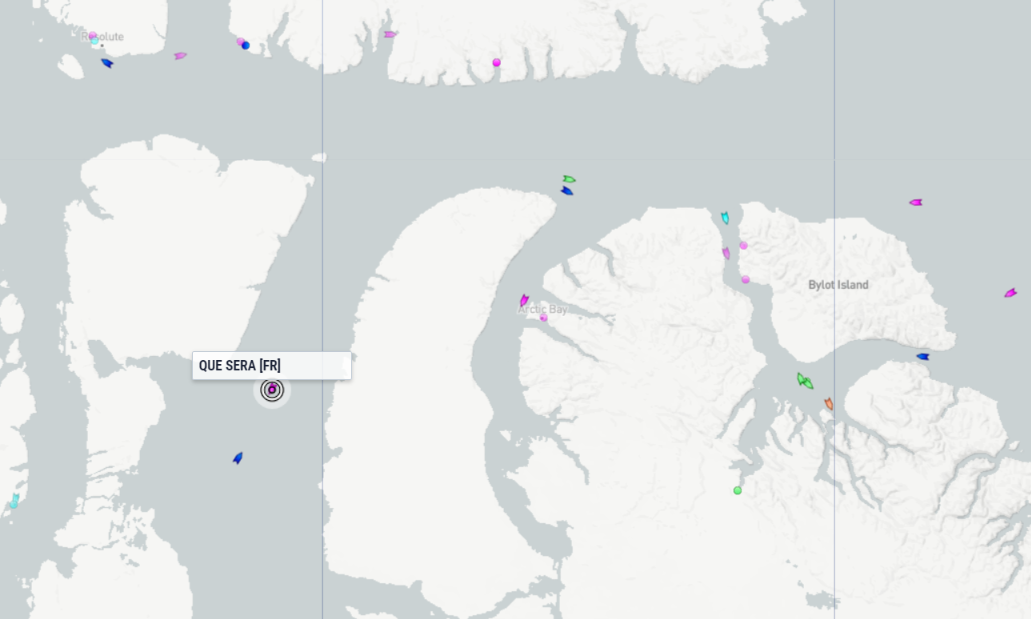
Que Sera looks likely to be the first “pleasure craft” to negotiate Bellot Strait this year, and is currently heading south through Prince Regent Inlet:
The crew are writing a slightly delayed blog about the voyage. Yesterday’s article is entitled “In Lancaster Sound“. On reaching Pond Inlet on August 4th:
A change of crew. Maria and the artist Katharina leave the boat. Antoine replaces the crew. Paul, a student at the UNIGE, replaces Maria, and Alexis will be the professional mediaman for this passage of the NW. A few days later, Jessica and Okalik from the ‘Beyond Her Horizons’ team joined the crew.
[Edit – August 12th]On 9 August, the team was on the move and on the lookout for a potential exit to the west of Bylot Island to reach Lancaster Sound. An opportunity presented itself, as several boats followed the fisheries surveillance boat, which had opened up a route that was still impassable the day before. Que Sera was one of them.
Today, the boat is making good speed, with the small town of Cambridge Bay as its next target. The crew is now in the NW Passage, and conditions look ideal for what lies ahead.
I’ve been waiting for the skies to clear over the Bellot Strait, so the satellites can get a good look. No such luck so far, but here is that latest CIS ice chart for the area:
Que Sera appears to be waiting for a good opportunity to take a closer look at the eastern entrance to the Strait:
Sure enough, Que Sera emerged from the western entrance to Bellot Strait last night (UTC):
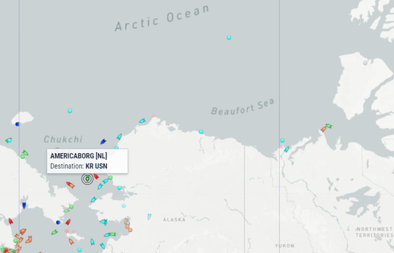
Further west Americaborg is approaching the Bering Strait and Albanyborg is emerging from the Amundsen Gulf:
National Geographic Resolution is not far behind Americaborg, en route to Nome.
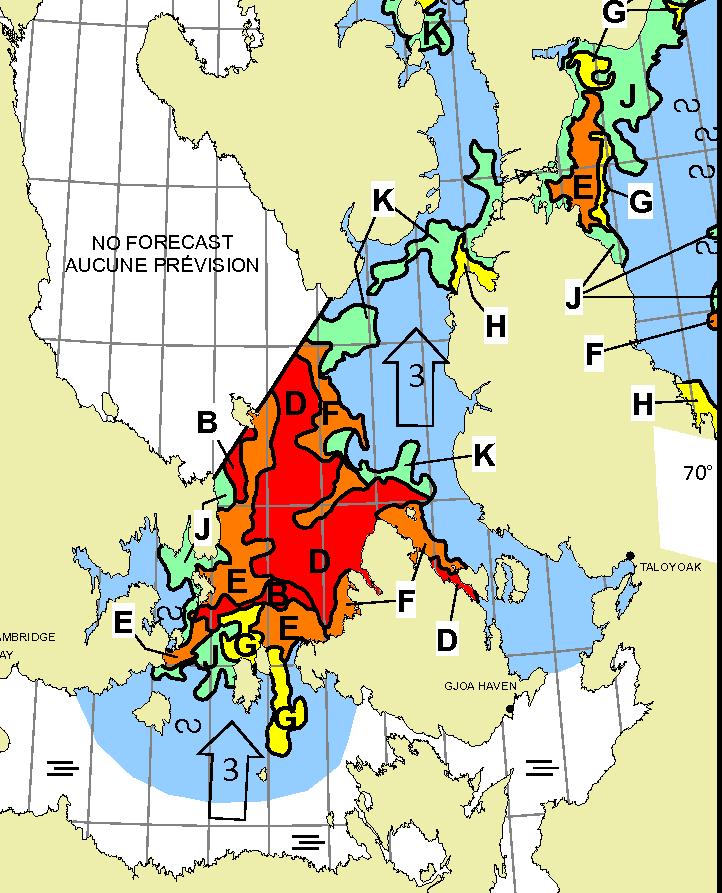
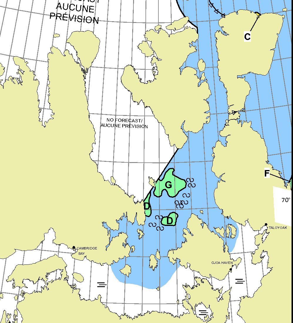
[Edit – August 15th]The sea ice in the heart of the Northwest Passage is melting away. There is now a <= 6/10 concentration route through Larsen Sound and Victoria Strait on the CIS ice charts:
However there is a bit of a breeze blowing in the area at the moment:

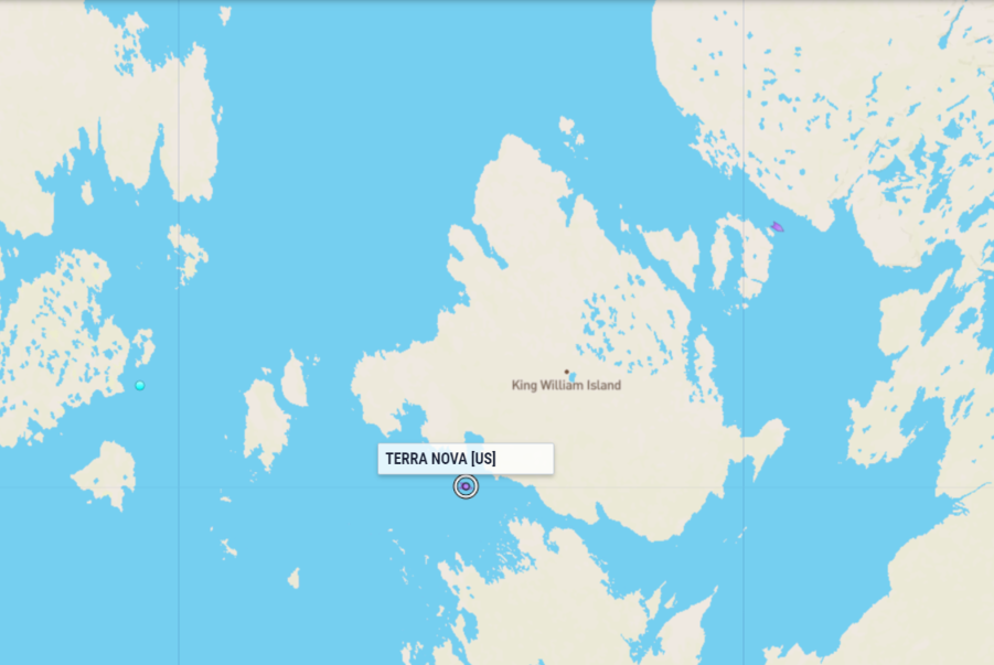
Que Sera is sheltering in Pasley Bay. Meanwhile Terra Nova is anchored in Cambridge Bay, and CCGS Henry Larsen is heading in that direction:
In the wake of the storm Tecla is about to round Cape Bathurst as CCGS Sir Wilfrid Laurier heads in the opposite direction:
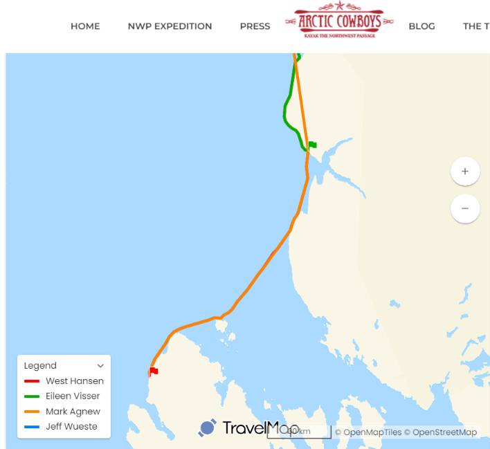
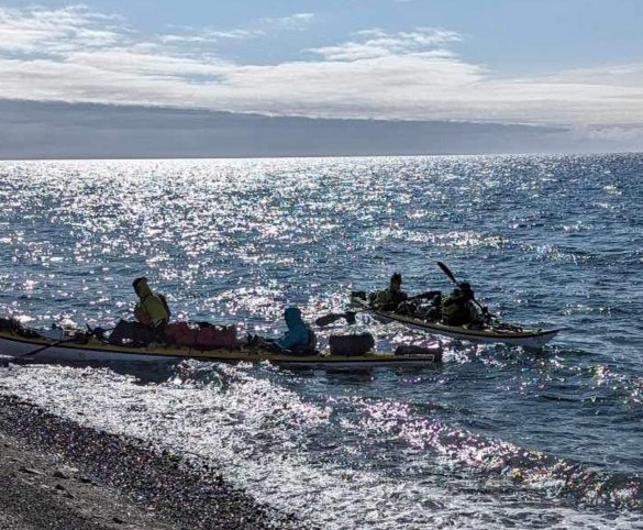
It has only recently come to my attention that the Arctic Cowboys are attempting to kayak through the Northwest Passage again this year. They also appear to be heading for Pasley Bay:
The Canadian Ice Service aren’t covering the area yet, but “unofficially” a particularly adventurous yacht captain could probably now navigate out of McClure Strait into the Beaufort Sea:
The southern route through the Northwest Passage is now wide open:
Que Sera and Terra Nova are both on the move again, heading for Gjoa Haven from opposite directions. CCGS Henry Larsen doesn’t have a lot to do at the moment:
Now I cannot help but wonder when (if?) the CIS will start daily coverage of the Parry Channel and McClure Strait! In the meantime here’s what AMSR2 sees:
and the latest weekly ice chart, dated August 14th:
Here too is a glimpse through the clouds of the remaining sea ice in Viscount Melville Sound:
Admiral Bellingshausen has become the second “pleasure craft” to successfully make its way through the Bellot Strait this summer. Not forgetting the two kayaks of the Arctic Cowboys!
Integrity is on the move in Peel Sound as well.
[Edit – August 19th]Skokica doesn’t appear to have functional AIS, but her tracking map reveals that she successfully made her way through Bellot Strait yesterday:
Taking a look at other “small vessels” with their own live tracking map, Seabelle is currently waiting out some strong winds in Arctic Bay:
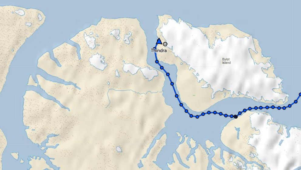
Presumably for the same reason, Thindra remains in Tay Bay:
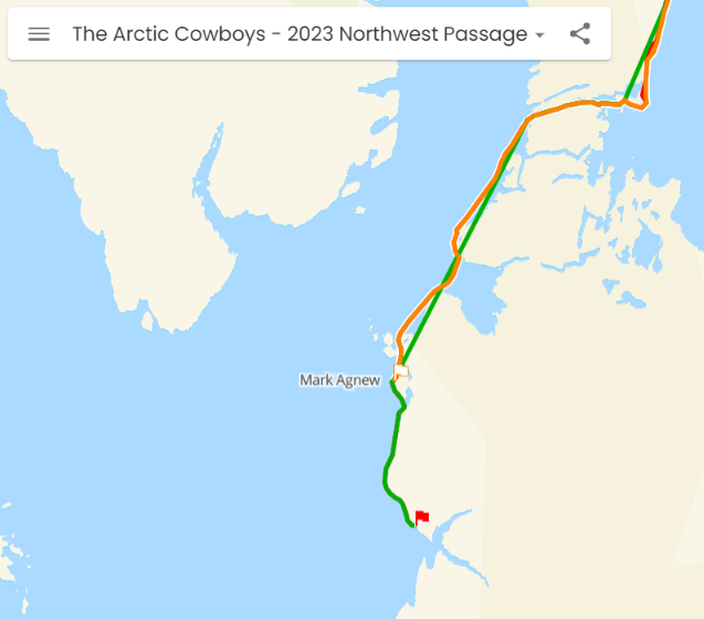
Meanwhile the Arctic Cowboys have reached King William Island, and seem intent on heading down the Victoria Strait:
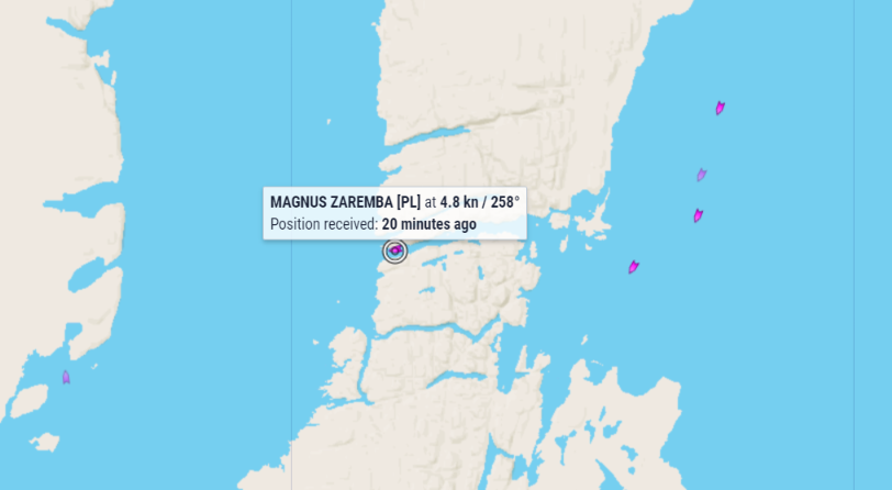
Magnus Zaremba is poised to emerge from the western entrance to Bellot Strait:
Meanwhile there is a long queue forming at the eastern entrance!
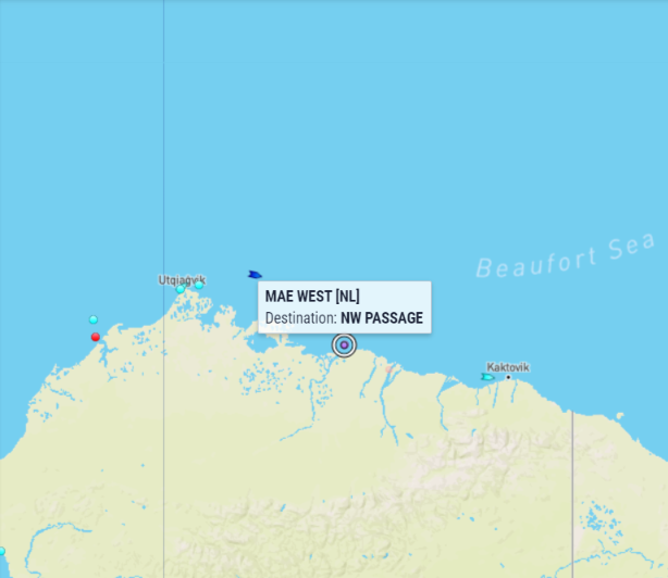
[Edit – August 22nd]André Speet in Mae West has rounded Point Barrow on his single handed west to east voyage through the Northwest Passage. The cruise ship Roald Amundsen is not far behind:
Further east it’s all go around Bellot Strait. Terra Nova will shortly be emerging from the eastern entrance. Meanwhile Magnus Zaremba, Thindra and Seabelle have made it through heading west, with Sentijn, Caprivi and Walkabout waiting their turn.
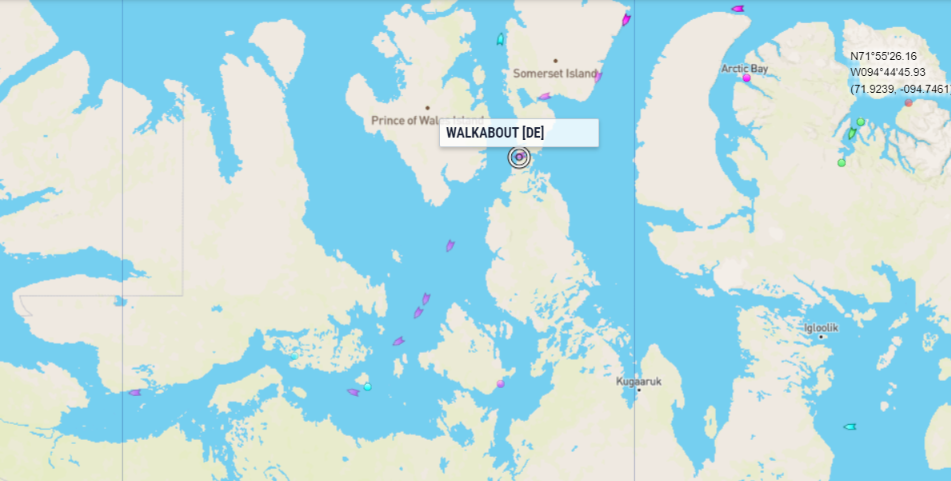
[Edit – August 23rd]Walkabout is the latest “pleasure craft” to make it through the Bellot Strait heading west, following in the wake of yachts heading through the now “wide open” Victoria Strait:
According to the latest weekly CIS ice chart Route 1 through the Parry Channel and McClure Strait is now “open” to anyone willing to try ploughing through a large area of 5/10 concentration ice:
Route 7 through Foxe Basin is now also “open”:
The Tenacious Arctic Cyclone has finally moved away from the Arctic Basin and is now blowing through the Coronation Gulf:
Several expeditions are sheltering in Cambridge Bay, including Admiral Bellinghausen, Magnus Zaremba, Seabelle, Sentijn, Thindra and the Arctic Cowboys:
Tecla has reached Fort Ross heading east. The rowers in Hermione are heading south towards Bellot Strait, while Aquijo and Hayat are at anchor:
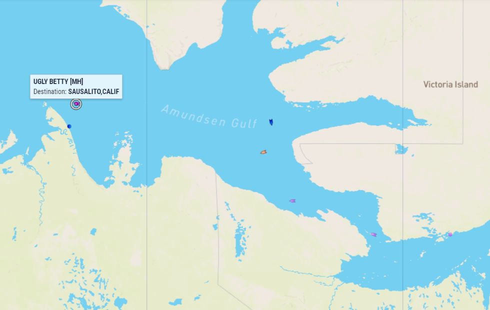
Heading west, Ugly Betty is about to enter the Beaufort Sea, with Que Sera, Integrity and Caprivi in her wake:
The latest weekly CIS ice chart shows that the northern route is now navigable without coming across anything worse than 2/10 concentration ice:
Heading from east to west, Ugly Betty and the bulk carrier Arneborg have both now rounded Point Barrow:
Meanwhile MS Roald Amundsen is currently heading east through Bellot Strait:
The Canadian Ice Service has started daily coverage of McClure Strait, presumably because CCGS Louis S. St. Laurent appears to be intent on taking Route 1 to the Arctic Ocean:
Ugly Betty has reached Nome, and has thus become the first “small vessel” to complete a full “circle to circle” voyage through the Northwest Passage in 2023.
[Edit – September 11th]Thindra, Skokica and Caprivi have passed through the Bering Strait, and hence completed the full Northwest Passage:
The crew of Caprivi report that:
[Edit – September 12th]Unfortunately the weather for the next two days is more partial to motor boats but alas we do have a motor! Calm weather for our crossing of the Bering Strait wasn’t what we had pictured but after six days at sea, it’s not so bad.
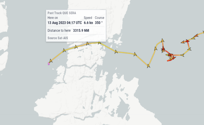
At 2200 hrs we cross back over the Arctic Circle marking the official completion of the NWP. Almost two months in the Arctic and 3,460nm since we crossed the line in Baffin Bay, Greenland. We toast with a bottle of french wine over some good chowder.
The evening proves dark with brilliant bioluminescence as we continue upwind in calm seas.
The clouds above the McClure Strait cleared today, to reveal:
A glimpse through the clouds suggests that the McClure Strait is still “open” for (extremely!) adventurous pleasure craft:
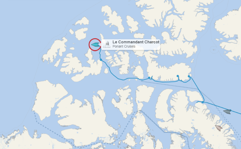
Numerous passenger vessels have cruised through the Northwest Passage this summer. However none have previously taken the route via the Byam Martin Channel, currently being followed by Ponant Cruises’ Le Commandant Charcot:
To be continued…
Interesting indeed. Garlic Press here we come…
The already high sea surface temperature together with the impact of the El Niño make the outlook for Arctic sea ice for September 2023 look grim.
Sea ice concentration is getting lower in many places and there is open water off the Siberian coast and in parts of the Beaufort Sea and Baffin Bay, as illustrated by the Uni of Bremen image
Looking forward to reading your updates!
Regards,
SY Thindra – we will attempt a passage this season and are currently in south Greenland
Hi Sigurd,
Thanks for the info, and I look forward to following SY Thindra’s progress!
I’ve also found some moving pictures:
https://youtu.be/oZXO9wVO15s
“West to East passage”? I assume you meant “East to West”, given the start in Greenland. I wonder what route is being contemplated – the northern ones seem a bit clogged at this point.
I did indeed! Typo now fixed.
It’s still very early in the NWP sailing season. As Tom points out, ice melt in the CAA is ahead of the historical schedule this year:
I believe the CAA sea ice is relatively low at the moment compared to recent years, the Bremen map looks that way, but the proof of course will be to sail a boat through it.
It looks as though the first Royal Wagenborg freighter of the year is heading for the western entrance to the Northwest Passage:
All these updates are very much appreciated, Jim! Just like Thindra, we are attempting the NWP from E-W this year as well. Currently in stunning Greenland (Sisimiut) yacht name “Seabelle”, 47′ Garcia Passoa, New Zealand flag, 3 of us on board.
Welcome Calin,
Thanks very much for the info, and your kind words!
I note that Seabelle has a “tracking map”, a bit like Thindra’s but with added wind!
That’s handy, because sadly coastal AIS doesn’t have very good coverage in the CAA!
28th of July! I wonder how that compares to other early years?
It’s the earliest since I’ve been following such things closely, but I’ll go away and double check when the NWP opened in 2012 using the <= 6/10 criterion...
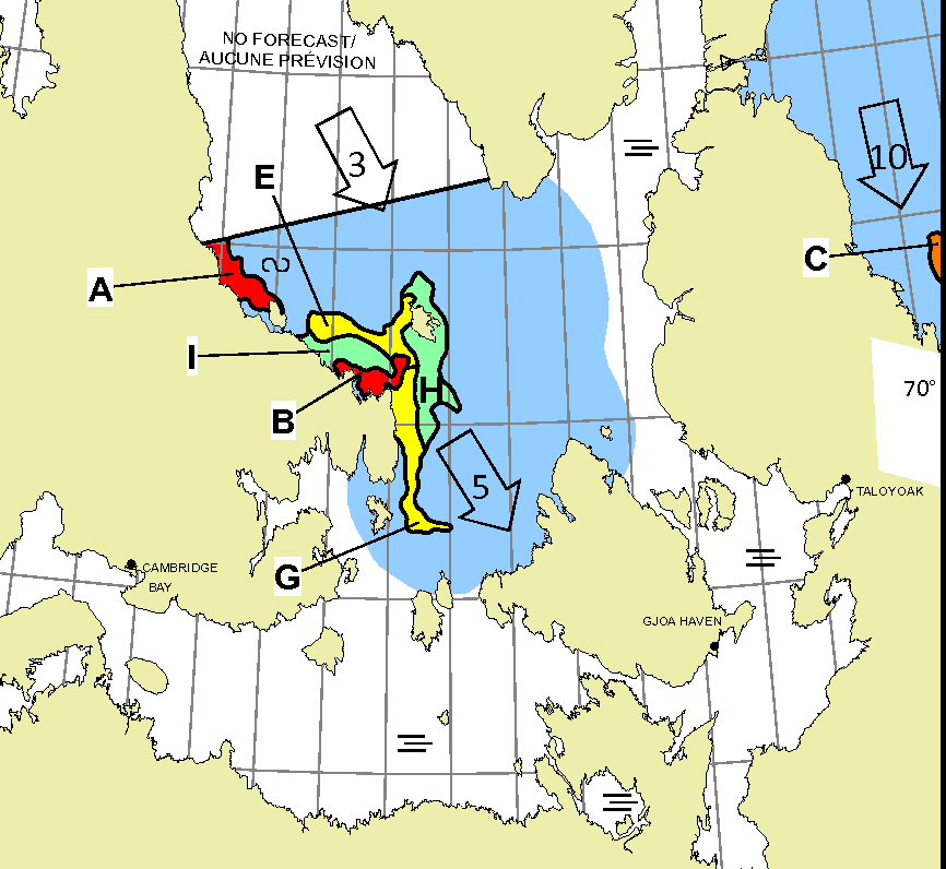
The latest CIS chart shows the James Ross Strait cleared back to 4-6/10 concentration:
However there is still a short section of 9+/10 ice that reaches the coast south of the eastern to Bellot Strait.
Yes, we have the now “old school” iridiumGo package with Predictwind and still happy with its reliability despite the slow speed.
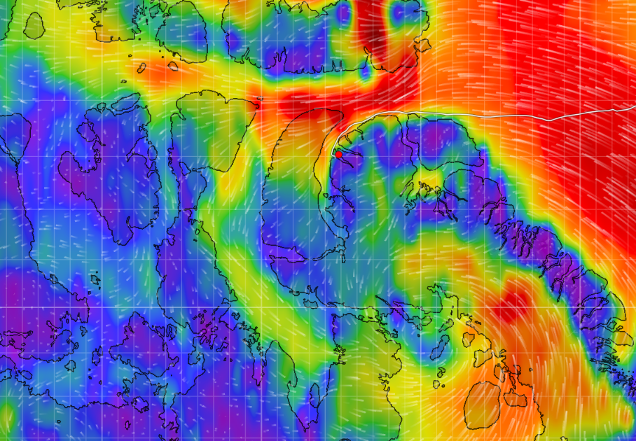
Starlink is amazing out here though if it works. So far so good but we only put it out when needed for pretious ice info like your page here! Fog and bergs all day here north of Disko Is.
Franklin Str had some changes south of Bellot I see today.
Thanks for the info Calin,
I await this evening’s (UTC) “official” CIS charts for Bellot/Franklin with great interest!
This was the view from Sentinel 2 yesterday:
On the “commercial” front Henry Larsen is currently leading Alaskaborg towards the western entrance to Bellot Strait, while Albanyborg is heading for the eastern entrance:
Further west Americaborg is leaving the comparative calm of the Amundsen Gulf and emerging into the Beaufort Sea:
Alaskaborg and Albanyborg passed each other in the (UTC) night at the eastern entrance to Bellot Strait:
Henry Larsen appears to be waiting to lead Albanyborg through the ice remaining in Victoria Strait
National Geographic Resolution has departed from Nome, having become the first cruise ship to complete a full “circle to circle” voyage through the Northwest Passage in the summer of 2023:
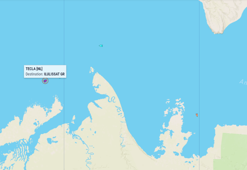
Heading in the opposite direction, Scenic Eclipse is now in Baffin Bay heading for Ilulissat:
Here’s a picture of Scenic Eclipse in Bellot Strait on August 11th, courtesy of Jason Kelley:
Albanyborg is currently heading south through the Bering Strait:
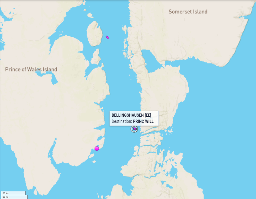
Bellingshausen is waiting at the eastern entrance to Bellot Strait:
Ugly Betty and Integrity have taken the road less travelled this summer, and are heading south through Peel Sound
In an intriguing development on the “commercial shipping” front, the Canadian trawler Frosti is heading for the Prince of Wales Strait!
Hello,
I have seen, you are following news about sailing boats in the NWP.
sy SKOKICA 3 is sailing west trough the NWP this year and we are in Cambridge Bay at the moment. Here is link to our fb: https://www.facebook.com/jadrnicaskokica/
and to our Garmin tracker: https://share.garmin.com/HAKWB
Best regards
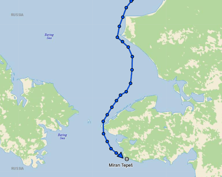
Miran
Hi Miran,
Thanks very much for popping in here, and for the additional info. What do you use for accessing the internet, when in Cambridge Bay and/or when in the middle of nowhere?
I’ve been looking at your old tracking map, but I will now go and look at the Garmin version forthwith!
P.S.
You don’t seem to have operational AIS at the moment? By the look of it you’re going to be joined by Ugly Betty real soon now.
We use Starlink for internet.
We also have AIS, but it works only with VHF antenna and is not connected to satelite. And we use it only in fog together with radar.
Are there any other boats close ahead of us, or soon coming from the west?
Sorry for the delay Miran.
It’s frantic here at the moment, and your recent comments went into the GWC “moderation queue”. That shouldn’t happen after I approved your first comment, but…
Here’s the current AIS derived map:
Integrity is currently the nearest boat in your wake, but I don’t know how long Will intends to remain in Cambridge Bay. Ugly Betty and Que Sera are the ones in front of you.
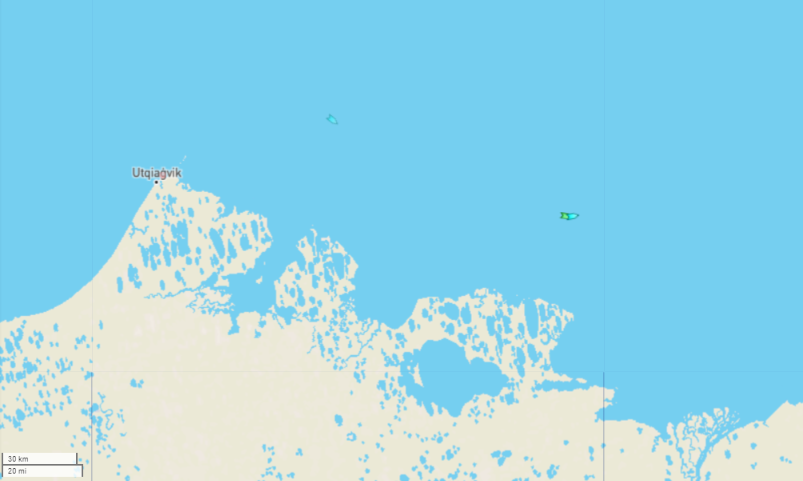
The remarkable lack of sea ice in the Northwest Passage this year has facilitated a remarkable feat by Captain Dean (aged 6). Dean is without doubt the youngest seafarer in recorded history to attempt to pilot his yacht through the fabled Northwest Passage:
As you can see, “Quadamaran” is also by far the smallest “pleasure craft” to ever attempt the arduous journey. Quadamaran did unfortunately run aground whilst Dean was navigating in thick fog, since his vessel is not large enough to carry AIS or radar equipment:
However the fog lifted, the next tide lifted Quadamaran, and Dean is now continuing his long journey west:
Watch this space!
The Royal Wagenborg bulk carrier Trinityborg is taking route 7 via the Fury and Hecla Strait, en route from China to Bécancour on the St. Lawrence River:
Thindra and Skokica have reached Nome, where the crews are presumably now enjoying a well earned rest:
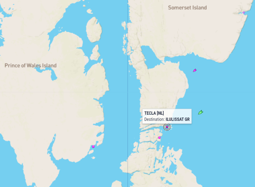
Heading in the opposite direction, Tecla is nearing Ilulissat: