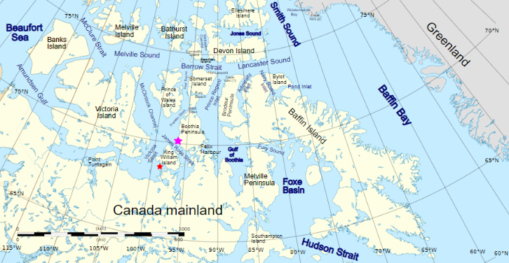
For those of you unfamiliar with the names of the assorted islands and channels of the Canadian Arctic Archipelago here is a map that hopefully helps:
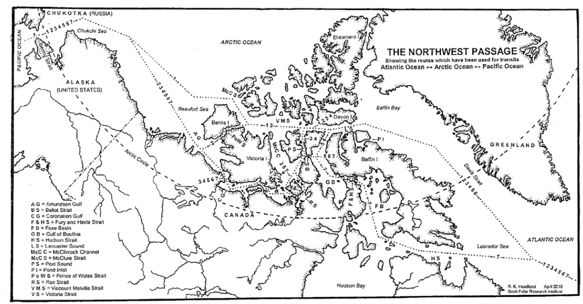
Plus another map detailing the routes through the Canadian Arctic Archipelago that have previously been successfully navigated by vessels large and small:
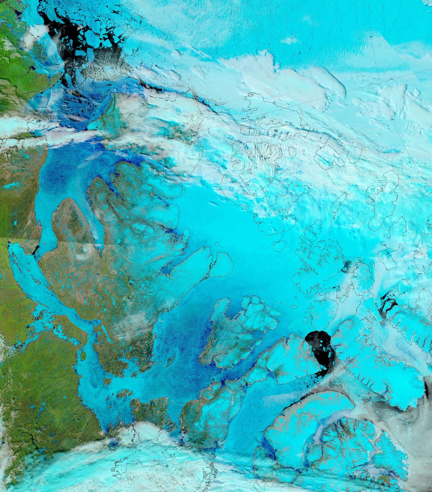
The sea ice in Lancaster Sound and the Amundsen Gulf is breaking up, and melt ponds are now visible on the fast ice across much of the southern route through the Canadian Arctic Archipelago:
“False colour” image of the Canadian Arctic Archipelago on June 17th from the MODIS instrument on the Terra satellite
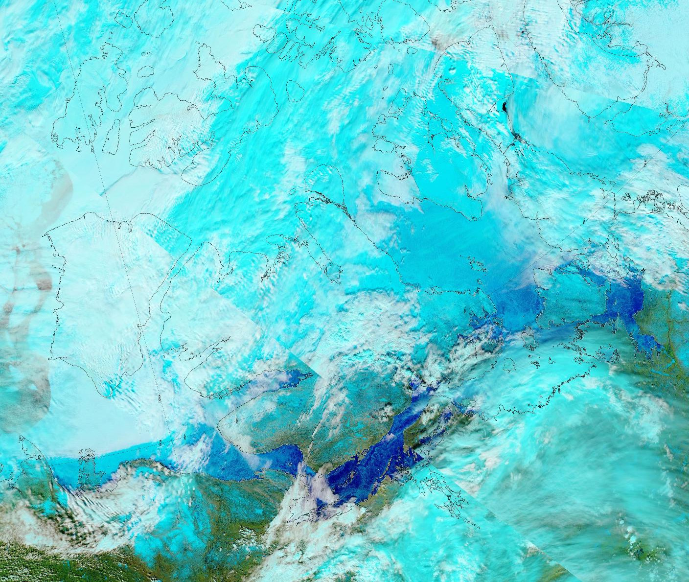
The melt ponds previously visible in the Coronation Gulf now appear to have drained:
“False colour” image of the Canadian Arctic Archipelago on June 3rd from the MODIS instrument on the Aqua satellite
The time has come to start speculating about if, and when, the Northwest Passage will become navigable for the host of small vessels eager to traverse it this summer. Almost one month later than in 2017!
Whilst the eastern and western entrances to the assorted routes through the Canadian Arctic Archipelaga have been empty of sea ice for quite some time, the central section between Bellot Strait and Gjoa Haven and/or Cambridge Bay is still chock a block:
In the east here is a drone’s eye view of Cumming Inlet, courtesy of the Polish team of Michał and Ola Palczyński aboard S/V Crystal:
created by dji camera
It’s not entirely clear when that picture was taken, since according to Michał’s blog:
The waters beyond the Bellot Strait are covered with impassable ice, and the ice in the Beaufort Sea has 90% concentration in some places and reaches up to the shore. In this difficult situation, by 15th August two yachts have already given up and turned back to Greenland (including Blue Peter from our cove).
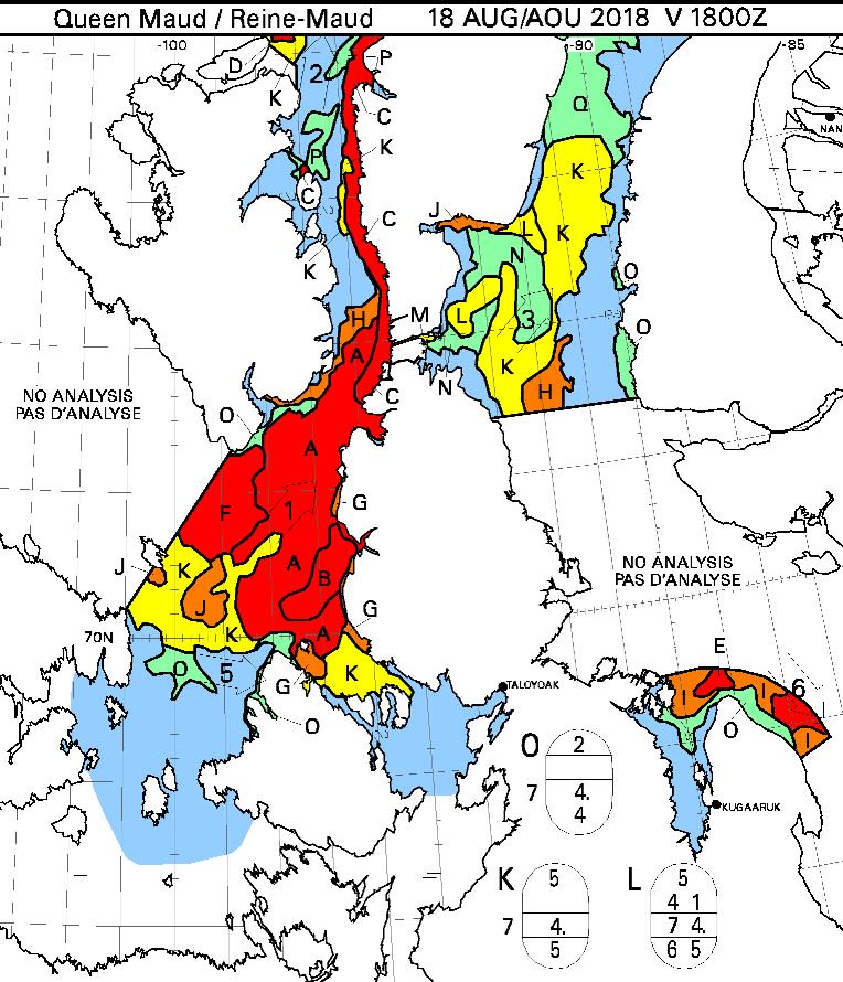
Here’s what lies ahead of Crystal and her remaining companions, according to the Canadian Ice Service:
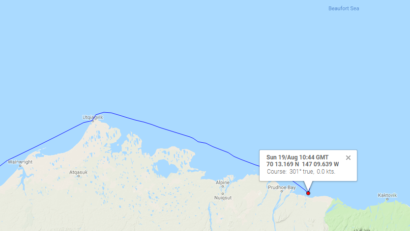
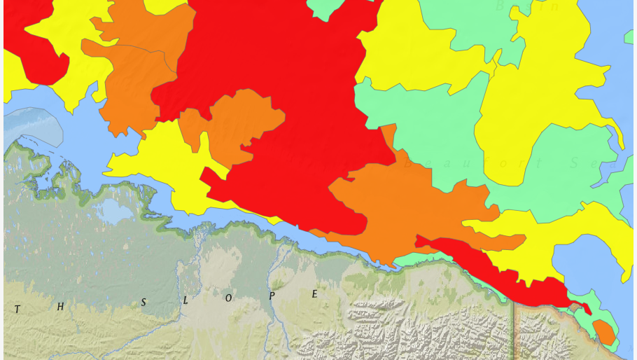
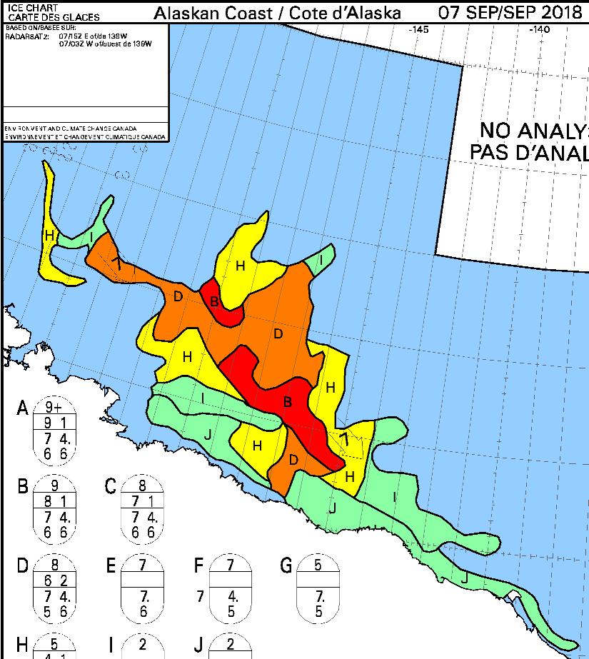
Meanwhile in the Beaufort Sea S/V Dogbark has been battling her way through that “90% concentration” sea ice. Dogbark has now made it as far as Mikkelsen Bay, just past Prudhoe Bay in Alaska:
What does 7/10ths ice mean? We don’t want to know! It is more ice than we want to try and pass, that’s for sure. But the ice charts we look at refer to ice by % of sea coverage, so 7/10ths would look like water mostly covered by large, immovable objects. 5/10ths was as much as we have seen, and we got out of there as fast as we could with some help from our flying eyeball. See Dogbark’s Facebook page for a quick snippet of less dangerous ice.
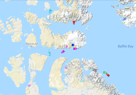
Meanwhile the Canadian icebreaker CCGS Amundsen has sailed past Arctic Bay and Resolute:
I cannot help but wonder what vessels might be closely following in his wake?
[Edit – September 7th]
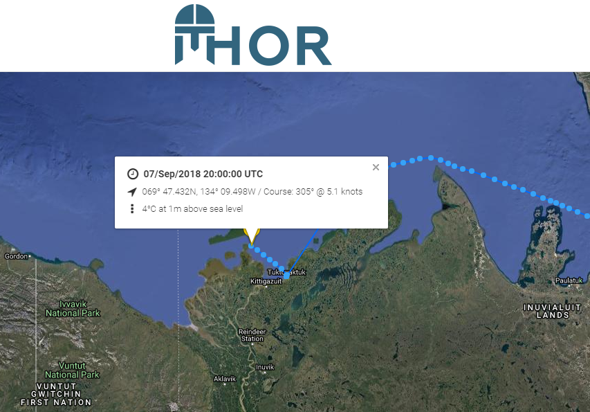
Finally there comes news that a “pleasure craft” has made it through the Canadian Arctic Archipelago from east to west as far as Tuktoyaktuk. I’d been wondering which vessel it was that seemed immobile near the western end of the Bellot Strait on the MarineTraffic maps. This one’s from August 19th:
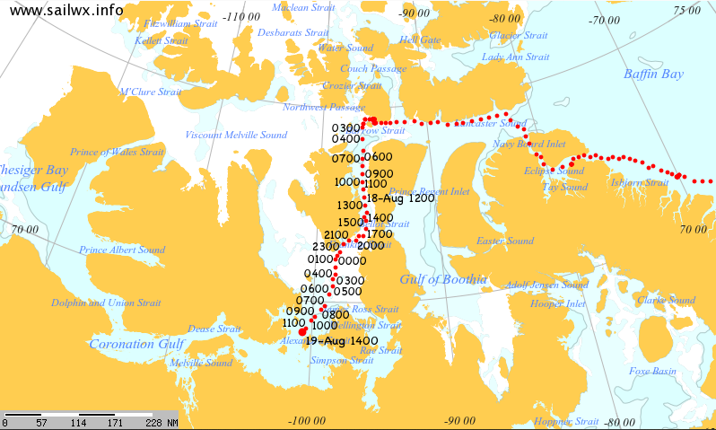
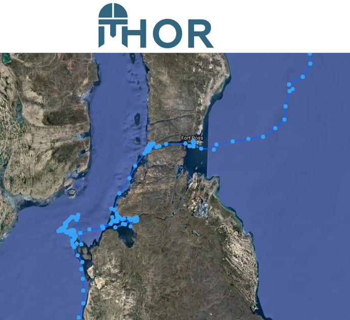
Now I know! Thanks to a heads up on the Arctic Sea Ice Forum I’ve discovered that it’s the S/V Thor. Here’s the tracking map of his efforts to get through all the old ice in the vicinty.
The map reveals that Thor made it through the Bellot Strait on August 6th, but didn’t manage to make significant headway out of the Franklin Strait until August 28th.
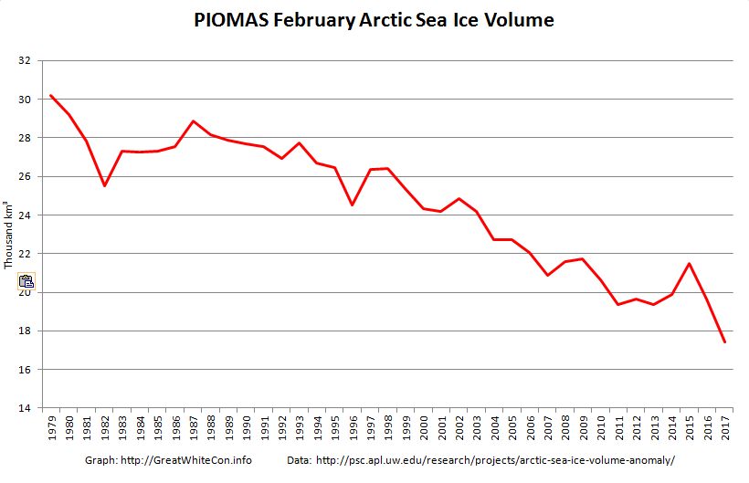
The February 2017 PIOMAS Arctic sea ice volume numbers are out. It’s no longer surprising to report that they are the lowest ever for the month of February in records going back to 1979:
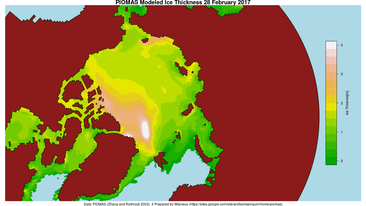
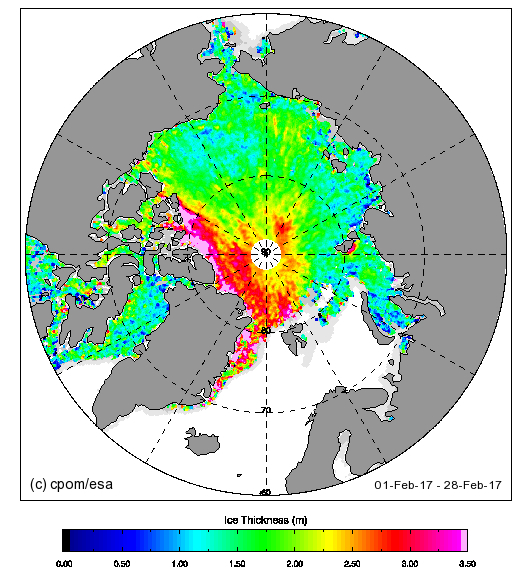
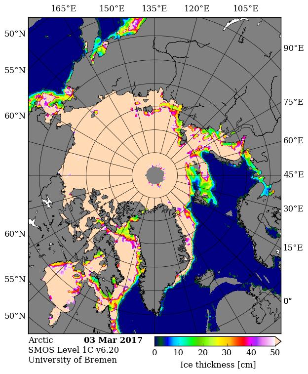
Here’s the PIOMAS gridded thickness map for February 28th:
There does seem to be a small patch of slightly thicker ice in the East Siberian Sea off Chaunskaya Bay, but there’s still a much larger area of sub 0.5 meter thick ice in the Laptev and Kara Seas.
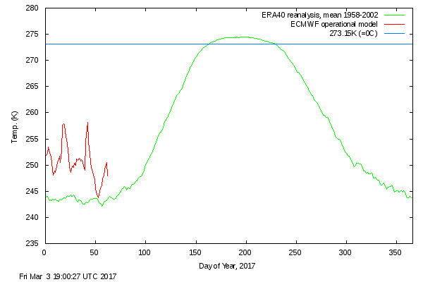
The Danish Meteorological Institute’s temperatures for the “Arctic area north of the 80th northern parallel” graph shows somewhat more “normal” readings in February 2017, but still without falling below the ERA40 climatology this year or in 2016:
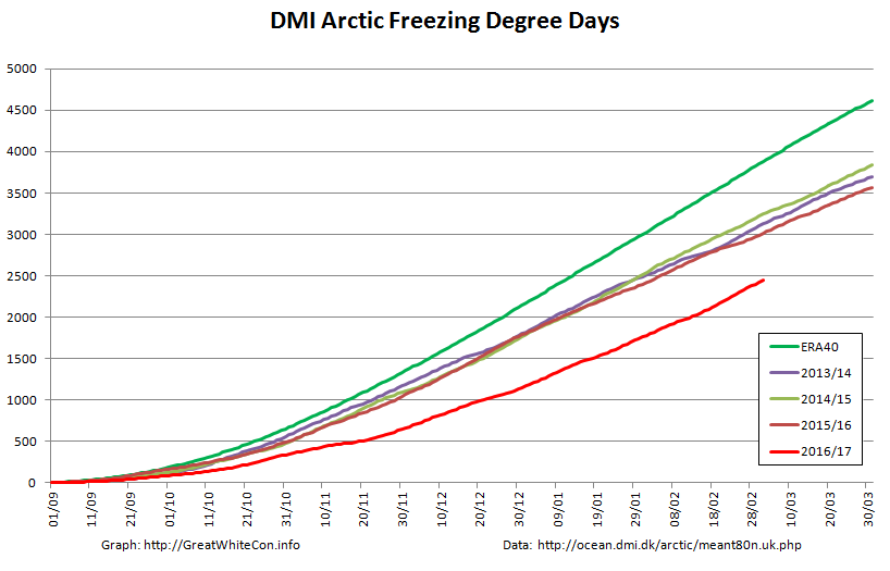
The graph of cumulative Freezing Degree Days (FDD for short) is still far below all previous years in DMI’s records going back to 1958:
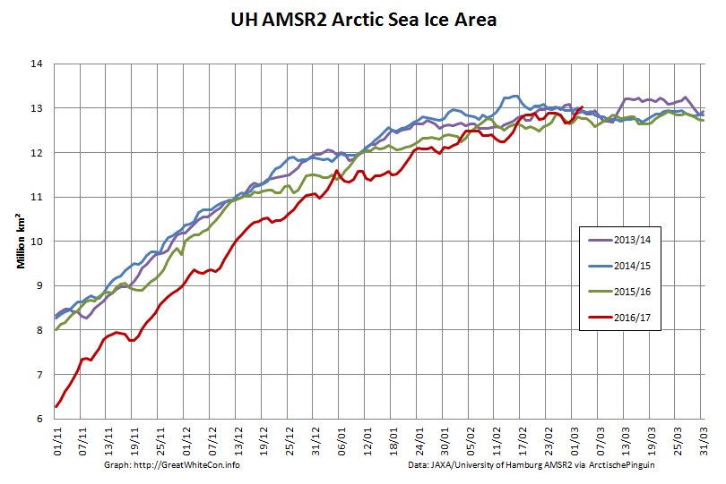
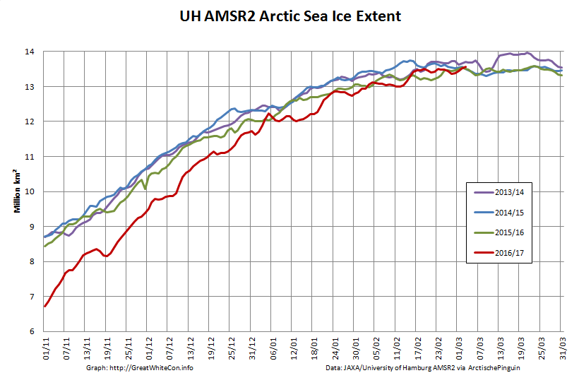
Finally, for the moment at least, here’s the high resolution AMSR2 Arctic sea ice area and extent:
I’m going to have to eat some humble pie, or crow pie as I gather it’s usually referred to across the Atlantic, following my tentative “2017 maximum prediction” a couple of weeks ago. Both area and extent posted new highs for the year yesterday, with area creeping above 13 million square kilometers for the first time this year.
[Edit – March 7th]
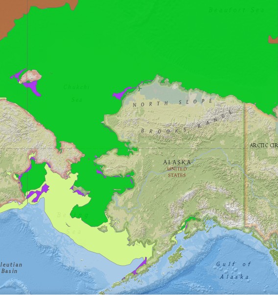
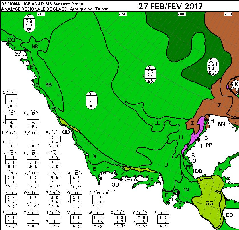
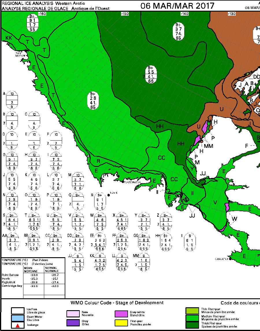
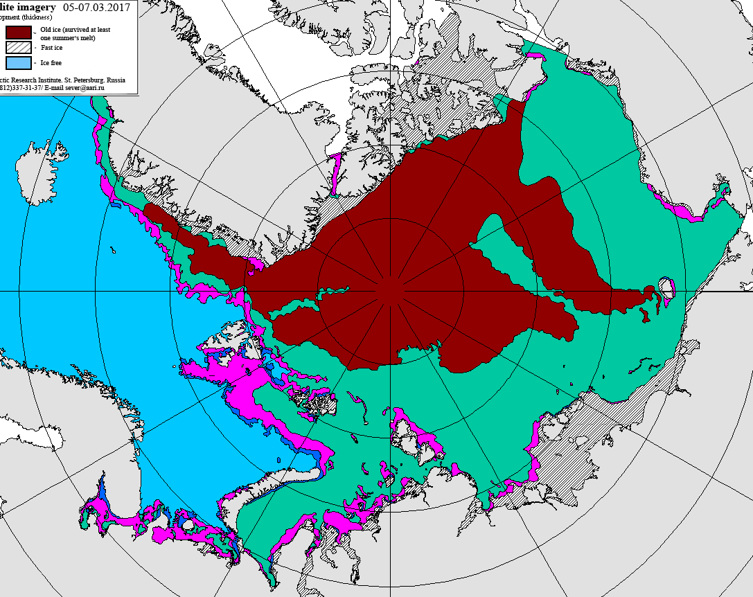
Commenter Michael Olsen suggests that “thicker ice being pushed into the Alaskan and Russian parts of the Arctic Ocean”. Here’s some evidence:
The United States’ National Weather Service current sea ice stage of development map for Alaskan waters:
This week’s Canadian Ice Service sea ice stage of development map is expected later today, so for now here’s last week’s:
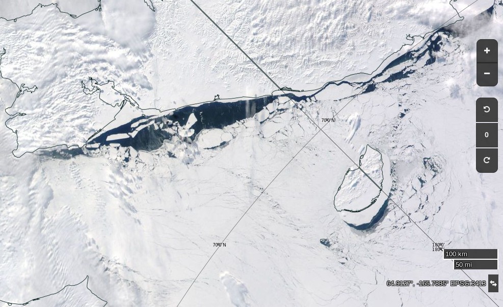
Especially for Michael, a visual image of all the “thicker ice [that’s been] pushed into the Russian parts of the Arctic Ocean” courtesy of the nice folks at NASA:
NASA Worldview “true-color” image of the Chukchi Sea on March 10th 2017, derived from the MODIS sensor on the Aqua satellite
[Edit – March 12th]
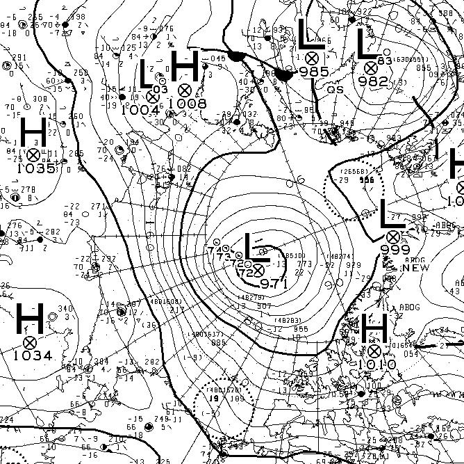
Yet another strong Arctic cyclone has been battering the sea ice in the Arctic Basin. According to Environment Canada this one bottomed out at 971 hPa at 06:00 UTC today.
This website uses cookies to improve your experience. We'll assume you're ok with this, but you can opt-out if you wish. Cookie settingsACCEPT
Privacy & Cookies Policy
Privacy Overview
This website uses cookies to improve your experience while you navigate through the website. Out of these, the cookies that are categorized as necessary are stored on your browser as they are essential for the working of basic functionalities of the website. We also use third-party cookies that help us analyze and understand how you use this website. These cookies will be stored in your browser only with your consent. You also have the option to opt-out of these cookies. But opting out of some of these cookies may affect your browsing experience.
Necessary cookies are absolutely essential for the website to function properly. This category only includes cookies that ensures basic functionalities and security features of the website. These cookies do not store any personal information.
Any cookies that may not be particularly necessary for the website to function and is used specifically to collect user personal data via analytics, ads, other embedded contents are termed as non-necessary cookies. It is mandatory to procure user consent prior to running these cookies on your website.