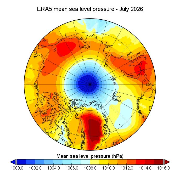
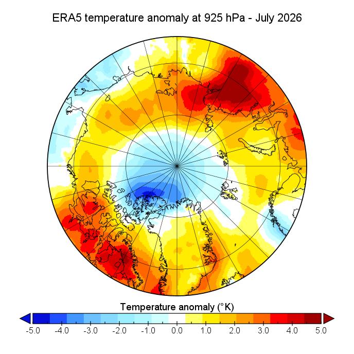
July was once again dominated by low pressure and anomalously low temperatures over the central Arctic:
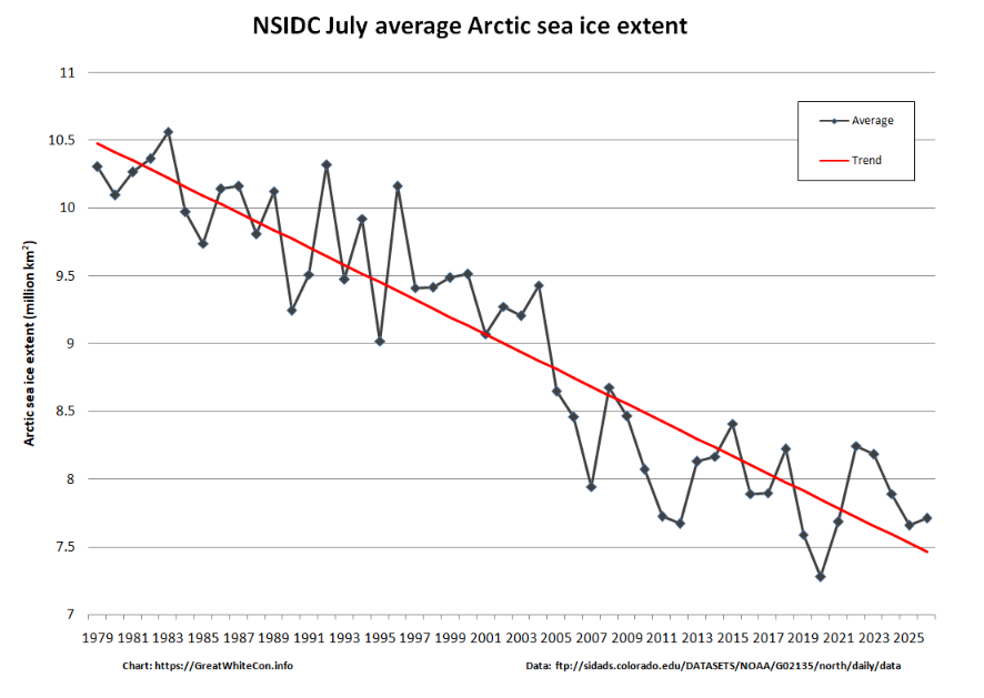
As a consequence the NSIDC monthly average extent for July was 6th lowest in their record going back to 1979:
August began with low pressure still dominant. According to the Canadian Meteorological Centre yet another cyclone bottomed out with a mean sea level pressure of 973 hPa on the 4th:

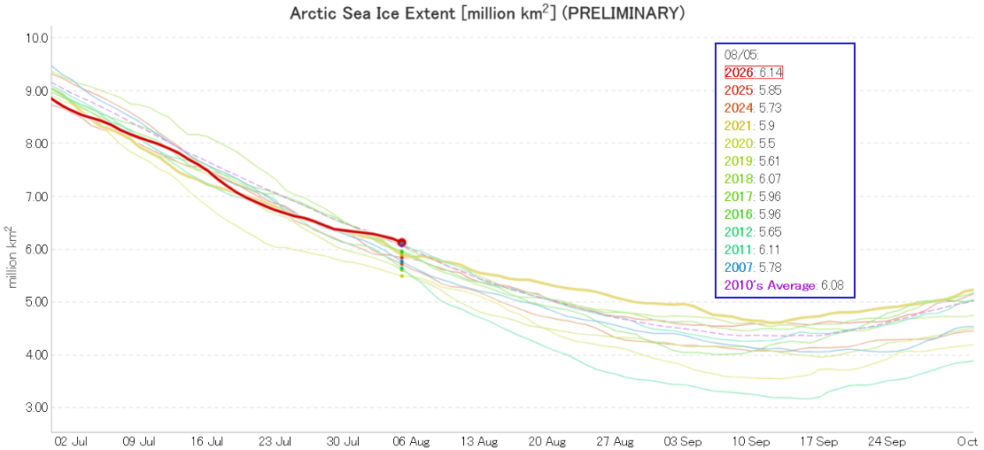
The continuing cyclonic activity has dispersed the sea ice, and JAXA extent is currently 12th lowest in their record:
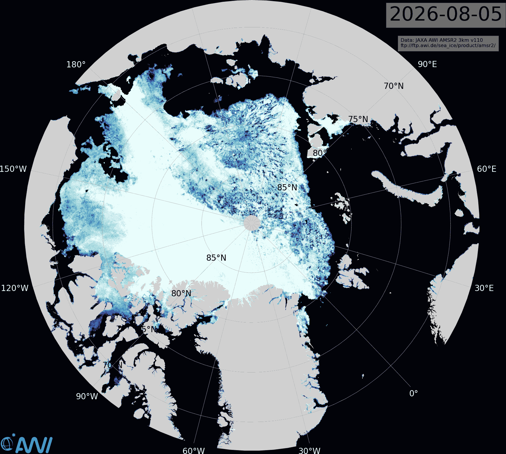
The other side of the same coin is that reduced sea ice concentration is now apparent across large areas of the Central Arctic Basin:
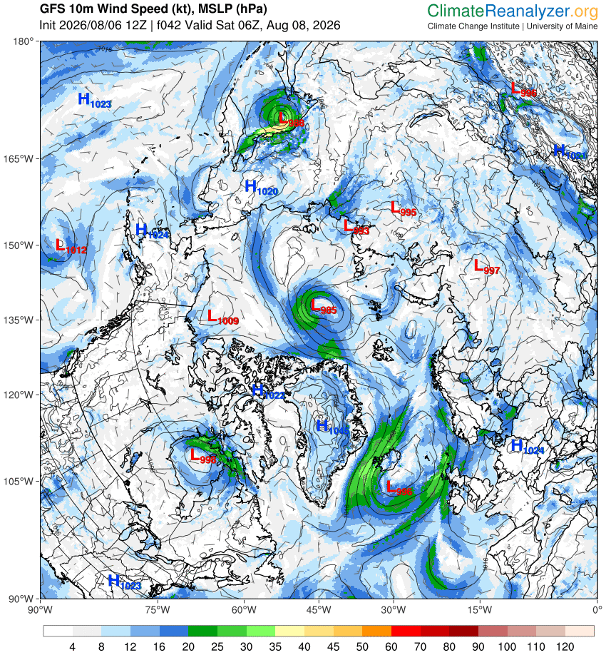
Another, less intense, storm is due to arrive over the coming weekend. Here is the current GFS forecast for Saturday morning:
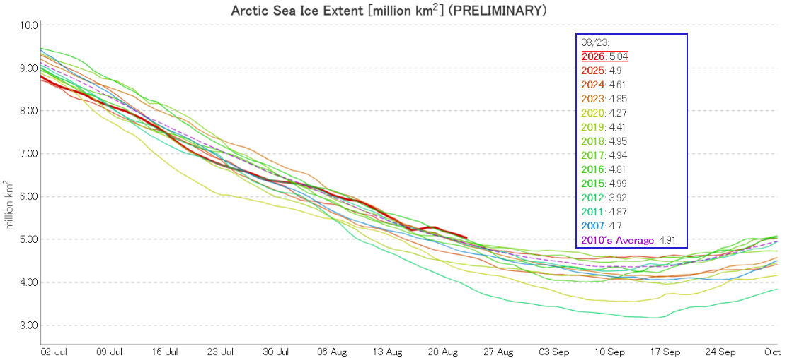
After a mid month dip, JAXA extent is now 13th lowest for the date, and back above the 2010’s average:
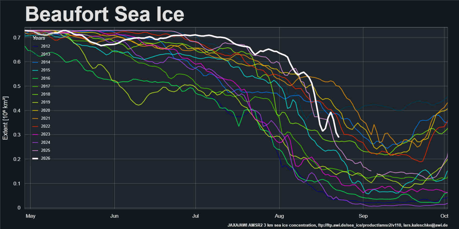
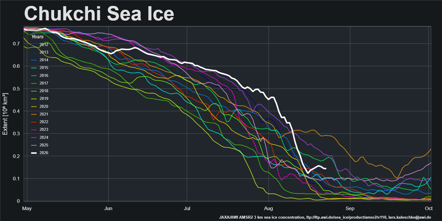
The brief “refreeze” in the middle of the month is due to weather related artifacts creating the apparent disappearance/reappearance of ice near the 15% concentration threshold, particularly in the Beaufort and Chukchi Seas:
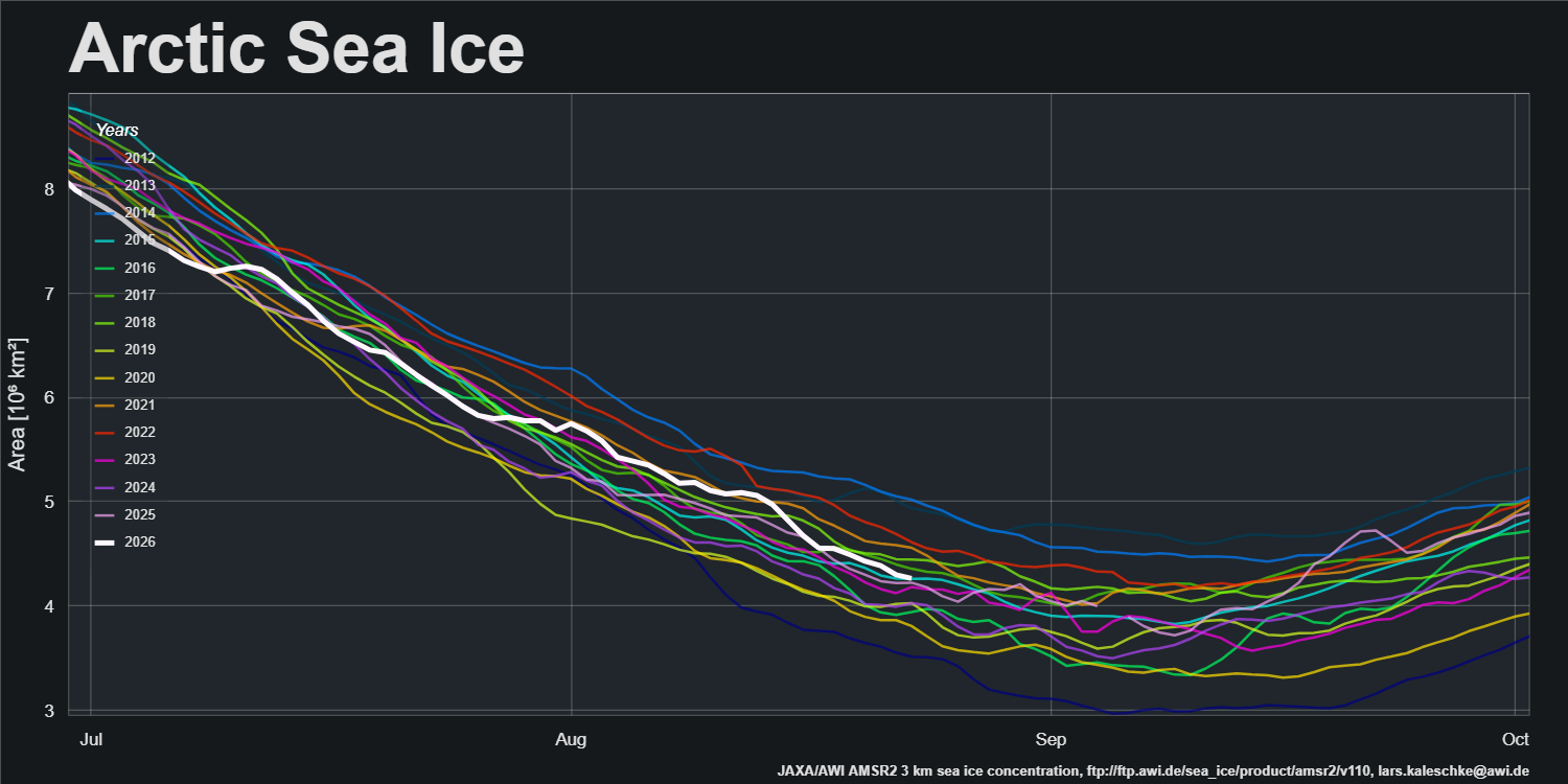
Note that the pan Arctic sea ice area graph does not show a similar artifact:
Here’s the current AWI AMSR2 concentration map, showing considerably more fragmentation than earlier in the month, and the ice edge above 85 degrees north of Franz Josef Land:
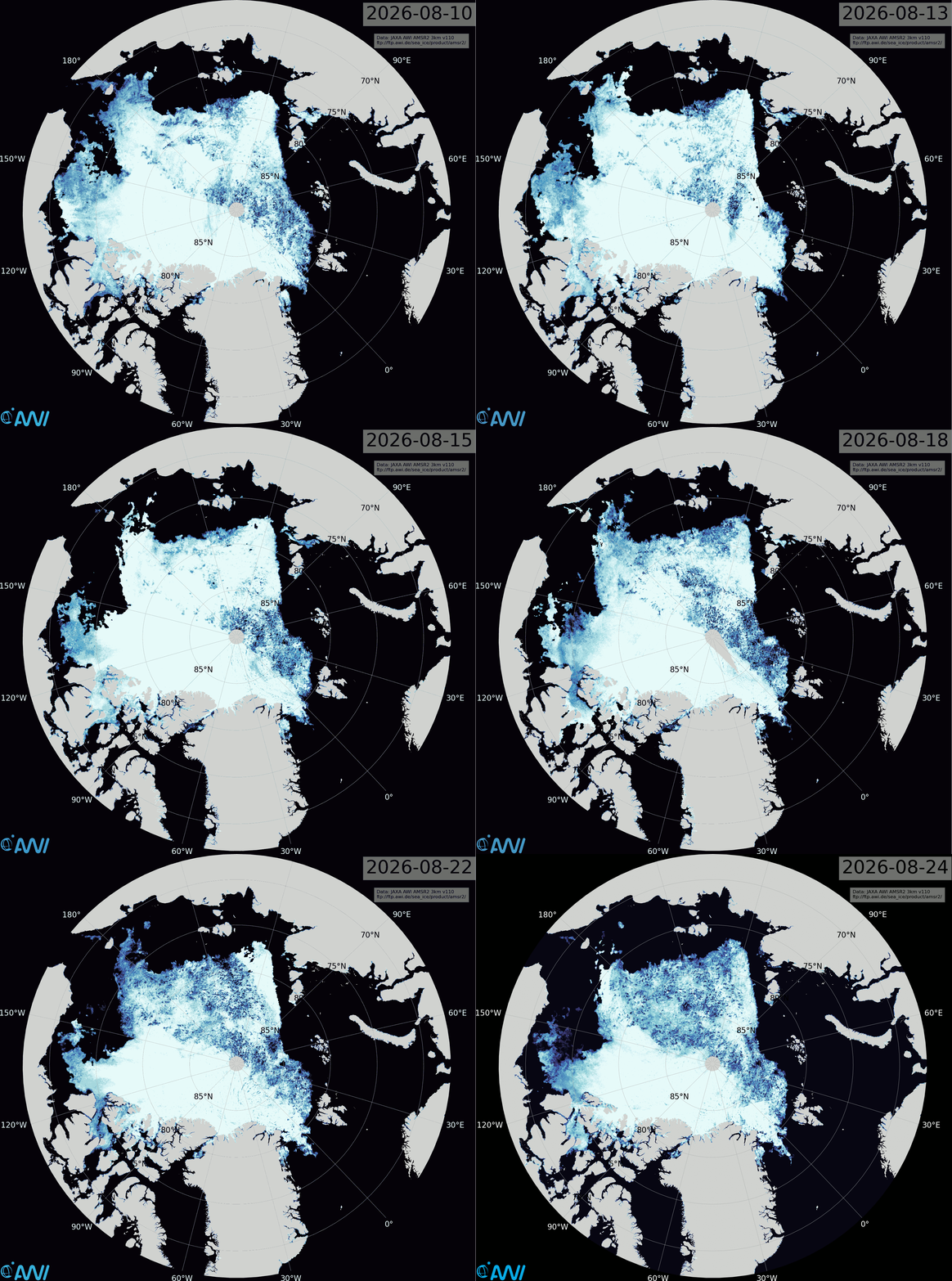
Click the image to see an animation covering the last two weeks.
The conversation continues over on the September open thread.
Up until August 1st we were every day (save 1 day) in the lower 9 positions for the day (Arctic sea ice extent\JAXA). Since that we’ve been 11th & 12th.
Like you, Jim, I interpret this as an ice dispersal exercise, meaning we spread the ice thin, and making it more vulnerable to waves and the other elements. We’d need sea ice volume data to verify if that’s actually happening, or put more accurately: To assess whether or not this melts ice faster than a strategy of less dispersal.
What we experience in both polar areas in later years, are kind of ‘fake-resilience’ dispersal events over the latest 5-10 weeks before the summer minimum. During these weeks, let’s say 1 Aug to 15 Sep for the Arctic, extent numbers appear to be ‘benign’ compared to previous years.
It’s a new(ish) development where we consistenly lose our Top 10 Lowest position in the weeks leading up to the minimum, but because the very dispersal causing the detour from the lowest positions also causes the ice to melt out faster, giving the elements more attack vectors, so to speak, it works towards at least potentially lower summer minimums.
We may feel nonplussed by the 11th + 12th lowest extent this August. But if last summer is anything to go by, late summer positions in ‘the teens’ do not a bad melt-year make.
JAXA extent stats from Summer Solstice till Winter Solstice
1-5 pos Jun21-Jul15
5-10 pos Jul16-Aug14
7-14 pos Aug15-Sep17
9-15 pos Sep18-Oct15
5-9 pos Oct16-Oct30
1-4 pos Oct31-Dec21
So we spent large portions of July to September in the 10-15 position for extent, last year, but it was still the lowest year for sea ice on record (2025 volume was), and one of the biggest loss years (2024 to 2025).
PIOMAS (Univ of Washington) summary of 2025: “2025 finished with an annually averaged sea ice volume that was the lowest on record with 12,830km3”
Again; spending late summer in the low teens in extent position terms isn’t bad for melt, it may actually put ice in the firing line for maximum melt, and end the year in the lowest ever ice volume zone (like 2025).
It’s been a very unusual summer weather wise in the central Arctic!
It remains to be seen how much of the large area of fragmented ice eventually melts out.
It also remains to be seen when (if?) PIOMAS volume data starts flowing again, but at least CryoSat/Sentinel will presumably be back in October.
9th Lowest extent, so back in the single digits again. Overall, only 14 days thus far this year have been 10th or higher position.
Of interest, today’s drop was the highest on record for Day 227, a full 140,574 km2.
If such drops happened every day, we’d be ‘Blue Ocean Event’ (1m) by September 15th.
A first ever BOE that is, of course.
Jim, thx for another great update!
+ I’m curious as to whether the Northern Sea Route folks would have closed their waters for hobbyists & explorers if that decision was made today?
I think Matt explained it well: You can have the lowest ice levels overall, and still be blocked by ice if the North wind blows the pack towards land!
JAXA extent down to 4,558k this morning.
Just level with last year’s minimum.
Will the weather/wind be right for a top ten finish?