Back in 2013 I sat around a table with the Chinese delegation during lunch at the Economist’s Arctic Summit in Oslo. In the evening there was a reception with the British Ambassador to Norway, where amongst other people I met Kevin Vallely.
Fast forwarding to July 2021, the Chinese icebreaker Xue Long 2 (which translates to Snow Dragon 2) set sail from Shanghai to do some research in the Central Arctic Basin:
According to a report by the China Global Television Network (CGTN):
The expedition plans to monitor sea, marine ice, atmosphere, microplastics and ocean acidification in the high seas of the Arctic through navigation observation, cross-sectional survey and satellite remote sensing to obtain hydrological, meteorological and biological data of the region.
It will also conduct scientific surveys in the Gakkel Ridge in the Arctic Ocean to learn about the formation of rocks and magma and the geomorphic features there to further enhance knowledge of the natural environment in the North Pole.
Then in August a recent United States Coast Guard press release reveals that:
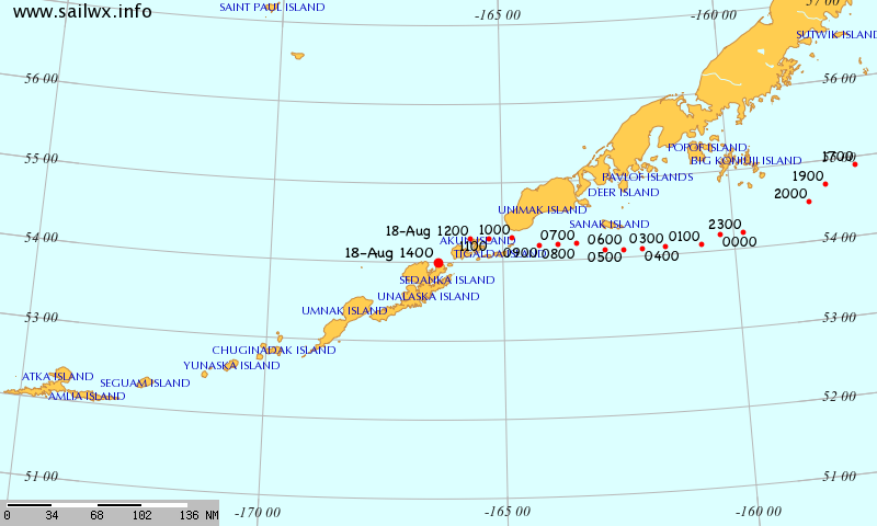
The U.S. Coast Guard demonstrated its commitment to the Bering Sea and Arctic region with deployments of national security cutters Bertholf and Kimball, and a U.S. Arctic patrol by icebreaker Healy.
“Security in the Bering Sea and the Arctic is homeland security,” said Vice Adm. Michael McAllister, commander Coast Guard Pacific Area. “The U.S. Coast Guard is continuously present in this important region to uphold American interests and protect U.S. economic prosperity.”
Crews interacted with local, national and international vessels throughout the Arctic. During the deployment, Bertholf and Kimball observed four ships from the People’s Liberation Army Navy (PLAN) operating as close as 46 miles off the Aleutian Island coast. While the ships were within the U.S. exclusive economic zone, they followed international laws and norms and at no point entered U.S. territorial waters.
The PLAN task force included a guided missile cruiser, a guided missile destroyer, a general intelligence vessel, and an auxiliary vessel. The Chinese vessels conducted military and surveillance operations during their deployment to the Bering Sea and North Pacific Ocean.
All interactions between the U.S. Coast Guard and PLAN were in accordance with international standards set forth in the Western Pacific Naval Symposium’s Code for Unplanned Encounters at Sea and Convention on the International Regulations for Preventing Collisions at Sea.
Now comes more news via CGTN, which according to YouTube “is funded in whole or in part by the Chinese government”, that:
Chinese captain Zhai Mo’s sailing boat is currently on the Northwest Passage of the Arctic Ocean.
According to the CGTN video it was “streamed live on Sep 15, 2021” from “Ilulissat, Denmark”. Then on September 16th CGTN reported that:
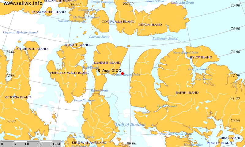
Canada has illegally stopped Chinese captain Zhai Mo and his crew while circumnavigating their sailboat in the Arctic Ocean near Lancaster Sound, a part of the northwest passage.
The United Nations defines the “right of innocent passage” as a vessel’s right to enter and pass through another’s territory as long as it is not prejudicial to the peace, good order or security of the other state.
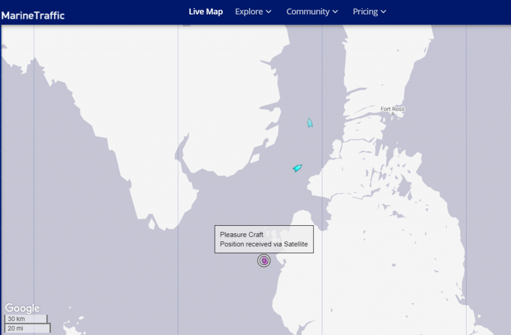
Ilulissat is of course a long way from Denmark, and also a considerable distance from Lancaster Sound. Which perhaps explains why CBC reported on September 17th that:
Canadian officials are disputing reports in Chinese media that a famous sailor from that country attempting to circumnavigate the Arctic was turned back in the Northwest Passage…
Transport Canada told CBC News in an email on Friday that it was aware of Zhai’s vessel, but said “at this point, it has not entered Canada’s Arctic Waters.” The Northwest Passage has been off limits to foreign pleasure craft since March 2020 due to an interim order from the Canadian government intended to limit the risk of introducing COVID-19 in remote Arctic communities.
Transport Canada said it was in touch with Zhai via email to inform him of the rule.
“Transport Canada has since seen public reports that Captain Zhai Mo no longer plans to pass through Canadian Arctic waters and the department continues to monitor the situation,” the department said in a second statement to CBC News on Friday evening.
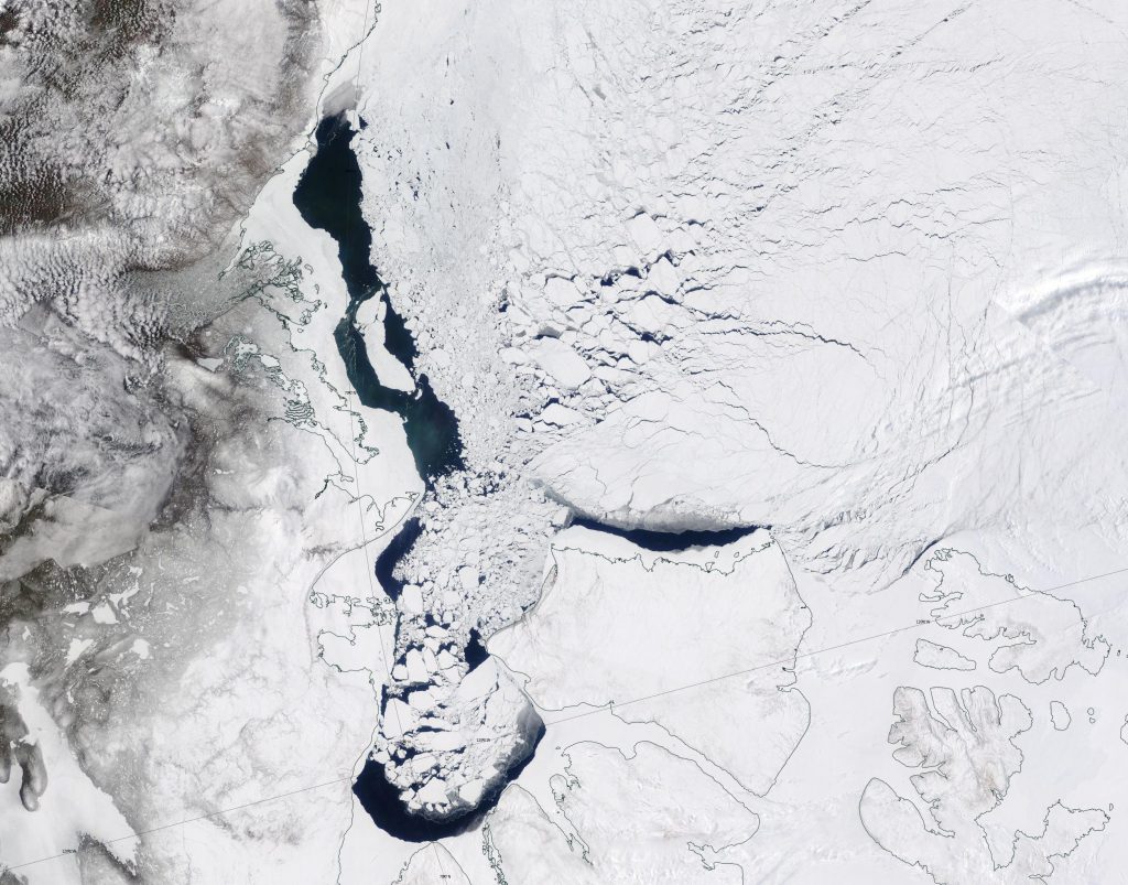
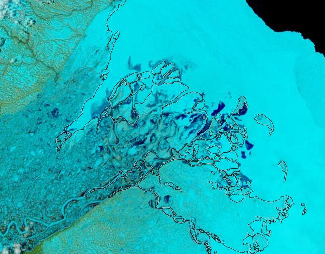
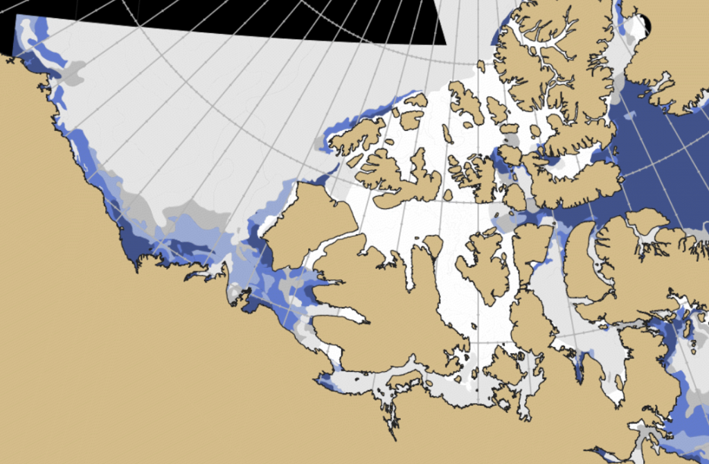
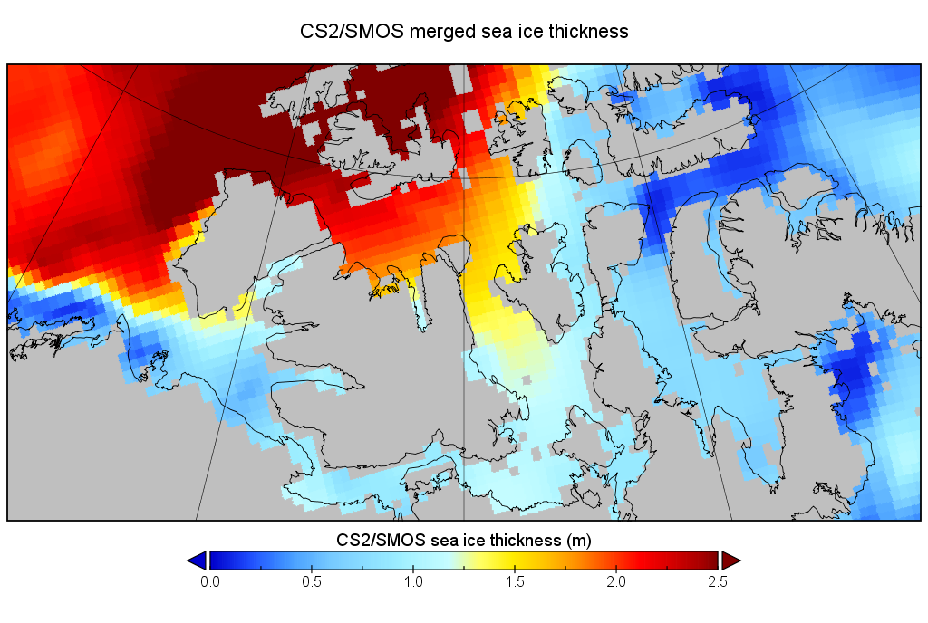
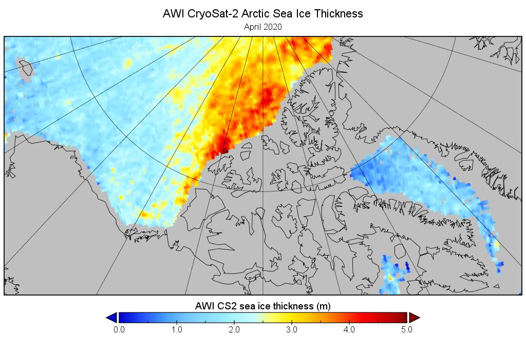
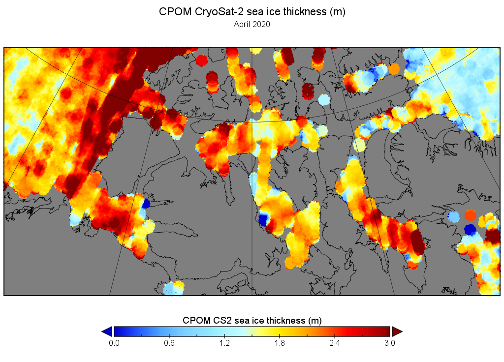
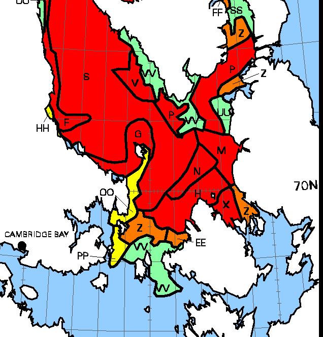
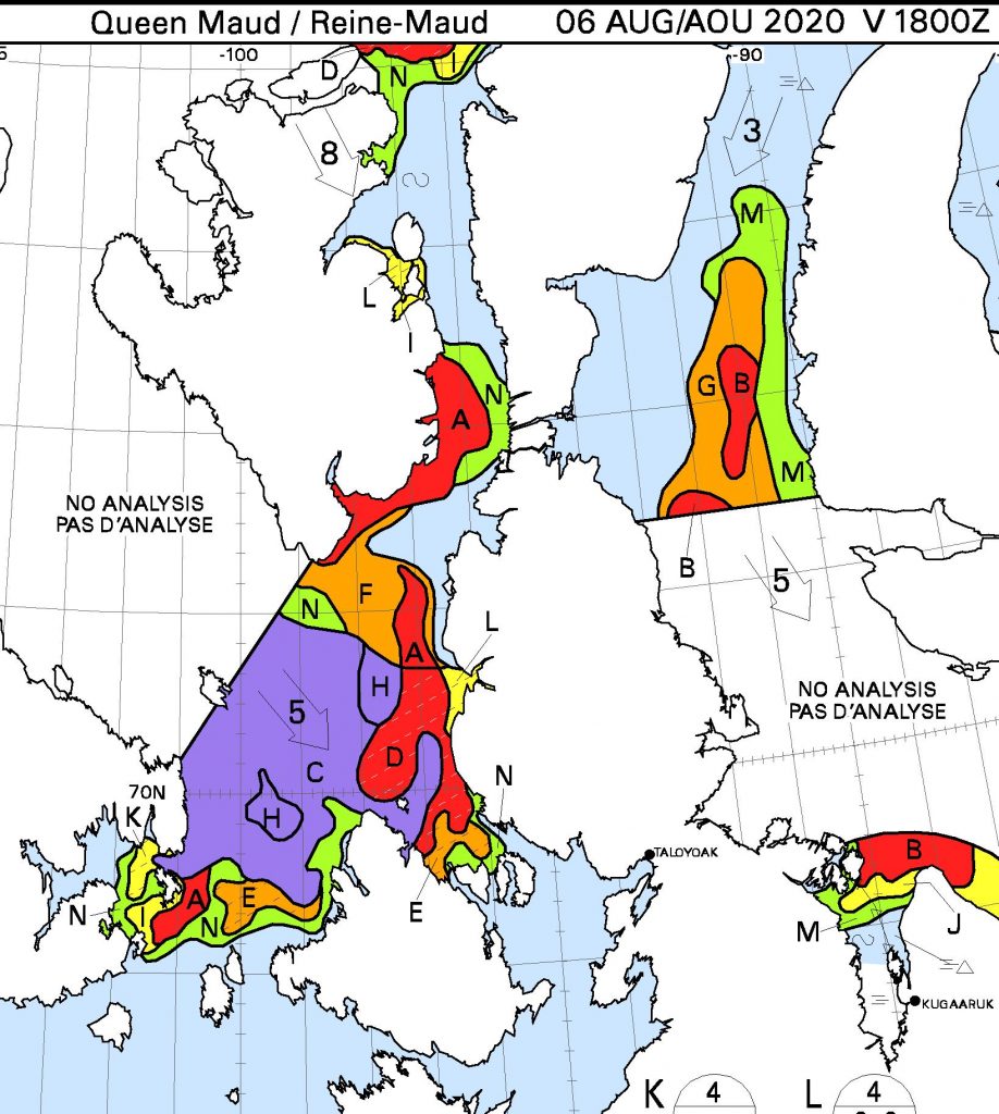
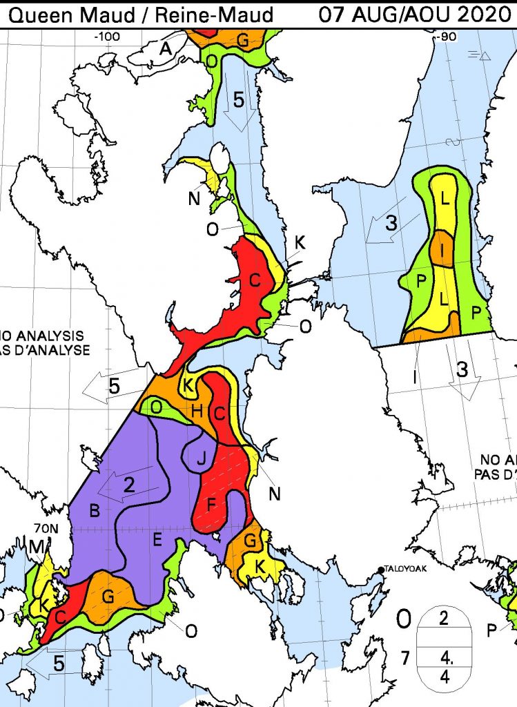
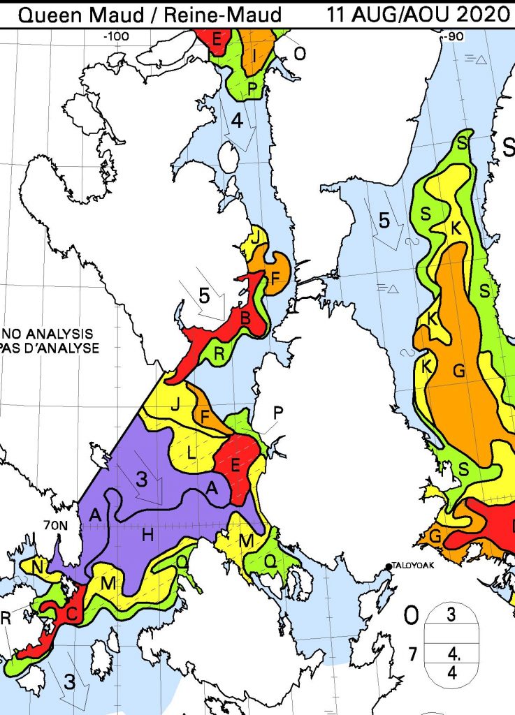
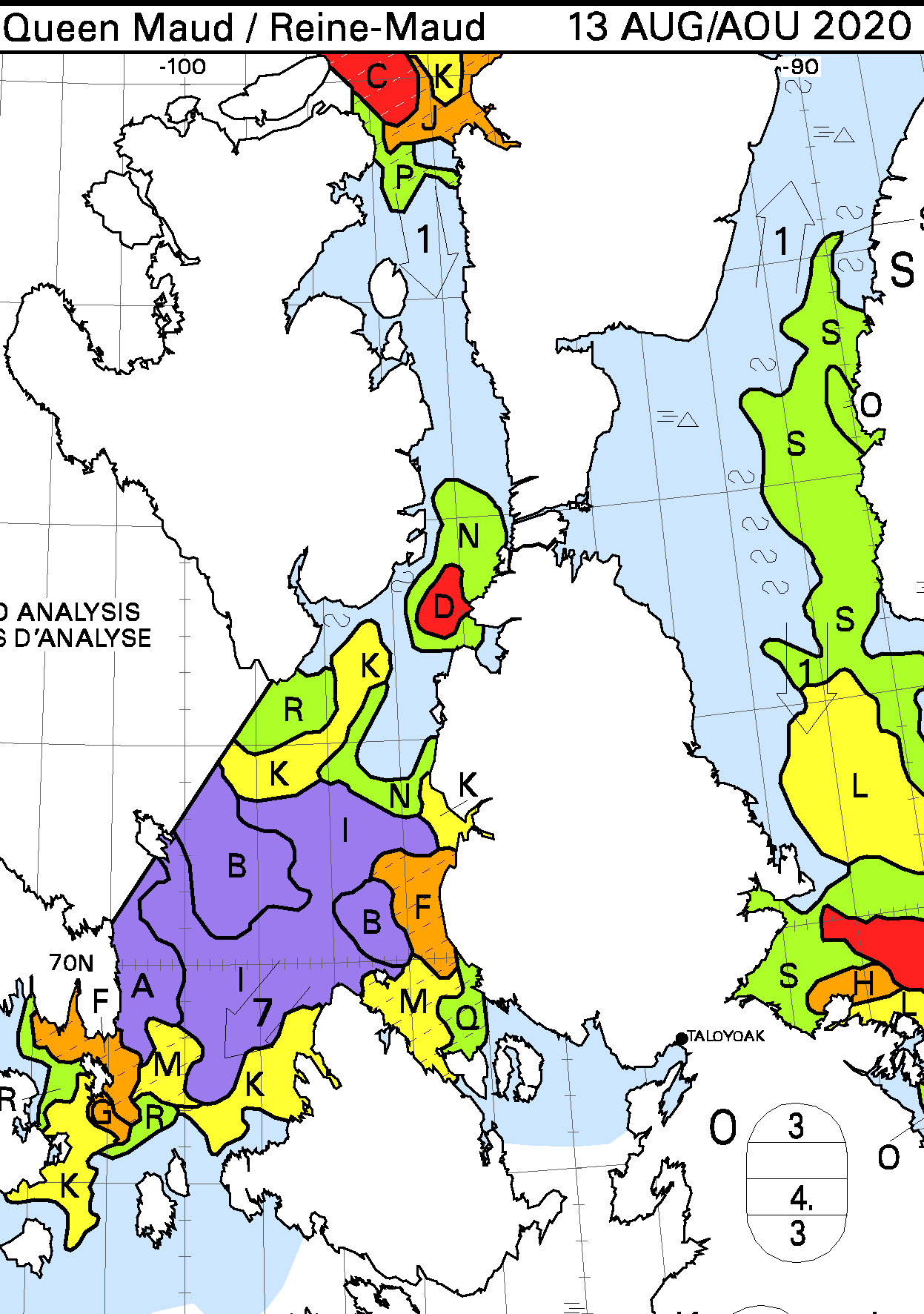
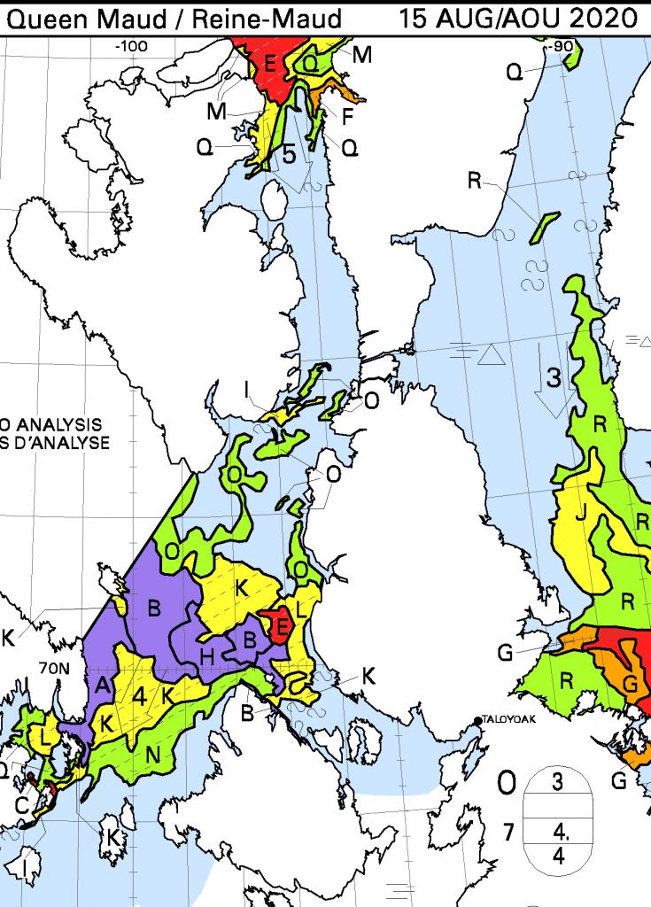
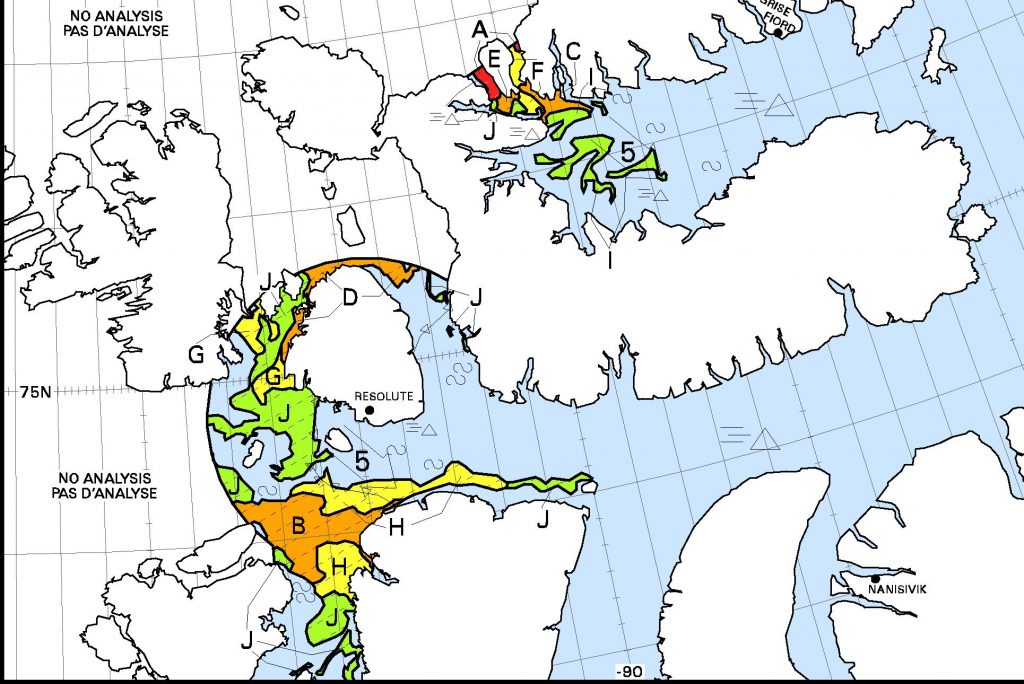
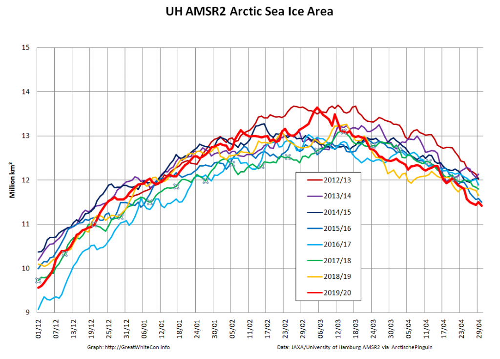
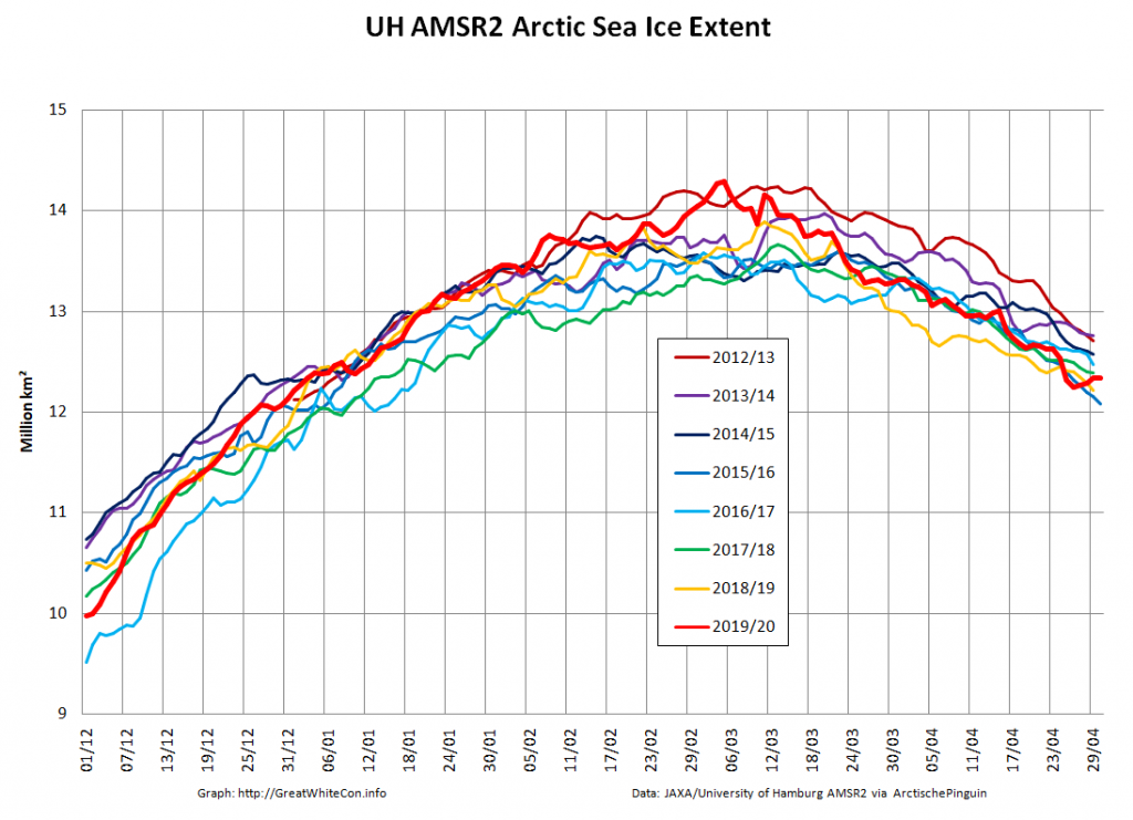
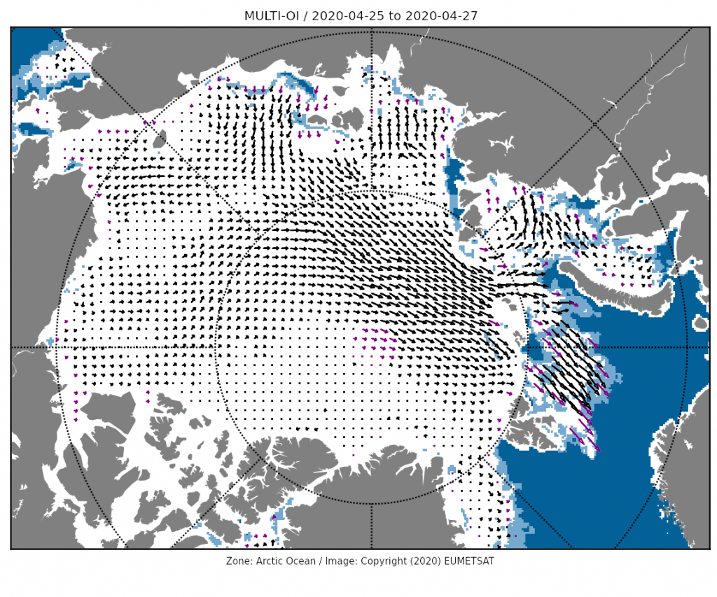
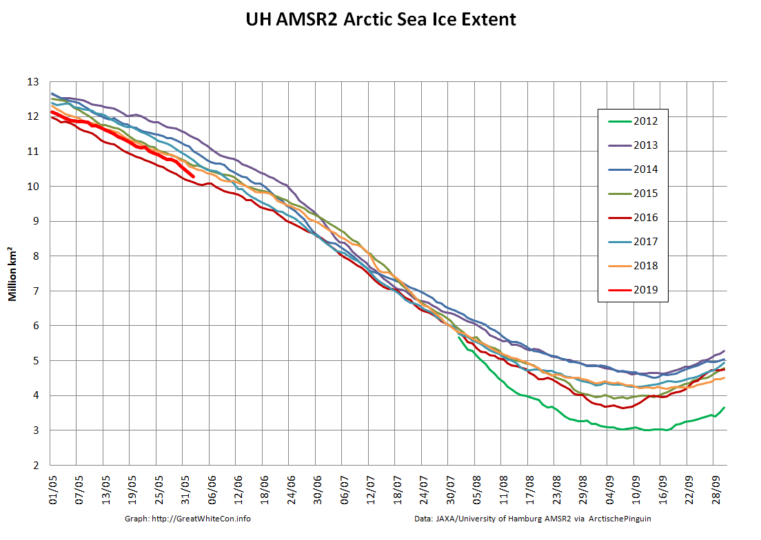
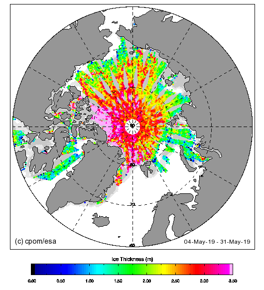
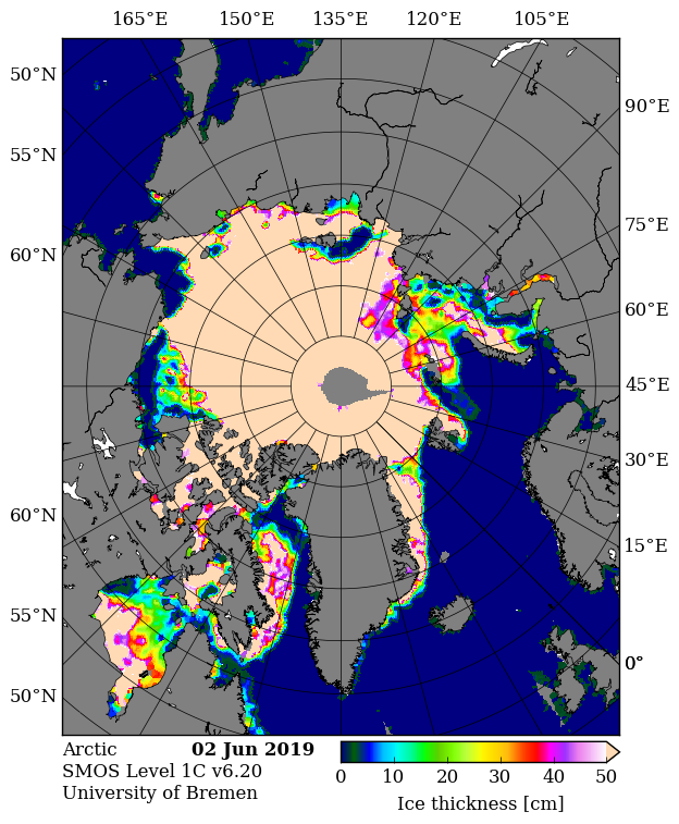
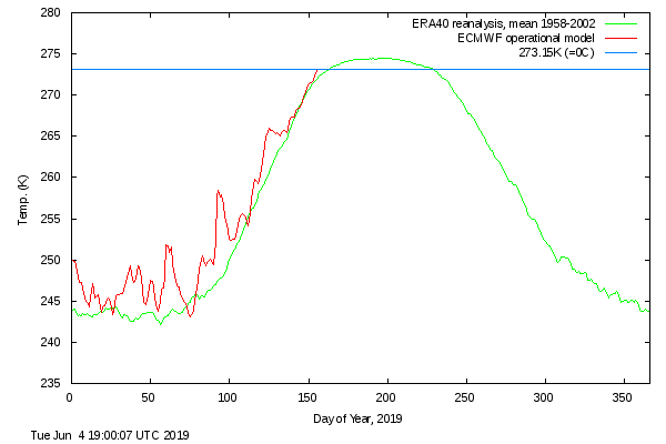
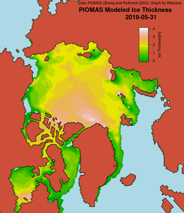
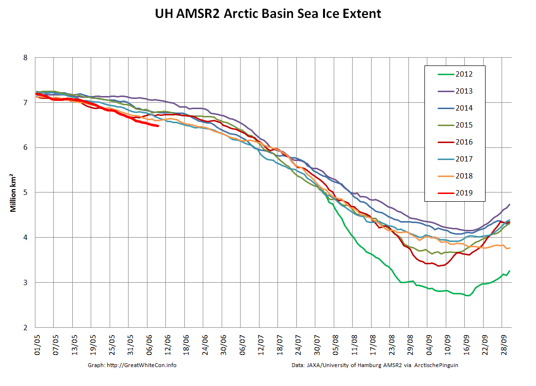
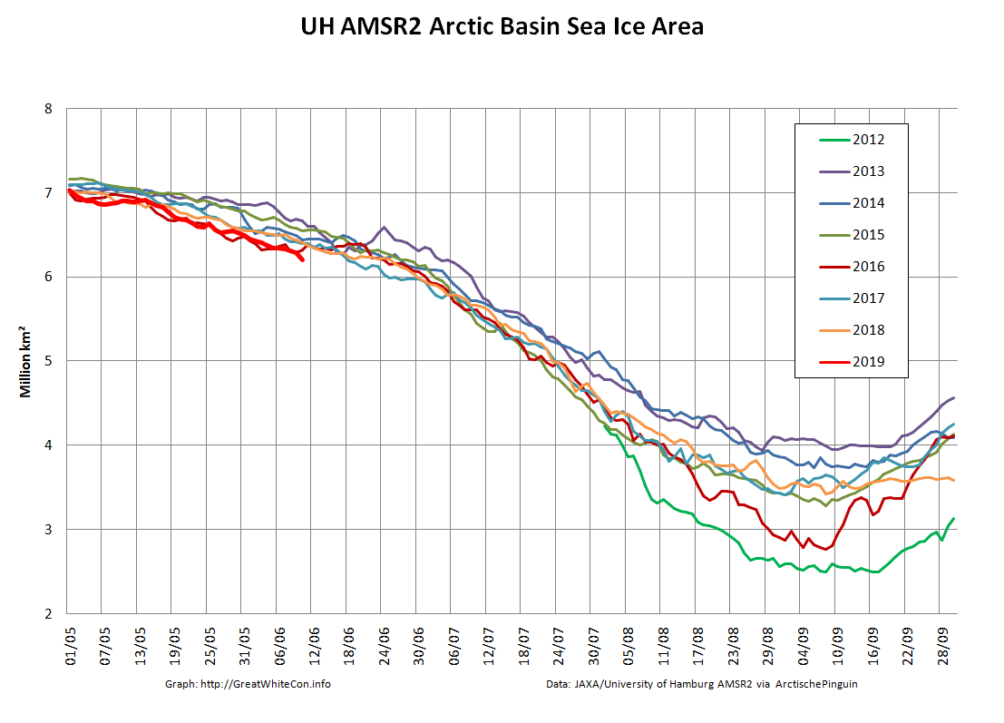
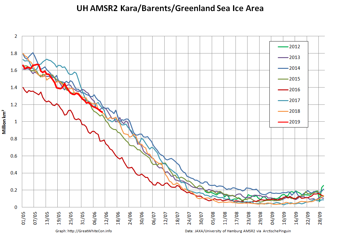
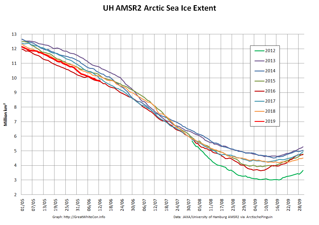
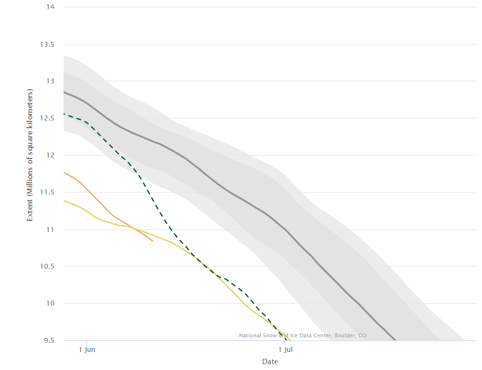
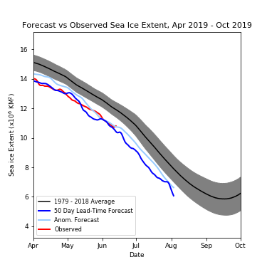
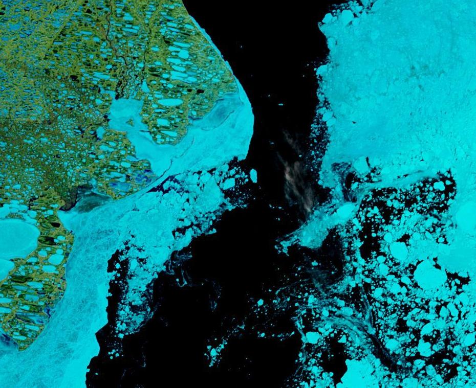
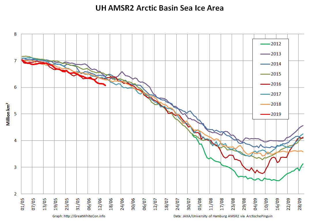
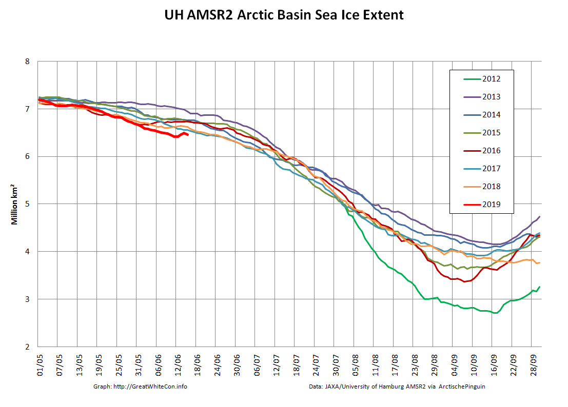
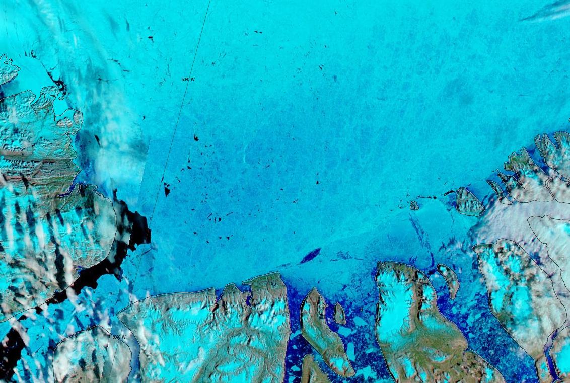
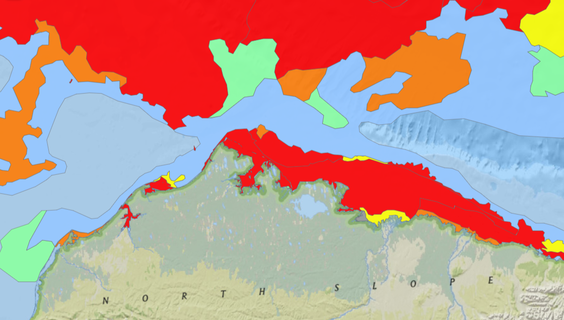
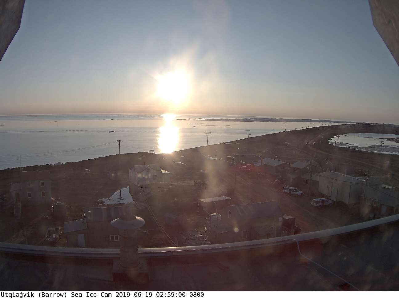
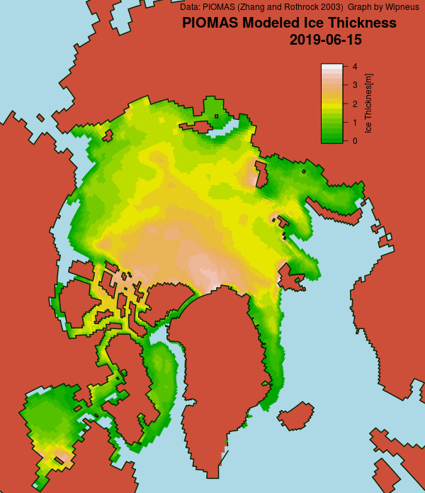
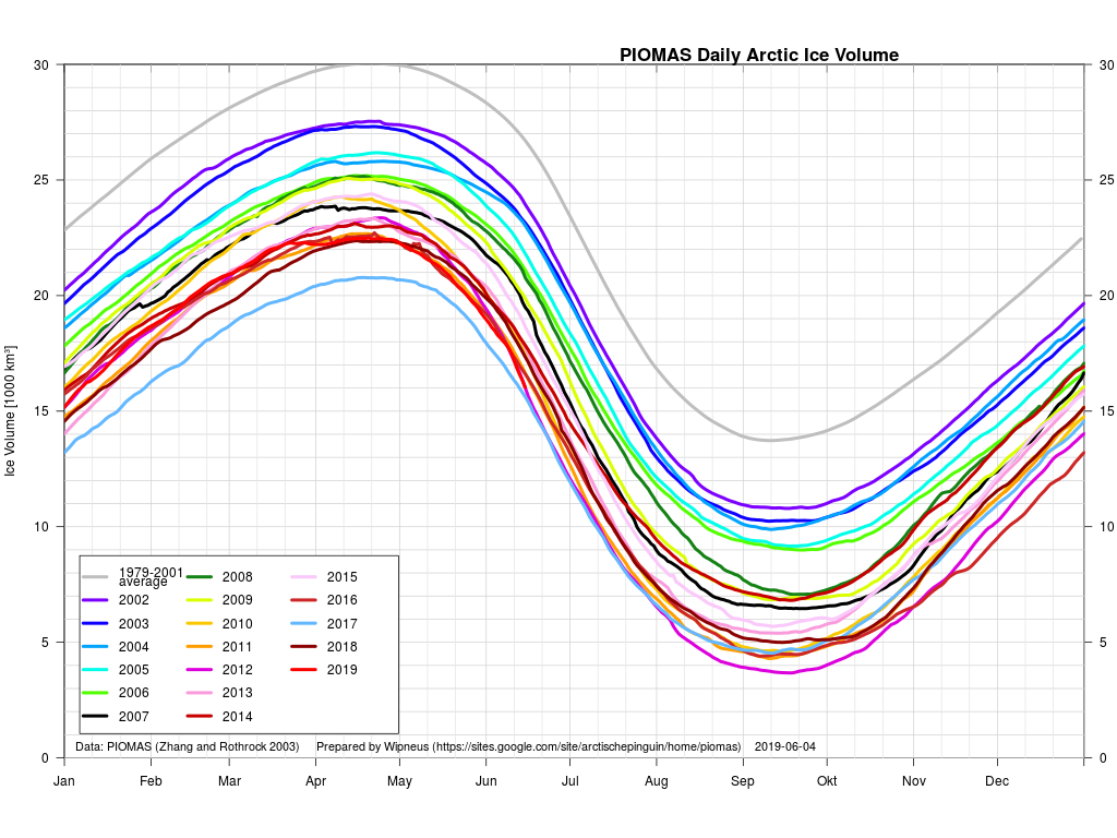
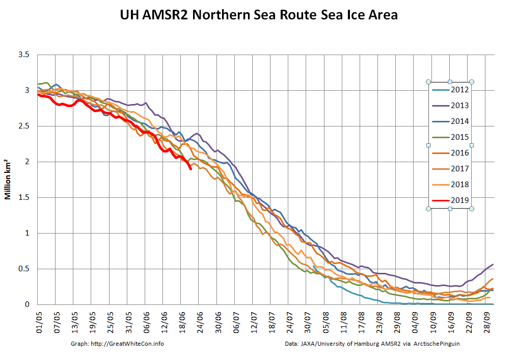
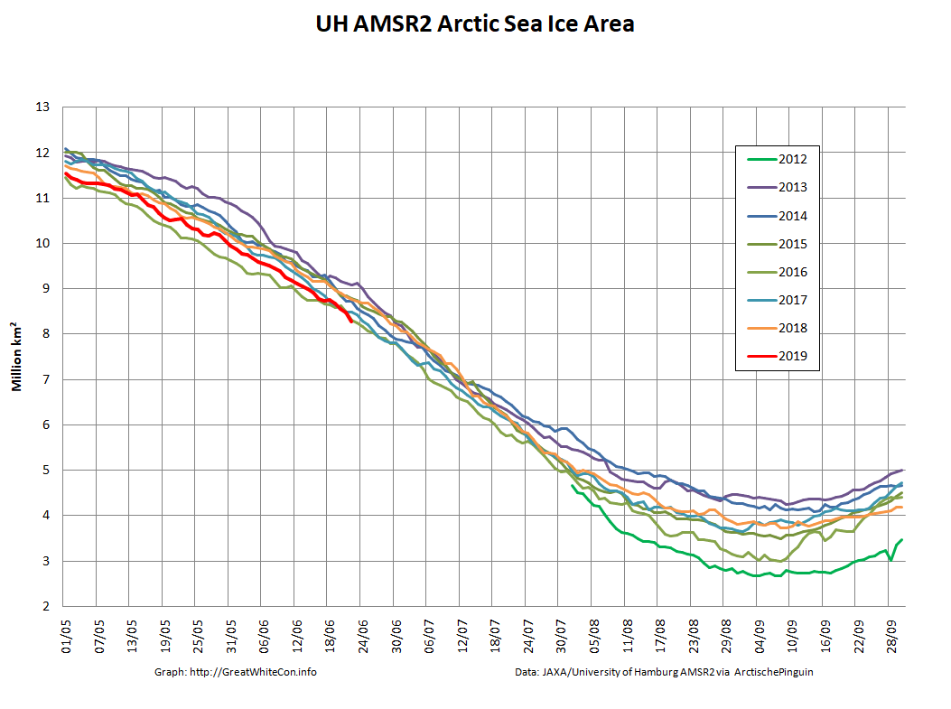
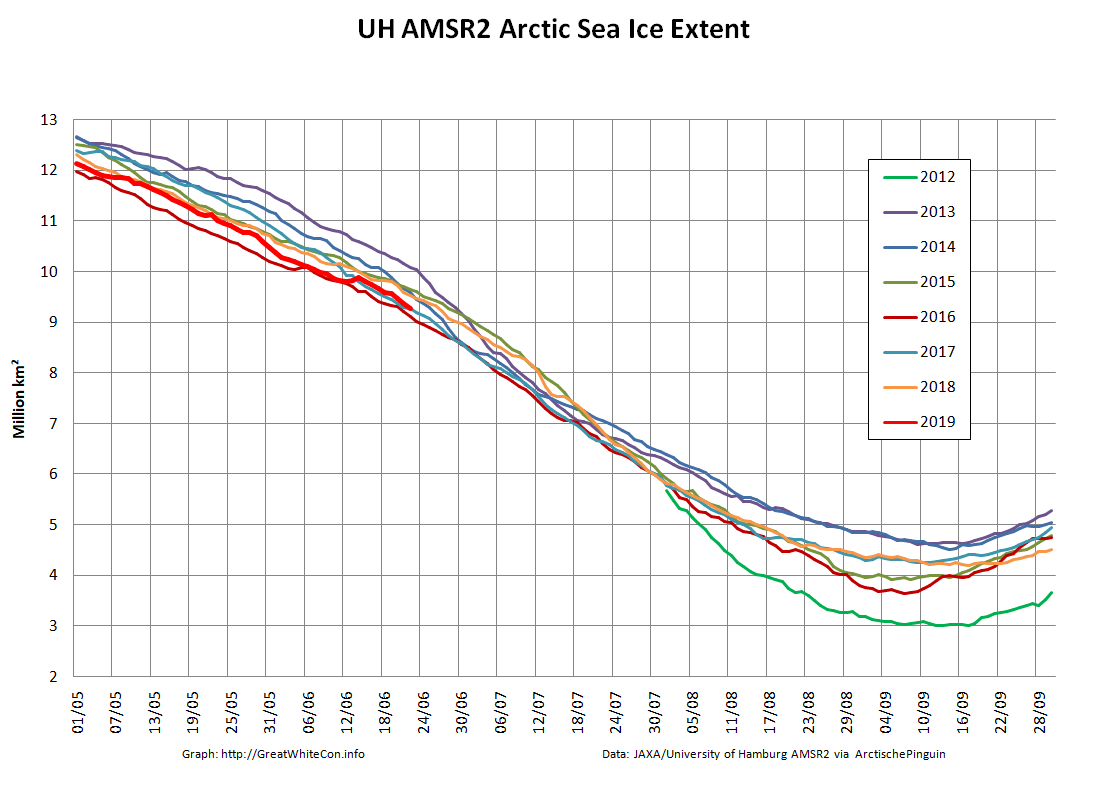
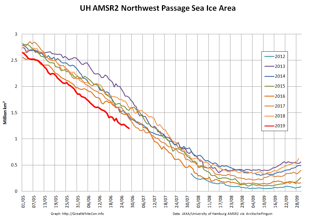
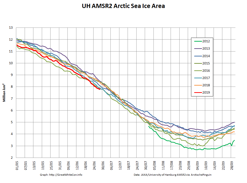
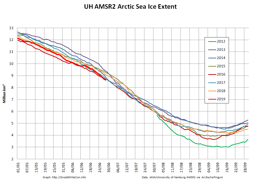
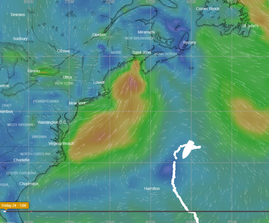
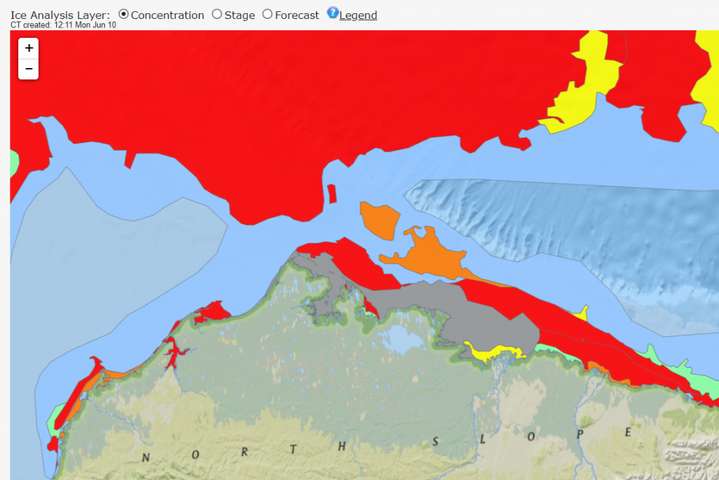
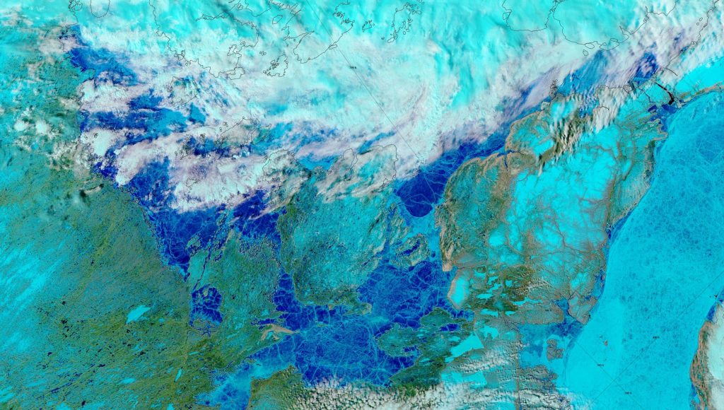
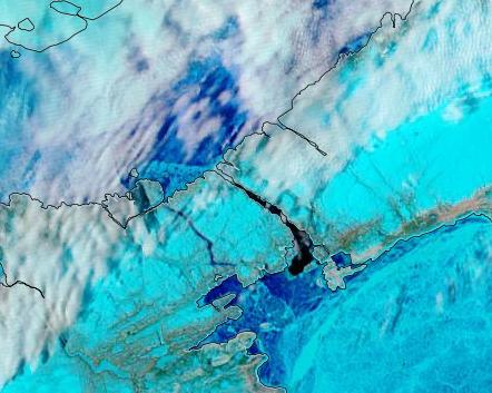
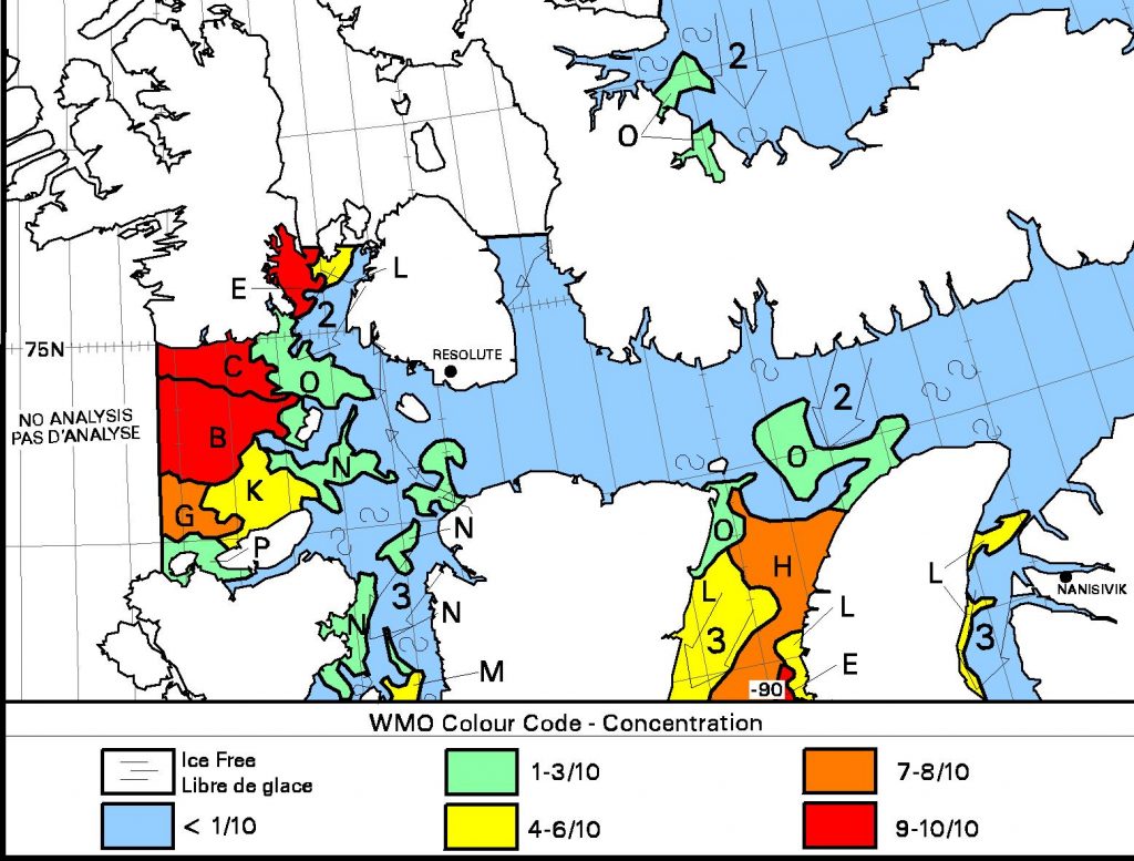
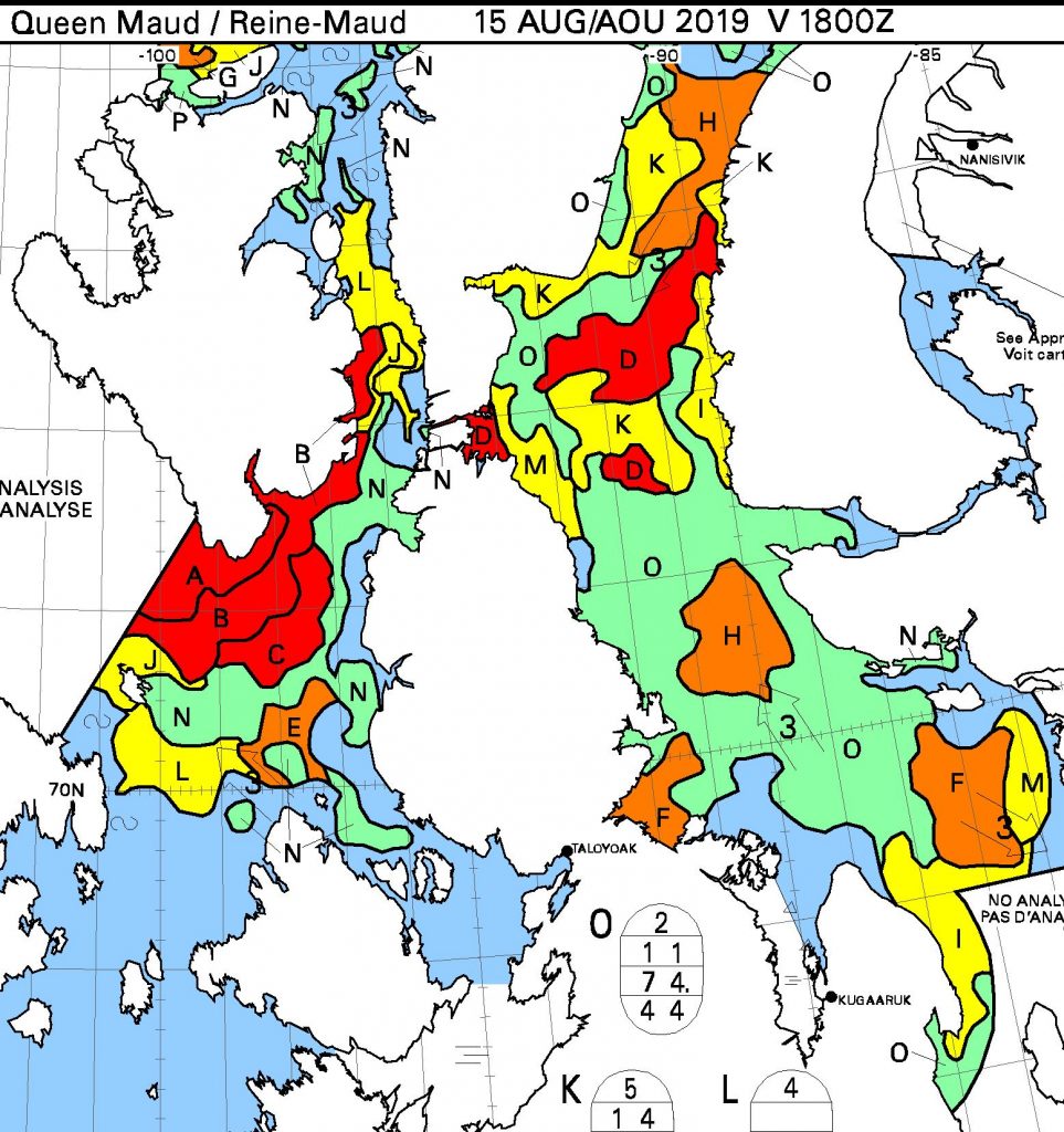
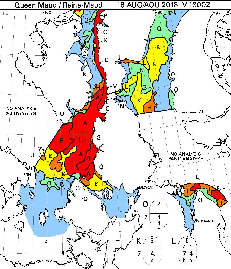
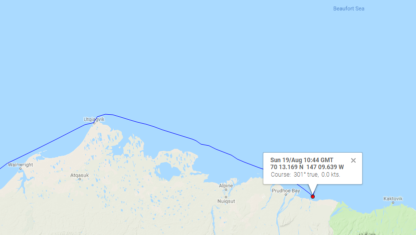
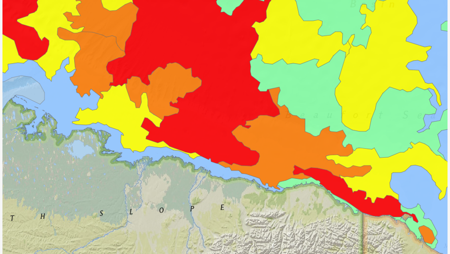
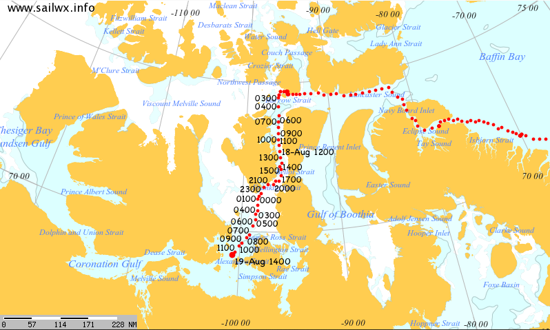
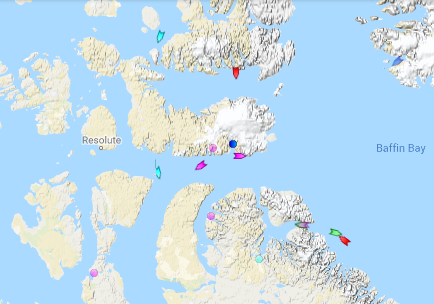
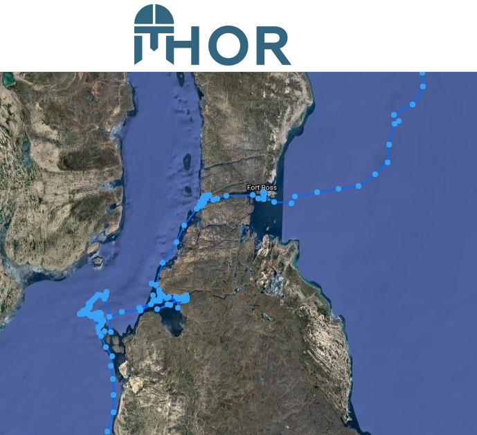
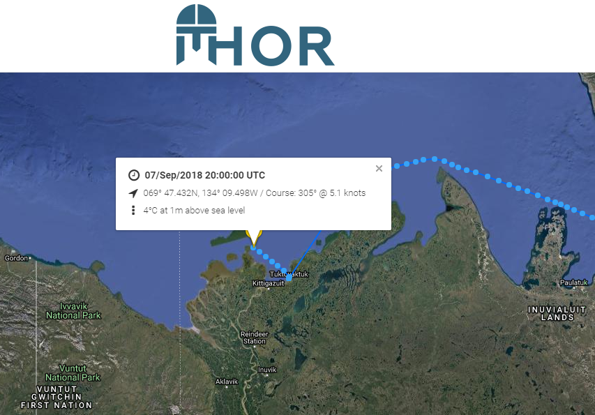
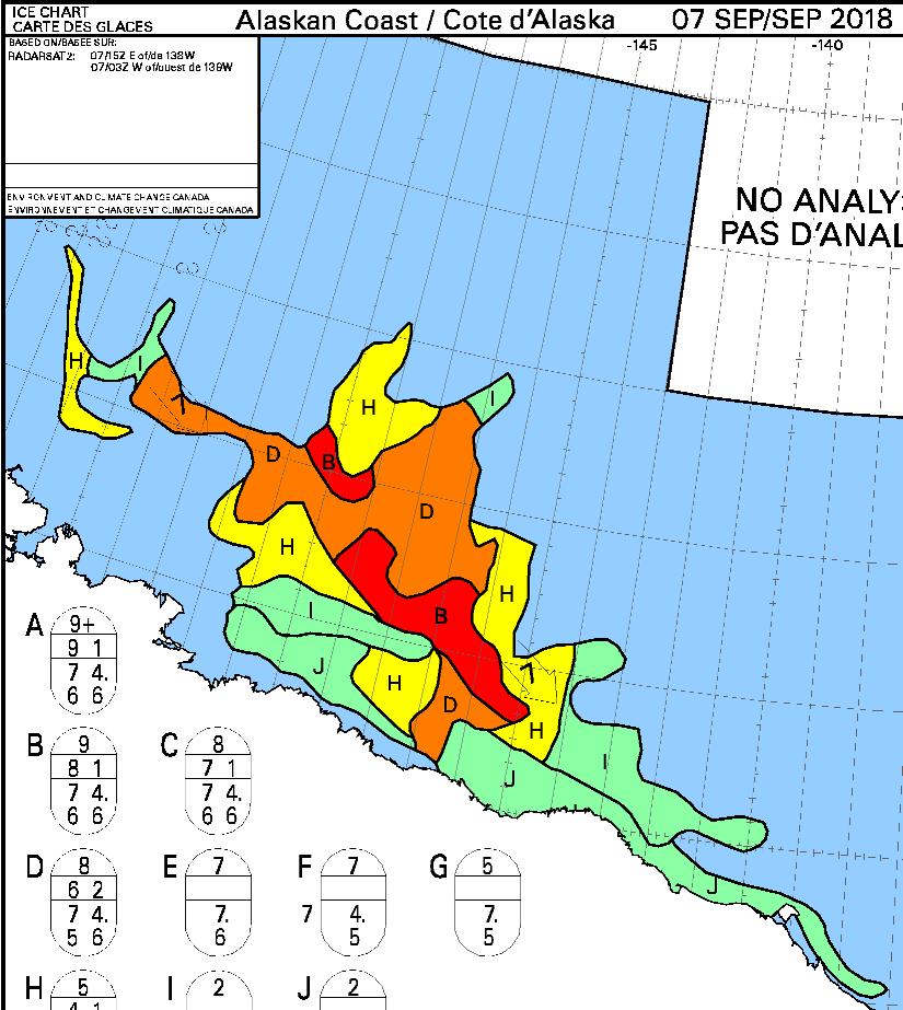
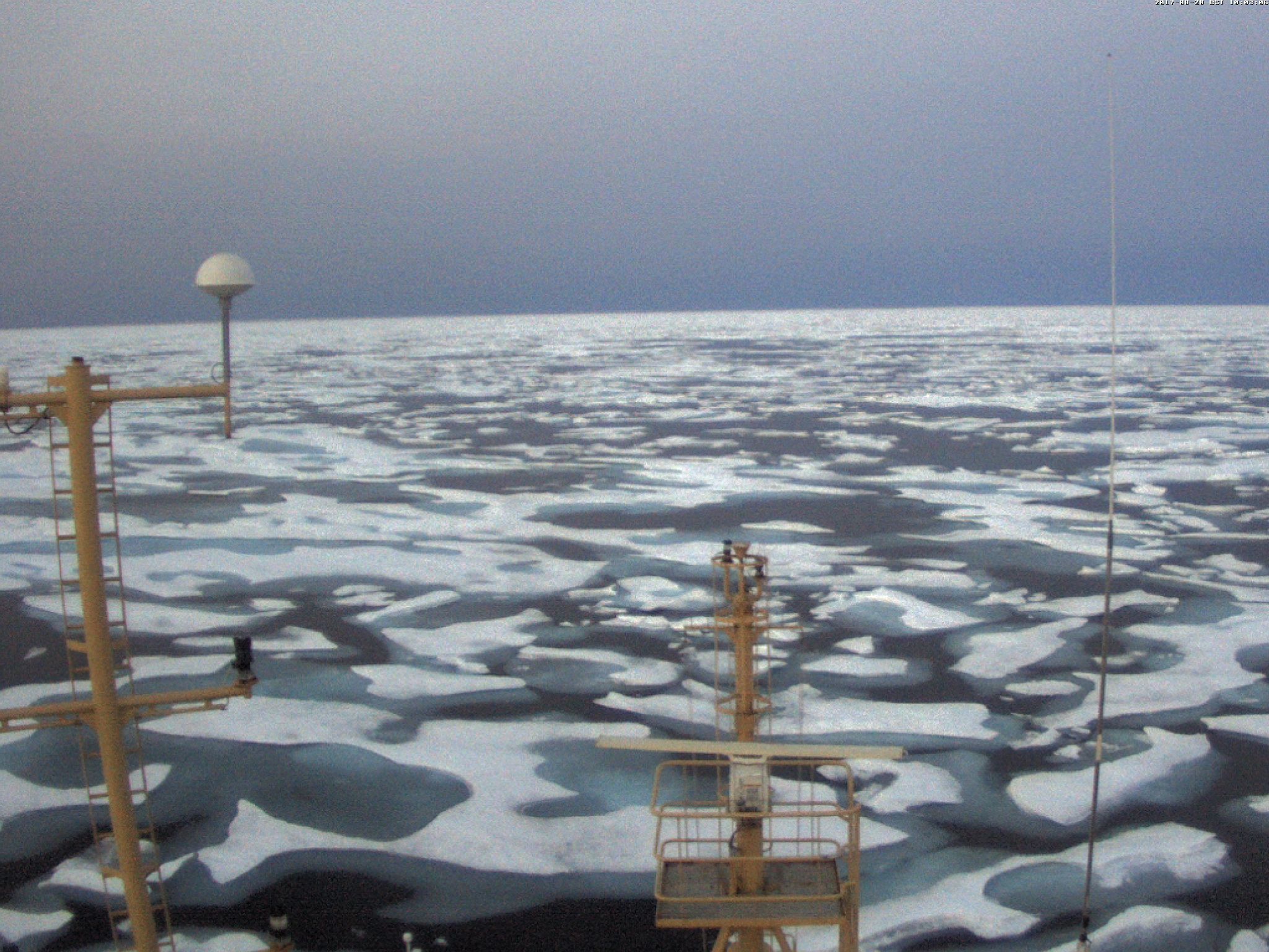
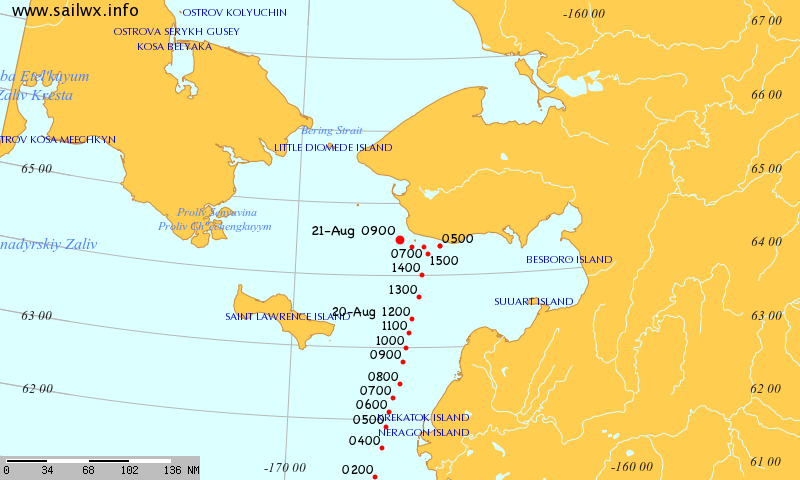
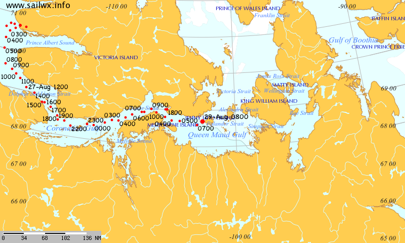
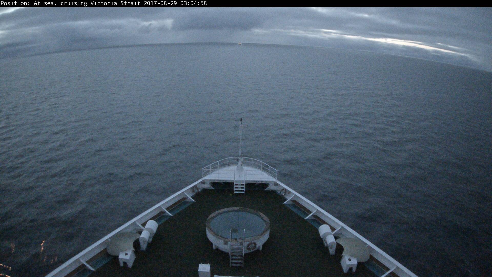
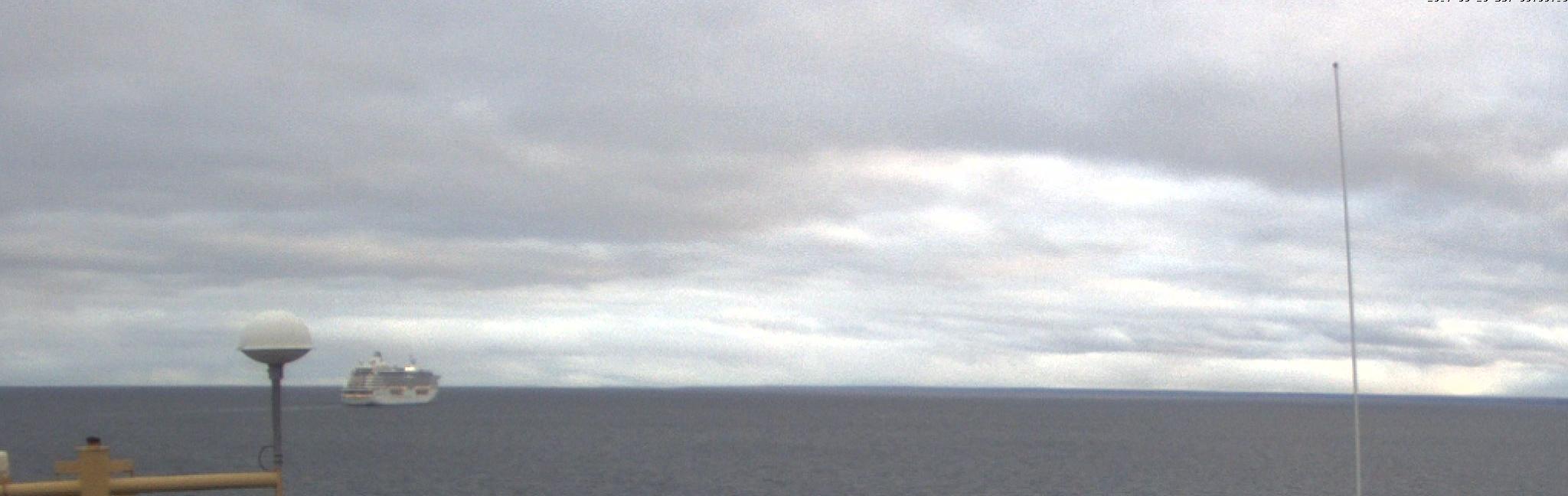
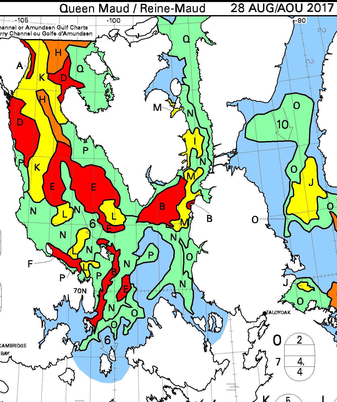
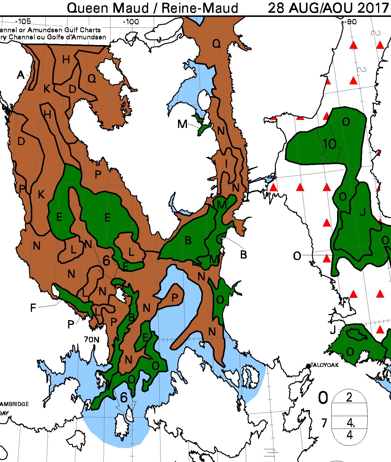
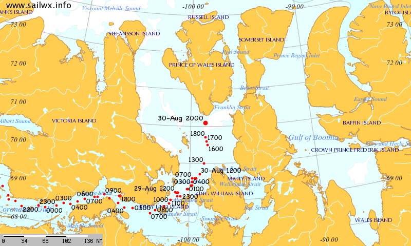
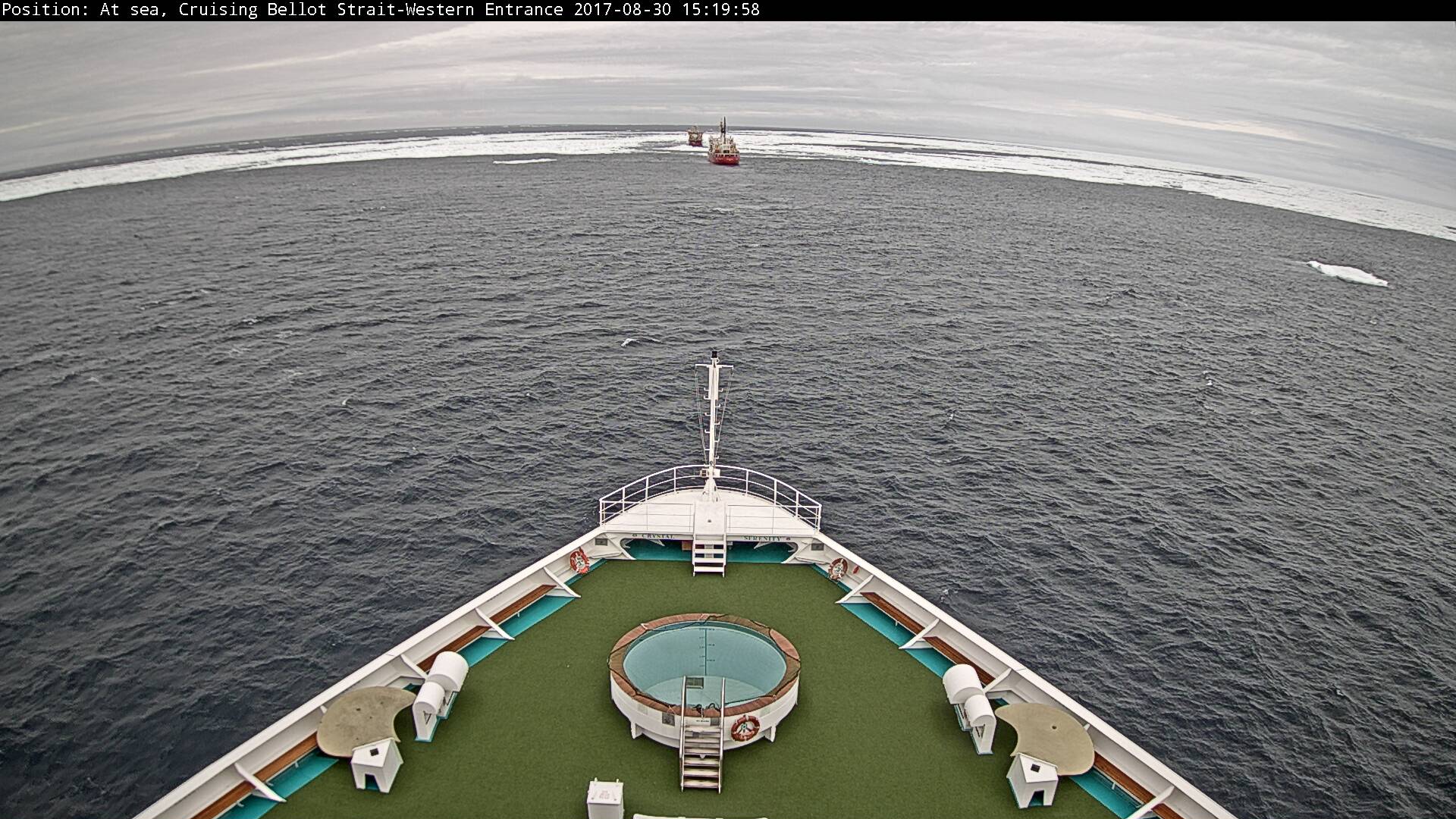
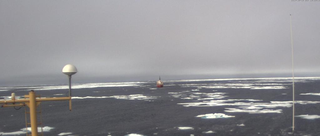
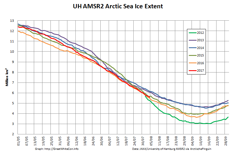
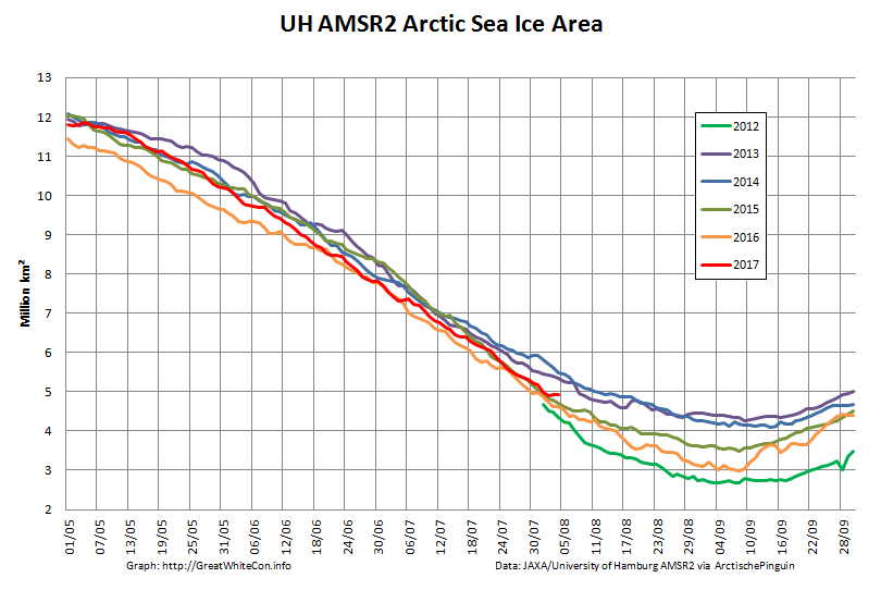
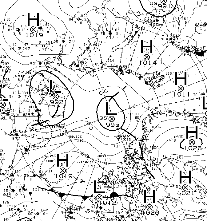
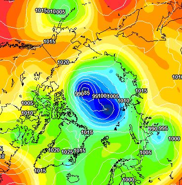
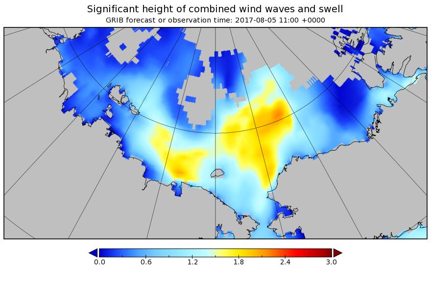
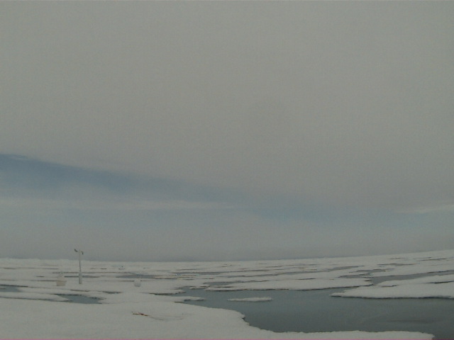
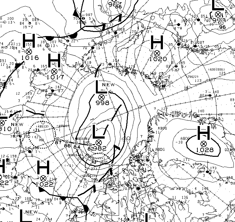
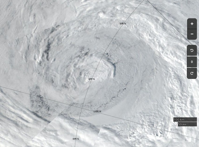
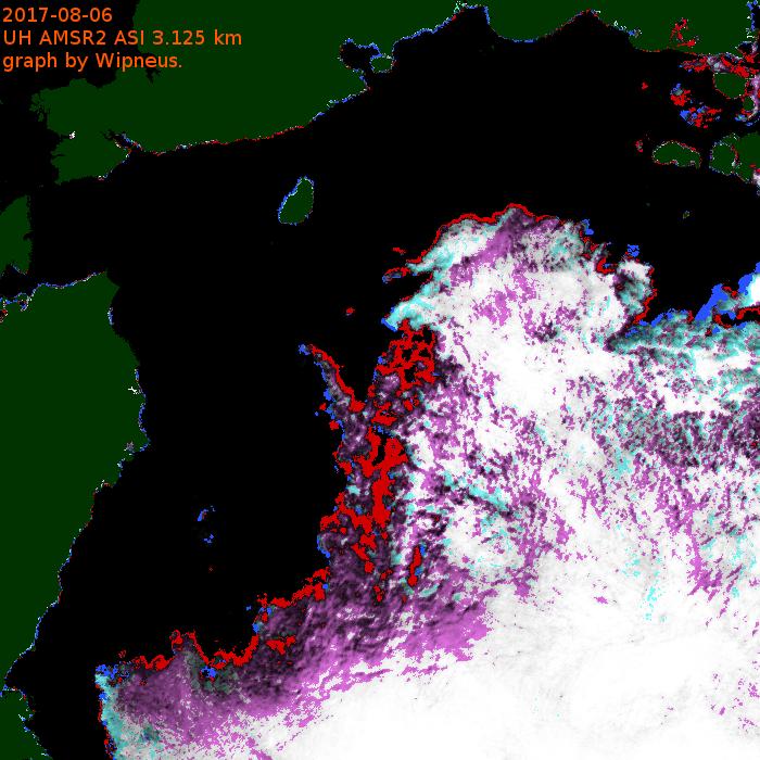
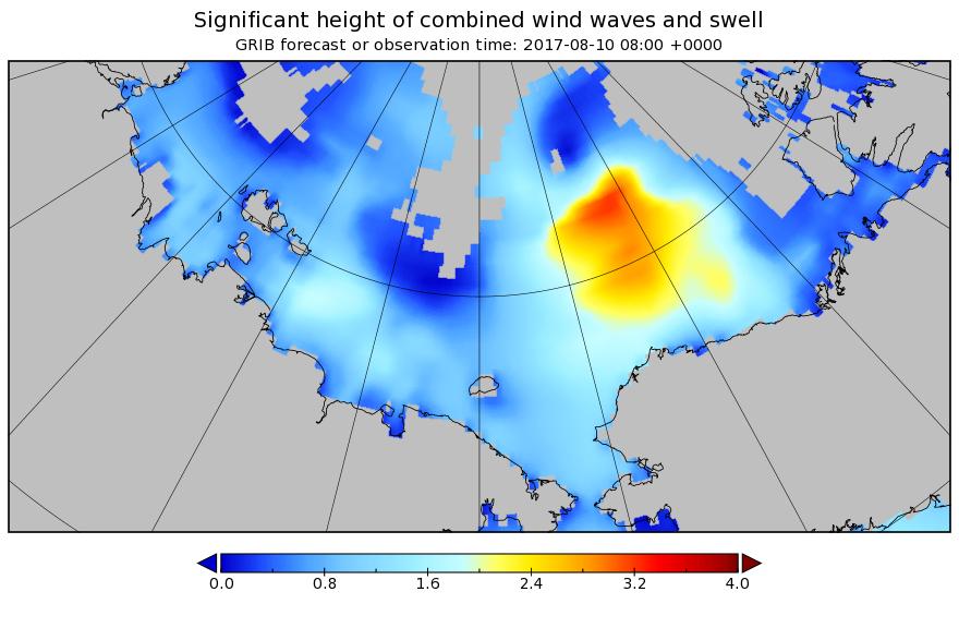
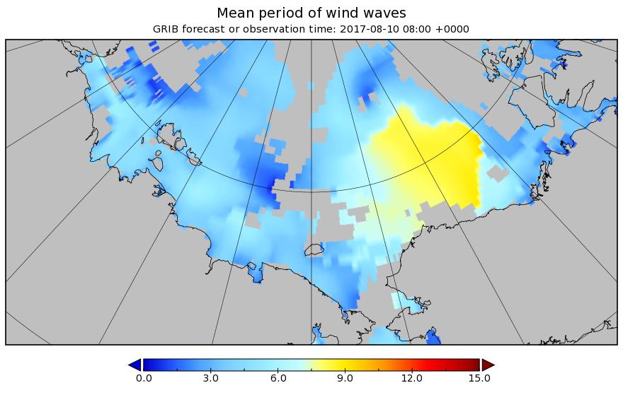
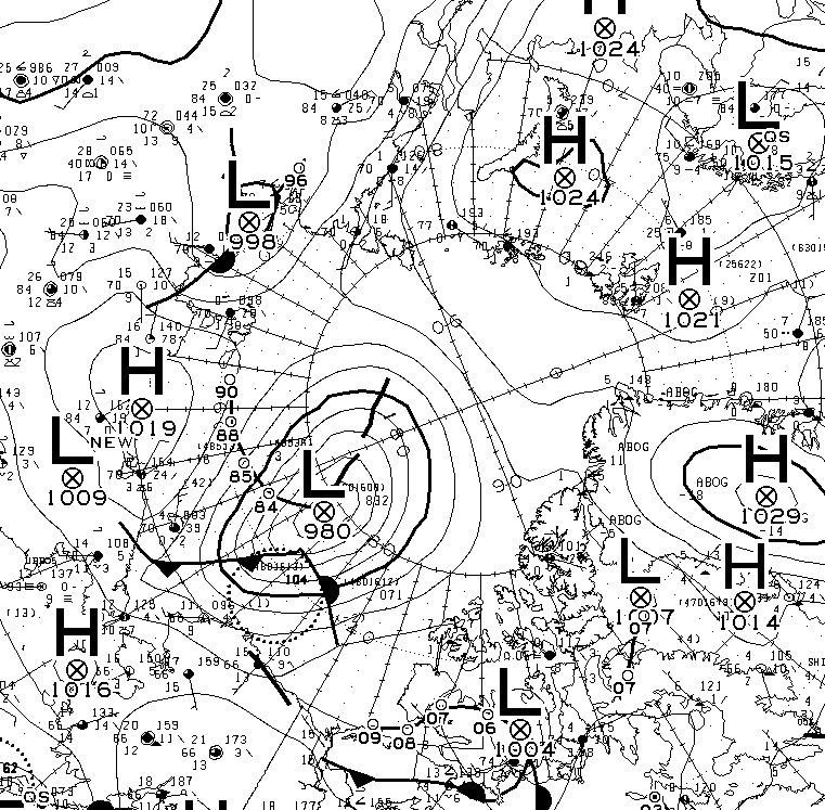
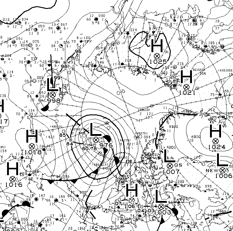
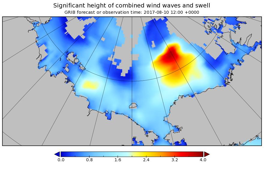
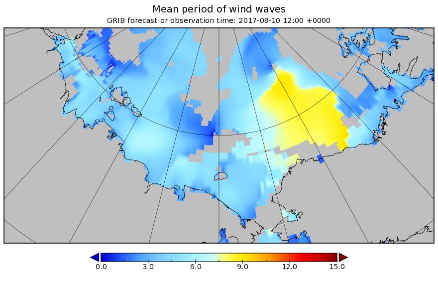
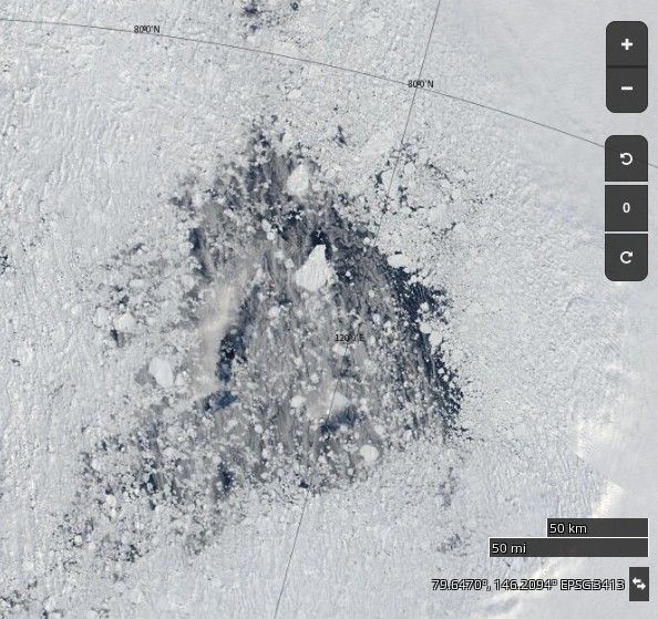
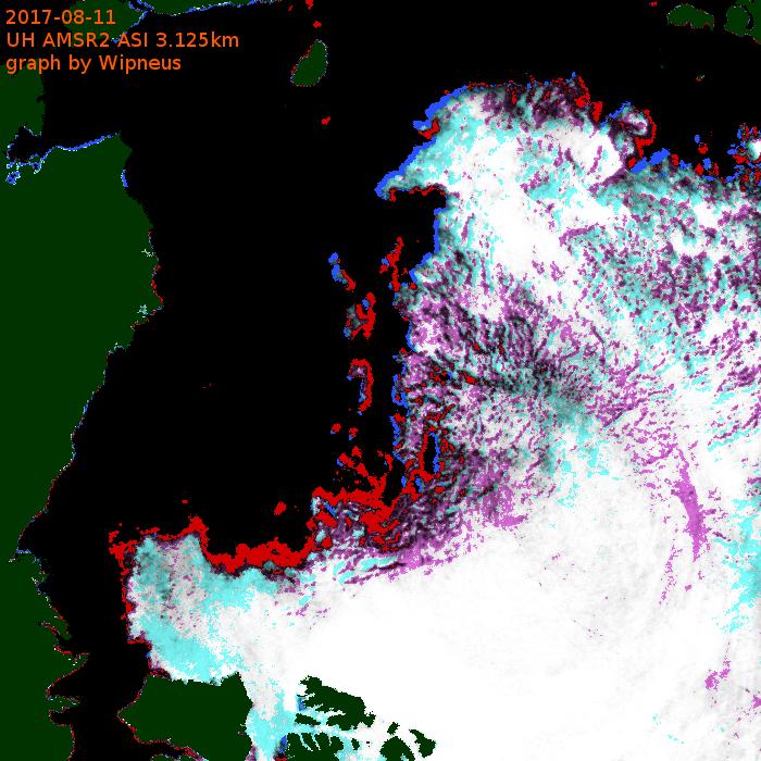
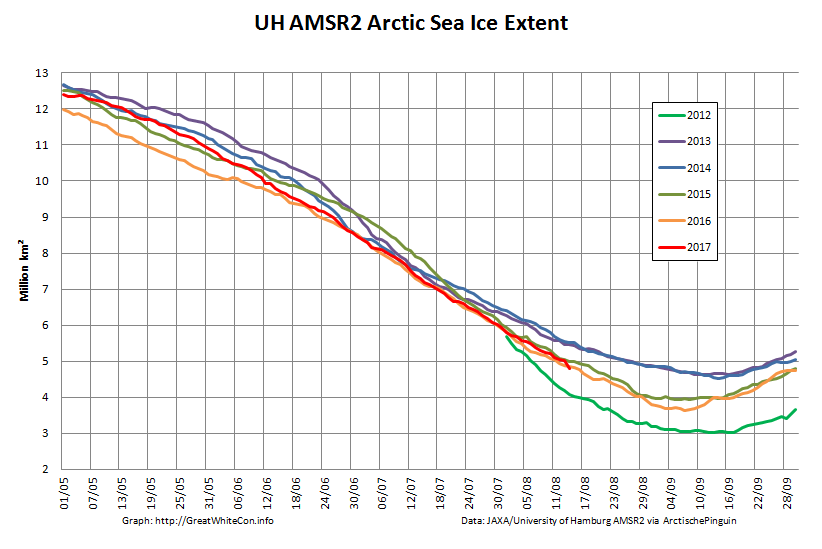
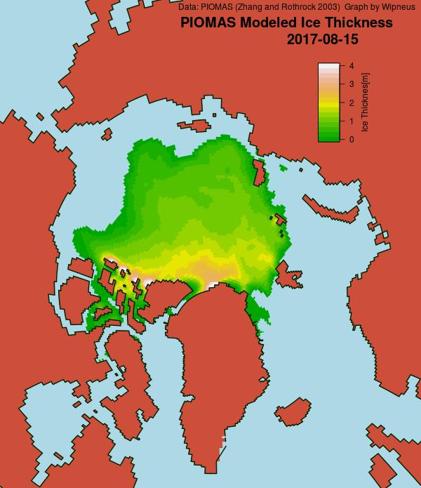
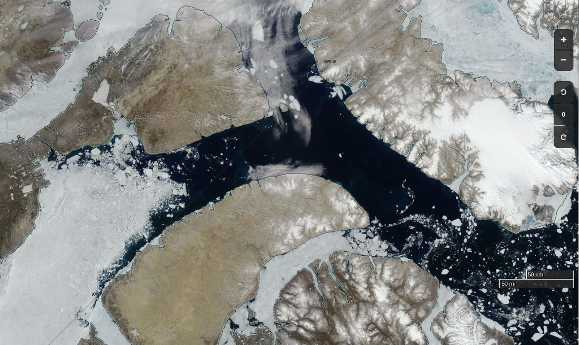
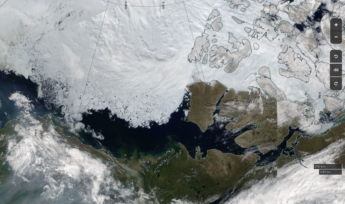
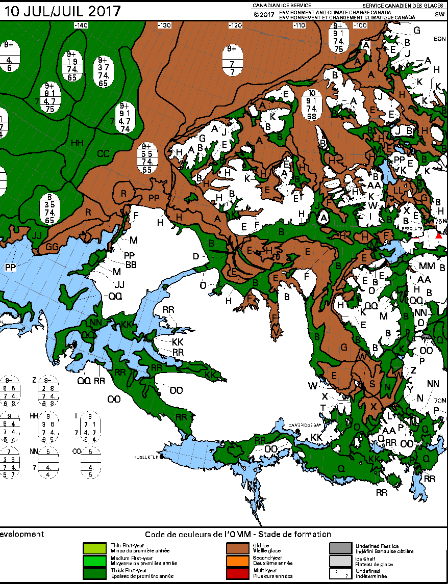
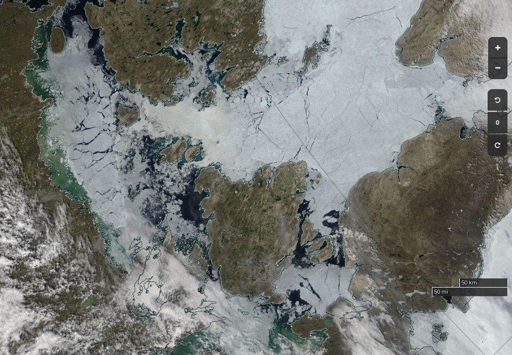
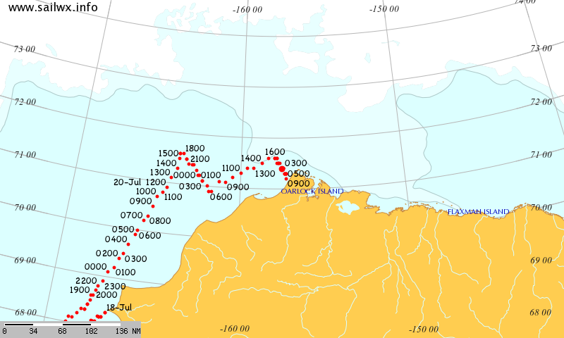
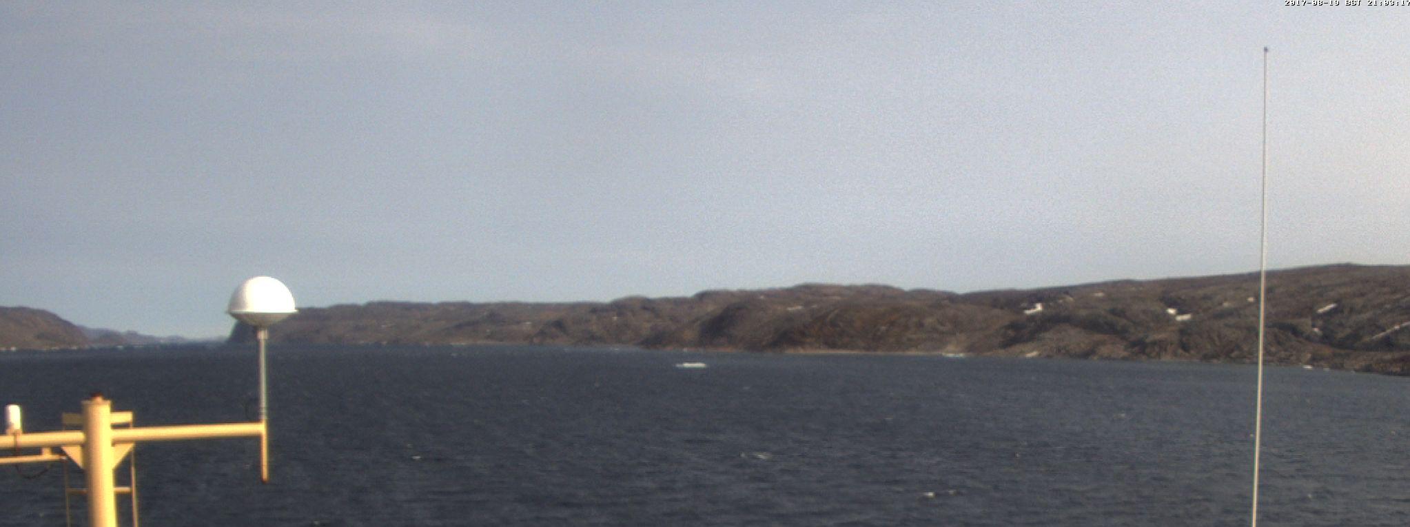
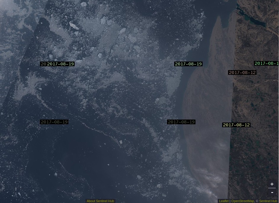
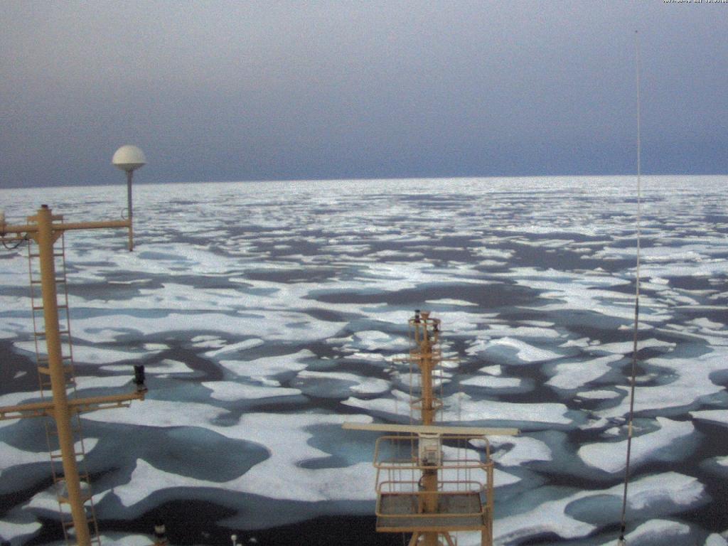
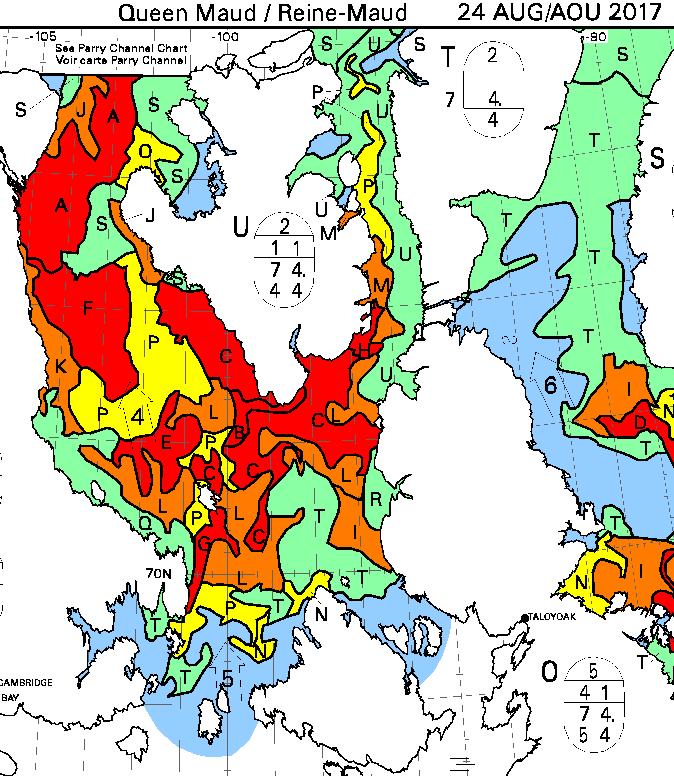
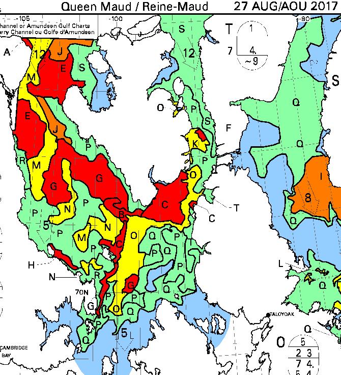
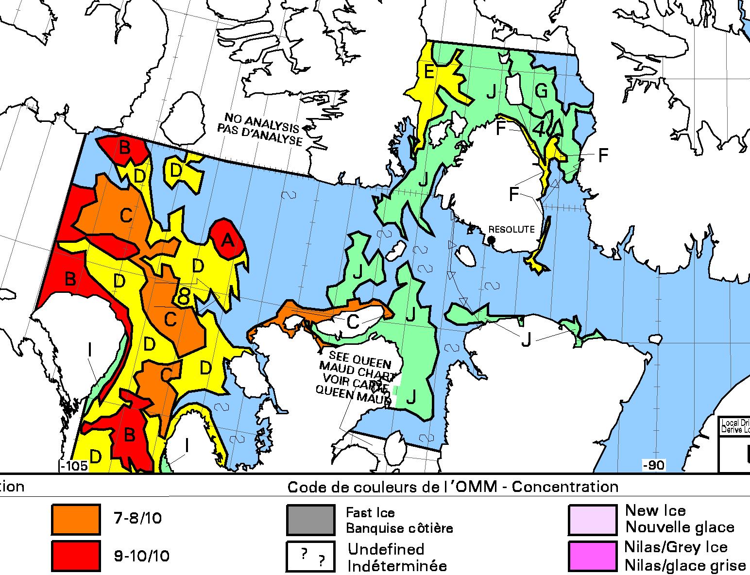
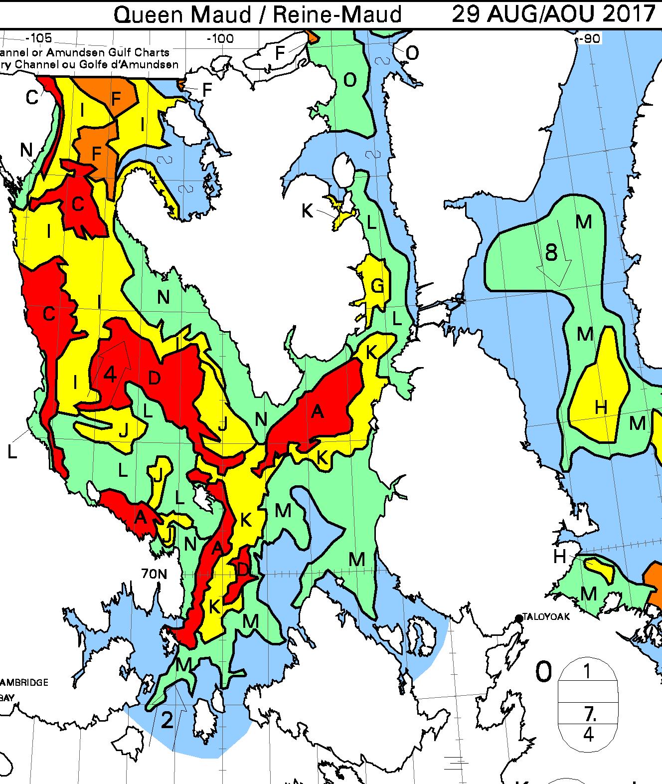
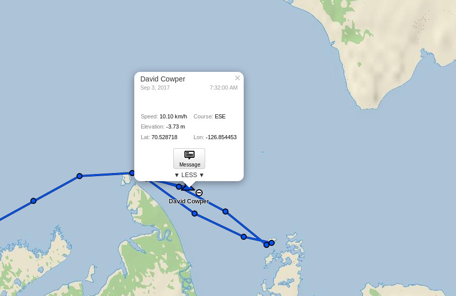
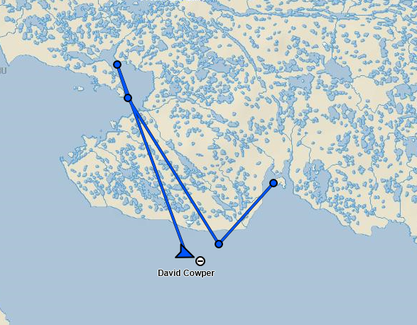
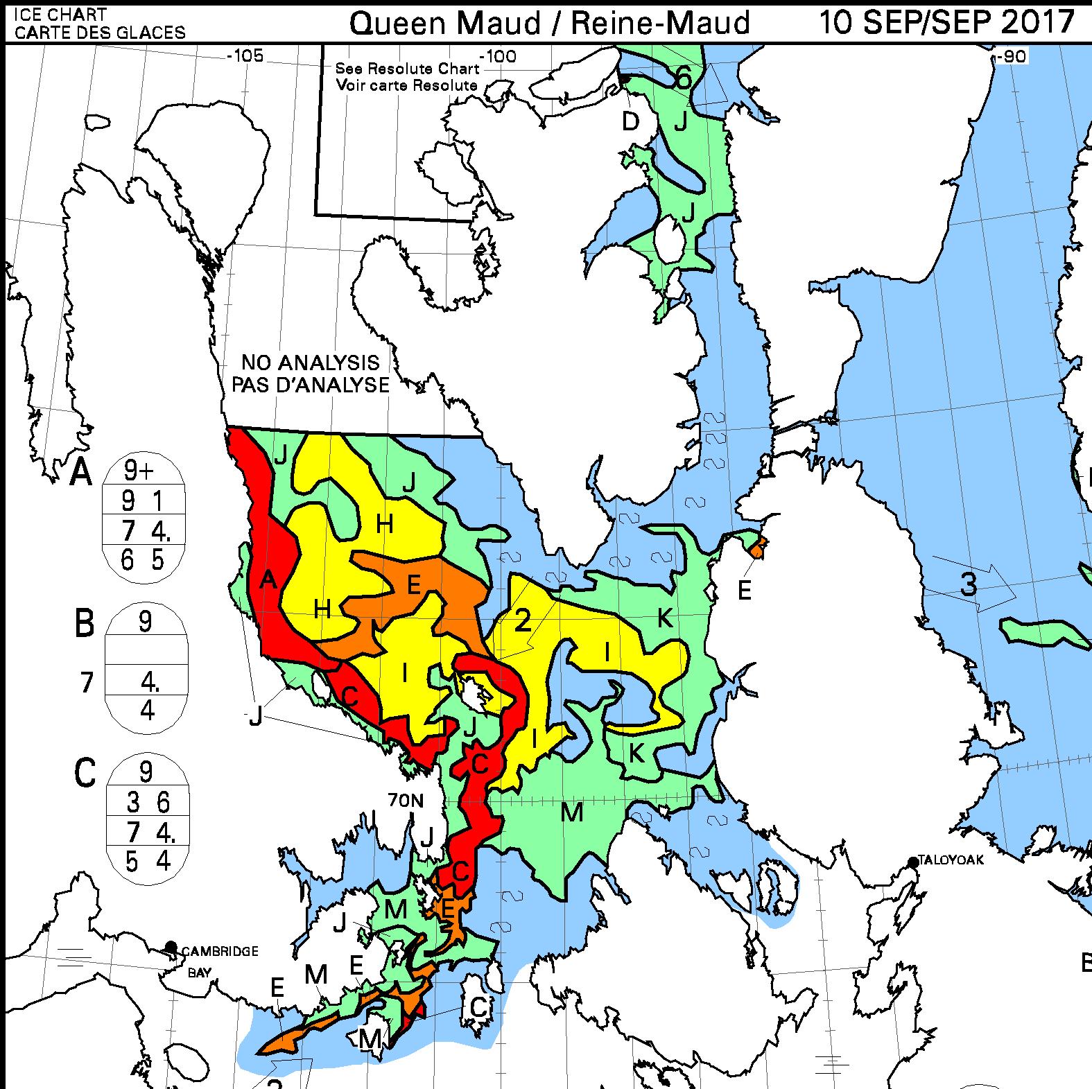
It seems to me that no longer planning to pass through Canadian Arctic waters is very prudent on Zhai Mo‘s part, since navigating the Northwest Passage without support from Xue Long 2 or a Canadian icebreaker is currently fraught with difficulty:

By way of some additional background information, on January 26th 2018 China published a “white paper” on China’s Arctic Policy:
China is an important stakeholder in Arctic affairs. Geographically, China is a “Near-Arctic State”, one of the continental States that are closest to the Arctic Circle. The natural conditions of the Arctic and their changes have a direct impact on China’s climate system and ecological environment, and, in turn, on its economic interests in agriculture, forestry, fishery, marine industry and other sectors.
China is also closely involved in the trans-regional and global issues in the Arctic, especially in such areas as climate change, environment, scientific research, utilization of shipping routes, resource exploration and exploitation, security, and global governance. These issues are vital to the existence and development of all countries and humanity, and directly affect the interests of non-Arctic States including China. China enjoys the freedom or rights of scientific research, navigation, overflight, fishing, laying of submarine cables and pipelines, and resource exploration and exploitation in the high seas, the Area and other relevant sea areas, and certain special areas in the Arctic Ocean, as stipulated in treaties such as the UNCLOS and the Spitsbergen Treaty, and general international law. As a permanent member of the UN Security Council, China shoulders the important mission of jointly promoting peace and security in the Arctic. The utilization of sea routes and exploration and development of the resources in the Arctic may have a huge impact on the energy strategy and economic development of China, which is a major trading nation and energy consumer in the world. China’s capital, technology, market, knowledge and experience is expected to play a major role in expanding the network of shipping routes in the Arctic and facilitating the economic and social progress of the coastal States along the routes. China has shared interests with Arctic States and a shared future with the rest of the world in the Arctic.
Followed by:
The Arctic shipping routes comprise the Northeast Passage, Northwest Passage, and the Central Passage. As a result of global warming, the Arctic shipping routes are likely to become important transport routes for international trade. China respects the legislative, enforcement and adjudicatory powers of the Arctic States in the waters subject to their jurisdiction. China maintains that the management of the Arctic shipping routes should be conducted in accordance with treaties including the UNCLOS and general international law and that the freedom of navigation enjoyed by all countries in accordance with the law and their rights to use the Arctic shipping routes should be ensured. China maintains that disputes over the Arctic shipping routes should be properly settled in accordance with international law.
China hopes to work with all parties to build a “Polar Silk Road” through developing the Arctic shipping routes. It encourages its enterprises to participate in the infrastructure construction for these routes and conduct commercial trial voyages in accordance with the law to pave the way for their commercial and regularized operation.
Watch this space!