Tag Archives: Northabout

Northabout Heads for Home

The Polar Ocean Challenge team issued a press release last night. This is what it said:

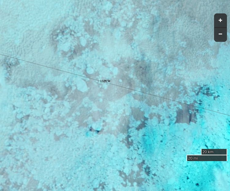
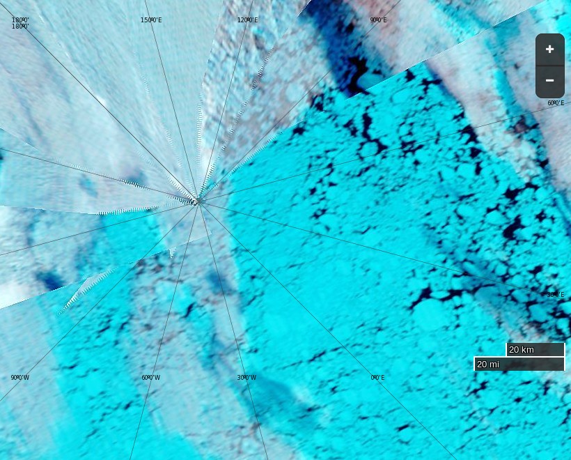
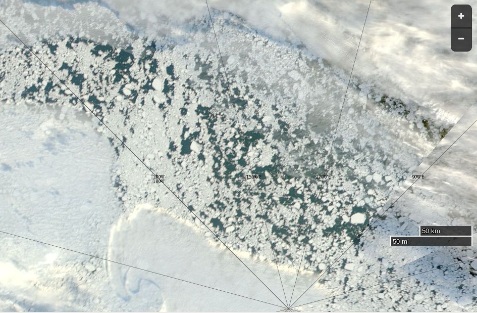
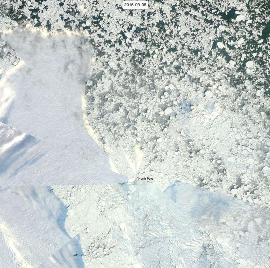
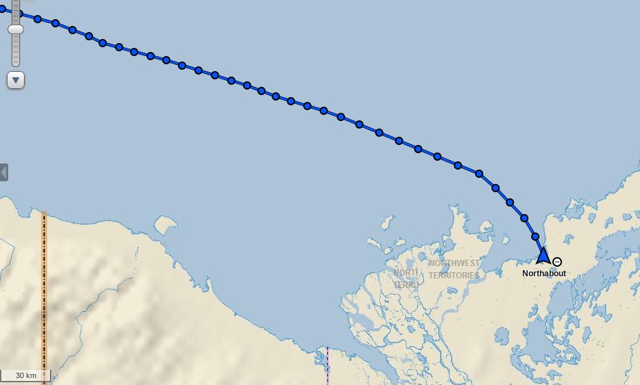
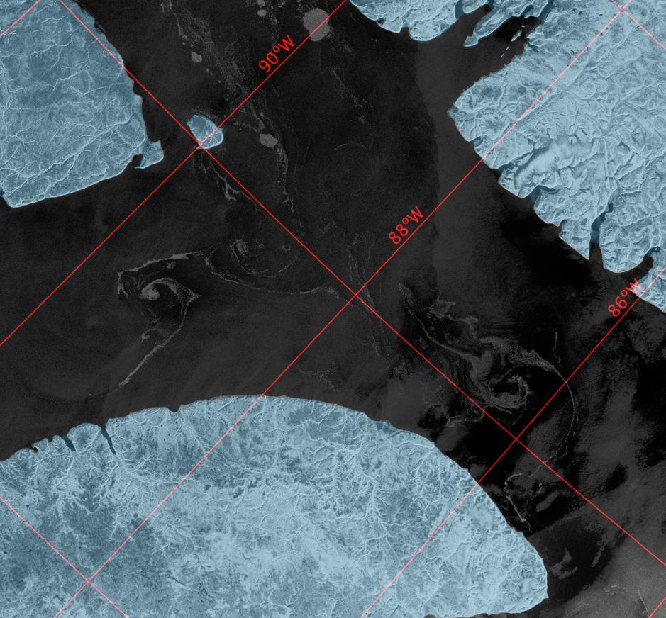
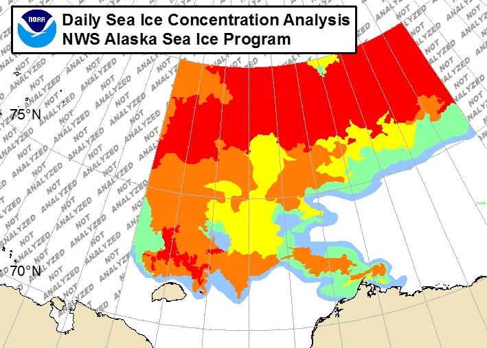
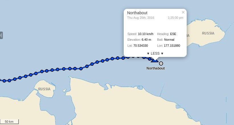
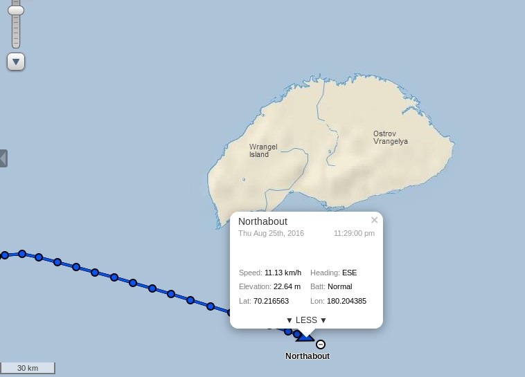
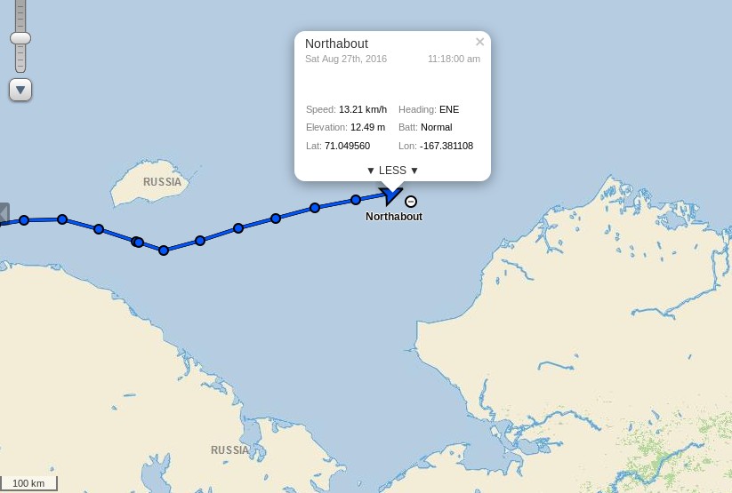
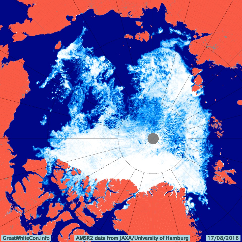
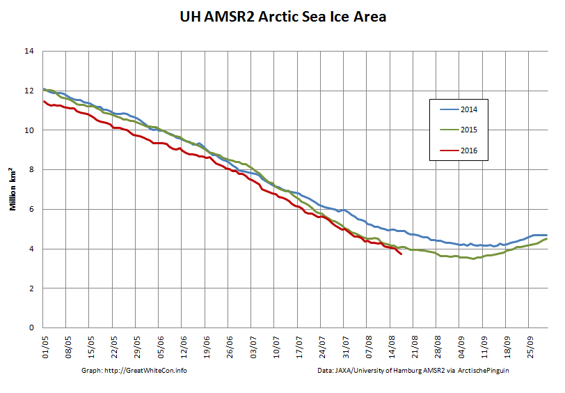
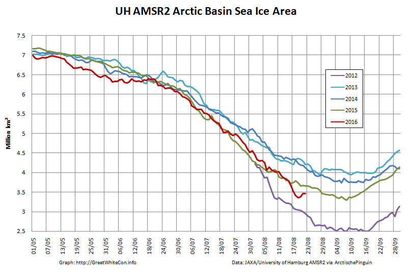
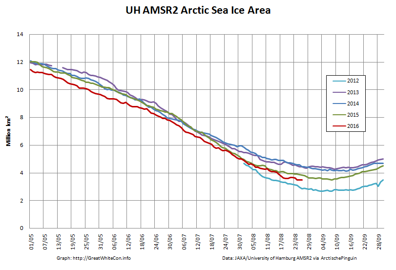
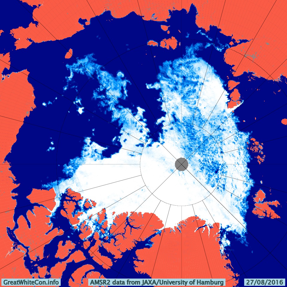
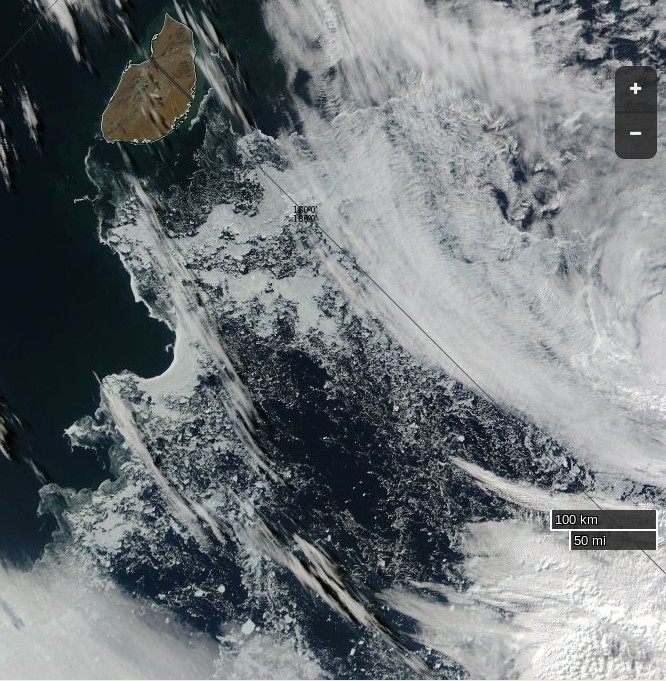
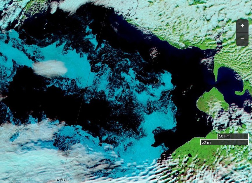
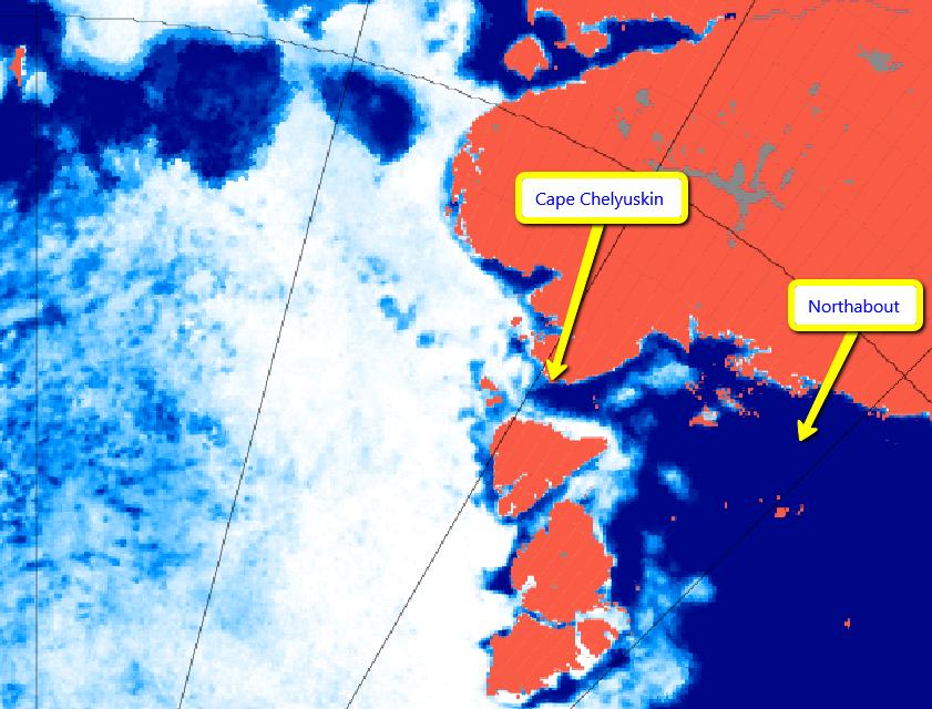
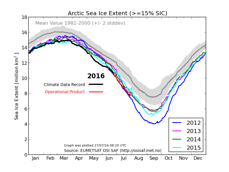
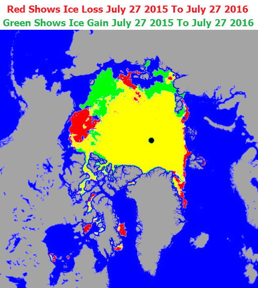
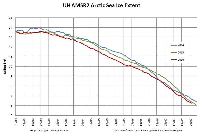
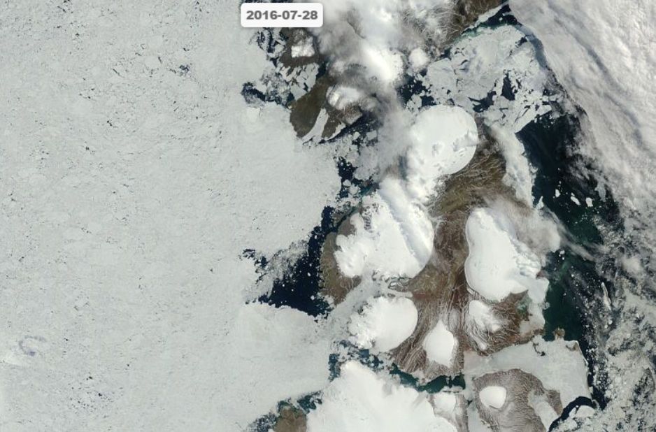
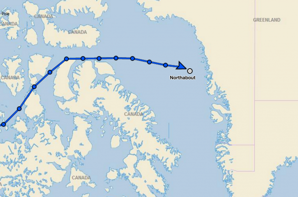
The Polar Ocean Challenge successfully completed their quest to sail the North East Passage and North West Passage in one season. The North West Passage was completed in an astonishing 14 days due to the fact that it was almost totally ice free. They encountered ice only twice in their 1800 mile NW Passage part of the voyage. This highlights an extraordinary loss of sea ice in the Arctic in the 30 years that David Hempleman-Adams has been coming to the area. He said, ‘whilst we are all delighted to have succeeded, it is extremely worrying to see this lack of ice so starkly‘ The objective of the expedition was to raise awareness of the change in the fragile climate in the Arctic. They left Lancaster Sound at the end of the NW Passage at 19.18 UTC on 12th September and are headed for Greenland.

This seems likely to cause much gnashing of teeth in certain quarters, where it is claimed that:

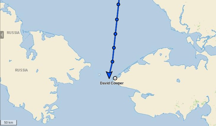
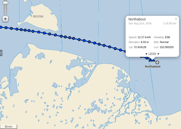
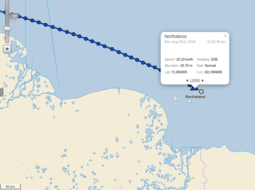
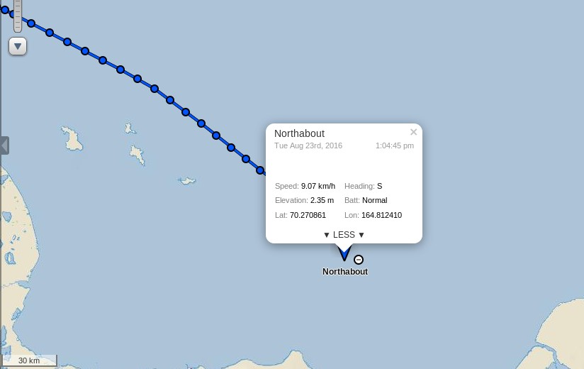
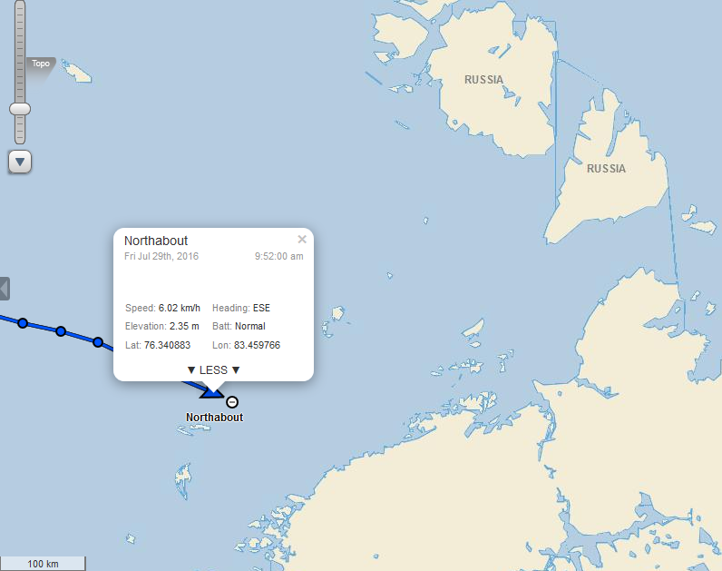
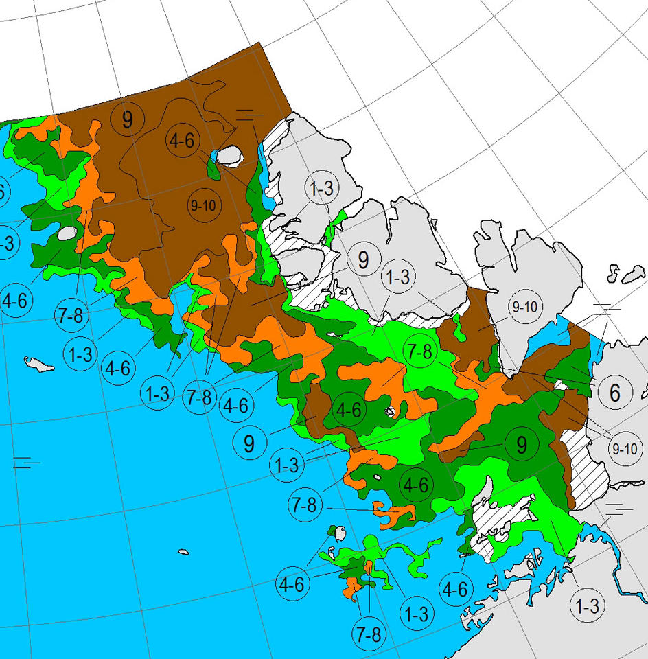
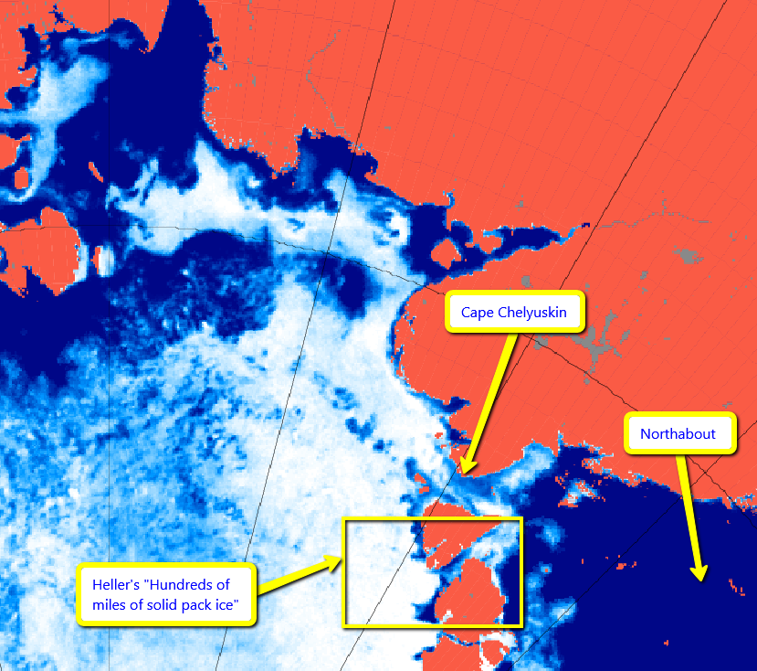
The S/V NORTHABOUT has failed to cross the Pacific Ocean Arctic Circle in the Bering Strait as the official starting line to validate their Northwest Passage attempt. You cannot say you climbed Mount Everest by just reaching high camp – you must summit. You don’t ride a bicycle in the Tour de France without starting and finishing over the course in the designated places. Likewise, you must cross BOTH the Pacific Ocean Arctic Circle in the Bering Strait and the Atlantic Ocean Arctic Circle in Davis Strait to validate a Northwest Passage.

In Northabout’s defence I pointed out that:

Perhaps the Polar Ocean Challenge team have other priorities than gaining an entry on that particular list?

If you’re planning a single season circumnavigation a diversion via Provideniya or Nome doesn’t make a whole lot of sense, rules or no rules.

but nobody else seemed to take that view!

Today they also pointed out on their Twitter feed that they are a:

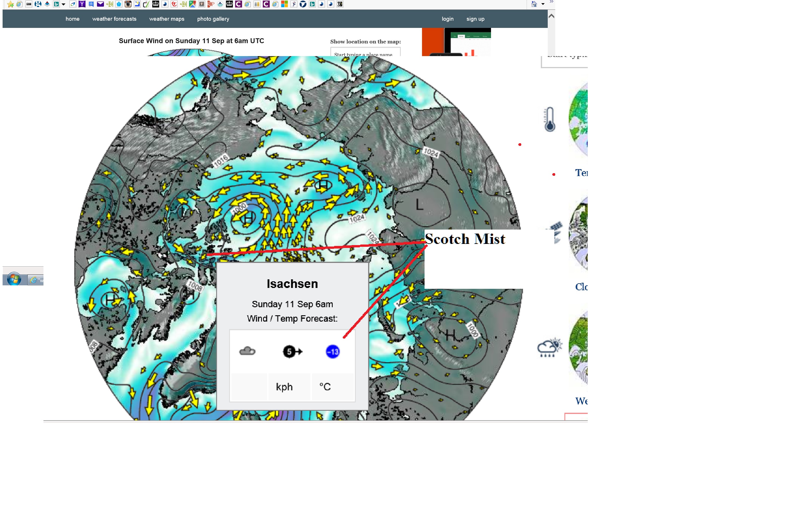
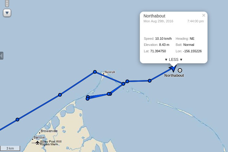
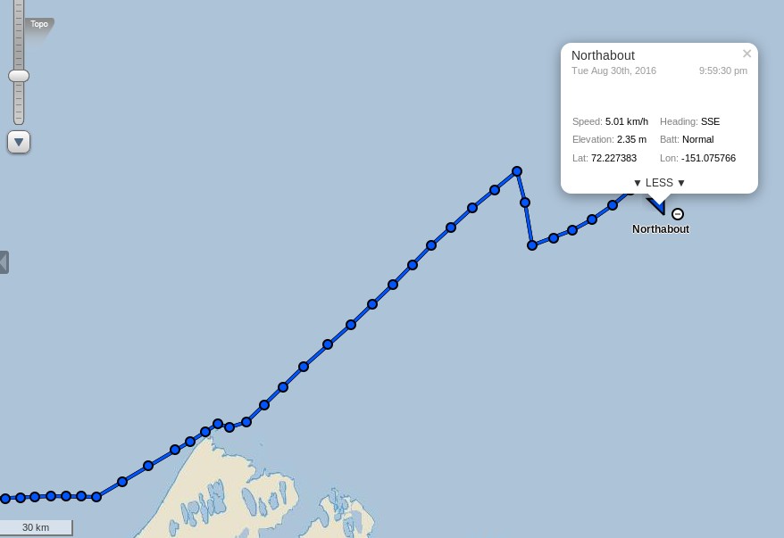
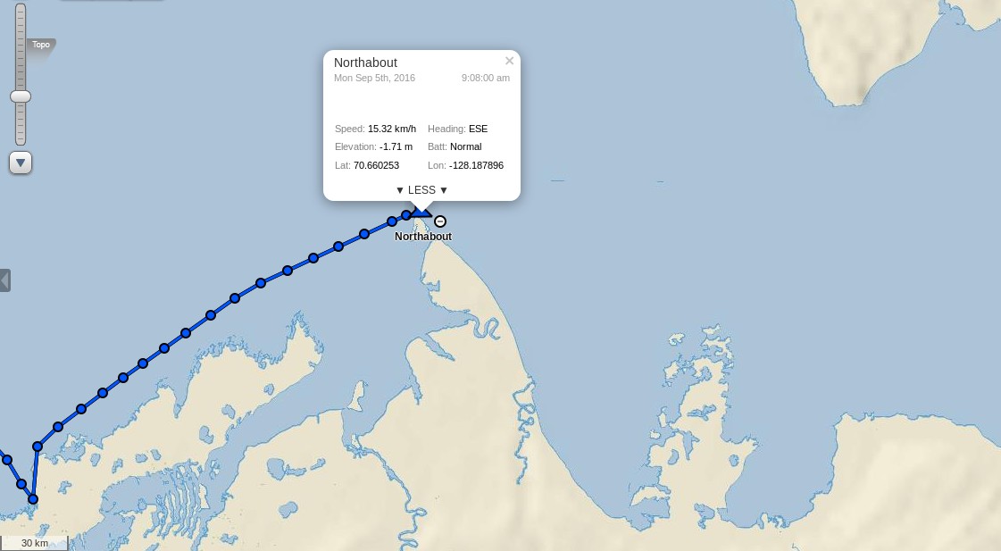
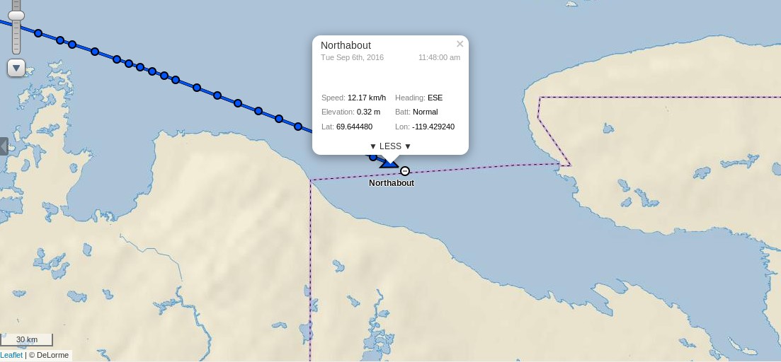
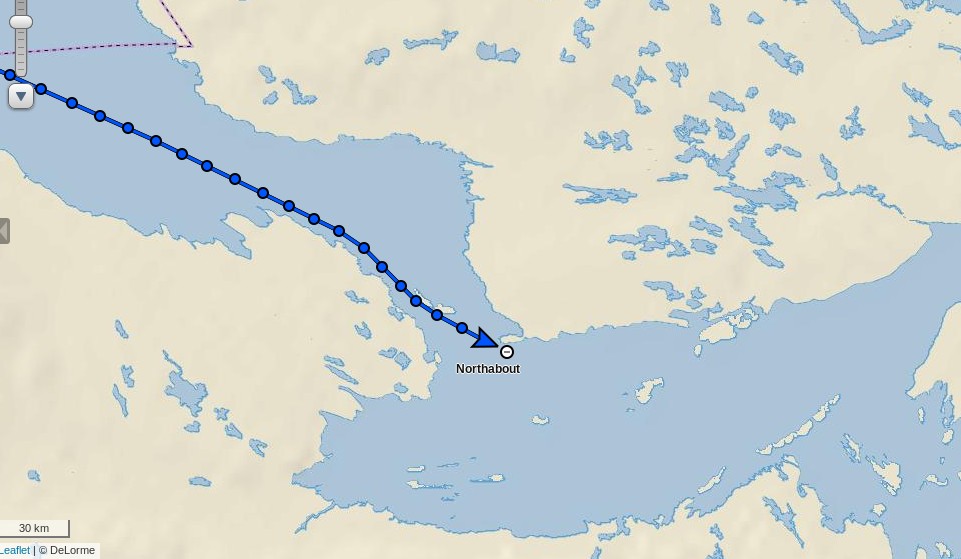
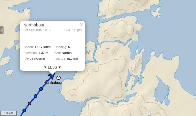
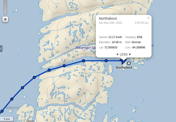
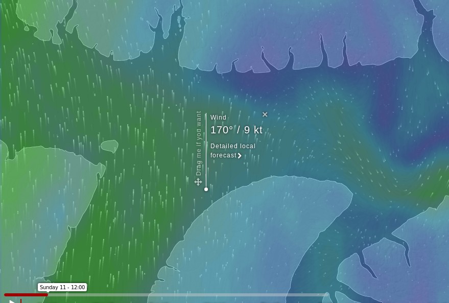
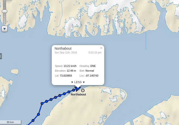
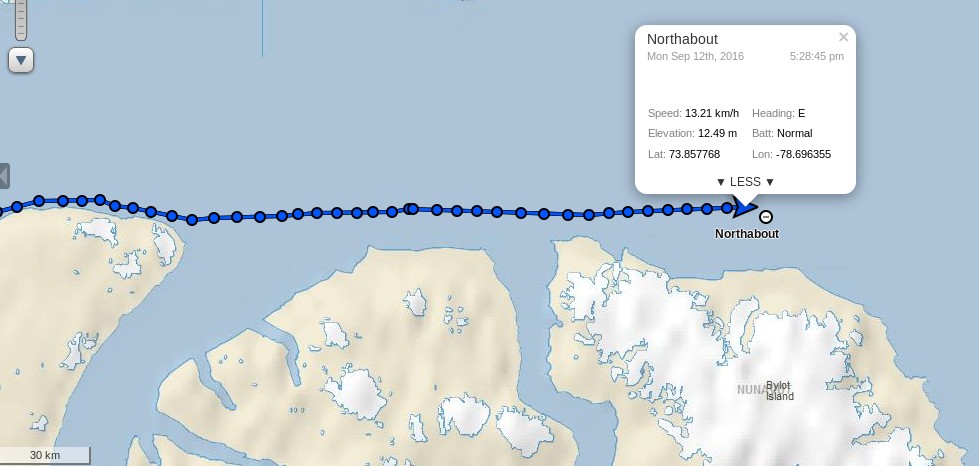
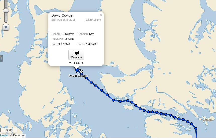
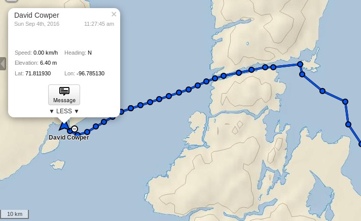
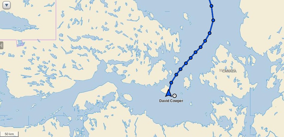
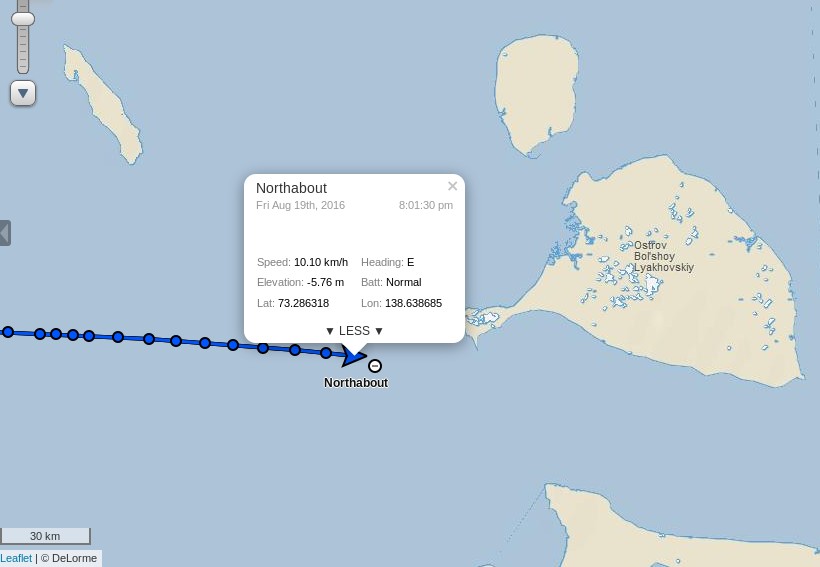
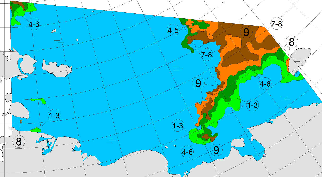
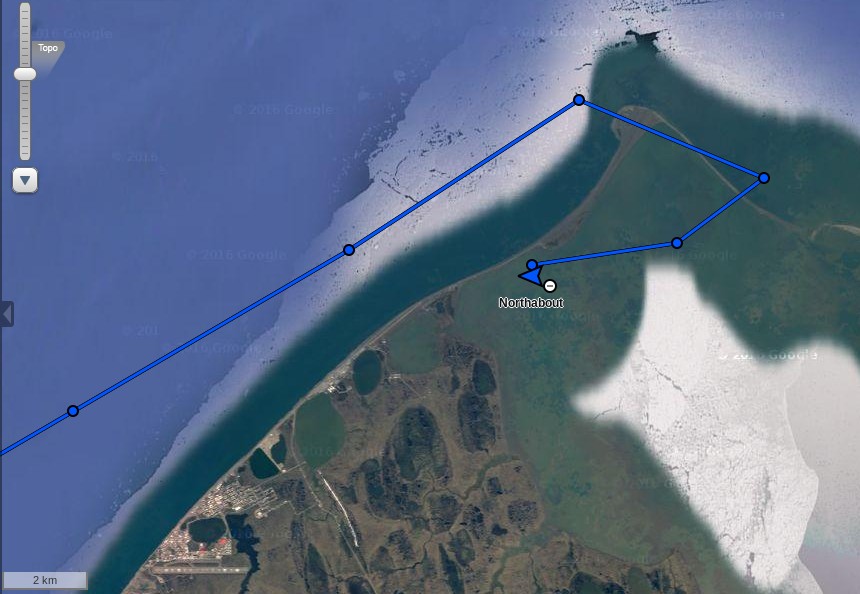
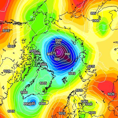
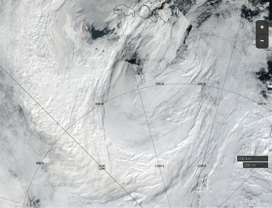
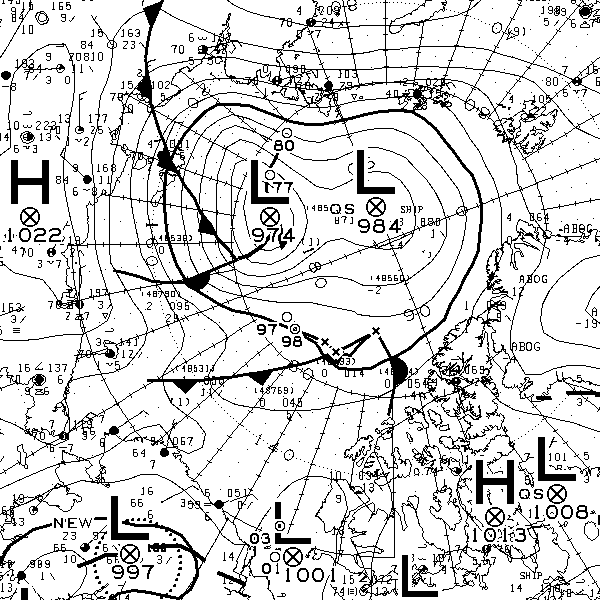
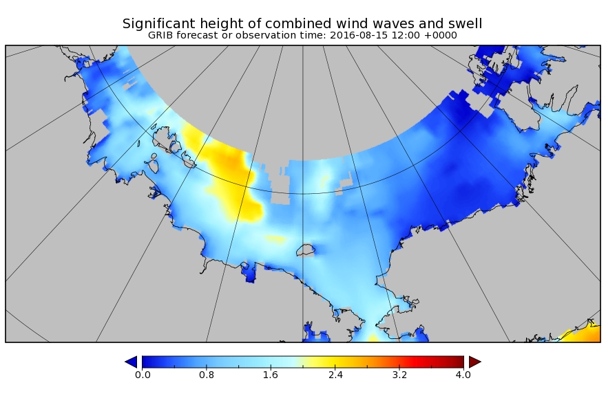
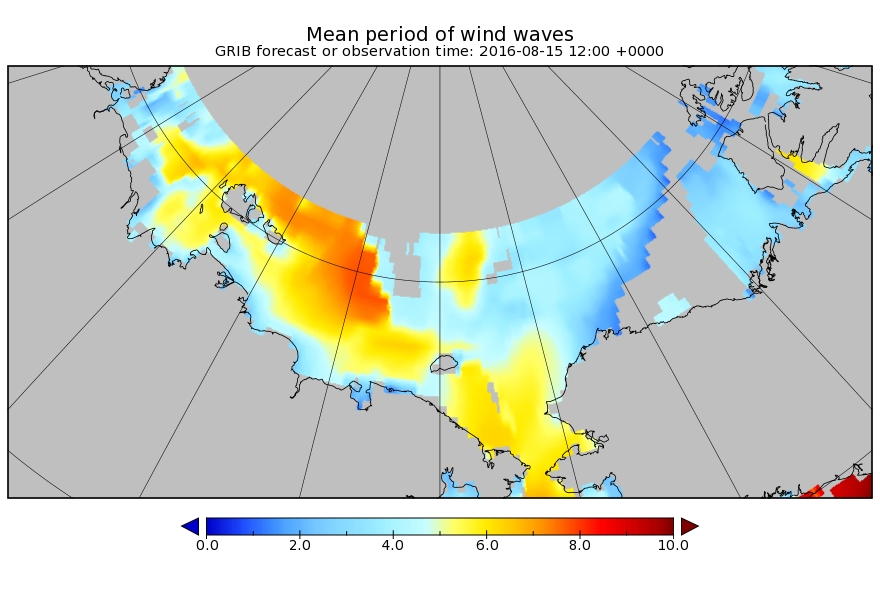
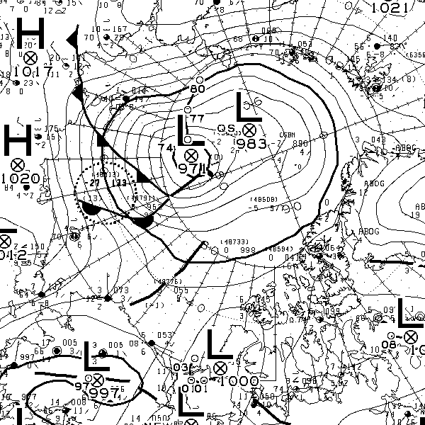
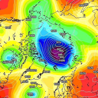
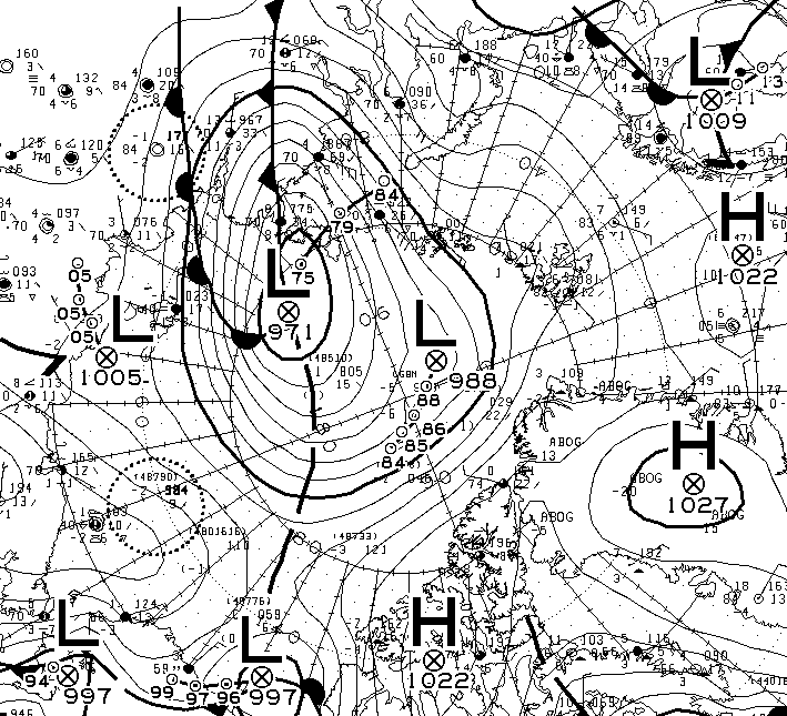
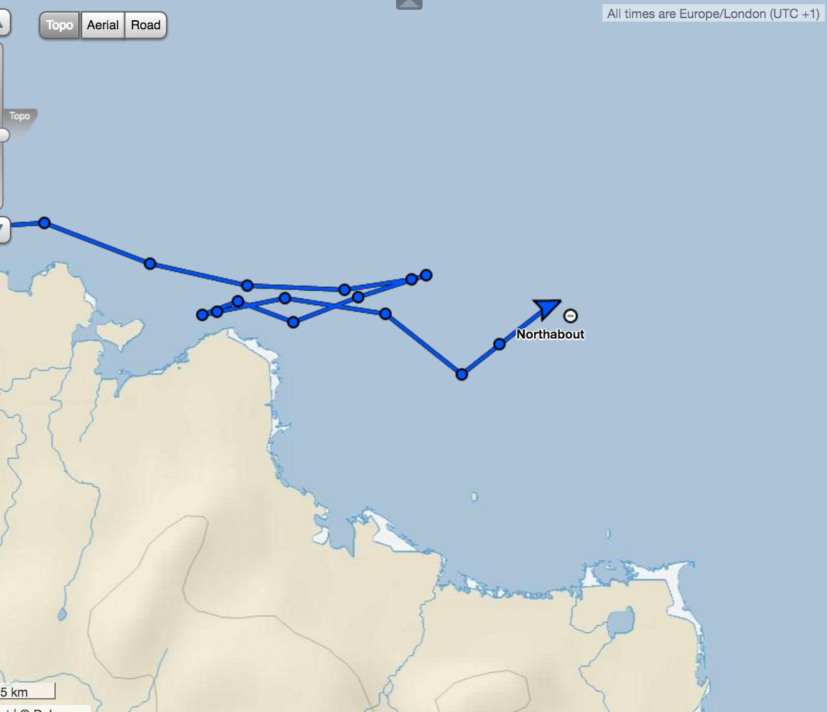
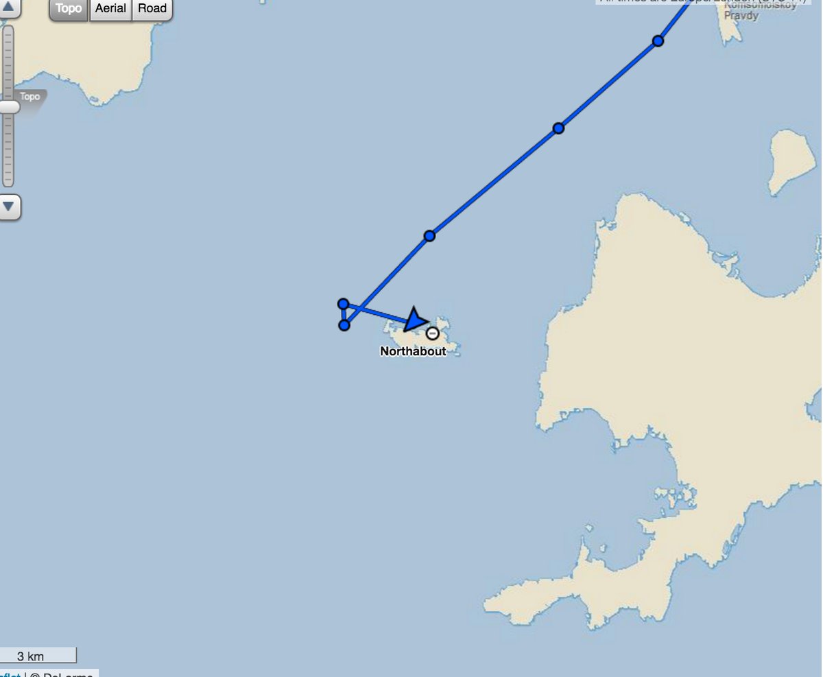
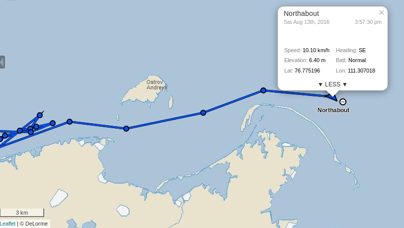
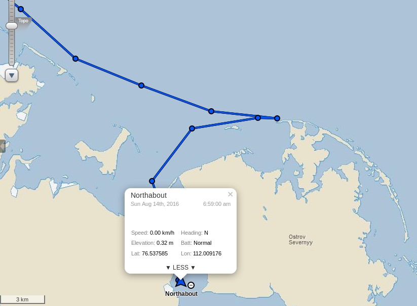
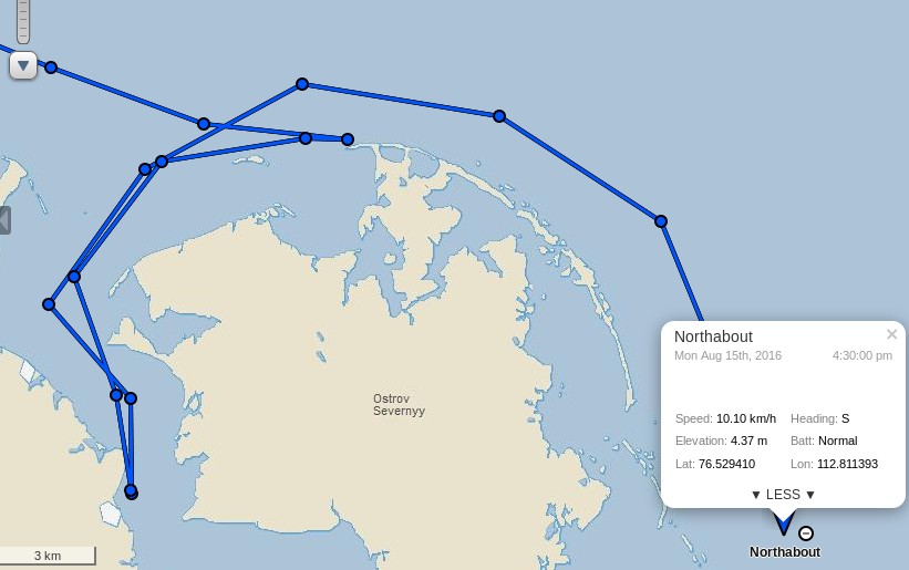
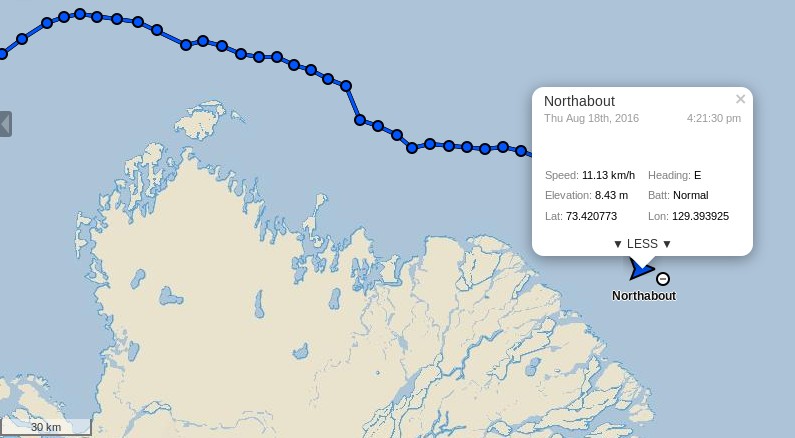
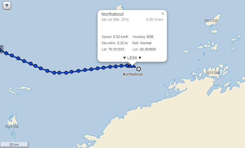
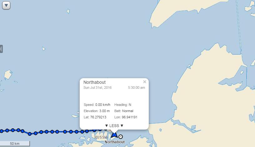
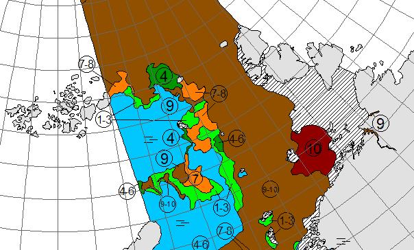
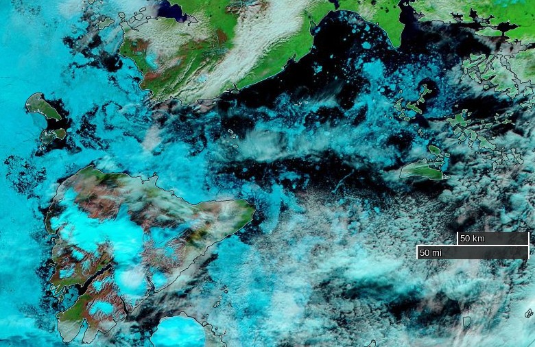
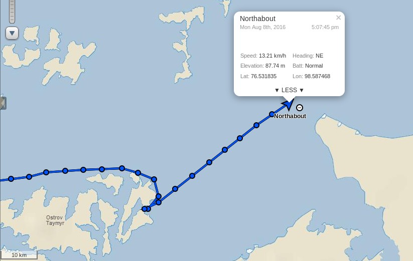
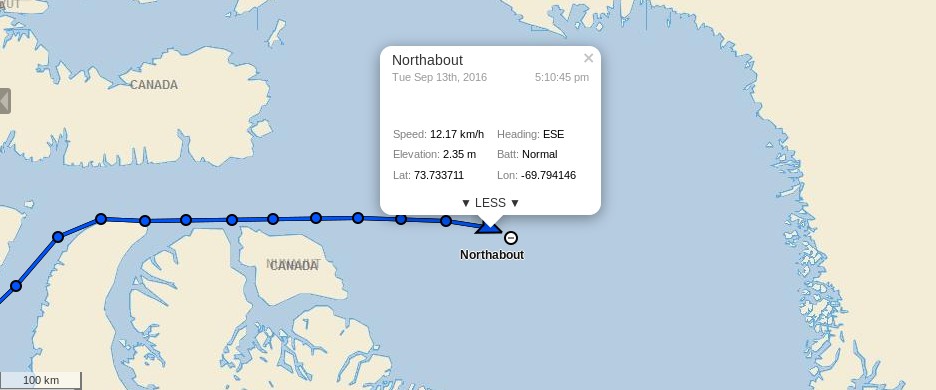
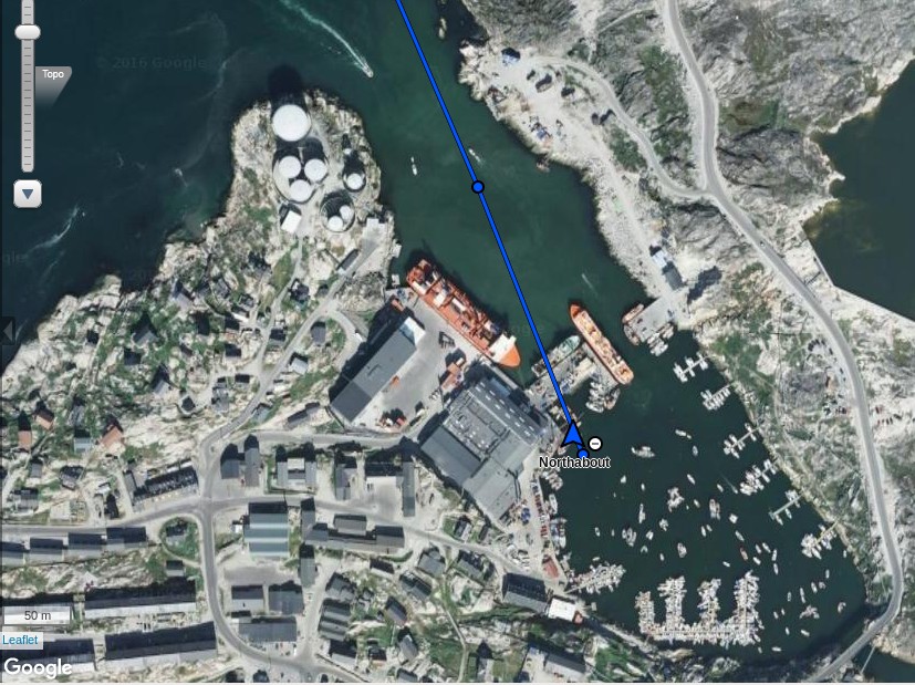
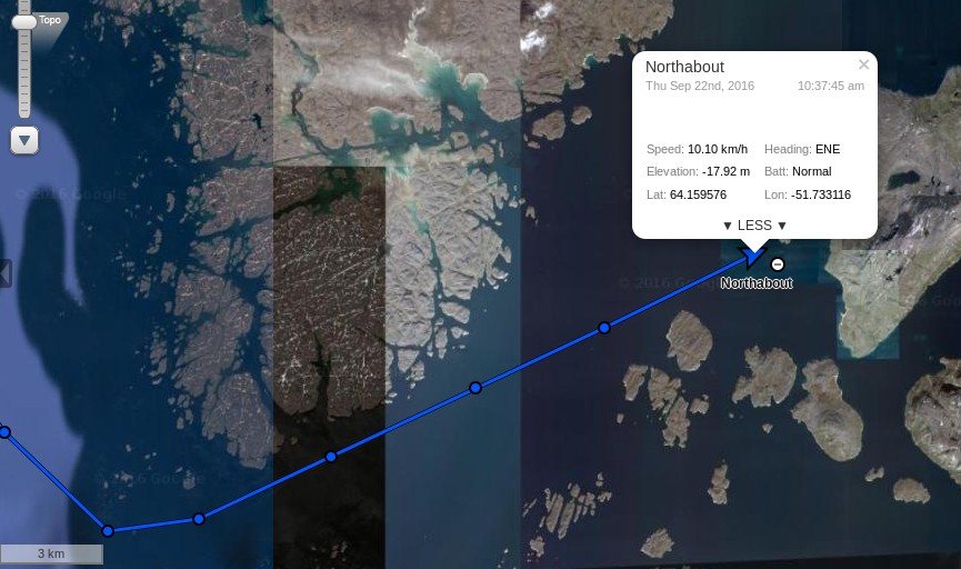
Pressing on the crew of Northabout are now approaching halfway across Baffin Bay:

northabout-20160913-1730

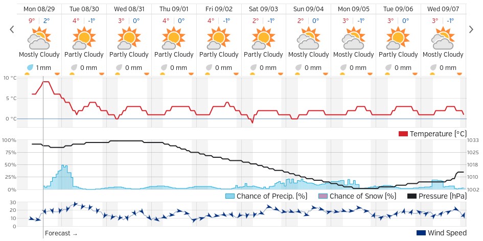
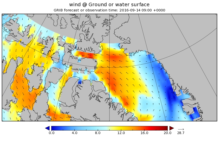
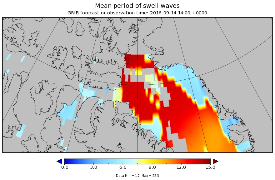
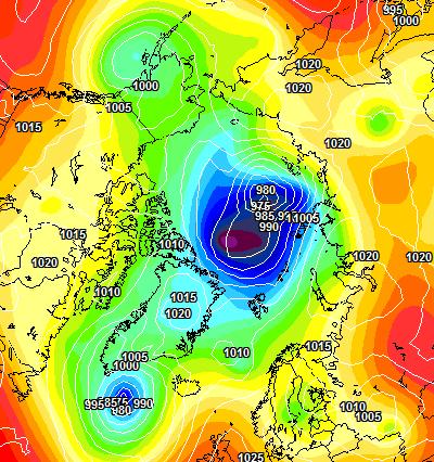
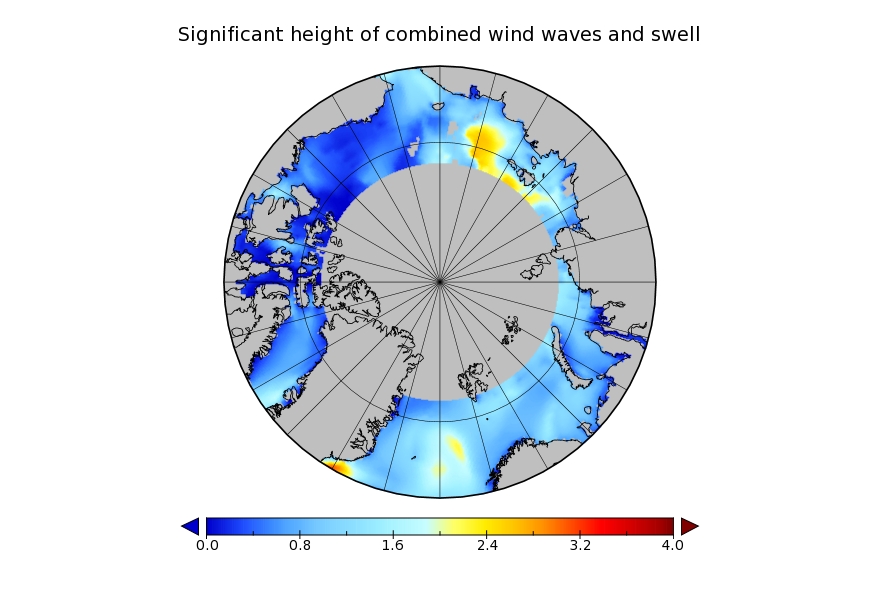
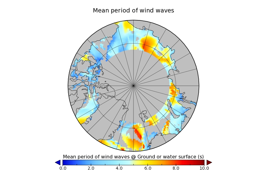
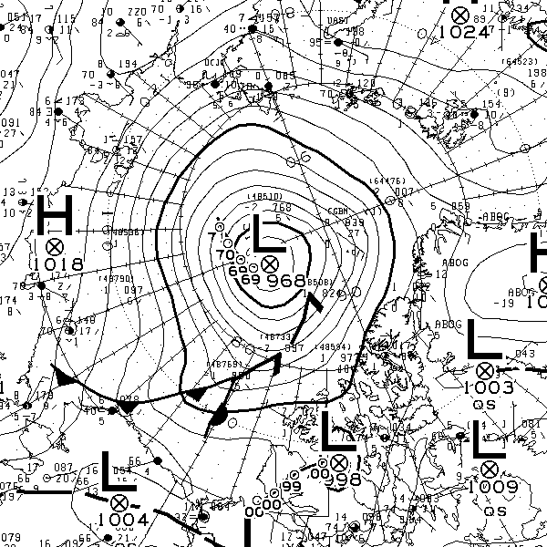
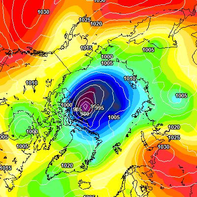
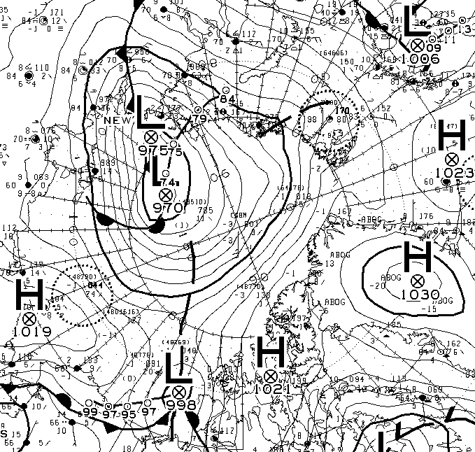
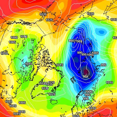
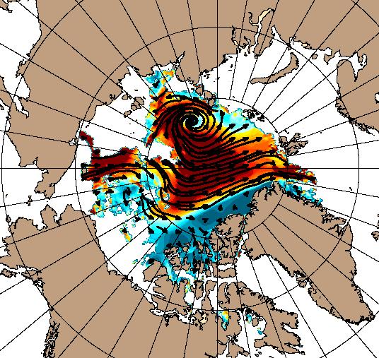
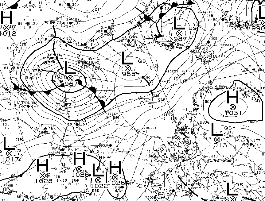
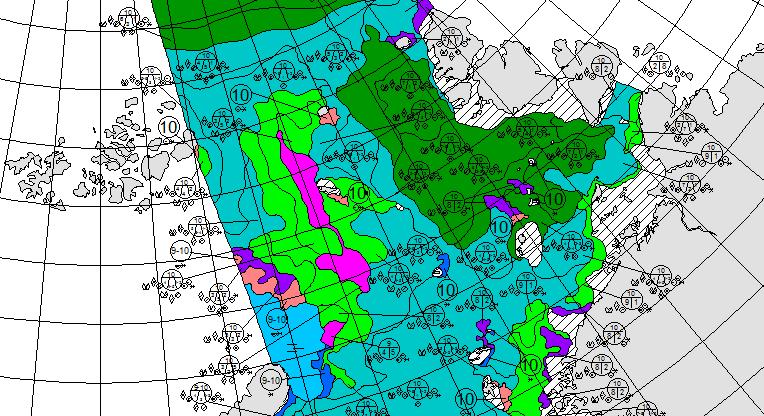
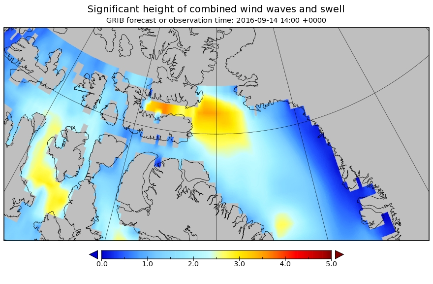
Her crew are trying to reach Upernavik in Greenland before the impending storm gets too bad. Here’s our own WaveWatch III based forecast for tomorrow afternoon:

significant_height_of_combined_w-in-multi_2-glo_30m-20160912_00063

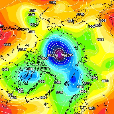
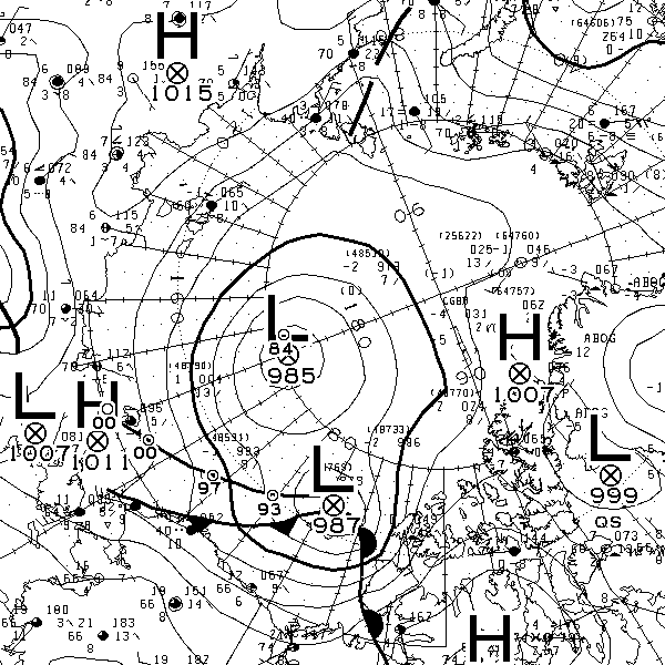
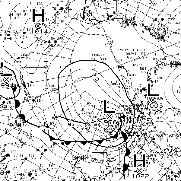
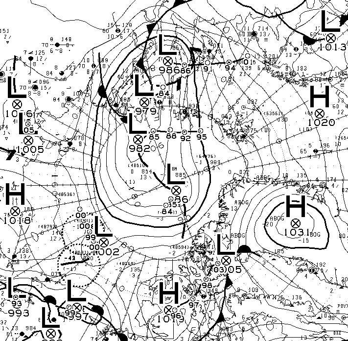
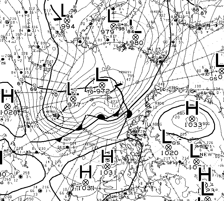
and here’s the official Environment Canada forecast for East Baffin:

Issued 05:30 AM EDT 13 September 2016

Winds

Today Tonight and Wednesday Wind light increasing to south 15 knots early this evening and to south 20 late this evening. Wind backing to southeast 25 overnight then diminishing to light Wednesday afternoon.

Waves

Today Tonight and Wednesday Seas 1 metre building to 2 after midnight.

Thursday

Wind light increasing to northwest 15 knots in the afternoon then veering to north 20 late in the day.

Friday

Wind north 30 knots diminishing to north 20.

I seem to recall that 30 knot winds are best avoided! After Upernavik Northabout will head for Nuuk further south in Greenland and then across the North Atlantic back to Bristol, where she started her voyage back in June. It is certainly not beyond the bounds of possibility that there will be winds of 30 knots and more to contend with on that final leg of the Polar Ocean Challenge!


[Edit – September 14th]

Northabout has obviously not managed to escape the storm entirely. Ben Edwards reports today:

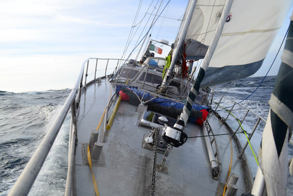
I hate this part of a journey. Yesterday as I came off watch we were scheduled to arrive about midnight tonight. I hate that anyway because you get the so close yet so far feeling. But typically as I came off watch the wind picked up, moved to an unhelpful angle and created the worst sea state we’ve had since the Chuckchi Sea. We’re still supposed to arrive about two in the morning but it will make the next twenty two hours really horrible. Not that our arrival time mattes too much, we can’t go in till it’s light anyway.

The Danish Meteorological Institute marine forecast for Qimusseriarsuaq (Melville Bay) states:

Gale from south and southeast, 13 to 18 m/s. From the western part decreasing and becoming south and southwest, 5 to 10 m/s, in northern part locally 13 m/s. Thursday gradually in eastern part south and southeast, 8 to 13 m/s, but in western part cyclonic variable, up to 10 m/s. Especially in northern part locally rain, sleet or snow with moderate to poor visibility, otherwise good visibility.

Significant wave height: 3,5 m. Swells: 3 m.

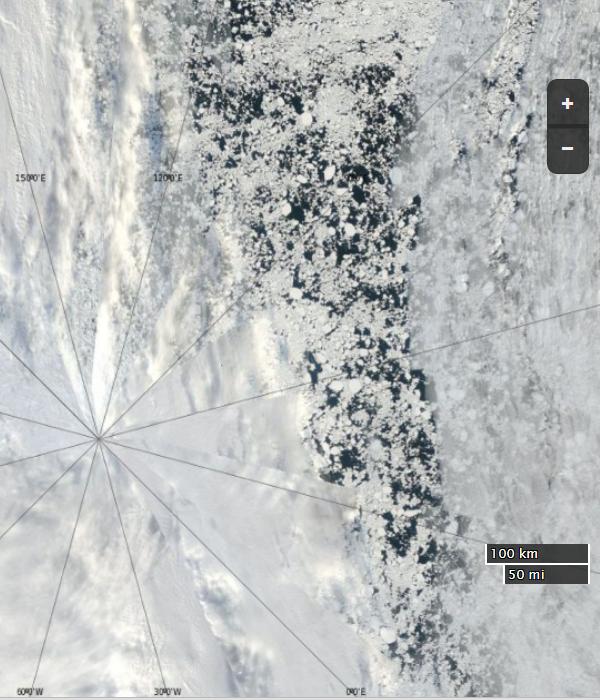
Many icebergs and growlers in the eastern part along the coast, otherwise few icebergs and growlers.

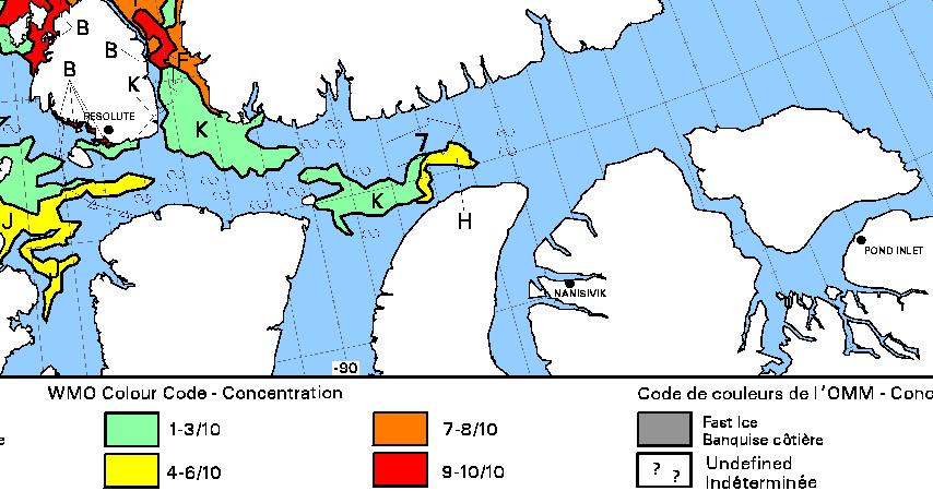
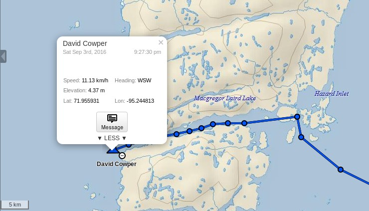
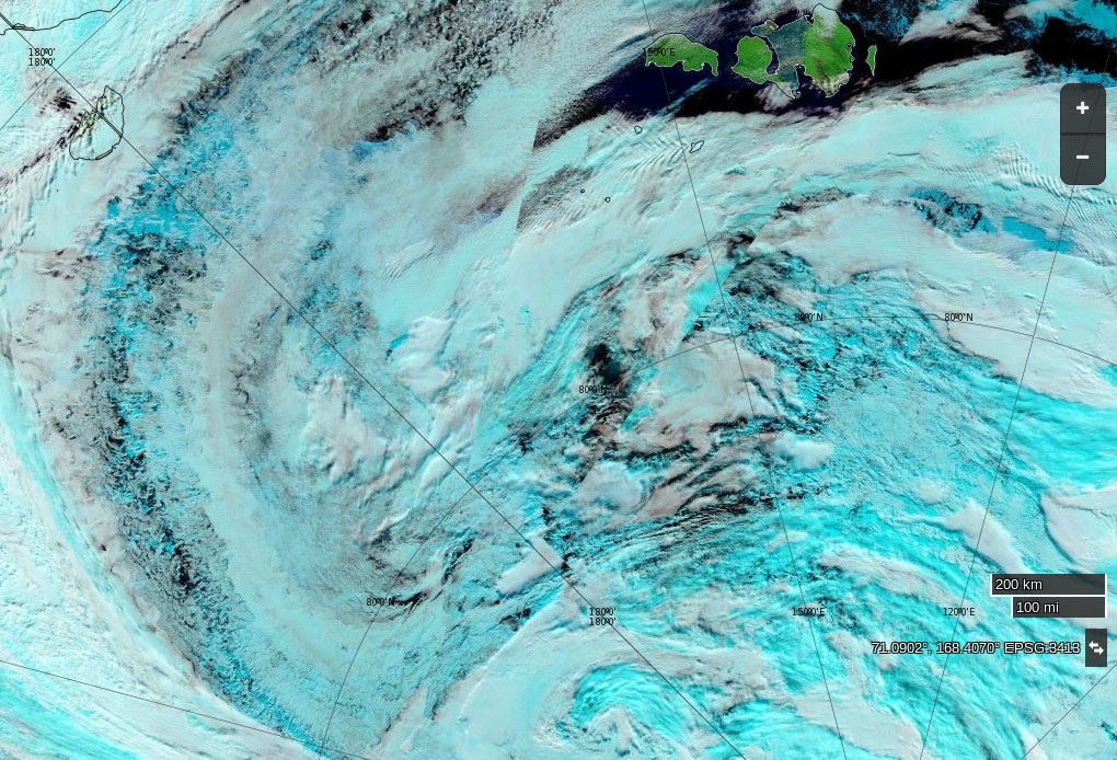
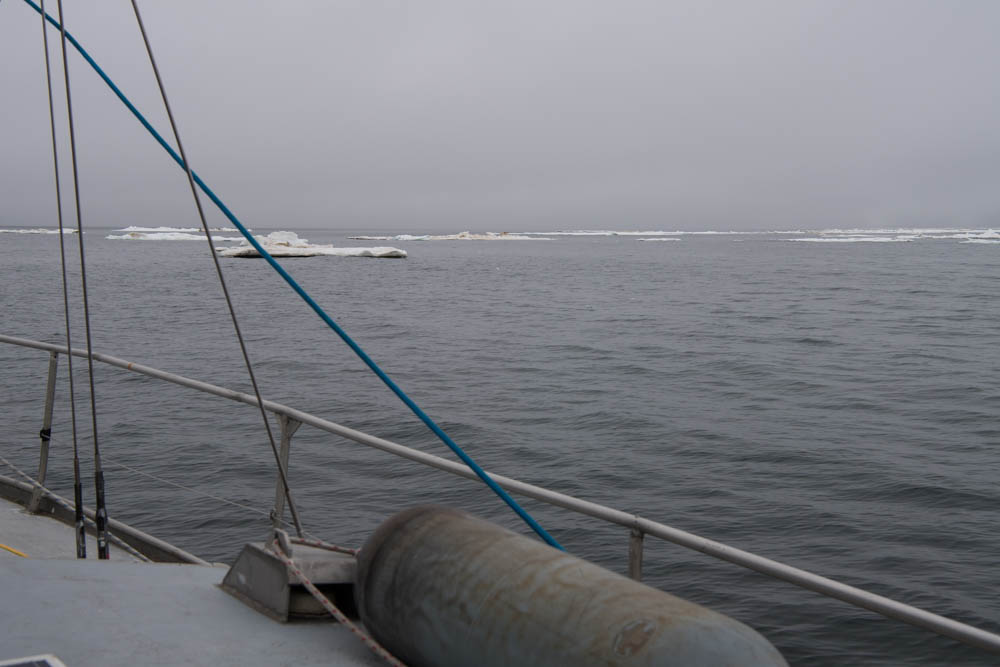
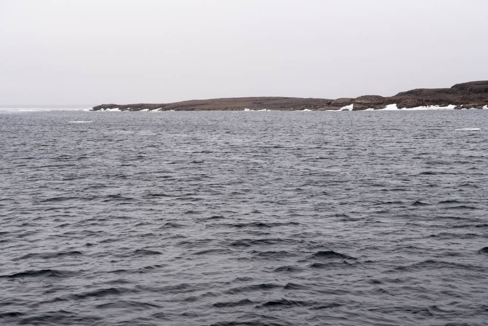
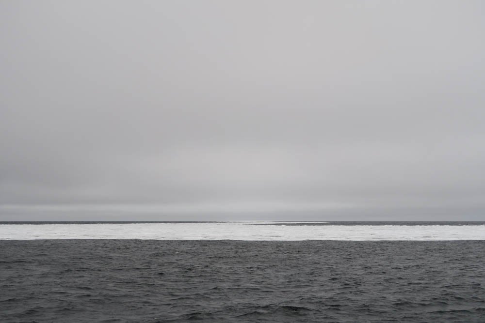
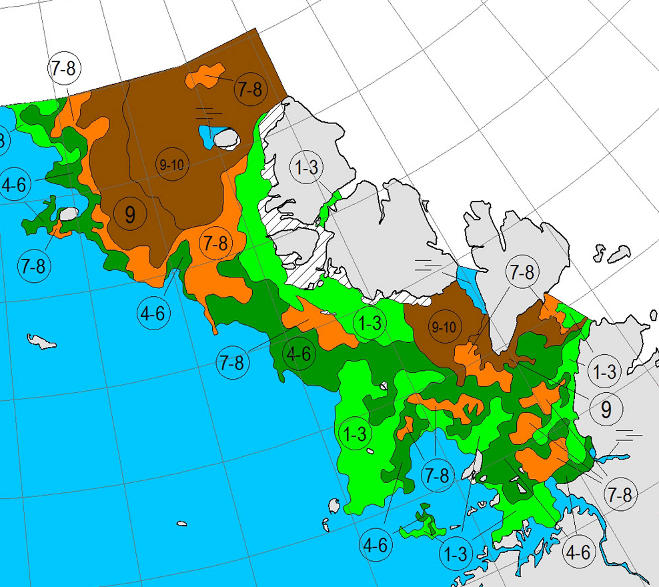
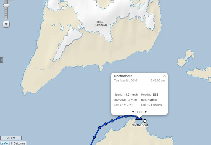
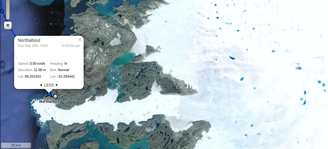
Upernavik is slightly south of there, but nonetheless Ben will have a few more uncomfortable hours, and Northabout may yet meet some more ice before her crew set foot on dry land once again:

polar-ocean-challenge-2016-09-14-18-16-01-1024x678


[Edit – September 15th]

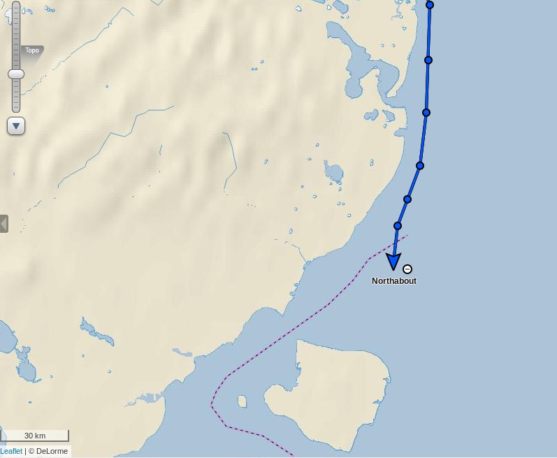
Northabout has just arrived in Upernavik:

northabout-20160914-1320


[Edit – September 16th]

It looks as though Northabout has just left Upernavik, and is now en route to Nuuk:

northabout-20160916-1845


[Edit – September 18th]

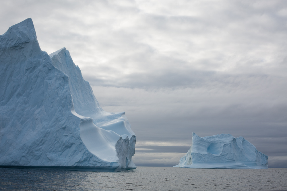
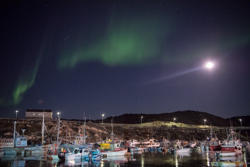
Northabout is now moored at Ilulissat:

northabout-ilulissat-babies

northabout-20160918-ilulissat

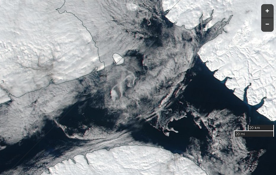
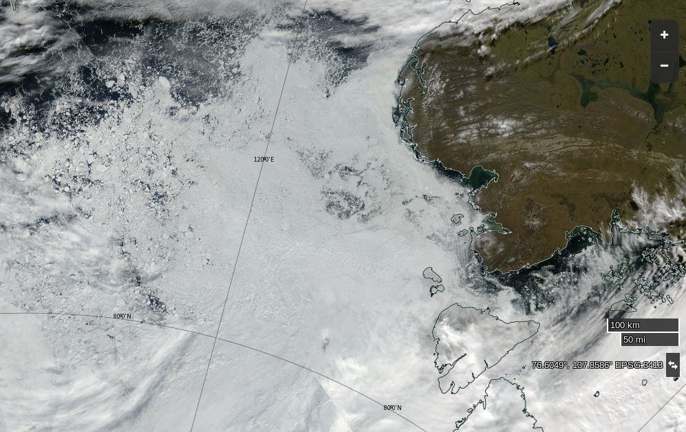
That’s very near the mouth of Ilulissat Icefjord which leads to the famous Jakobshavn Glacier:

northabout-20160918-1400

Perhaps that’s where these icebergs came from?

ilulissatbergs
 

According to the latest Polar Ocean Challenge log:

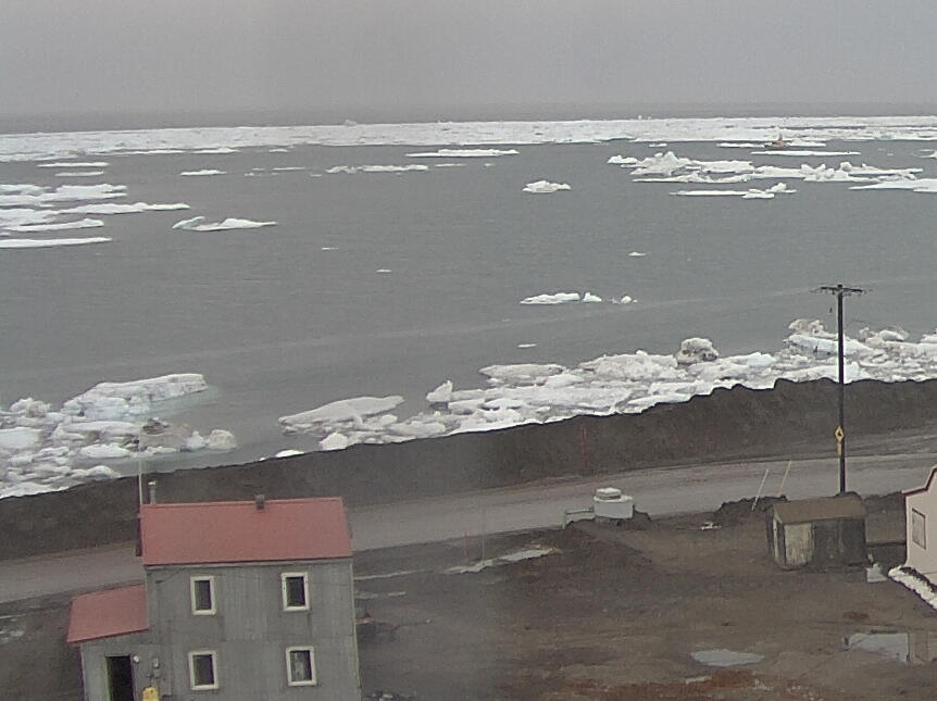
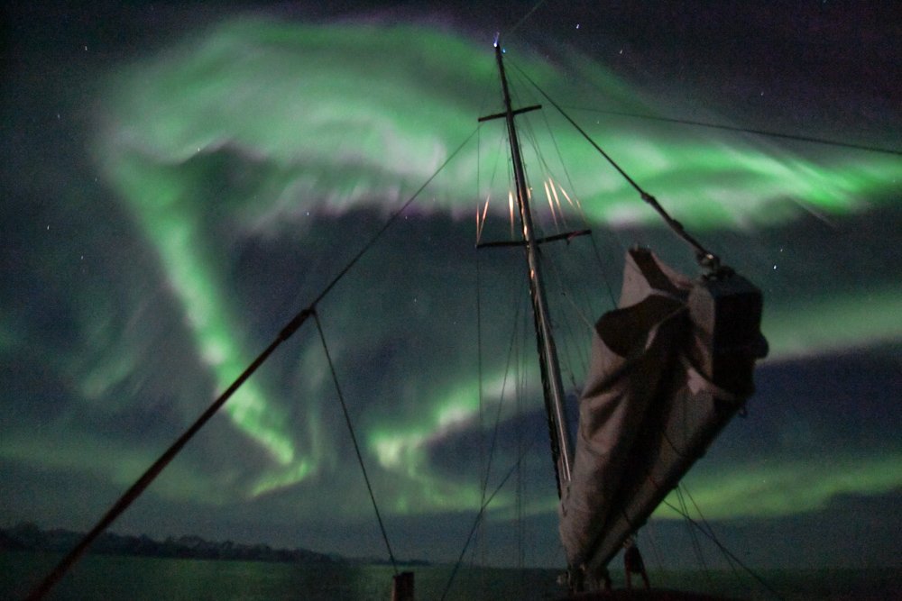
As we expected, it was a long night last night as the big swell and Northernly winds continued to sweep us along from Upernavik, big surf waves behind us breaking under us, Northabout became a little Hawwai five o. We made our way along the coastline through amazing beautiful icebergs created by glaciers at Ilulissat.

The icebergs were between the size of telly to the size of a house to the size of a grand hotel. They were breaking up, and once or twice right in front of us creating lots a small bergs and ice chunks that don’t float so high above the water and so are difficult to spot especially with a large 10 foot swell, they disappear and reappear in the water around us.


[Edit – September 19th]

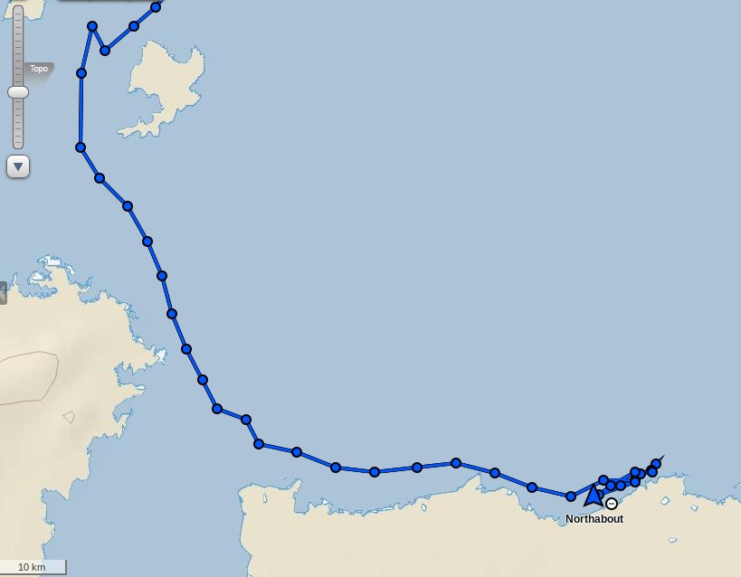
Northabout has just left Ilulissat, en route for Nuuk:

northabout-20160919-1830


[Edit – September 22nd]

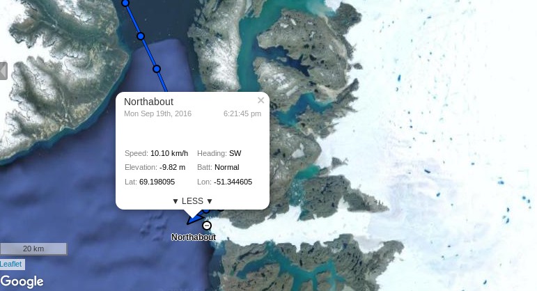
Northabout has crossed the Arctic Circle and has just reached Nuuk, the capital of Greenland:

northabout-20160922-1100

En route from Ilulissat her crew have seen some amazing sights:

ilulissataurora

northaboutaurora


Previous Polar Ocean Challenge articles:

Non Fiction:

Northabout Braves the Northwest Passage

Northabout Races for the Date Line

Northabout Meets Some Serious Sea Ice

Northabout Bides Her Time

Northabout’s Great Adventure

Satire:

Could Northabout Sail to the North Pole?

Fiction:

Is the Polar Ocean Challenge About to End in Disaster?

Dumb and Dumberer at the Blog of Fools

Our esteemed guest author “Bill the Frog” recently posed a question:

Looking at the latest Eastern Arctic ice charts from the Canadian Ice Service, I don’t think the crew [of Northabout] will exactly be shitting themselves.

I’m more interested in what a certain Tony Heller will be coming out with next.

It seems as though a certain Tony Heller and his many merry minions are already shitting themselves at the prospect of the plucky little yacht Northabout NOT getting “trapped in ice”. Hence we can provide this preliminary report on the astonishing ignorance of Tony and his faithful flock concerning all things Arctic. For the present we will confine ourselves to Mr. Heller’s latest missive on the Polar Ocean Challenge expedition, wittily entitled but strangely capitalised:

“we are in a race against time before the freeze”

screen-shot-2016-09-09-at-7-20-50-pm

I blogged the same thing yesterday, and the usual hysterical alarmists showed up complaining.

As luck would have it I blogged the same thing recently, and in actual fact it’s the usual hysterical denialists who have showed up both here and there to pen over a hundred comments and counting. Let’s take a look at a select few of them shall we?

For a reason known only to herself our old friend (and “New Einstein” award winner!) Gail Combs posted the weather forecast for Resolute yesterday, but without any link to her source(s):

Resolute, Nunavut
Presently: 28 °F , wind gusts to 14 mph, cloudy

TONIGHT: Saturday Night 09/10 80% / 1-3 in of snow

Snow showers early will become steadier snow overnight. Low 28 °F. Winds S at 15 to 25 mph. Chance of snow 80%. Snow accumulating 1 to 3 inches.

Then today Lawrence13 posts what purports to be the weather forecast for Isachsen whilst simultaneously suggesting that Isachsen is just around the corner from Resolute, which of course it is not:

unreal-isachsen-2

No link to his source this time either.

Meanwhile AndyG55 claims that:

Thing to note though, is that the northern part of the Northwest Passage was blocked by multi-year ice – foremost the western exit – FOR THE ENTIRE SUMMER, and was even not passable by ice breakers.

Needless to say Andy didn’t trouble to provide a link to his source. I therefore took the liberty of revealing to him the latest and greatest Great White Con Northwest Passage video:

Andy’s considered response?

Yep Jimbo, one HECK OF A LOT OF SEA ICE

Wadhams was so, so wrong.

And YOU know it.

He appears to be convinced that Isachsen is somewhere on the “main” route through the Northwest Passage. I took the trouble to inform him that:

According to the Environment Canada Climate Severity Index, Isachsen and the surrounding area has the worst weather in Canada with a CSI severity value of 99 out of a possible 100.

For some strange reason the Polar Ocean Challenge team are not planning on sailing past Isachsen any time soon!

His reply?

Nothing strange about it at all, Jimbo.

The Satellite Sea Ice charts told them they had NO CHANCE through the main North West Passage, so they snuck around through Cambridge Bay.

Andy then doubled down by throwing down all his gauntlets and issuing this challenge to Snow White’s manhood:

FFs, Jimbo, you have GOT to be joking !!!

Come on, coward, take my challenge.

Next year, WITHOUT sea ice charts, FOSSIL FUELS, or satellite navigation..

… I DARE you. !!

Her timid response?

Andy – It sounds as though you’re volunteering to enter the Great White Con Arctic Basin Big Wave Surfing Competition?

https://greatWhiteCon.info/2015/02/shock-historical-news-towing-in-at-the-north-pole-in-1958/

Do you fancy your chances surfing calving glaciers against GMac?

It’s hard to be sure, but I don’t think he does:

So, refusing to take up the challenge.

Coward.

There’s no answer to that! Or is there?

Please feel free to let me know when you want to be fitted for your polar bear suit Andy.

SurfBear

As you may be able to imagine, there’s plenty more dumbness to be discovered where that lot came from. As the day wears on and as time allows expect more amusing anecdotes from the depths of the cryodenialosphere.


[Edit – September 13th]

Not content with the dumbness quotient displayed by his faithful follows at the Blog of Fools, “Steven Goddard” has taken to Twitter to harangue poor defenceless Snow White. Here is a brief extract from his Gish gallop around the North Pole:


[Edit – September 14th]

Not content with haranguing Snow White about the Arctic “Steve”/Tony and merry Mendy fulminate about flash flooding in Cornwall & Manchester. Allegedly it’s all the media’s fault.


[Edit – September 19th]

Tony Heller has blocked poor defenceless Snow White on Twitter, so she cannot include his Tweets in her Storifys. Please feel free to try and work out where this one fits in the grand scheme of things:

It seems self evident that Americans have no sense of humour. They can’t even spell the word correctly. What’s more they also seem not to have the slightest clue about flash floods on this side of the Atlantic, preferring instead to rant about (the lack of) sea level rise on the shores of the “Land of the Free”:


Believe it or not, there’s plenty more where that lot came from.

We’ll keep you posted!

Could Northabout Sail to the North Pole?

No is the obvious answer just at the moment, since the plucky little yacht is currently parked at a pontoon in Tuktoyaktuk. However actual facts aren’t sufficient to stop Tony Heller suggesting that Andrew Freedman suggested on Mashable that Mark Serreze of the NSIDC said that such a feat is feasible:

Mark “Arctic Is Screaming” Serreze says the Ship of Fools could sail to the North Pole.

Tony (AKA (m)Alice) attempts to justify his scurrilous allegation by referencing Andrew’s recent article entitled “After unusual Arctic storms, sea ice coverage in region is plummeting“. According to Andrew:

In an interview with Mashable, Serreze said sea ice coverage across the different regions of the Arctic has fallen dramatically in association with a series of unusually powerful summertime Arctic storms during August.

That much is certainly true, as we here at Great White Con have documented in detail. Mr. Heller however highlights this section of Mr. Freedman’s article:

In fact, if they want to, the Hempleman-Adams and the rest of the ship’s crew could actually sail nearly all the way to the North Pole, since sea ice cover is largely absent to about 86 degrees north, according to Mark Serreze, director of the National Snow and Ice Data Center (NSIDC) in Boulder, Colorado.

It’s not out of the question that the North Pole will become a geographical marker in open water, rather than ice cover, sometime in the next few weeks.

Serreze called this situation “pretty darned unusual.”

Let’s examine the facts about this “pretty darned unusual” situation shall we? Here is the latest high resolution AMSR2 visualisation of Arctic sea ice concentration:

Arc_20160902_res3.125

Can you see the stretch of open water leading all the way from the East Siberian Sea, where Northabout was a couple of weeks ago, to 86 degrees north? Apparently Tony Heller and his faithful followers cannot! Not only that, but also supposedly:

A NASA image [shows that] the North Pole is indeed encased in Thick ice right now.

Here’s a (somewhat foggy) NASA image of the North Pole right now:

NASA Worldview “false-color” image of the North Pole on September 3rd 2016, derived from the MODIS sensor on the Terra satellite

and for good measure here’s a (somewhat foggy) NASA image from 86 degrees north in the Central Arctic Basin right now:

NASA Worldview “false-color” image of the Central Arctic on September 3rd 2016, derived from the VIIRS sensor on the Suomi satellite

Need I say more?


[Edit – September 4th]

Today Terra offers a glimpse of the Greenland side of the North Pole:

NASA Worldview “false-color” image of the North Pole on September 4th 2016, derived from the MODIS sensor on the Terra satellite


[Edit – September 5th]

Today Aqua offers us a view of what’s left of the sea ice on the Siberian side of the North Pole:

NASA Worldview “true-color” image of the North Pole on September 5th 2016, derived from the MODIS sensor on the Aqua satellite


[Edit – September 9th]

SHOCK NEWS!!!

Tony Heller has just posted an accurate image of the state of the sea ice near the North Pole! Here it is:

unreal-pole-20160908

The accompanying text is nonsense of course:

The Ship Of Fools is facing a -10C weather forecast in five days, which would be impassable. They better put their fossil fuel powered pedal to the metal and get out of there fast, so that they can go back to Bristol and lie about the ice.

Meanwhile, professional fraudster Mark Serreze said last week they could sail to the North Pole

Needless to say Tony doesn’t provide a link to his source. Try this one and then have a good look around on NASA Worldview.


[Edit – September 10th]

Lord Soth on the Arctic Sea Ice Blog mentions this image of the 2016 version of Santa’s secret summer swimming pool:

Northabout Braves the Northwest Passage

After the briefest of stops in Elson Lagoon behind Point Barrow Northabout is on the move once again:

Northabout-20160829-2000

She’s currently heading out into the Beaufort Sea before following in the giant footsteps of the cruise liner Crystal Serenity in the direction of the Amundsen Gulf and the Canadian Arctic Archipelago. Here’s the United States National Weather Service’s current ice chart for Alaskan waters:

NWS-Alaska-20160828

There looks to be far less to worry about ice wise on the next leg of the Polar Ocean Challenge than on the previous one! The weather forecast isn’t too bad either, with high pressure over the Beaufort Sea and a fair bit of sunshine. Here’s the Weather Underground forecast for Ulukhaktok, Crystal Serenity’s first port of call in the CAA:

Wunderground-Ulukhaktok-20160829

There is currently a “small craft advisory” warning in effect for the Beaufort Sea coast:

CAPE HALKETT TO FLAXMAN ISLAND-
207 PM AKDT MON AUG 29 2016

…SMALL CRAFT ADVISORY IN EFFECT FROM TUESDAY MORNING THROUGH
TUESDAY AFTERNOON…

TONIGHT
E WINDS 20 KT. SEAS BUILDING TO 4 FT.

TUE
E WINDS 25 KT. SEAS 5 FT.

TUE NIGHT
E WINDS 20 KT. SEAS 6 FT.

WED
E WINDS 20 KT. SEAS 6 FT.

WED NIGHT
E WINDS 20 KT. SEAS 5 FT.

THU
NE WINDS 20 KT. SEAS 4 FT.

THU NIGHT
NE WINDS 15 KT. SEAS 4 FT.

FRI
N WINDS 10 KT. SEAS 2 FT.

SAT
N WINDS 15 KT. SEAS 3 FT.

All in all it looks like fairly plain sailing for the foreseeable future, with only occasional moderate headwinds to contend with.


[Edit – August 30th]

It seems my “fairly plain sailing” conclusion was overly hasty. According to the latest “Ship’s Log“:

The weather forecast is pants. A 30/35 knot headwind along the coast . No one has the appetite for it, so we are heading North, slacker winds, staysail out, still a choppy sea and uncomfortable, but not as bad as 30 knots. Hopefully no ice tonight on my watch.

This is the end result:

Northabout-20160830-2200

As Phil points out below:

Our next stop along the North West Passage is Tuktoyaktuk. That’s when we can use a pontoon, get rid of our rubbish, fill the tanks, do the laundry and have a shower. 500nm away.


[Edit – August 31st]

The Polar Ocean Challenge team report via Twitter:


[Edit – September 3rd]

Last night Northabout reached Tuktoyaktuk near the delta of the great Mackenzie River:

Northabout-20160903-1000

The Polar Ocean Challenge team have had some repairs to do after the stormy start to their trip from Barrow:

They have some more to carry out in Tuk too. Despite the great “groove” displayed above Ben Edwards reports that:

Joy of joys, the auto-helm’s stopped working. Dad (Steve Edwards, crew), thinks he knows why so we’ll hopefully be able to fix it in Tuk. In the meantime we’re back to helming by hand. This is a mixed blessing, on the one hand it’s really irritating to have to helm in large swells and with a strong headwind because any movement you make is at first ignored, and then exaggerated by, the wind. So it’s hard to keep a decent track and it makes it harder to look out for ice. On the other hand, moving and putting effort into the steering keeps you warm which is nice and it means you don’t have to put as many clothes on which is also nice because when you go down stairs and it’s twenty four degrees it can get quite uncomfortable.


[Edit – September 4th]

Northabout has just left Tuktoyaktuk:

Northabout-20160904-1445

Her crew have been refreshed and her auto-helm has been repaired with the assistance of numerous people from Tuk:

We all had our job lists, ice lights, bilge pumps, laundry, shopping but the man who gets the Vodka Salute is unquestionably Steve.

I dropped him off wth Willard. Two peas in a pod. They made a broken Pilot Spigot. That sounds quite easy but it took the whole day in a machine shop in a container, working to fine tolerances, and many modifications. Fitting it in the bowels of the Lazzerette in cold weather and driving rain. It worked first time. Brilliant effort.

Here’s the current weather forecast for the area:

Issued 07:00 AM MDT 04 September 2016
Today Tonight and Monday

Wind – Northwest 15 knots diminishing to light late this morning then becoming northwest 15 Monday morning.
Waves

Seas – 1 metre.

Weather & Visibility – Chance of showers changing to periods of rain near noon then to chance of showers tonight and Monday. Fog patches dissipating early this evening.

My famous last words? Plain sailing by the look of it!


[Edit – September 5th]

Northabout has just rounded Cape Bathurst, the northernmost point of mainland Northwest Territories:

Northabout-20160905-0930

I wonder if her crew will take a close look at the nearby Smoking Hills?


[Edit – September 6th]

Northabout gave the Smoking Hills a miss and headed strait for Cape Parry. She has already crossed the Amundsen Gulf and is heading into the Dolphin & Union Strait:

Northabout-20160906-1200

According to Ben Edwards’ latest blog post:

In light of the lack of ice and in the spirit of saving time we’ve decided not to stop in Cambridge Bay or Pond Inlet and go straight on to Upernavik in Greenland before doing our crew change. Looking at the ice maps at the moment it seems we’ll be able to get through with little or no trouble, though this is almost bound to change, if it stays that way we’ll reach Upernavik in about fourteen days. I’m looking forward to it!


[Edit – September 7th]

Northabout has reached Coronation Gulf this morning (UTC):

Northabout-20160907-0930

According to their recent reports the plan is to pass Pond Inlet without stopping. The weather up there is starting to look rather wintry:

PondInlet-20160907


[Edit – September 9th]

The Polar Ocean Challenge team report via Twitter that they have seen and chatted to David Scott Cowper:

as well as spotting some more ice:


[Edit – September 10th]

This morning Northabout is rapidly approaching the western entrance to Bellot Strait:

northabout-20160910-1300

Their stated intentions are to head past Pond Inlet and across Baffin Bay to Upernavik in Greenland. Assuming they initially follow the same route as Crystal Serenity they will soon to need to pick their way past some bergy bits in Prince Regent Inlet before negotiating some currently “wispy” areas of sea ice as they enter Lancaster Sound. Here is the current Canadian Ice Service chart for the area:

resolute-20160909-1800

plus a rather cloudy “visual” image:

lancaster-suomi-20160909

The current weather forecast for Pond Inlet doesn’t suggest the parts of the Northwest Passage still on Northabout’s route are going to start refreezing just yet:

pondinlet-20160910

Currently there is an obvious passage past the existing ice, but that may of course have changed by the time Northabout gets there.


[Edit – September 10th PM]

Northabout has just emerged safely from the eastern end of Bellot Strait:

northabout-20160910-1900

I wonder if her crew will stop to make a new entry in the visitors book at Fort Ross?


[Edit – September 11th]

Here’s the latest CIS ice chart:

resolute-20160910-1800

The gap between the coast and the yellow area of 4-6/10 concentration ice has closed considerably, and there’s now a broad expanse of 1-3/10 ice which Northabout may be forced to try and wend her way through. A change in wind direction would come in very handy, and that’s just what the ECMWF forecast at Windyty is suggesting for Sunday 11th:

ecmwf-20160911-1200

Just what the doctor ordered?


[Edit – September 11th PM]

Video shot from Northabout’s drone of her ice-free passage through Bellot Strait:

However the passage from Prince Regent Inlet into Lancaster Sound has not proved to be ice-free!


[Edit – September 11th 20:30 UTC]

Northabout is obviously endeavouring to skirt around the eastern edge of the 4-6/10 old ice in her path:

northabout-20160911-2130

Today’s CIS ice concentration chart suggests there isn’t much room to spare:

resolute-20160911-1800

The stage of development chart does reveal some new ice, but it’s well to the north of Northabout’s route through Lancaster Sound to Pond Inlet:

resolute-devel-20160911-1800

Somewhat belatedly, here’s a Sentinel 1A synthetic aperture radar image of the sea ice Northabout is squeezing past as we speak:

s1a_ew_grdm_1sdh_20160911t125111_c6c8


[Edit – September 12th]

Northabout has emerged safely into Lancaster Sound, and is bypassing Pond Inlet in order to head strait across Baffin Bay:

northabout-20160912-1800

Here are a couple of videos of some remnants of sea ice on her once again eastward travels:

There are several more on the Polar Ocean Challenge web site.

With all that ice now safely behind her Northabout has new dangers to face. Wind and waves! Let’s take a look at the WaveWatch III “surf forecast” for Baffin Bay over the next few days. A low pressure area is heading in Northabout’s direction from across the Canadian Arctic Archipelago. By Wednesday morning (UTC) the resultant wind field looks like this:

u-component_of_wind_surface-in-multi_2-glo_30m-20160912_00058

By Wednesday afternoon those winds of around 15 m/s will have produced waves in Baffin Bay that are forecast to have reached over 3 meters high:

significant_height_of_combined_w-in-multi_2-glo_30m-20160912_00063

and what’s more they won’t be just wind waves. A modest swell with a period of over 12 seconds is predicted too:

mean_period_of_swell_waves_order-in-multi_2-glo_30m-20160912_00063

I’m sure the Polar Ocean Challenge team will be doing their level best to be safely on the opposite side of Baffin Bay by the time the worst of the weather arrives!


Previous Polar Ocean Challenge articles:

Non Fiction:

Northabout Races for the Date Line

Northabout Meets Some Serious Sea Ice

Northabout Bides Her Time

Northabout’s Great Adventure

Satire:

Could Northabout Sail to the North Pole?

Fiction:

Is the Polar Ocean Challenge About to End in Disaster?

David Scott Cowper Makes History – Again

David Scott Cowper in Polar Bound is currently approaching the eastern entrance to Bellot Strait in the heart of the Northwest Passage. There’s nothing unusual in that in this day and age, you may think, but take a look at how he got there:

PolarBound-20160828-1300

We speculated about this possibility earlier this year, and Polar Bound has now travelled in a westerly direction through Fury and Hecla Strait rather than taking the usual route via Lancaster Sound. According to the definitive reference on such matters by Bob Headland of the Scott Polar Research Institute she is the first vessel ever to do so using route West 7:

NWP-Routes

According to the Canadian Ice Service charts Polar Bound will only have needed to negotiate a short stretch of 1-3 tenths concentration sea ice to achieve her latest Northwest Passage “first”:

Foxe_20160828180000

Maud_20160828180000

David Scott Cowper is already mentioned several times in the SPRI list of successful Northwest Passage transits:

1986-89
Mabel E. Holland (12·8 m lifeboat), Britain, David Scott Cowper, West 6, Single-handed voyage, vessel wintered at Fort Ross twice, and at Inuvik

2003-04
Polar Bound (14·6 m motorboat), Britain, David Scott Cowper, East 5, Single-handed voyage, wintered in Cambridge Bay, assisted by CCGS Louis S. St Laurent in Prince Regent Inlet

2009
Polar Bound (14·6 m motorboat), Britain, David Scott Cowper, West 5, Single-handed voyage

2011
PolarBound (14·6 m motorboat), Britain, David Scott Cowper, East 3

2012
PolarBound (14·6 m motorboat), Britain, David Scott Cowper, West 1

2013
PolarBound (14·6 m motorboat), Britain, David Scott Cowper, East 5, Traversed Pond Inlet

It looks as though there will be another addition real soon now, but for the moment note in particular the entry for 2012. Route 1 is the northernmost of the potential paths through the Northwest Passage and involves negotiating the usually ice bound McClure Strait. Polar Bound was the first ever small vessel to do so! At the moment it looks like that will be a difficult feat to repeat this year. Whilst many of the assorted channels through the Northwest Passage melted out early this year the recent recurring cyclones have ensured that McClure Strait remains firmly blocked:


[Edit – September 3rd]

Polar Bound has just emerged from the western end of Bellot Strait:

PolarBound-20160903-2130

The $64,000 question is where is she headed next?


[Edit – September 4th]

The short term answer is a sheltered spot between Hobday Island and Prince of Wales Island:

PolarBound-20160904-1330


[Edit – September 7th]

Polar Bound is taking the most obvious exit from the Canadian Arctic Archipelago, and is currently heading for Coronation Gulf via Dease Strait:

PolarBound-20160907-1200

Northabout is currently travelling in the opposite direction. Perhaps they’ll soon meet there?


[Edit – September 8th]

It seems they did!


[Edit – September 17th]

David Scott Cowper is currently approaching Barrow in Polar Bound, but the weather forecast is more than a bit blustery. According to today’s National Weather Service forecast, here’s what he should expect:

POINT FRANKLIN TO CAPE HALKETT-
405 AM AKDT SAT SEP 17 2016

…SMALL CRAFT ADVISORY IN EFFECT FROM LATE THIS MORNING THROUGH
EARLY SUNDAY MORNING…

TODAY
SW WINDS 25 KT. SEAS BUILDING TO 5 FT. SNOW AND RAIN.

TONIGHT
W WINDS 30 KT. SEAS 9 FT. FREEZING SPRAY.

SUN
W WINDS 30 KT. SEAS 10 FT. FREEZING SPRAY.

SUN NIGHT
W WINDS 30 KT. SEAS 11 FT.

Let’s hope Polar Bound finds some shelter before the worst of it arrives on Sunday night.


[Edit – September 21st]

It seems Polar Bound didn’t find shelter, and instead reversed course during the worst of the storm:

polarbound-20160921-1100

However, as you can see, she has now passed Point Barrow and is Heading south towards the Arctic Circle via the Bering Strait:

polarbound-barrowcam_20160921_024500

Can you spot the yellow needle in the icy haystack? There is currently much “debate” in the cryodeinialosphere to the effect that Northabout nearly became “trapped by ice”, so let’s also take a quick look at the National Weather Service ice chart covering Barrow shall we?

nws-alaska-20160921

It seems Polar Bound somehow managed to wend her way through 7-8/10 concentration sea ice, does it not?


[Edit – September 24th]

Polar Bound has now crossed the Arctic Circle and is heading south through the Bering Strait:

polarbound-20160924-1030

David Scott Cowper has therefore now “officially” completed his record breaking route West 7 transit of the Northwest Passage.

Very well done sir, and bon voyage!

Northabout Races for the Date Line

It’s time to open another chapter in the continuing adventures of Northabout. The Polar Ocean Challenge team have been plagued by sea ice along their route across the Laptev Sea, but currently they are hurrying towards the exit into the East Siberian Sea via the Dmitry Laptev Strait:

Northabout-20160819-2000

The latest chart of sea ice in the East Siberian Sea from the Arctic and Antarctic Research Institute suggest they should now have plenty of (comparatively!) plain sailing ahead of them:

AARI-ESS-20160819

Certain quarters of the cryodenialosphere have been questioning the plucky little yacht’s ability to make it through the Northwest Passage before it freezes up once again in the Autumn. As a crude reality check on that assertion let’s see how previous successful single season polar circumnavigations fared in that regard. The international date line runs through the Bering Strait, and effectively defines a boundary between the Northern Sea Route and the Northwest Passage. In 2010 Børge Ousland and Thorleif Thorleifsson in the catamaran Northern Passage crossed the date line on September 3rd:

http://www.ousland.no/reflections-from-the-chukchi-sea/

Then in 2013 the yacht Tara achieved a similar feat on September 10th:

http://oceans.taraexpeditions.org/en/jdb/the-date-line-off-wrangel/

Let’s wait and see when Northabout manages to pass that milestone, before heading to their next scheduled port of call at Barrow in Alaska.


[Edit – August 21st]

Northabout has spotted some more sea ice, this time in the Dmitry Laptev Strait. Presumably the small area shown in the AARI chart above? According to the latest “Ship’s Log”:

Well slowly making progress, and now into a new sea, East Siberian, Looks the same to be honest. Saw a ship,on the AIS , but couldn’t see it with the fog. Went between the Islands. We had a large patch of 8/10ths ice in the middle, but managed to keep north of it. Along the coast you could again see the remnants of an old Polar station. What a vast coast to look after.

Just as things were getting into a rhythm, the engine is over revving. We are so close but so far out here. My stomach is sometimes in my mouth, Comrades trying to work it out. If not, is a slow sail from here to Alaska.

The reported engine trouble doesn’t seem to have slowed Northabout down. She crossed 150 east earlier this morning and is now passing the delta of the Indigigirka River:

Northabout-20160821-1400


[Edit – August 22nd]

Her engine has been serviced, and Northabout continues to make good progress. She’s crossed 160 east, and is now passing the delta of the Kolyma River:

Northabout-20160822-2330

According to Ben Edwards’ latest blog post:

We’ve got enough wind to put the staysail out and the skies are clear. I think quite a lot of how I was feeling may have been that I hadn’t got any sunshine for over two weeks, the last couple of days however have been warm(ish) and bright. I at least am coming dangerously close to feeling actually happy, I don’t know about anyone else… Provided we continue like this we should be in Point Barrow in under a week.


[Edit – August 23rd]

Northabout looks to be turning south:

Northabout-201608223-1300

Presumably that is to skirt the patch of high concentration sea ice in their path, rather than try to break through the lower concentration area to the north (which is towards the bottom of this image!):

ESS-Terra-721-2016-08-23


[Edit – August 25th]

Northabout is currently closing in on “the edge of the world” at 180 degrees east and/or west:

Northabout-201608225-1330

Her crew aren’t entirely happy with the speed at which that is happening at present though:

A long slog of a day. Very choppy seas which makes living onboard difficult, especially sleeping, when you can be fast asleep and suddenly wake up in mid air.

The wind we had was a head wind, so slow going. Getting to the edge of the World is proving tiresome.

Our track to get the best wind is towards the ice, and north east, hoping this will change during the night, and bring us back south to our waypoint.

A new day tomorrow, and hopefully better winds.


[Edit – August 25th 22:40 UTC]

Need I say more?

Northabout-201608225-2330


[Edit – August 27th]

Overnight Northabout crossed the international date line and officially completed the Northern Sea Route and left Russian waters:

A long slog in the Chukchi Sea. Its renown for its wild weather and seas. With rising winds now in the 25/30 knots, we have had a bumpy ride, but fast and in the right direction.

Well, well, we passed the date line and the W 168 58 .620 at 16.57 boat time, that is the point we can inform the Russian Authorities that we have finished their Northern Sea Route, and we no longer have to report to them daily. I will celebrate this milestone when we get to Point Barrow. It’s only just sinking in what we have all done.

Northabout-201608227-1130

Next stop Barrow, and after that Northabout takes on one of the Southern routes through the NorthWest Passage. It looks like she’ll have much more difficulty spotting some sea ice than on the first half of her polar circumnavigation!


[Edit – August 29th]

After a “wet and wild” crossing of the Chukchi Sea:

Northabout-Chukchi-20160827

followed by a last minute detour to avoid a bit more sea ice:

Northabout is now safely secured in Elson Lagoon north of Barrow:

Northabout-201608229-1130

Next comes the Northwest Passage, after a couple of days of rest and recuperation!


Previous Polar Ocean Challenge articles:

Non Fiction:

Northabout Meets Some Serious Sea Ice

Northabout Bides Her Time

Northabout’s Great Adventure

Fiction:

Is the Polar Ocean Challenge About to End in Disaster?

The Great Arctic Cyclone of 2016

A storm is brewing in the Arctic. A big one! The crew of the yacht Northabout are currently sailing along the western shore of the Laptev Sea and reported earlier today that:

The sea is calm. Tomorrow a gale 8. But this moment is perfect.

That perfect moment will not last long. Here is the current ECMWF forecast for midnight tomorrow:

ECMWF-20160813+48

and here is the current Arctic surf forecast for 06:00 UTC on Monday:

height_20160813+55h

period_20160813+55h

A 975 hPa low pressure system will be creating 3 meter waves with a period of around 8 seconds heading across the East Siberian Sea in the direction of the ice edge. By midnight on Monday the cyclone is forecast to have deepened to a central pressure below 970 hPa:

ECMWF-20160813+3d

All of this is rather reminiscent of the “Great Arctic Cyclone” in the summer of 2012, which looked like this on August 7th:

ECMWF-20120807

and which ultimately led to the lowest Arctic sea ice extent in the satellite record. Using the National Snow and Ice Data Center’s numbers that was 3.41 million square kilometers on September 16th 2012. Here’s the NSIDC’s current graph comparing 2012 with this year:

Charctic-20160813

I wonder what the minimum for 2016 will be, and on what date?


[Edit – August 14th]

The cyclone is currently centred near Severnaya Zemlya, and the central pressure is down to 981 hPa according to Environment Canada:

Synopsis-20160814-06Z

Northabout is sheltering from the storm.


[Edit – August 15th]

Here’s how the Great Arctic Cyclone of 2016 looks from on high this morning:

NASA Worldview “true-color” image of the 'Great Arctic Cyclone' on August 15th 2016, derived from the VIIRS sensor on the Suomi satellite
NASA Worldview “true-color” image of the ‘Great Arctic Cyclone’ on August 15th 2016, derived from the VIIRS sensor on the Suomi satellite

The latest synopsis from Environment Canada shows that the central pressure of the cyclone is now down to 974 hPa:

Synopsis-20160815-00Z

The WaveWatch III forecast for noon today UTC confirms the forecast of two days ago:

Significant_height_of_combined_w in multi_2.glo_30m.20160815_00013

Mean_period_of_wind_waves_surfac in multi_2.glo_30m.20160815_00013

u-component_of_wind_surface in multi_2.glo_30m.20160815_00013

P.S. The Canadian 0600Z synopsis has the cyclone’s SLP down to 971 hPa:

Synopsis-20160815-06Z


[Edit – August 16th]

This morning the cyclone’s SLP is down to 969 hPa:

Synopsis-20160816-00Z

and the clouds over the Central Arctic are parting:

NASA Worldview “false-color” image of the Arctic Basin on August 16th 2016, derived from the MODIS sensor on the Terra satellite

Our favourite method of seeing through the clouds using the AMSR2 maps from the University of Hamburg doesn’t seem to working at the moment, so here’s one from the University of Bremen instead:

asi-AMSR2-n6250-20160815-v5_nic

P.S. The University of Hamburg high resolution AMSR2 maps are up and running again:

Arc_20160815_res3.125


[Edit – August 17th]

According to Environment Canada the cyclone central pressure bottomed out at 968 hPa yesterday:

Synopsis-20160816-06Z

However, over on Twitter there is this:


[Edit – August 18th]

The cyclone central pressure is now up to 983 hPa, and some indications of the effect it has had on the sea ice in the Arctic are being revealed:

Arc_20160817_res3.125

UH-Arctic-Area-2016-08-17


[Edit – August 19th]

According to Environment Canada the cyclone’s central pressure rose to 985 hPa earlier today:

Synopsis-20160819-00Z

However the 987 hPa low near the Canadian Arctic Archipelago is currently forecast to deepen below 980 hPa over the next 24 hours. Here’s the ECMWF forecast for first thing tomorrow morning:

ECMWF-20160719+1d

The high resolution AMSR2 Arctic sea ice area has reduced by another 133.5 thousand square kilometers since yesterday. A similar drop tomorrow will take us below the 2015 minimum.


[Edit – August 19th PM]

The MSLP of the rejuvenated cyclone had dropped to 976 hPa by 12:00 UTC today:

Synopsis-20160819-12Z

The ECMWF forecast for lunchtime tomorrow is for something similar:

ECMWF-20160719-12Z+1d


[Edit – August 20th]

The current incarnation of the cyclone bottomed out at 971 hPa near the Canadian Arctic Archipelago:

Synopsis-20160820-00Z

The 72 hour forecast from ECMWF for the next phase of GAC 2016 is beginning to enter the realms of plausibility. Here’s what it reveals:

ECMWF-20160720+3d

“Wipneus” reports on the Arctic Sea Ice Forum that:

BREAKING NEWS: Uni Hamburg is releasing AMSR2 sea ice concentration data from 2012. August 1-13 until now.

so here are the latest high resolution AMSR2 metrics, now with added 2012!

UH-Arctic-Area-2016-08-19

UH-Arctic-Extent-2016-08-19

The effect on area of the Great Arctic Cyclones of 2012 and 2016 is evident, but 2016 extent looks to have a lot of catching up to do.


[Edit – August 22nd]

Phase 3 of GAC 2016 started with 4 lows in a row this morning:

Synopsis-20160822-06Z

which have now resolved into a cyclone with 971 hPa MSLP:

Synopsis-20160822-18Z

Note also the high pressure area over Greenland, and Reggie’s developing dipole. I wonder what tomorrow will bring?


[Edit – August 23rd]

MSLP is down to 970 hPa this morning, and the CAB Low / Greenland High dipole is still evident:

Synopsis-20160823-00Z

Hence the GFS forecast of a “blowtorch” on the Pacific side of the Arctic by the weekend:

CCI-T2-20160823+4d

and the US Navy’s ACNFS ice drift forecast for today:

ACNFS-Drift-2016082118_2016082300

The University of Hamburg have been processing more AMSR2 data from 2012. You can argue until the cows come home about which is the best metric to peruse at this time of year, but try this one for size:

UH-Basin-Area-2016-08-22

That’s the high resolution AMSR2 sea ice area for the Arctic Basin, comprising the CAB plus Beaufort, Chukchi, East Siberian and Laptev Seas.


[Edit – August 25th]

There’s a bit of a gap in the clouds over the Central Arctic today:

NASA Worldview “true-color” image of the Central Arctic Basin on August 25th 2016, derived from the MODIS sensor on the Terra satellite

This is merely the calm before the next storm. Here is the current ECMWF forecast for Saturday lunchtime (UTC):

ECMWF-20160825-12Z+2d

Low pressure on the Siberian side of the Arctic and high pressure on the Canadian side producing an impressive dipole with lots of sea ice “drift” towards the Atlantic:

ACNFS-Drift-2016082518_2016082700


[Edit – August 27th]

Saturday morning has arrived, and so has the predicted storm. As the centre of the cyclone crossed the coast of the East Siberian Sea its central pressure had fallen to 967 hPa, whilst the high pressure over Alaska had risen to 1028 hPa:

Synopsis-20160827-00Z

The effect of the earlier bursts of high wind is apparent in the high resolution AMSR2 sea ice area graph:

UH-Arctic-Area-2016-08-26

However they are not as apparent in the corresponding extent graph:

UH-Arctic-Extent-2016-08-26


[Edit – August 28th]

As the centre of the cyclone heads for the North Pole the isobars are tightening across the last refuge of multi-year sea ice north of the Canadian Arctic Archipelago and Greenland:

Synopsis-20160828-06Z

The area north of the East Siberian Sea that was predicted to bear the brunt of the wind and waves overnight is still covered in cloud. However the latest AMSR2 update from the University of Hamburg suggests that open water now stretches as far as 86 degrees north:

Arc_20160827_res3.125

The skies over the northern Chukchi Sea have cleared to reveal this:

NASA Worldview “true-color” image of the northern Chukchi Sea on August 28th 2016, derived from the MODIS sensor on the Aqua satellite


[Edit – August 29th]

Some of the effects of the recent high winds can be judged by this Canadian Ice Service chart of ice concentration near the North Pole:

Pole_20160828180000


[Edit – September 1st]

Arctic sea ice area continues to fall quickly for the time of year:

UH-Arctic-Area-2016-08-31

The recent dipole has finally caused some compaction of the scattered sea ice. Hence the high resolution AMSR2 extent is following suit and is now below last year’s minimum:

UH-Arctic-Extent-2016-08-31

Northabout Meets Some Serious Sea Ice

Having rounded Cape Chelyuskin yesterday Northabout has now come across some serious sea ice in the Laptev Sea. The crew are posting regular updates on conditions. Here’s a recent example:

DSC_1030

Having anchored against some land-fast ice overnight Northabout is on the move once again:

Northabout-20160810

Not before indulging in some strenuous early morning exercise though!


[Edit – August 11th]

Northabout made further progress yesterday and anchored last night in the shelter of Ostrov Volodarskiy:

Northabout-20160811

There seems to have been less sea ice in attendance than the night before!

Northabout-Anchorage-20160810

Northabout is now approaching the area in which the most recent AARI forecast suggests there will be sea ice all the way to the coast:

ICEFRC_LAP_20160809_72

Will the hoped for winds have done their work by tomorrow?


[Edit – August 13th]

Northabout spent yesterday trying to find a way south. Ultimately they failed, reporting that:

The wind and sea state were really picking up. Our options were few. Wind and tide against us, really shallow water of 5m , small bergy bits in the water to miss. NO shelter whatsoever. Do we make our way back the 40 miles where we knew a good anchor spot ? At this rate it would take us 11 hours, using up precious diesel. In the end a nice large floe came into sight, so we gingerly approached, and my comrades made the boat secure. It would protect us from the sea state like a pontoon, and protect us from the mass of ice coming our way. My watch finishes at 12 and I got into my pit at 3.30am.

To our surprise, the floe was moving at 1.3 knots, so up again to move. The strong winds were driving huge belts of pack ice our way, we didn’t want to be caught up against the shore. So, off towards our anchorage, and then a nice large ‘Stamukha’ appeared. Russian for ice that has grounded on the bottom, so not moving. Another mooring. This time it felt safe, so a good couple of hours sleep,

This morning it looks like they are still anchored to that Stamukha:

Northabout-20160813-1000

Here’s a picture of their anchorage the previous night:

and moving pictures of Northabout mooring to the “stamukha”.

Here’s the latest AARI sea ice chart:

AARI-Laptev-20160812

which still shows a considerable length of the coast of the Taymyr Peninsula beset by 9/10 concentration sea ice. However Sentinel 1A imaged that coast just before midnight last night. Here’s what it revealed:

S1A_20160812T233250_Overview

S1A_20160812T233250_Closeup

So near and yet still so far for Northabout?


[Edit – August 13th PM]

Stop Press! Northabout has now passed Ostrov Andreya and turned south:

Northabout-20160813-1600

If last night’s Sentinel 1A images are to be believed the worst is now behind the Polar Ocean Challenge team, until the winds of the forthcoming “Great Arctic Cyclone” of 2016 arrive at least? Here’s the current ECMWF forecast for early Monday morning, courtesy of MeteoCiel:

ECMWF-20160813+48


[Edit – August 14th]

After inspecting a possible route to the east of Ostrov Severnyy, the crew of Northabout have decided that:

We have had to go and find shelter tonight. A huge storm on the way, and high wind, in shallow waters with masses of ice driving your way, is no place to hang around to see what might happen.

So, now at anchor, all tired, excited after today, and looking forward to the next hurdle – I think! As I write, the wind is gusting 30 knots, so clever to run for shelter.

Northabout-20160814-1000


[Edit – August 15th]

The Sentinel image from last night isn’t very clear, and today’s MODIS images are rather cloudy so here’s one from yesterday:

NASA Worldview “true-color” image of the western Laptev Sea on August 14th 2016, derived from the MODIS sensor on the Aqua satellite

It shows that the winds had already opened up a fairly ice free channel past Ostrov Severnyy, and also the smoke that Northabout’s crew reported smelling yesterday:

Staying at Anchor for another night behind Ostrov Severnyy – Air 9C water 5C 76 53N 112 E 30 knot winds from SW 15.40 UTC 22.40 local time

Well, as predicted from the Grib files, winds slowly increased throughout last night to 35 and gusting much higher. Also, as predicted, the temp rose to an amazing 17 degrees today! In the morning, I also got the distinct smell of wood smoke. Maybe a forest fire 500 miles south and the smell drifted with the wind. At one point, we slipped the anchor, so good we had an anchor watch and wise to find shelter, no ice, 7m of depth, surrounded by land but still bouncing about like a cork.

In the wake of the cyclone they are sailing south again today, apparently unhindered by sea ice:

Northabout-20160815-1630


[Edit – August 16th]

Northabout has made good progress overnight:

Northabout-20160816-1130

The skies are clear this morning over the south-west Laptev Sea:

NASA Worldview “false-color” image of the south-western Laptev Sea on August 16th 2016, derived from the MODIS sensor on the Terra satellite

The next question is which side of Ostrov Bol’shoy Begichev will Northabout pass? All the indications are that the answer will be to the east.

Whilst we wait for that to be confirmed, here is some video footage of Northabout passing Ostrov Andreya on August 13th:

P.S. Here’s the latest AARI ice chart for the Laptev Sea:

AARI-Laptev-20160815


[Edit – August 18th]

Northabout has encountered yet more sea ice. According to the “Crew Blog” of Ben Edwards:

Over night we’d sailed into ice. I know, I said we shouldn’t be troubled by ice for a bit, I was wrong. The ice on its own wasn’t too bad, the thing was we had fog as well. The fog was terrible, we could barely see five meters in front of the prow and the ice just kept on coming. After a bit the fog went, thankfully, the ice didn’t. Eight hours later when I’m back on watch we still had ice and even better, we had to divert to avoid a sandbank. Then the fog came back, typical. Luckily after another two and a half hours the ice began to clear a bit, for now.

Despite the ice, fog and sandbank Northabout is still making good progress across the Laptev Sea, and is currently sailing past the delta of the Lena River:

Northabout-20160818-1630


Previous Polar Ocean Challenge articles:

Non Fiction:

Northabout Bides Her Time

Northabout’s Great Adventure

Fiction:

Is the Polar Ocean Challenge About to End in Disaster?

Northabout Bides Her Time

The Polar Ocean Challenge team in Northabout report that they have experienced some heavy seas during their crossing of the Kara Sea:

I had an interesting watch this morning. Just crawled out of bed, rocking and rolling getting ready. I even put my second thermals on, checked the log to see what was happening. clipped on before leaving the saloon, and clipped on behind the wheel.

Just sitting down, put my leg up for stability and a wave came across the boat. Didn’t see it or hear it. For a fraction of a second, my whole body was under water, and it was only my leg stopping me going out of the side, and hopefully my tether would have stopped me going over completely.

I actually had a mouth full of sea water which was novel. Nikolai thought it was hilarious. I’m just very pleased it was me and not one of the lighter ladies.

Here’s brief video showing some slightly smaller waves:

Their live tracking map reveals that they have passed Ostrov Troynoy and are now heading east in the general direction of the Nordenskiöld Archipelago:

Northabout-2016-07-29-1000

The latest sea ice map of the north eastern Kara Sea reveals some open water in the Vilkitsky Strait, but as yet no way through for a small yacht like Northabout:

AARI_ICEANL_20160729_KARA-Crop

A bit further afield the University of Hamburg’s AMSR2 imagery reveals the current ice conditions along the rest of the Northern Sea Route:

Arc_20160728_res3.125_LARGE

All in all it doesn’t look as though Northabout’s crew will beaming videos back to us from the Laptev Sea over the next few days, but never say “never” in the Arctic!


[Edit – July 30th 2016]

Somewhat tongue in cheek David Hempleman-Adams reports from the Kara Sea:

N76 20 E083 28 Pressure 998 water temp 4 outside temp 5 cloud 6/8 sea state 3 winds 15 knots.

Making steady progress east. I always love it when we click over degree of longitude. Of course, they are pretty close together up here. ( I have been dreaming of the 180 long), for weeks.

The winds will slowly take us north east today and tomorrow. Hopefully find our island with the Palm trees and wait for the Ice to break up. Looking forward to seeing an Ice update today and see if this storm has changed anything. Fingers crossed.

Northabout-2016-07-30_0945

The Vilkitsky Strait is covered in thick clouds this morning, so here once again is the view from on high using passive microwaves:

Northabout-AMSR2-2016-07-29

Today’s sea ice update is that concentration in the Nordenskiöld Archipelago and Vilkitsky Strait seems to be falling fast. Visual confirmation of that is eagerly awaited.


[Edit – July 30th 2016 PM]

10 days out of Murmansk, and there’s visual confirmation of some sea ice at long last! An extract from today’s Polar Ocean Challenge update:

Making steady progress East. We had the latest ice charts for the Vilkitskogo straight. Still blocked and the Laptev still blocked, but big changes from the last set of charts, and encouraging.

Nikolai and Dennis are having bets. Nikolai thinks it will be free on his birthday, the 9th Aug, and Dennis on his, 6th Aug . Either way, would mean a few days rest. We are heading for a small sheltered Island. Different to the first choice, as the ice from the North has come down and blocked it, so trying for another Island closer to shore and closer to the straight. So if anything dramatic changed quickly, we would be close to react. Ie, A strong southerly taking the ice from the shore.

Saw our first ICE today on my watch, just an hour ago. What is slightly worrying, it didn’t show up on the Radar. It’s probably good for the big icebergs, but not low ice in the water. I think we will see a lot more of that before the trip is out. You can’t beat that old eyeball.

Northabout-1stIce-2016-07-30


[Edit – July 31st]

In a brief update this morning the crew of Northabout report they are:

Anchored! for rest repairs and to wait for favourable ice conditions in the NE passage and for the new ice charts. Proper shipslog update coming later with some photos (which take ages to upload) But for now we’re getting a bit of a rest & having a cuppa.

Northabout-2016-07-31_0530

They have found some shelter in the convoluted coastline of Ostrov Pilota Makhotkina, just off the shores of Siberia and within striking distance of their exit from the Kara Sea:

Makhotkina-2016-07-31_0530

As Reggie points out below, the sea ice in the Vilkitsky Strait broke up remarkably early this year. Here’s his view from June 23rd:

NASA Worldview “false-color” image of the Vilkitsky Strait on June 23rd 2016, derived from the VIIRS sensor on the Suomi satellite

and if you watch our latest Northern Sea Route animation carefully you’ll note that the ice was already mobile at the beginning of June:

In actual fact the Vilkitsky Strait never became blocked with land-fast ice last winter. Compare this ice chart from the Russian Arctic and Antarctic Research Institute for May 4th 2016:

AARI-Kara-20160504

with this one from July 2nd 2013:

AARI-Kara-20130702

Three years ago the island where Northabout is now sheltering was still encased in land fast ice at the beginning of July, as was the Vilkitsky Strait itself. By August 25th when the yacht Tara passed around Cape Chelyuskin into the Laptev Sea on her own Polar circumnavigation the Strait looked like this:


[Edit – August 1st]

The latest video from the crew of Northabout reveals them anchoring off Ostrov Pilota Makhotkina:

The skies have cleared over the Vilkitsky Strait this morning! Here’s a “false colour” image from the MODIS instrument aboard the Aqua satellite:

NASA Worldview “false-color” image of the Vilkitsky Strait on August 1st 2016, derived from the MODIS sensor on the Aqua satellite

On “true colour” images sea ice looks white, and so do clouds. Using a different set of wavelengths reveals the ice in pale blue, with the clouds still white. Northabout remains anchored, and it’s easy to see why!


[Edit – August 2nd]

The latest AARI ice charts are out, but don’t reveal a way through to the Laptev Sea for Northabout just yet:

AARI-Kara-20160802

Here’s a fairly cloud free satellite image of what lies ahead:

NASA Worldview “true-color” image of the Laptev Sea on August 2nd 2016, derived from the MODIS sensor on the Aqua satellite

The crew of Northabout report that some of that ice has made its way into their anchorage:

Whilst at anchor we have a respite from our normal watch routine and it is replaced with Anchor Watch, which is an hour and half slot, mine is from 12.30am to 2am. The other crew and Northabout are in a deep slumber, perfect quiet interspersed with gentle snoring from contented crew! Last night was an exception, as the wind picked up and changed direction, resulting in some bits of drifting ice coming into the bay, ‘crashing’ into the boat at about 4am, giving all the crew an alarming wake up call. There was no danger, it was simply the deafening noise of ice and aluminium in the still of the night! Dennis was soon on the job with the ice poles, keeping all at bay!


[Edit – August 8th]

As Bill points out below, Northabout is now heading in the direction of Vilkitsky Strait:

Northabout-20160808-1700

Perhaps they’ve had an early look at the latest AARI ice charts of the Laptev Sea? The Northern Sea Route Administration web site is still displaying the ones from August 5th, which showed the route blocked by 9/10 ice coverage in places:

AARI-Laptev-20160805

Satellite imagery at visual frequencies is rather cloudy again today:

NASA Worldview “false-color” image of the Laptev Sea on August 8th 2016, derived from the VIIRS sensor on the Suomi satellite

but there’s still no obvious way through to the East Siberian Sea that I can see.


[Edit – August 9th]

Northabout has just rounded Cape Chelyuskin and is now heading into the Laptev Sea!

Northabout-20160809-1750

Here’s the new ice chart for the Laptev Sea:

AARI-Laptev-20160809

A navigable strip does seem to be opening up around the coast, but there’s still a stubborn patch of 9/10 concentration sea ice blocking Northabout’s way.


Previous Polar Ocean Challenge articles:

Non Fiction:

Northabout’s Great Adventure

Fiction:

Is the Polar Ocean Challenge About to End in Disaster?

More Arctic BS From Tony Heller

Please forgive my mixing of metaphors this morning, but the interminable stream of piss poor propaganda from Tony Heller grows ever more voluminous. Not only has he reprised his “DMIGate” nonsense but he is also posting pictures of the wrong bit of the Arctic yet again. Exhibit A:

DMI shows Arctic sea ice extent well below last year, and near a record low.

unReal-DMI-20170728

In fact, there is more ice than last year, and it likely that 2016 will end considerably higher than last year. This is because the big red spot (below) in the Beaufort Sea disappeared in a storm during the second week of August last year.

unReal-DMI-Delta-20170728

The forecast is for very cold air over the Beaufort Sea the next two weeks, so it is unlikely that a lot of melting is going to occur there. This is shaping up to be a disastrous year for Arctic alarmists, and it will be interesting to see how the graphs progress, and if and when they catch up with reality.

DMI aren’t the only ones that “show Arctic sea ice extent well below last year”:

UH-Arctic-Extent-2016-07-27

and Tony still wouldn’t recognise a higher resolution coastal mask if it bit him in the backside.

Moving on to Exhibit B, Tony still has it in for the valiant Polar Ocean Challenge team in brave little Northabout, who he claims are “Not Going Anywhere“:

The clouds over the Northeast Passage have finally cleared, and you can now see what our intrepid explorers are up against. Hundreds of miles of solid pack ice.

unReal-Vilkitsky-20170728

I pointed out the error of his ways to him yesterday, but for some strange reason Tony is still posting pictures of the wrong place. Here is an overview of the actual facts, as assessed by AMSR2:

Laptev-Kara-AMSR2-2016-07-29