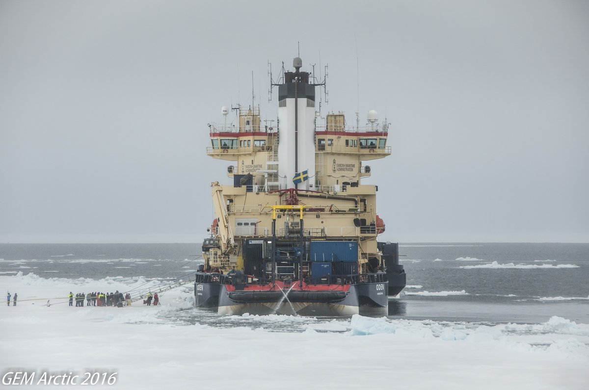
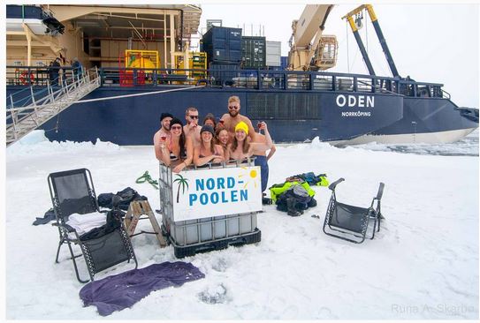
Our regular reader(s) may recall our extensive coverage of the Swedish icebreaker Oden’s visit to the North Pole (AKA Santa’s secret summer swimming pool) in 2016?
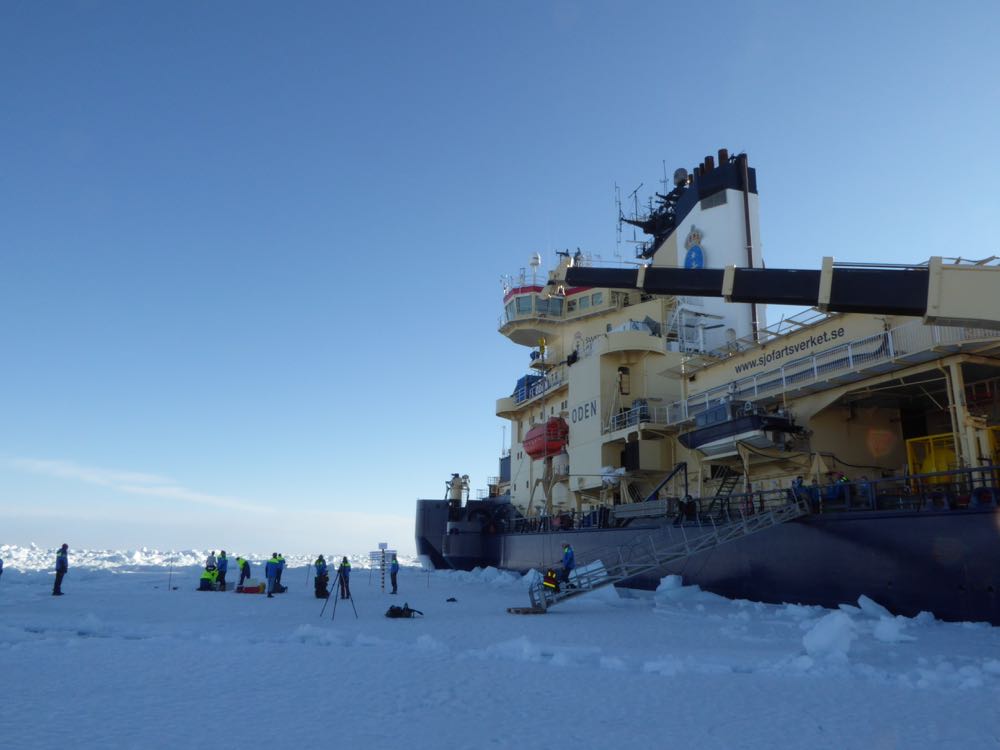
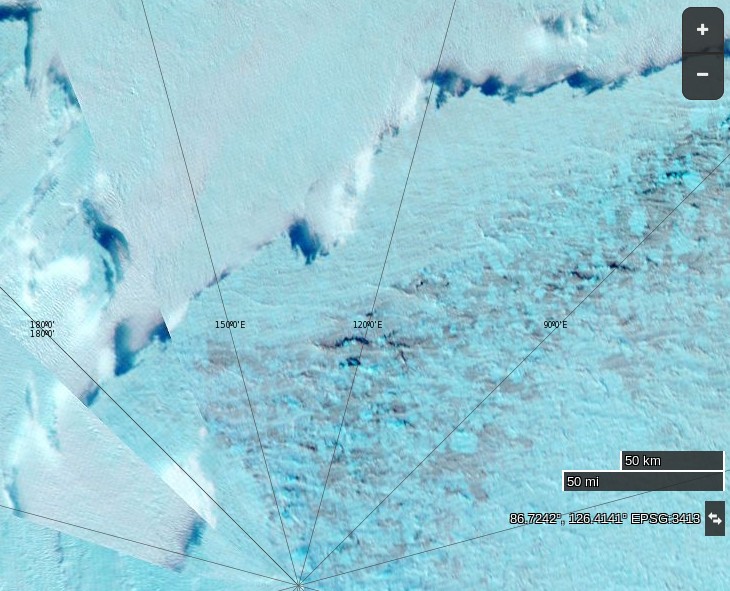
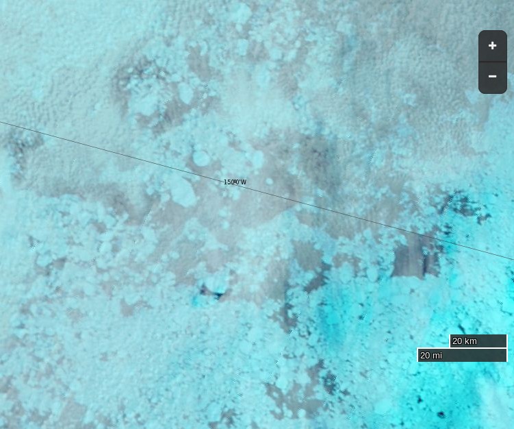
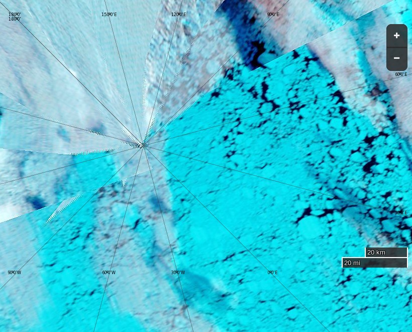
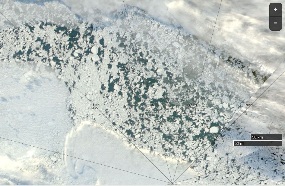
We are now able to report that Oden has been back at the North Pole once again, this time somewhat earlier in the season:
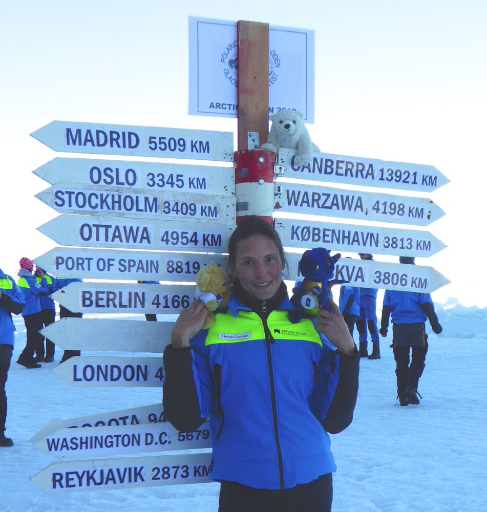
There’s not as much open water to be seen this year, although Oden’s visit is a week earlier than in 2016 so that may not be too surprising? What is perhaps surprising is that this year visiting the Pole wasn’t part of Oden’s plan! According to British physicist and oceanographer (and BBC TV star!) Helen Czerski:
We weren't really aiming for the pole, just to find a good ice floe as far north as possible. But we haven't found an ice floe yet and it looks as though I'll wake up tomorrow morning at the North Pole. Hello to the top of the world! #ArcticOcean2018pic.twitter.com/fDPnua4V6N
Arctic explorer Pen Hadow trekked, and swam, from Ward Hunt Island to the North Pole in 2003. Solo and unsupported. He plans to return to the North Pole this summer, but on this occasion he’ll be sailing with a few companions. According to yesterday’s Sunday Times:
Pen Hadow launches bittersweet mission to sail to North Pole
For his new record attempt, Hadow and his nine-strong team will take two yachts on a 3,500-mile round trip from Nome in Alaska to the pole, using satellites to find a route through the ice and avoid getting stuck. He will fly to Alaska to join his team members on Saturday.
If all goes to plan, he will arrive at the pole between August 15 and early September, about 510 miles further north than anyone has sailed before.
Although the Sunday Times failed to mention it the expedition has a web site of its own. According to the Arctic Mission “About” page:
Arctic Mission sets off from Nome in Alaska (USA) in the first week of August. The expedition team will not see land again for six weeks. We will cover about 3,500 miles by the time they return to harbour at Nome in mid-September.
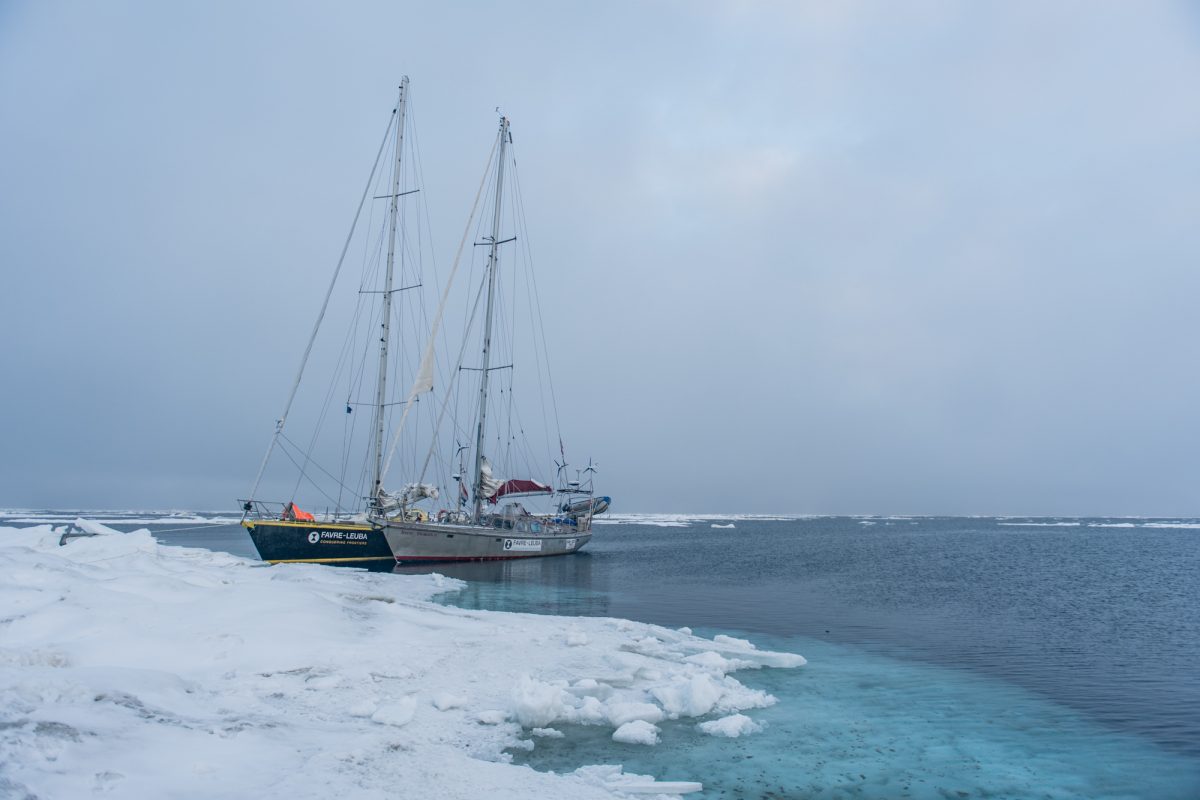
Our two 50 foot yachts, Bagheera and Snow Dragon II, are specially built to sail in waters with sea ice, and the four skippers, two on each boat, are exceptionally experienced in polar seas, and with navigation and safety procedures in sea ice.
The Arctic Mission team intend to do lots of science during their attempt to reach the Pole:
Our expedition is going to explore, discover and share the stories of the spectacular marine wildlife – plants, animals and even bacteria – that lives around the North Pole. Be prepared to be surprised!
We’ll also be doing essential scientific studies and sharing this information, so that our international policy-makers can decide how best to #protect90North.
The more we explore this unexplored ocean, the better we will understand how it works, which means we can make the best decisions to protect it for the benefit of everyone for ever.
We’ve met the two yachts in question before. In 2015 Bagheera and Snow Dragon II both successfully negotiated the Northwest Passage. However this voyage will be far more difficult. During their attempt to sail to the North Pole in the summer of 2013 Sébastian Roubinet and Vincent Berthet had to be rescued by the Russian icebreaker Admiral Makarov when the Central Arctic refreeze set in earlier than originally anticipated. Unlike the ice skating catamaran Babouchka, Bagheera and Snow Dragon II both have engines which will certainly help avoiding a similar fate. In addition perhaps the sea ice in the Arctic is less of an obstacle than it was in 2013? In an interview with the BBC World Service on Sunday Pen pointed out that:
Now 40% of the international waters around the North Pole, what we call the Central Arctic Ocean, are open water in the summer time.
When asked:
Do you think you’ll actually achieve this goal then?
Pen replied:
I think it’s quite possible, with the assistance of a US agency that have satellites that are going to be helping us each day pick the best route through these ever narrowing cracks, and it’s quite possible that we’ll reach the North Geographic Pole.
I also trust that the Arctic Mission team will be keeping a close eye on the Arctic weather forecast over the next month or so. Last August the crew of the yacht Northabout feared for their lives when caught in an Arctic cyclone in a sheltered anchorage on the Northern Sea Route. There is no such safe haven anywhere near the North Pole.
Pen concluded his BBC interview as follows:
If we can produce a visual image of a sail boat at 90 degrees north I think that could become an iconic image of the challenge that the twenty-first century faces. Are we serious about running this planet, which is actually what we need to start doing, and it’s biophysical resources on a sustainable basis, or are we just here for a laugh?
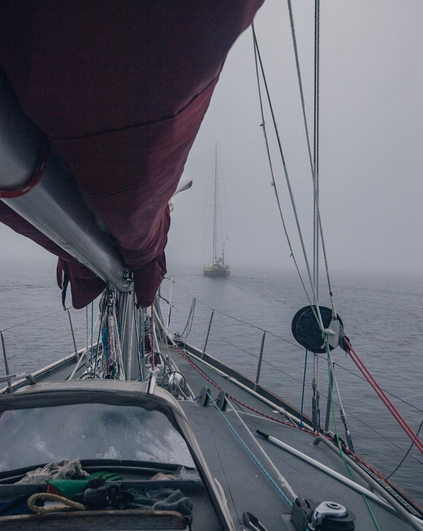
We wish him and the Arctic Mission team well. Watch this space for further updates, and possibly that iconic visual image! Meanwhile here’s a picture of Bagheera in the Northwest Passage in 2015:
plus an image from the Sentinel 1B satellite of the current state of the Arctic sea ice on the direct route from Nome to the North Pole:
Sentinel 1B image of Arctic sea ice at 86N, 180W on July 24th 2017
There don’t seem to be many “narrow cracks” just yet.
[This] brings us to the summer of 2016, and an idea I was mulling over. A rather Big Idea. Had the deterioration of the Arctic sea ice got to a point where switching from Spring-time sledge-hauling to Summer-time sailing was appropriate? In my solo journey from northern Canada to the North Geographic Pole in 2003, I had spent over 30 hours swimming open water stretches, out of the total 850 hours spent hauling my sledge while walking on skis across the sea ice. It had dawned on me then that global warming was the likely cause of so much open water. Since then, it has become highly unlikely that the ski route from northern Russia to the Pole will be done again, due to the absence of sea ice for most of the year off the Severnaya Zemlya island group. And the other classic route from northern Canada no longer has an aircraft operation to provide the necessary support for sea ice expeditions, due to the worsening quality of the sea ice. Both routes have now been lost to the Arctic Ocean’s fast-changing environment. And with this change, the Arctic Ocean with its hitherto frozen summer surface is now rapidly becoming open-access to surface vessels for the first time in human history.
Would it be possible to sail a small yacht to the Pole? Could that create a useful platform to share the unfolding situation with a global audience? Might this be the best way I could focus world attention on the merit of creating a new marine reserve in the international waters surrounding the North Pole?
It looks like we’re just about to find out the answer to those questions. The team have also announced another livestream from Nome, Alaska. This one is scheduled for 8 PM BST tomorrow, Thursday August 10th. They say:
Ahead of our Friday departure (weather permitting – there’s a nasty storm brewing over the Bering Strait that may prove problematic) we’d love to introduce you to the Arctic Mission team.
This is probably what they are referring to:
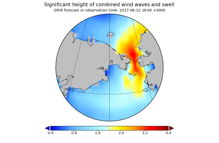
A bumpy ride for Pen Hadow et al. is in store on Saturday, and some big waves for Utqiaġvik (Barrow as was) as well.
[Edit – August 13th]
An overly brief and (hence?) rather misleading article in the Sunday Times today. According to Jonathan Leake:
Sailing to North Pole will have to wait
Pen Hadow, the British explorer, is today due to start a sailing expedition across the Arctic Ocean to highlight the effects of climate change, including an attempt to reach the North Pole.
Scientists warned, though, that despite the rapid melting of the ice there was unlikely to be access to the North Pole via open water for some years.
Professor Mark Serreze, director of America’s National Snow and Ice Data Centre, said the North Pole was still surrounded by nearly 800 miles of solid pack ice as of last week.
Jonathan appears not to have a particularly good grasp of sea ice (thermo)dynamics during the latter stages of the summer melting season!
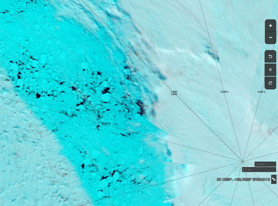
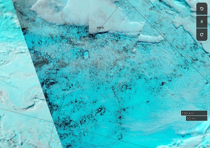
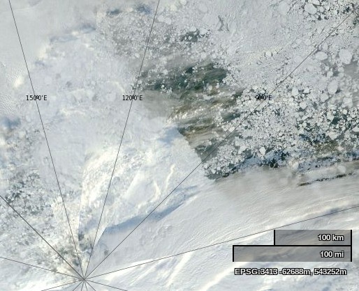
NASA Worldview “false-color” image of the North Pole on August 13th 2017, derived from the MODIS sensor on the Terra satellite
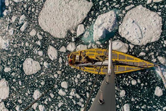
Whilst waiting for the waves in the Bering Strait to die down Conor McDonnell, Arctic Mission’s photographer, has recorded a video from the top of Bagheera’s mast, amongst other places:
[Edit – August 14th]
According to Pen Hadow Bagheera and Snow Dragon II will set sail in the small hours of tomorrow morning (UTC):
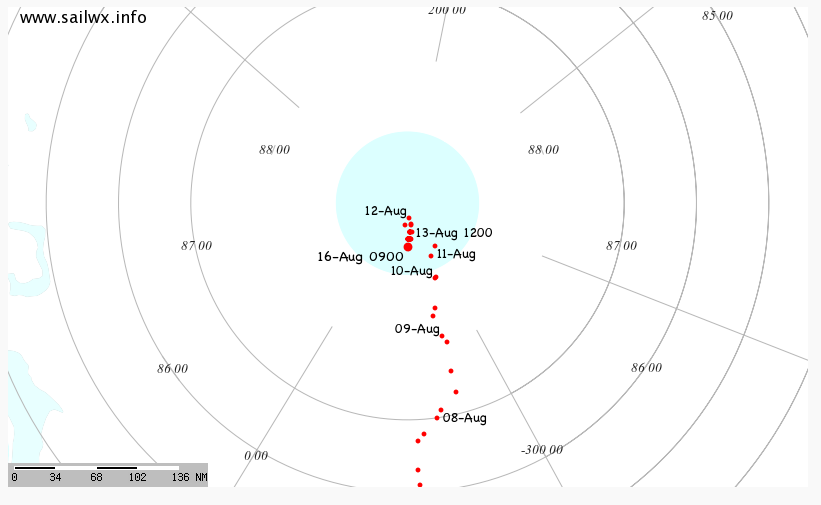
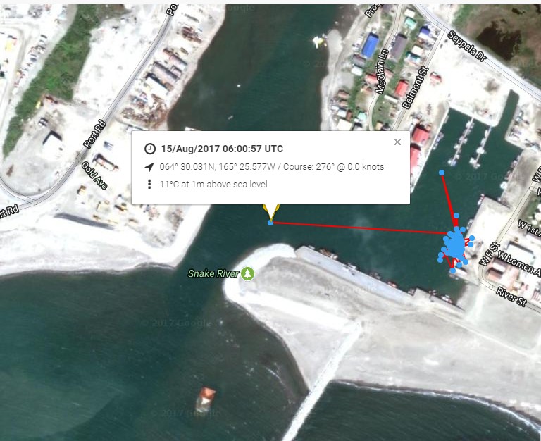
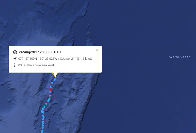
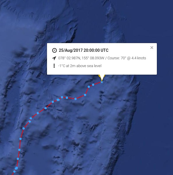
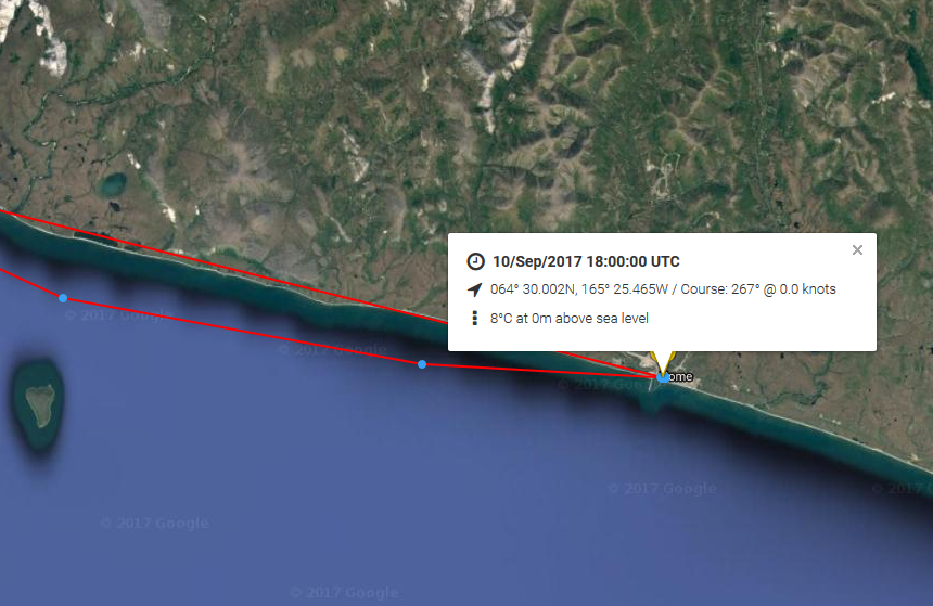
The Arctic Mission live tracking map is operational at last. Here is what it reveals so far:
It looks as though Bagheera and Snow Dragon II left Nome on their voyage of discovery at 06:00 UTC this morning.
[Edit – August 18th]
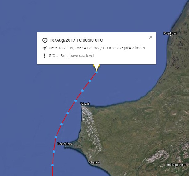
Point Hope is now behind the Arctic Mission team:
Next is Point Lay. Much further north, there are significant gaps appearing in the sea ice up to around 83N:
NASA Worldview “false-color” image of the Central Arctic north of the Beaufort Sea on August 18th 2017, derived from the MODIS sensor on the Terra satellite
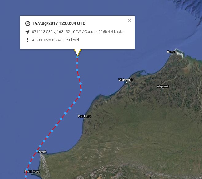
[Edit – August 19th]
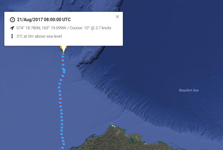
Bagheera and Snow Dragon II are obviously not heading for the Northwest Passage in 2017!
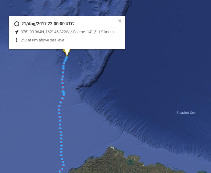
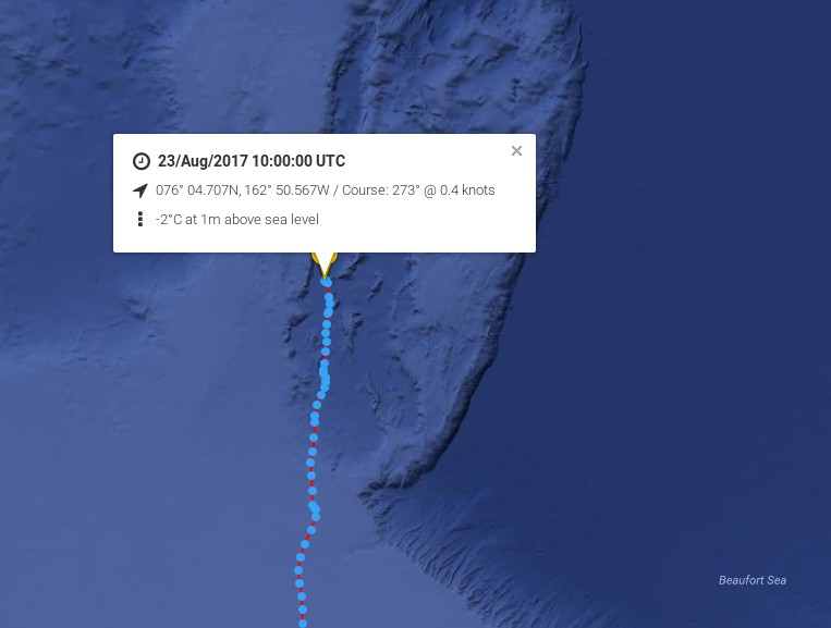
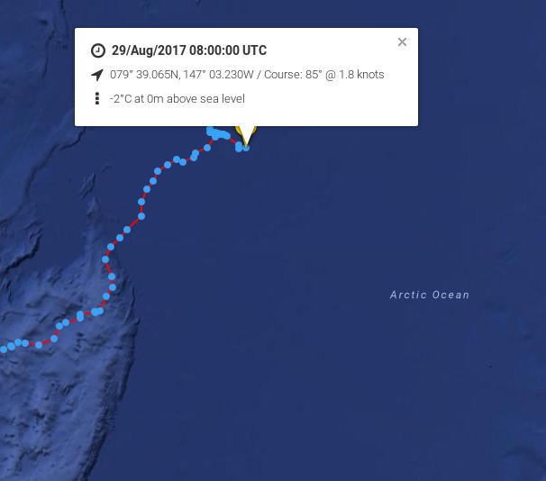
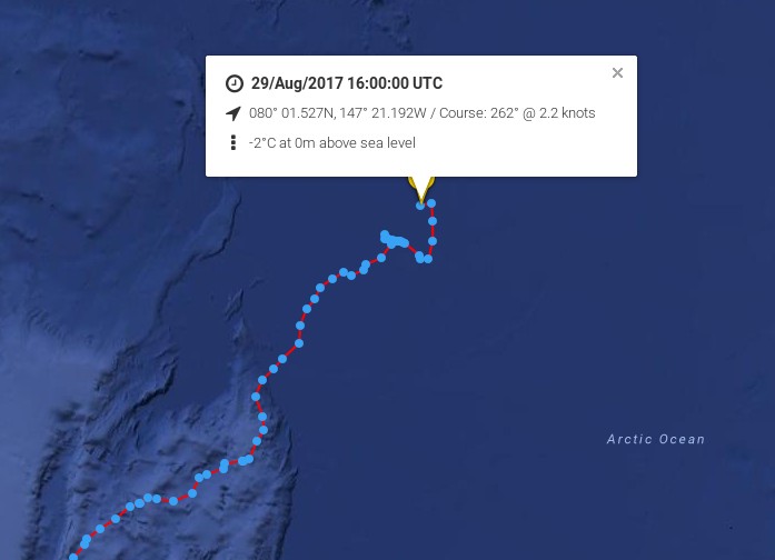
Arctic Mission’s furthest North was 80 degrees 10 minutes North, 148 degrees 51 minutes West, reached at 22:04:12 (Alaskan Time, GMT-9hours) on 29 August 2017 by yachts, Bagheera and Snow Dragon II.
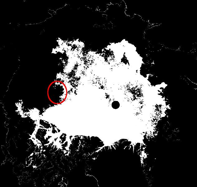
Arctic Mission moored its yachts to an ice floe on 29 August to conduct one of its 24-hour marine science surveys, while drifting with the sea ice. The strategy for any future northward progress had been to monitor the sea surface currents, sea ice, and weather conditions (both observed from the yachts and through satellites imagery downloaded onto our computers), and decide how to proceed as we approached the end of the 24-hour survey.
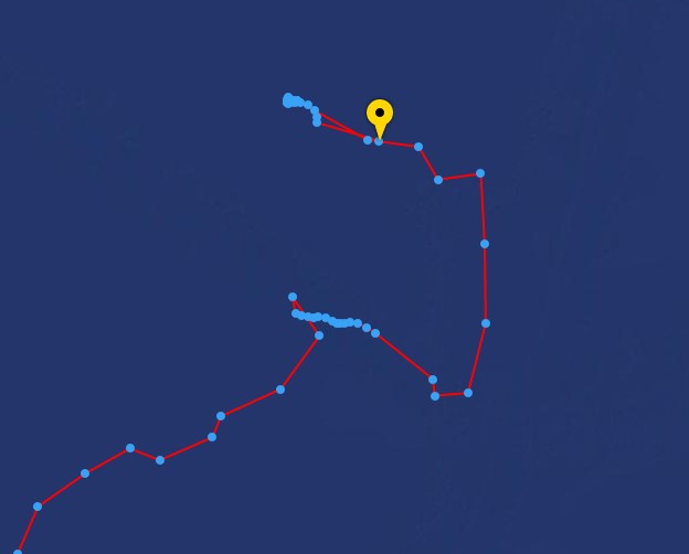
A meeting of the four skippers was held led by Erik de Jong, with Pen Hadow present, and it was agreed further northward progress would increase considerably the risks to the expedition, with very limited scientific reward. The decision to head south, back to an area of less concentrated sea ice in the vicinity of 79 degrees 30 minutes North, was made at 18.30 (Alaskan time).
Here’s the live tracking map from 06:00 UTC this morning:
A prudent and not unexpected decision. Cue the cackling from all the usual suspects?
[Edit – August 31st]
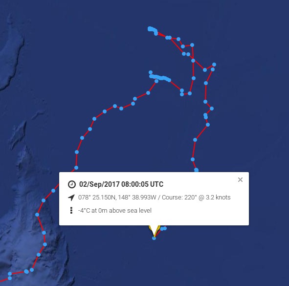
The cackling from all the usual suspects has indeed begun. It has even inspired a somewhat surreal modern art installation! Meanwhile according to their Twitter feed:
We are slowly making our way back to Nome now after reaching the northernmost point of our… https://t.co/GhrYYza6gk
An experienced team of polar explorers set off on April 4th intending to ski from a latitude of 88° North to 90° North, better known as the North Pole!
According to the expedition’s web site those 2 degrees of latitude are symbolic of the United Nations Framework Convention on Climate Change agreement in Paris to “hold the increase in the global average temperature to well below 2 °C above pre-industrial levels”, and are thus part of the expedition’s name.
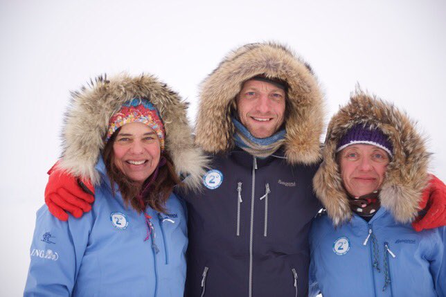
Here’s the team of Bernice Notenboom, Martin Hartley and Ann Daniels pictured shortly before departing on their arduous journey via the Russian Barneo ice camp near the North Pole:
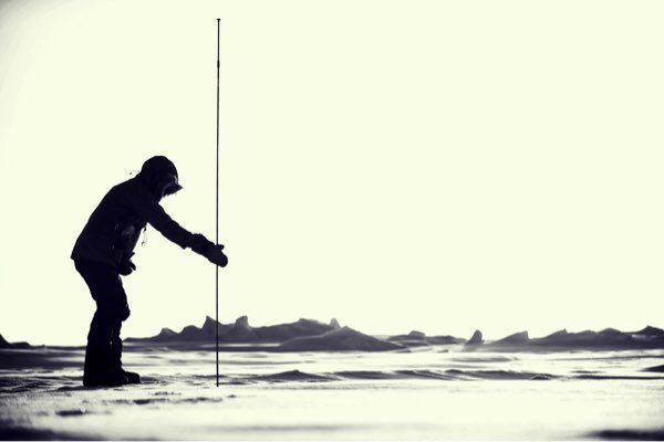
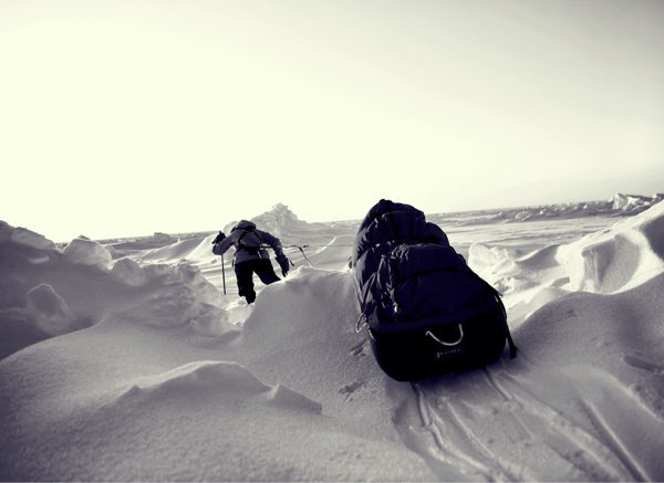
Apart from hauling their sleds across some very challenging terrain they will also be doing lots of “citizen science” en route, including stopping regularly to measure the depth of snow covering the sea ice:
Photo: Martin Hartley
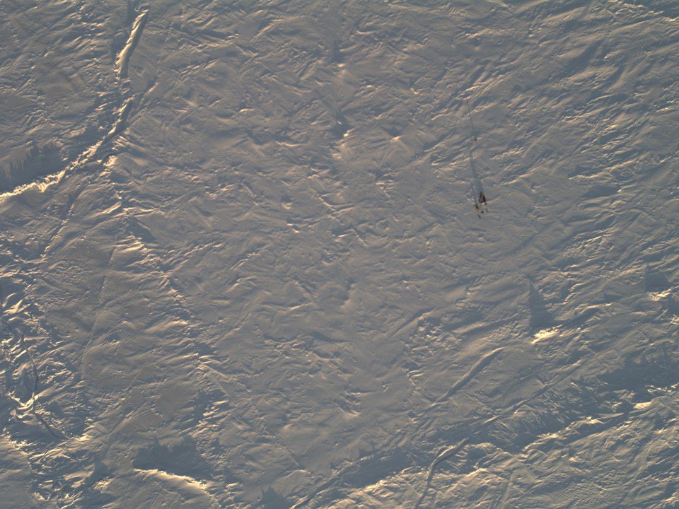
As part of that scientific mission the NASA Operation IceBridge Orion P3 aircraft overflew the team, and amongst other things took this picture:
Photo: NASA
Bernice announced on the 2 Degrees expedition’s blog this morning that:
A milestone today – skied 1/2 degree of latitude.
Victor Serov who I call into every night with our position is really happy with our progress: ” You are doing very well Bernice and you are doing science” is his encouraging response every time I call in.
I imagine he is sitting in a tent in Barneo with a giant map, North Pole in the middle, and plotting all routes towards the pole. Each team on the ice has to call in coordinates at night so if something happens, they are standby with 2 MI8 helicopters to assist. Like yesterday somebody had to get evacuated because of frostbite.
To get a compliment from a Russian scientist who has spend a year in Vostok in Antarctica [coldest place on earth] as well as being an accomplished polar explorer, we should be proud of ourselves to have skied 1/4 of the way on day 5. But it hasn’t come easy. The half degree has been really hard work temperatures dipped to -41C too cold to film, do science, all we can do is keep moving until we need to eat and drink.
The sleds weigh over 80 kilo’s and new pains and aches show unexpectedly in places you don’t want them, like my back. On the odd break, I would get the notebook out, jot down the GPS position while Ann pokes into the snow and yells the various snow depths to me. The rest of the day we are doing cold management: toes we don’t feel anymore and need nurturing or placing your thumb between the fingers to warm them up inside your mitt, and worse letting your arm hang so the blood can race back to the extremities.
If you are cold all blood flows to your heart and core to protect it, so to call it back is playing a trick with your mind. Despite this careful nursing, I still end up with frost nip on all fingers. I now need to be extra careful with exposure to cold.
Meanwhile Ann Daniels published this image of the sort of terrain they’ve been crossing on her Twitter feed:
Photo: Martin Hartley
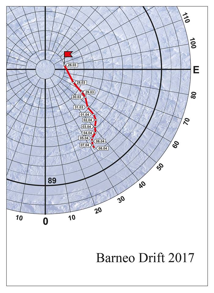
The expedition’s current position is reported as as 88.52 N, 147.75 E. Only another 1 1/2 degrees to go! As this map of the drift of the Barneo ice camp shows, the winds are currently somewhat in the team’s favour:
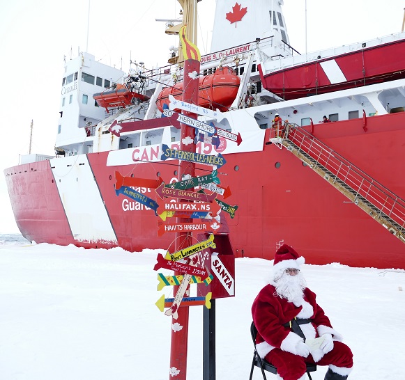
The Swedish icebreaker Oden and the Canadian icebreaker Louis S. St. Laurent recently met up at the North Pole on a joint scientific expedition. To be more precise the Oden’s Captain’s log recorded her position at 11:03 UTC on August 22nd as N 89° 59,998´ W 046° 40,558´.
and then take a look at his newly extended swimming pool:
What could be more refreshing after a long voyage than a quick dip followed by a Piña colada by the pool?
Santa’s secret summer swimming pool is obviously big enough this year to accommodate all the icebreakers and nuclear submarines on the planet. All his little helpers have a giant pool of their very own too:
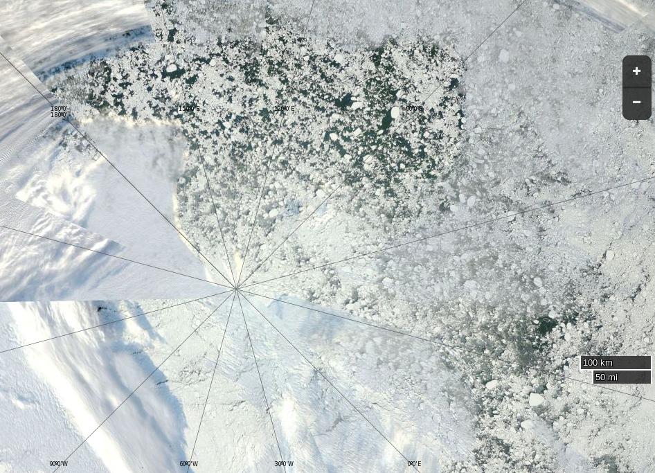
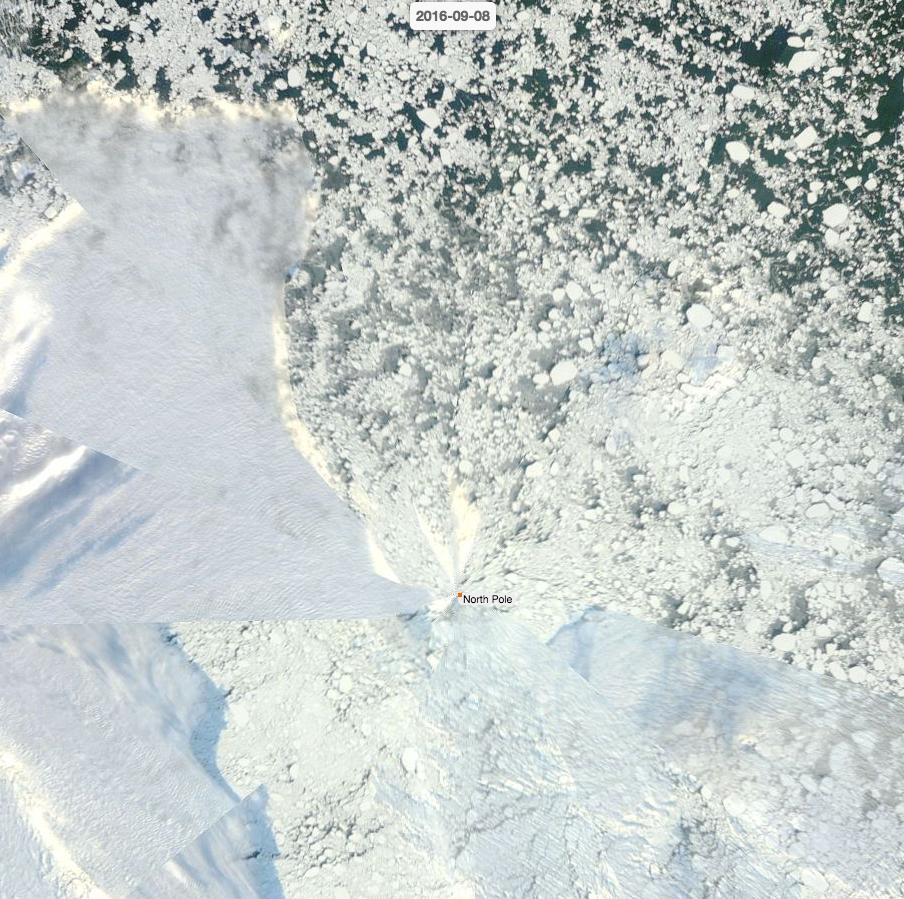
NASA Worldview “true-color” image of the North Pole on September 8th 2016, derived from the MODIS sensor on the Terra satellite
No is the obvious answer just at the moment, since the plucky little yacht is currently parked at a pontoon in Tuktoyaktuk. However actual facts aren’t sufficient to stop Tony Heller suggesting that Andrew Freedman suggested on Mashable that Mark Serreze of the NSIDC said that such a feat is feasible:
Mark “Arctic Is Screaming” Serreze says the Ship of Fools could sail to the North Pole.
In an interview with Mashable, Serreze said sea ice coverage across the different regions of the Arctic has fallen dramatically in association with a series of unusually powerful summertime Arctic storms during August.
That much is certainly true, as we here at Great White Con have documented in detail. Mr. Heller however highlights this section of Mr. Freedman’s article:
In fact, if they want to, the Hempleman-Adams and the rest of the ship’s crew could actually sail nearly all the way to the North Pole, since sea ice cover is largely absent to about 86 degrees north, according to Mark Serreze, director of the National Snow and Ice Data Center (NSIDC) in Boulder, Colorado.
It’s not out of the question that the North Pole will become a geographical marker in open water, rather than ice cover, sometime in the next few weeks.
Serreze called this situation “pretty darned unusual.”
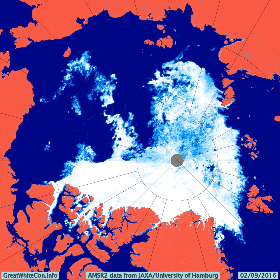
Let’s examine the facts about this “pretty darned unusual” situation shall we? Here is the latest high resolution AMSR2 visualisation of Arctic sea ice concentration:
Can you see the stretch of open water leading all the way from the East Siberian Sea, where Northabout was a couple of weeks ago, to 86 degrees north? Apparently Tony Heller and his faithful followers cannot! Not only that, but also supposedly:
A NASA image [shows that] the North Pole is indeed encased in Thick ice right now.
Here’s a (somewhat foggy) NASA image of the North Pole right now:
NASA Worldview “false-color” image of the North Pole on September 3rd 2016, derived from the MODIS sensor on the Terra satellite
and for good measure here’s a (somewhat foggy) NASA image from 86 degrees north in the Central Arctic Basin right now:
NASA Worldview “false-color” image of the Central Arctic on September 3rd 2016, derived from the VIIRS sensor on the Suomi satellite
Need I say more?
[Edit – September 4th]
Today Terra offers a glimpse of the Greenland side of the North Pole:
NASA Worldview “false-color” image of the North Pole on September 4th 2016, derived from the MODIS sensor on the Terra satellite
[Edit – September 5th]
Today Aqua offers us a view of what’s left of the sea ice on the Siberian side of the North Pole:
NASA Worldview “true-color” image of the North Pole on September 5th 2016, derived from the MODIS sensor on the Aqua satellite
[Edit – September 9th]
SHOCK NEWS!!!
Tony Heller has just posted an accurate image of the state of the sea ice near the North Pole! Here it is:
The accompanying text is nonsense of course:
The Ship Of Fools is facing a -10C weather forecast in five days, which would be impassable. They better put their fossil fuel powered pedal to the metal and get out of there fast, so that they can go back to Bristol and lie about the ice.
Meanwhile, professional fraudster Mark Serreze said last week they could sail to the North Pole
Needless to say Tony doesn’t provide a link to his source. Try this one and then have a good look around on NASA Worldview.
We speculated a few days ago about whether the “Son of Storm Frank” might have battered Britain by now, and be sending a 10 meter swell past Svalbard towards the Arctic sea ice edge. That’s not quite how things have worked out in practice however! We haven’t had another named storm affecting the United Kingdom directly, but we have received a series of long distance swells from a sequence of hurricane force storms further out in the North Atlantic. I even managed to test my Arctic surfing equipment by personally partaking in the swell generated by Hurricane Alex!
Moving from the water into the air, here’s the Danish Meteorological Institute’s forecast for Greenland tomorrow:
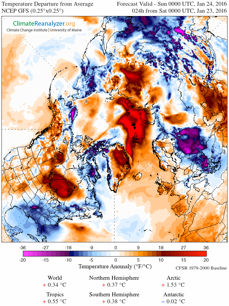
If you’re at all familiar with isobars you’ll note yet another storm off Southern Greenland and that comparatively warm, moist air will be heading up the east coast of Greenland towards the Fram Strait, albeit not at the speeds generated by Storm Frank! As a consequence here is Climate Reanalyzer’s surface temperature anomaly map for first thing tomorrow:
and here is how it looks by Wednesday lunchtime:
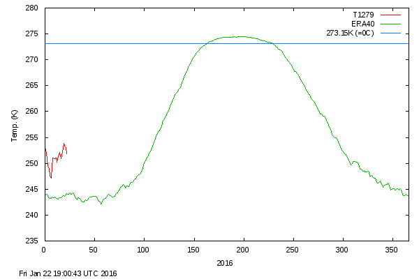
As you can see, the ultimate effect of the recent hurricane force storms in both the Atlantic and the Pacific is to attack the Arctic with warm, moist air from both sides. Whilst we wait to see exactly how this much shorter term forecast pans out, particularly at the North Pole itself, the DMI’s graph of temperatures in the central Arctic has burst back into life after a “brief hiatus” in the New Year. Here’s how it looks at the moment:
Construction of Ice Camp Barneo 2014 began close to the North Pole at the beginning of April, and now the first scientific data has started flowing from the sea ice near the Pole. The first of three webcams has been successfully installed on the ice, and the slightly noisy initial images are available from the North Pole Environmental Observatory 2014 web site:
NPEO webcam 1 image from April 14th 2014
Data is now also arriving from ice mass balance buoy 2014E, which as you can see if you click on the pushpins on the map below, has been drifting at the rate of 16 km / day during its brief lifetime on the Arctic sea ice so far:
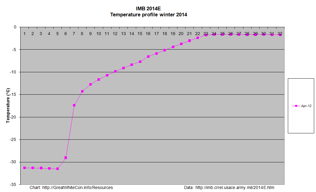
Here’s the initial temperature profile for 2014E:
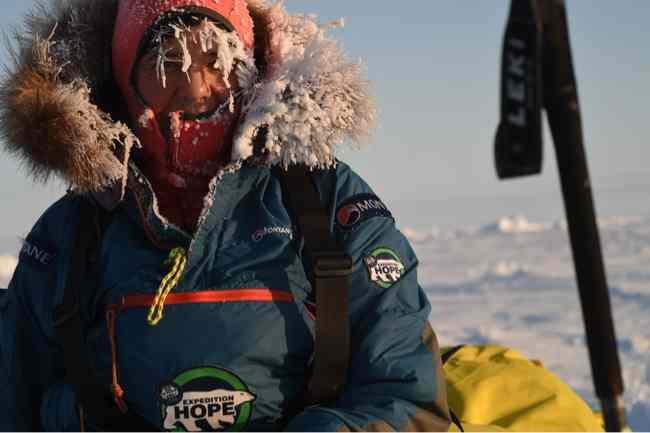
At present the ice on the floe is 1.7 m thick, covered with 19 cm of snow. As you can see, temperatures were a touch chilly when the buoy was installed on April 12th, at around -32 degrees Celsius. A variety of expeditions have already set off from Barneo in various directions. Expedition Hope are heading in the direction of Cape Discovery on Ellesmere Island, and here Bernice Nootenboom illustrates the effects of such low temperatures on the human body:
Bernice Nootenboom near the North Pole. Photo: Martin Hartley
You can also view data from IMB 2014E and the other active ice mass balance buoys on our IMB overview page.
USS Skate (SSN-578) made submarine history on 11 August 1958 when it became the first submarine to surface at the North Pole
Us:
It would seem to be the USS Skate on 11 August 1958 when it became the first submarine to surface at the North Pole. What is this picture of?
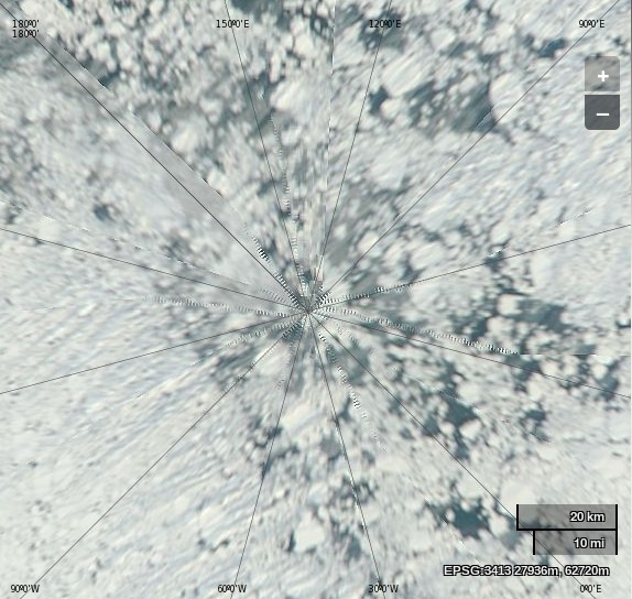
NASA Worldview “true-color” image of the North Pole area on September 2nd 2013, derived from bands 1, 4 and 3 of the MODIS sensor on the Terra satellite
Them:
Frozen ice. What is my prize?
And basically yours is just a snipe hunt. Mine disproves your hysteria.
Us:
No prize I’m afraid. The correct answer is vast areas of open ocean. Plenty of room for every submarine on the planet.
Them:
Sorry, there is no open water. Check your picture again. So you are reneging? Typical.
Us:
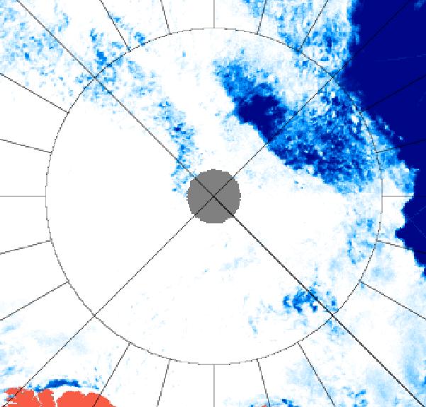
I have checked again, and I still see lots of open water underneath a thin veil of cloud. Perhaps you should arrange a hasty visit to an optician? Luckily microwaves can see through clouds, even if you cannot. Here’s another satellite image of the North Pole area from September 2nd 2013, this time a University of Hamburg visualisation of data from the AMSR2 sensor on board the Japanese SHIZUKU satellite.
AMSR2 image of the North Pole area on September 2nd 2013
You have X-ray vision? I am sorry! I did not realize you were stuper girl! Want to try again? This time with normal vision.
BTW. for the SLOOOOOW learners. 85 North +/= North pole. The North Pole is WITHIN 85 North. But it is NOT 85 North.
The Skate is at 90 North. The NORTH POLE.
You may have x-ray vision, but you still cannot read a map. neither picture shows open water AT the north pole.
How many submarines are on the planet Snowy? better recheck your figures. They are not tinker toys.
Us:
You’re a hard man to please Phil! Feast your eyes on this picture instead then:
NASA Worldview “true-color” image of the North Pole area on August 28th 2013, derived from bands 1, 4 and 3 of the MODIS sensor on the Aqua satellite
Them:
We’ll keep you posted!
This website uses cookies to improve your experience. We'll assume you're ok with this, but you can opt-out if you wish. Cookie settingsACCEPT
Privacy & Cookies Policy
Privacy Overview
This website uses cookies to improve your experience while you navigate through the website. Out of these, the cookies that are categorized as necessary are stored on your browser as they are essential for the working of basic functionalities of the website. We also use third-party cookies that help us analyze and understand how you use this website. These cookies will be stored in your browser only with your consent. You also have the option to opt-out of these cookies. But opting out of some of these cookies may affect your browsing experience.
Necessary cookies are absolutely essential for the website to function properly. This category only includes cookies that ensures basic functionalities and security features of the website. These cookies do not store any personal information.
Any cookies that may not be particularly necessary for the website to function and is used specifically to collect user personal data via analytics, ads, other embedded contents are termed as non-necessary cookies. It is mandatory to procure user consent prior to running these cookies on your website.