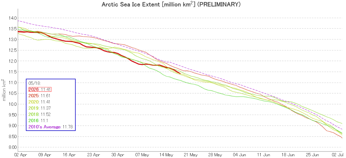
JAXA have updated their visualisations of Arctic sea ice extent data. The “traditional” 2 day average graph is now labelled “preliminary”, and currently shows 2026 in a tie with 2020 for third lowest for the date:
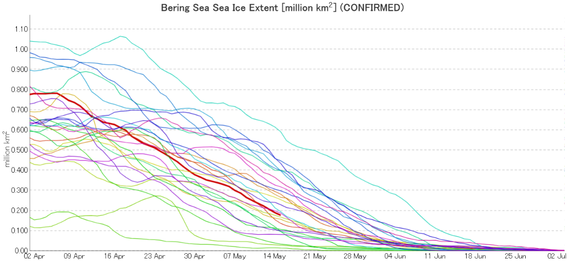
5 day averaged “confirmed” data is also available, including regional graphs. By way of example here’s JAXA’s latest extent graph for the Bering Sea, dated May 15th:
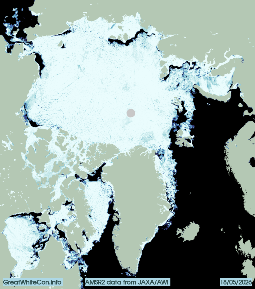
The Alfred Wegener Institute’s sea ice concentration data reveals open water in the Beaufort, Chukchi, East Siberian and Laptev Seas:
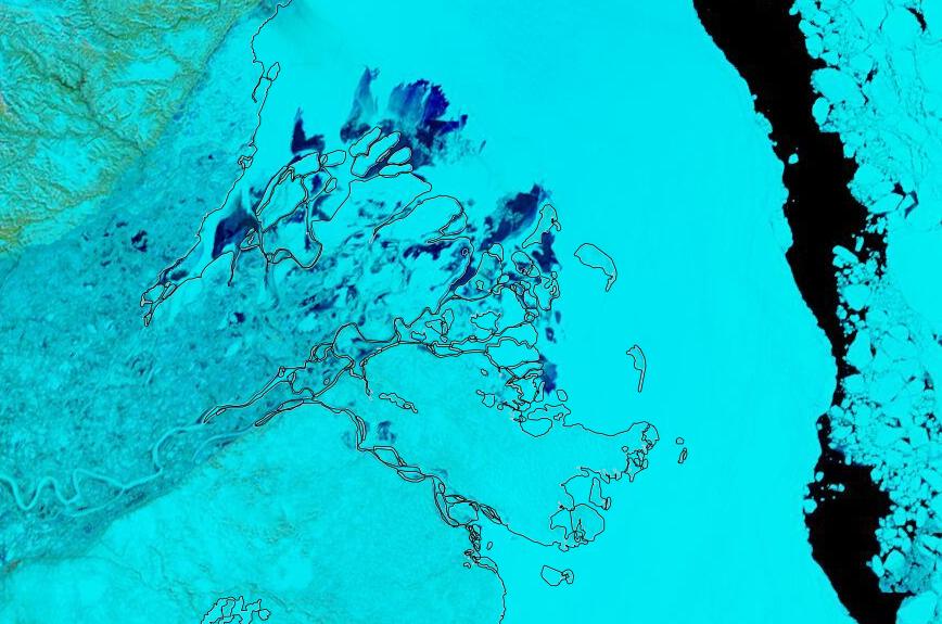
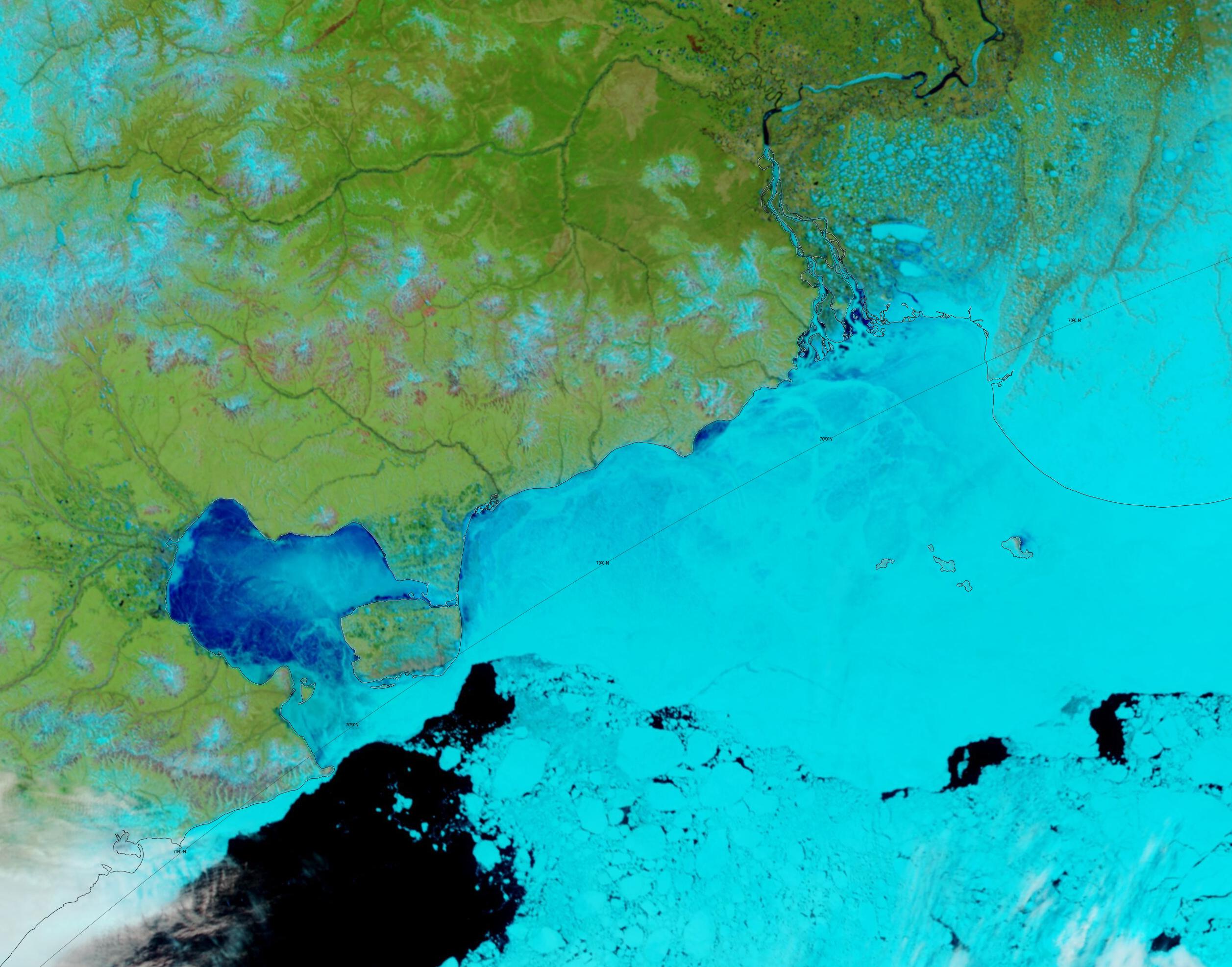
In the eastern Beaufort Sea albedo is further reduced by the waters of the Mackenzie River encroaching upon the fast ice off the river delta:
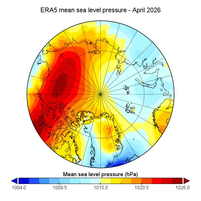
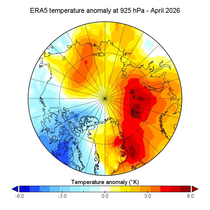
The monthly summary of atmospheric conditions over the Arctic during April 2026 reveal part of the reason for the open water. A persistent area of high pressure over the Beaufort Sea:
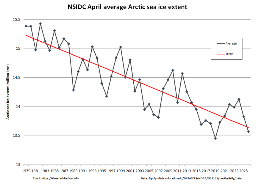
The NSIDC monthly average extent graph for April shows 2026 second lowest behind 2019:
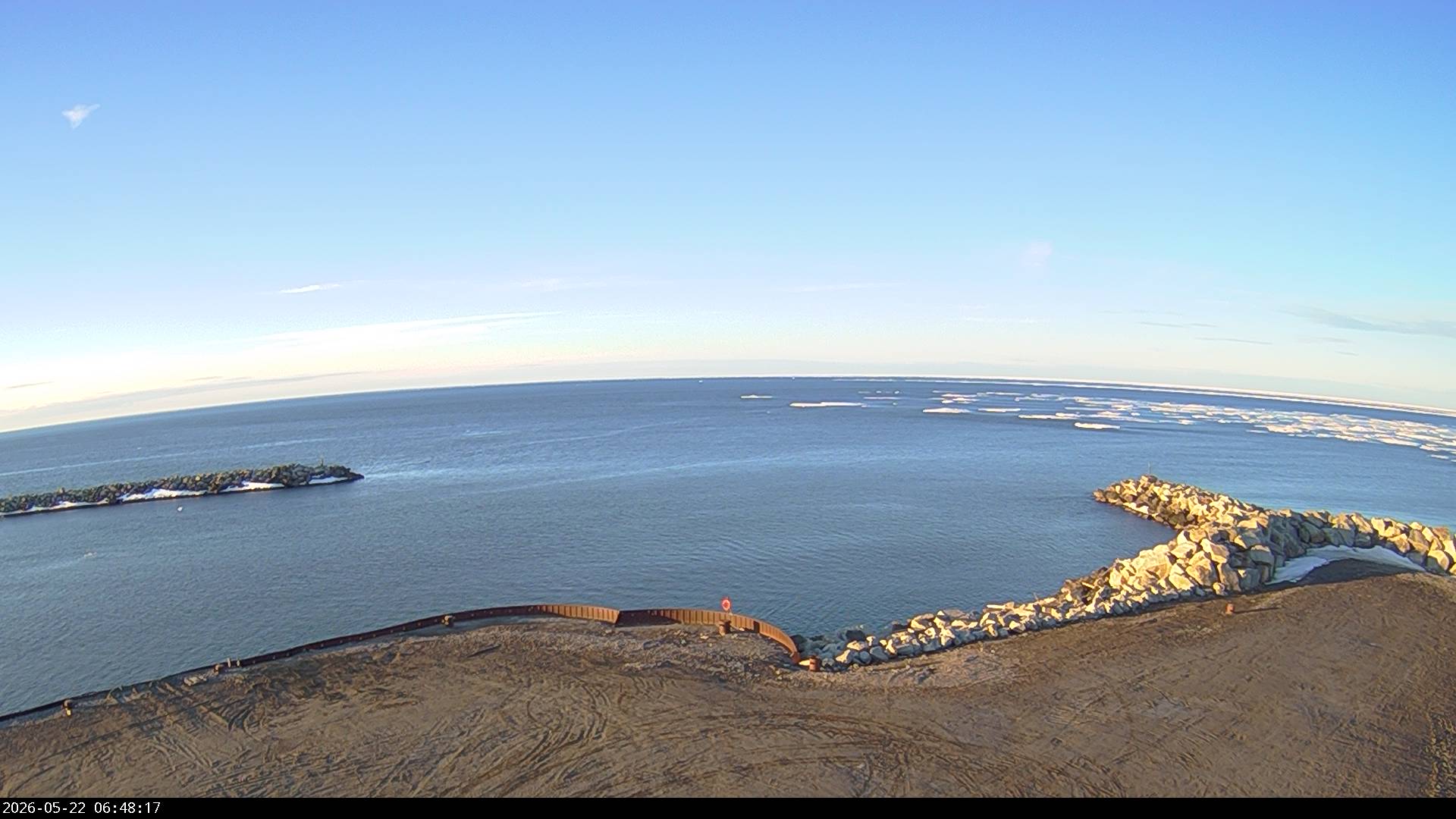
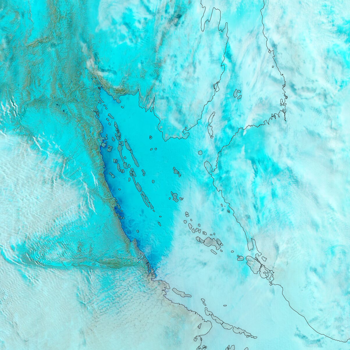
Nome Harbour is now clear of sea ice:
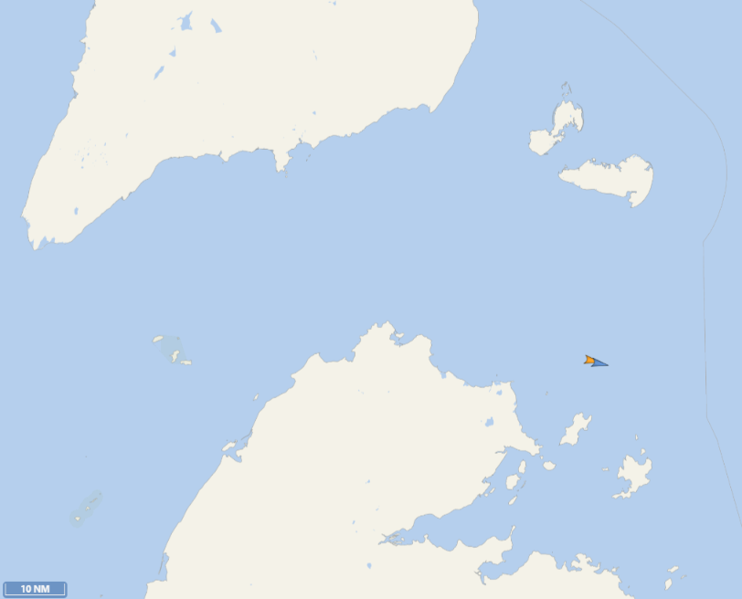
Further north, melt ponds have begun to form in Darnley Bay:
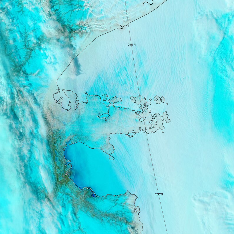
and Coronation Gulf:
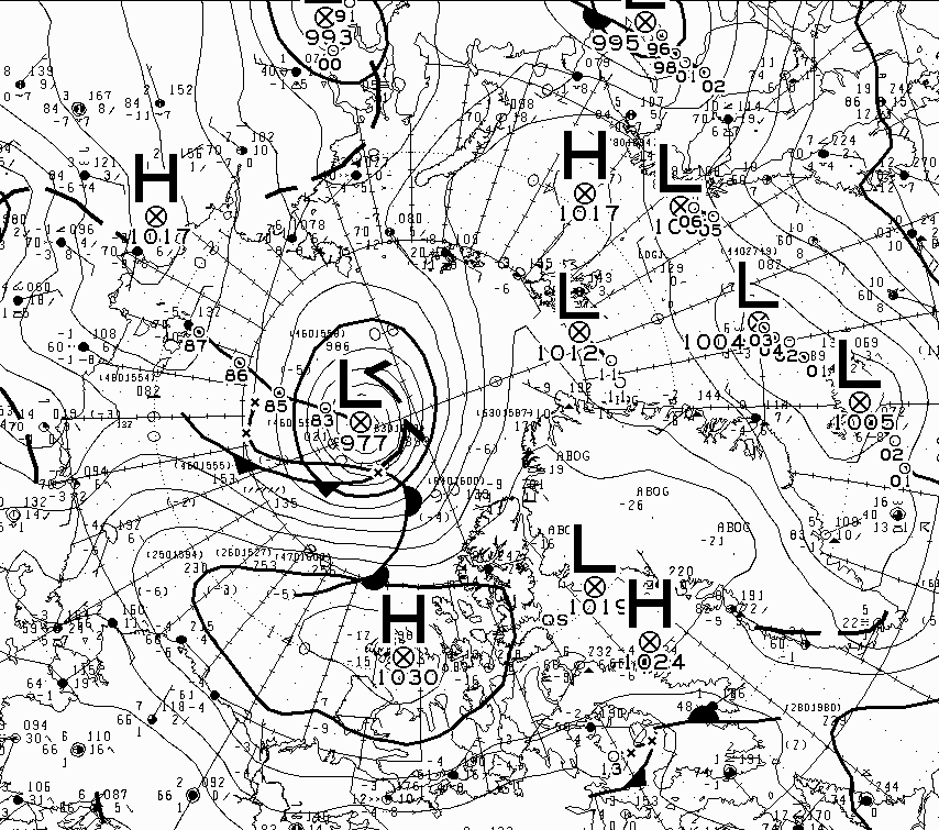
According to the Canadian Meteorological Centre a cyclone in the Central Arctic achieved a minimum central pressure of 977 hPa at 12:00 UTC yesterday:
Melt ponds are now clearly visible in Chaunskaya Bay, and have begun to form further west along the Chukotka coast:
In an early start to traffic along the Northern Sea Route this year, nuclear icebreaker Ural has just led LNG tanker Christophe de Margerie through the Vilkitsky Strait.
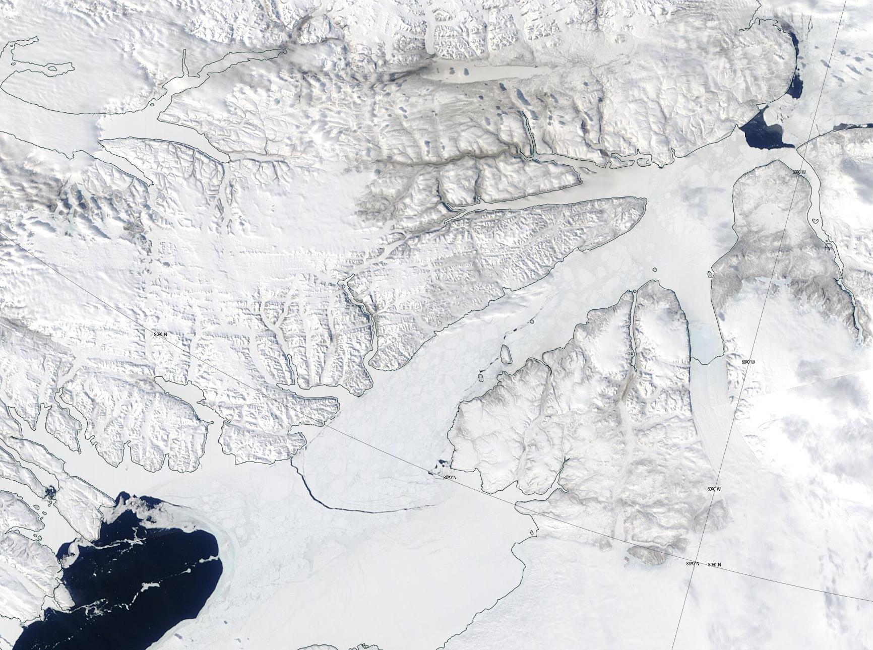
In other news, cracks have started to appear in the fast ice blocking the Nares Strait:
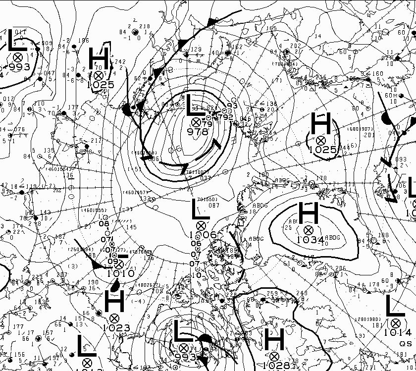
Another cyclone has reached the Central Arctic, this time entering from the Barents Sea. This one reached a minimum central pressure of 978 hPa at 00:00 UTC this morning:
The conversation continues over on the June open thread!
Just noticed this morning on ASIF 9 of the lowest JAXA extent on this day from the last 10 years ( plus 2016).. just a random day!