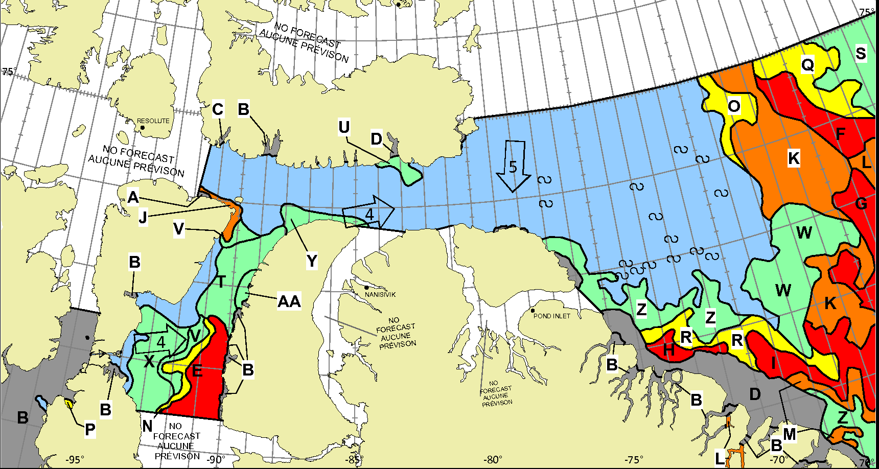
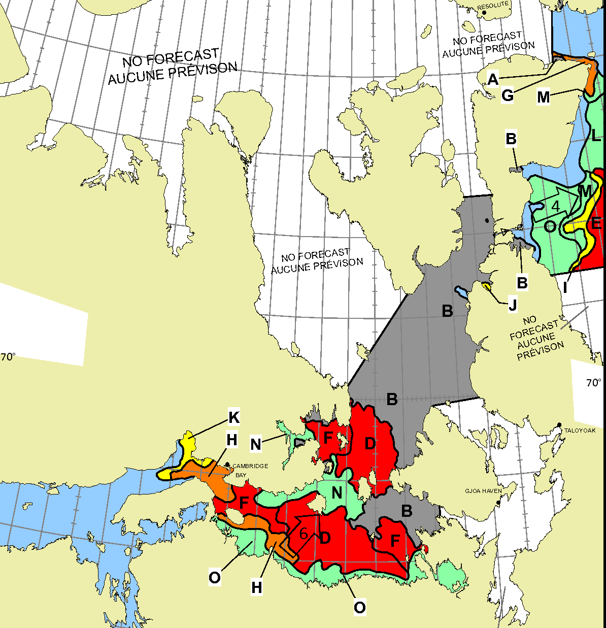
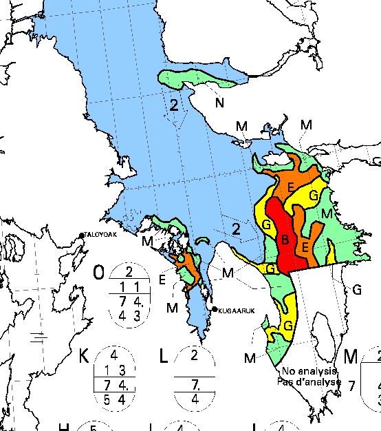
Some “pleasure craft” are currently heading up the west coast of Greenland en route to the Bering Strait via Lancaster Sound and one of the assorted routes through the Canadian Arctic Archipelago. For those of you unfamiliar with the geography of the Northwest Passage, here are couple of hopefully helpful maps:
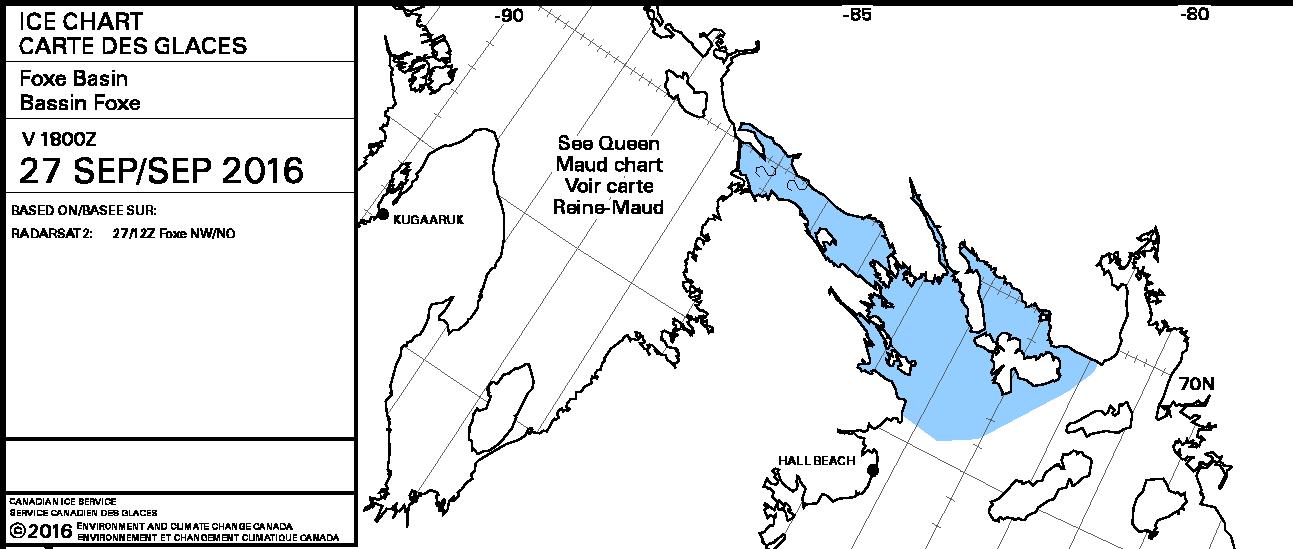
Whilst there is still ice blocking the route across Baffin Bay from Greenland, the Canadian Ice Service has already started daily coverage of the heart of the southern route through the Northwest Passage. There’s plenty of open water in Lancaster Sound and low concentration sea ice in Prince Regent Inlet:
Further south there is also open water in the Coronation Gulf, but the fast ice between Peel Sound and King William Island has not yet started breaking up:
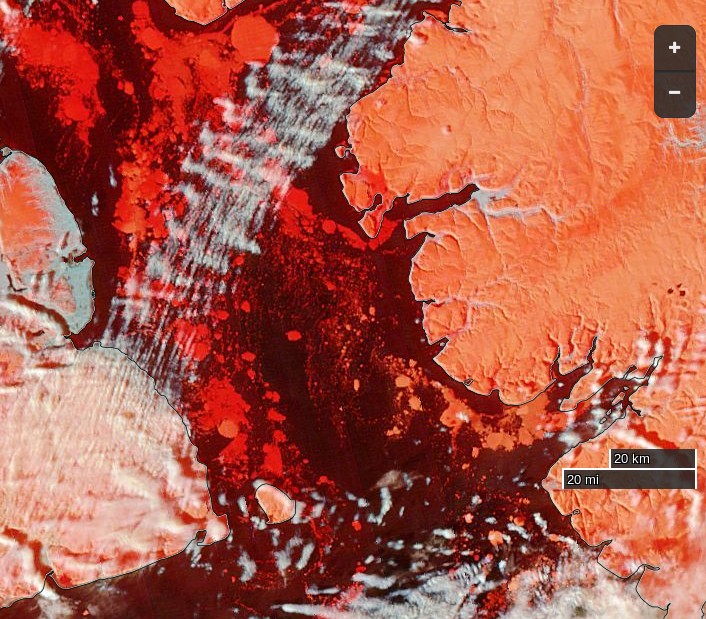
This slightly cloudy satellite image of the Canadian Arctic Archipelago also shows that the exit of the northern route via McClure Strait into the Beaufort Sea is already navigable:
A reader writes to ask us to explain the answer to the above question in more detail. Are you sitting comfortably once again? Then let us begin.
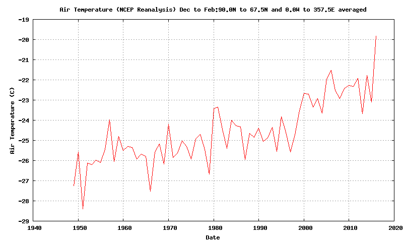
There has been a lot of unusual “weather” in the Arctic over the last twelve months. First of all there was an anomalously warm winter:
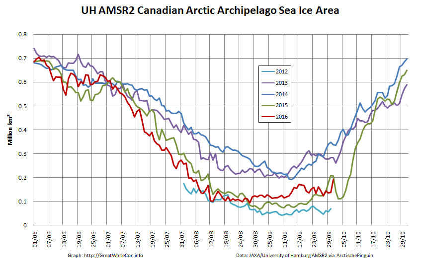
Then came what we dubbed the Great Arctic Anticyclone of 2016 in April. Take a look at what happened to the sea ice north of Alaska and Canada during the Spring and early Summer:
The ice was put through the mincer for the first time. Then during August there were a series of strong cyclones, collectively the Great Arctic Cyclone of 2016. The ice was put through the mincer once again, but in an anti-clockwise direction this time. Watch what happens in the Northwest Passage as summer turns to Autumn:
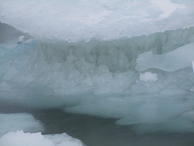
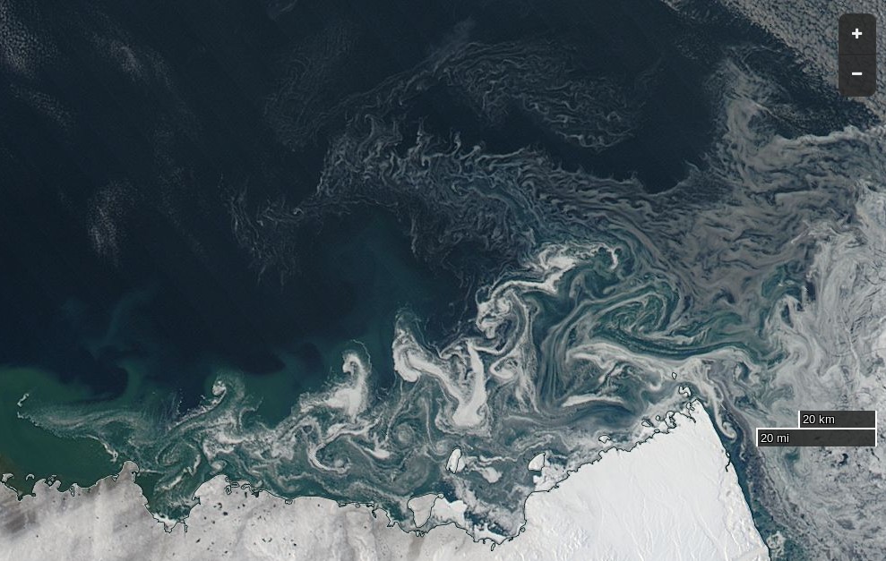
Some of the oldest, thickest ice in the Arctic has been chopped into small pieces which then easily flow through the channels of the Canadian Arctic Archipelago and into the Northwest Passage. Hence when the yacht Northabout (amongst others) was racing to reach Baffin Bay it wasn’t to avoid “the refreeze” as claimed in certain quarters. It was in fact to try and avoid the worst of the chopped up chunks of old sea ice being carried swiftly in their direction by winds and currents. Here’s what some of them looked like in close up:
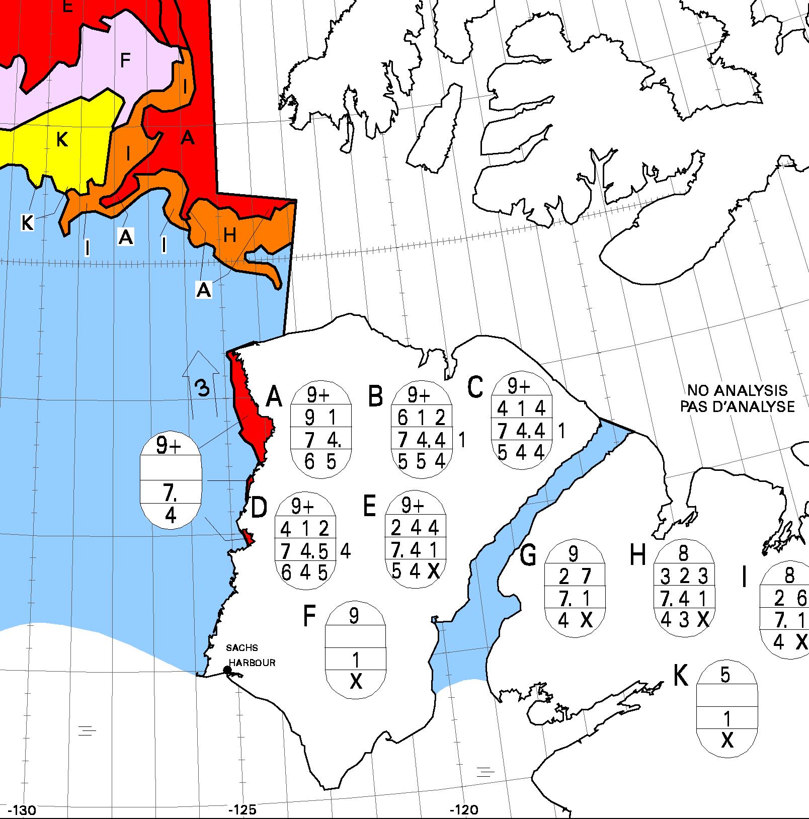
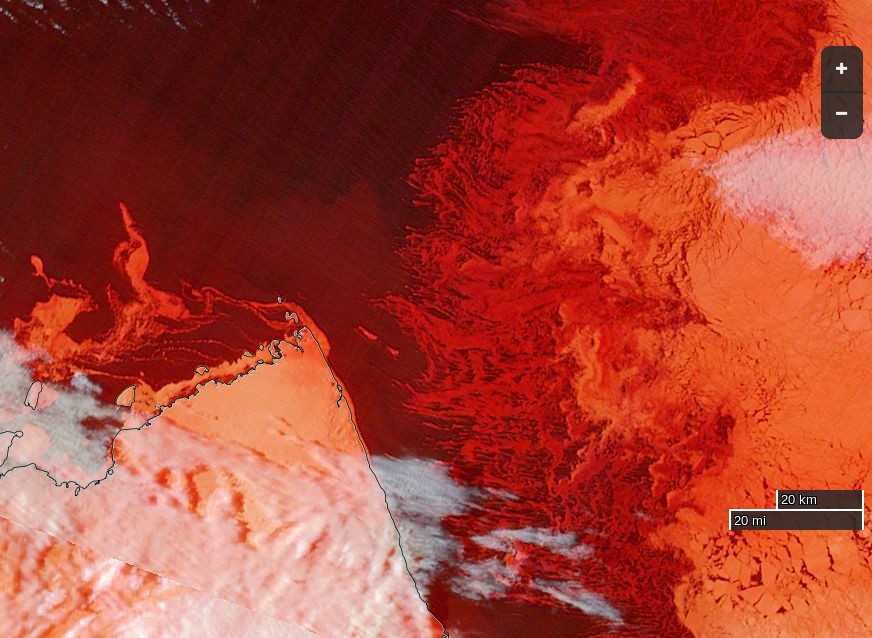
The next question then becomes, if the Northwest Passage wasn’t refreezing then, is it freezing now? The answer is not yet. In fact the favourite talking point of the cryodenialista, McClure Strait at the western end of the “main” route through the Passage has recently become navigable:
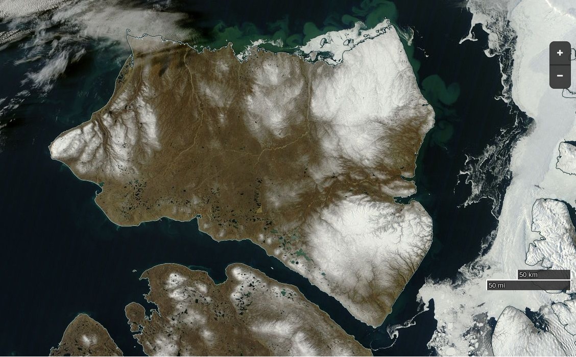
NASA Worldview “true-color” image of Banks Island on September 24th 2016, derived from the MODIS sensor on the Terra satellite
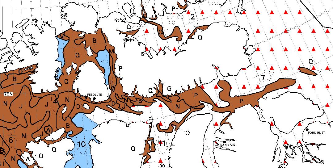
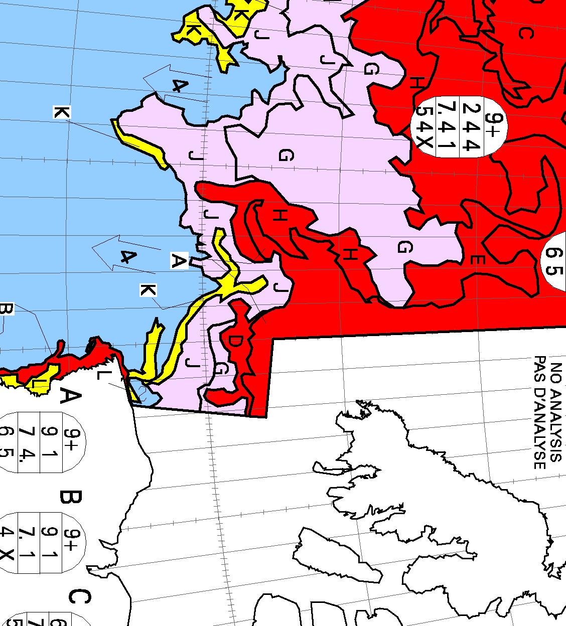
The “pretty pink” area towards the top left of the chart reveals “new ice”. The Northwest Passage will have started to refreeze when some of that shows up on a “stage of development” chart of the Passage itself, but that hasn’t happened yet. Here’s yesterday evening’s chart of the “Approaches to Resolute“:
Lots of old ice! It was raining in Resolute yesterday, and the old ice there was still melting:
[Edit – September 27th]
No sooner said than done! This evening’s ice charts from the CIS do now show some “pretty pink” new ice in the Northwest Passage:
The wispy areas of new ice are also visible on this “false-color” image of the Parry Channel:
NASA Worldview “false-color” image of the Parry Channel on September 27th 2016, derived from the MODIS sensor on the Terra satellite
However even if Northabout were still in Prince Regent Inlet she wouldn’t be “trapped in ice”. There is still a way back to Bristol via Fury and Hecla Strait:
A clear view of McClure Strait from the Terra satellite in “false colour”:
NASA Worldview “false-color” image of the McClure Strait on September 30th 2016, derived from the MODIS sensor on the Terra satellite
The inclusion of some infra red reveals the thicker old ice on the right noticeably paler than the new ice to its left. Compare also with the CIS ice chart, which has been rotated to match the orientation of the satellite image:
[Edit – October 2nd]
Pretty patterns in the new sea ice forming at the western entrance to McClure Strait:
NASA Worldview “true-color” image of the McClure Strait on October 1st 2016, derived from the MODIS sensor on the Aqua satellite
The freshly frozen new ice in the Northwest Passage has been spotted by the AMSR2 instrument aboard the Japanese “Shizuku” satellite:
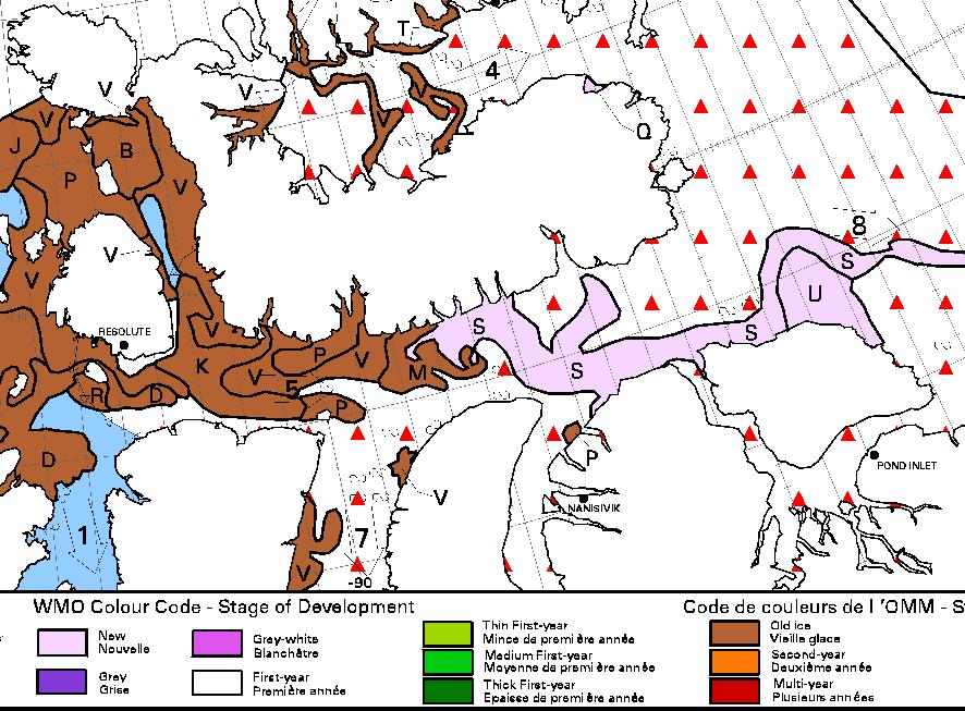
On the latest CIS “stage of development” chart the brown “old ice” has turned to deep red “multi-year ice”, and there’s lots more pretty pink out in the Beaufort Sea:
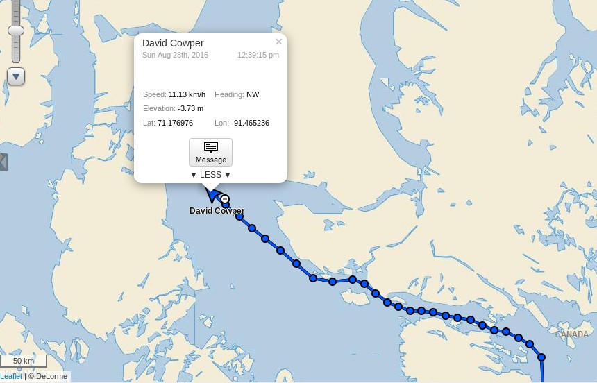
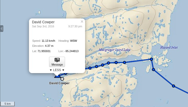
David Scott Cowper in Polar Bound is currently approaching the eastern entrance to Bellot Strait in the heart of the Northwest Passage. There’s nothing unusual in that in this day and age, you may think, but take a look at how he got there:
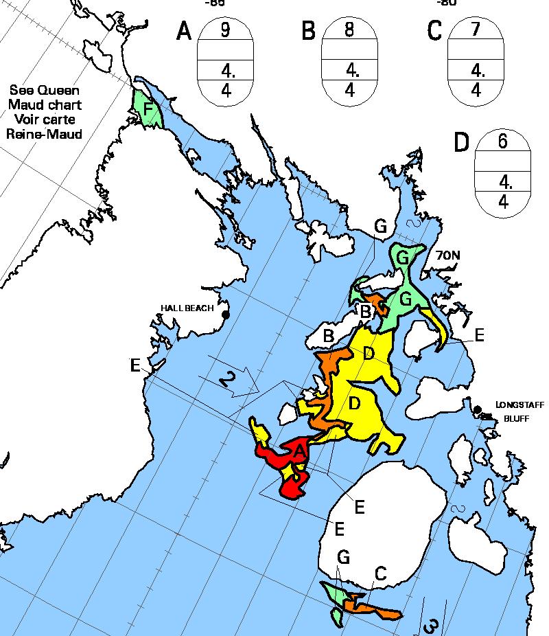
According to the Canadian Ice Service charts Polar Bound will only have needed to negotiate a short stretch of 1-3 tenths concentration sea ice to achieve her latest Northwest Passage “first”:
David Scott Cowper is already mentioned several times in the SPRI list of successful Northwest Passage transits:
1986-89
Mabel E. Holland (12·8 m lifeboat), Britain, David Scott Cowper, West 6, Single-handed voyage, vessel wintered at Fort Ross twice, and at Inuvik
2003-04
Polar Bound (14·6 m motorboat), Britain, David Scott Cowper, East 5, Single-handed voyage, wintered in Cambridge Bay, assisted by CCGS Louis S. St Laurent in Prince Regent Inlet
2009
Polar Bound (14·6 m motorboat), Britain, David Scott Cowper, West 5, Single-handed voyage
2011
PolarBound (14·6 m motorboat), Britain, David Scott Cowper, East 3
2012
PolarBound (14·6 m motorboat), Britain, David Scott Cowper, West 1
2013
PolarBound (14·6 m motorboat), Britain, David Scott Cowper, East 5, Traversed Pond Inlet
It looks as though there will be another addition real soon now, but for the moment note in particular the entry for 2012. Route 1 is the northernmost of the potential paths through the Northwest Passage and involves negotiating the usually ice bound McClure Strait. Polar Bound was the first ever small vessel to do so! At the moment it looks like that will be a difficult feat to repeat this year. Whilst many of the assorted channels through the Northwest Passage melted out early this year the recent recurring cyclones have ensured that McClure Strait remains firmly blocked:
[Edit – September 3rd]
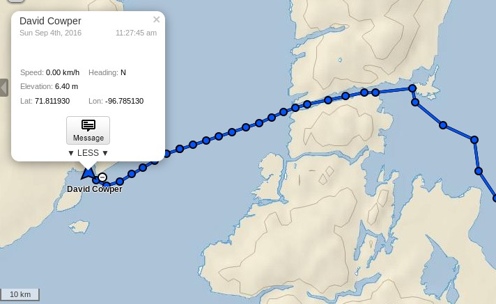
Polar Bound has just emerged from the western end of Bellot Strait:
The $64,000 question is where is she headed next?
[Edit – September 4th]
The short term answer is a sheltered spot between Hobday Island and Prince of Wales Island:
[Edit – September 7th]
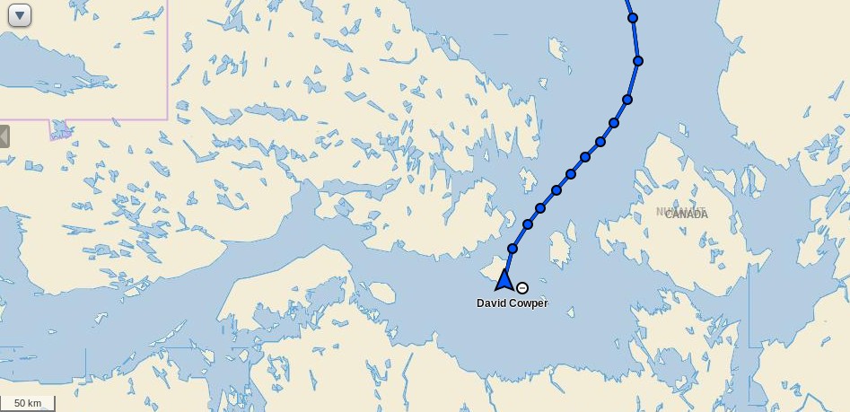
Polar Bound is taking the most obvious exit from the Canadian Arctic Archipelago, and is currently heading for Coronation Gulf via Dease Strait:
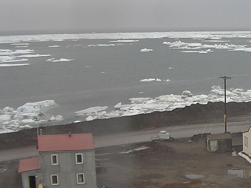
David Scott Cowper is currently approaching Barrow in Polar Bound, but the weather forecast is more than a bit blustery. According to today’s National Weather Service forecast, here’s what he should expect:
POINT FRANKLIN TO CAPE HALKETT-
405 AM AKDT SAT SEP 17 2016
…SMALL CRAFT ADVISORY IN EFFECT FROM LATE THIS MORNING THROUGH
EARLY SUNDAY MORNING…
TODAY
SW WINDS 25 KT. SEAS BUILDING TO 5 FT. SNOW AND RAIN.
TONIGHT
W WINDS 30 KT. SEAS 9 FT. FREEZING SPRAY.
SUN
W WINDS 30 KT. SEAS 10 FT. FREEZING SPRAY.
SUN NIGHT
W WINDS 30 KT. SEAS 11 FT.
Let’s hope Polar Bound finds some shelter before the worst of it arrives on Sunday night.
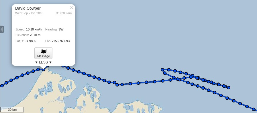
[Edit – September 21st]
It seems Polar Bound didn’t find shelter, and instead reversed course during the worst of the storm:
However, as you can see, she has now passed Point Barrow and is Heading south towards the Arctic Circle via the Bering Strait:
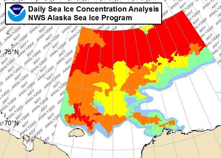
Can you spot the yellow needle in the icy haystack? There is currently much “debate” in the cryodeinialosphere to the effect that Northabout nearly became “trapped by ice”, so let’s also take a quick look at the National Weather Service ice chart covering Barrow shall we?
It seems Polar Bound somehow managed to wend her way through 7-8/10 concentration sea ice, does it not?
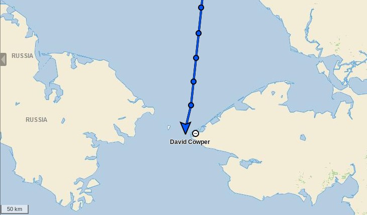
[Edit – September 24th]
Polar Bound has now crossed the Arctic Circle and is heading south through the Bering Strait:
David Scott Cowper has therefore now “officially” completed his record breaking route West 7 transit of the Northwest Passage.
Very well done sir, and bon voyage!
This website uses cookies to improve your experience. We'll assume you're ok with this, but you can opt-out if you wish. Cookie settingsACCEPT
Privacy & Cookies Policy
Privacy Overview
This website uses cookies to improve your experience while you navigate through the website. Out of these, the cookies that are categorized as necessary are stored on your browser as they are essential for the working of basic functionalities of the website. We also use third-party cookies that help us analyze and understand how you use this website. These cookies will be stored in your browser only with your consent. You also have the option to opt-out of these cookies. But opting out of some of these cookies may affect your browsing experience.
Necessary cookies are absolutely essential for the website to function properly. This category only includes cookies that ensures basic functionalities and security features of the website. These cookies do not store any personal information.
Any cookies that may not be particularly necessary for the website to function and is used specifically to collect user personal data via analytics, ads, other embedded contents are termed as non-necessary cookies. It is mandatory to procure user consent prior to running these cookies on your website.