The JAXA extent graph is currently not updating, so let’s begin this month with the latest AMSR2 sea ice concentration map from the Alfred Wegener Institute. Click the image to see a ~10 Mb animation of the last four weeks:
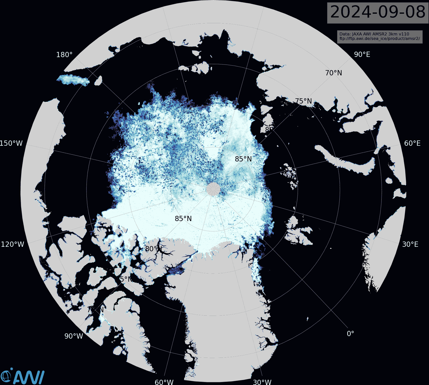
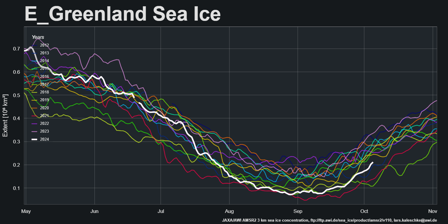
Note in particular the restart of export into the East Greenland Sea via the Fram Strait:
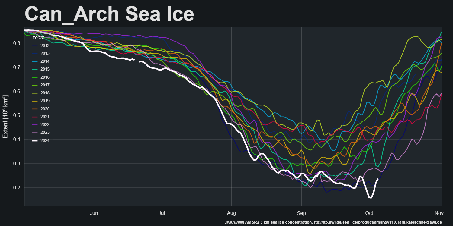
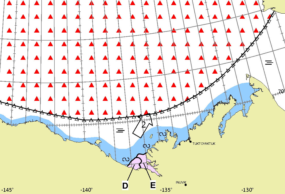
and the movement of ice within the Canadian Arctic Archipelago:
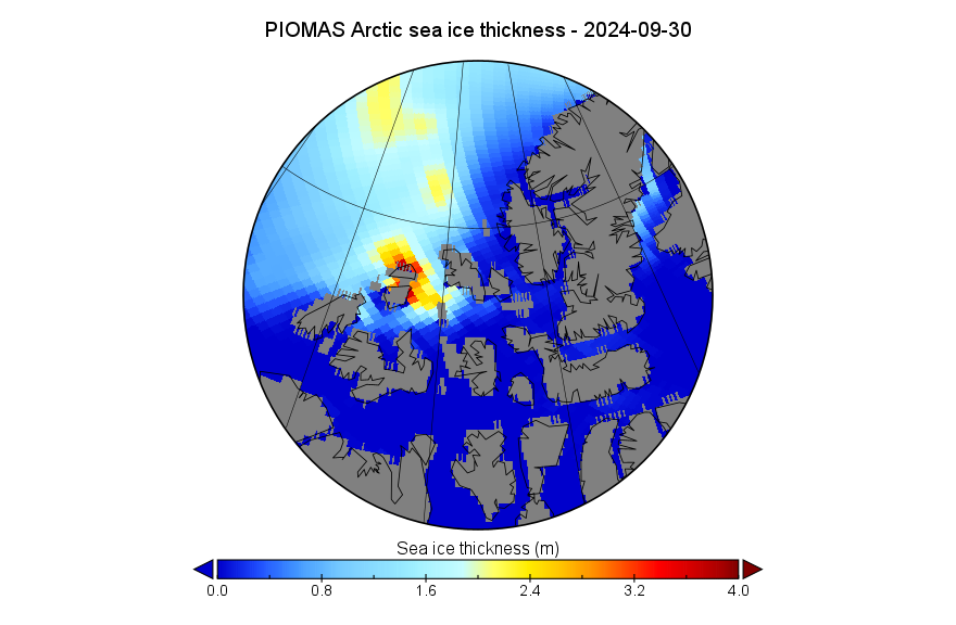
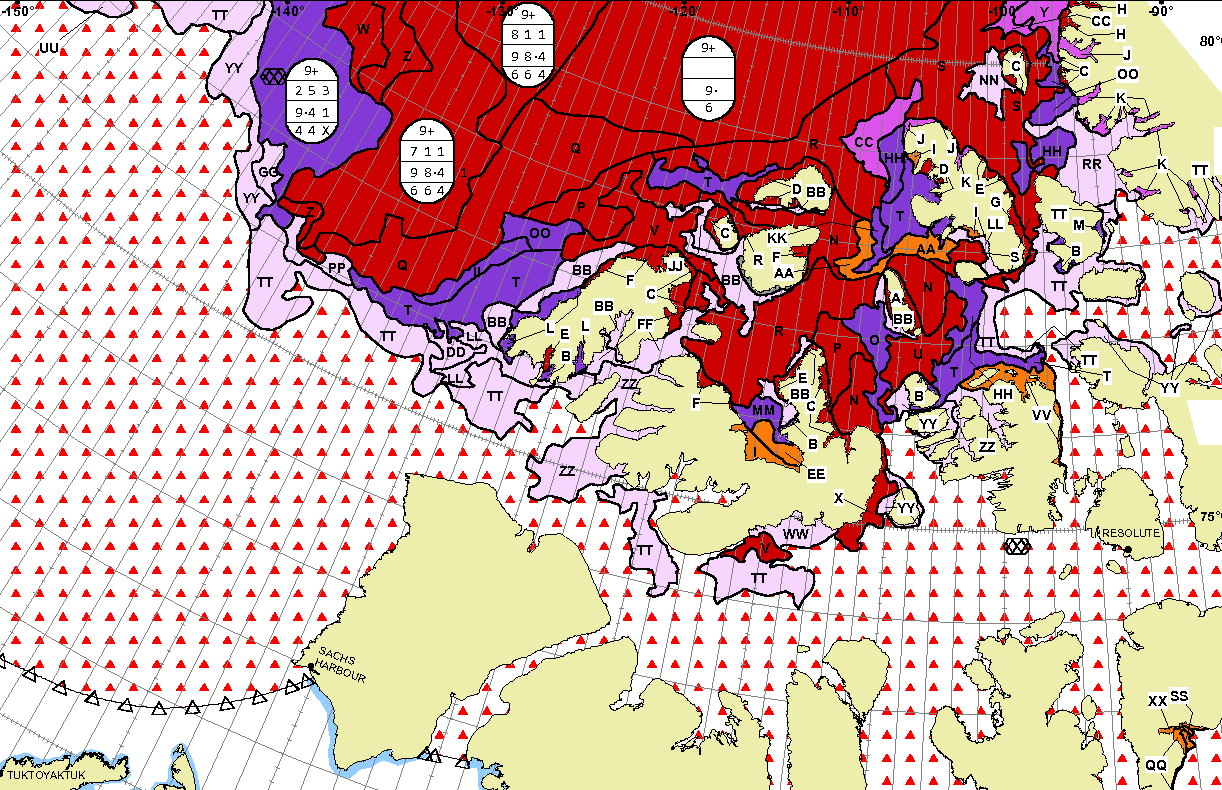
The PIOMAS gridded thickness data for September 2024 has been released:
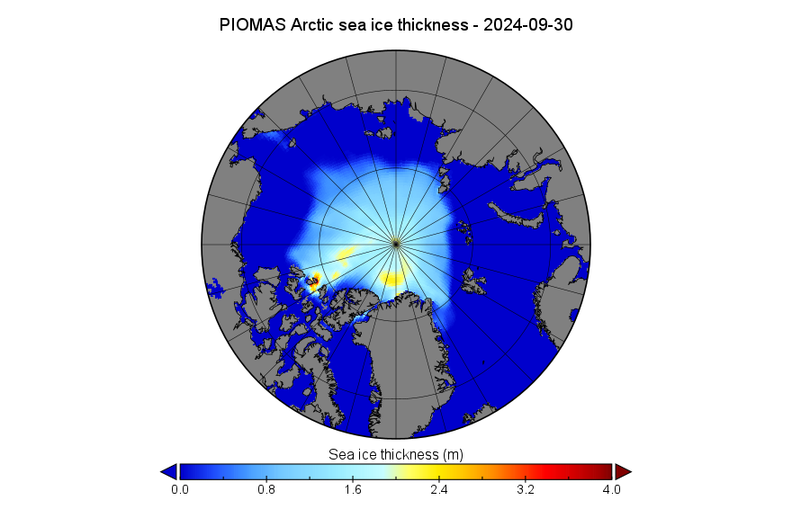
Note that there is only one small area remaining with ice over 3 meters thick. Zooming in on the CAA, and comparing with last month, it can be seen that what little remains of the thickest ice has been moved by recent winds west across the the Prince Gustaf Adolf Sea:
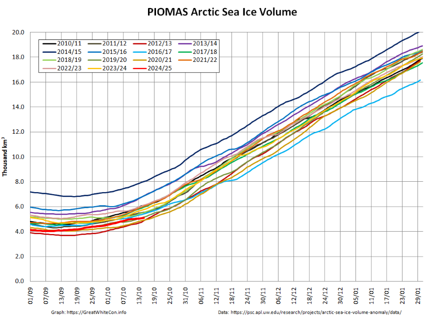
Plus (somewhat belatedly) the accompanying volume graph:
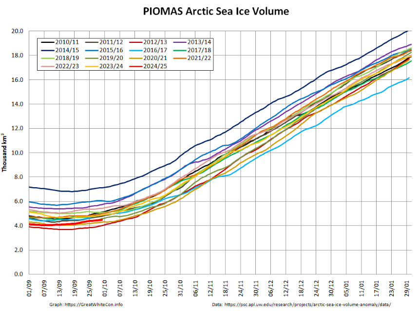
At the end of September PIOMAS volume was 4.50 thousand km³, 3rd lowest for the date (in the satellite era).
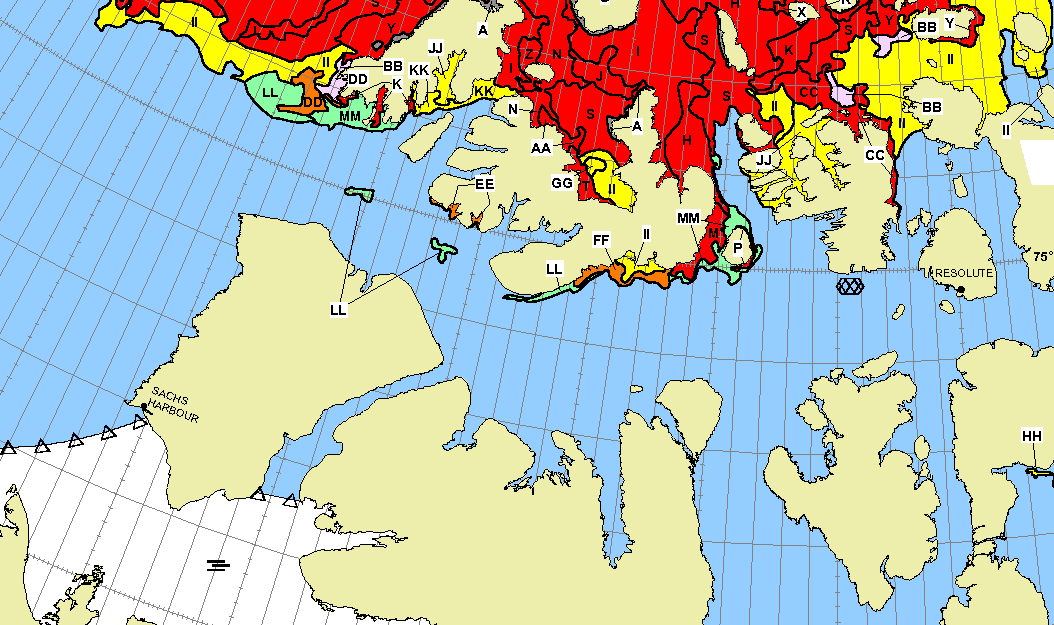
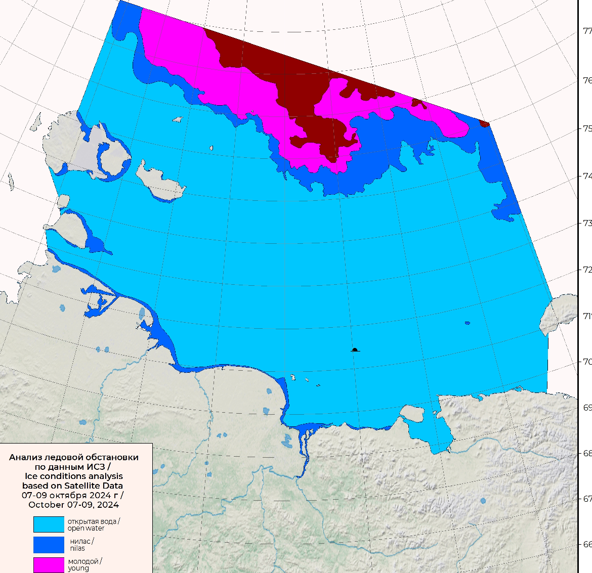
The most recent weekly chart from the Canadian Ice Service reveals that the Parry Channel remains almost entirely free of sea ice:
On September 29th the Northern Sea Route General Administration announced that:
The ice situation in the waters of the Northern Sea Route this year is characterized by the early onset of ice formation due to the large amount of residual ice, especially in the eastern sector of the Arctic ( the Laptev Sea, the East Siberian Sea, the Chukchi Sea). For this reason, the end of summer-autumn navigation in areas 12-28 of the NSR water area will be due to earlier ship release dates from the NSR water area for the following types:
For vessels without an ice class, the sailing period is until 10/15/2024;
For all vessels with Ice1-Ice3 ice class, the sailing period is until 10/20/2024;
For vessels with bulbous and ice class Arc4-Arc5 until 10/31/2024.
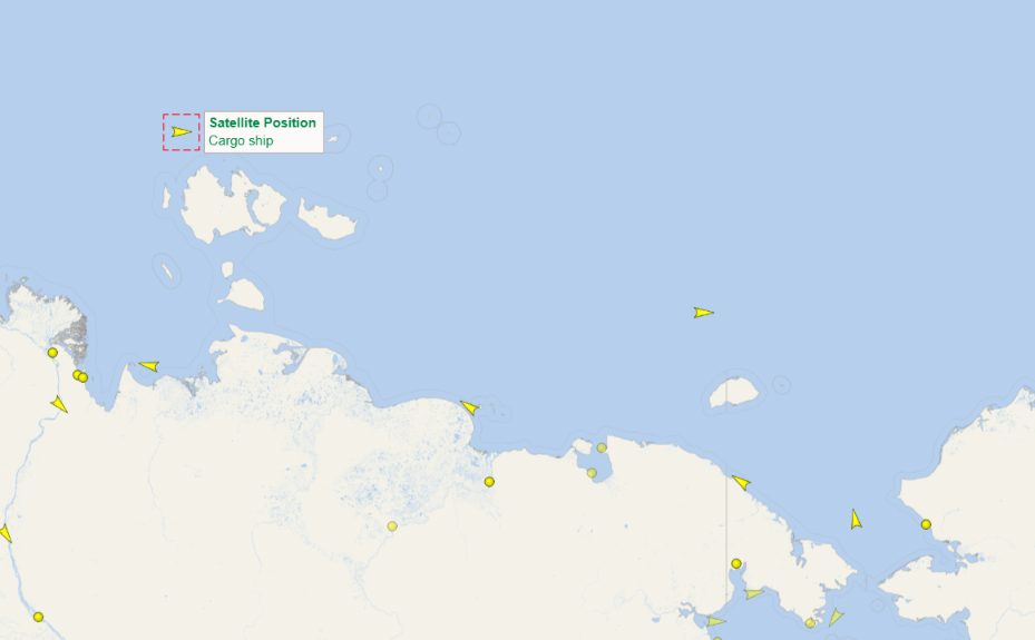
The container ship Hui Da 9, which possesses a non Arctic ice class 1 certification, is currently passing the New Siberian Islands en route to Cape Dezhnev and beyond:
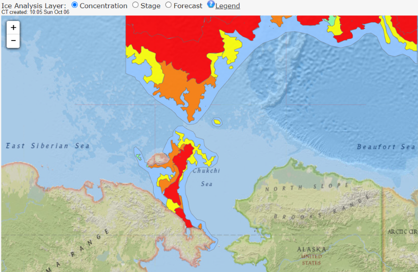
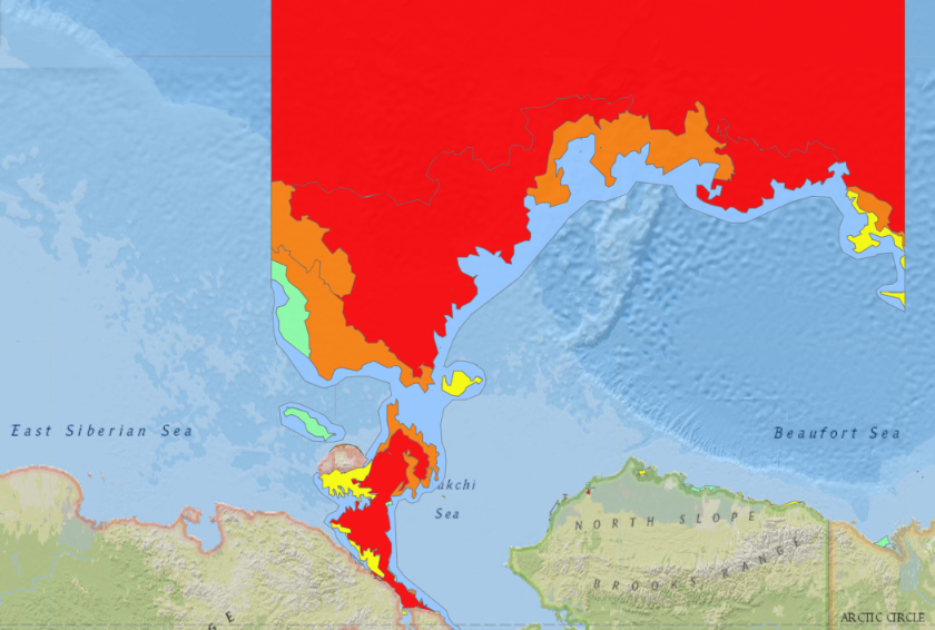
The latest National Weather Service sea ice chart for Alaska shows that the ice free gap between the East Siberian and Chukchi Seas has already shrunk almost to nothing:
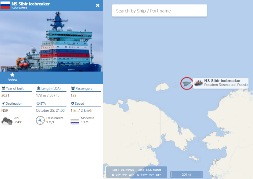
However, help is at hand in the form of the icebreaker Sibir:
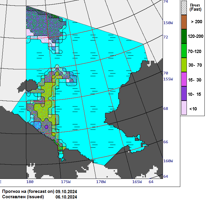
The latest Arctic and Antarctic Research Institute forecast suggests the way will remain clear for a few more days at least, but I await further developments in the region with interest!
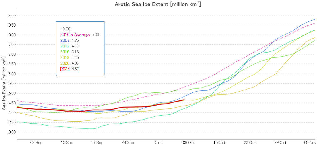
The JAXA extent graph has burst back into life! Currently extent is 4th lowest for the date in the satellite era:
Doing further due diligence on traffic along the Northern Sea Route it seems the non ice hardened bulk carrier Smoke is currently in the Kara Sea, heading for the Vilkitsky Strait en route to Shanghai:

The latest weekly charts from the Canadian Ice Service reveal new ice (coloured pink on the left hand stage of development map) starting to form in the McClure Strait and eastern Beaufort Sea:
The latest CIS daily charts show new ice starting form on the Beaufort Sea coast:
The latest AARI charts show similar developments on the shores of the East Siberian Sea:
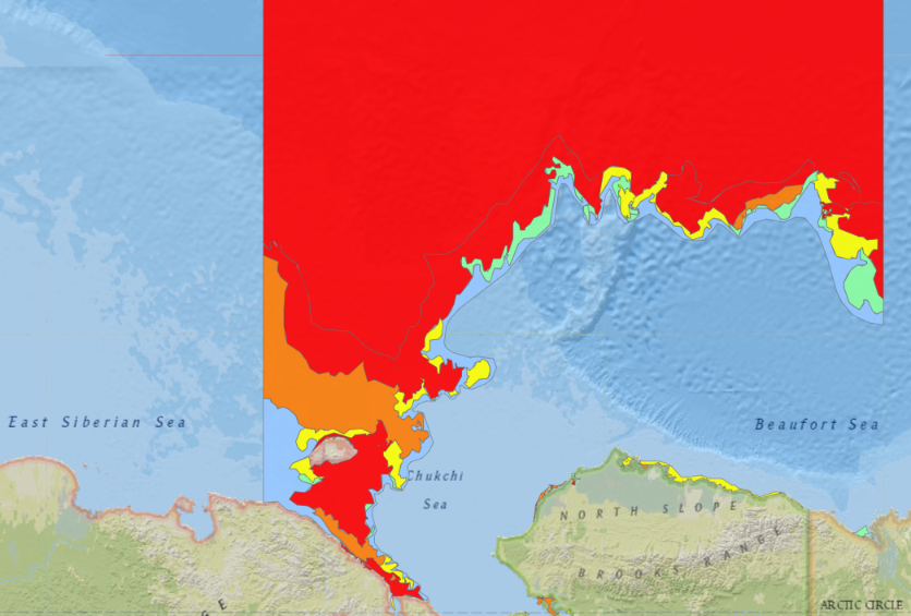
Meanwhile Hui Da 9 has made it safely through the shrinking gap of navigable water into the Chukchi Sea, which is now occupied by 1/10 concentration of new ice:
Smoke has reached the western East Siberian Sea
[Update – October 15th]The Arctic sea ice age map for the end of the 2024 melting season has finally been released:
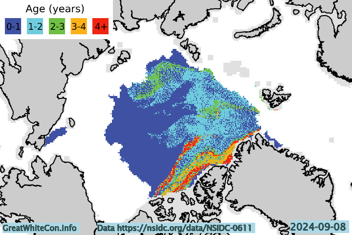
The arm of older ice in the northern Beaufort Sea has melted away, leaving the Pacific side of the Central Arctic with only first year ice remaining.
The exit from the East Siberian Sea into the Chukchi Sea is now full of new ice:
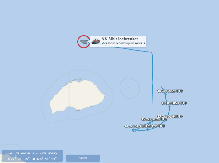
Smoke made it through the gap without apparent mishap, but Sibir is now actively icebreaking in the region:
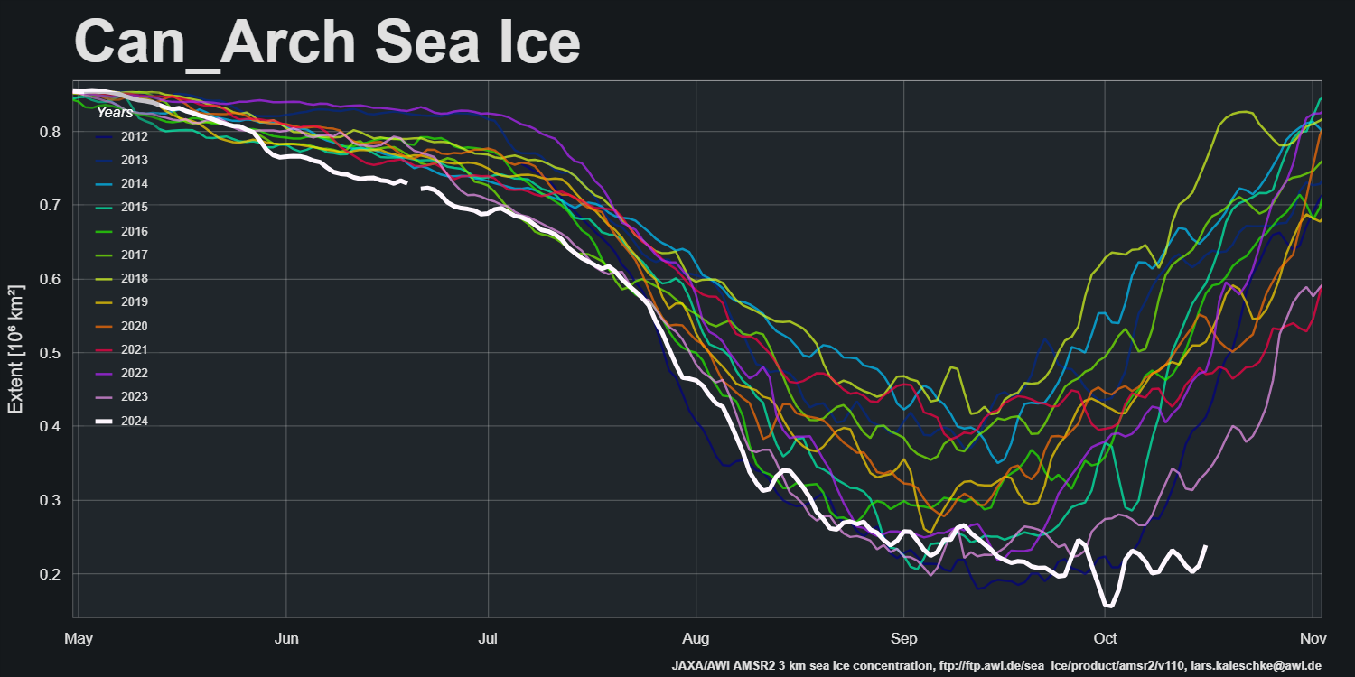
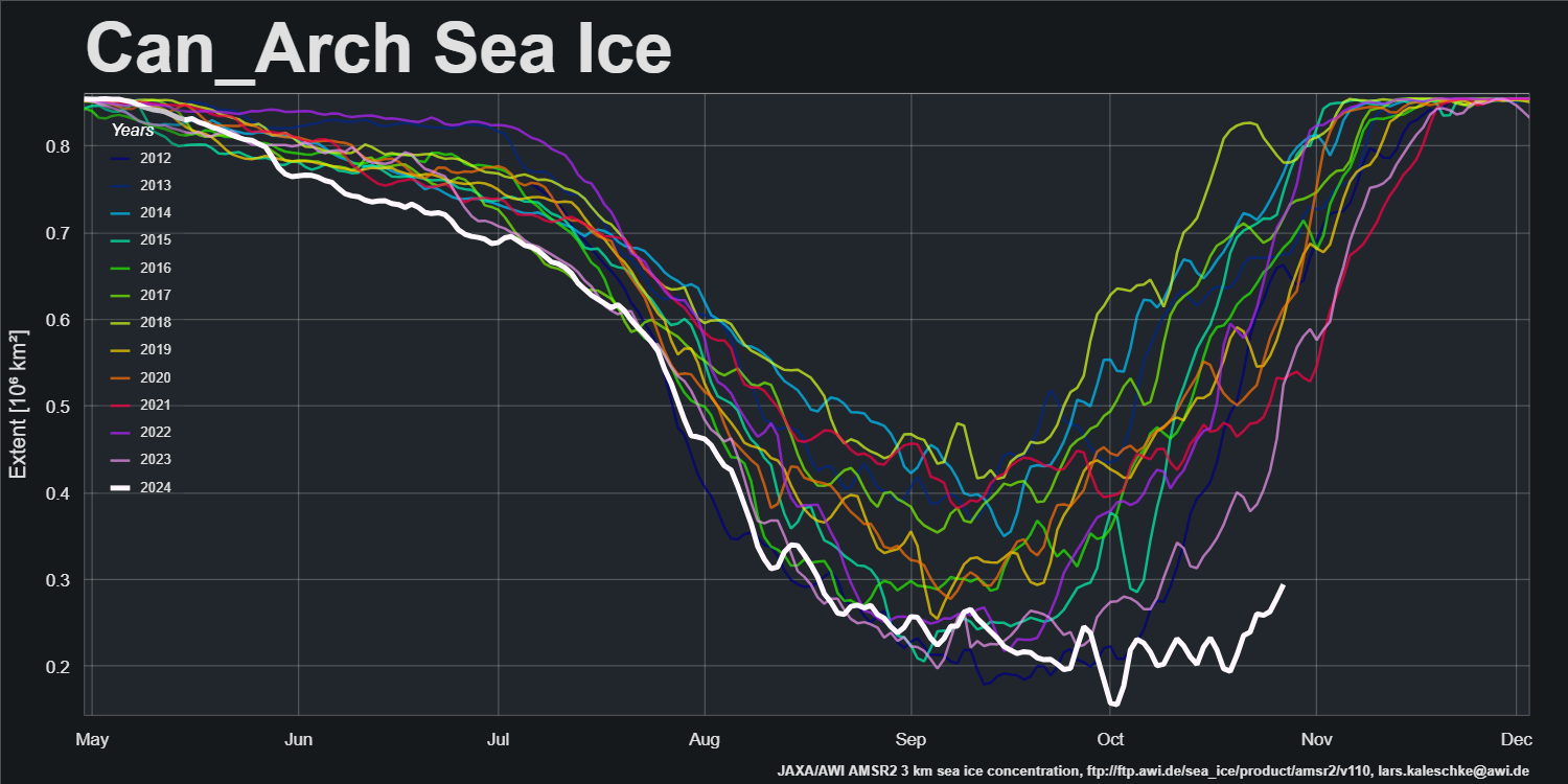
Meanwhile at the other end of the Beaufort Sea, according to AWI’s AMSR2 metric sea ice extent in the Canadian Arctic Archipelago is still lowest for the date by a considerable margin:
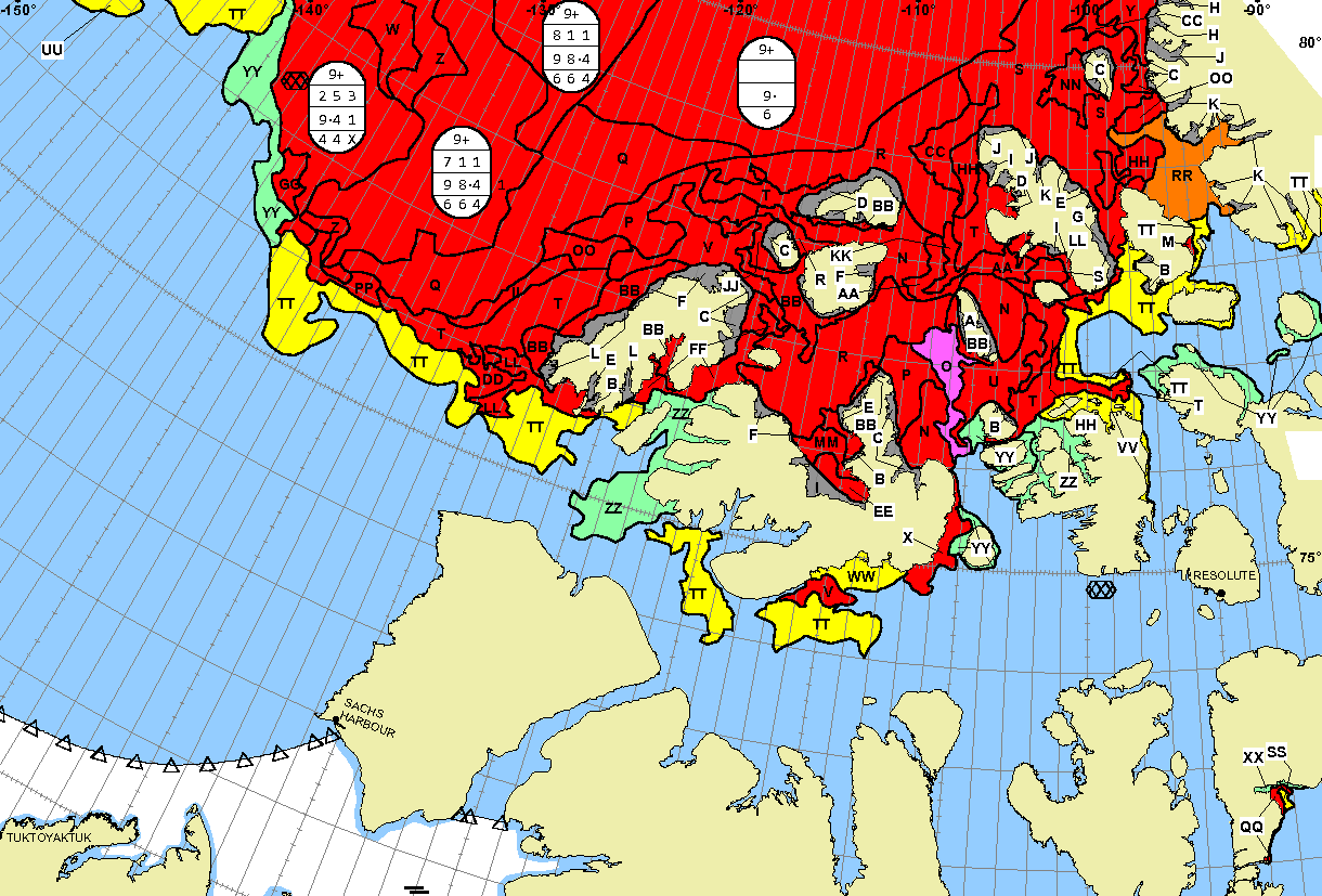
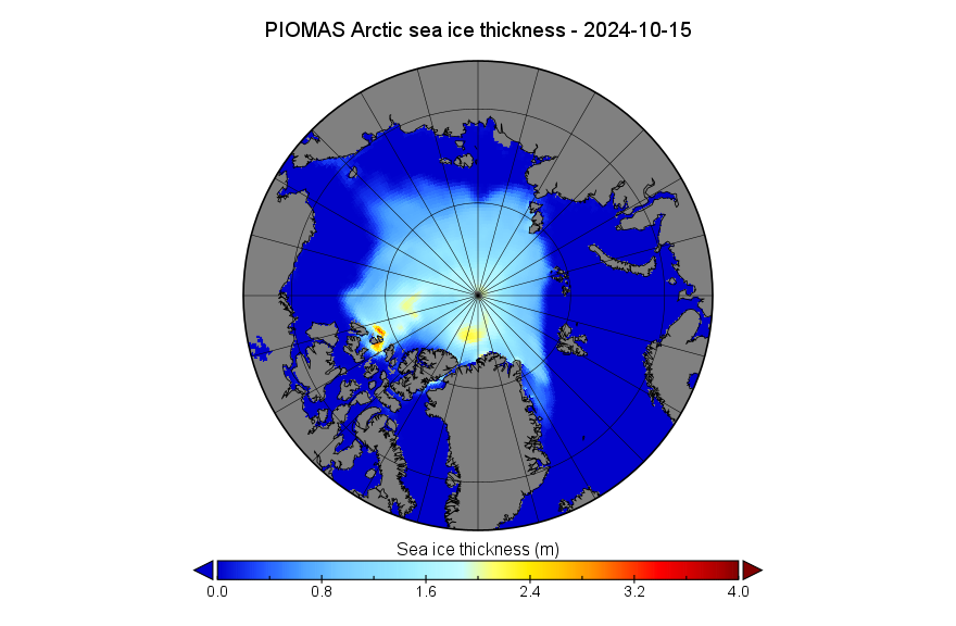
Here’s the mid month PIOMAS gridded thickness map:
On October 15th Arctic sea ice volume had increased to 5.11 thousand km³, once again 3rd lowest for the date in the PIOMAS record:
The Alfred Wegener Institute has been releasing “near real time” CryoSat-2/SMOS merged thickness data for a few days, and here is the resulting Arctic sea ice volume chart:

Note that NRT volume is likely to be revised upwards when the reanalysed data is eventually released. The associated thickness map looks like this for October 25th:

Note the different scale to the PIOMAS maps above. Here too is the latest SMOS/SMAP “thin ice thickness” map:

The refreeze of the Northwest Passage has started at long last:
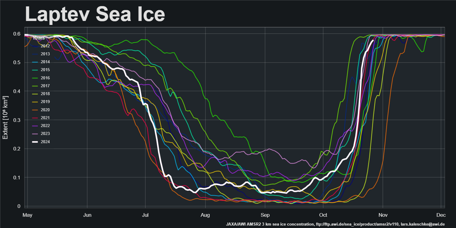
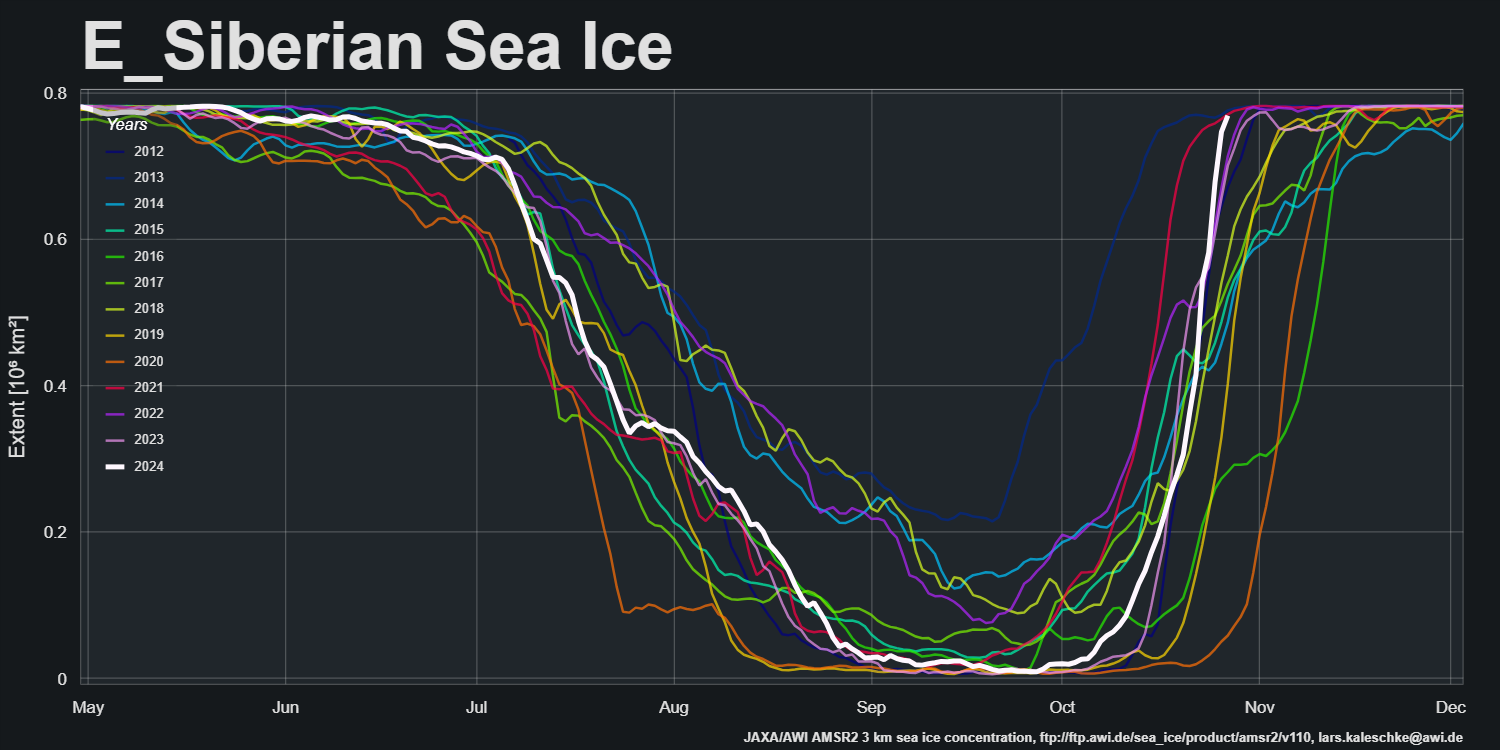
The Laptev and East Siberian Seas are both now almost completely refrozen:
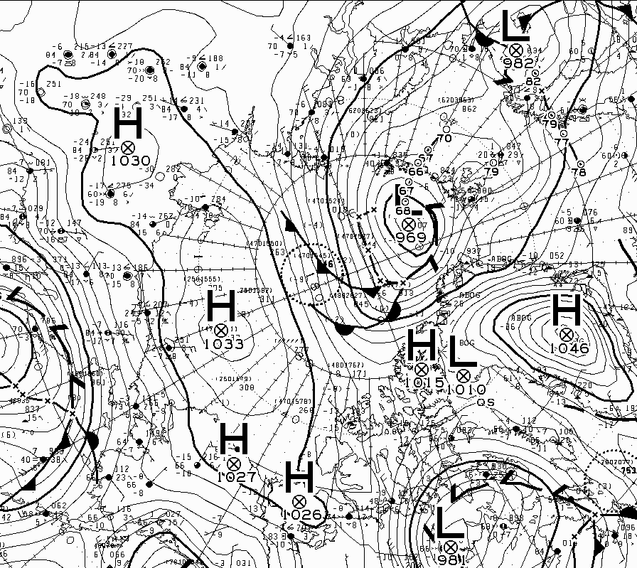
It’s been a long wait, but the first cyclone of the 2024/25 freezing season has entered the Central Arctic Basin. According to the Canadian Meteorological Centre the mean surface level pressure is currently 969 hPa, having bottomed out overnight at 966 hPa, between Svalbard and Franz Josef Land:
The discussion continues over on the November open thread.
is it just me or did the thickness take a real nose-dive from the end of Sept into early October? Northern midwest lower 48 is experiencing a record dry hot September into October – so sounds like that also happened in the Arctic?
thanks,
drew
A drop in thickness at this time of year probably indicates a lot of new thin ice.
Area has been increasing faster than extent due to freezing of sea water between despersed Ice flows at high latitudes
3. All the nonsense about volume age is just a hysterical reaction to the fact that Arctic ice extent stopped shrinking 17 years ago.
8. There are none so blind as those that will not see.
[Excessive repetition redacted – Mod]
At the risk of repeating myself, “Can you spot the difference between 2007 and 2024?”
Wow land was not a net carbon sink in 2023!
https://www.nationalobserver.com/2024/10/18/news/trees-land-co2-nature-carbon-sink
looks like things will be accelerating much faster than expected.
“For the algae-eating zooplankton, melting sea ice is exposing them to more sunlight – a shift scientists say could keep them in the depths for longer, disrupting the vertical migration that stores carbon on the ocean floor.”…
The models tend to show this happening rather slowly over the next 100 years or so,” says Prof Andrew Watson, head of Exeter University’s marine and atmospheric science group. “This might happen a lot quicker,” he says.
So, what explains the CAA?
Global Sea Ice has consistently not been good..so, correlation with that?
Recovery Rate is the best measure of fitness of a system at the end of the day !
There is almost no thick multi-year ice left in the Arctic Ocean north of the CAA. Any ice that filtered down through the channels of the CAA this summer melted out in the Parry Channel, which opened up early this year. It will take a very cold winter in the region to prevent much the same thing happening again next year.
.. although perhaps 2024 is simply an outlier for the CAA given it’s shape over the whole graph in comparison to the shape of others over the whole graph !
DMI temperature north of 80° seems to have flat lined for the month of October!
Sure does:
At the risk of repeating myself:
[Snip – Mod]
Polar bears are now at the highest numbers ever recorded since shooting was stopped 50 years ago and ships still can’t transit the Arctic.
But, never let the facts interfere with your blind faith.
“Polar bears are now at the highest numbers ever recorded since shooting was stopped 50 years ago”
Got any peer reviewed evidence for that assertion Peter?
“Ships still can’t transit the Arctic”.
Numerous ships transited the Arctic this year, via the Northwest Passage and the Northern Sea Route.
What’s more a cruise ship transited the Arctic via the North Pole in September.
“Never let the facts interfere with your blind faith”!