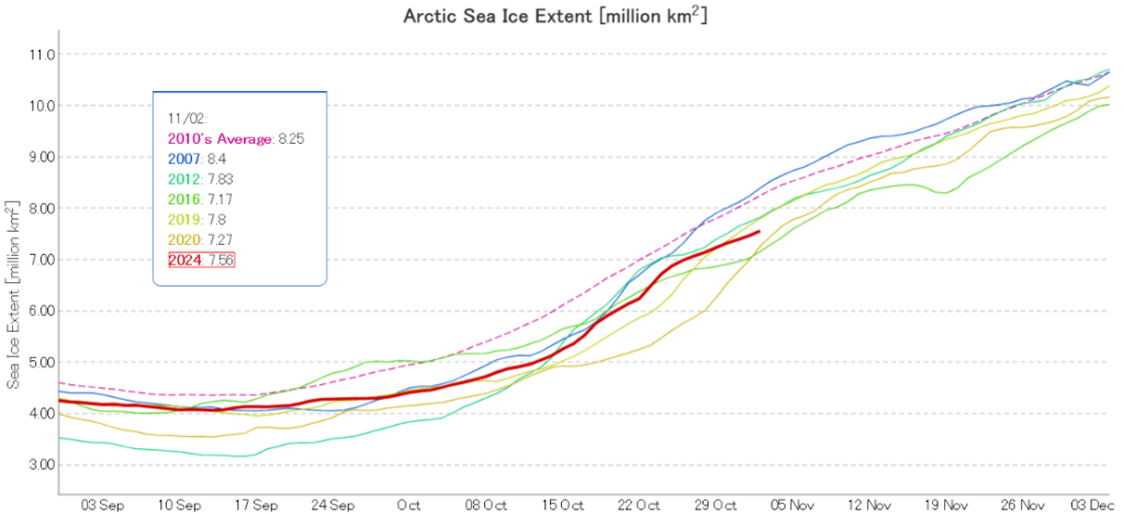
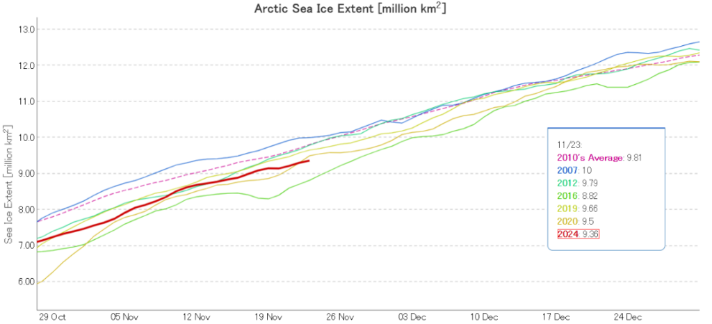
The Laptev and East Siberian Seas have now refrozen. Consequently Arctic sea ice extent is now increasing more slowly, and JAXA/ViSHOP extent is 3rd lowest for the date in the satellite era:
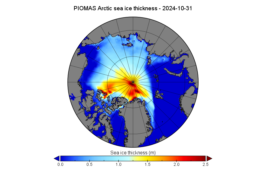
Introducing the third dimension, here’s the PIOMAS gridded thickness data for the end of October 2024:
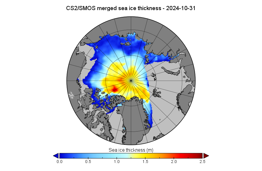
Note the change in scale from previous months, to allow for easier comparison with the “near real time” CryoSat-2/SMOS merged thickness data from the Alfred Wegener Institute:
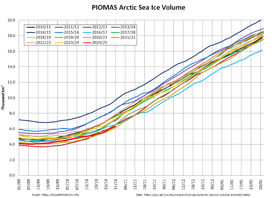
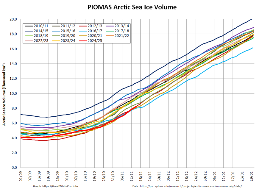
On October 31st Arctic sea ice volume had increased to 6.33 thousand km³, 2nd lowest for the date in the PIOMAS record:
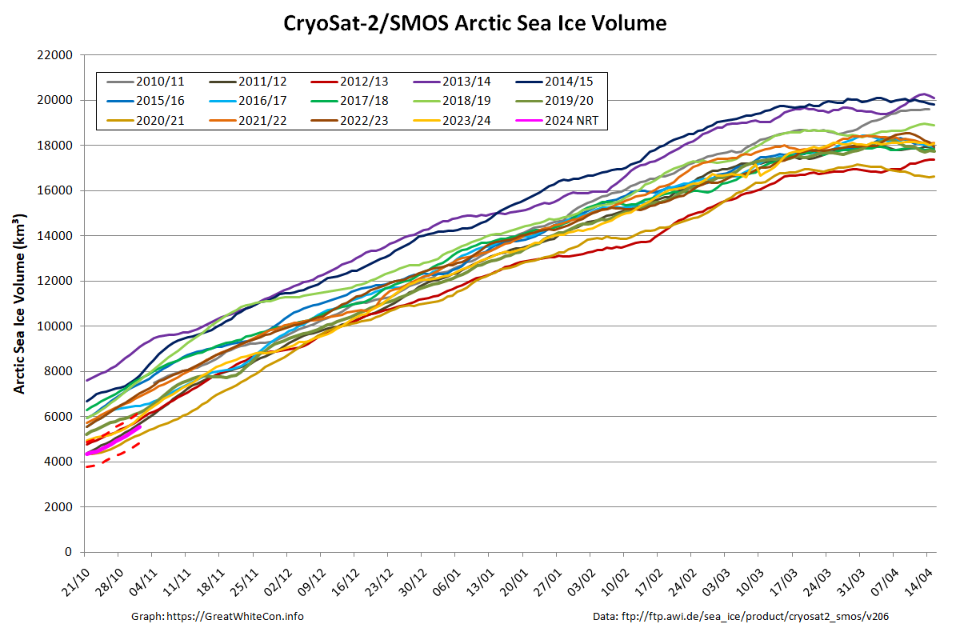
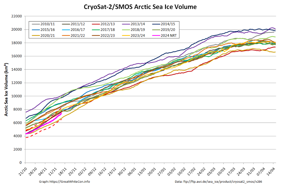
CryoSat-2/SMOS volume is also currently 2nd lowest for the date, although likely to be revised upwards slightly when the reanalysed data is released in a few weeks time:
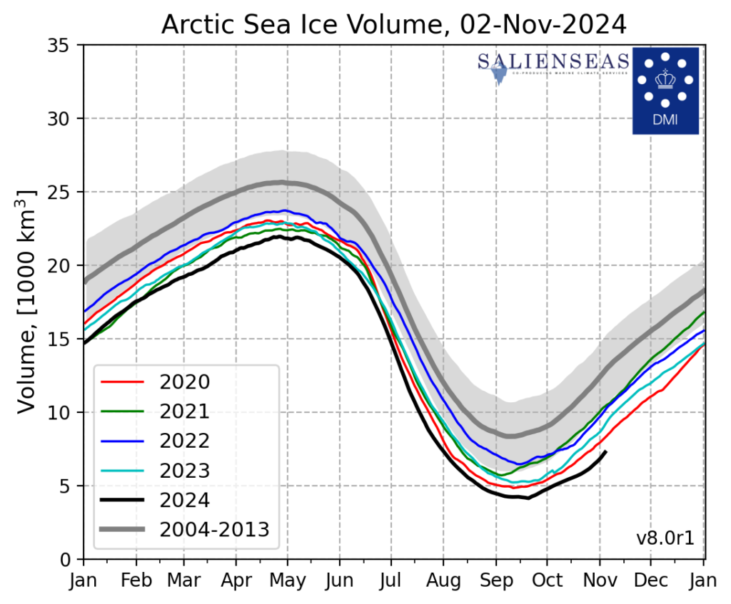
DMI modelled Arctic sea ice volume is still lowest for the date in the satellite era. Here’s the latest daily graph:
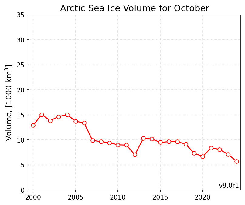
Plus the monthly graph for October:
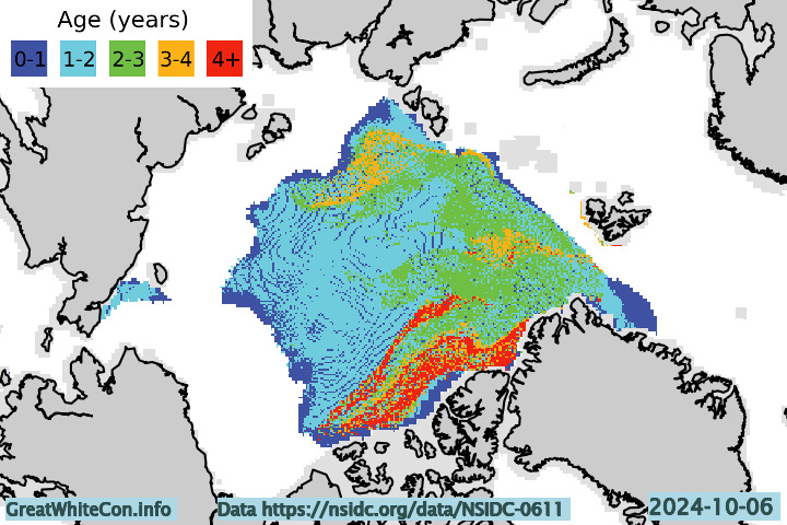
Finally, for the moment at least, here is the map of sea ice age at the beginning of October:
[Update – November 10th]According to the October edition of the National Snow and Ice Data Center’s “Sea Ice Today” analysis:
Average Arctic sea ice extent for the month of October was 5.94 million square kilometers, fourth lowest in the 46-year-satellite record and 610,000 square kilometers higher than 2020, the record low extent for the month. Sea ice extent is particularly low in the Barents and Kara Seas, and in the Beaufort Sea, Baffin Bay, and the Canadian Archipelago. Elsewhere, the extent was near average with the ice reaching the Russian coast everywhere east of the Kara Sea.
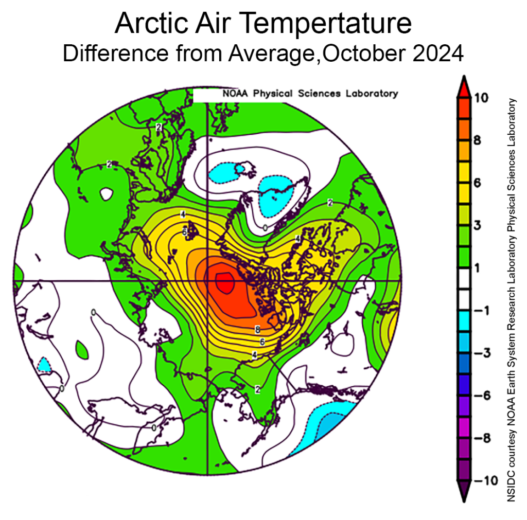
During October, much of the Arctic was markedly warmer than average. Air temperatures at the 925 hPa level (approximately 2,500 feet above the surface) were 6 to 10 to degrees Celsius above average near the pole and north of Greenland and the Canadian Archipelago. Much of the rest of the Arctic was at least 2 degrees Celsius above average, with the exception of the coastal areas of the Chukchi, East Siberian, and Laptev Seas, where average temperatures prevailed.
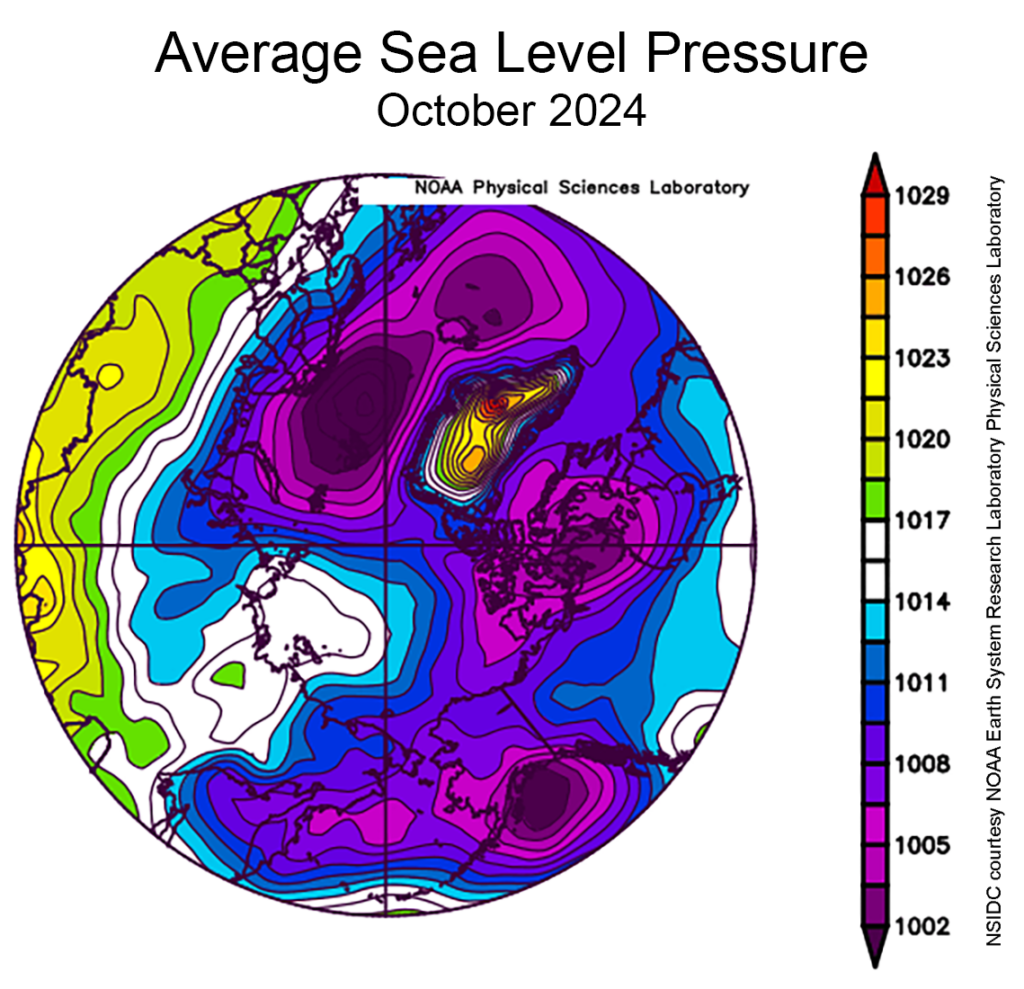
Sea level pressure was low over most of the Arctic during October with distinct lows centered over the Gulf of Alaska, the Canadian Archipelago, and Svalbard. This pressure pattern helped to push ice northwards in the Kara and Barents Seas and bring in warmer air towards the central Arctic Ocean:
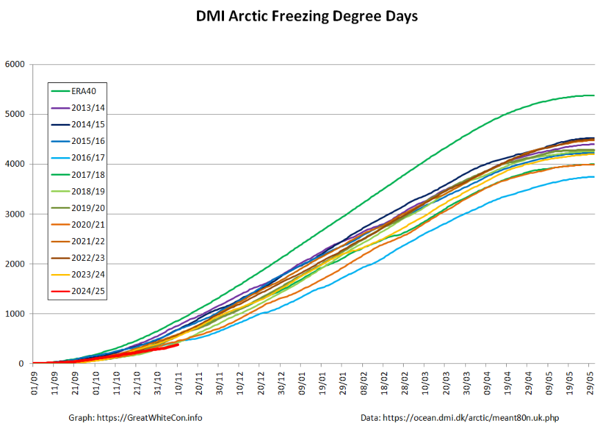
The Danish Meteorological Institute’s high Arctic temperature data confirms the unprecedented warmth north of 80°:
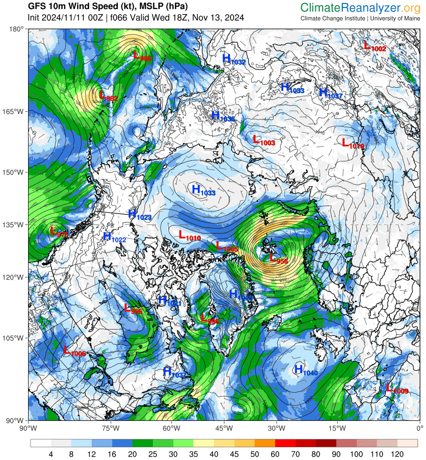
There’s still high pressure over the Central Arctic, but on the Atlantic periphery the latest GFS forecast predicts a cyclone with a minimum mean sea level pressure of 956 hPa over the Fram Strait on Wednesday:
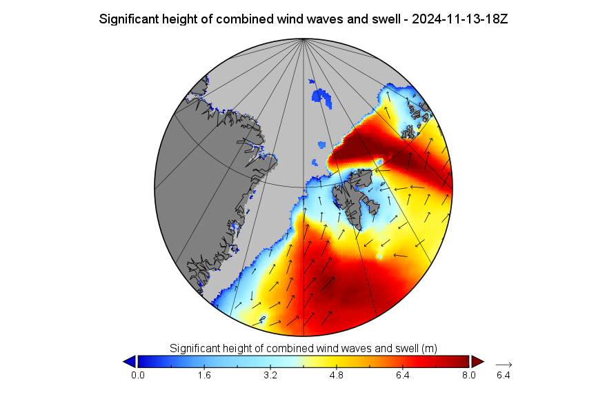
The forecast includes large waves in the Norwegian and Barents Seas, and a long period swell directed at the ice edge in the Fram Strait:
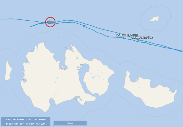
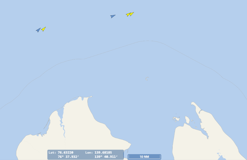
In other news the nuclear powered icebreaker Sibir is passing the New Siberian Islands, leading what is probably the last west bound convoy on the Northern Sea Route this year:

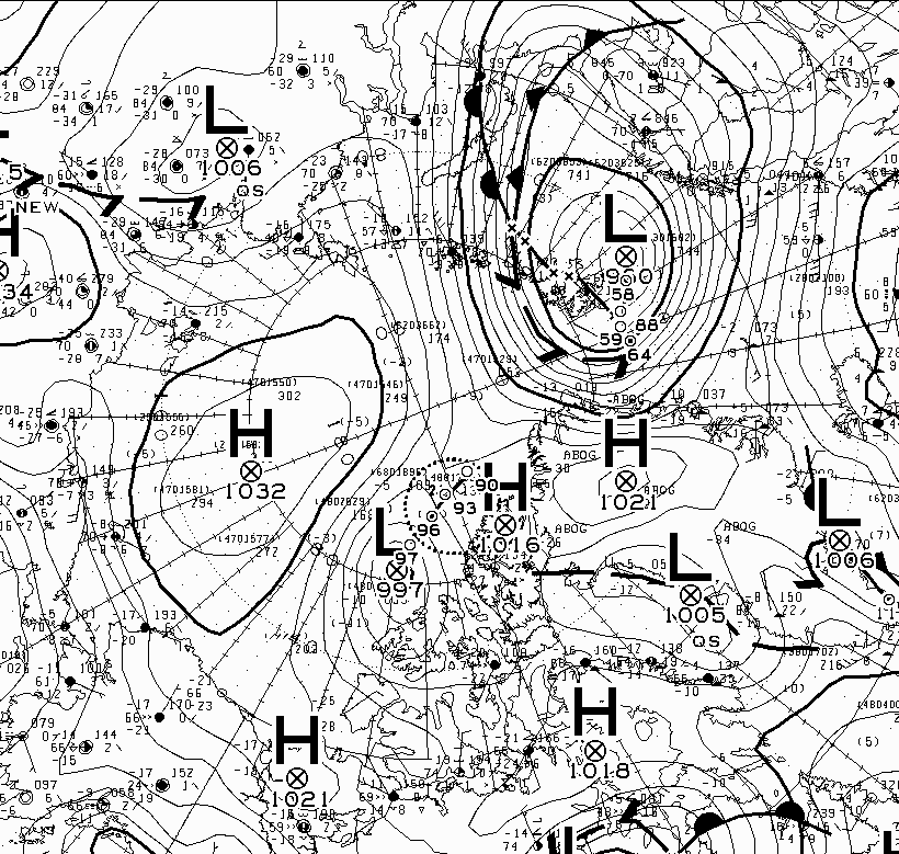
According to the Canadian Meteorological Centre the Fram Strait cyclone bottomed out with a mean surface level pressure of 958 hPa:
In other news, sea ice is now forming at Nome, Alaska:
The National Weather Service chart of sea ice concentration around Alaska shows the coastal freeze up has begun further south too:
[Update – November 18th]The mid month CryoSat-2/SMOS volume is still 2nd lowest for the date, although it looks as though that will change soon:
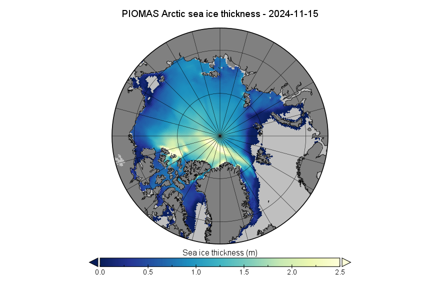
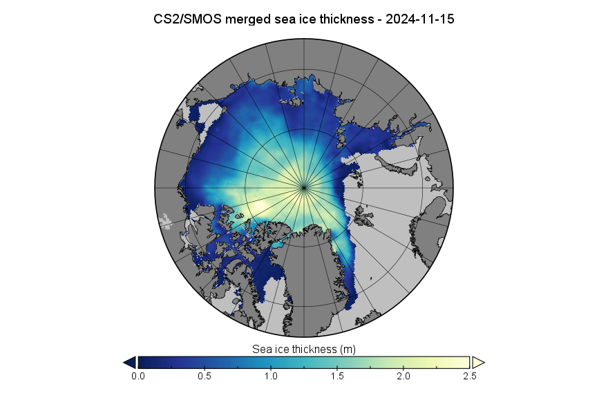
Here’s the associated sea ice thickness map, using an experimental set of colours. Which do you prefer?
The mid month PIOMAS gridded thickness data has just been released. On November 15th Arctic sea ice volume was 8.23 thousand km³, 4th lowest for the date in the PIOMAS record:
Here’s the associated sea ice thickness map. Compare and contrast with the CS2 version above:
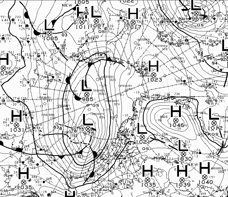
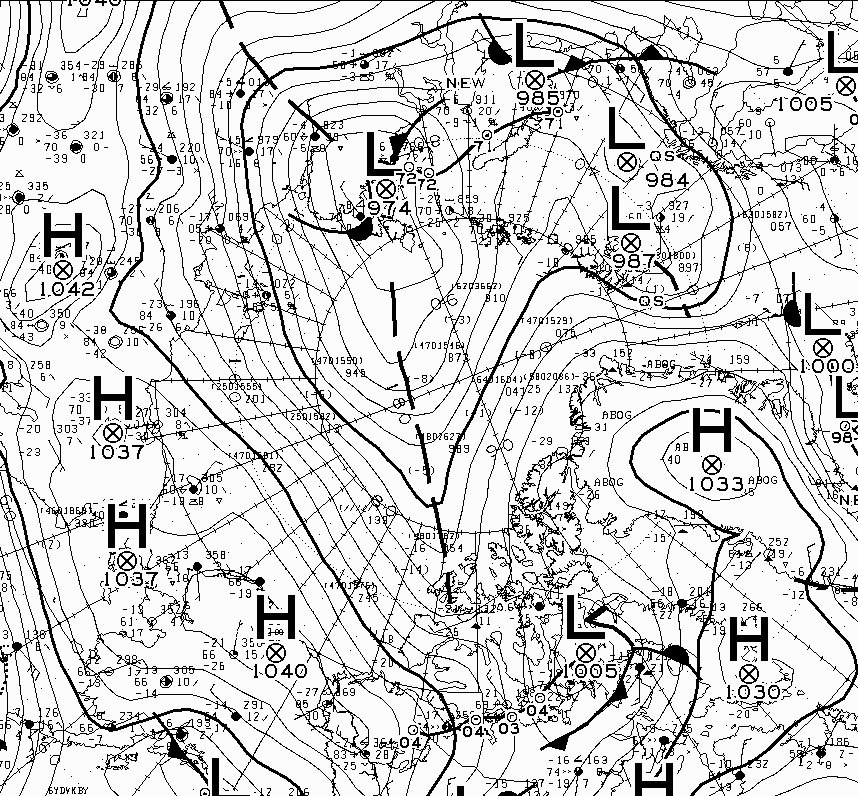
In other news, a significant area of low pressure has finally formed in the central Arctic. According to the CMC it bottomed out with a mean surface level pressure of 975 hPa earlier today:
[Update – November 24th]The refreeze has slowed down over the last few days, and the JAXA extent metric is now second lowest for the date in the record that goes back to 1978:
In other news the Barents Observer reports that:
Three vessels from Russia’s Northern Fleet in early August set out from Kola Bay with course for icy Arctic waters. The two destroyers and an oil tanker sailed more than 11,000 nautical miles across the whole Northern Sea Route before they returned to base about 2,5 months later.
It was the longest and most comprehensive Arctic voyage of the kind ever for the Northern Fleet, Vice-Admiral and Deputy Commander of the Northern Fleet Oleg Golubyev says in an interview to military newspaper Na Strazhe Zapolyarya.
However it seems the voyage was not all plain sailing!
Russia is in the process of building a fleet of naval icebreakers, and two powerful ships are already in operation. But neither the Ilya Muromets or Yevpaty Kolovrat were part of the expedition. Two more ships, the Ivan Papanin and the Nikolay Zubov, are due to be commissioned in 2025 and 2026.
Consequently, the three Northern Fleet vessels sailed without icebreaker support. On one occasion, Golubyev and the ship captains had to contact nuclear icebreaker operator Rosatom for assistance.
The Northern Fleet sailors encountered heavy sea-ice first of all in the Long Strait, the waters between the Wrangel Island and the mainland, and the sheet stretched all the way to the Bering Strait.
“In order not to subject ourselves to additional danger in the fragmented sea-ice during night time, we this year applied a new approach – to lay adrift until the next day,” Golubyev explains.
“Then, with the help of sea-ice reconnaissance, we could identify a safe route and follow it.”
The sailors had two helicopters at their disposal and these were actively applied for the ice reconnaissance.
“Reconnaissance was conducted twice every day, in the morning and before sunset. Afterwards, when it become absolutely dark and dangerous to sail in the sea-ice, we simply lay adrift,” he says.
Although major parts of the waters along the Northern Sea Route have been mapped, there are still areas that need further survey. The processes connected with formation and melting of sea-ice are affecting also the water depths, Golubyev explains.
“The difference in depths can be up to three meters from what is displayed on the map,” he says.
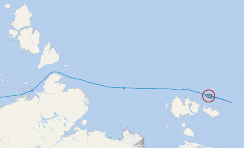
In more recent news from the Northern Sea Route, Sibir has recently taken over the lead of another westbound convoy of cargo vessels from Yamal, and is now retracing its path back to the Vilkitsky Strait:
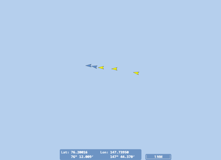
The convoy consists of the research vessel Petr Kottsov plus the merchant ships Mys Zhelaniya, Severniy Proyect and Yuriy Arshenevskiy.
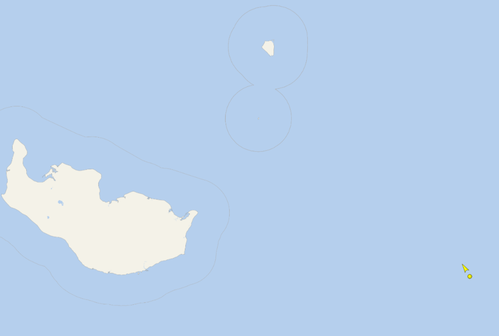
[Update – November 25th]The NSR convoy appears to have encountered a problem. All 5 ships are currently retracing their steps in an easterly direction:
Another cyclone has reached the Central Arctic! This one had started filling in over in the Kara Sea, before threading the eye of the Vilkitsky Strait needle at an MSLP of 974 hPa:
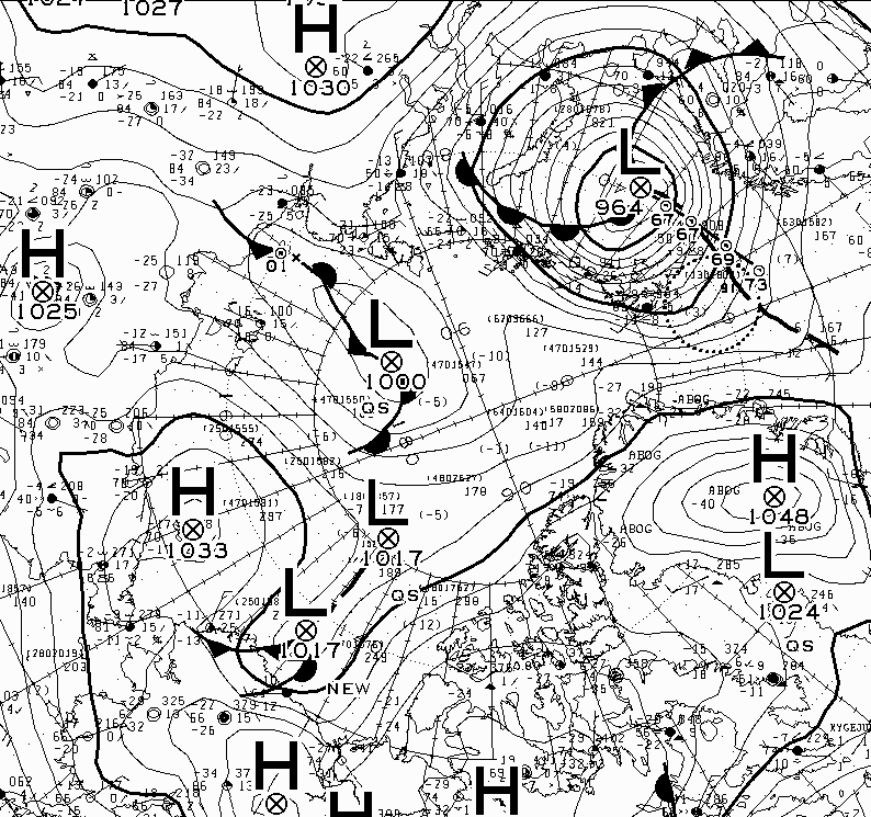
The cyclones are coming quick and fast at the moment! Another one bottomed out in the Barents Sea at 964 hPa overnight:
The discussion continues over on the December open thread.
