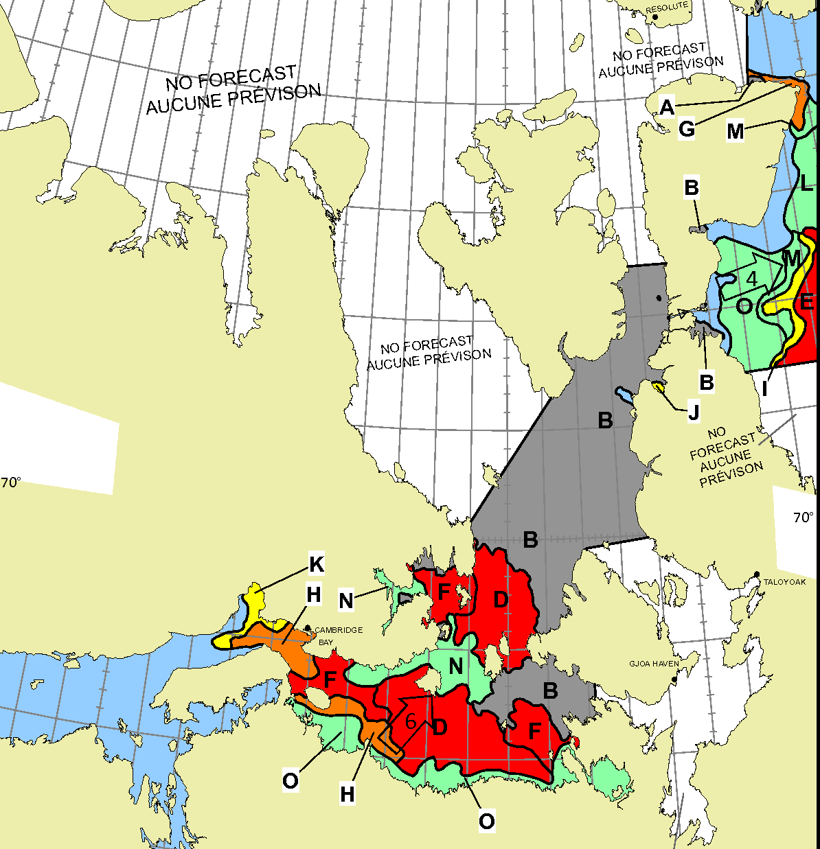
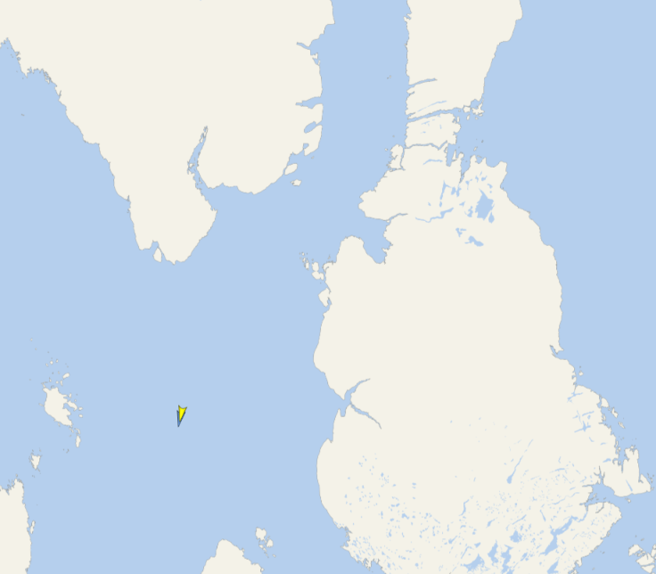
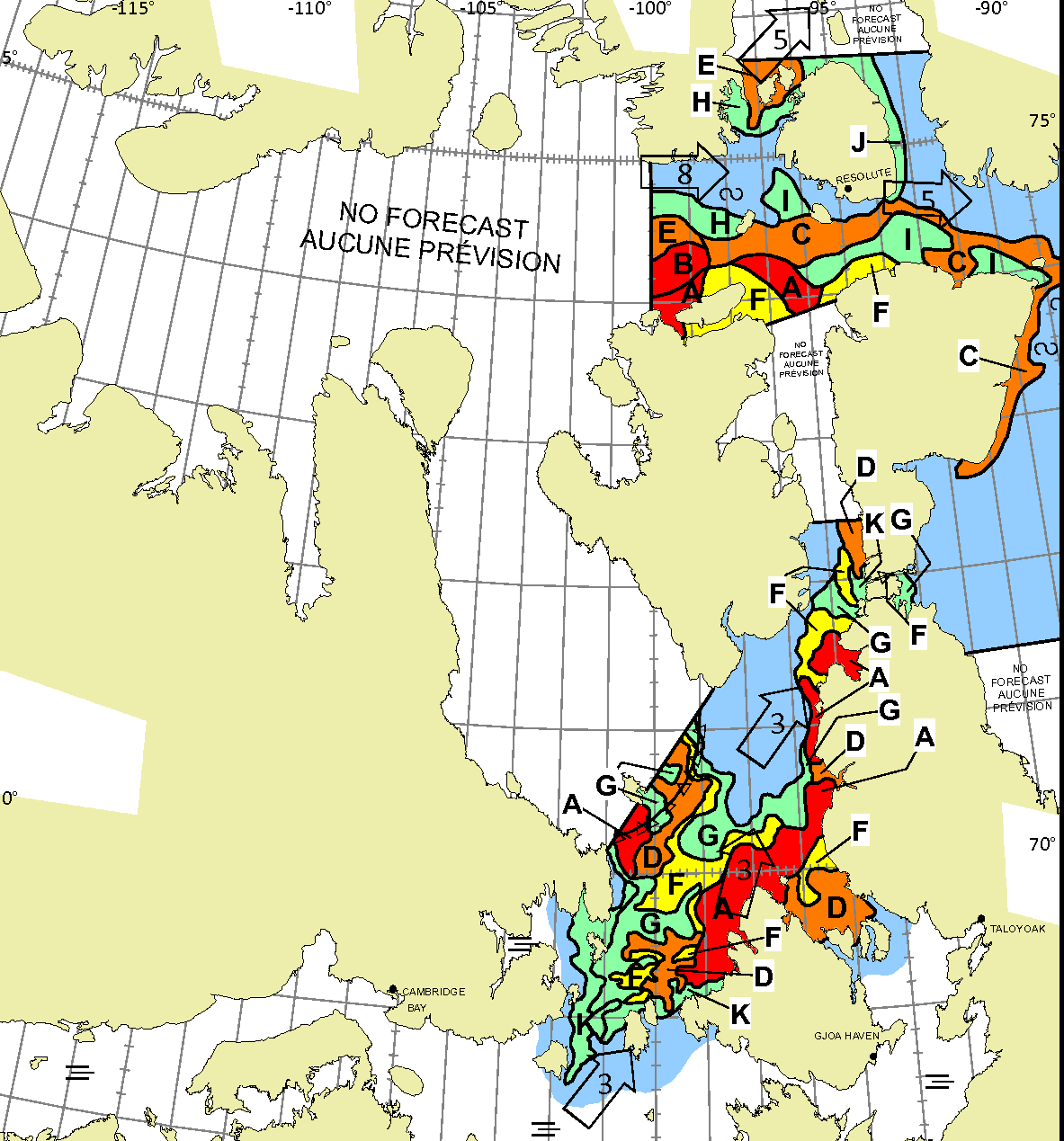
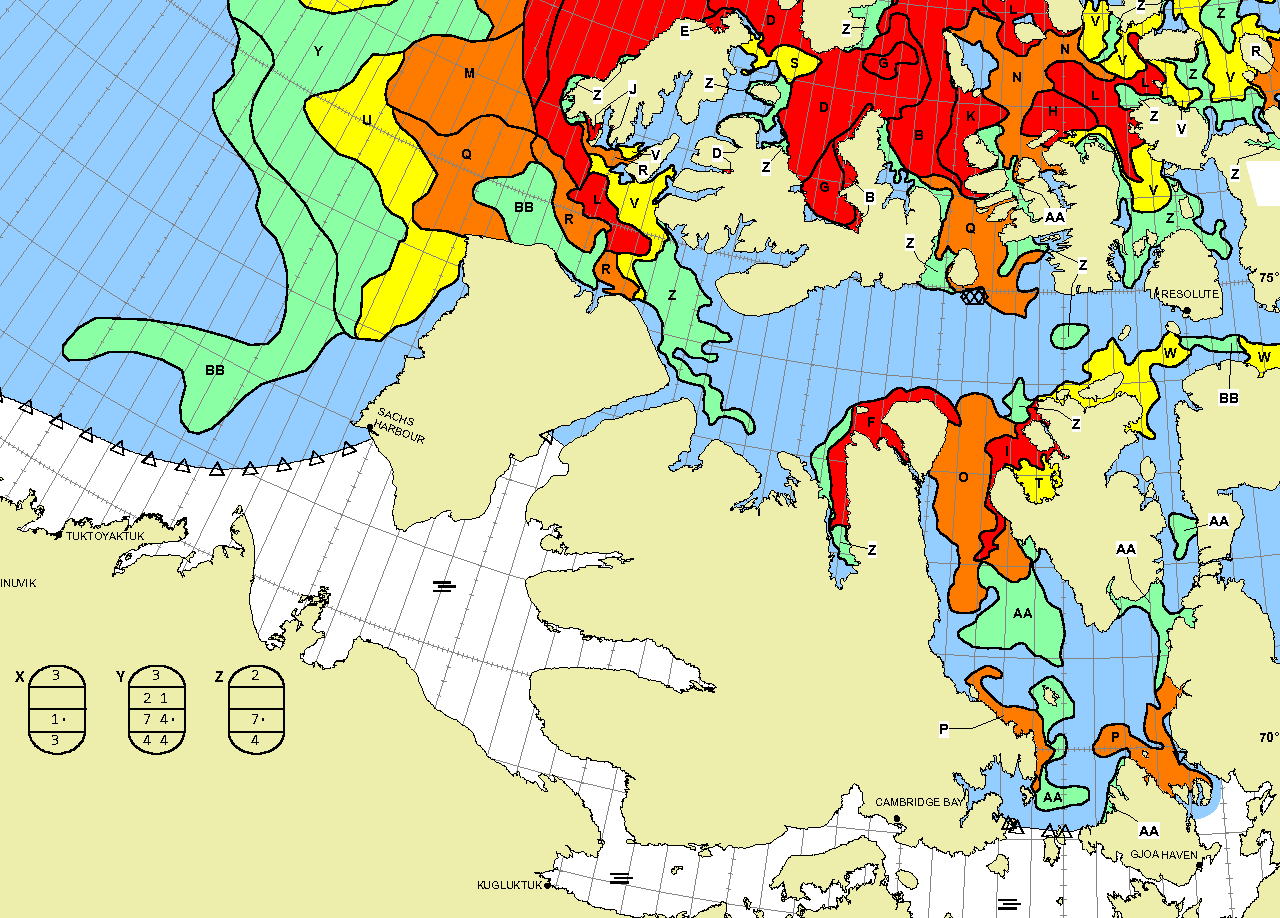
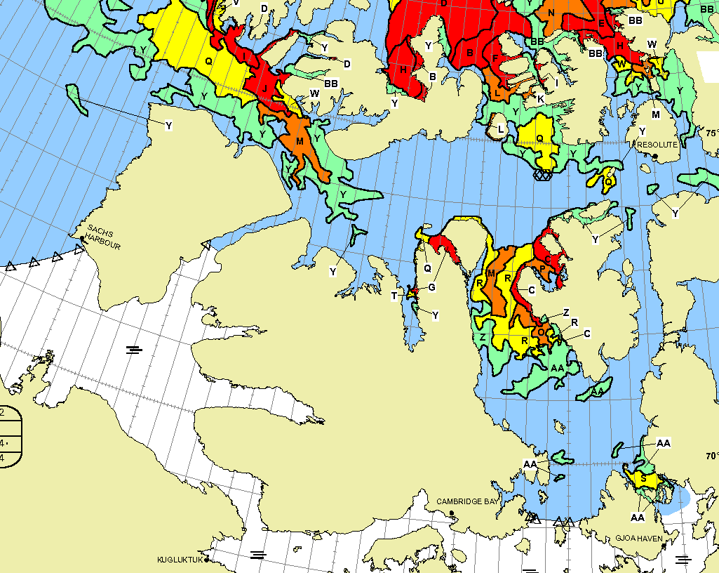
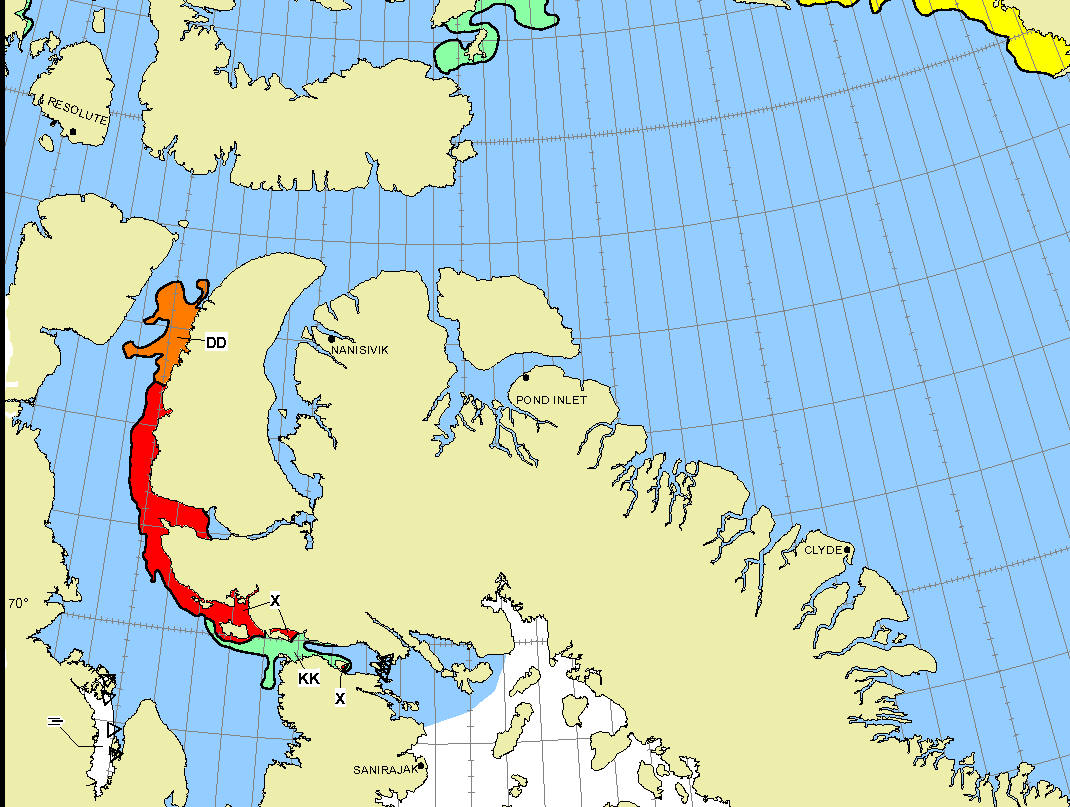
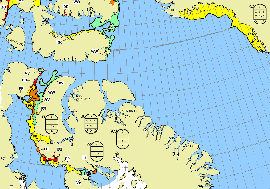
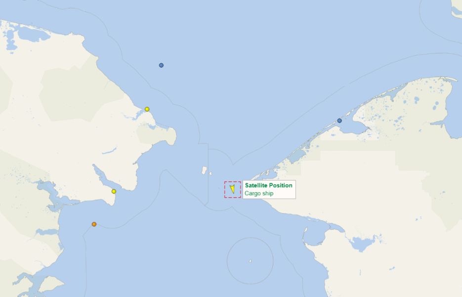
Some “pleasure craft” are currently heading up the west coast of Greenland en route to the Bering Strait via Lancaster Sound and one of the assorted routes through the Canadian Arctic Archipelago. For those of you unfamiliar with the geography of the Northwest Passage, here are couple of hopefully helpful maps:


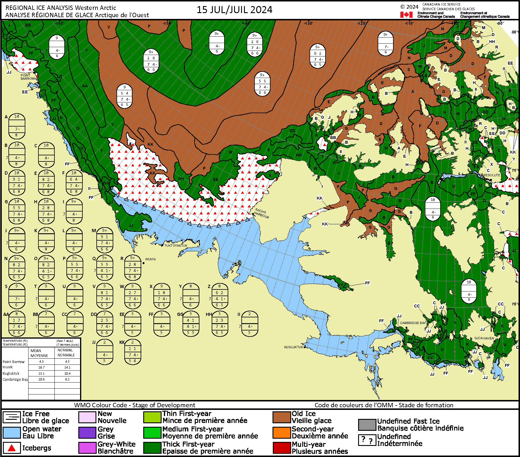
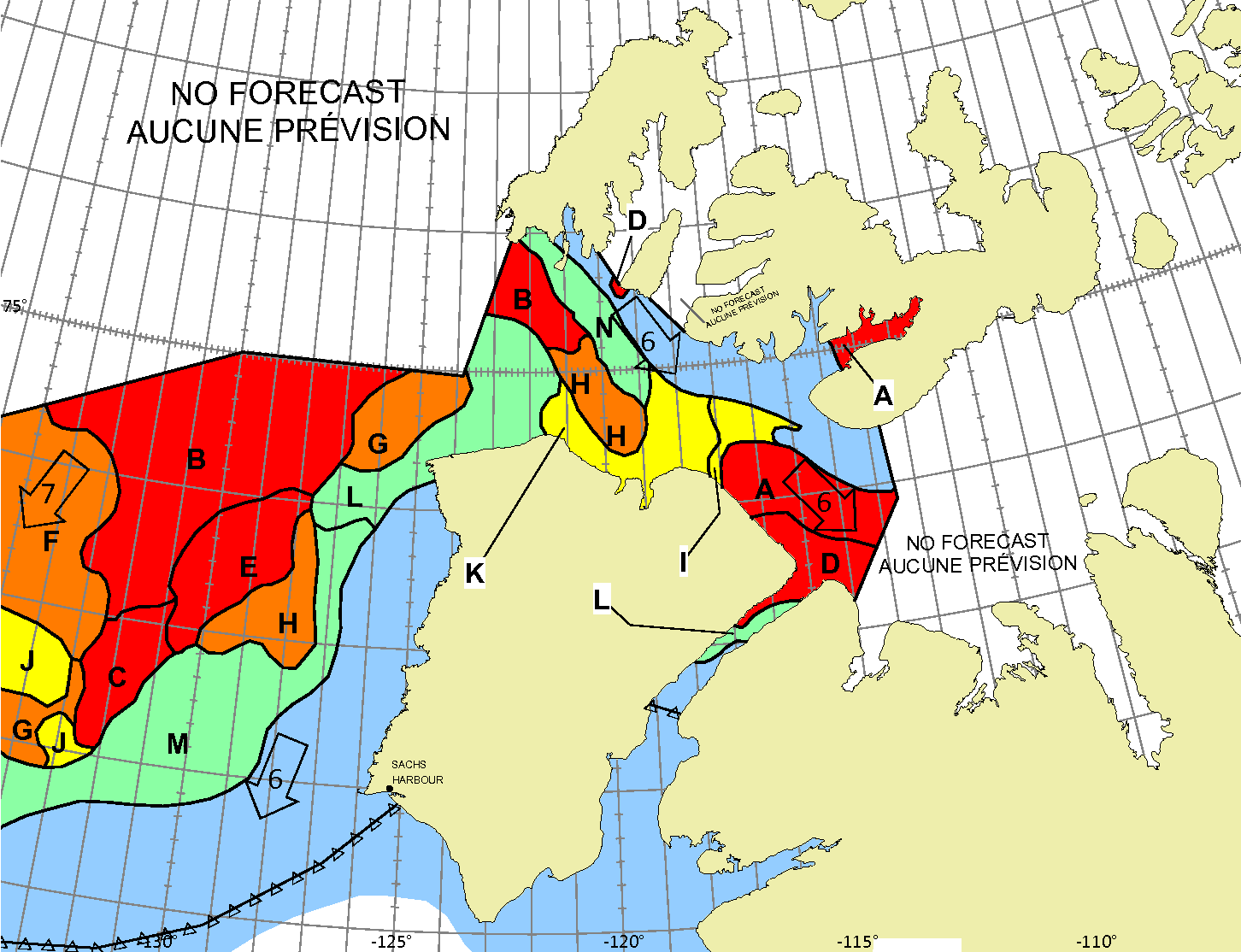
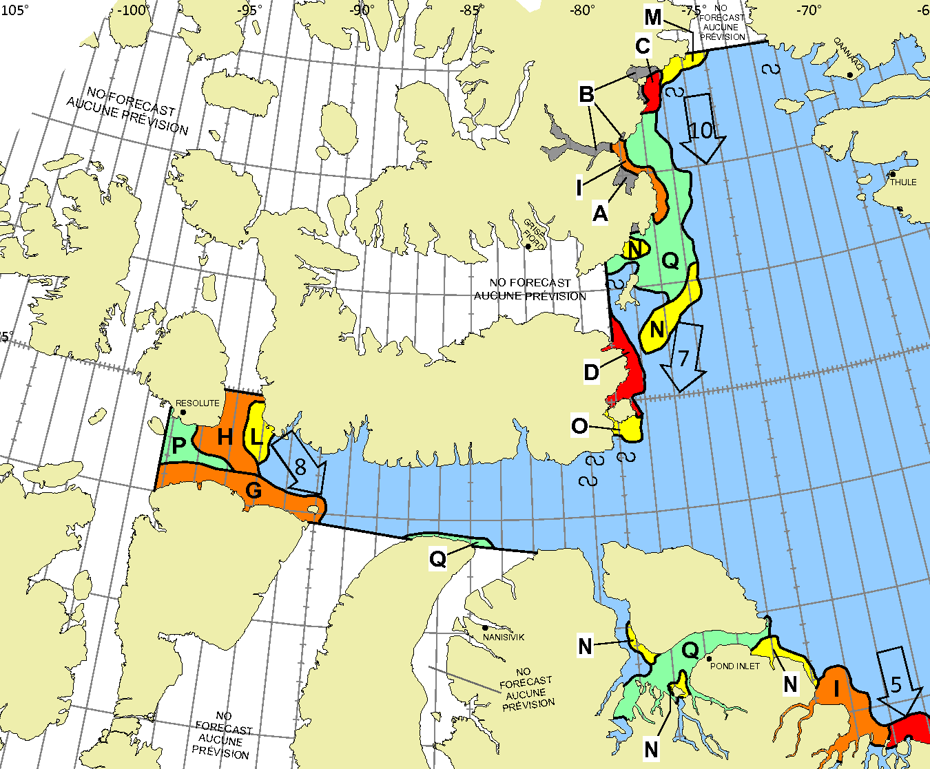
Whilst there is still ice blocking the route across Baffin Bay from Greenland, the Canadian Ice Service has already started daily coverage of the heart of the southern route through the Northwest Passage. There’s plenty of open water in Lancaster Sound and low concentration sea ice in Prince Regent Inlet:
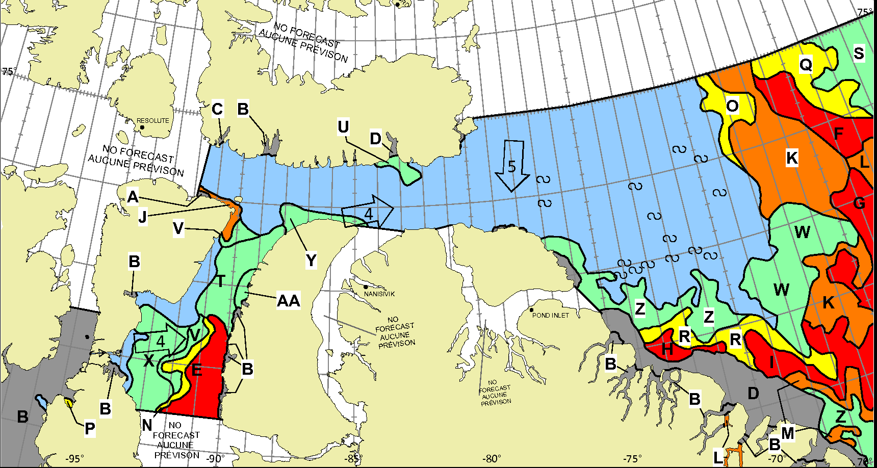
Further south there is also open water in the Coronation Gulf, but the fast ice between Peel Sound and King William Island has not yet started breaking up:
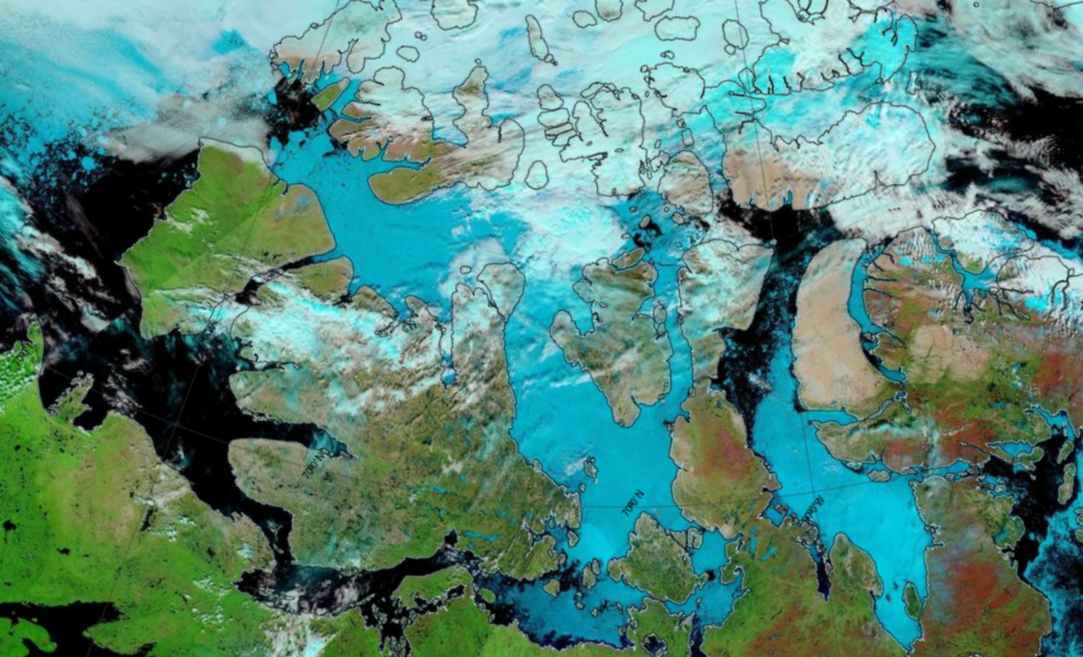
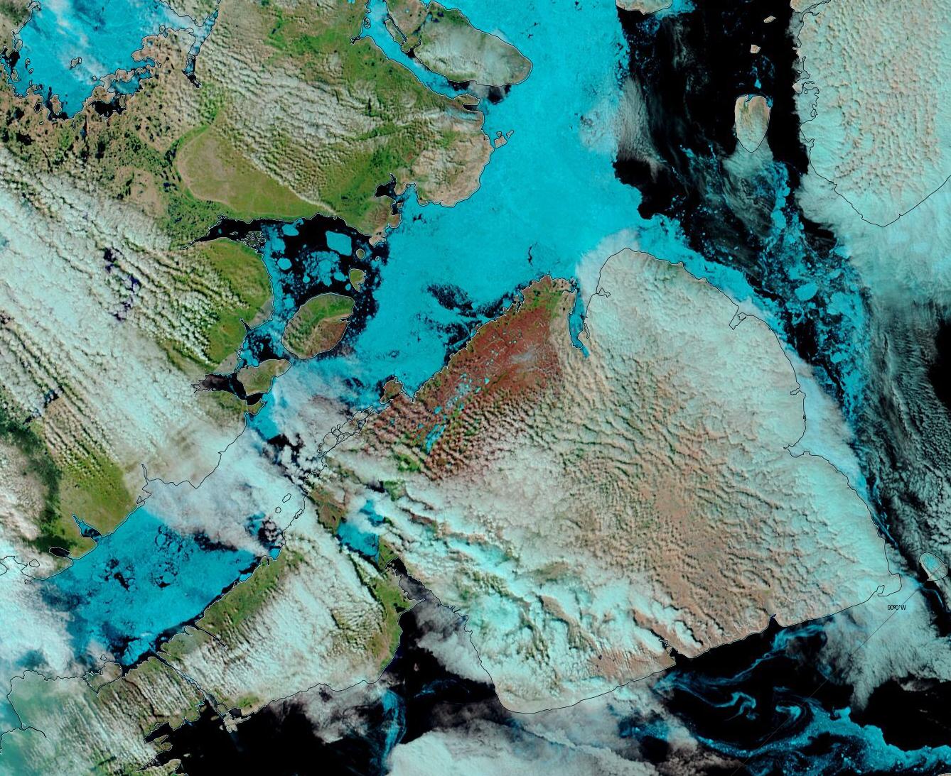
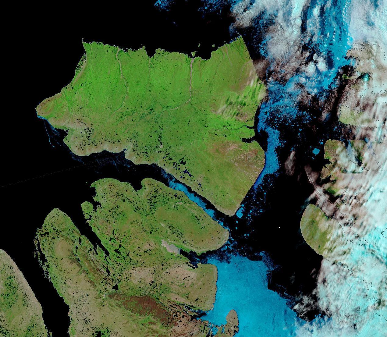
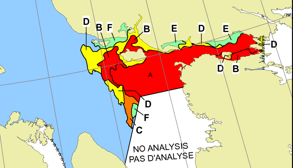
This slightly cloudy satellite image of the Canadian Arctic Archipelago also shows that the exit of the northern route via McClure Strait into the Beaufort Sea is already navigable:
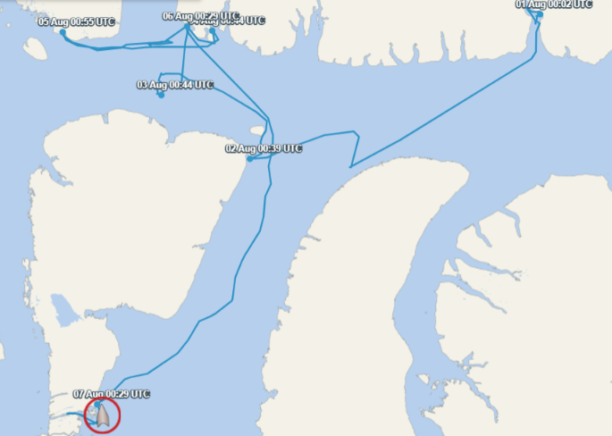
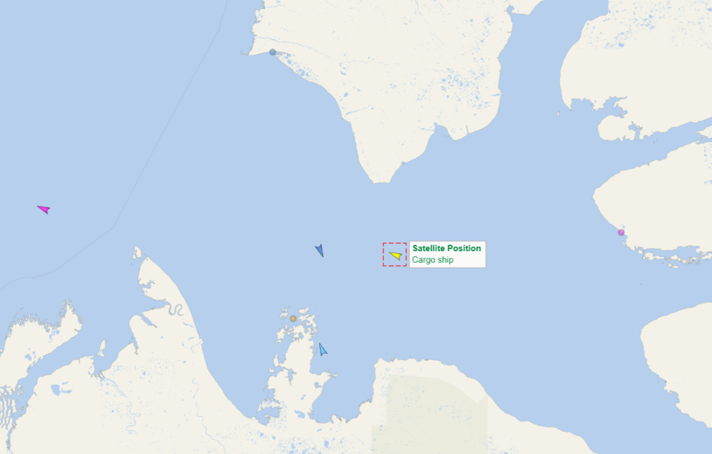
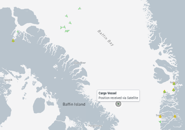
Amongst the “small vessels” attempting an east to west voyage through the Northwest Passage this summer, S/V Lumina has already crossed the Arctic Circle heading north. She has recently reached Ilulissat:
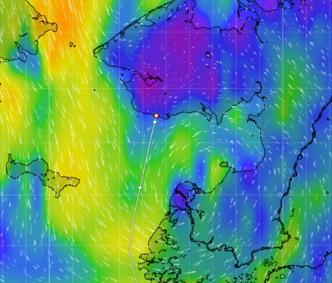
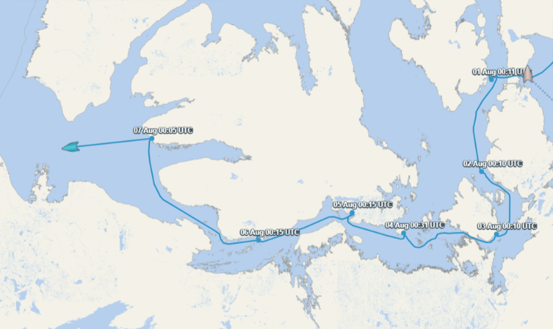
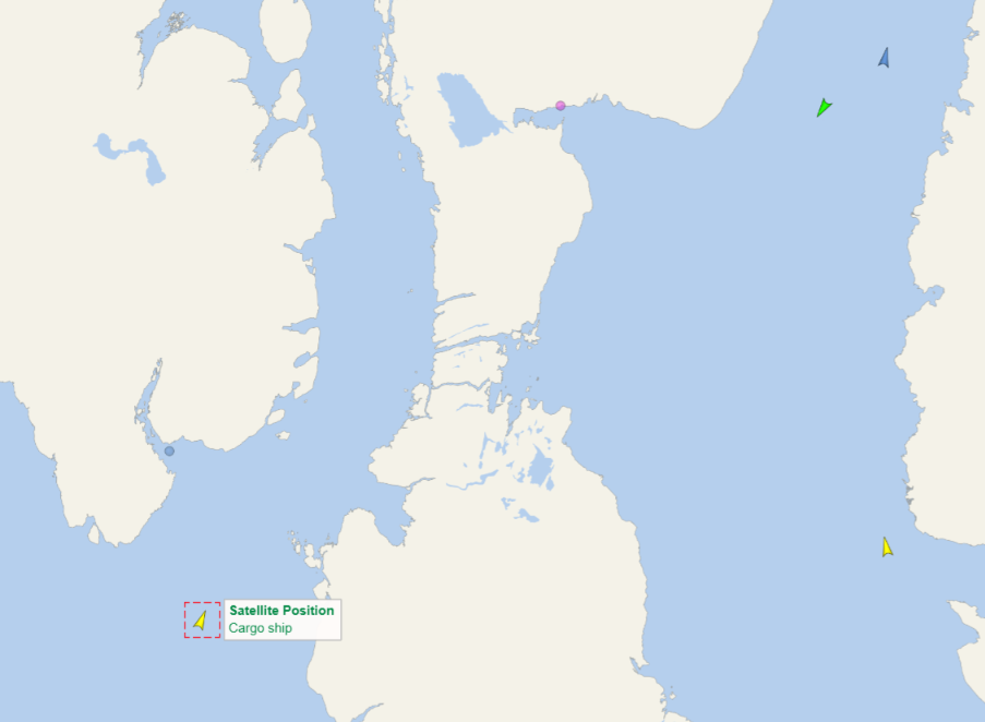
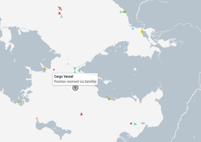
Heading west to east, S/V Lumi has yet to cross the Arctic Circle but has now reached Nome heading north:
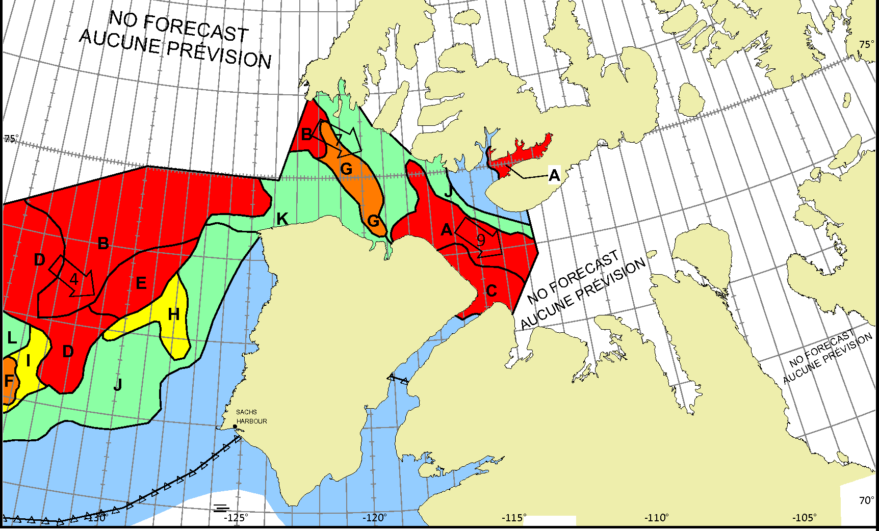
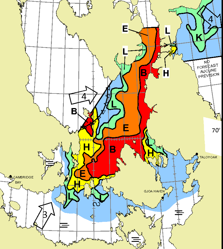
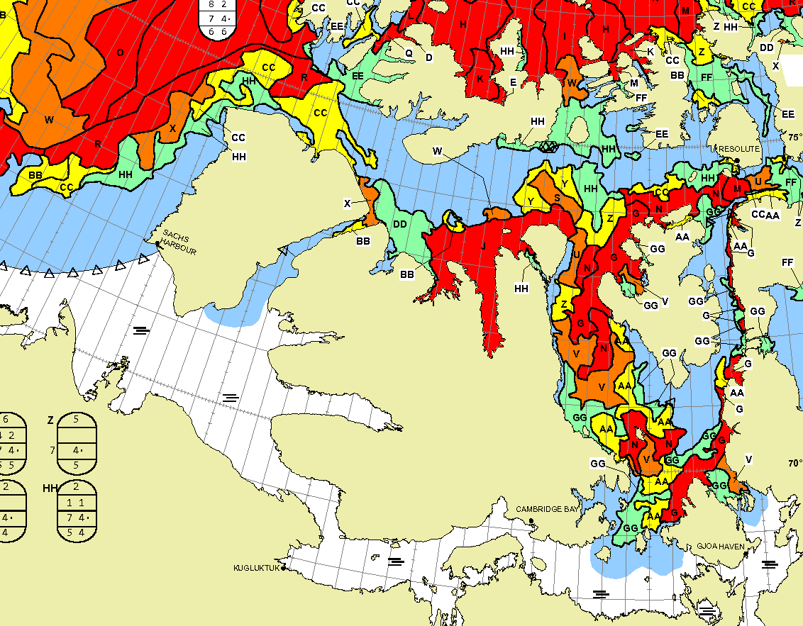
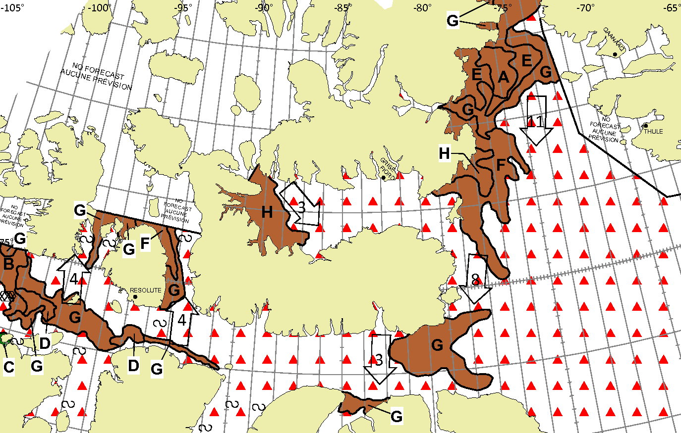
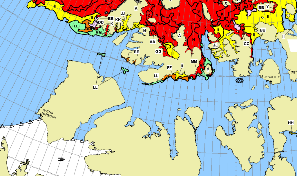
The latest CIS weekly stage of development chart shows thick first year ice throughout the Northwest Passage, except for some old ice in Viscount Melville Sound:
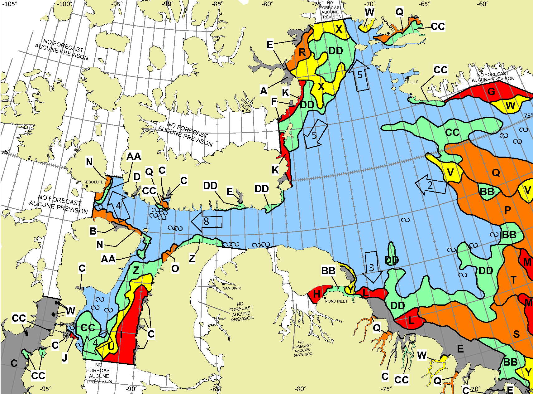
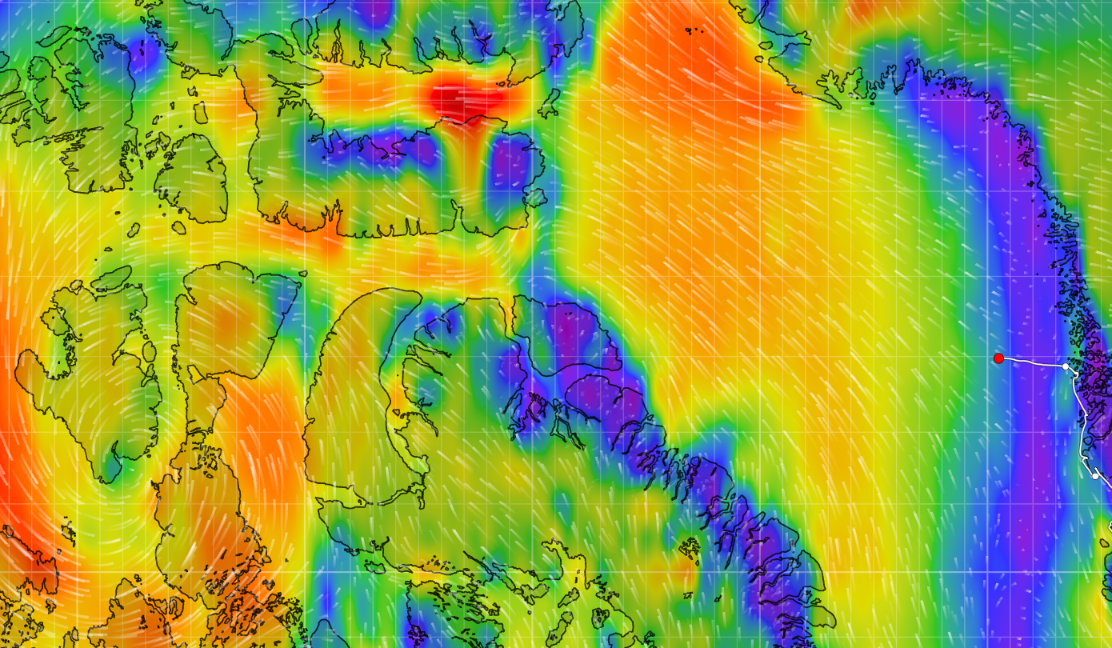
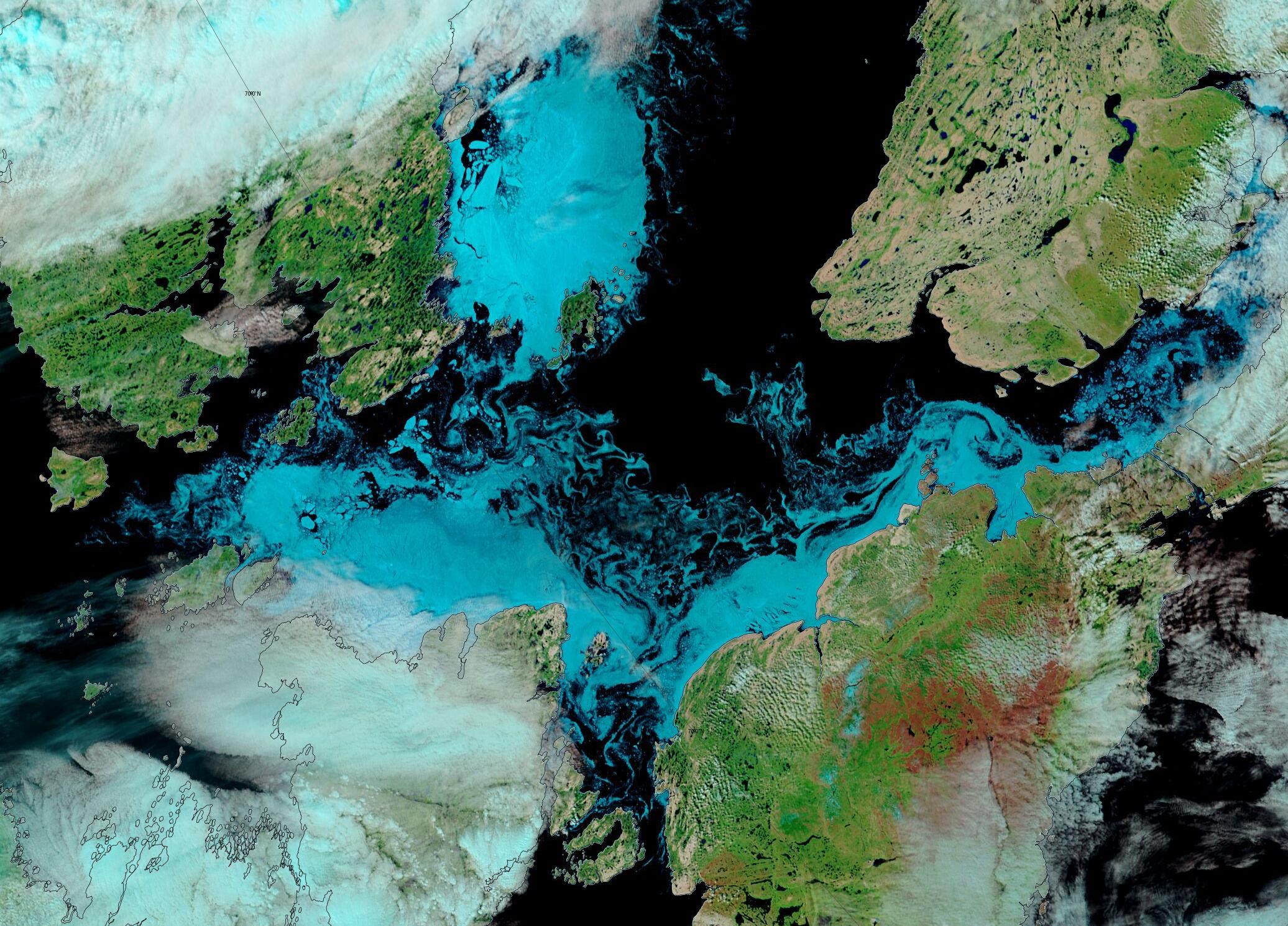
The latest daily concentration charts show an open water route across Baffin Bay, albeit involving a northerly excursion along the coast of Greenland:
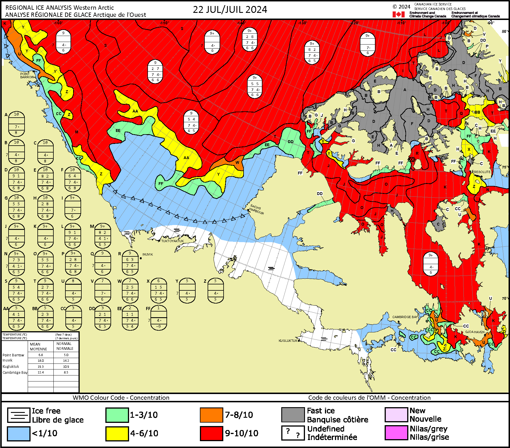
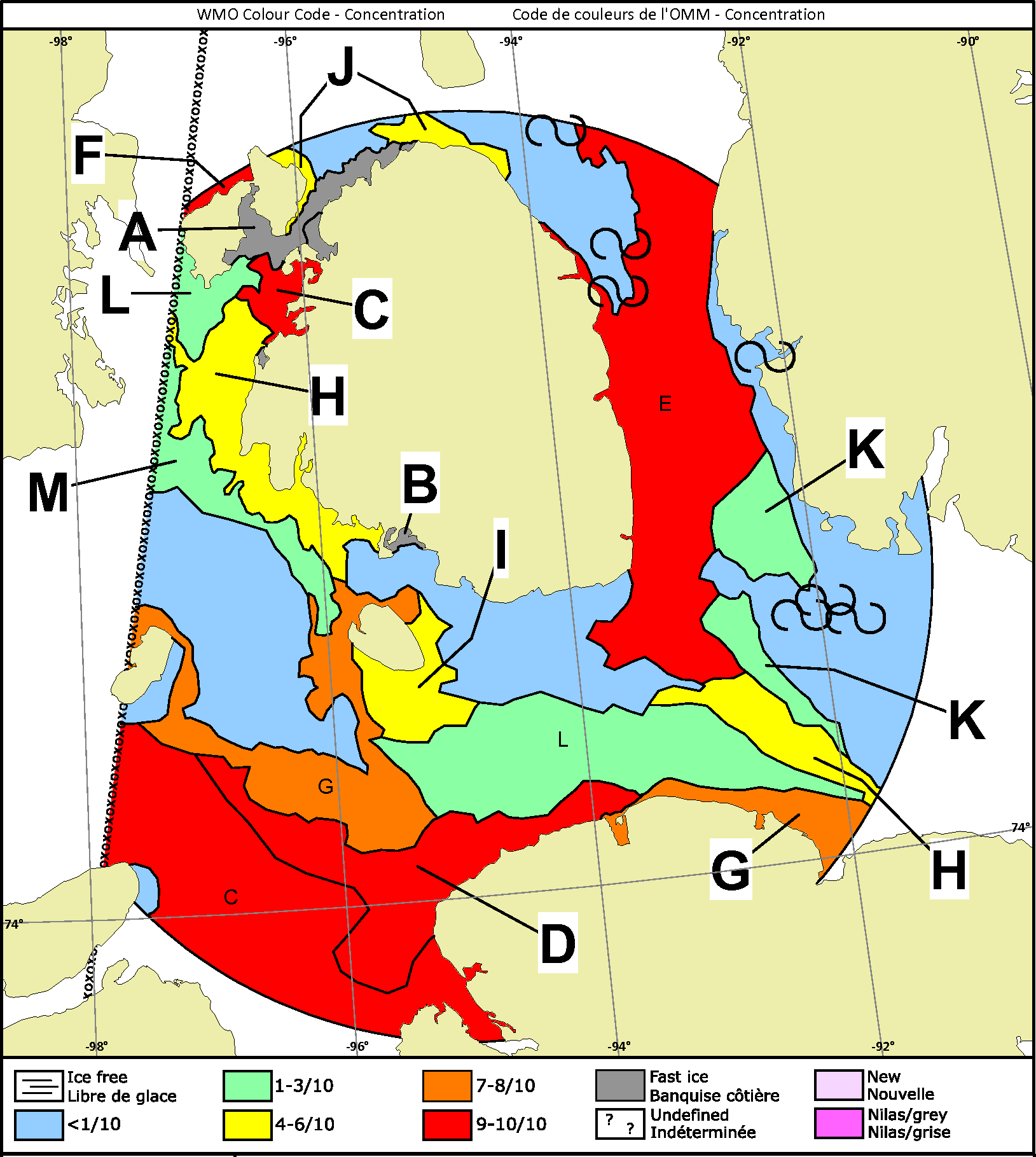
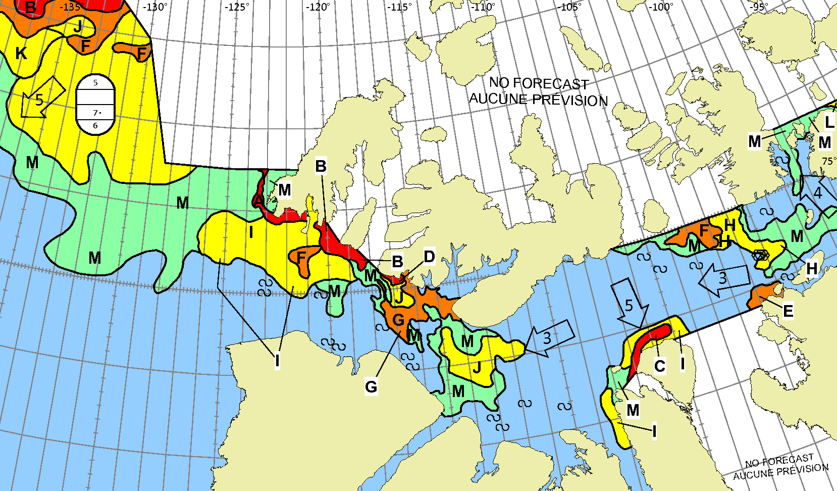
The latest CIS weekly concentration chart has just been released:
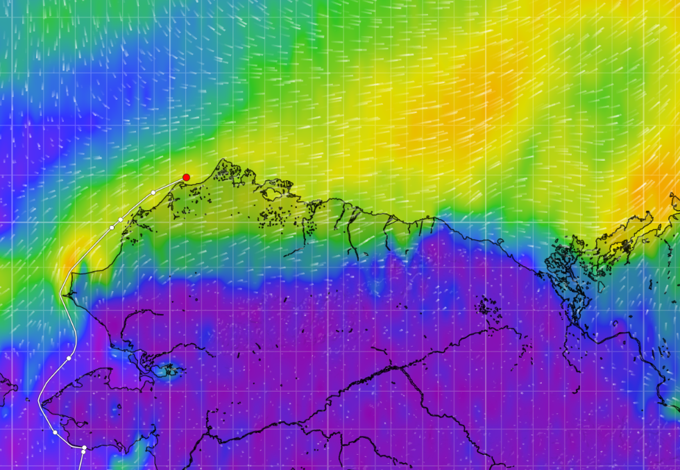
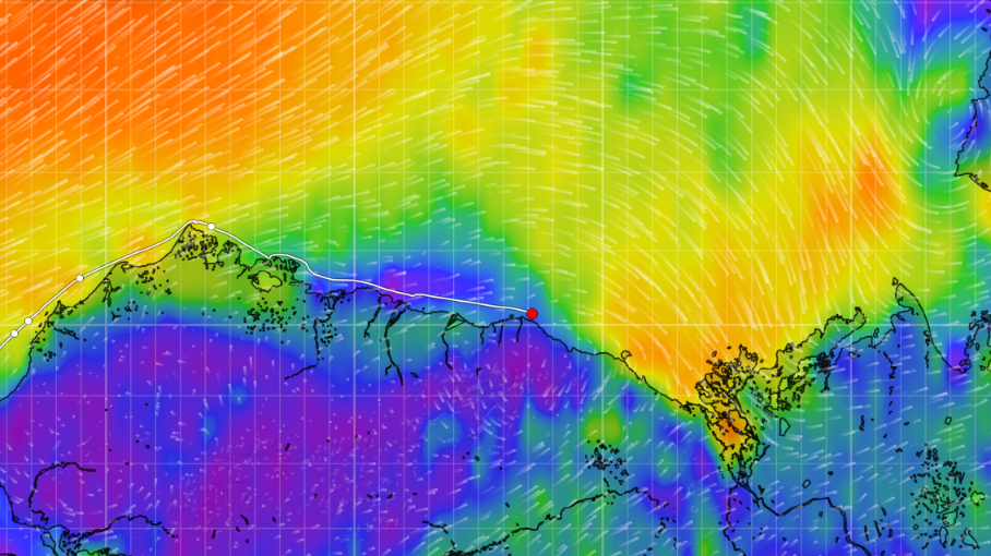
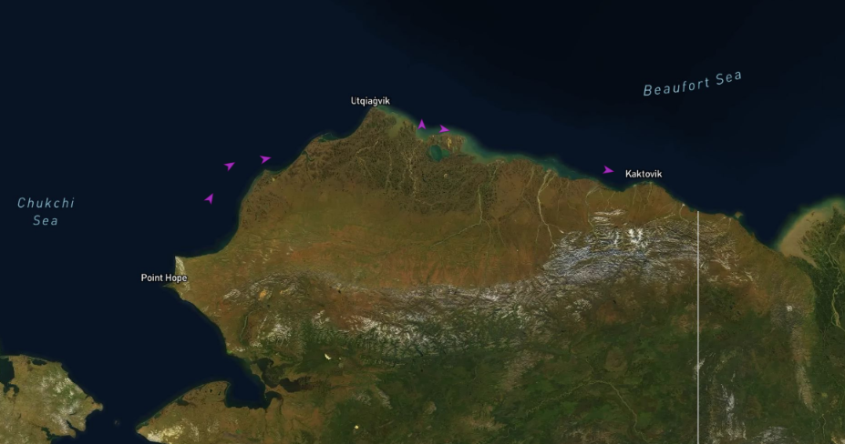
A thin, navigable channel has opened up along the Beaufort Sea coast of Alaska. S/V Lumi is heading for Elson Lagoon. The winds are currently offshore, so she may not need to wait long there:
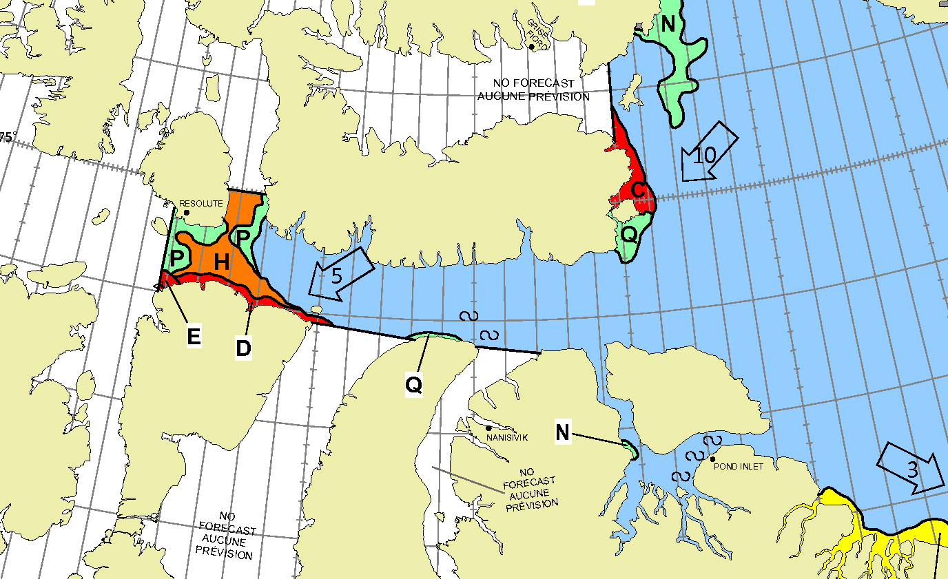
Meanwhile over on the west coast of Greenland nobody has yet decided to cross Baffin Bay towards Pond Inlet or Lancaster Sound.
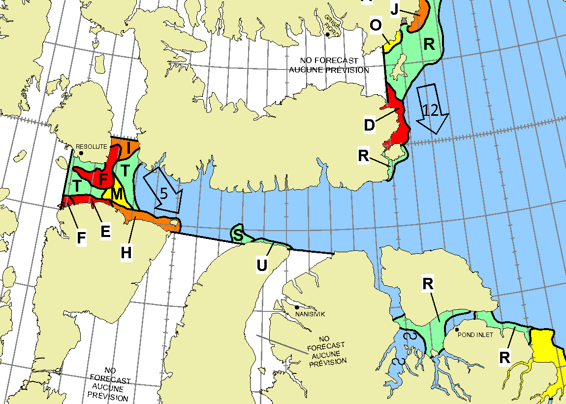
[Update – July 25th]Today USCGC Healy has entered McClure Strait from the Beaufort Sea:
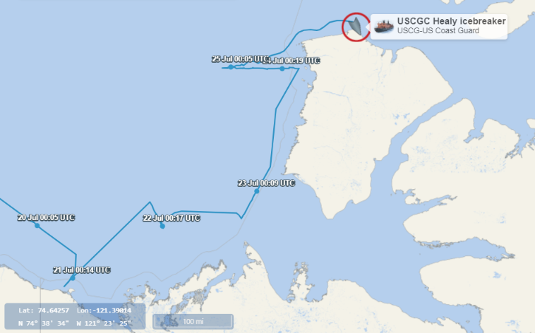
As a consequence the Canadian Ice Service has started daily coverage of the region:
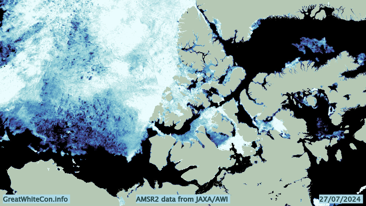
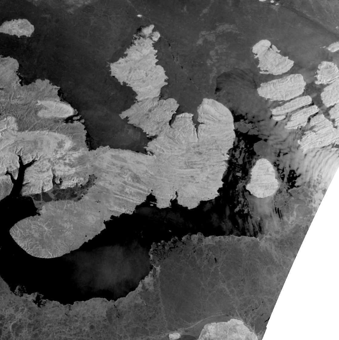
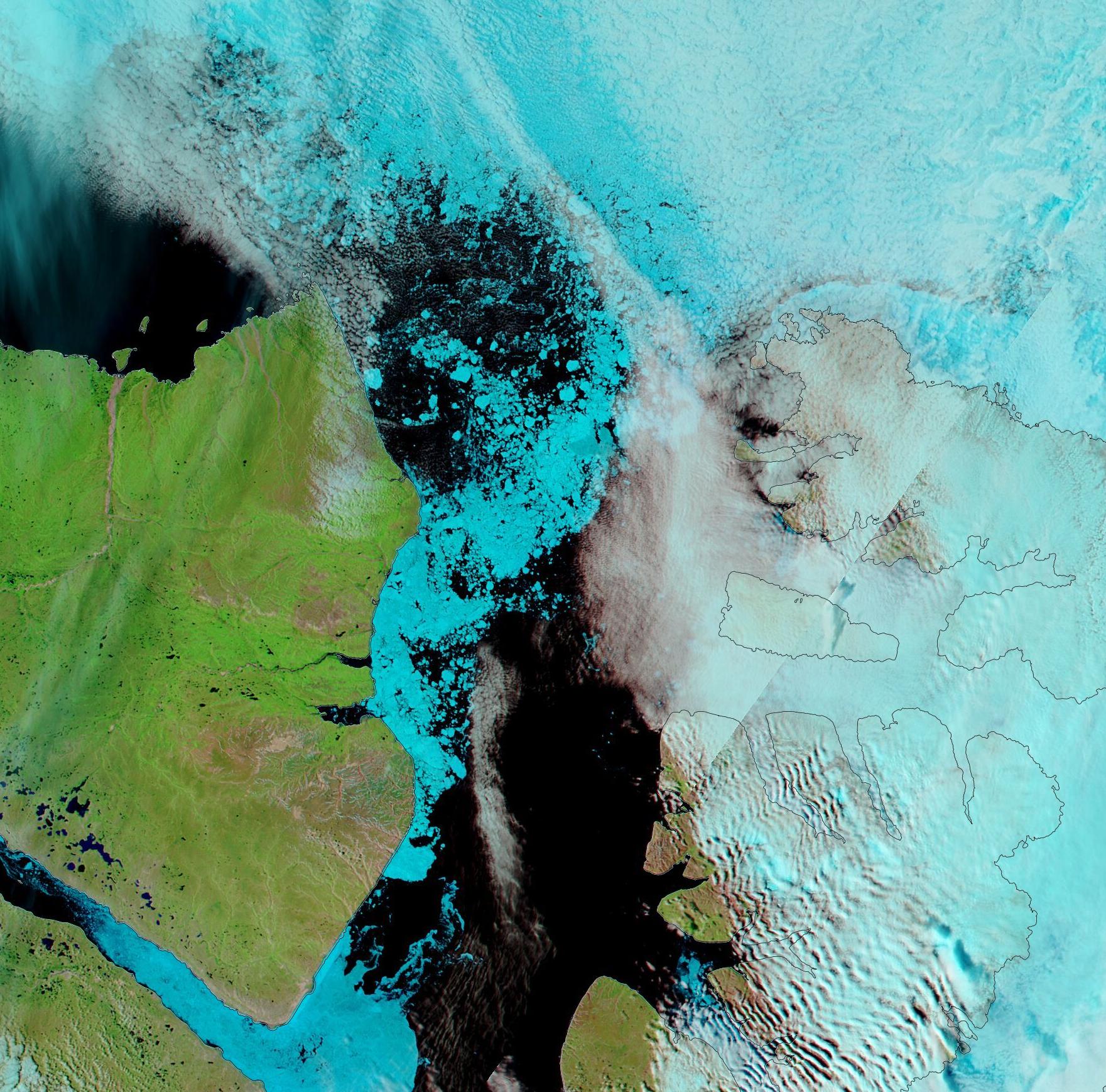
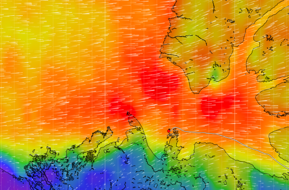
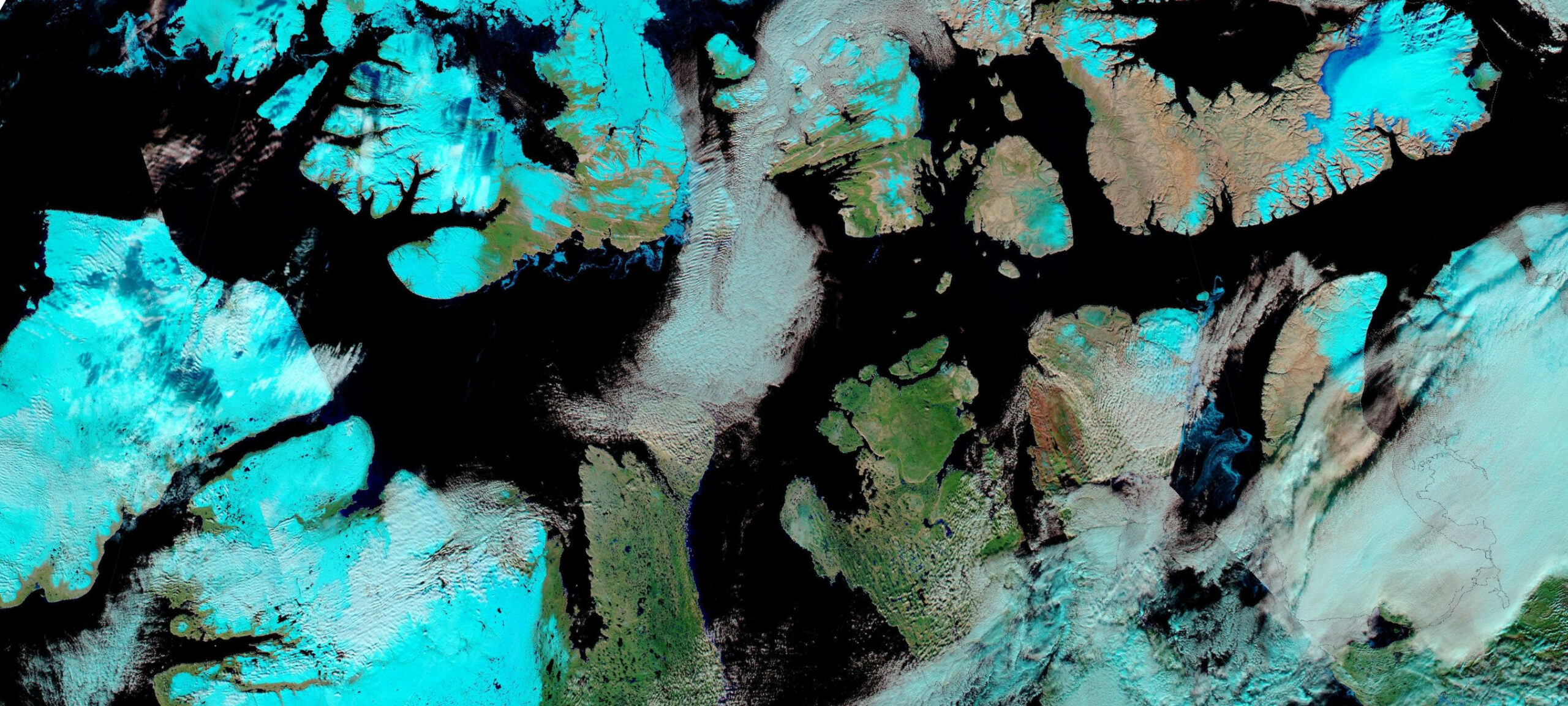
The Alfred Wegener Institute’s AMSR2 data suggests that much of the sea ice on the northern route through the Northwest Passage has already melted:
The latest CIS sea ice concentration chart of the McClure Strait shows an area of theoretically navigable ice with <= 6/10 concentration along the north coast of Banks Island:
Another CIS chart shows that a navigable route also exists through Barrow Strait south of Cornwallis Island:
Another possible “choke point” evident on the AMSR2 image lies between Bathurst Island and Prince of Wales Island. Unfortunately the CIS is not currently providing daily coverage of that region, the skies above Viscount Melville Sound are cloudy and recent Sentinel 1 imagery also doesn’t cover the whole area:
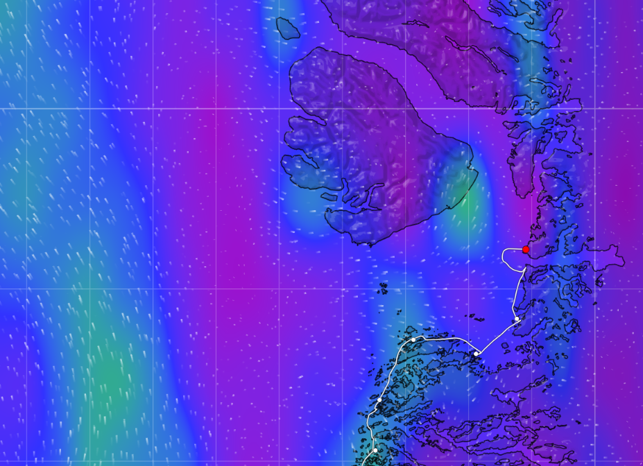
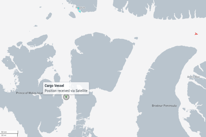
All in all my own conclusion is that route 1 is not “open” for the passage of “pleasure craft” just yet. S/V Lumi’s tracking map reveals that she has reached the safety of Elson Lagoon, and that the current winds are generally northerly:
Those winds may open up a passage through Viscount Melville Sound, but they may also close McClure Strait!
[Update – July 28th]Now that Healy has returned to the Beaufort Sea the CIS has ceased daily coverage of McClure Strait. The latest concentration chart of the Barrow Strait suggests that it is currently “closed” to small vessels:
The chart also shows that Pond Inlet is now accessible, so perhaps assorted “pleasure craft” will soon start crossing Baffin Bay ?
[Update – July 29th]The latest CIS chart suggests that there is currently a way to squeeze past Resolute in <= 6/10 concentration ice:
However, the skies have cleared over the McClure Strait to reveal that the western exit is now blocked:
There’s still no sign of any yachts in the vicinity, but the cruise ships Sylvia Earle and National Geographic Resolution have visited Pond Inlet:
Tonight’s CIS chart still shows an area of 7-8/10 ice blocking Barrow Strait near Resolute:
In other news S/V Lumi is now heading east through the Beaufort Sea:
Heading in the opposite direction is Seabelle, after spending the long Arctic winter in Inuvik:
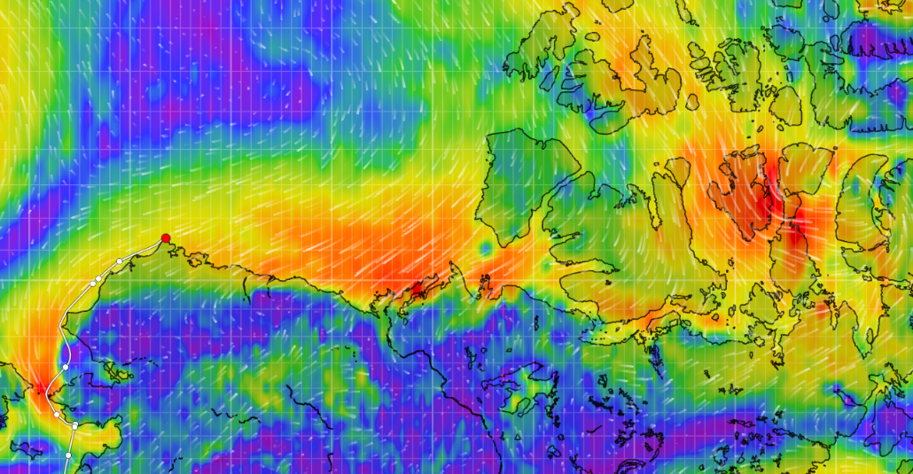
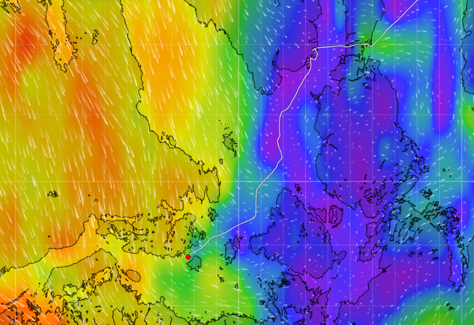
Here’s the CIS chart of the the sea ice they will both have to contend with. Note the direction of forecast drift:
A fairly clear view from on high of Peel Sound reveals that the sea ice is beginning to break up:
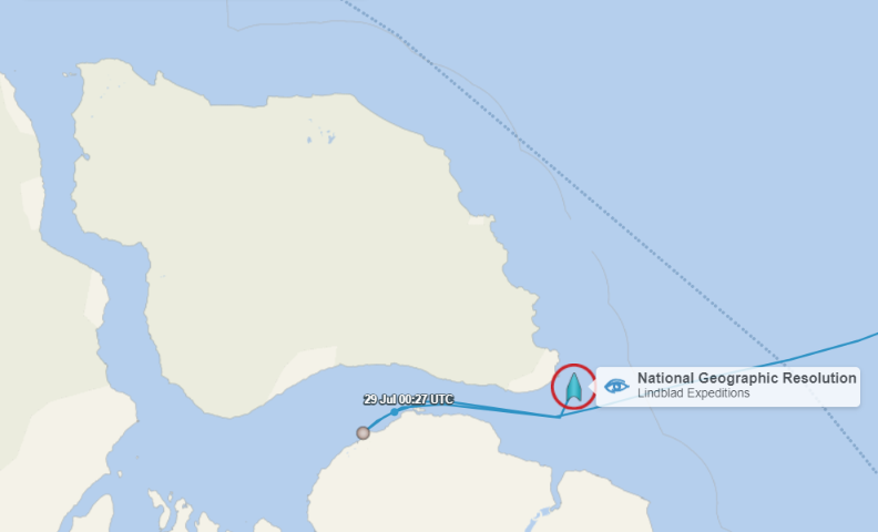
Prince Regent Inlet is already largely ice free, and NG Resolution is heading for the eastern entrance to Bellot Strait:
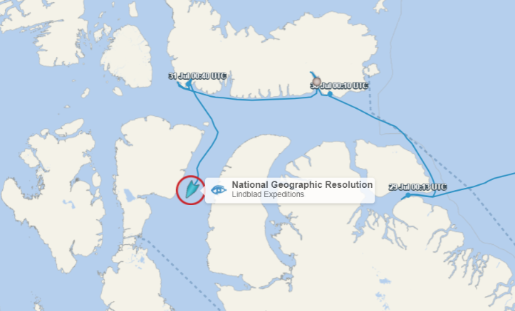
P.S. NG Resolution is now heading through Bellot Strait:
Perhaps that will persuade the Canadian Ice Service to release a daily chart for the Queen Maud Gulf later today?
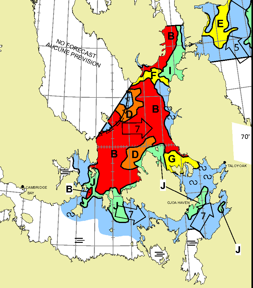
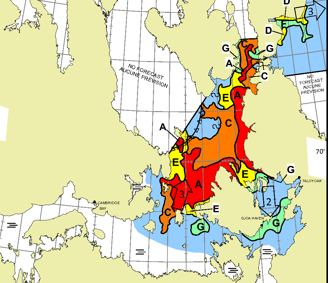
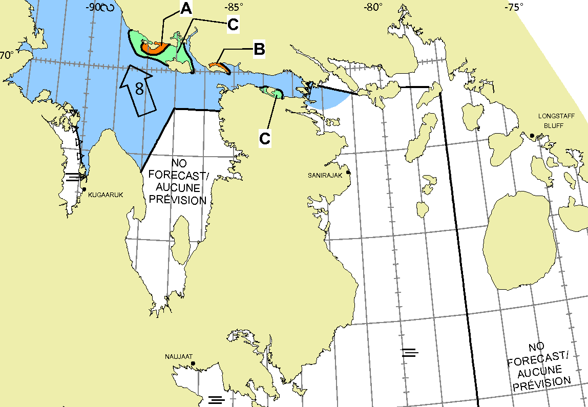
P.P.S. The CIS has produced a chart for the Queen Maud region! It shows route 6 still waiting for James Ross Strait to open up:
In other news this evening, S/V Lumina has set off across a rather breezy Baffin Bay:
NG Resolution appears to be taking route 6 and has reached James Ross Strait:

However, the latest CIS chart shows that the route is still “closed” for “small vessels” lacking ice breaking capability:
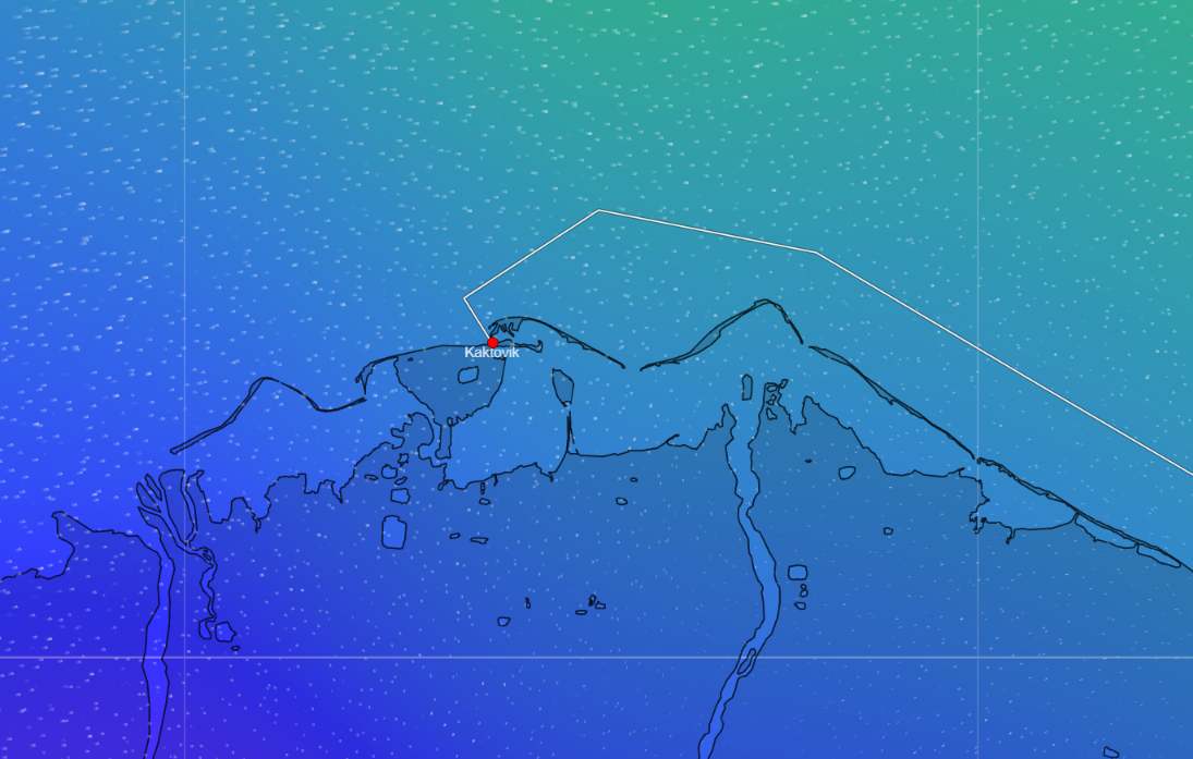
In the Beaufort Sea Seabelle has stopped at Kaktovik heading west:
Meanwhile Lumi has passed by offshore heading east:
Following behind Lumi are Que Sera, Libertaire, Moli, Pinocchio and Y Not:
NG Resolution is taking route 6 to Gjoa Haven:
However the latest CIS chart shows that the route is not yet “open” for “pleasure craft”:
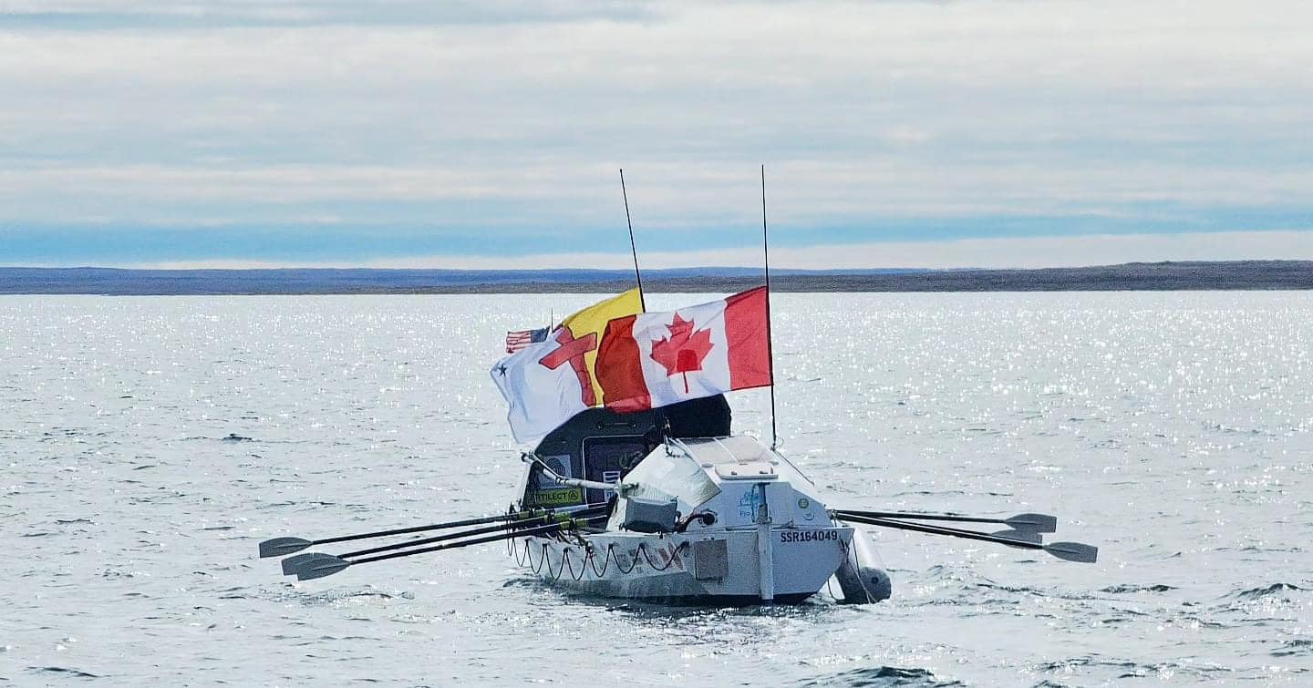
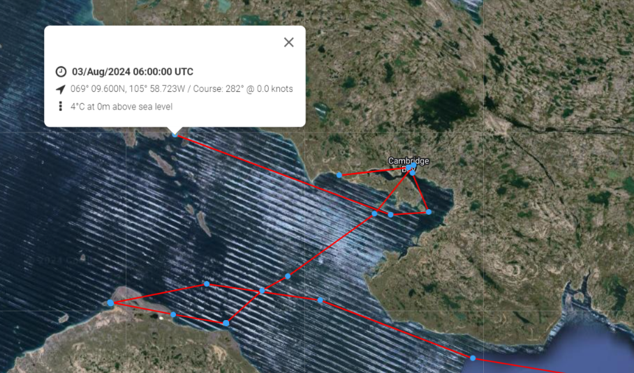
The Northwest Passage Expedition has relaunched Hermione and set off westwards once more from Cambridge Bay:
Lumina has reached Pond Inlet:
After threading her way through some substantial chunks of ice…
Lumi has reached Herschel Island:
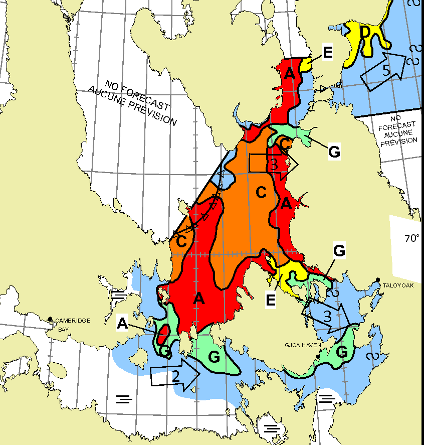
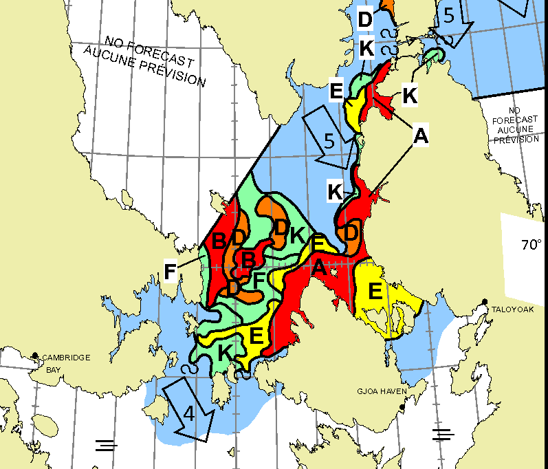
The skies have cleared over Larsen Sound today, and routes 3/4/5/6 still look “closed” to me:
The skies have been fairly clear over the McClure Strait today. The western end is still blocked, but it looks as though a passage through the remaining ice in the Prince of Wales Strait might be possible soon:
Meanwhile Peel Sound and the western entrance to Bellot Strait are also still blocked:
The first “commercial” vessel of the 2024 summer season has entered Lancaster Sound. Royal Wagenborg’s Adriaticborg is en route to Busan in Korea:
Sylvia Earle has visited Zenith Point in the Bellot Strait and then retraced her steps:
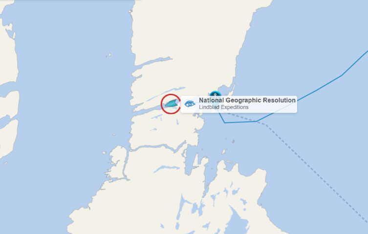
Meanwhile NG Resolution has reached the Amundsen Gulf, en route to Nome:
Lumina has left Pond Inlet and is heading for Navy Board Inlet. Meanwhile Adriaticborg is heading down Prince Regent Inlet towards the eastern entrance to Bellot Strait:
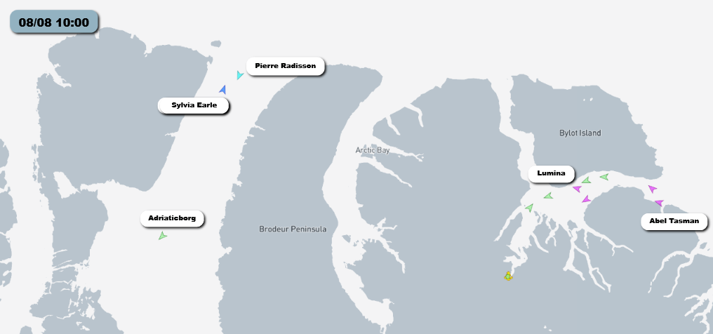
The strait itself currently contains quite a lot of sea ice, as does the eastern side of Peel Sound. That may well explain why the Canadian icebreaker Pierre Radisson is also heading in that direction:
CCGS Pierre Radisson has successfully led Adriaticborg through Bellot Strait. They are both now in convoy through Larsen Sound, en route to Victoria Strait:
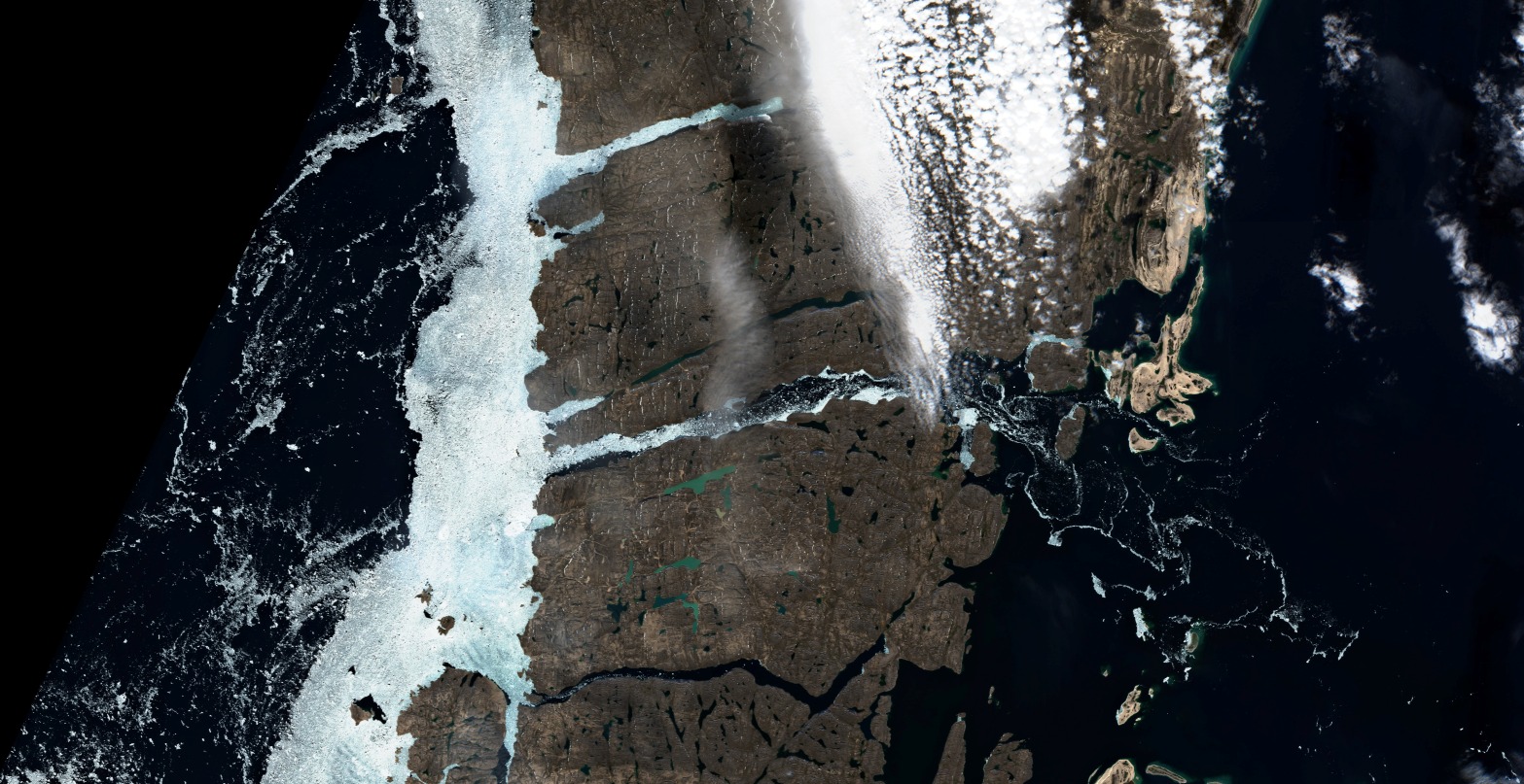
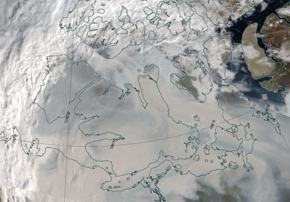
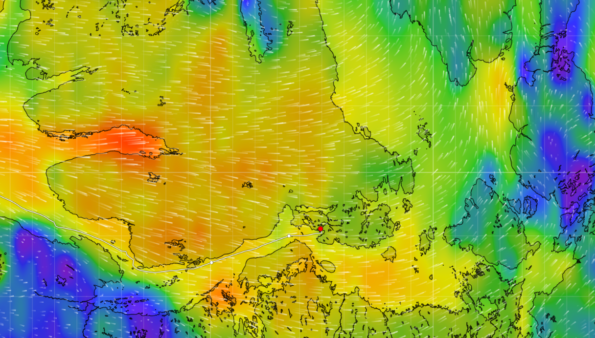
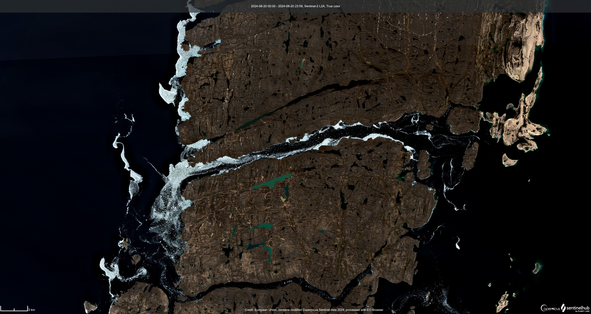
From far above the entire southern part of the Canadian Arctic Archipelago looks as though it’s covered in a blanket of smoke from all the Canadian wildfires:
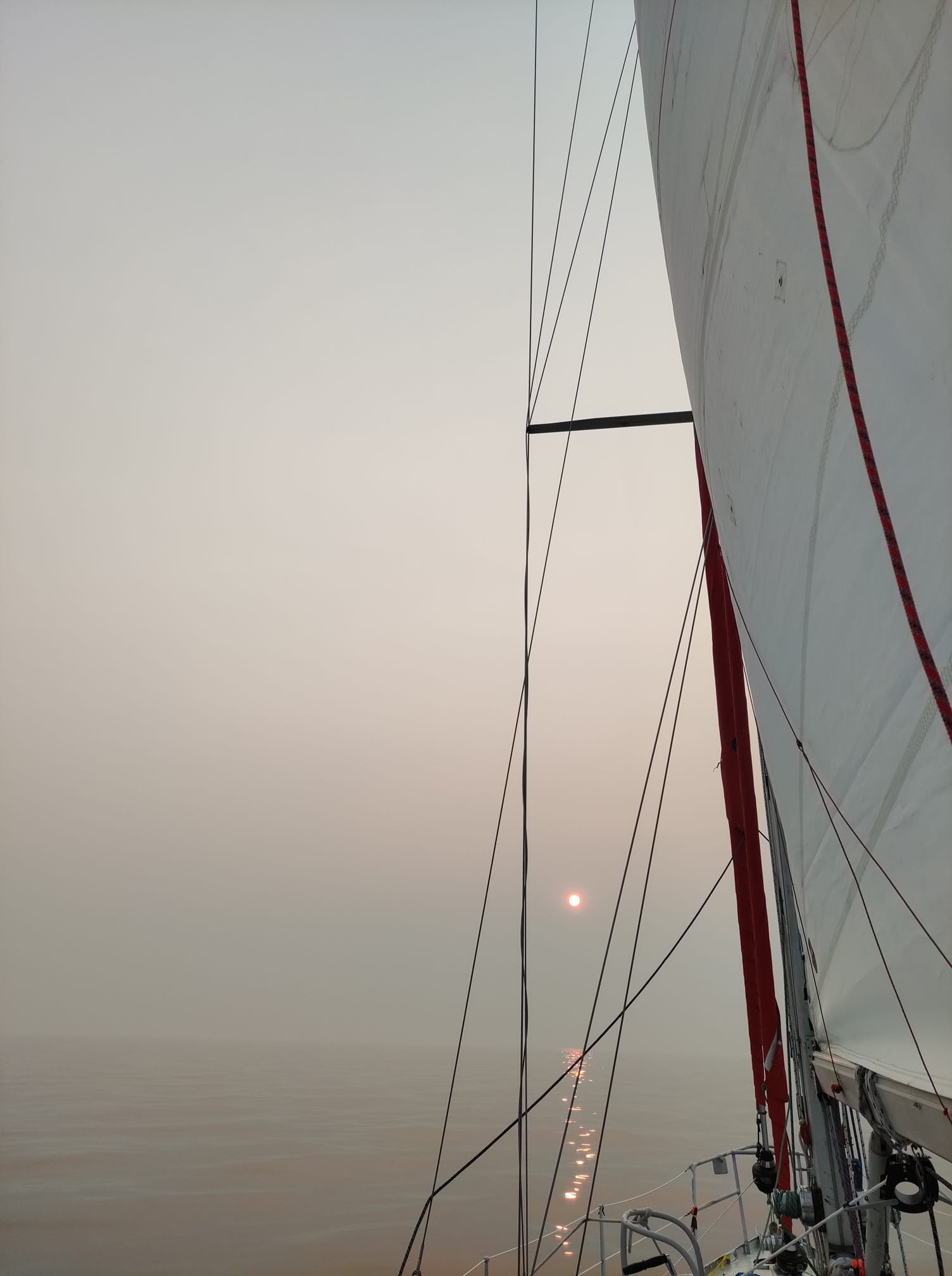
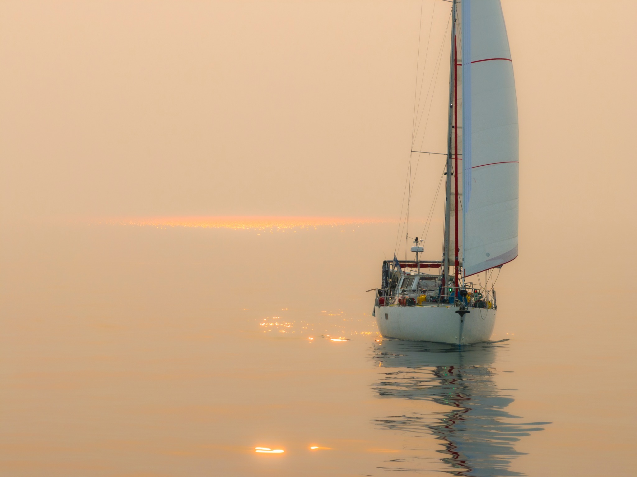
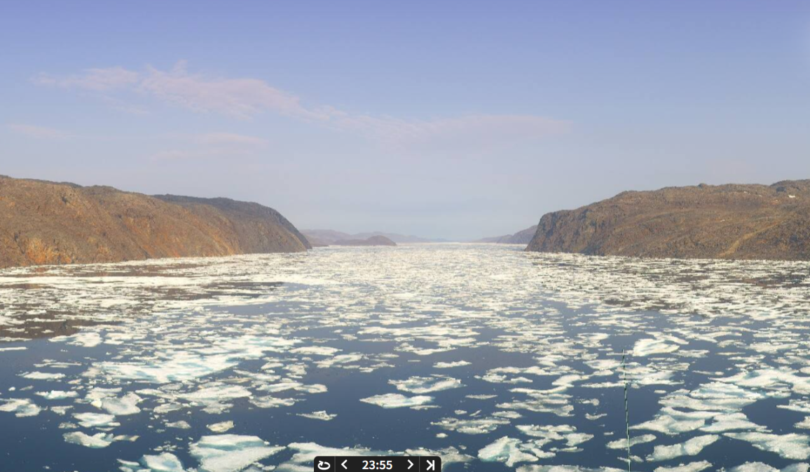
Here’s how the smoke looks from below, courtesy of S/V Lumi in the Coronation Gulf:
Seabelle has reached Nome, and thereby completed her 2 summer east to west voyage through the Northwest Passage:
In other news, S/V Lumi has reached Cambridge Bay:
where there is still plenty of wildfire smoke to be seen:
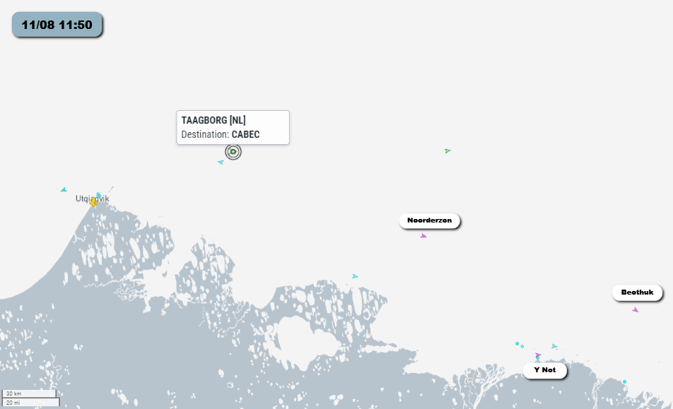
Meanwhile Taagborg, another Royal Wagenborg cargo ship, has rounded Point Barrow heading east:
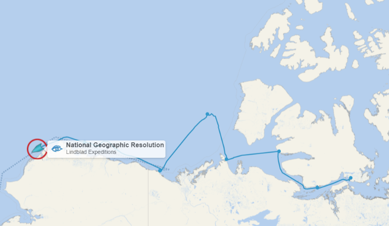
NG Resolution has also rounded Point Barrow, travelling in the opposite direction:
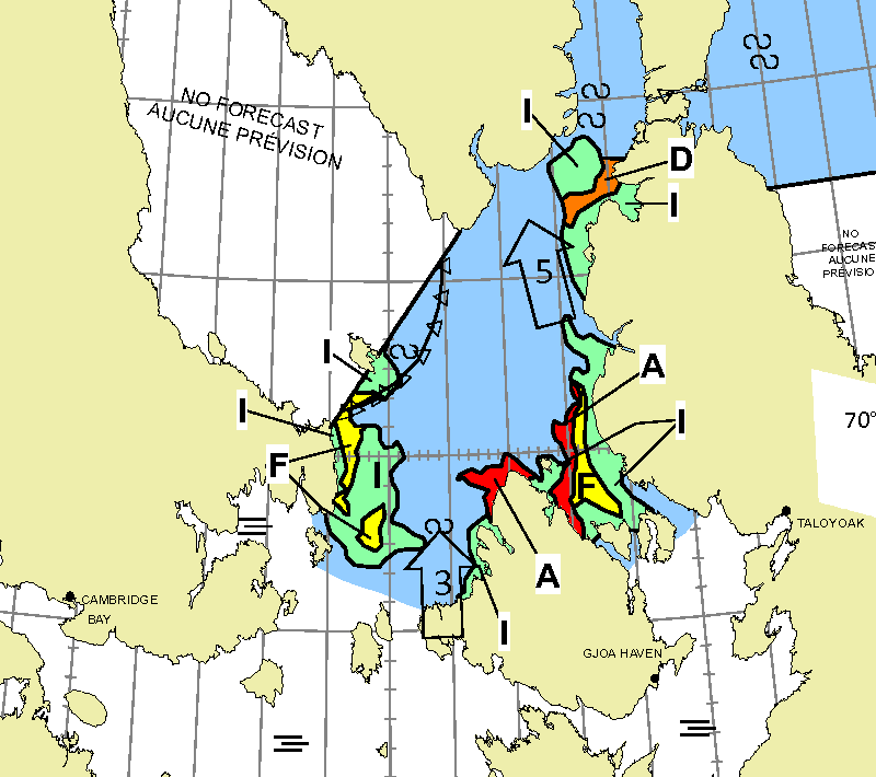
This evening’s CIS forecast shows that route 5 through the Northwest Passage is now “open”, to any brave “pleasure craft” willing to endure sailing for a considerable distance through 5/10 concentration sea ice:
The CIS weekly concentration chart dated August 12th shows route 1 through the Parry Channel “open”, albeit with a long stretch of 5/10 concentration ice to negotiate in McClure Strait:
The daily chart for the Queen Maud Gulf shows that it’s now possible to sail through Victoria Strait without encountering anything worse than 3/10 concentration ice:
Since discretion is the better part of valour, the icebreaker Henry Larsen has been leading Taagborg north towards Larsen Sound:
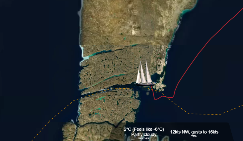
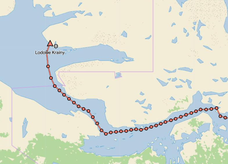
Meanwhile, the “expedition yacht” Abel Tasman is waiting at Fort Ross before negotiating Bellot Strait:
Further south S/V Lumi is waiting for a bit more melting before venturing north through Victoria Strait:
Abel Tasman has become the first “pleasure craft” to successfully negotiate Bellot Strait this summer:
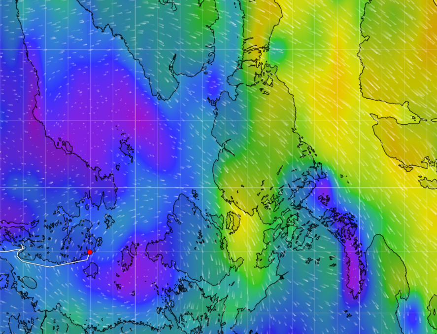
Taagborg is about to enter the strait heading in the opposite direction. Meanwhile a fleet of other yachts are heading for Fort Ross. This is what awaits them in Victoria Strait:
According to the latest Canadian Ice Service chart the strait is now blocked by 7/10 concentration ice:
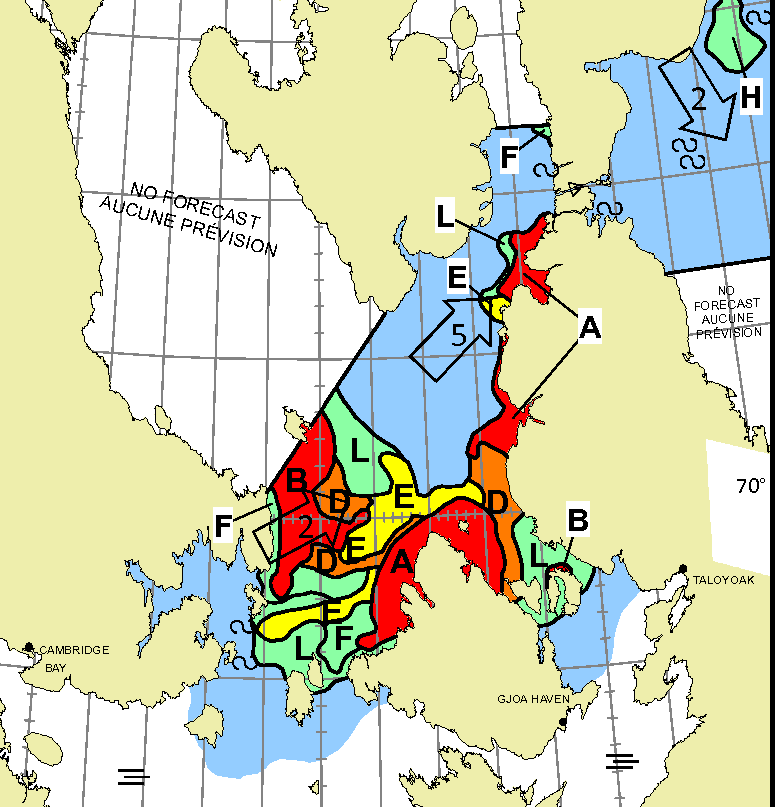
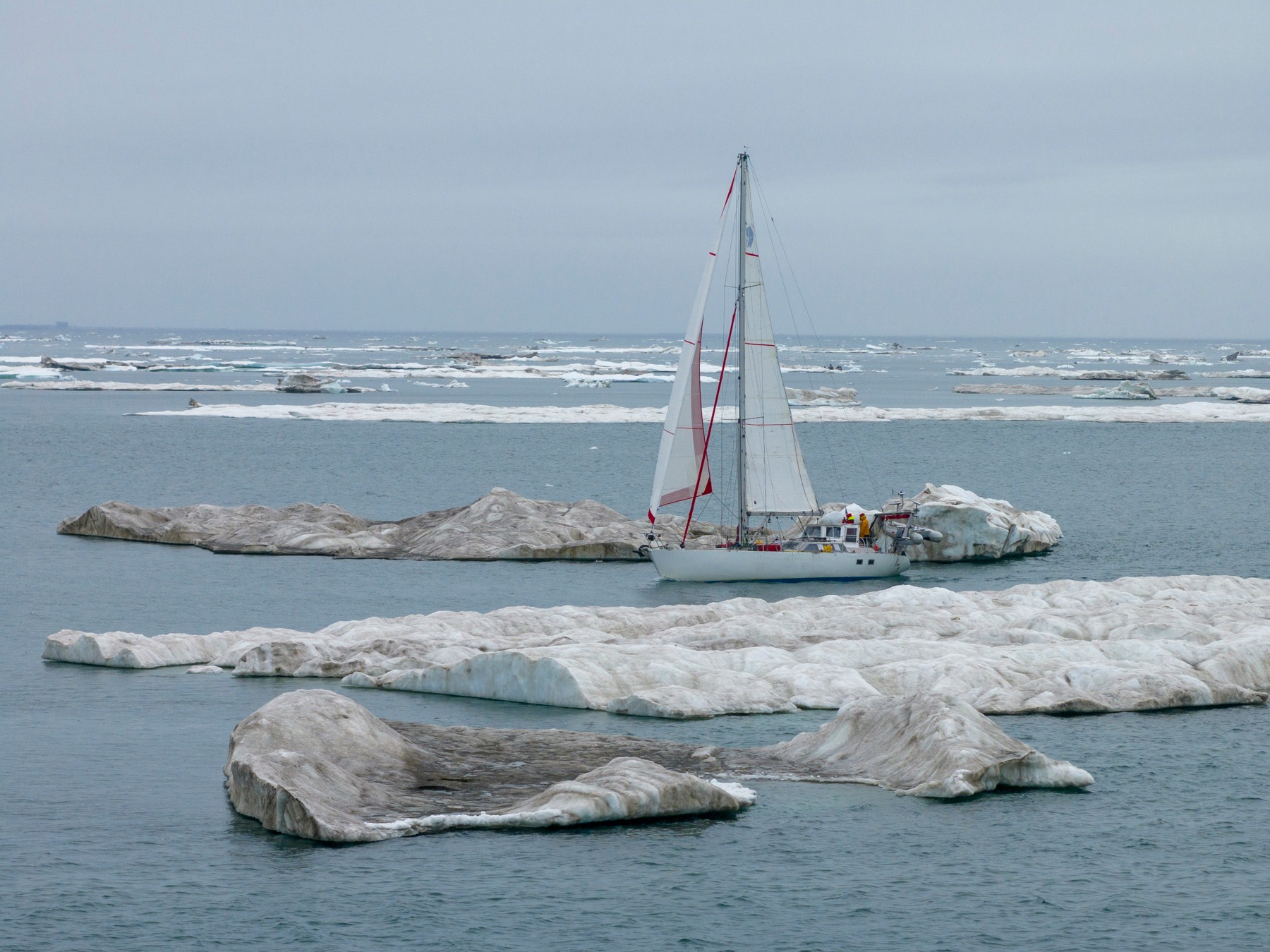
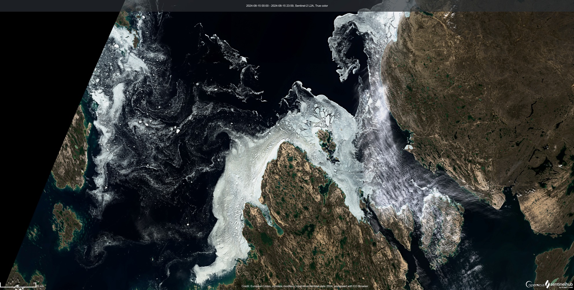
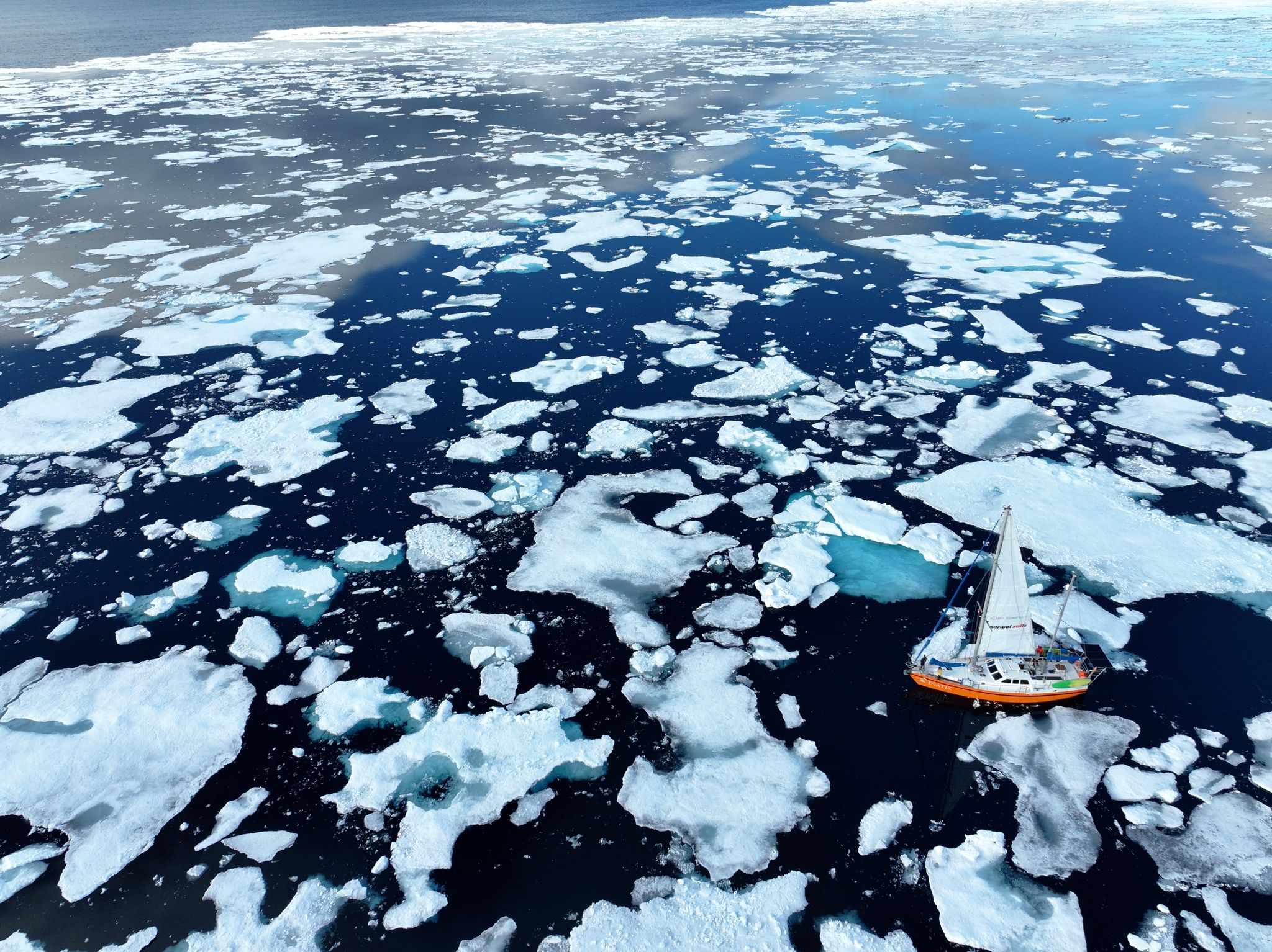
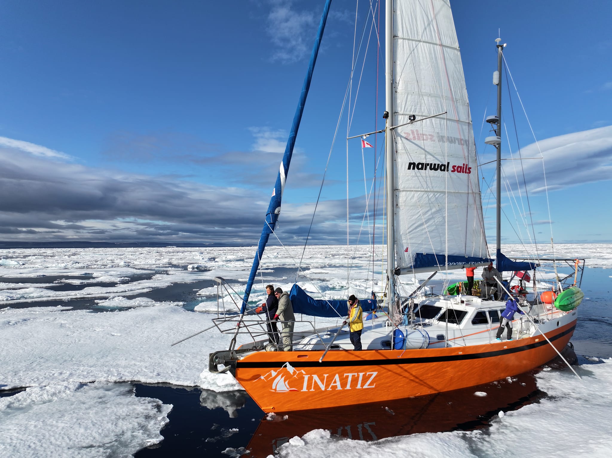
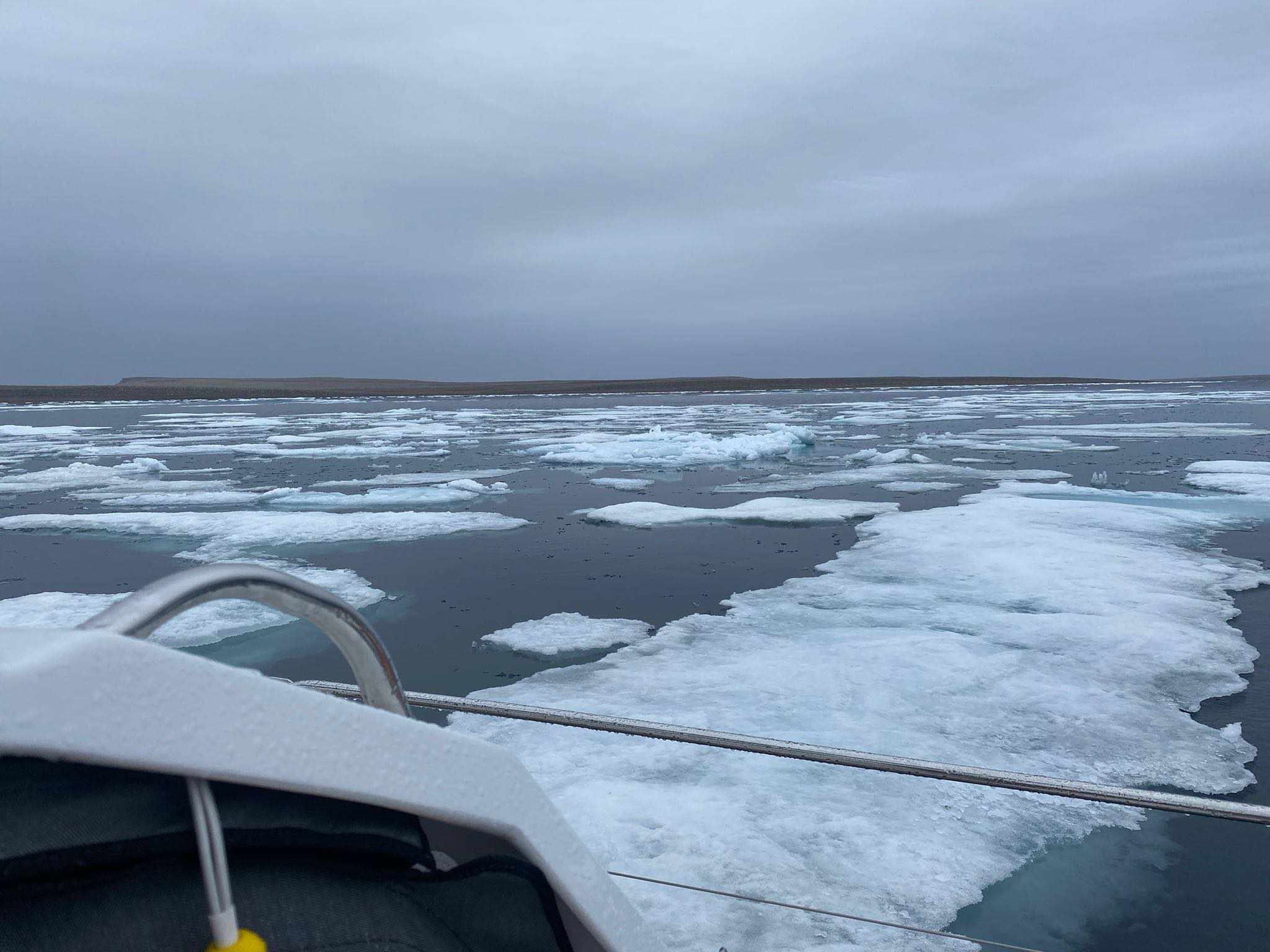
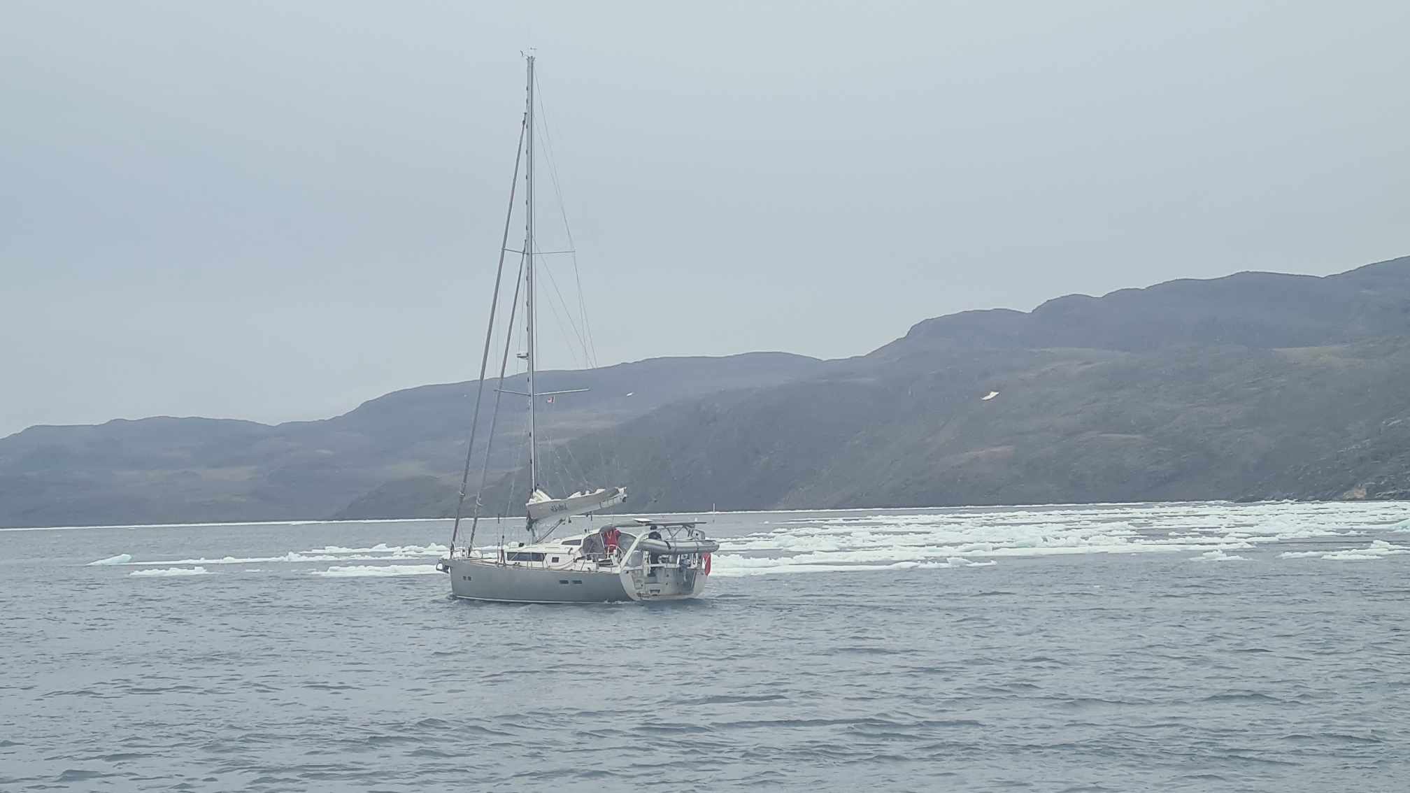
Here’s a band of ice that S/V Inatiz encountered in Prince Regent Inlet yesterday, in an area classified as 2/10 on the CIS chart:
Yesterday Depot Bay began to fill with sea ice. This was the view from Inatiz:
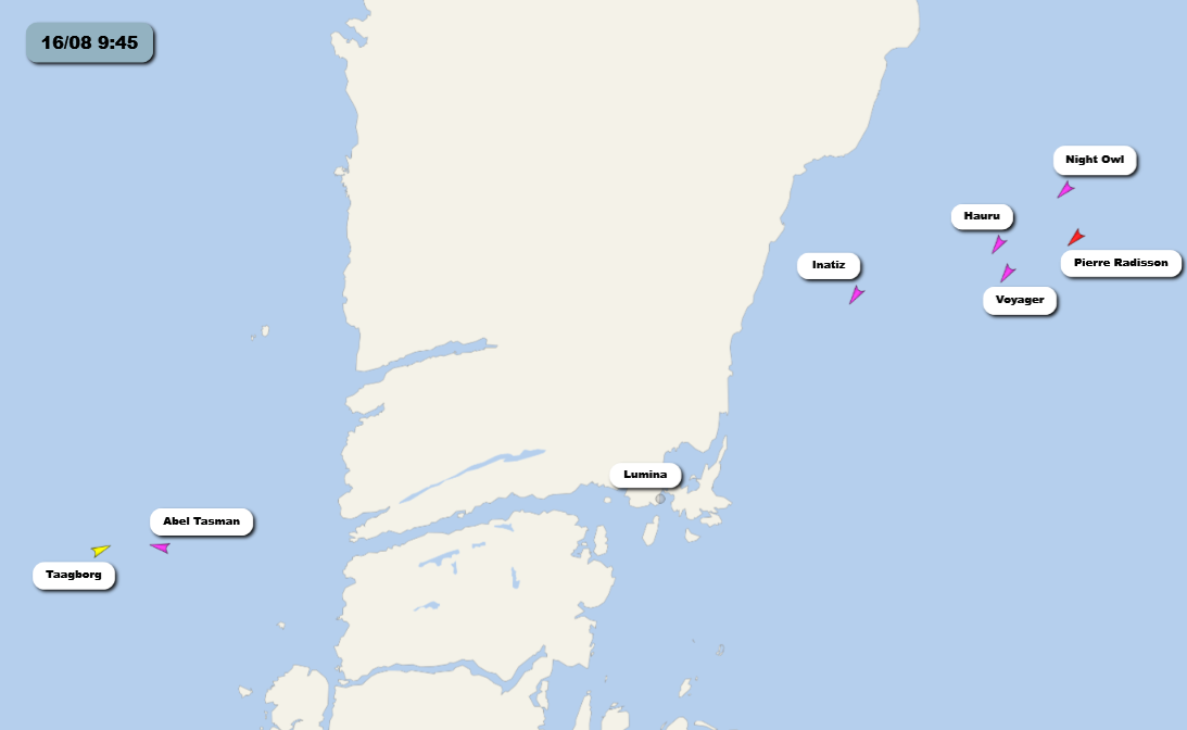
Two yachts decided to seek shelter in Levesque Harbour off Brentford Bay, south of the entrance to Bellot Strait. However Inatiz, Hauru and Lumina headed west through the strait instead:
There was still plenty of ice once the yachts reached Peel Sound…
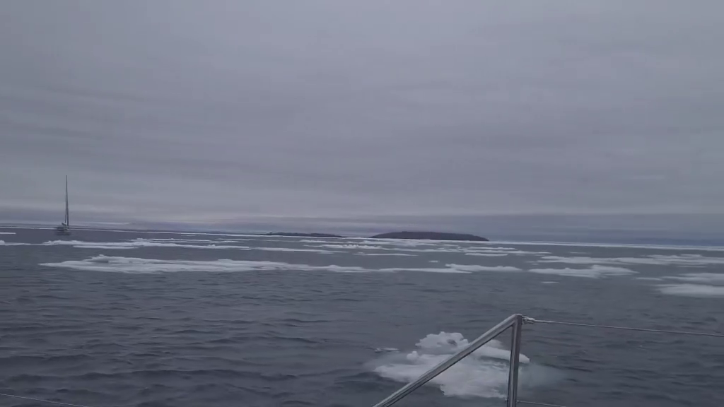
and after a northerly detour the three yachts are spending the night in Willis Bay:
P.S. This evening’s CIS chart shows routes 3 and 4 are now “open”. However if you look closely routes 5 and 6 are “closed” in the western section of Bellot Strait:
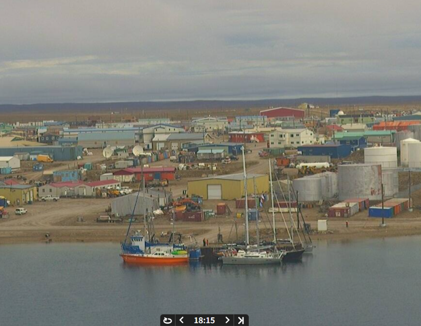
Here’s a picture of the sea ice in Bellot Strait at 21:55 UTC, via the webcam on MS Fridtjof Nansen:
Here’s the view from another angle:
Night Owl has successfully negotiated the remaining ice in Victoria Strait and has reached Icebreaker Channel:
The latest CIS chart shows that a virtually ice free route now exists through Victoria Strait:
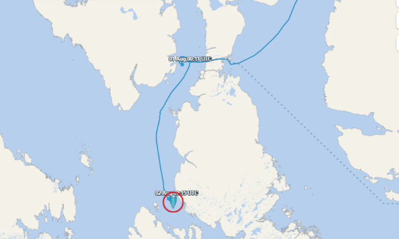
Inatiz reports that two groups of yachts heading east and west have passed each other in the strait. Lumina has reached Cambridge Bay.
So have Night Owl, Abel Tasman and Inatiz. Thanks to the webcam on MS Fridtjof Nansen, here’s a picture of the yachts moored in Cambridge Bay
Lumi has made it through Bellot Strait to Fort Ross:
So have Libertaire, Moli and Dogbark.
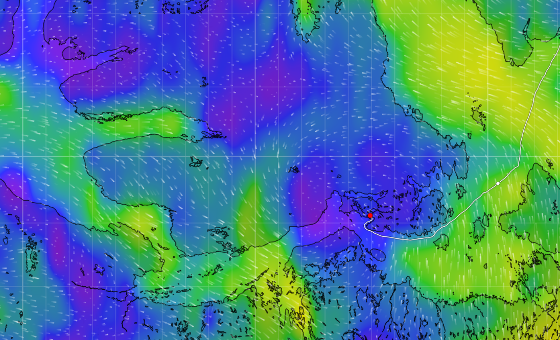
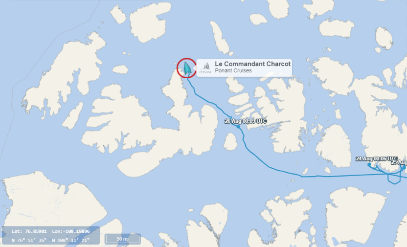
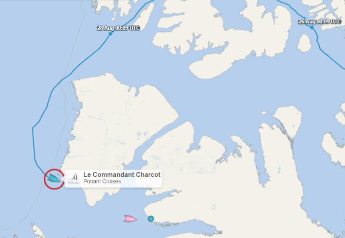
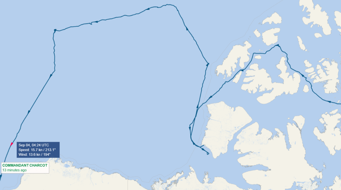
[Update – August 26th]Much like last year, the icebreaking cruise ship Le Commandant Charcot is taking a very unusual route through the Northwest Passage using Byam Martin Channel:
Here’s what the sea ice in the channel looks like, courtesy of Le Commandant Charcot’s webcam:
Heading east, the first “pleasure craft” to reach Baffin Bay is MV Beothuk.
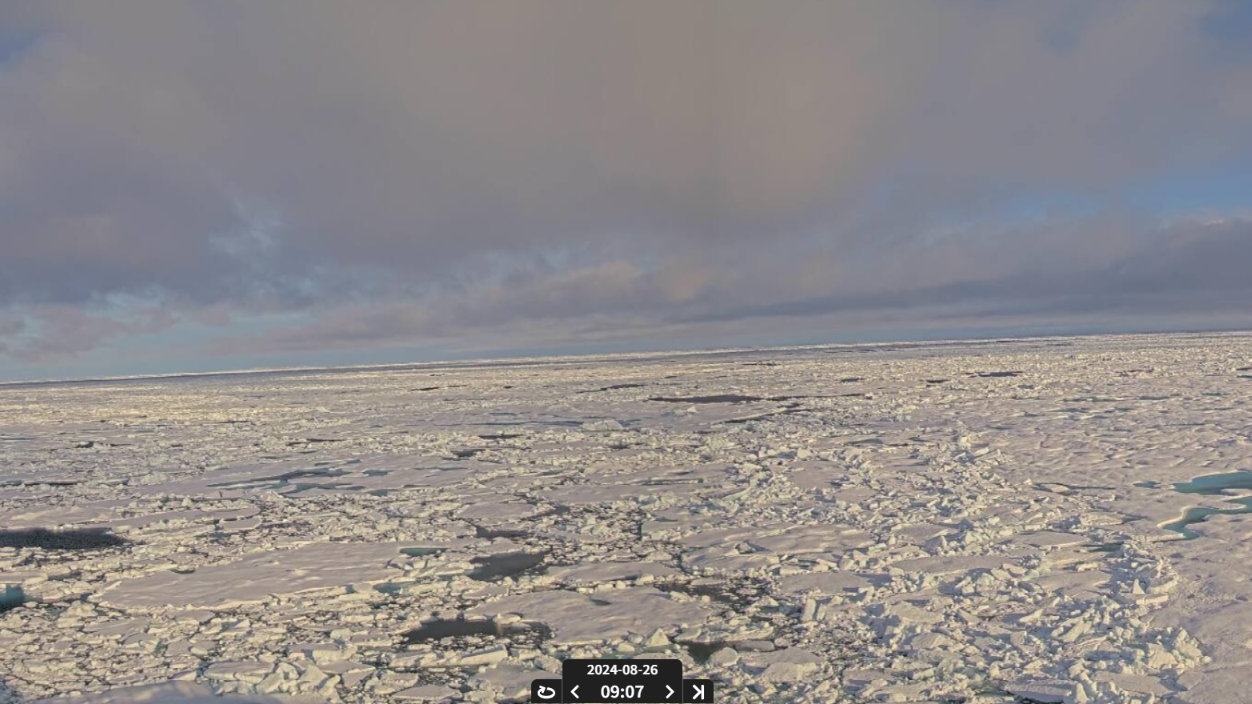
[Update – August 27th]Hanseatic Spirit is the first cruise ship this year to voyage from west to east through the Northwest Passage:
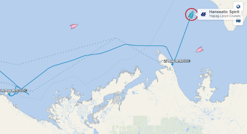
She has reached the Amundsen Gulf, and not far behind in the Beaufort Sea is MS Roald Amundsen! Meanwhile MS Fridtjof Nansen is emerging from the depths of the CAA and is going to take a look at the Smoking Hills south-east of Cape Bathurst.
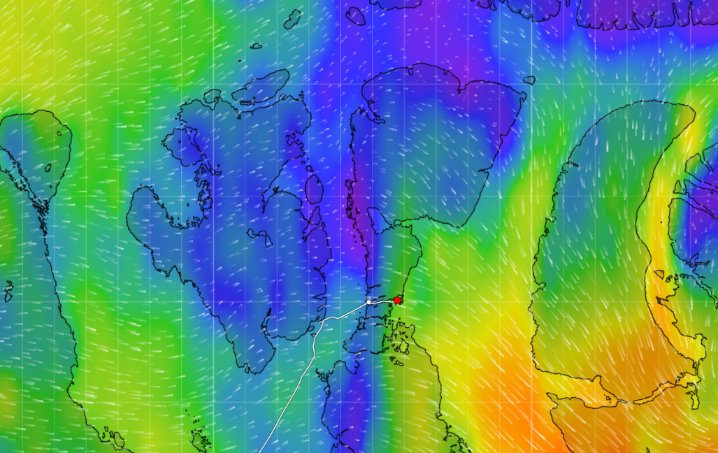
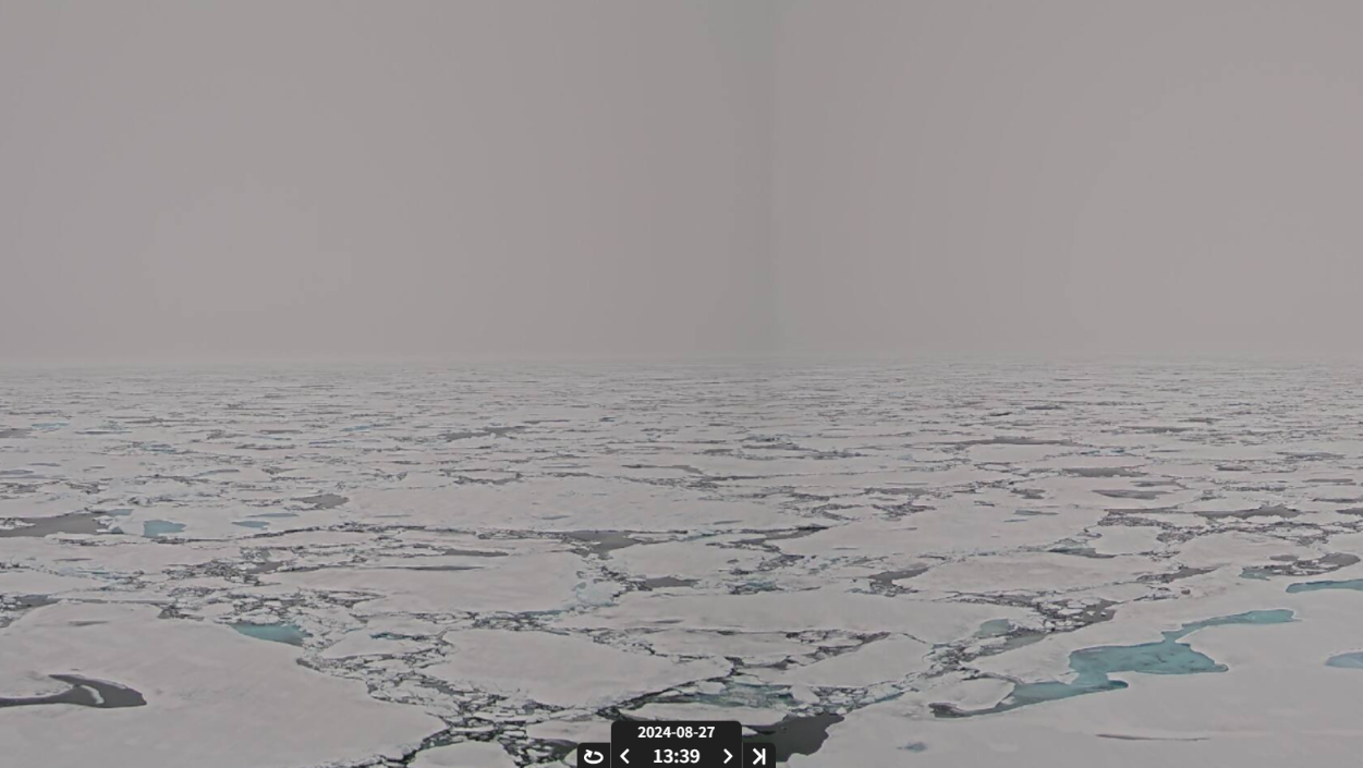
Le Commandant Charcot has reached McClure Strait, to discover plenty of sea ice and fog:
The weekly CIS chart dated August 26th shows McClure Strait closed once again:
Le Commandant Charcot made it through the 9/10 concentration sea ice, and is now nearing Sachs Harbour:
Hanseatic Spirit has reached Ulukhaktok, and MS Roald Amundsen is heading in that direction.
Dogbark is the first of the yachts heading east to reach Pond Inlet:
Thor is leading the way west, and has reached the Amundsen Gulf:
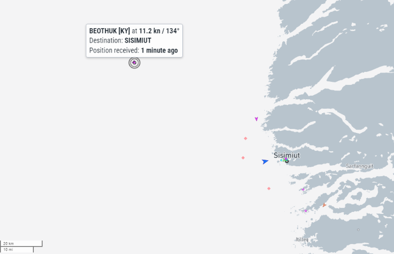
Beothuk is nearing Sisimiut:
Libertaire chose not to stop in Pond Inlet, and hence has become the first “sailing vessel” heading east to reach Baffin Bay this year.
[Update – August 31st]Heading west, Night Owl is currently sheltering from some stormy weather in Summer Harbour near Cape Parry:
Joining her there are Thor and Polar Bound.
[Update – September 2nd]In the comparative shelter of the Amundsen Gulf, Inatiz has reached Ulukhaktok:
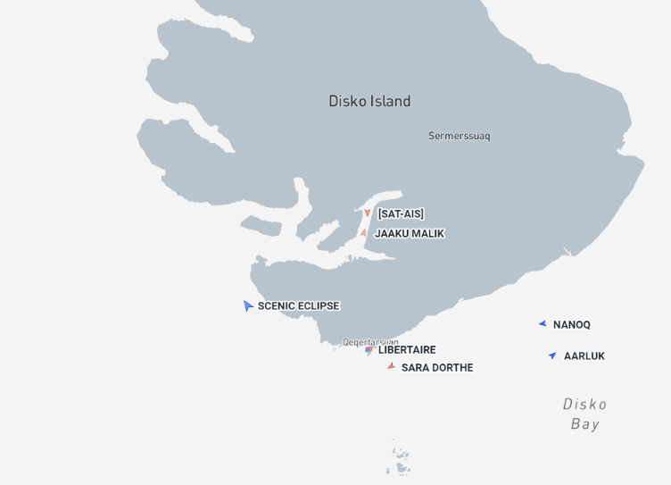
Libertaire has reached Qeqertarsuaq on Disko Island:
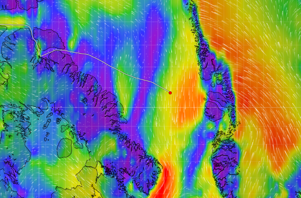
Meanwhile Lumi and Que Sera are still crossing Baffin Bay:
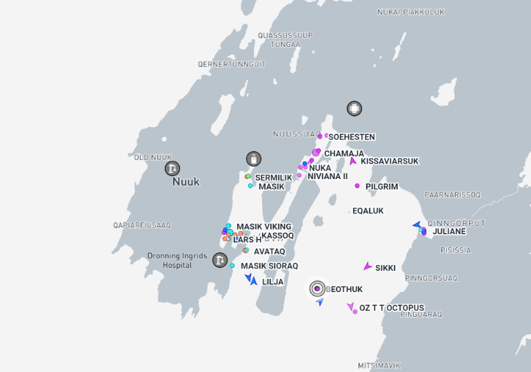
Further south Beothuk has reached Nuuk, and thus become the first “pleasure craft” to cross the Arctic Circle and complete the full west to east Northwest Passage in the summer of 2024:
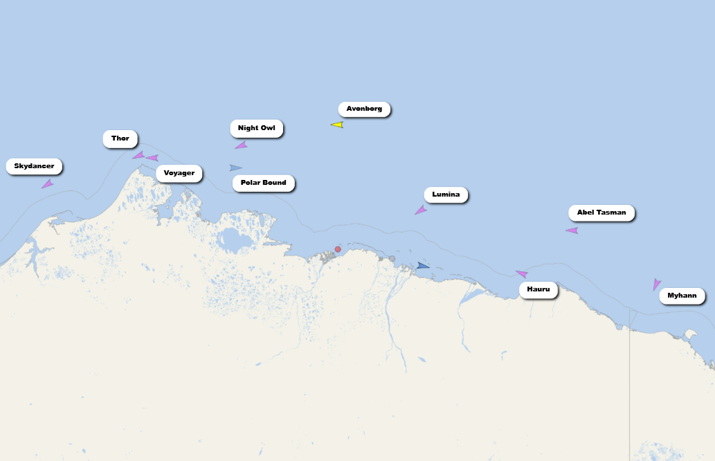
Amongst those heading west Voyager, Night Owl and Polar Bound have all reached the Beaufort Sea. So has Thor, which appears to be heading for Tuktoyaktuk:
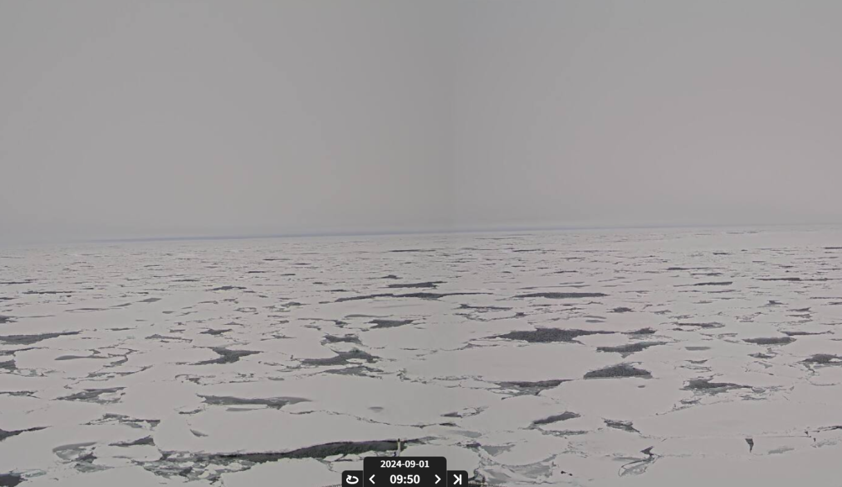
After leaving Sachs Harbour Le Commandant Charcot headed north again to take an excursion through the sea ice on the Pacific periphery:
Here’s an example of the state of the ice:
The weekly CIS chart dated September 2nd reveals that McClure Strait is now well and truly “open”, and likely to remain that way for a while:
The same applies to routes 2-6, but route 7 is still blocked at Fury and Hecla Strait:
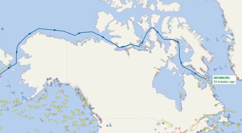
Two more Royal Wagenborg cargo ships are currently in the heart of the Northwest Passage. Avonborg is in the Amundsen Gulf en route to Ulsan in Korea:
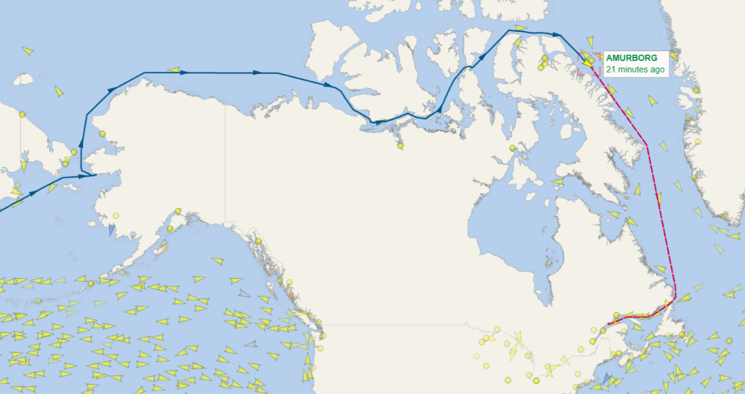
Amurborg is in Larsen Sound, heading for Baie Comeau on the St. Lawrence River:
Plenty of multi-year ice is now starting to feed into the northern route through the Northwest Passage from the central Arctic via the Nares Strait and the northern CAA:
Meanwhile in the open water further west a veritable fleet of yachts heading west are queuing up to round Point Barrow, as is Avonborg:
Over to the east, Amurborg has reached Baffin Bay:
Further south Dogbark! has crossed the Arctic Circle , and thus become the first “sailing vessel” to complete the full west to east “circle to circle” Northwest Passage in the summer of 2024:
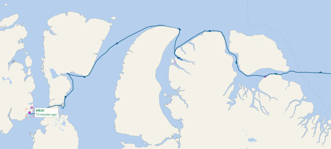
In other news, Anju has successfully negotiated Bellot Strait and appears to be intent on a full east to west passage rather late in the season:
On the other hand, having spent some time in Cambridge Bay Nashachata II is now retracing her steps via route 6:
Once through Bellot Strait the plan is to take route 7 to Iqualuit:
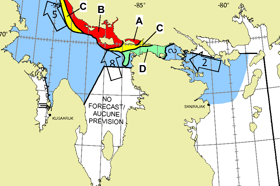
However, the path through Fury & Hecla Strait remains problematic at the moment:
The Canadian Ice Service has restarted daily coverage of McClure Strait:
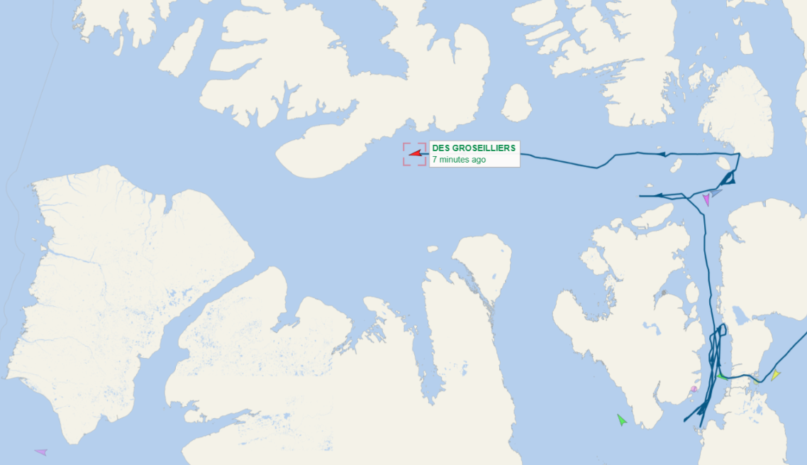
Presumably that is because CCGS Des Groseilliers is currently heading west through Viscount Melville Sound:
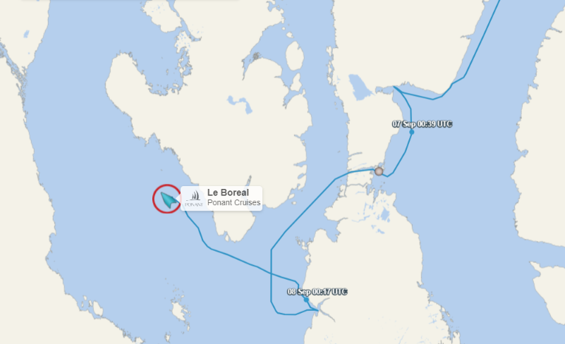
Also taking a road less travelled through the Northwest Passage is Ponant’s ice hardened cruise ship Le Boreal, currently heading north through McClintock Channel:
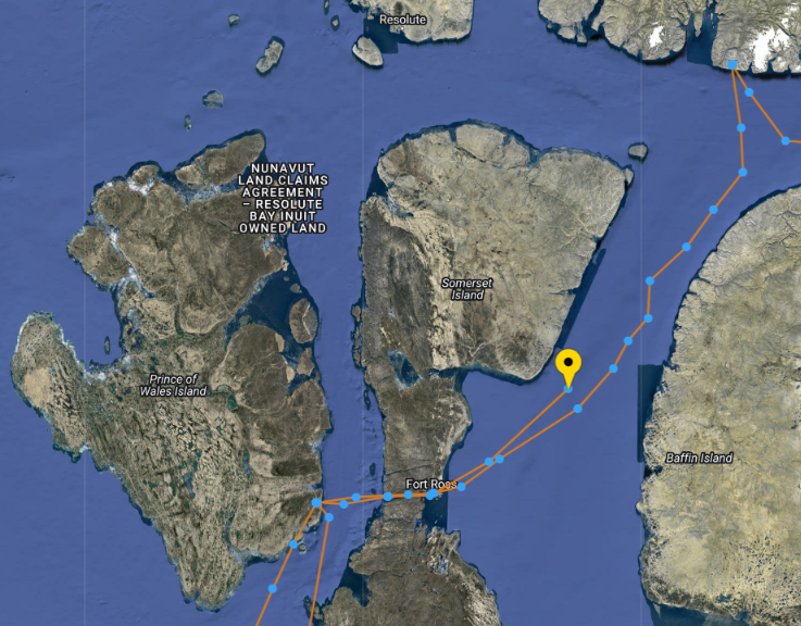
The crew of Nashachata II have evidently decided that discretion is the better part of valour and they are taking the long way around to Iqualuit:
Skydancer is the first (trackable!) yacht to have finished a complete westbound “circle to circle” voyage through the Northwest Passage this summer:
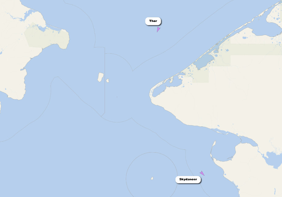
Thor is next in the queue, having been delayed by going to assist another yacht in trouble:
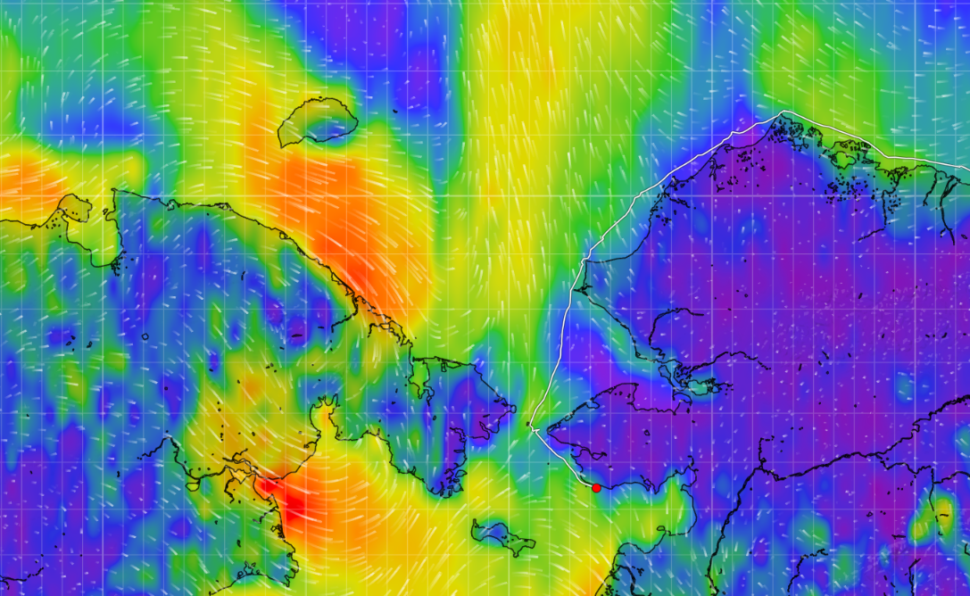
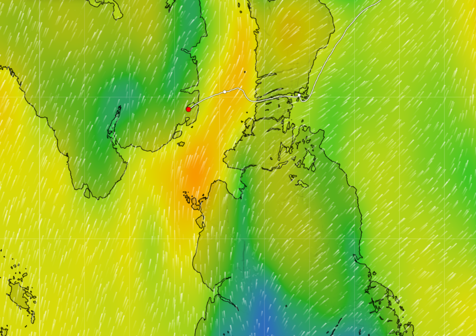
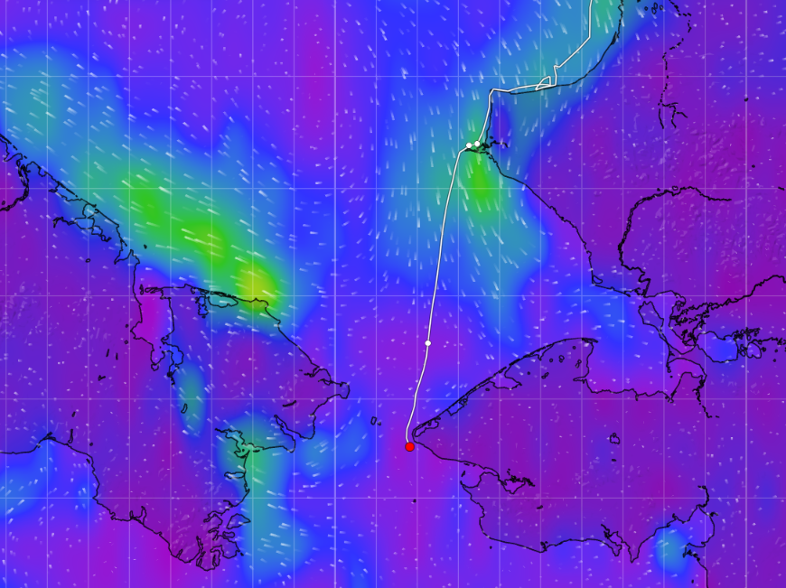
Departed Cape Hope in the pitch dark hoping of making it into Nome in the daylight tomorrow. Fortunately, strong winds have subsided but southerlies continue. Of course, the wind direction did not change as predicted but did subside somewhat.
Some may wonder about our erratic course change a couple of days ago, north of Cape Lisburne. Our plan had been to anchor near shore to shelter from the 30+ knot winds. Luck was not on our side—the bottom was rock and the anchor would not hold. After our third attempt at different places along the coast, we gave up. Just as we turned south, we received an emergency call from a disabled yacht north of us. We were the closest yacht-50 miles away—so we immediately turned to render assistance. Luckily after a few hours, the owner was able to fix his problem and we returned to looking for a safe shelter.
After another horrible passage into high winds and disturbing steep seas, we found good holding ground off Cape Hope in sand.
P.S. Thor has now successfully negotiated the Bering Strait, in much lighter winds!
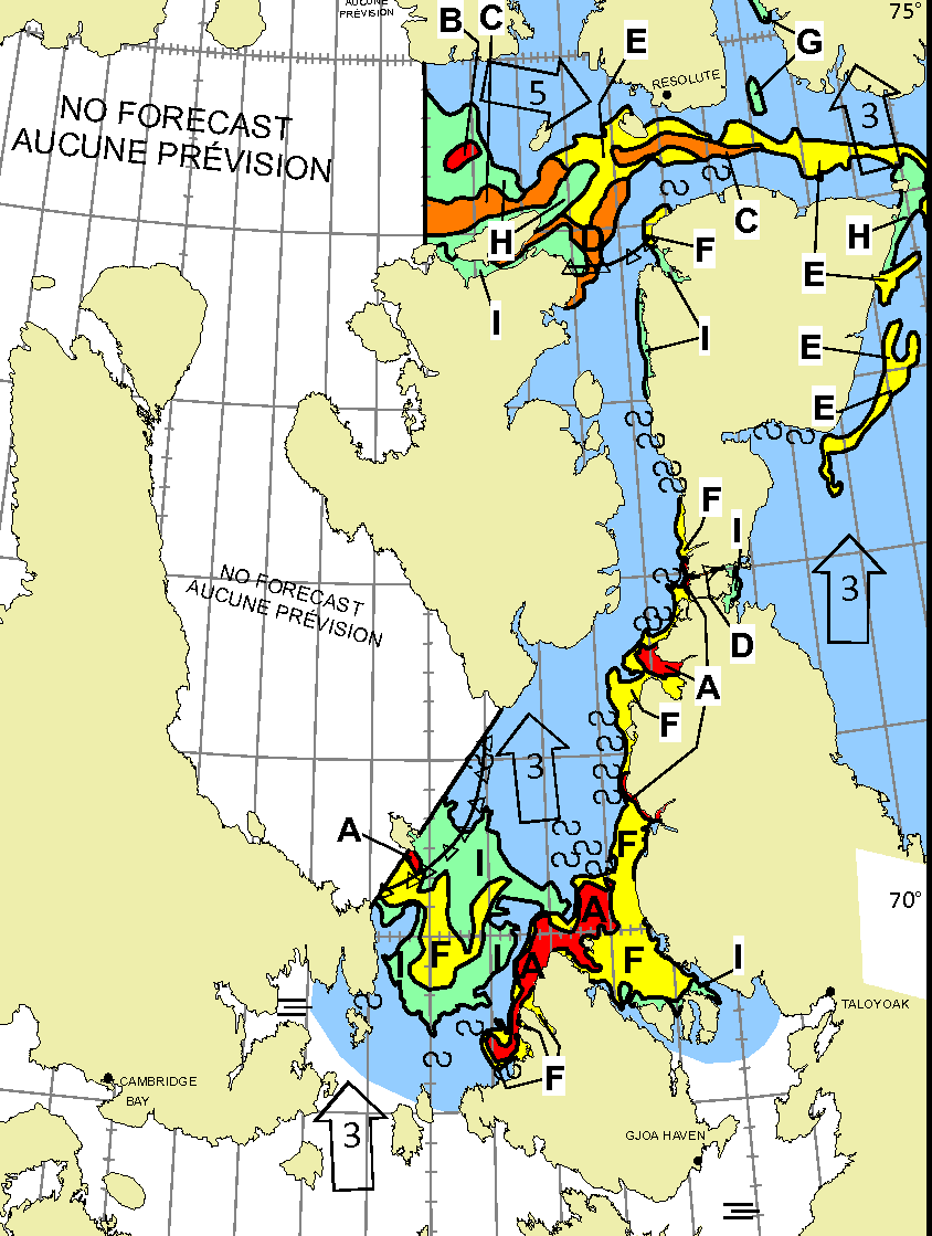
There is now a route through Fury and Hecla Strait that is free of sea ice in concentrations over 3/10. Hence it is now possible to announce that all seven of the traditional routes through the Northwest Passage are “open” for navigation by small “pleasure craft”:
The latest weekly charts from the Canadian Ice Service show that all 7 routes are “wide open”, with < 1/10 ice concentration almost everywhere:
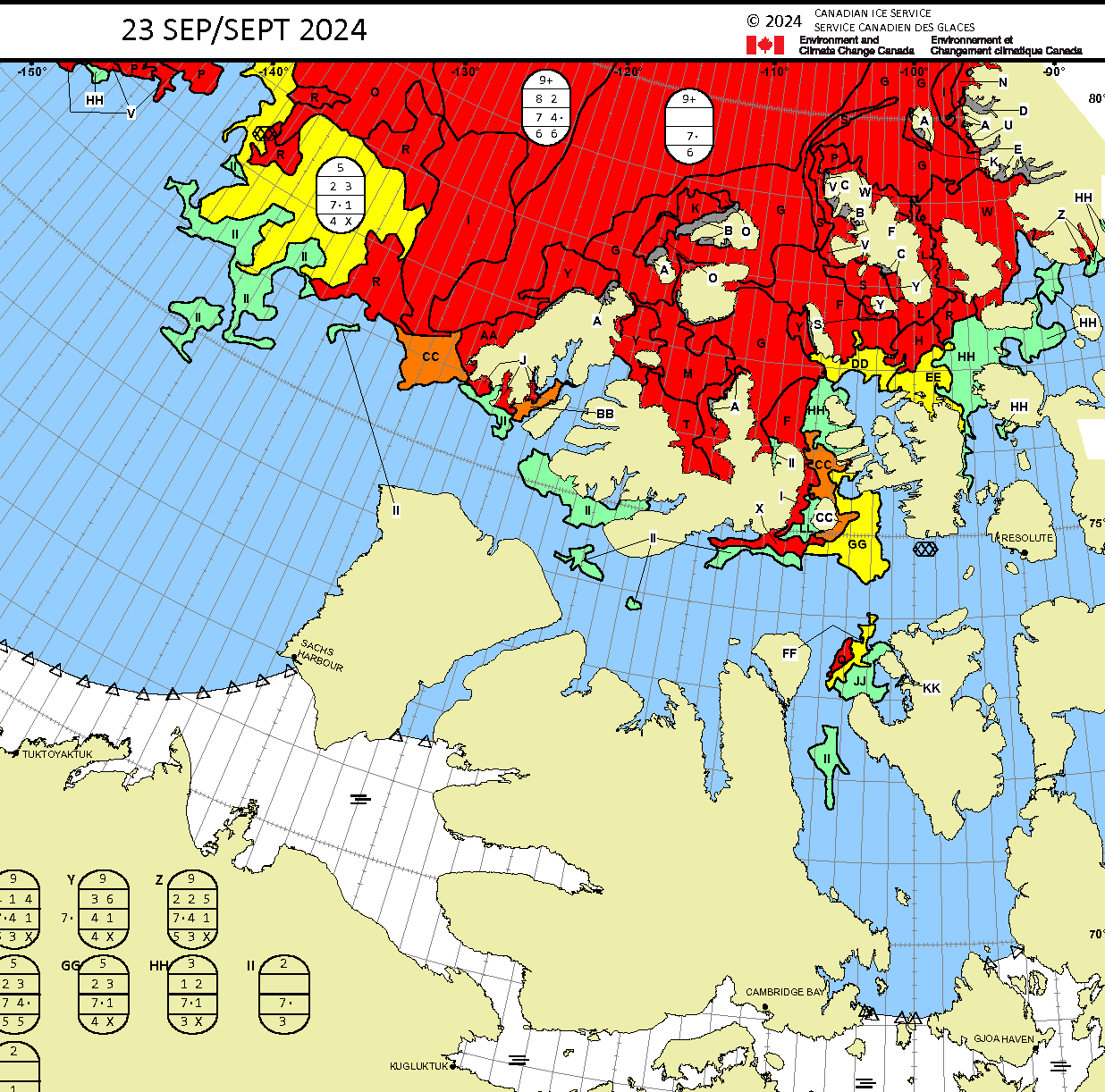
The only exception is a small area of 2/10 concentration ice in the Fury & Hecla Strait:
Royal Wagenborg’s Atlanticborg has just completed a westbound transit of the Northwest Passage, en route to Kawasaki in Japan:
Also heading west is Amurborg, which has just crossed the Arctic Circle heading north into Baffin Bay:
The latest CIS weekly charts show that the Parry Channel is currently almost entirely free of sea ice:
As indeed does this satellite image from September 30th:
I was wondering if Amurborg might try the road less travelled through the Prince of Wales Strait, but evidently Peel Sound is the route of choice on this occasion:
In what I presume will be the final “commercial” voyage through the Northwest Passage this year, Royal Wagenborg’s bulk carrier Nassauborg is heading through Foxe Basin towards the Fury and Hecla Strait:

Here’s the current CIS ice chart of the region:
Nassauborg has reached the Bering Strait, and hence completed the final [westbound] commercial transit of the Northwest Passage this year:
In other news USCGC Healy has returned to the Beaufort Sea after a fire caused an abrupt return to Seattle for repairs earlier in the summer.
I’m ashamed to admit that I’d given up looking, but Aker Arctic spotted Avonborg emerging into the Davis Strait on November 9th following what must surely be the final eastbound commercial transit of the Northwest Passage in 2024:
Watch this space!
Hi Jim
I’m Keith Tuffley, owner of Abel Tasman. We enjoy reading your blog.
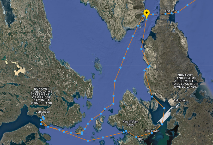
We’re now in Willis Bay, hoping to head towards Gjoa Havn in the next few days.
Keith
Hi Keith,
Thanks for your kind words. It looks as though you’ve now been joined by Night Owl:
And that the winds are not exactly favourable just at the moment, although with luck they’ll loosen up the remaining ice in James Ross Strait?
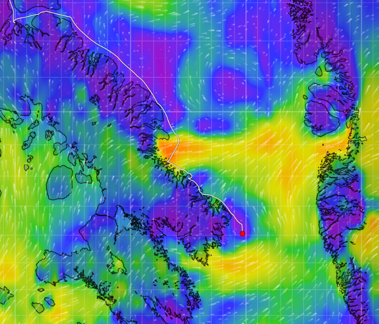
S/V Lumi now on the way to Bellot Strait, currently about half way there.
S/V Lumi now entering Lancaster Strait
“Further south Dogbark! has crossed the Arctic Circle , and thus become the first “sailing vessel” to complete the full west to east “circle to circle” Northwest Passage in the summer of 2024:”
As has Lumi.
Unless they’ve turned tracking off, Lumi hasn’t crossed the Arctic Circle yet?
Although Moli might have just done so.
Sorry, I misread it as 66.24!
Bonjour,
J’ai rencontré les 2 gars du S/V ANJU à Nuuk le 17 août.
Tard dans la saison pour faire le NWP …
Je ne le trouve plus sur Marinetraffic.
Comment faîtes-vous pour avoir sa trace ?
Marinetraffic par satellite ?
Merci pour toutes les infos.
Patrick
Hi Patrick,
I hope your English is better than my French?
I was following Anju’s progress using VesselFinder’s free plan, after paying for one day of satellite AIS data at a judicious moment. I’m afraid I’ve been too busy on other (renewable energy) stuff to keep up to date on their progress recently.
However I strongly suspect that Anju has recently rounded Point Barrow: