According to the latest edition of the National Snow and Ice Data Center’s “Arctic Sea Ice News”
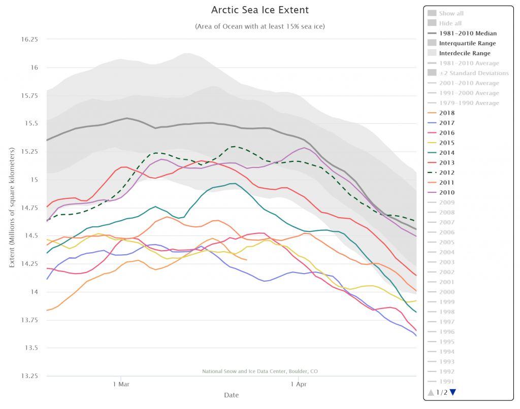
On March 17, 2018, Arctic sea ice likely reached its maximum extent for the year, at 14.48 million square kilometers (5.59 million square miles), the second lowest in the 39-year satellite record, falling just behind 2017. This year’s maximum extent is 1.16 million square kilometers (448,000 square miles) below the 1981 to 2010 average maximum of 15.64 million square kilometers (6.04 million square miles).
The four lowest seasonal maxima have all occurred during the last four years. The 2018 maximum is 60,000 square kilometers (23,200 square miles) above the record low maximum that occurred on March 7, 2017.
Here’s a close up view of recent maxima via the NSIDC’s Charctic interactive sea ice graph:
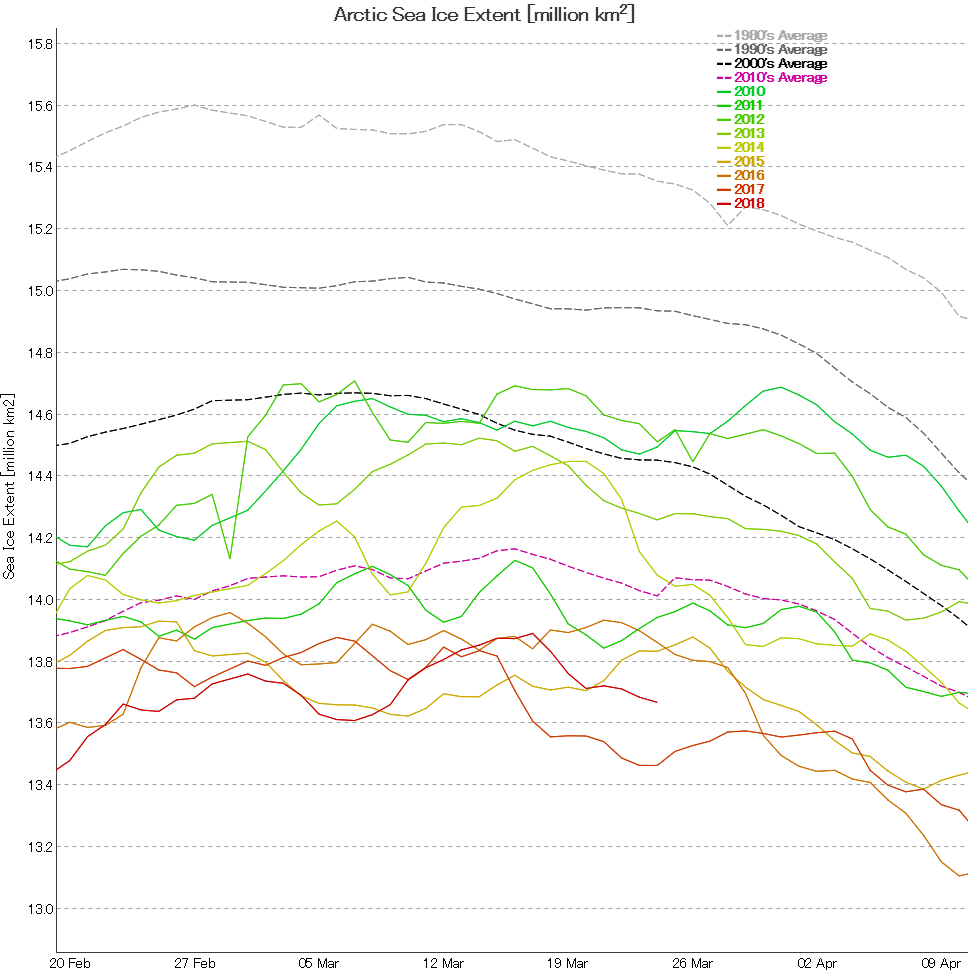
Next let’s take a look at extent data from the Japanese National Institute of Polar Research, colloquially referred to as “JAXA extent”
In this case the maximum was 13.89 million square kilometers, also on March 17th.
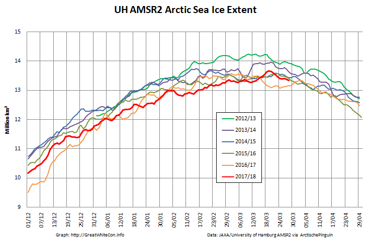
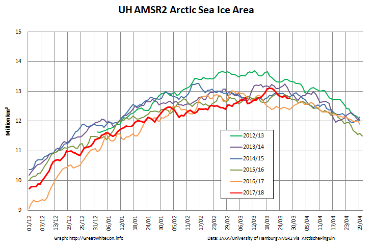
Here too are the extent and area graphs based on Wipneus’ processing of the University of Hamburg’s AMSR2 based concentration data:
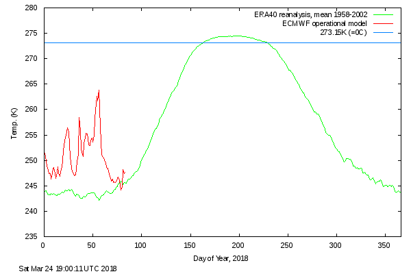
They highlight the surge in Arctic sea ice area in the middle of March due to the sudden “cold snap”:
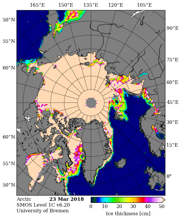
Looking at the third Arctic dimension, here’s the latest SMOS thickness map from the University of Bremen:
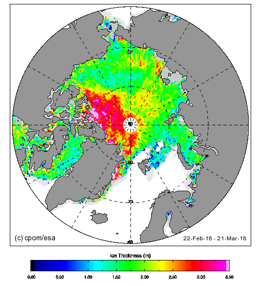
and here’s the latest CryoSat-2 thickness map:
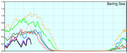
They reveal large areas of relatively thin sea ice in the Okhotsk and Barents Seas where the ice can now be expected to melt as quickly as it formed. There is also remarkably little sea ice in the Bering Sea for the time of year:
“They reveal large areas of relatively thin sea ice in the Okhotsk and Barents Seas where the ice can now be expected to melt as quickly as it formed.”
Is this not true every year that we reach a stage where melting occurs in these areas? Setting new minimums is news, not reaching them is not. This is the final amount of the old El Nino heat dissipating and we both know the next years results will show much larger ice volume and extent as the colder overall world temp and ocean conditions kick in.
W have had a good run of natural melting for the last 40 years, time for the cycle to turn unless the CO2 effect exists and can kick in hard which, in all seriousness it should be doing on ice and temps world wide, not at one pole.
Has the maximum even been truly reached this year?
Still a week for a surprise.
Did you see how quickly the ice formed on the Pacific periphery during the “cold snap”. It can’t possibly be very thick!
Now the winds on the Atlantic side are pushing ice into the Barents Sea, but I certainly don’t see that causing a new Arctic wide maximum for the year during April:
MAISIE no help. CAB, Greenland and Barents need to do some heavy lifting ala 2012 at this time of year.
I’m not sure that I’m with you angech. What help would you expect from MASIE?
Have you read my conversation with Walt Meier on that topic?
https://greatWhiteCon.info/2016/02/dmi-masie-and-the-sea-ice-index-an-interview-with-walt-meier/
Jim – Its April 1 – looks like Arctic forum is suffering ! Any news ?
Fred the Dungeon Master seems to have restored normality at the ASIF.
And Barneo 2018 is under way at long last!
https://forum.arctic-sea-ice.net/index.php/topic,2290.0.html
A blast from the past:
April the second and still time for a late maximum Jim, though will take a heck of a lot of freezing in the next 3 days Greenland and central arctic, big areas, going up nicely.
I get a bit of the data off Neven’s site where his MAISIE graph, when clicked on shows all the areas very well.
I see the comments about melting out and thin ice every year.
What to make of it?
The last ice will always be very thin.
Melting will be slow because it is still very cold so no hope for those wanting 100,000 falls this early.
Biggest area of concern this year is that bite out of the central arctic near Greenland though it is closing in again.
The last of the El Nino residual heat is going so this should be a slow melt year with higher extents and volumes throughout the year.
Cloud cover is the big unknown.
Snow albedo should ensure a colder North but of course colder is less cloud and hence more insolation.
The joys of predicting??
Since you’re here angech, perhaps you can answer the question I posed over at ex Prof. Judy’s more succinctly than the denizens have thus far succeeded in doing?
Mind you, I am a big fan of Schrödinger’s Cat:
So thanks to Mr. Ellison for this:
Extent going down? so sad.
“Perhaps somebody here would be good enough to explain the “Another loss for the alarmists” comment to me?”
You mean Dave Andrews comment.
“Translation… it’s cyclical. “Global warming” has nothing to do with it. Another loss for the alarmists.”
Well, if abrupt changes can happen with no changes in forcing and you are postulating that abrupt big changes are occurring then one would have imagined that such catastrophe would have already hit with global warming changes said to have been happening for so long.
Since it has not then it is the alarmists loss?