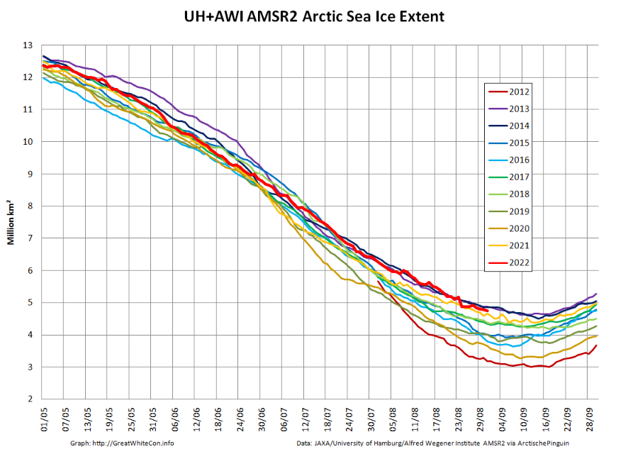
As in previous years there is already a thread devoted to this year’s minimum extent. By way of a summary here are the end of August numbers for our favourite “high resolution” AMSR2 area and extent metrics:
Extent is currently near the top of the range of the last 10 years.
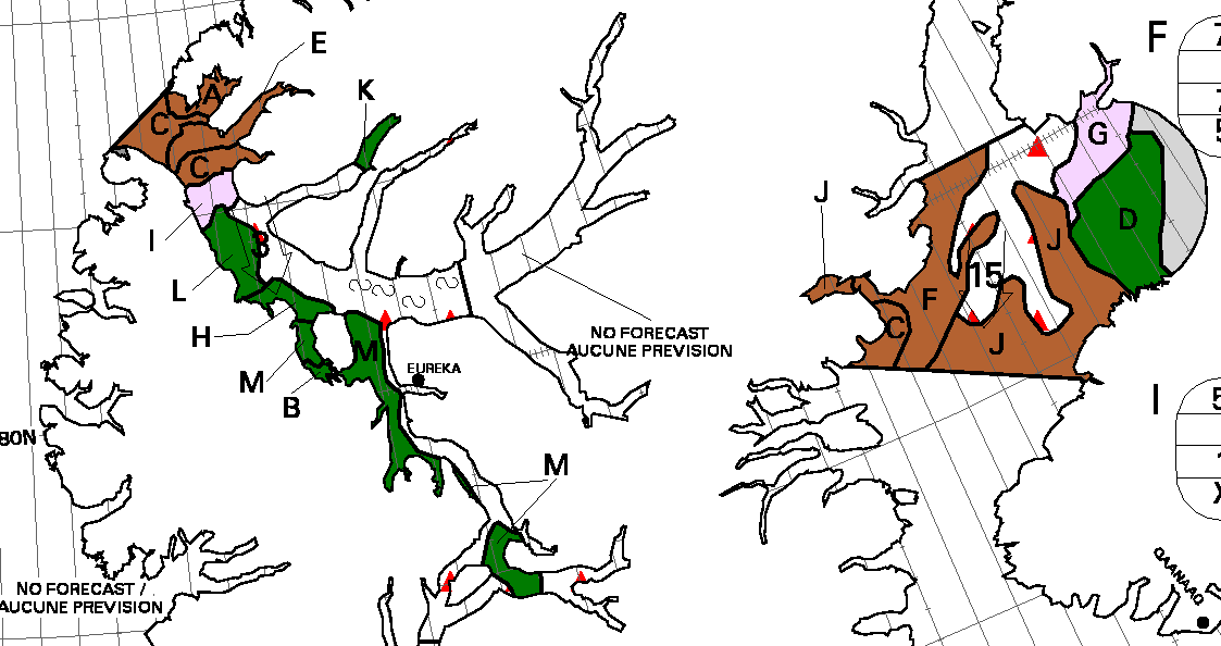
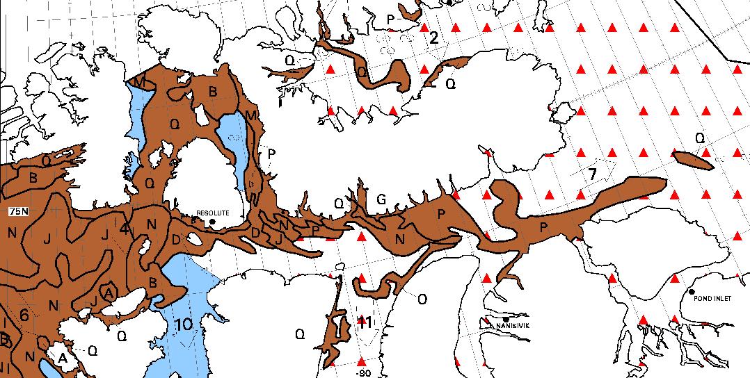
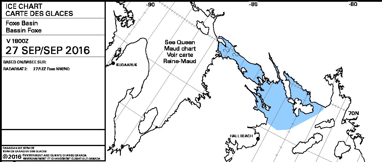
We have now reached the stage of the “melting season” when “refreezing” has started in the Central Arctic but melting at the periphery is outpacing it. However the Canadian Ice Service stage of development charts now show the arrival of new ice in the high latitudes of the Canadian Arctic Archipelago:
A reader writes to ask us to explain the answer to the above question in more detail. Are you sitting comfortably once again? Then let us begin.
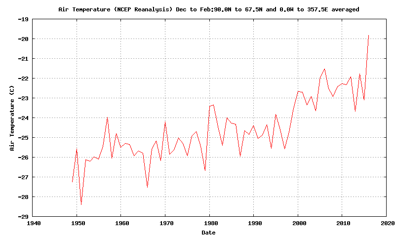
There has been a lot of unusual “weather” in the Arctic over the last twelve months. First of all there was an anomalously warm winter:
Then came what we dubbed the Great Arctic Anticyclone of 2016 in April. Take a look at what happened to the sea ice north of Alaska and Canada during the Spring and early Summer:
The ice was put through the mincer for the first time. Then during August there were a series of strong cyclones, collectively the Great Arctic Cyclone of 2016. The ice was put through the mincer once again, but in an anti-clockwise direction this time. Watch what happens in the Northwest Passage as summer turns to Autumn:
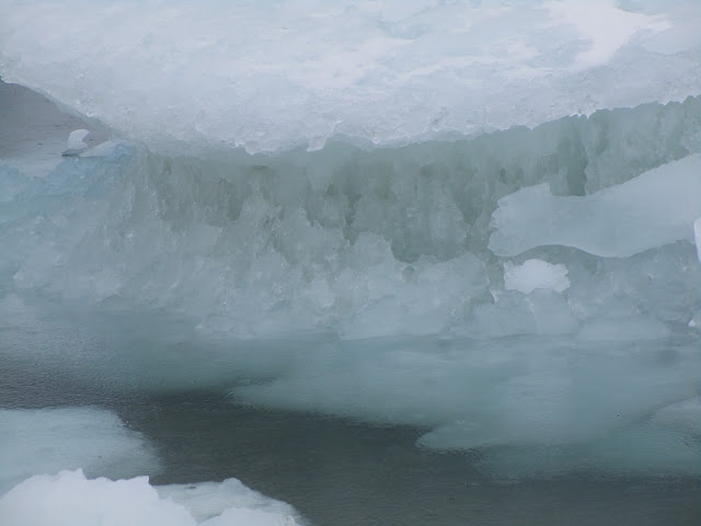
Some of the oldest, thickest ice in the Arctic has been chopped into small pieces which then easily flow through the channels of the Canadian Arctic Archipelago and into the Northwest Passage. Hence when the yacht Northabout (amongst others) was racing to reach Baffin Bay it wasn’t to avoid “the refreeze” as claimed in certain quarters. It was in fact to try and avoid the worst of the chopped up chunks of old sea ice being carried swiftly in their direction by winds and currents. Here’s what some of them looked like in close up:
The next question then becomes, if the Northwest Passage wasn’t refreezing then, is it freezing now? The answer is not yet. In fact the favourite talking point of the cryodenialista, McClure Strait at the western end of the “main” route through the Passage has recently become navigable:
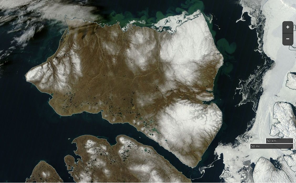
NASA Worldview “true-color” image of Banks Island on September 24th 2016, derived from the MODIS sensor on the Terra satellite
The “pretty pink” area towards the top left of the chart reveals “new ice”. The Northwest Passage will have started to refreeze when some of that shows up on a “stage of development” chart of the Passage itself, but that hasn’t happened yet. Here’s yesterday evening’s chart of the “Approaches to Resolute“:
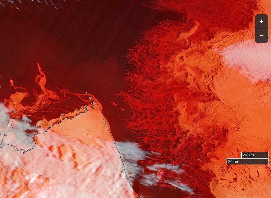
Lots of old ice! It was raining in Resolute yesterday, and the old ice there was still melting:
[Edit – September 27th]
No sooner said than done! This evening’s ice charts from the CIS do now show some “pretty pink” new ice in the Northwest Passage:
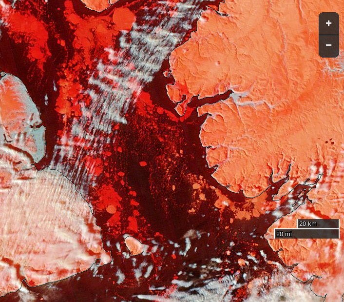
The wispy areas of new ice are also visible on this “false-color” image of the Parry Channel:
NASA Worldview “false-color” image of the Parry Channel on September 27th 2016, derived from the MODIS sensor on the Terra satellite
However even if Northabout were still in Prince Regent Inlet she wouldn’t be “trapped in ice”. There is still a way back to Bristol via Fury and Hecla Strait:
A clear view of McClure Strait from the Terra satellite in “false colour”:
NASA Worldview “false-color” image of the McClure Strait on September 30th 2016, derived from the MODIS sensor on the Terra satellite
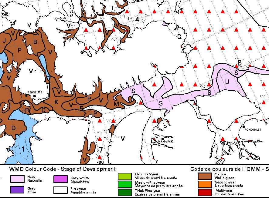
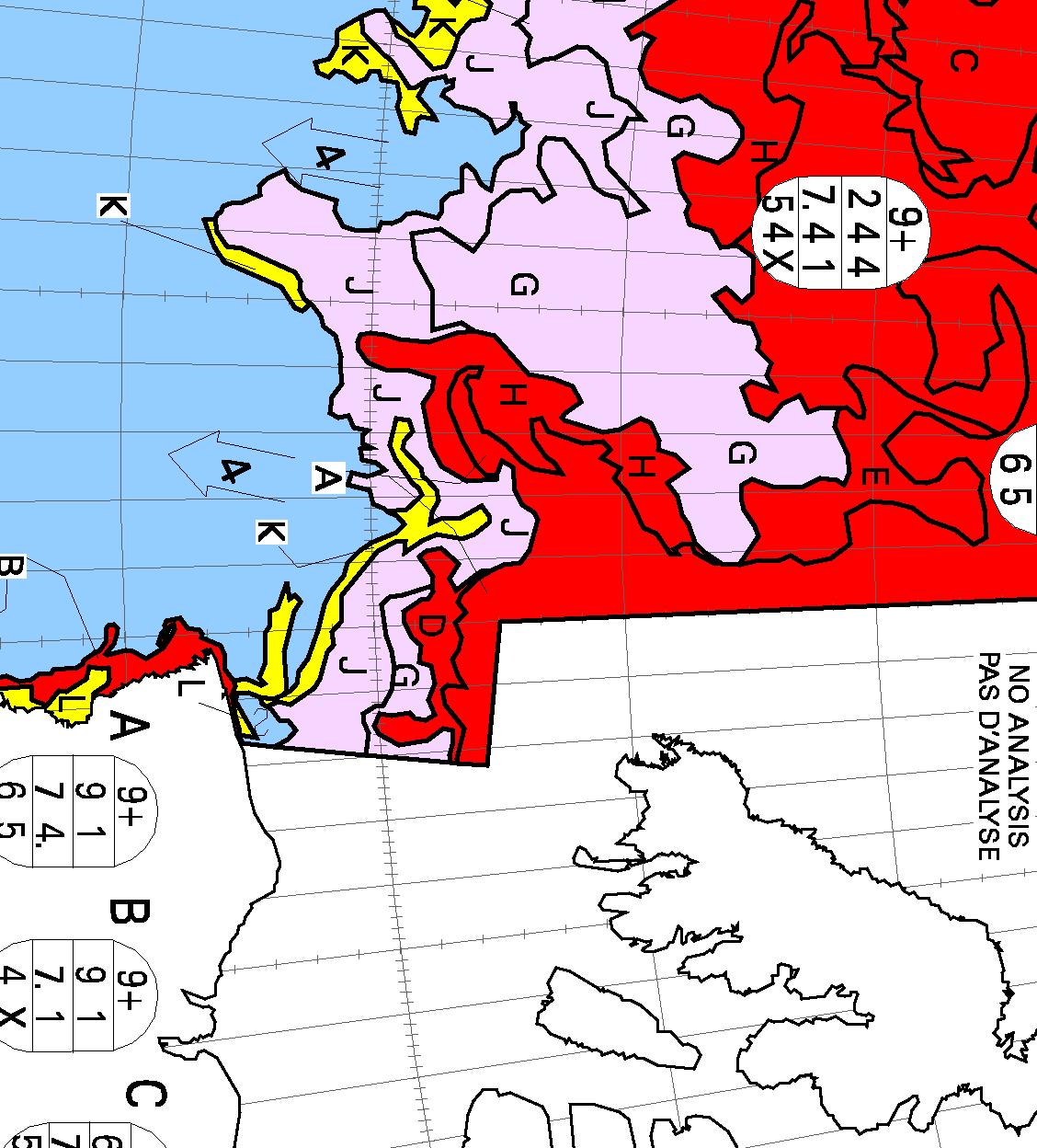
The inclusion of some infra red reveals the thicker old ice on the right noticeably paler than the new ice to its left. Compare also with the CIS ice chart, which has been rotated to match the orientation of the satellite image:
[Edit – October 2nd]
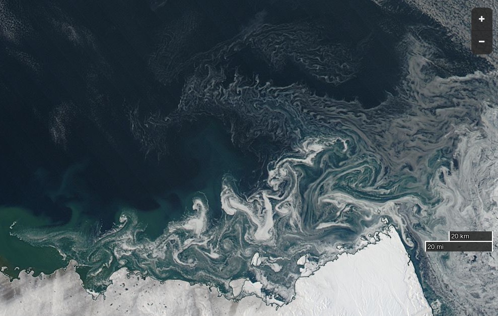
Pretty patterns in the new sea ice forming at the western entrance to McClure Strait:
NASA Worldview “true-color” image of the McClure Strait on October 1st 2016, derived from the MODIS sensor on the Aqua satellite
The freshly frozen new ice in the Northwest Passage has been spotted by the AMSR2 instrument aboard the Japanese “Shizuku” satellite:
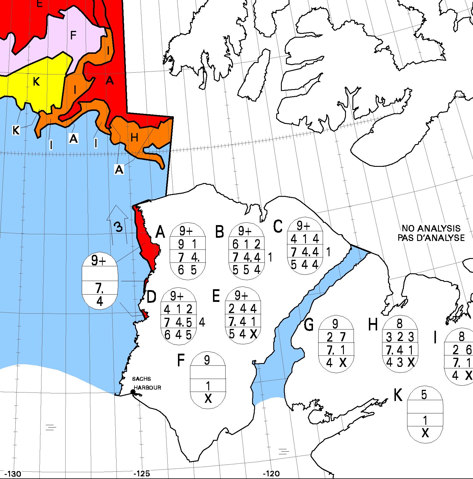
On the latest CIS “stage of development” chart the brown “old ice” has turned to deep red “multi-year ice”, and there’s lots more pretty pink out in the Beaufort Sea:
This website uses cookies to improve your experience. We'll assume you're ok with this, but you can opt-out if you wish. Cookie settingsACCEPT
Privacy & Cookies Policy
Privacy Overview
This website uses cookies to improve your experience while you navigate through the website. Out of these, the cookies that are categorized as necessary are stored on your browser as they are essential for the working of basic functionalities of the website. We also use third-party cookies that help us analyze and understand how you use this website. These cookies will be stored in your browser only with your consent. You also have the option to opt-out of these cookies. But opting out of some of these cookies may affect your browsing experience.
Necessary cookies are absolutely essential for the website to function properly. This category only includes cookies that ensures basic functionalities and security features of the website. These cookies do not store any personal information.
Any cookies that may not be particularly necessary for the website to function and is used specifically to collect user personal data via analytics, ads, other embedded contents are termed as non-necessary cookies. It is mandatory to procure user consent prior to running these cookies on your website.