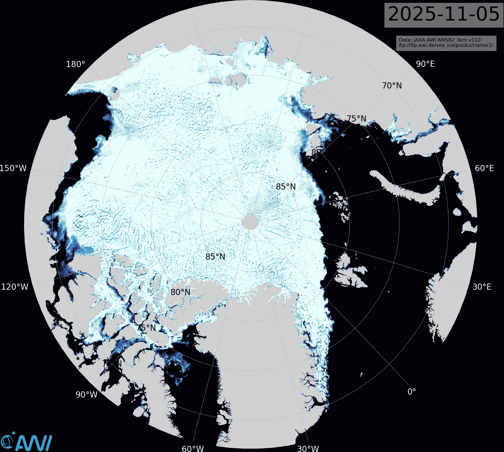
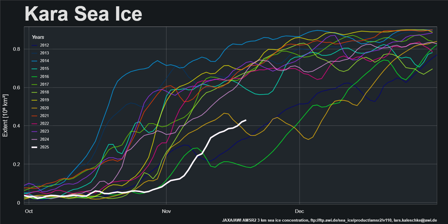
The latest Alfred Wegener Institute sea ice concentration map shows the East Siberian and Laptev Seas almost completely refrozen. However, refreeze of the Kara Sea has barely begun:
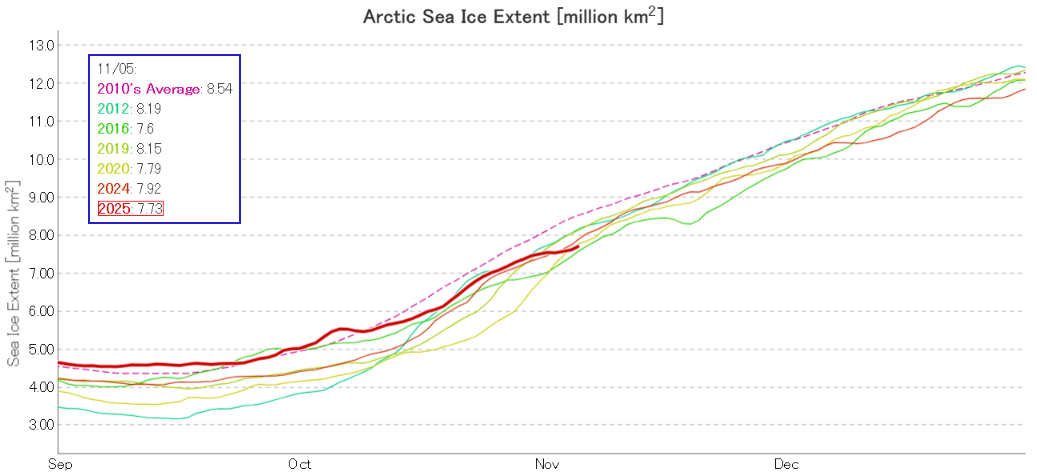
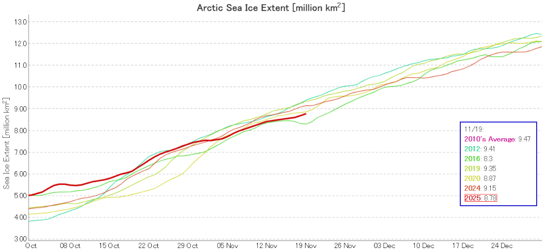
Across the Arctic as a whole the refreeze has slowed significantly, and JAXA/ViSHOP extent is now 2nd lowest in the satellite era:
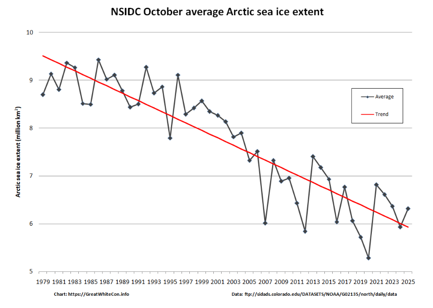
However, average NSIDC extent for the month of October was higher than last year and above the linear trend:
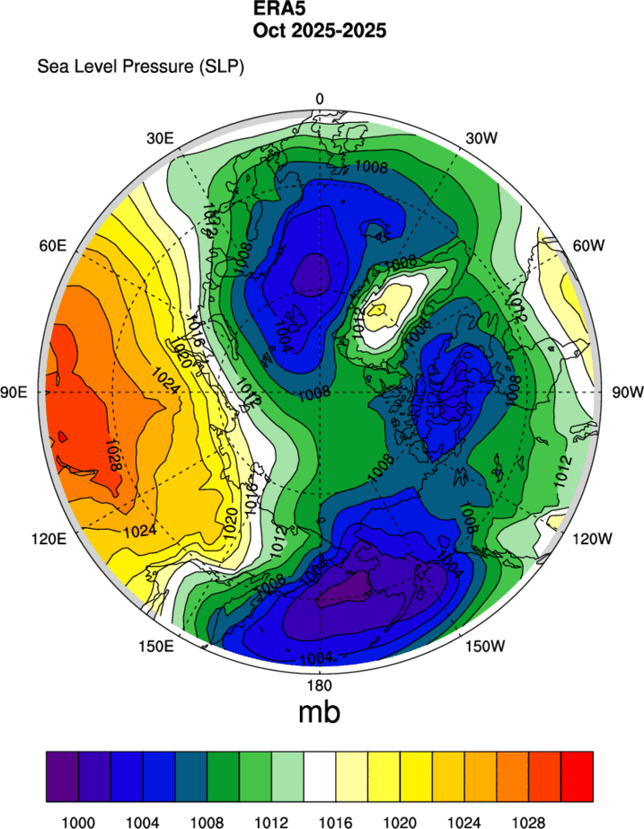
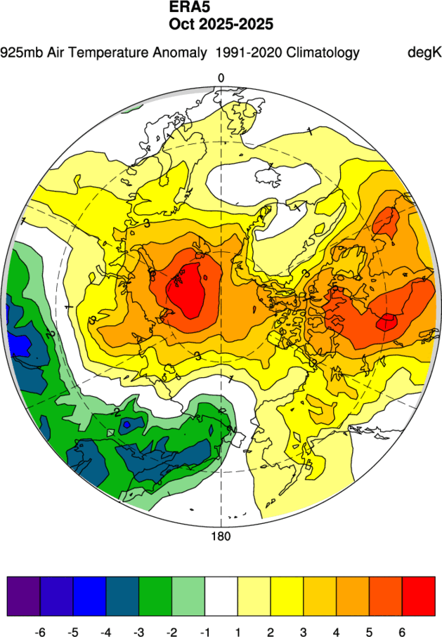
The ERA5 MSLP map for October shows high pressure over Siberia, associated with lower than normal air temperatures at 925 hPa across the region. However, temperatures across almost the entire Arctic Ocean were above normal:
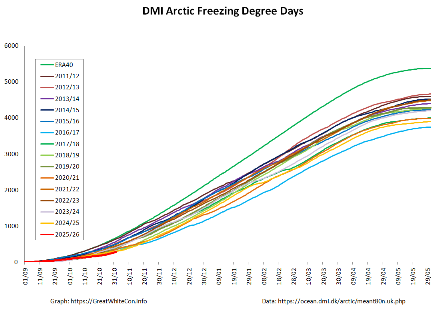
High Arctic freezing degree days based on DMI >80N data were lowest for the date at the beginning of November:
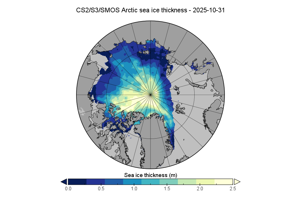
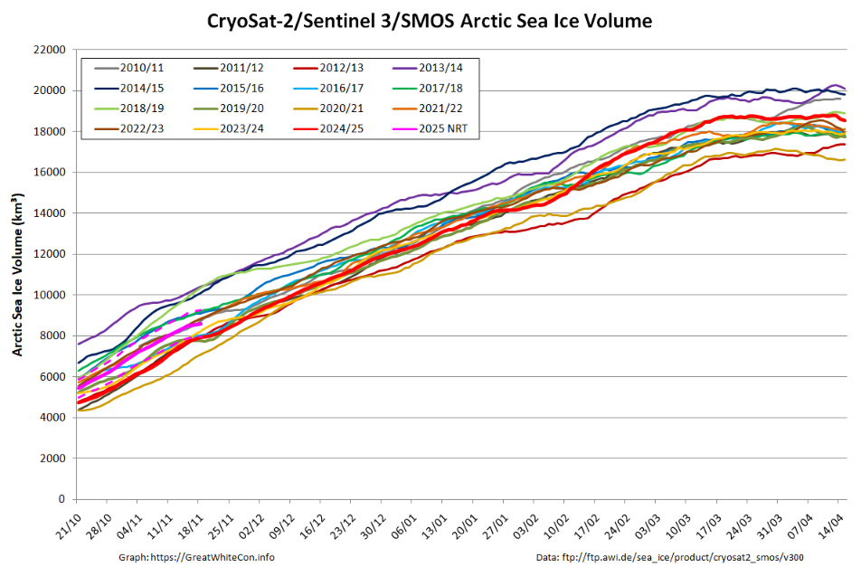
Here is the Alfred Wegener Institute’s CryoSat-2/Sentinel 3/SMOS Arctic sea ice thickness map at the end of October:
Here too is the associated sea ice volume graph:
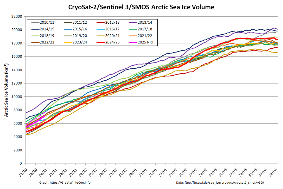
Bear in mind the caveats about the current lack of reliable SMOS data on the Atlantic side of the Arctic, and that Sentinel 3 data is only incorporated from Autumn 2023.
[Update – November 20th]Refreeze of the Beaufort Sea is complete, and refreeze of the Kara Sea has started in earnest:
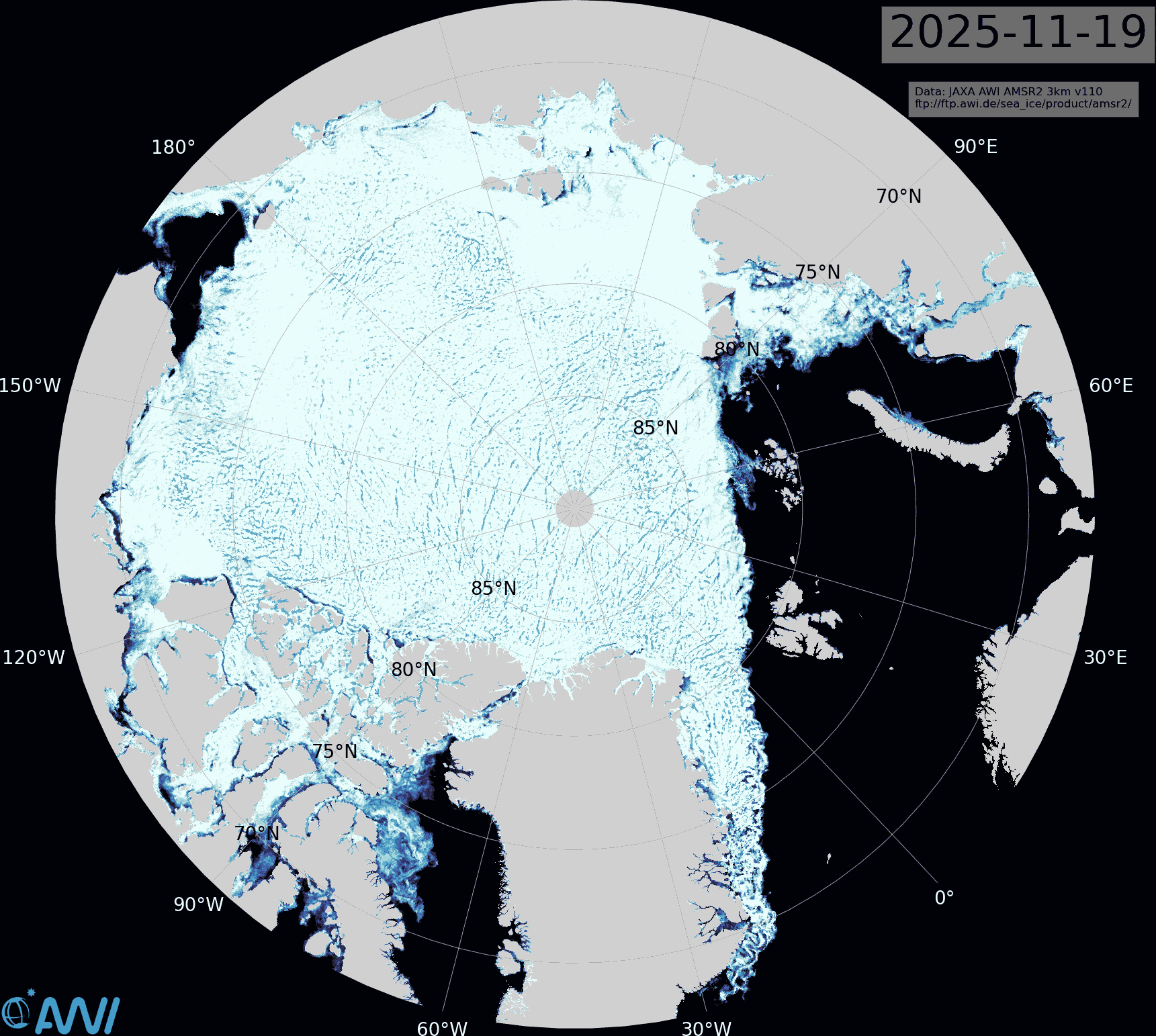
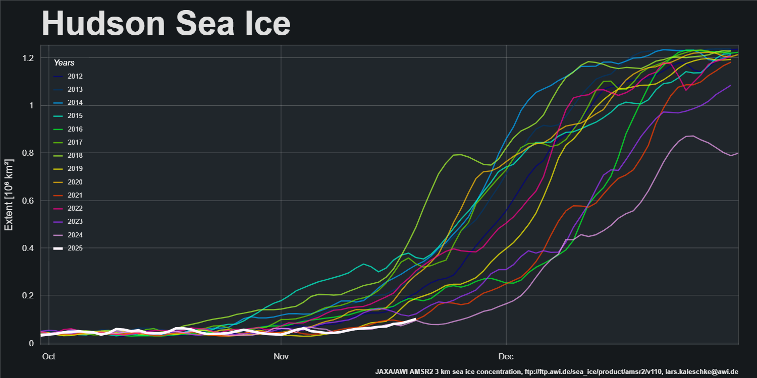
However, the Barents Sea is still sea ice free and refreeze of Hudson Bay has barely begun:
JAXA extent is still second lowest for the date:
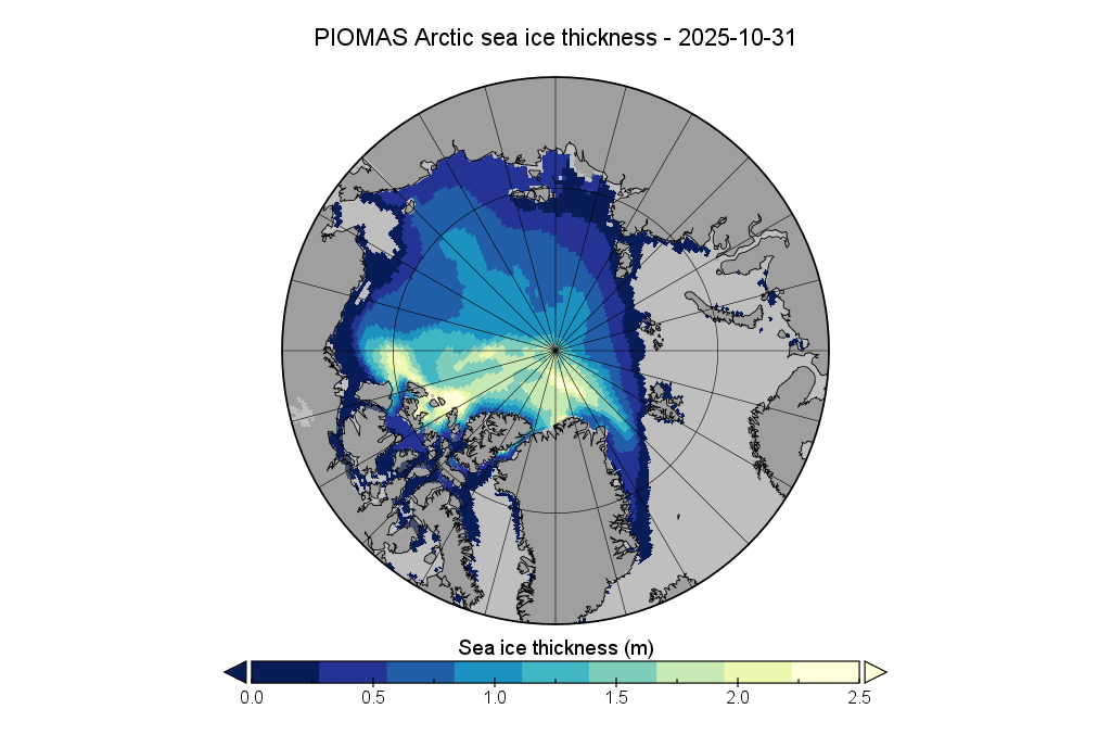
The PIOMAS gridded thickness data for October has yet to be corrected, but here is the mid month thickness map from AWI:
Here too is the associated volume graph:
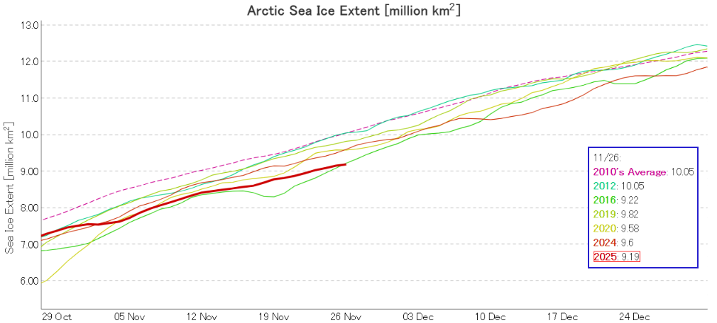
JAXA/ViSHOP extent is now lowest for the date in their record going back to 1978:
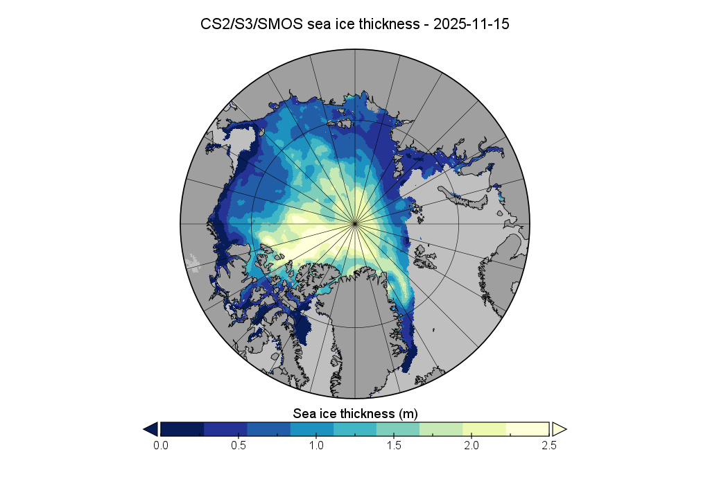
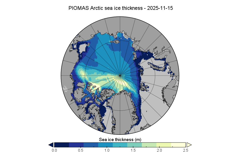
The PIOMAS team have finally published gridded thickness data for October and November, so here are the October 31st and November 15th thickness maps:
The conversation continues over on the December open thread, including the latest PIOMAS data.
We fly blind from August till November, with almost not a drop of (ice volume) info for e.g. September 1st from day-of and until about December 1st, which is 3 full months later.
Imagine what would happen if, on top of this, the US administration would *also* clamp down on the distribution of key climate data!
Let’s hope the Germans at ESA will figure this one out, and start publishing CryoSat Arctic sea ice volume data on a daily basis 365 days a year, i.e. even during the summer Melt!
Looking at the DMI >80N data,
When can we expect a value for the 2025 Autumn anomaly?
Presumably at some point in December?
In the meantime, here’s last year’s graph:
and the current graph of freezing degree days as a proxy:
2025 is currently 4th lowest, after 2016, 2020 and 2024.
#1
https://twitter.com/icegoingsouth/status/1993905744786424183
[Belatedly extracted from the moderation queue – Mod]
Don’t forget the AWI’s volume numbers. See above.
Or DMI’s for that matter:
I find it noteworthy that the previous #1, 2016, was post the 2015-peak EN, while 2025 which is now the #1 lowest extent, is post the 2023-peak EN. Although 2-yr past.
Volume-wise, 2024 was even lower than 2016, and with 2017 dipping even lower, 1.1 thousand km3 lower, in fact, it’s extra annoying that UW hasn’t published data after August 31. 2017 was to date the lowest year on record for Arctic sea ice volume.
2025 could be a new record low year, but we might not be told that before next summer.
Update: UW has somehow updated, although not their daily figures, and also not coherently or logically in their textual summary: “This value is the lowest on record for November, about 0. 1 10^3 km3 above the previous low”.
So presumably, we’re both lowest ever and also higher than the previous record low. Feels a bit like Schrödinger’s Piomas update…
Still lowest for date, even below 2016!