The time has arrived to start taking a close look at the assorted different Arctic sea ice extent metrics, in order to ascertain their respective maxima for 2025. To begin with here’s Zack Labe’s overview of previous years’ maxima:

It now seems highly likely that 2025’s maximum extent will ultimately prove to be the lowest in the satellite era. The remaining question is when this year’s maximum will occur.
My speculation yesterday that AWI’s flavour of Arctic sea ice extent had already achieved its maximum value for 2025 has been negated today:
The NSIDC 5 day average and JAXA extent metrics are also currently at their maximum levels for the year so far, so let’s wait and see which one is the first to take a downward turn.
[Update – March 28th]The National Snow and Ice Data Center have called the maximum extent of Arctic sea ice for 2025:
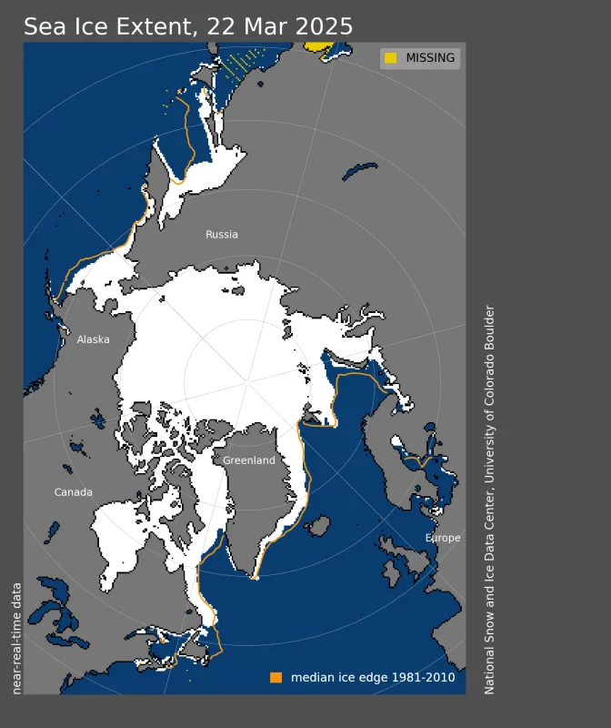
On March 22, Arctic sea ice likely reached its maximum extent for the year, at 14.33 million square kilometers, the lowest in the 47-year satellite record. This year’s maximum extent is 1.31 million square kilometers below the 1981 to 2010 average maximum of 15.64 million square kilometers and 80,000 square kilometers below the previous lowest maximum that occurred on March 7, 2017.
This year’s maximum occurred 10 days later than the 1981 to 2010 average date of March 12. The date of the maximum has varied considerably over the years, occurring as early as February 24 in 1987 and 1996 and as late as April 2 in 2010.
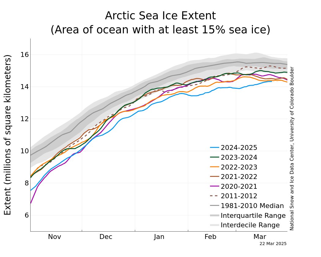
Low sea ice extent persisted around most of the Arctic during the 2024 to 2025 winter season. Notably, the Gulf of St. Lawrence remained virtually ice free and the Sea Okhotsk had substantially lower sea ice extent than average. Only the East Greenland Sea had near-average extent through the winter. The Bering Sea ice extent was low for much of the season, but growth from late February through late March brought the region closer to average conditions and was the primary contributor to the increase of total Arctic sea ice during March. Temperatures were 1 to 2 degrees Celsius above average in the Arctic and the surrounding seas, which likely slowed the rate of ice growth.
As is inevitably the case, the JAXA numbers are rather different to the NSIDC’s. JAXA maximum extent proved to be 13.78 million km² on March 21st:
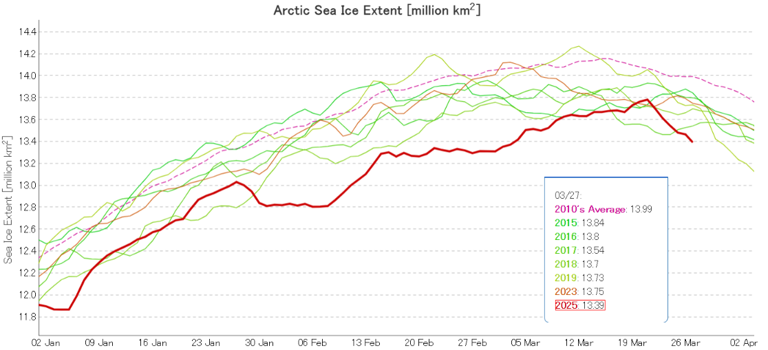
Since then extent has fallen swiftly, and it is now once again “lowest for the date” by a considerable margin.
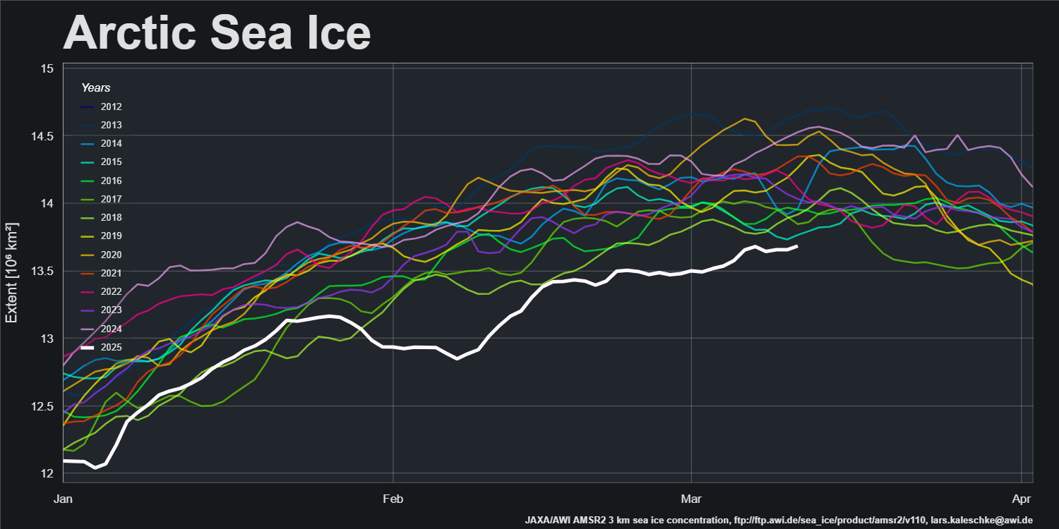
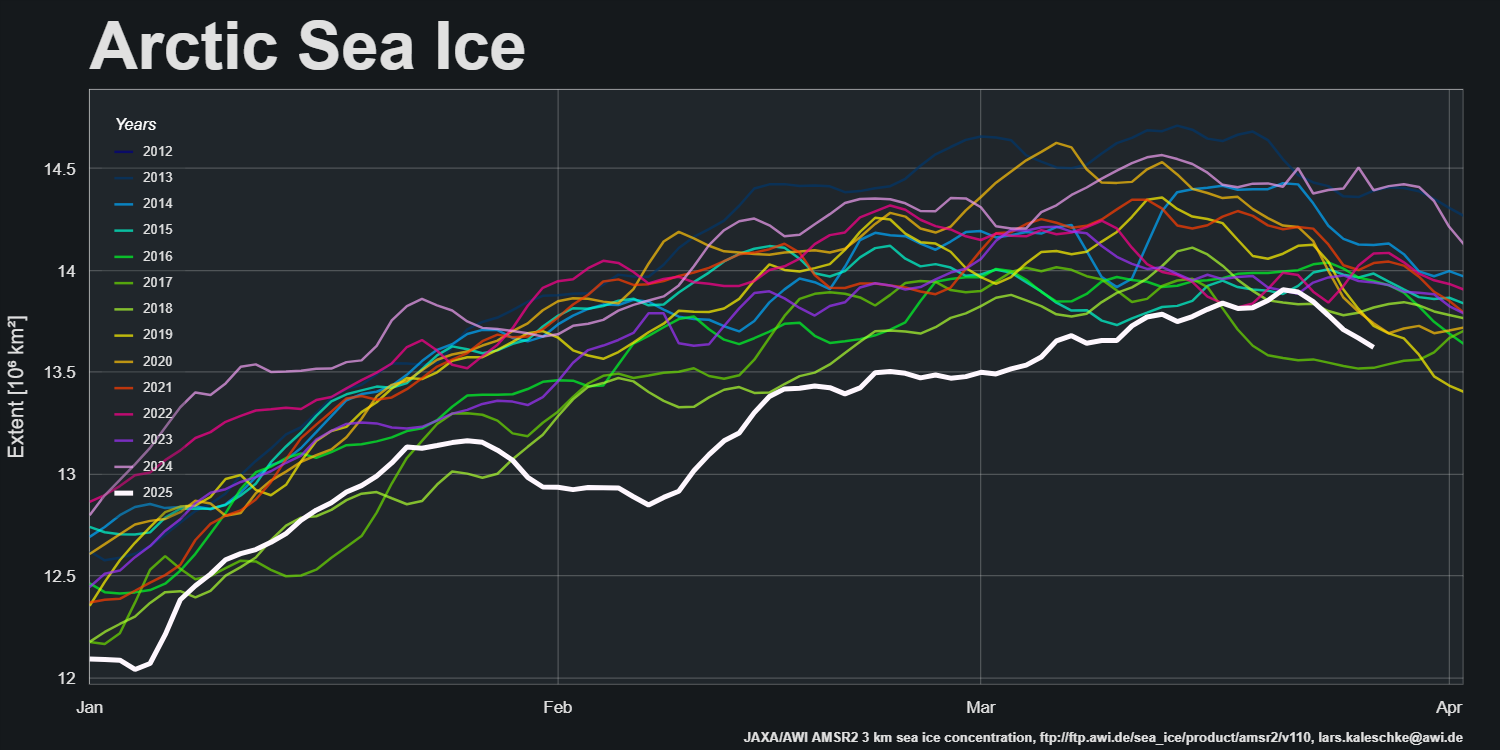
Amongst other extent metrics the AWI maximum extent for 2025 was 13.91 million km² on March 21st:
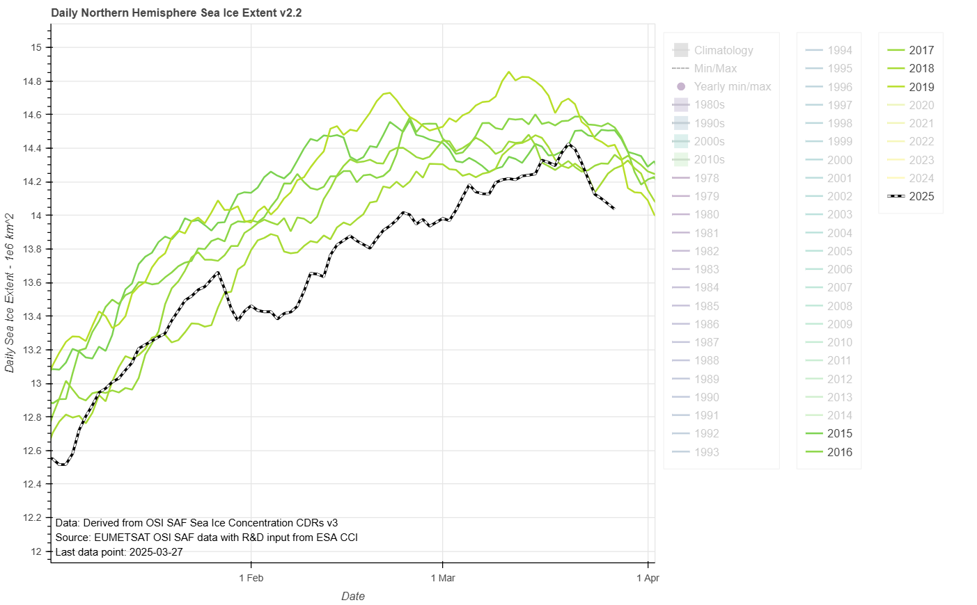
whereas OSI SAF maximum extent was 14.42 million km² on March 20th: