The first sea ice outlook report for 2024 has been published by the Sea Ice Prediction Network:
This year’s median forecasted value for pan-Arctic September sea-ice extent is 4.48 million square kilometers with an interquartile range of 4.21 to 4.74 million square kilometers. This is slightly lower than the 2022 (4.57 million square kilometers) and 2023 (4.54 million square kilometers) June median forecasts for September.
The lowest sea-ice extent forecast is 3.1 million square kilometers, from the UK Met Office, which would be a new record low for the satellite period (1979-present); the highest sea-ice extent forecast is 5.21 million square kilometers, submitted by both the HEU Group and SYSU/SML-MLM, which would be the highest September extent since 2015:
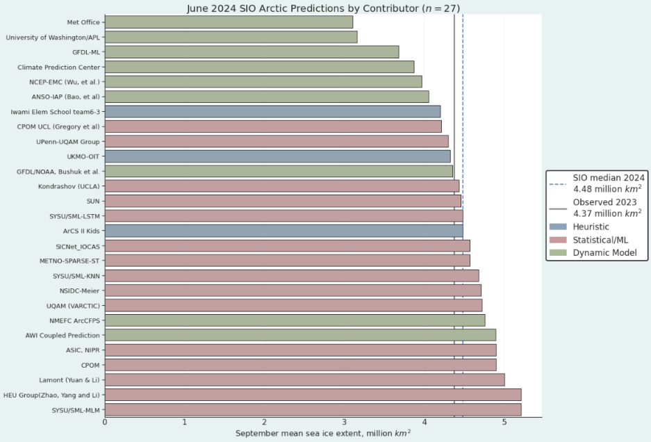
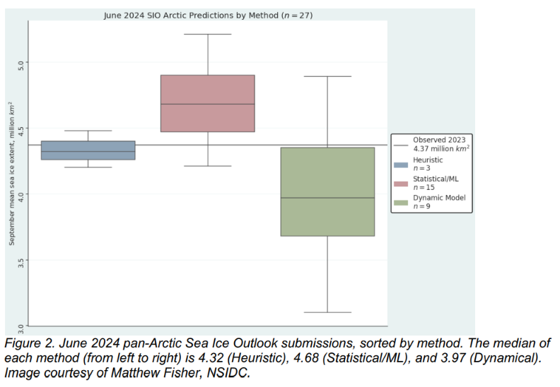
There are three heuristic Outlooks, with a median of 4.32 million square kilometers and an interquartile range of 4.26 to 4.4 million square kilometers. Statistical submissions total fifteen Outlooks with a median of 4.68 million square kilometers and an interquartile range of 4.47 to 4.9 million square kilometers. There are nine dynamical model contributions. The dynamical models have a median forecast of 3.97 million square kilometers with an interquartile range of 3.68 to 4.35 million square kilometers.
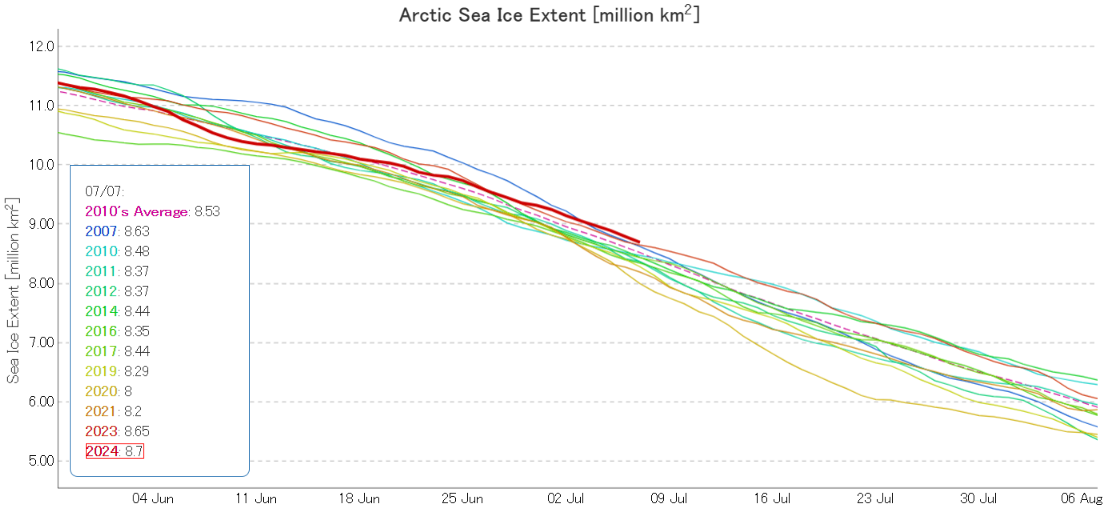
At the end of the first week of July JAXA/ViSHOP extent is 12th lowest for the date in the satellite era:
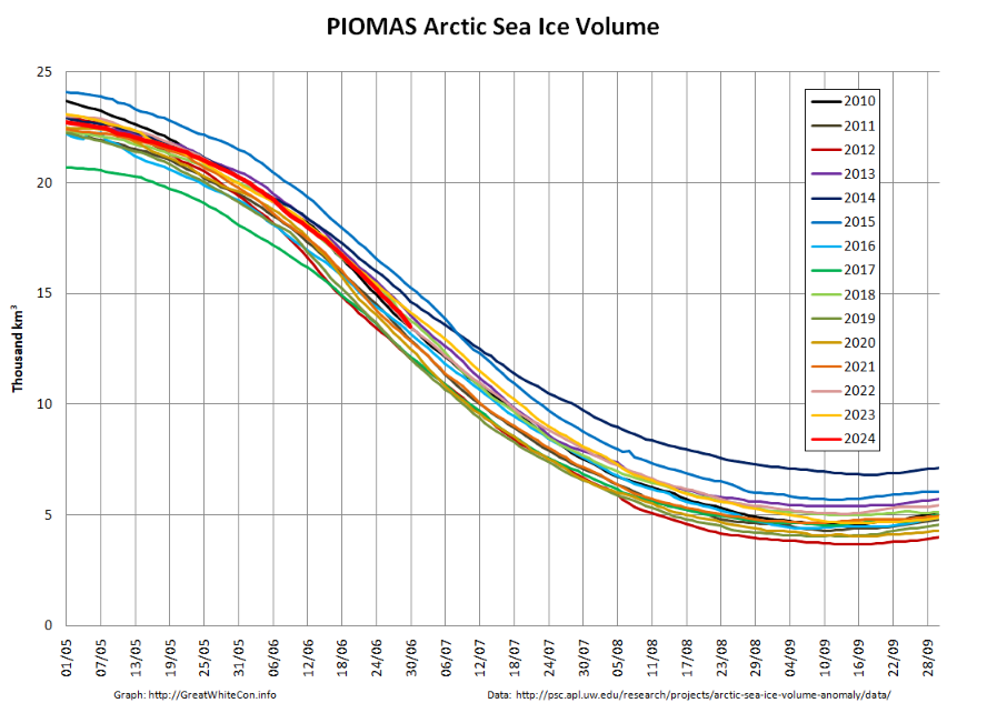
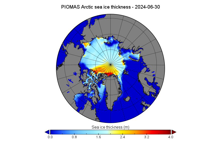
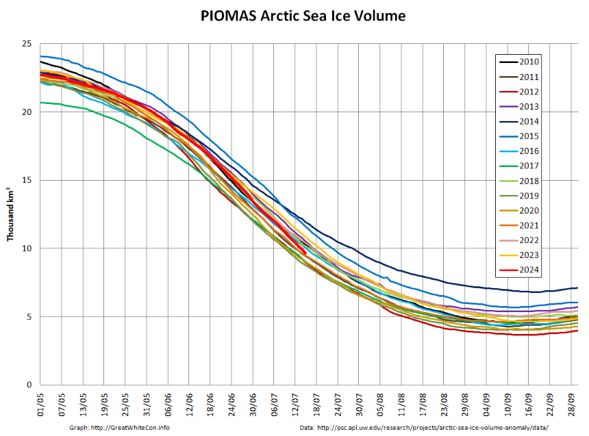
The PIOMAS gridded thickness data for June 2024 reveals a modelled Arctic sea ice volume of 13.49 thousand km³, which is 10th lowest for the date:
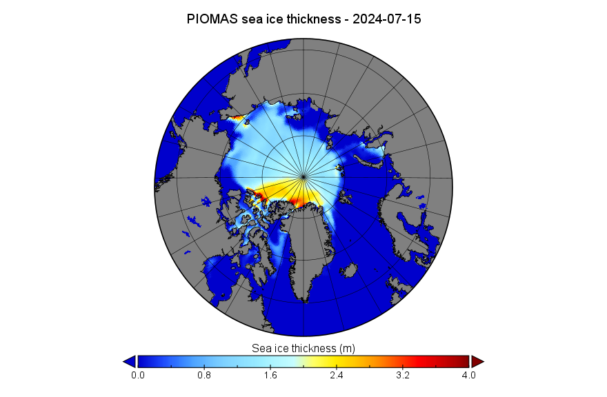
The end of June thickness map shows plenty of open water in the Beaufort and Laptev Seas, together with a persistent area of thick ice along the Siberian coast of the Chukchi Sea:
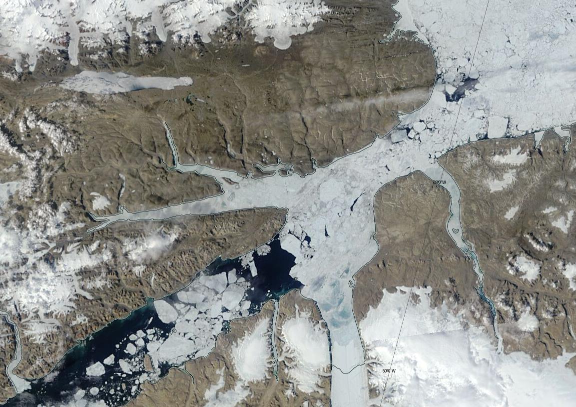
In other news the fast ice has finally broken up along the full length of the Nares Strait:
According to the June edition of the National Snow and Ice Data Center’s Arctic Sea Ice News:
Arctic sea ice extent for June 2024 averaged 10.90 million square kilometers, the twelfth lowest in the 46-year passive microwave satellite record. As of the beginning of July, extent is well below average in Hudson Bay and slightly below- to near-average elsewhere. The exception is in the Chukchi Sea where ice is above average for this time of year:
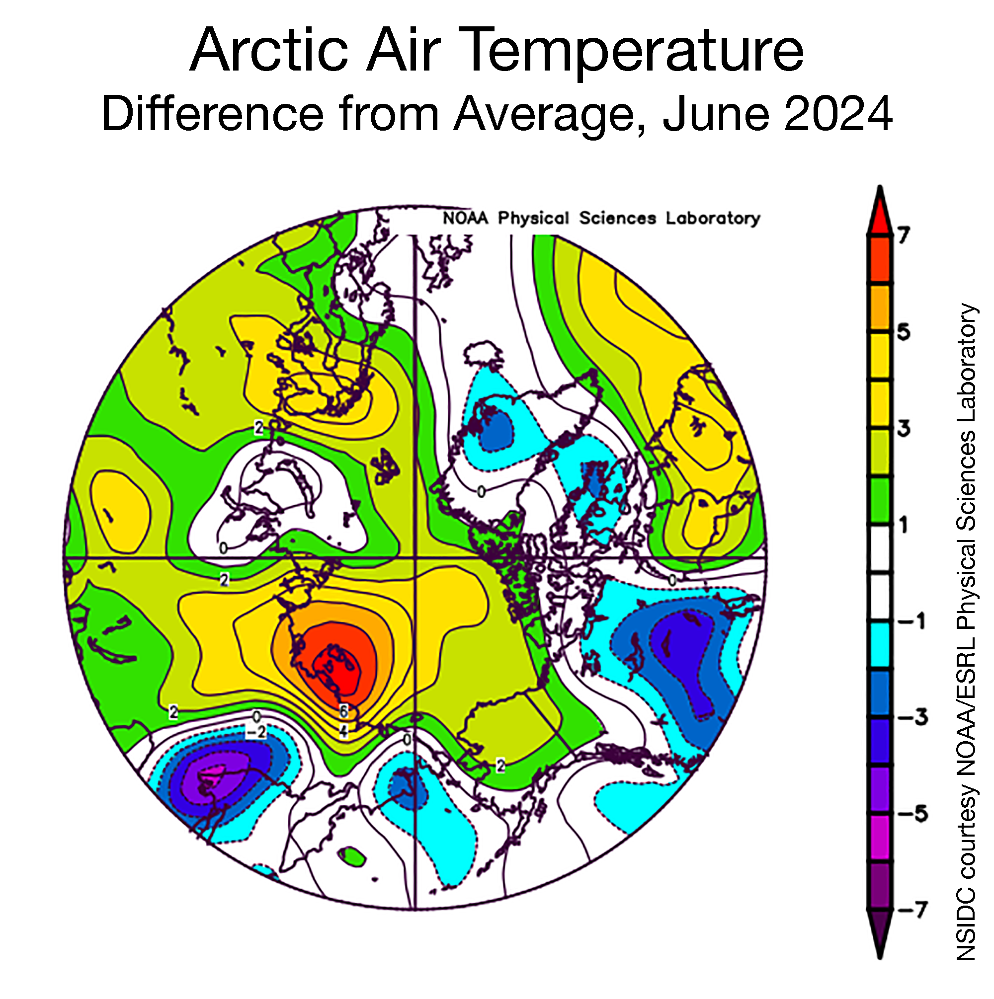
Air temperature at the 925 hPa level (about 2,500 feet above the surface) over the Arctic Ocean were mostly 1 to 4 degrees Celsius above average but as much as 7 degrees Celsius above average in the Laptev Sea where openings are observed in the sea ice cover. Near the Bering Sea, along the coast in the Kara Sea, and in the middle of Baffin Bay, temperatures were 1 to 3 degrees Celsius below average:
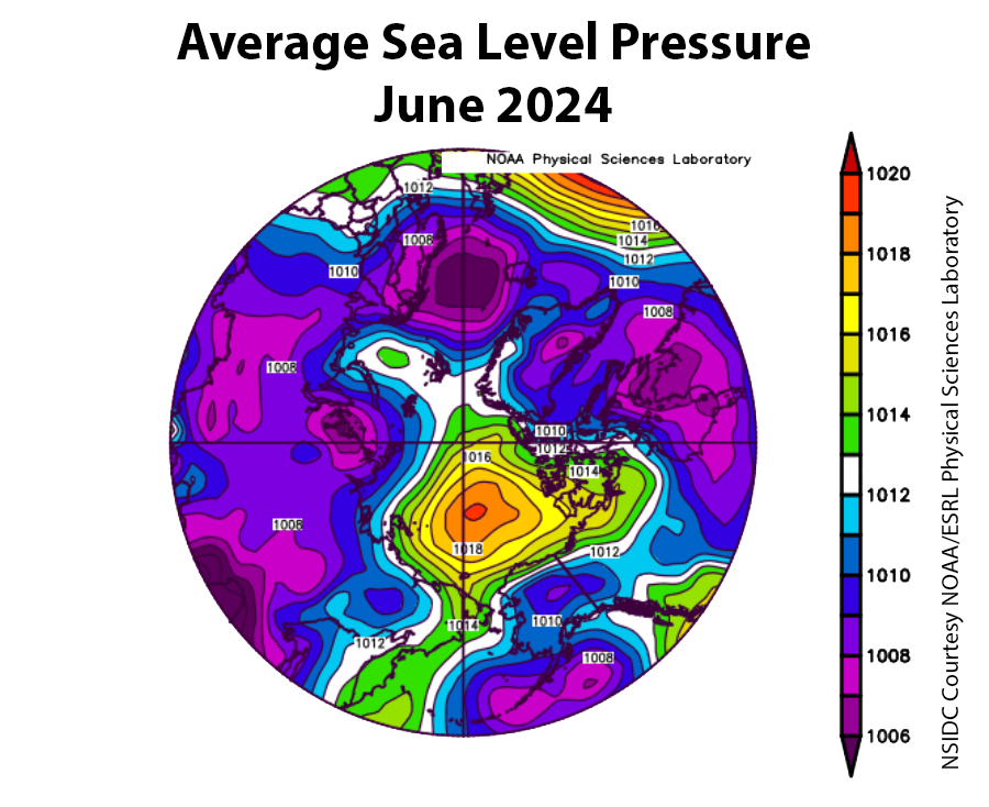
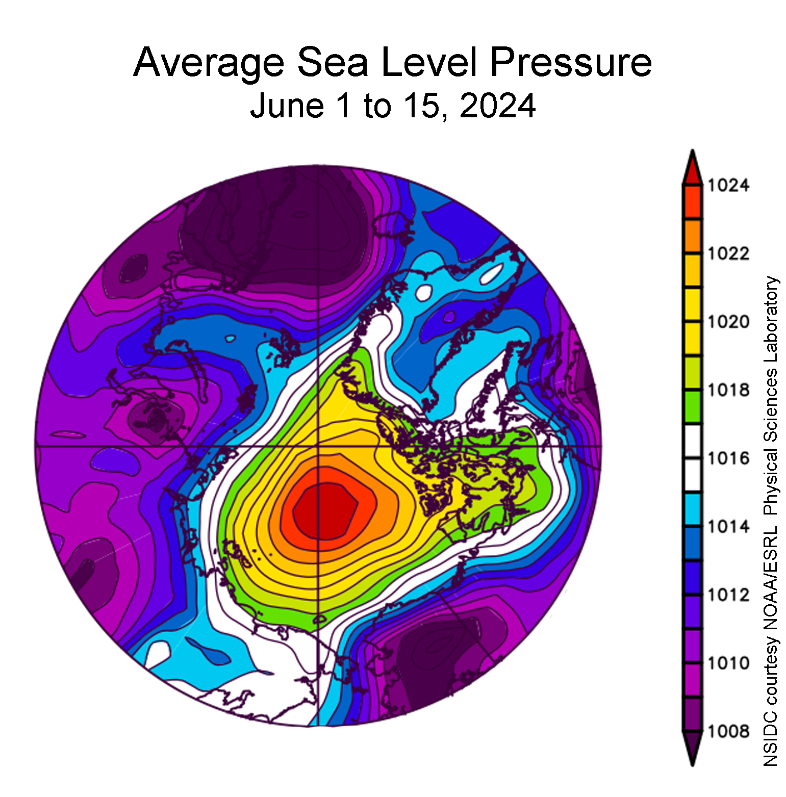
The sea level pressure pattern for June was characterized by above average high pressure over the central Arctic Ocean, reflecting a robust Beaufort High, and below average pressure in the North Atlantic, with its center located above Iceland. Typically under a strong Beaufort High, there are clear skies, which during the summer allow the sun’s energy to reach the sea ice surface and initiate melt. A strong Beaufort High also strengthens the clockwise circulation in the Arctic Ocean, resulting in ice being pushed westward towards the Chukchi Sea and southward out of Fram Strait:
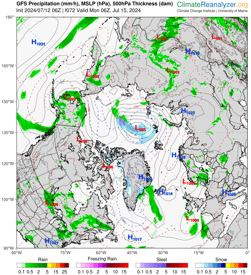
A low pressure area is currently heading up the east coast of Greenland towards the Fram Strait. If the GFS forecast is to be believed, in 3 days time it will have deepened and be located over the central Arctic Ocean where it will continue spinning for several more days:
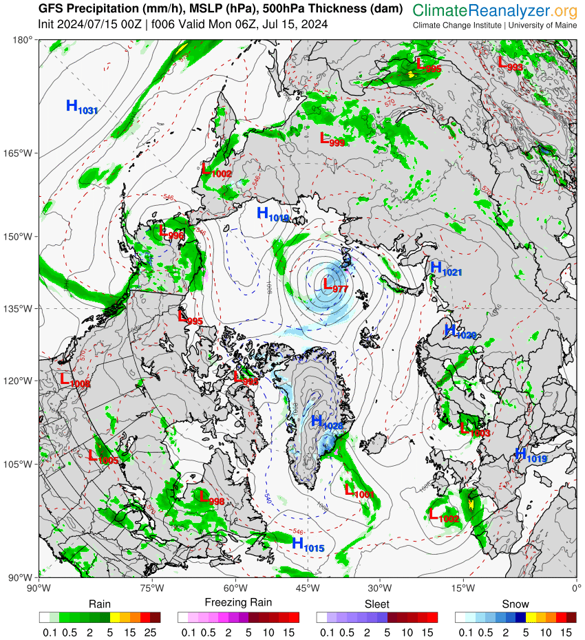
The central Arctic cyclone turned out to be stronger than forecast 3 days ago:
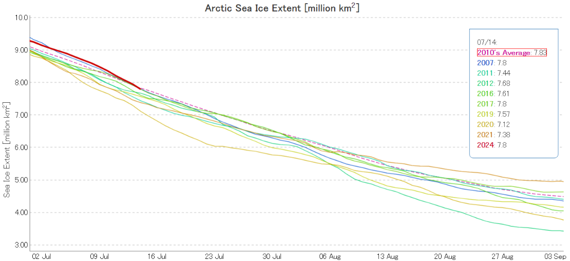
Meanwhile JAXA extent has crossed below the 2010s average again, after declining by 208 thousand km² over the last 2 days:
Given the recent rapid decline in sea ice extent it doesn’t come as a surprise that the mid month PIOMAS volume is down to 7th lowest in the satellite era:
Here’s the associated thickness map:
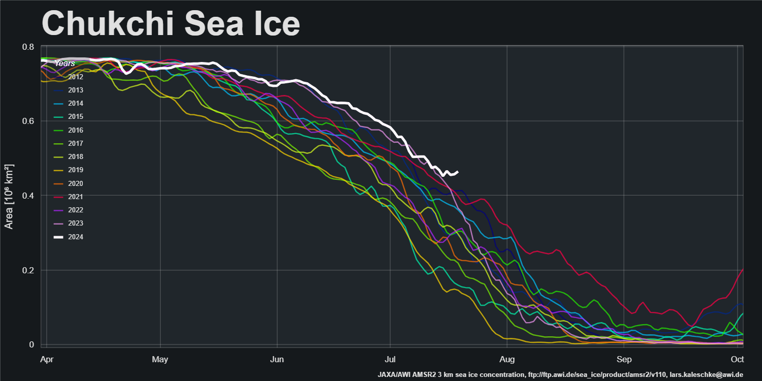
The thick ice on the Siberian side of the Chukchi Sea remains. Here’s Lars Kaleschke’s graph of sea ice area in the region, based on Alfred Wegener Institute data :
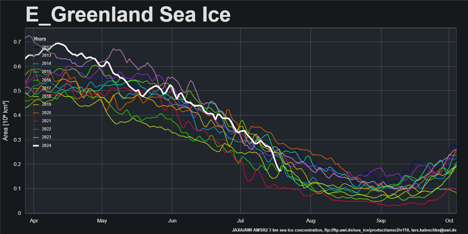
However, the ice in the Greenland Sea has been melting rapidly recently:
The National Snow and Ice Data Center have issued a mid month edition of Arctic Sea Ice News:
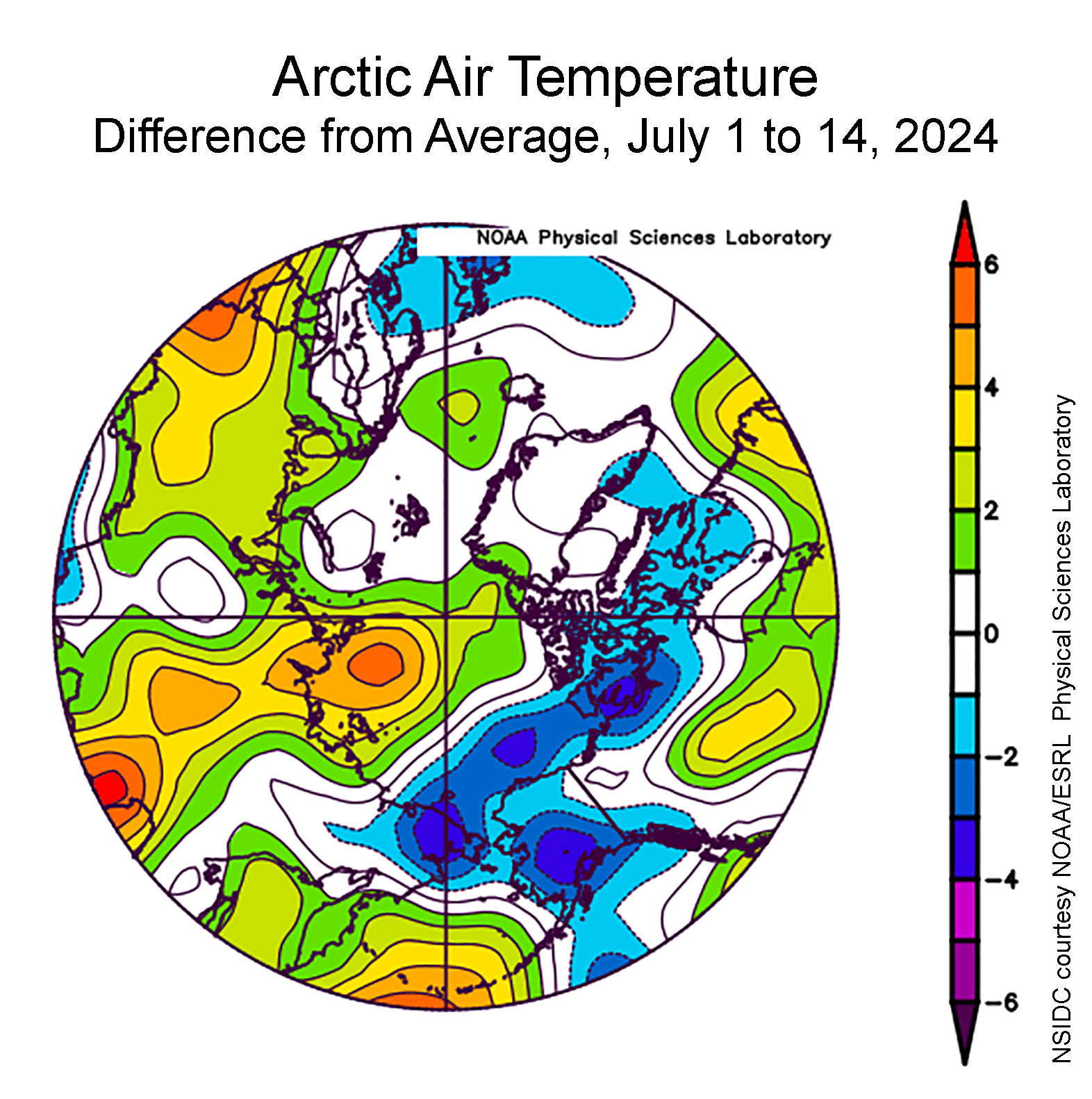
Air temperature at the 925 hPa level (about 2,500 feet above the surface) averaged over the first two weeks of July was 2 to 6 degrees Celsius above average over the Laptev Sea, where substantial sea ice losses have been observed so far in the month. Temperatures were also 2 to 4 degrees Celsius below average extending from the East Siberian Sea, across the Beaufort Sea, and in the western Canadian Arctic Archipelago:
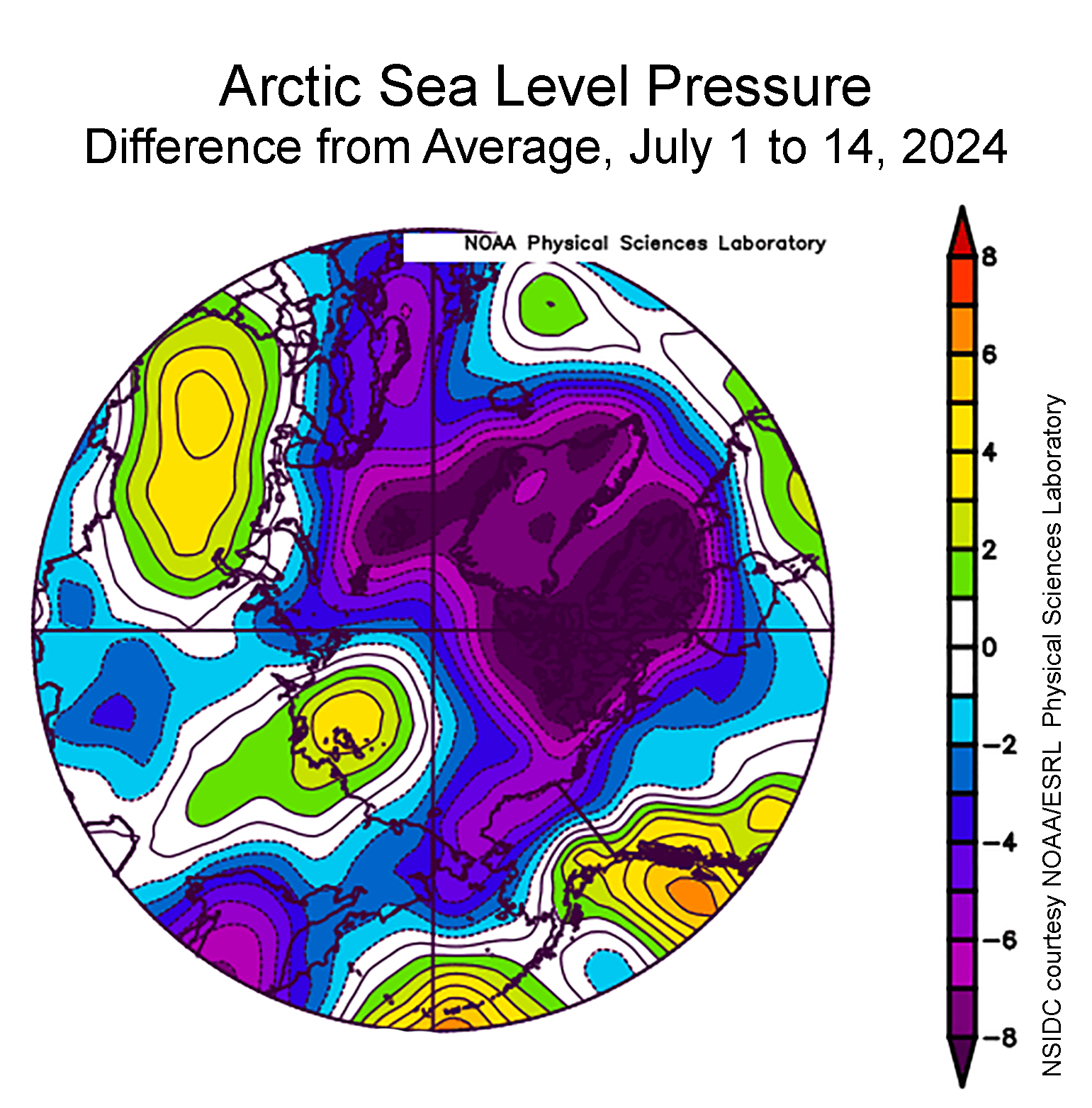
In contrast to June 2024, which was characterized by a strong Beaufort High, the sea level pattern for the first two weeks of July 2024 features below average pressure covering much of the Arctic Ocean, with a small area of above-average pressures centered over the Laptev Sea:
Winds from the east-southeast in spring have tightly packed sea ice between Wrangel Island and mainland Siberia…
Looking back at the sea level pressure field from earlier in the season, June 1 to June 15, points to winds that would compact sea ice into this region between the island and the mainland:
[Update – July 26th]Ice concentrations in this area appear to be nearly 100 percent. This sea ice also appears to be especially thick, 1.5 meters above average, as depicted in the June fields from the Pan-Arctic Ice Ocean Modeling and Assimilation System (PIOMAS).
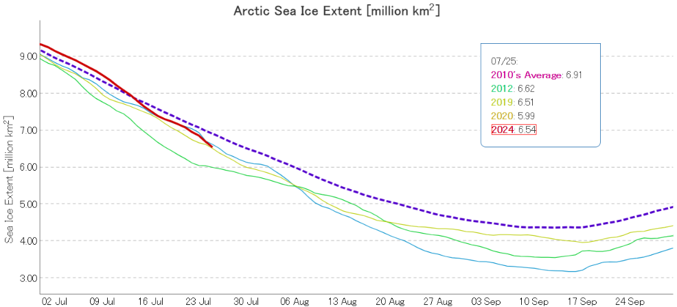
ViSHOP extent is now lower than on the same date in 2012, and in a “statistical tie” for 2nd lowest in the JAXA record:
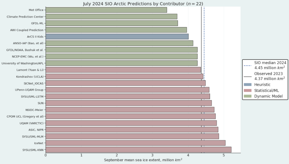
In other news the July 2024 sea ice outlook report was released today:
The July 2024 Outlook received 22 pan-Arctic contributions. This year’s median forecasted value for pan-Arctic September sea-ice extent is 4.45 million square kilometers with an interquartile range of 4.14 to 4.77 million square kilometers. This is slightly lower than the 2022 (4.66 million square kilometers) and 2023 (4.64 million square kilometers) July median forecasts for September. The July 2024 median forecast of 4.45 million square kilometers is also slightly lower that the June 2024 median forecast of 4.48 million square kilometers. The lowest sea-ice extent forecast is 3.4 million square kilometers, from the UK Met Office, which would be a new record low for the satellite period (1979-present); the highest sea-ice extent forecast is 5.21 million square kilometers, submitted by SYSU/SML-KNN, which would be the highest September extent since 2014:
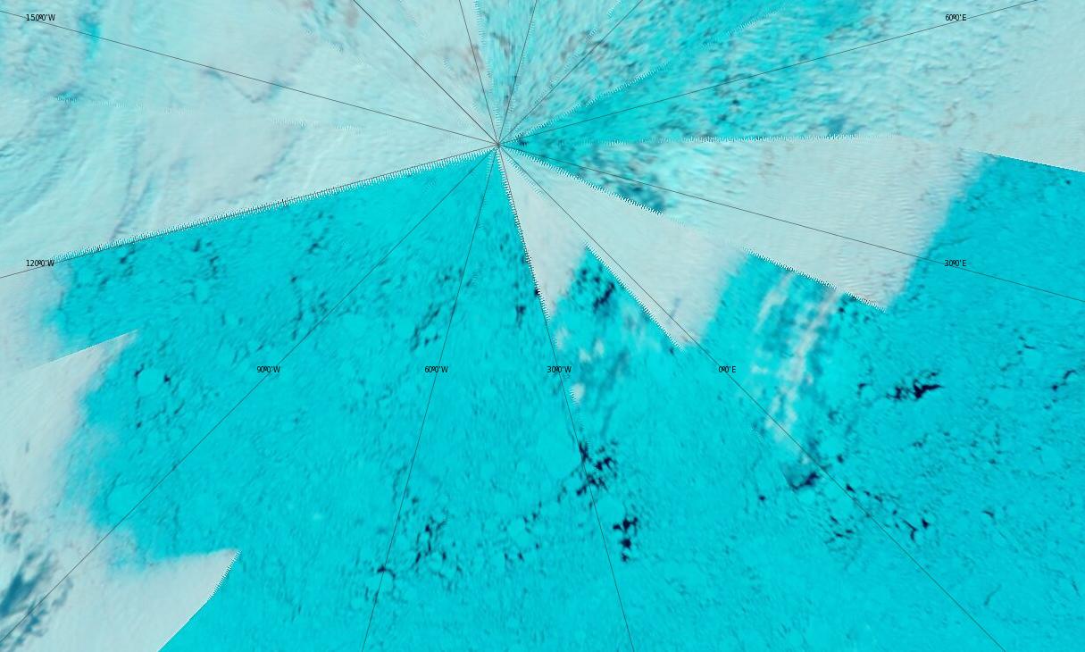
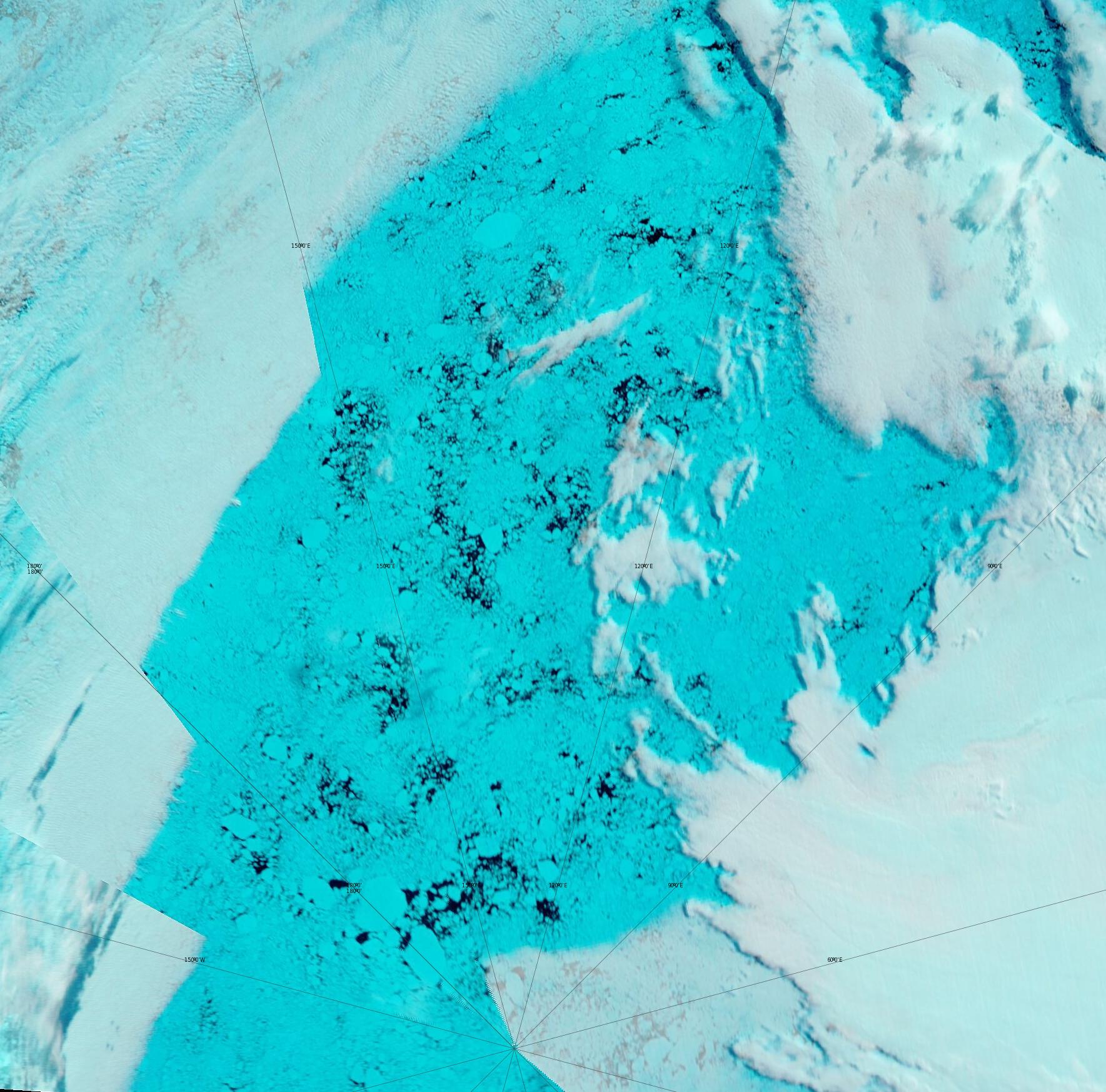
There have been some glimpses through the clouds of regions which in days of yore would have been full of high concentration pack ice at this time of year. Firstly here’s the North Pole:
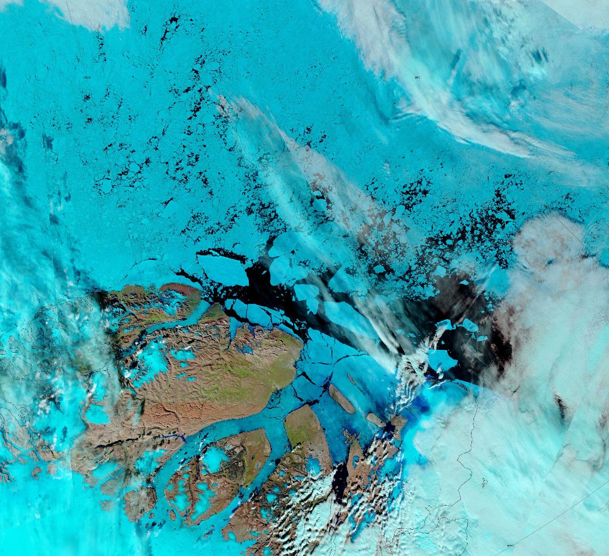
Here too is North East Greenland:
The conversation continues over on the August open thread.
July has produced the largest drop in extent since 2020, I think.
I’m waiting to see if we get the warm weather forecast for the Pacific side from next weekend.
Should be interesting…
It’s also interesting that it looks as though the northern route through the Northwest Passage will open very early this year:
https://GreatWhiteCon.info/2024/07/the-northwest-passage-in-2024/#Jul-29
“Large pieces of sea ice are breaking away from the northern tip of Greenland, to be carried by ocean currents to the Fram Strait east of Greenland. On their way they will melt away, illustrating how ocean heat can make even the thickest parts of the sea ice disappear in a matter of days.
The thick sea ice north of Greenland is breaking away due to high ocean heat and due to strong wind blowing from Greenland toward the North Pole, which is in turn due to deformation of the Jet Stream, one of the many feedbacks of the temperature rise.”
http://arctic-news.blogspot.com
[Moved from NWP thread – Mod]