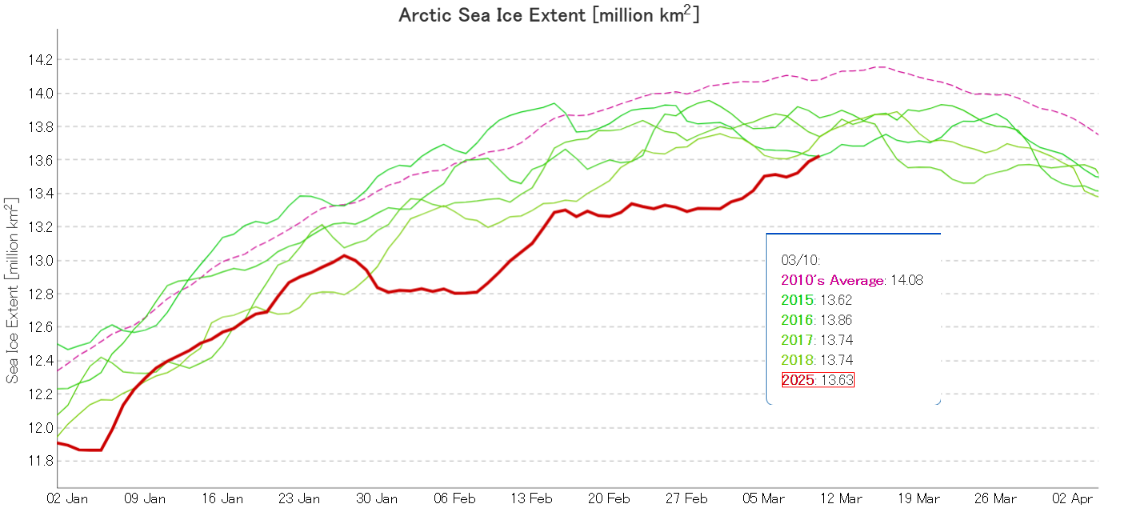
After spending several weeks in the unfortunate position of lowest for the date, JAXA/ViSHOP Arctic sea ice extent has just risen above 2015. By a mere 10,000 km²:
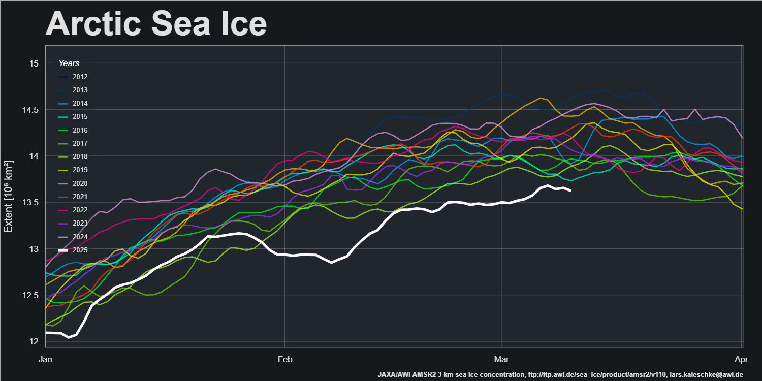
Despite the fact that JAXA extent is still rising, AWI extent has potentially already achieved its maximum value for 2025:
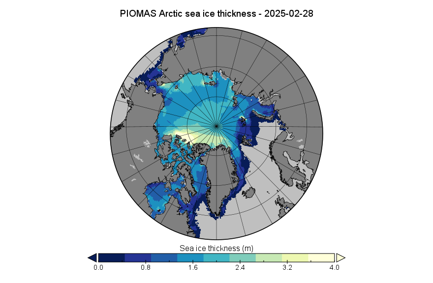
Somewhat belatedly, here is the PIOMAS sea ice thickness map for February 28th 2025:
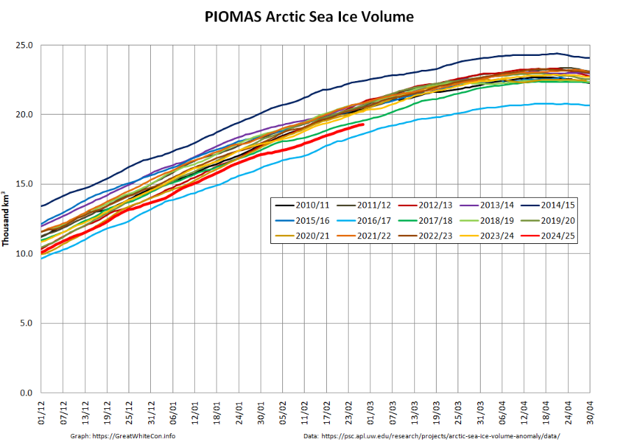
At the end of February Arctic sea ice volume had increased to 19.32 thousand km³, still 2nd lowest for the date in the PIOMAS record:
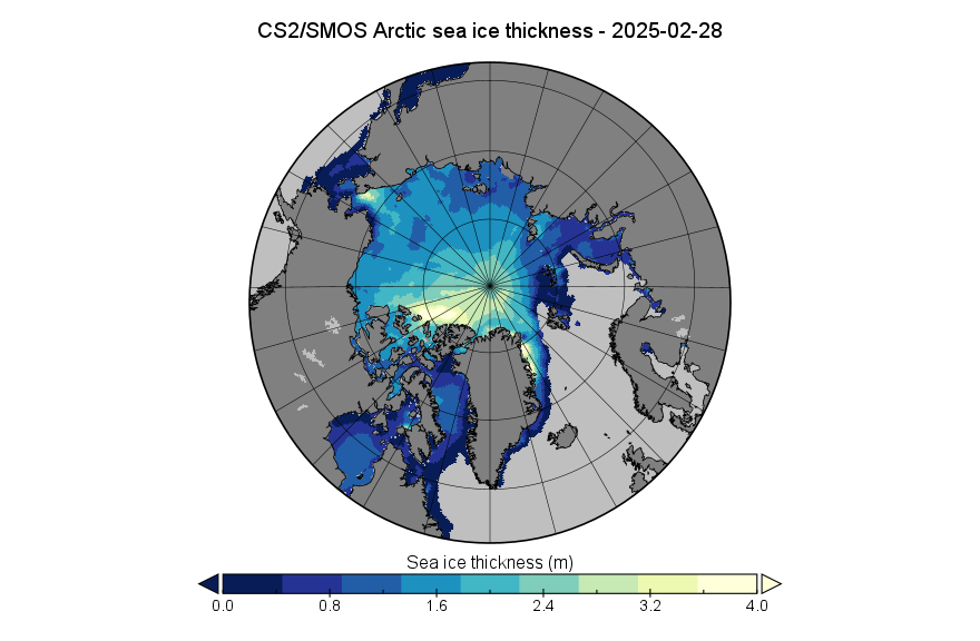
For comparison purposes, here is the “near real time” CryoSat-2/SMOS merged thickness data from the Alfred Wegener Institute:
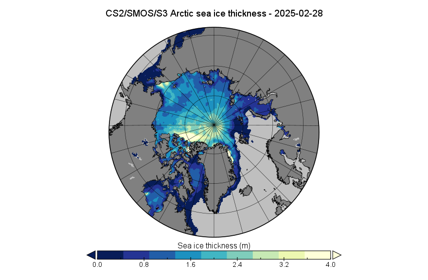
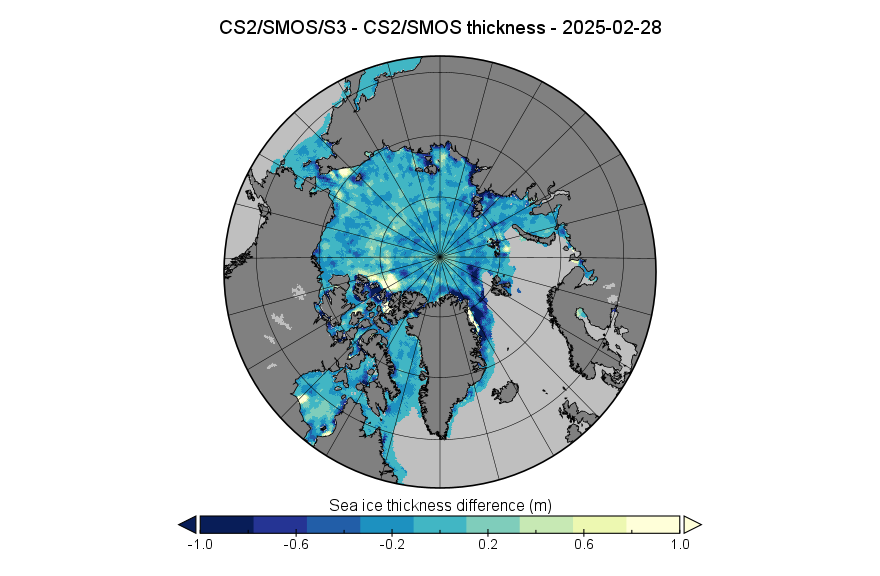
AWI have also released a new version of their thickness product, incorporating additional data from the two Sentinel 3 satellites. The thickness data for February 28th, looks slightly different:
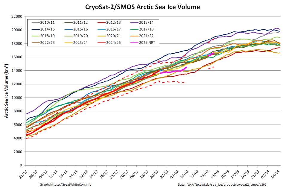
Reprocessed version 3.0 thickness data is not yet available, so for the moment here is the volume graph based on version 2.06 data. Note that data is missing for the period between February 10th and 23rd inclusive:
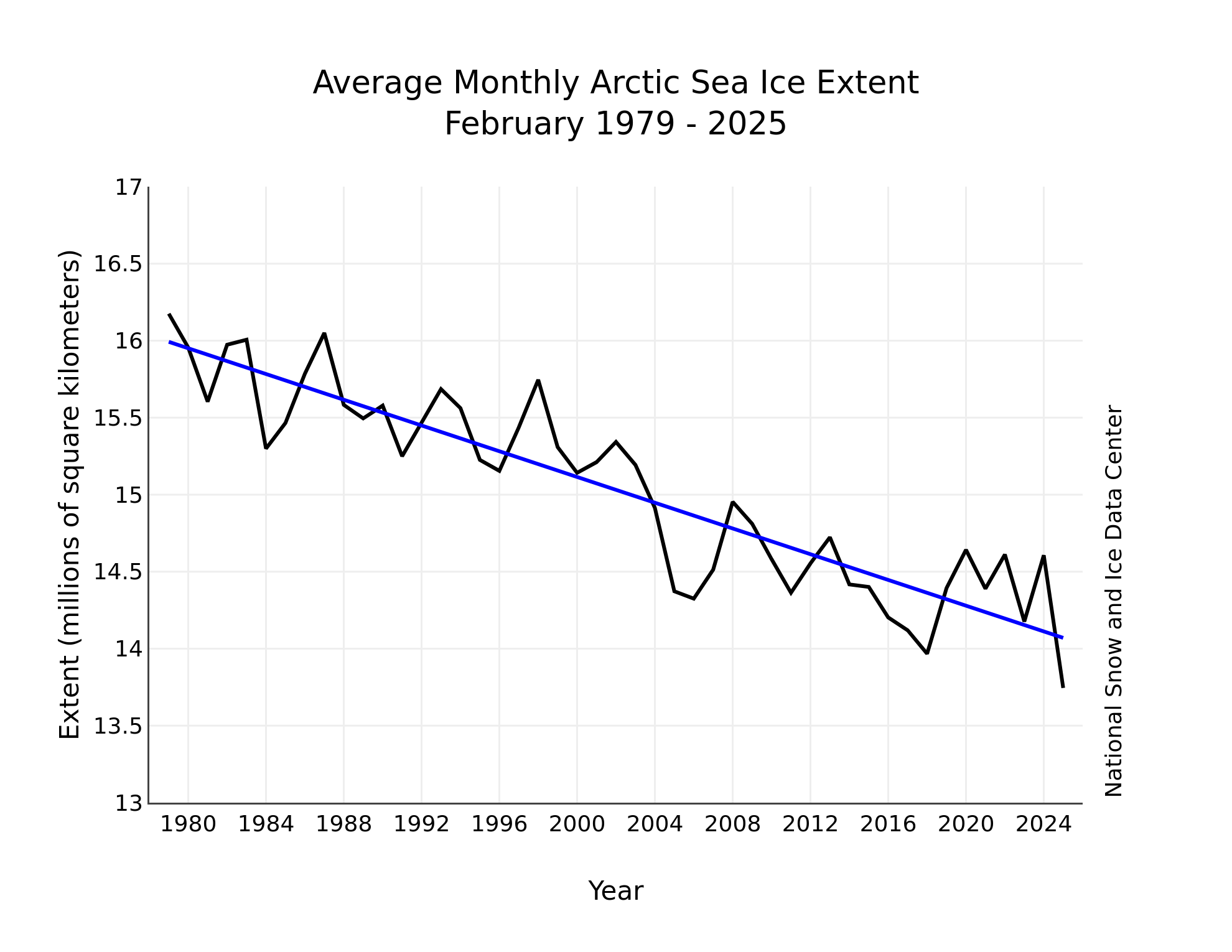
According to the National Snow and Ice Data Center’s “Sea Ice Today” analysis for February:
The average February 2025 Arctic sea ice extent was 13.75 million square kilometers, the lowest February extent in the 47-year satellite record, 220,000 square kilometers below the previous record low February set in 2018. Daily ice growth stalled twice during the month, which helped to contribute to low ice conditions and led to overall ice retreat in the Barents Sea. By the end of the month, extent was low nearly everywhere, the exception being the East Greenland Sea. Extent is far below average in the Labrador Sea and the Gulf of St. Lawrence:
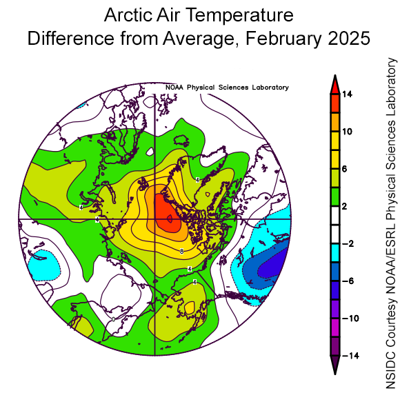
Air temperatures of at least 2 degrees Celsius above average dominated the Arctic. Between northern Greenland and the North Pole, temperatures were especially high, up to 12 degrees Celsius above average:
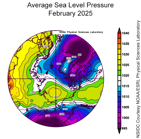
High pressure prevailed over the Pacific side of the Arctic (Beaufort, Chukchi, and East Siberian Seas), while low pressure was generally found over the Atlantic side. Strong low pressure occurred on the opposing fringes of the Arctic, over the Bering Sea and off the southern tip of Greenland, which stunted ice growth in the Bering and Barents Seas:
Watch this space!