As already mentioned in our February Arctic overview, another storm is brewing. Here is this morning’s weather forecast for Longyearbyen, the capital of Svalbard:
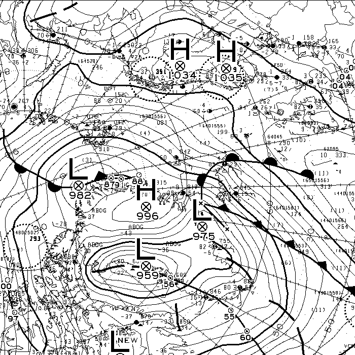
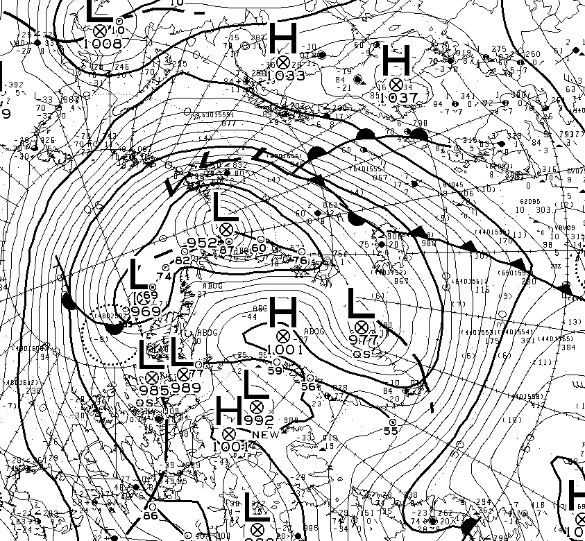
Much like last month, temperatures are above zero and rain is forecast. That’s because once again the current synoptic chart from Environment Canada shows a warm wet flow from way down south over Svalbard and on into the Central Arctic:
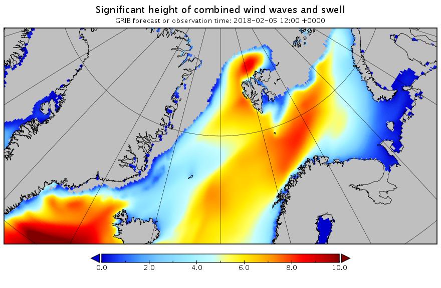
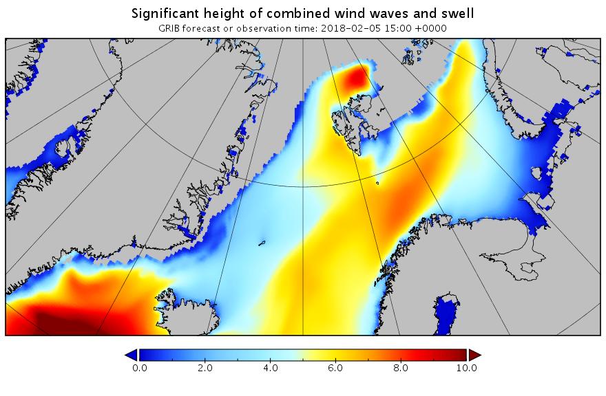
Next here’s the current combined wave and swell height forecast for the Svalbard area:
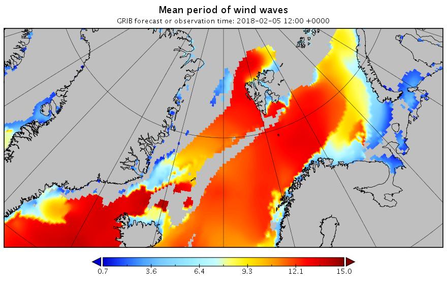
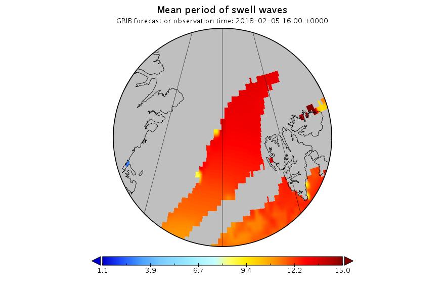
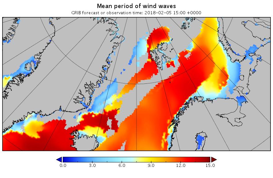
and here’s the associated wave period forecast:
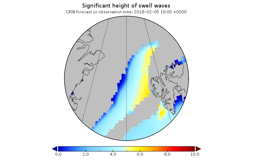
It’s still showing 10 meter waves with a 15 second period north of Svalbard tomorrow lunchtime. Somewhat unusually for the Arctic these aren’t merely giant wind waves. Zooming in on the Fram Strait and breaking out the underlying primary swell reveals:
A long distance swell of that magnitude is going to cause some damage.
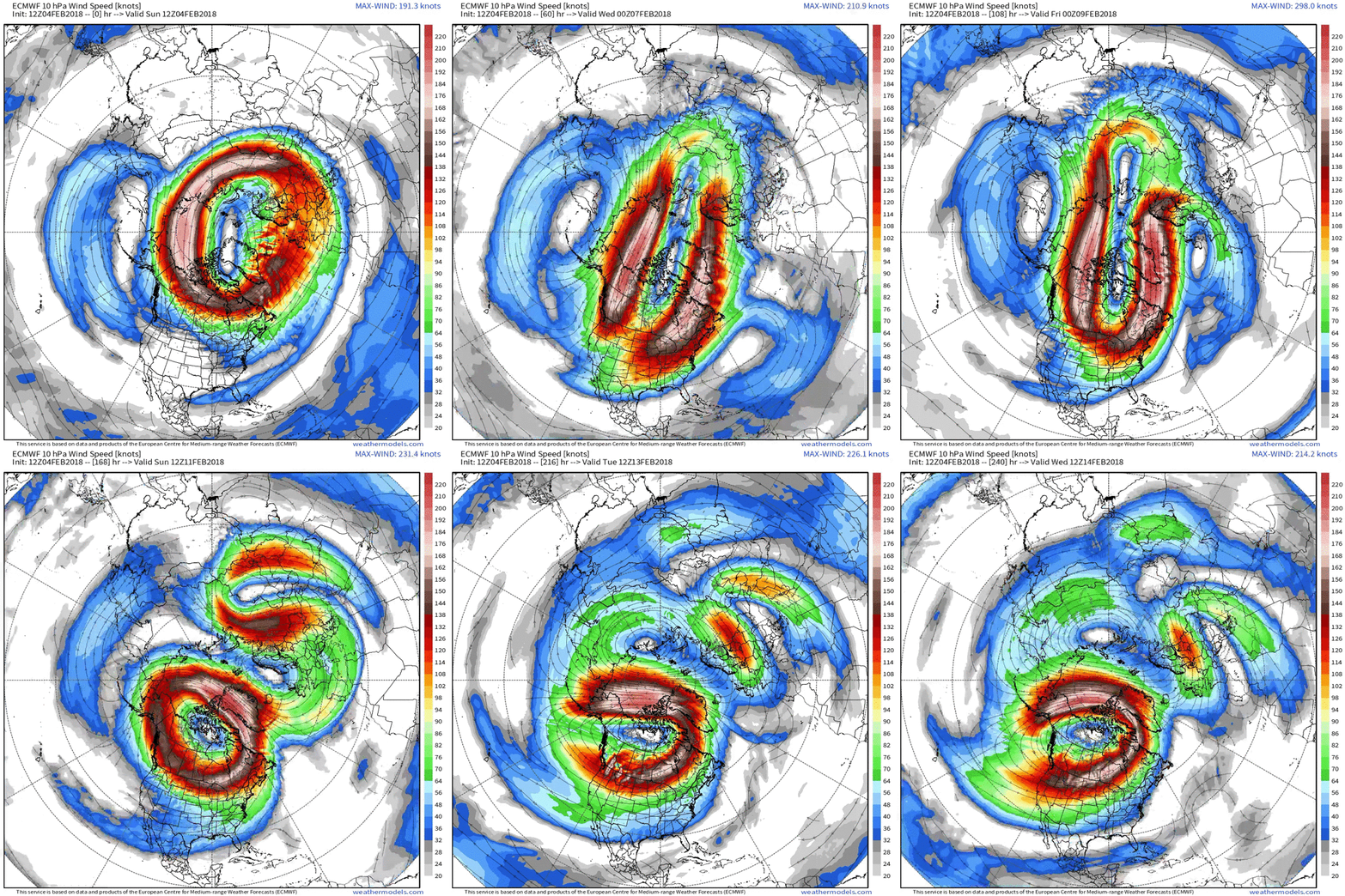
The current ECMWF forecast for a split polar vortex, courtesy of Ice Shieldz on the Arctic Sea Ice Forum:
This is suggestive of more cyclones to come, but sticking with the current one for now, here is the MSLP chart at 00:00 UTC this morning showing the cyclone’s central pressure has dropped to 952 hPa:
Here too is the current WaveWatch III forecast for 15:00 UTC today:
The peak of the swell north of Svalbard is now slightly later than originally forecast, but it’s still enormous!
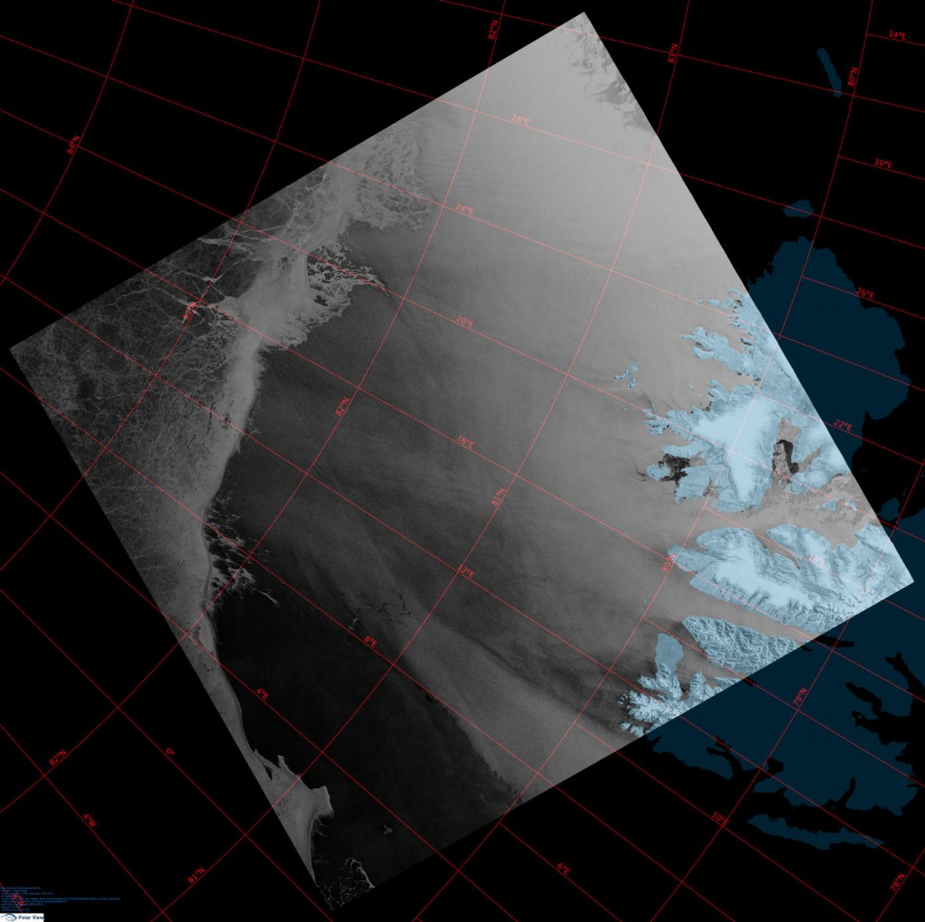
Here’s a single Sentinel 1B synthetic aperture radar image that captures the position of the ice edge north of Svalbard yesterday quite nicely:
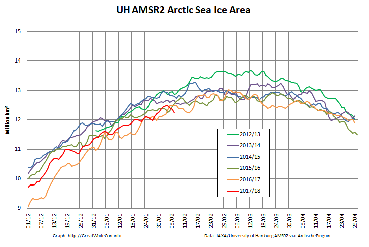
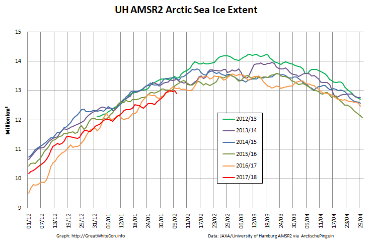
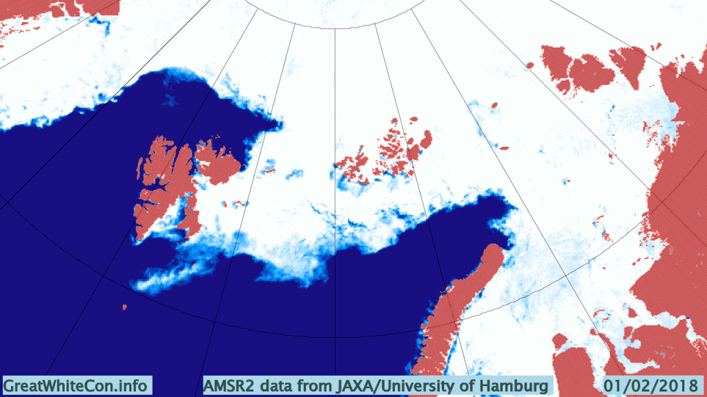
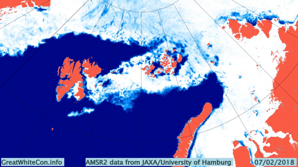
A brief overview of the effect of the recent cyclone on the sea ice in the Arctic via AMSR2:
Click the image to animate it.
An Arctic wide take via Thomas Lavergne on Twitter:
Your daily update on the "big low entering #SeaIce". The "spin" in motion moves East towards Severnaya Zemlya. Some opening from land there, increased flushing through Fram Strait. pic.twitter.com/q4m1CRhmtS
— Thomas Lavergne (@lavergnetho) February 8, 2018
plus the latest AMSR2 concentration map:
An interesting insight into CryoSat-2 sea ice thickness measurements from Stefan Hendricks on Twitter:
Radar altimetry tells you how far the surface waves penetrate into the #seaice cover. Unfortunetaly via a bias in #Cryosat freeboard information. 😉 pic.twitter.com/OxUTcFH94h
— Stefan Hendricks (@sthendric) February 9, 2018
Plus Judah Cohen on the split polar vortex:
GFS wants to keep major #PolarVortex (PV) center over Western Canada after the split and is consistent with predicted westward shift of troughing and #cold across North America but this is not typical following significant PV disruptions. pic.twitter.com/zX7n3rnMpo
— Judah Cohen (@judah47) February 9, 2018

Methinks you will have to do another post or two., record low global sea ice extent and this stratosphere thing developing that seems likely to throw everything into the air.
I did mention “cyclones” plural in the title!
See also this Sudden Stratospheric Warming primer over at Neven’s:
http://neven1.typepad.com/blog/2013/04/sudden-stratospheric-warmings-causes-effects.html
Neven’s primer on SSWs is, unfortunately, wrong. Judah Cohen is an actual research meteorologist who understands the physics of the stratosphere. Please refer people to Judah Cohen, not that story written by someone who doesn’t understand the basics of atmospheric science.
I linked to Judah just above also. Whilst we’re at it here’s a link to your own article on the subject of the January 2013 SSW event:
https://www.dailykos.com/stories/2013/01/16/1179397/-Sudden-Stratospheric-Warming-Split-the-Polar-Vortex-in-Two
There was a lot of discussion in the comments on the Arctic Sea Ice Blog. What in particular do you find fault with in that article?
SSWs are driven by planetary waves in the troposphere spin-coupling with the stratospheric polar vortex. Very strong layering in potential temperatures makes it impossible for a significant upward flux of mass to take place between the troposphere and the stratosphere in these events. There is a large scale upwelling in the tropics driven by persistent thunderstorms around Indonesia that slowly transports air into the stratosphere but tropospheric air is not transported upwards over the mountains of Asia into the stratosphere in the winter. However, Rossby wave energy may be rapidly transported upwards through the tropopause in the winter months. Those waves break in the upper stratosphere.
Judah Cohen linked to a relevant paper he wrote in his most recent tweet.
http://web.mit.edu/jlcohen/www/papers/Cohenetal2009.pdf
https://twitter.com/judah47?ref_src=twsrc%5Etfw&ref_url=http%3A%2F%2Fgreatwhitecon.info%2F2018%2F02%2Fthe-february-2018-fram-strait-cyclones%2F