It is perhaps rather early to start speculating about if, and when, the Northwest Passage will become navigable for the host of small vessels eager to traverse it this summer.
However one such vessel is already en route to the Arctic Circle, so why don’t we take a look at its live tracking map?
Moli (Mo for short) is being piloted singlehandedly by Randall Reeves, who has already circumnavigated Antarctica and is hell bent on circumnavigating America too!
According to Randall’s last but one update he’ll be stopping in St. Johns before heading for the Arctic Circle:
“Have you explained why your first stop is St John’s?” asked a friend recently, “Not New York, Boston, Camden, Lunenberg, Halifax, to name just, well, five?”
It is a good question, and the answer is simple: I never considered going anywhere else because a) St John’s is decidedly on the Figure 8 route and b) it has the required marine facilities and big grocery stores. And did I mention, it’s right on the route?
Actually, I did flirt briefly with the idea of Boston, thinking that goods there would be cheaper and marine facilities, more diverse. And though it does save some 500 miles of sailing on this inbound leg, Boston is so far west that it adds 1,000 miles to the leg up to the Arctic. So, I’ve decided to stick to the most logical stop.
St. John’s is less than a thousand miles north now. In any worthy wind, we’d be there before the end of the month. But when your average speed is 3.9 knots…you don’t do the when-do-we-make-port math.
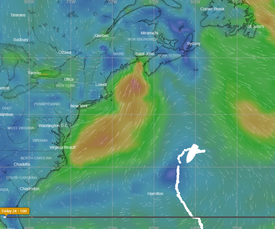
Interestingly the background to Moli’s live tracking map is from Windy.com.
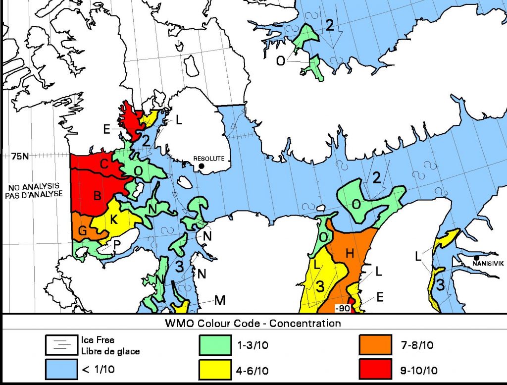
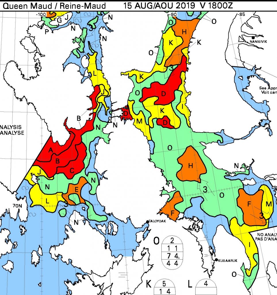
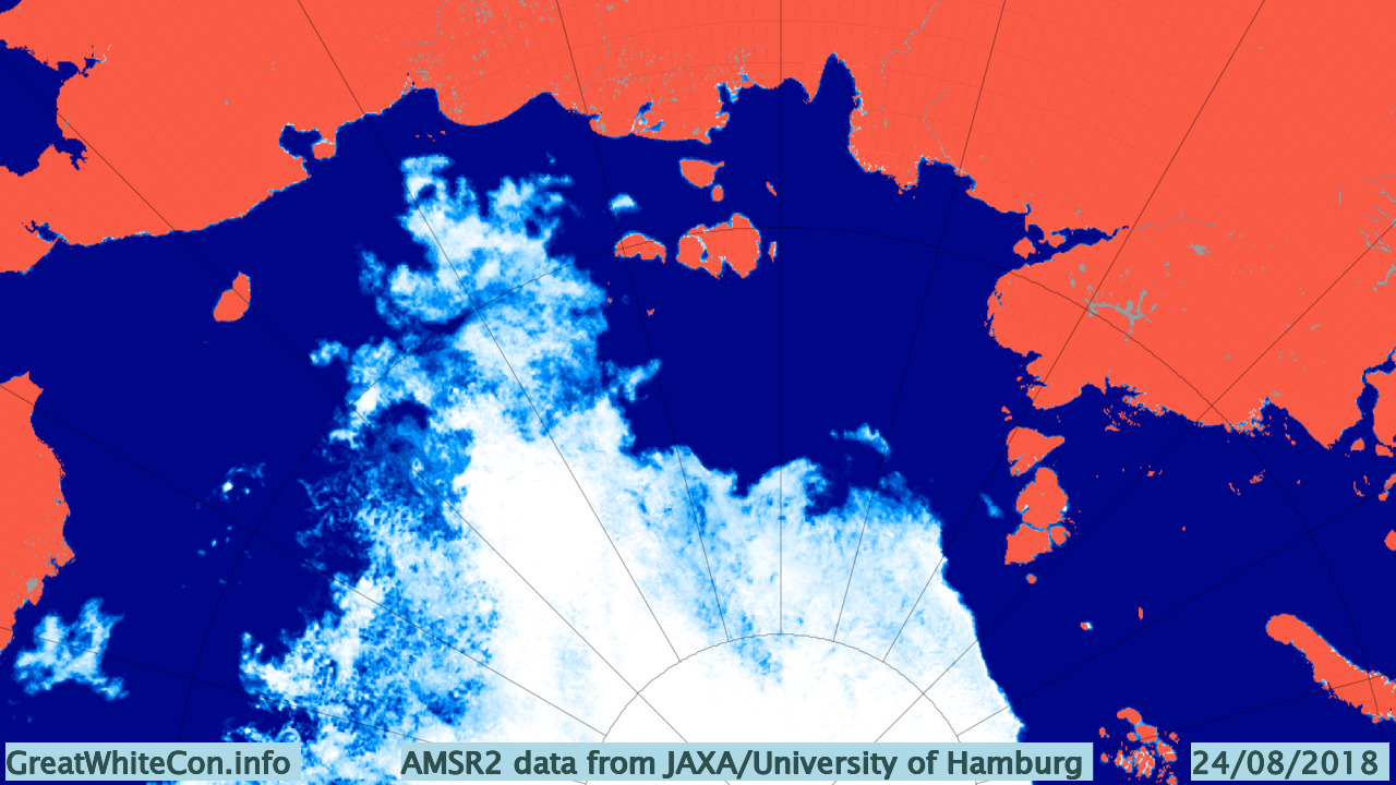
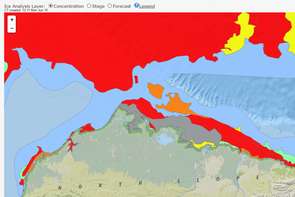
It’s very early in the melting season to be reporting on this event, but any early bird traversing the Northwest Passage from west to east could now sail through open water around Point Barrow, along the Alaskan and Canadian coast and into the Amundsen Gulf. Here’s the latest sea ice concentration chart for Alaskan waters from the US National Weather Service:
Whilst we’re here why don’t we take a look at how Randall is getting along in Moli. According to his latest blog post he is now in Halifax scraping barnacles off Moli’s bottom!
On Friday, June 8, day 245 of the Figure 8 Voyage, I hauled Mo here at the Royal Nova Scotia Yacht Squadron. My expectations were that the bum would be nearly spotless. Instead, we had a new crop of hitchhikers coming in at the base of those older barnacles that remained.
Lessons Learned:
“There is no good bottom paint for aluminum boats,” says my friend, fellow cruiser, and aluminum boat builder, Gerd Marggraff. Prior to departure, I had applied three generous coats of a bottom paint known specifically to ward off hard growth, but barnacles are superior beings, able to penetrate even the best defenses.An early jump. I might have had an easier time of it if I’d dived the hull before the first Cape Horn rounding, when the barnacles were young and few.
In hindsight, I think I could have dived the hull with some success, even when the barnacles had matured into a reef. I found here in the yard that the “hold fast” (the glue that holds the barnacle fast to the hull) was easier to remove with a sharpened spatula than I had thought. It would have been a big job, taking a full day or more–but not impossible.
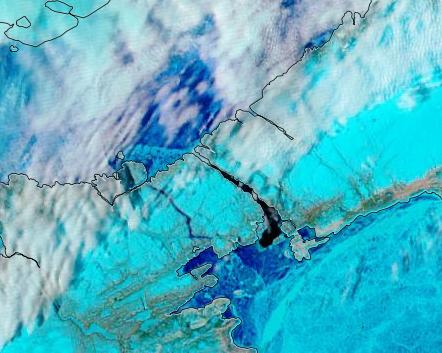
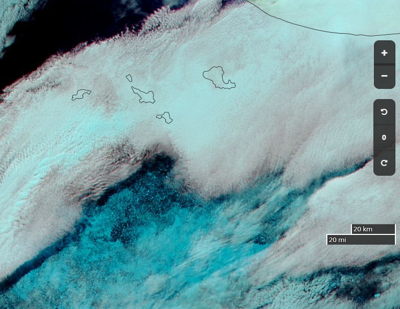
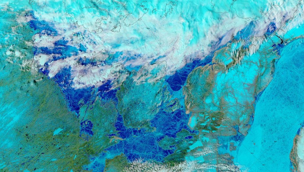
Delving deeper into the Canadian Arctic Archipelago, the clouds have cleared over “Amundsen’s Route” through the Northwest Passage to reveal extensive melt ponding:
Bellot Strait appears to be largely free of sea ice already: