Tag Archives: Ice Shelf

Thwaites Ice Shelf “within years of failure”?

There have been a plethora of headlines in the last 24 hours along the lines outlined above!

According to an article on Science.org the answer to the question posed above seems to be “yes”:

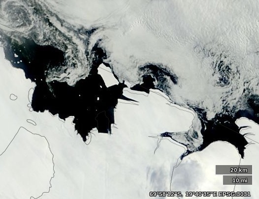
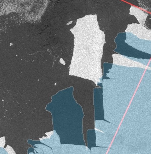
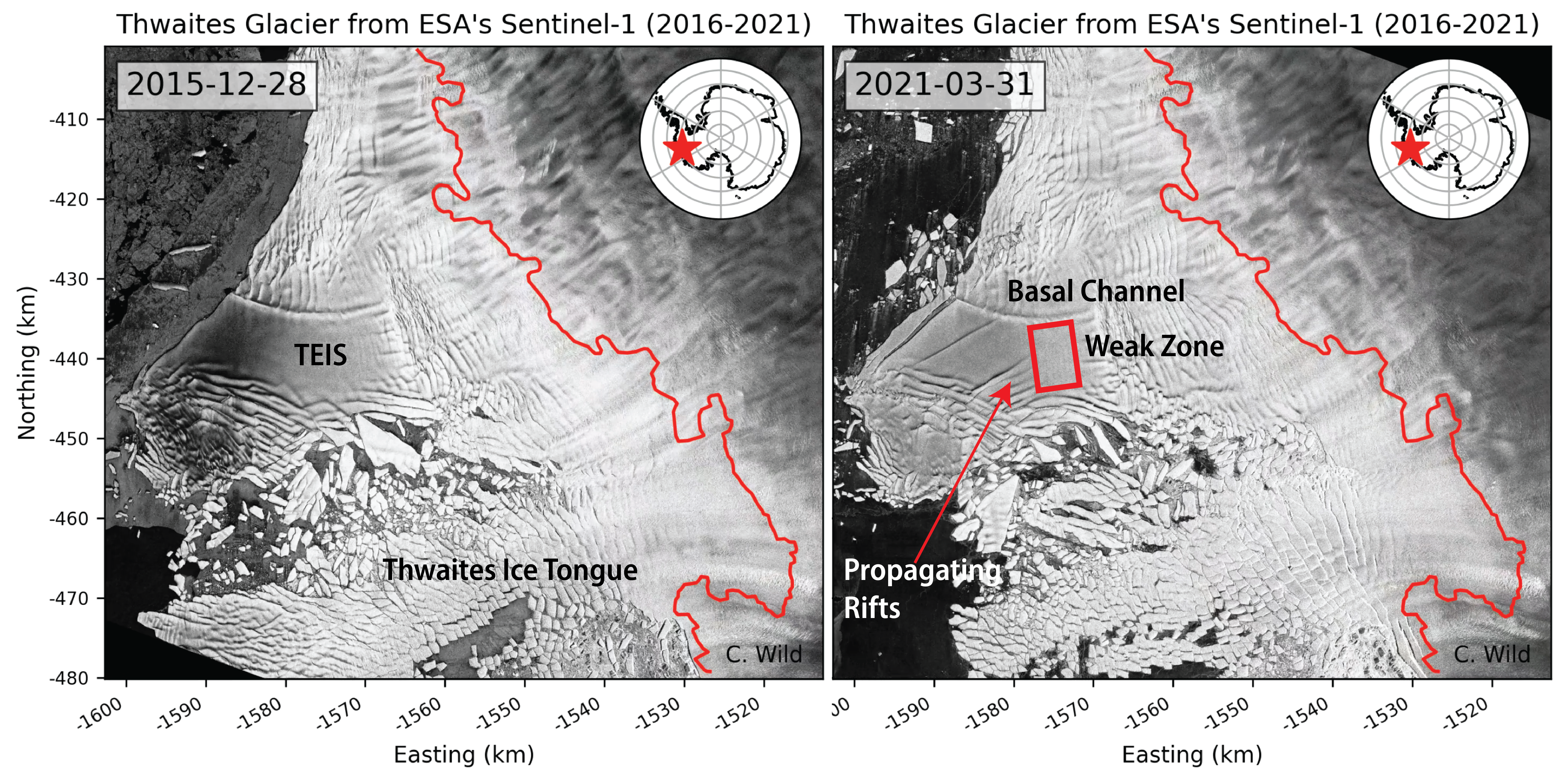
An alarming crackup has begun at the foot of Antarctica’s vulnerable Thwaites Glacier, whose meltwater is already responsible for about 4% of global sea level rise. An ice sheet the size of Florida, Thwaites ends its slide into the ocean as a floating ledge of ice 45 kilometers wide. But now, this ice shelf, riven by newly detected fissures on its surface and underside, is likely to break apart in the next 5 years or so, scientists reported today at a meeting of the American Geophysical Union.

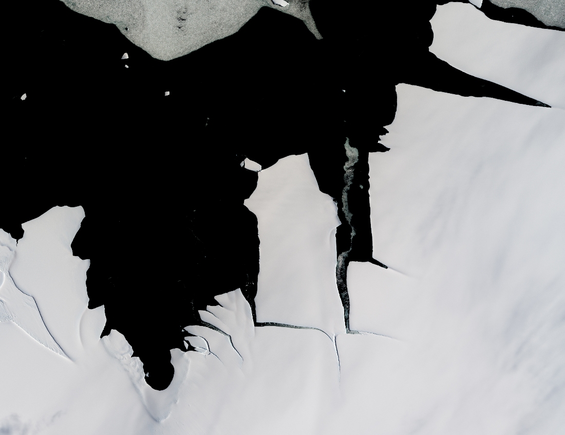
The most dramatic sign of impending failure is a set of diagonal fractures that nearly span the entire shelf. Last month, satellites spotted accelerating movement of ice along the fractures, says Erin Pettit, a glaciologist at Oregon State University, Corvallis, who is part of a multiyear expedition studying the glacier. The shelf is a bit like a windshield with a series of slowly opening cracks, she says. “You’re like, I should get a new windshield. And one day, bang—there are a million other cracks there.”

Here’s an image from the AGU abstract to illustrate the “cracks” Erin referred to:

Image: Christian Wild, Oregon State University

Once the ice shelf shatters, large sections of the glacier now restrained by it are likely to speed up, says Ted Scambos, a glaciologist at the University of Colorado, Boulder, and a leader of the Thwaites expedition. In a worst case, this part of Thwaites could triple in speed, increasing the glacier’s contribution to global sea level in the short term to 5%, Pettit says.

Here is the AGU press conference that caused all the excitement:


New Antarctic Sea Ice Resources

In the Arctic the refreeze is slowing down as the March maximum extent approaches. Meanwhile in the southern hemisphere Antarctic sea ice extent has taken a tumble as the annual minimum extent approaches.

Over the long cold Arctic winter “Wipneus” of ArctischePinguin fame has been porting his northern hemisphere regional sea ice area/extent methodology to cover the South Pole as well. We are pleased to be able to reveal the fruits of his labours on our new regional Antarctic Sea Ice Graphs page. The ultimate source of the information is the University of Hamburg’s sea ice concentration data based on a 3.125 km grid that uses data from the from the AMSR2  instrument on board the Japan Aerospace Exploration Agency’s SHIZUKU satellite. Here’s an overview of Antarctic sea ice area:

2015-02-07-Ant-Area and here’s a close up on the sea ice extent in the Bellingshausen and Amundsen Seas region, where what sea ice there is helps buttress the West Antarctic Ice Sheet:

2015-02-07-West-Extent

In future we will also be bringing you satellite images from Antarctica. By way of example, here’s the latest “Shock News!!!” from the Antarctic, courtesy of LandSat 8:

I
NASA report that:

While large icebergs calve regularly from fast-flowing ice shelves in West Antarctica, the coast of cooler, drier East Antarctica tends to be less active. That made it a mild surprise when a 70-square-kilometer chunk of ice broke off from the King Baudouin Ice Shelf in January 2015. The last time that part of King Baudouin calved such a large iceberg was in the 1960s.

and you can track the current position of the latest large chunk of ex ice shelf on their WorldView web site:

The recently calved King Baudouin Ice Shelf on February 3rd 2015

Thanks also to “Arcticio” from the Arctic Sea Ice Blog who pointed me in the direction of PolarView, where it was remarkably easy to locate this Sentinel-1A synthetic aperture radar image of the large iceberg in question on January 30th 2015:

RoiBaudouin-600