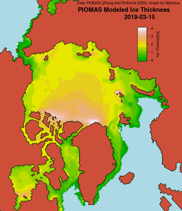
Wipneus has recently updated the mid month PIOMAS gridded thickness map, which looks like this:
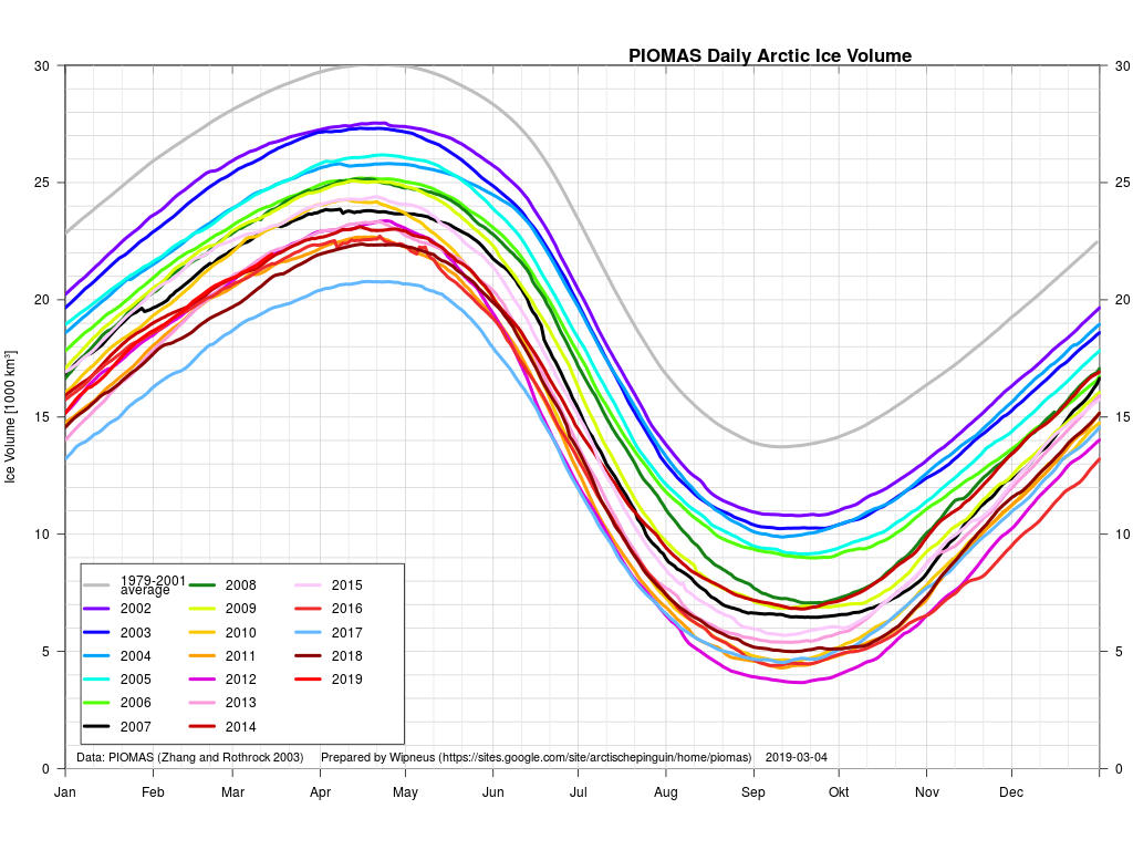
The accompanying PIOMAS volume graph currently shows 2019 in seventh place:
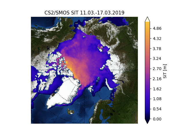
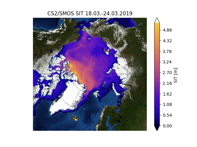
We now have a new thickness metric to peruse each month. Here’s the gridded merged CryoSat-2/SMOS thickness data from the Finnish Meteorological Institute:
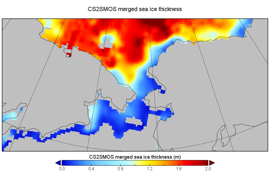
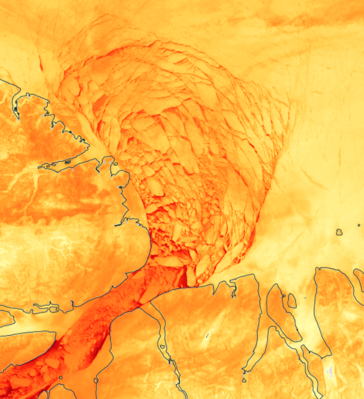
Since the FMI make the gridded data available as well as that visualisation, here’s a closer look at the Bering/Chukchi area:
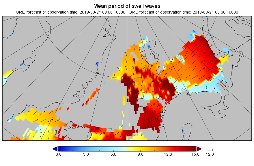
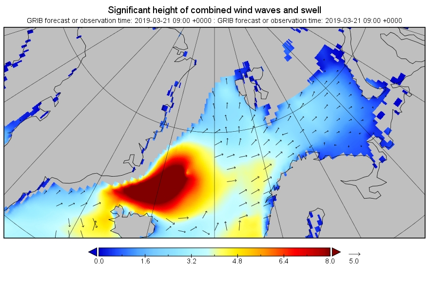
There’s an awful lot of thin ice in the region ripe for rapid melting now that the sun is shining down for a rapidly increasing number of hours per day. Over on the other side of the North Pole there’s also some significant swell forecast to hit the Atlantic edge of the Arctic ice pack. Here’s the current WaveWatch III forecast for 09:00 UTC tomorrow morning:
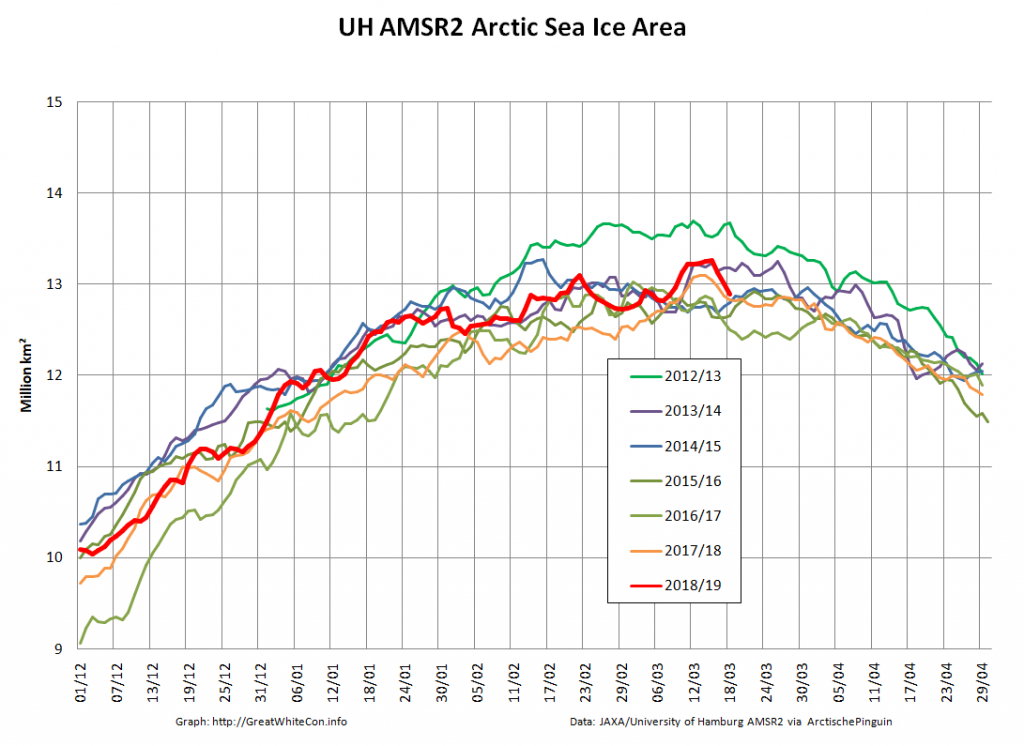
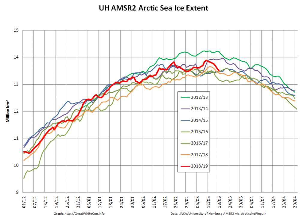
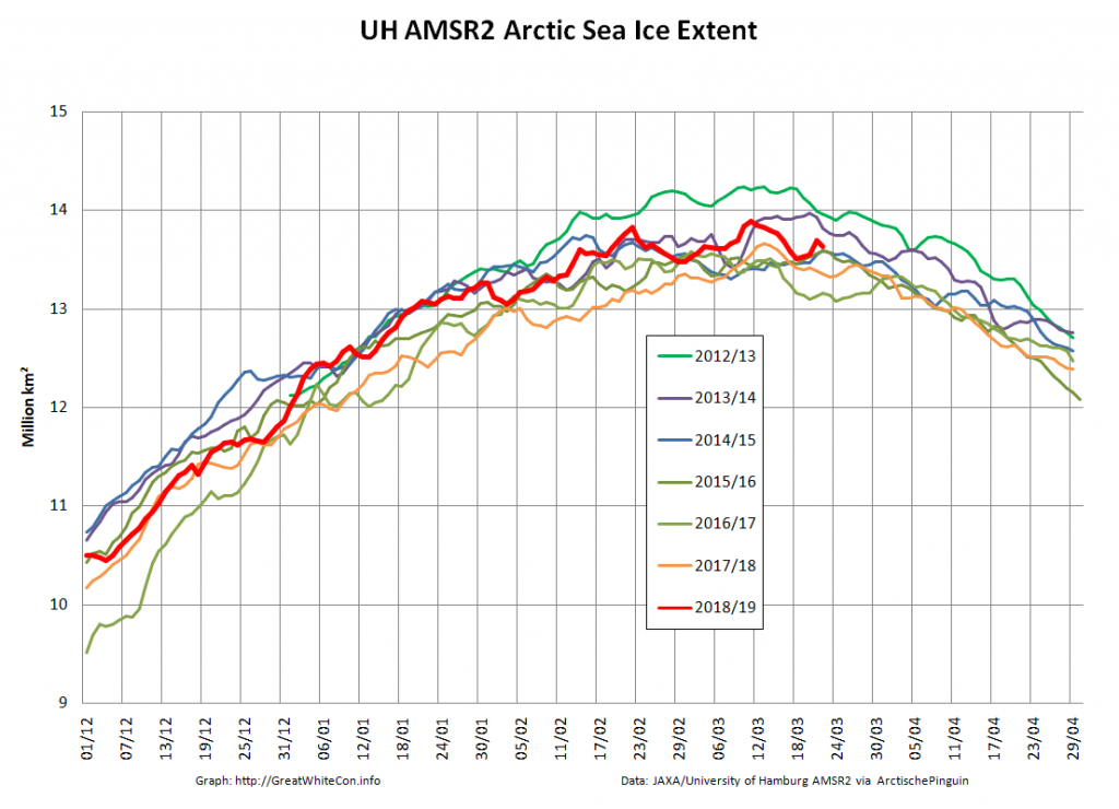
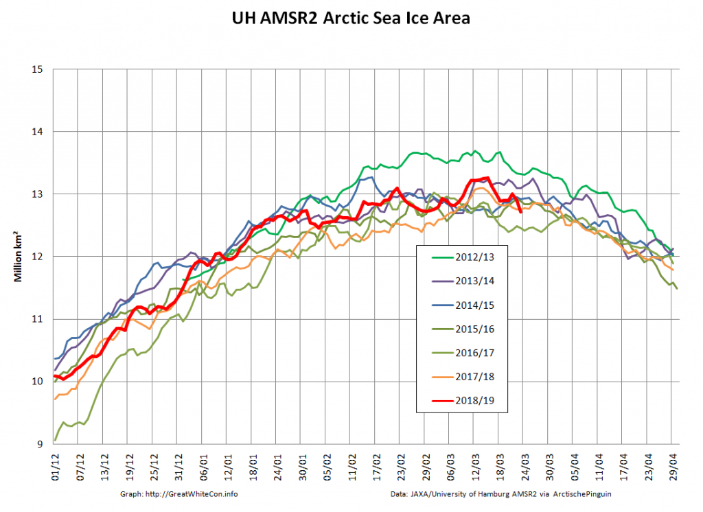
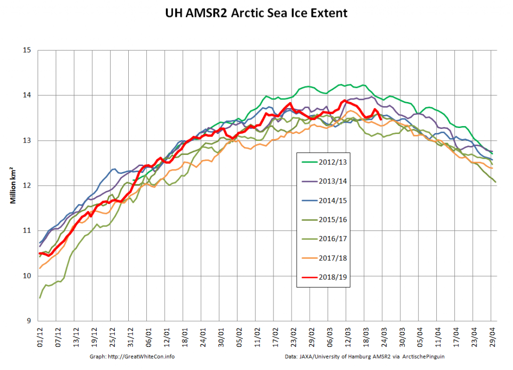
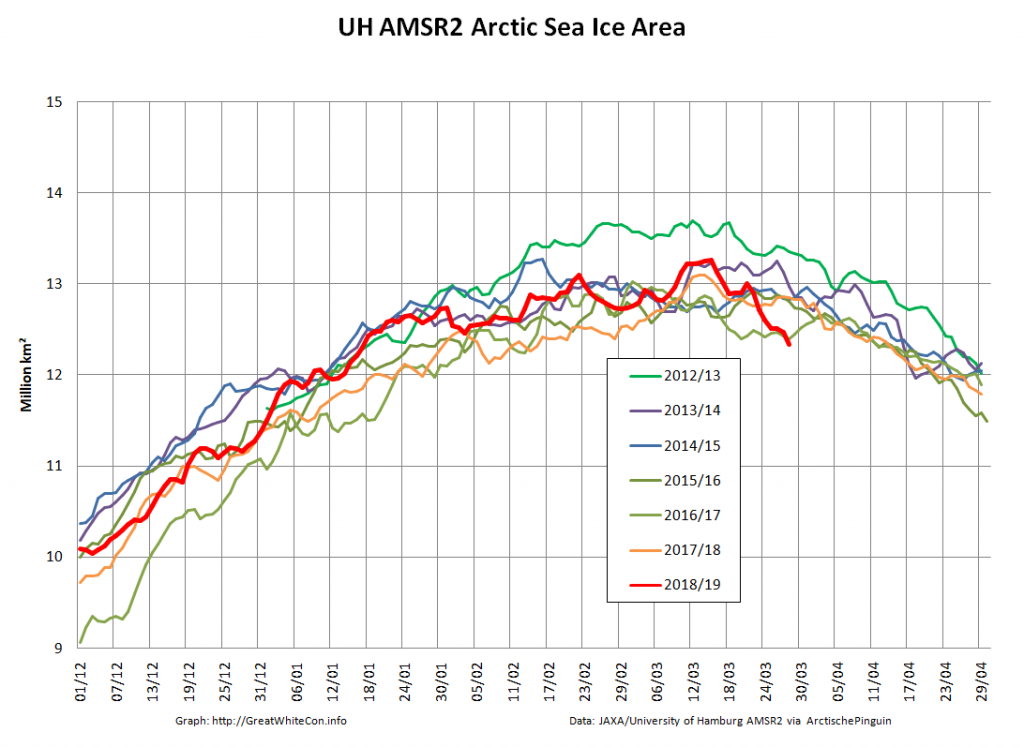
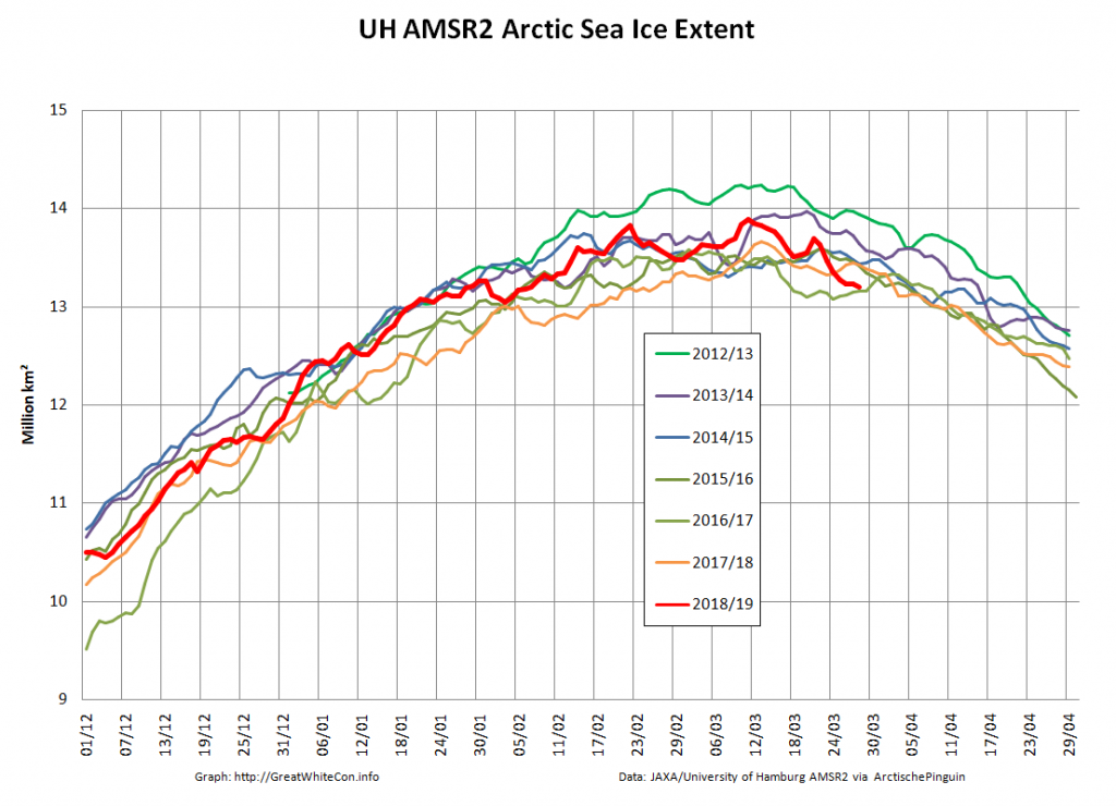
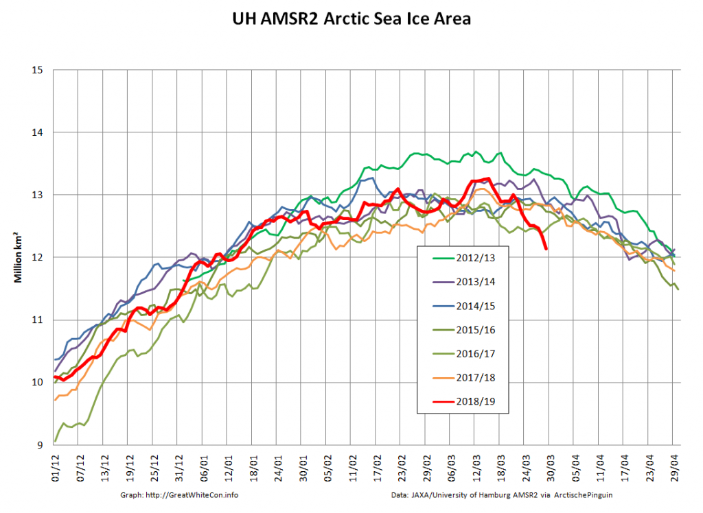
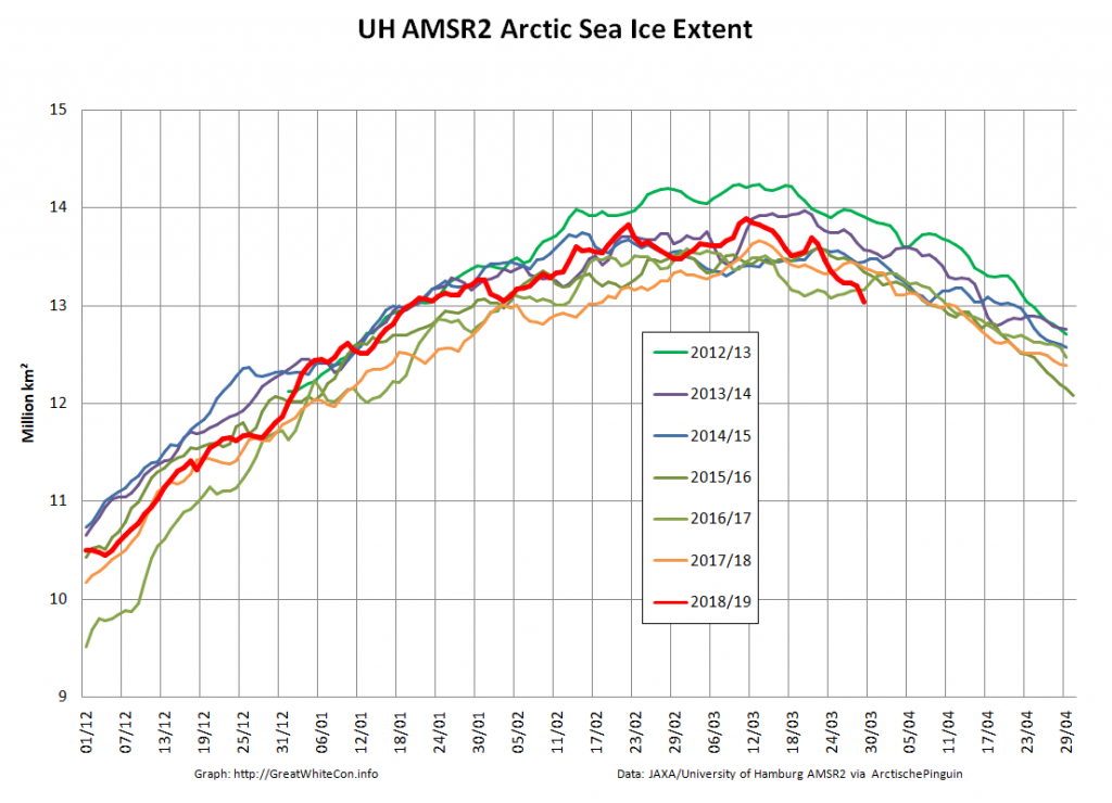
Finally, for the moment at least, here are the current Arctic wide high resolution AMSR2 sea ice area and extent graphs:
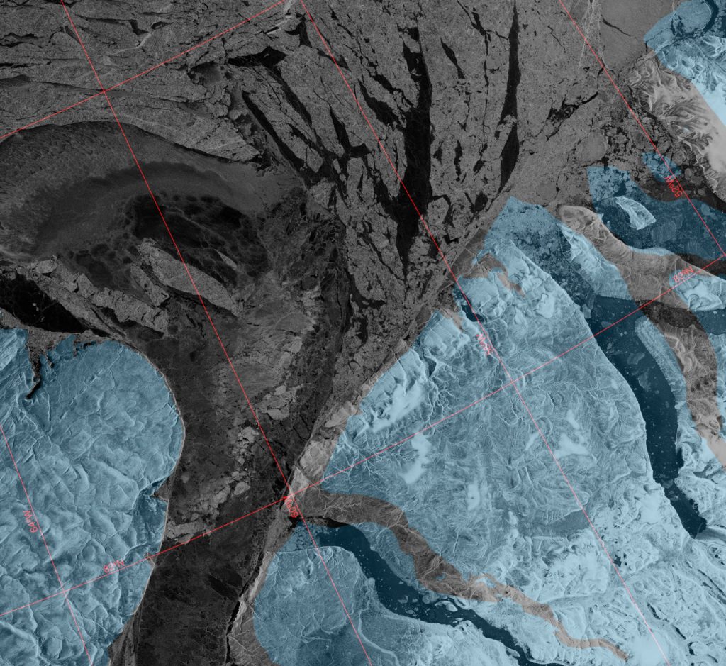
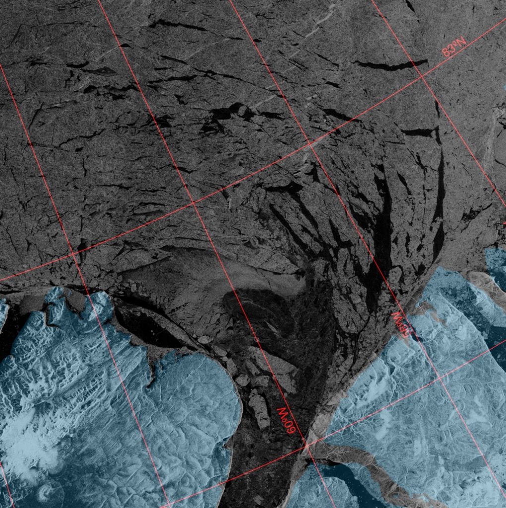
This Sentinel 1 SAR image of the Lincoln Sea from PolarView suggests that the northern arch of the Nares Strait is breaking up once again:
It is therefore conceivable that sea ice in the Lincoln Sea will continue to break up and flow south through the Nares Strait for the entire 2018/2019 winter.
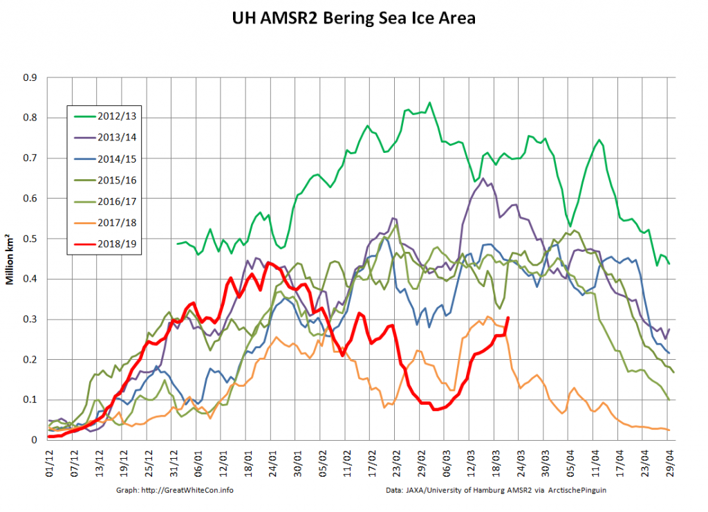
Bering Sea ice area has “rebounded” over the last few days:
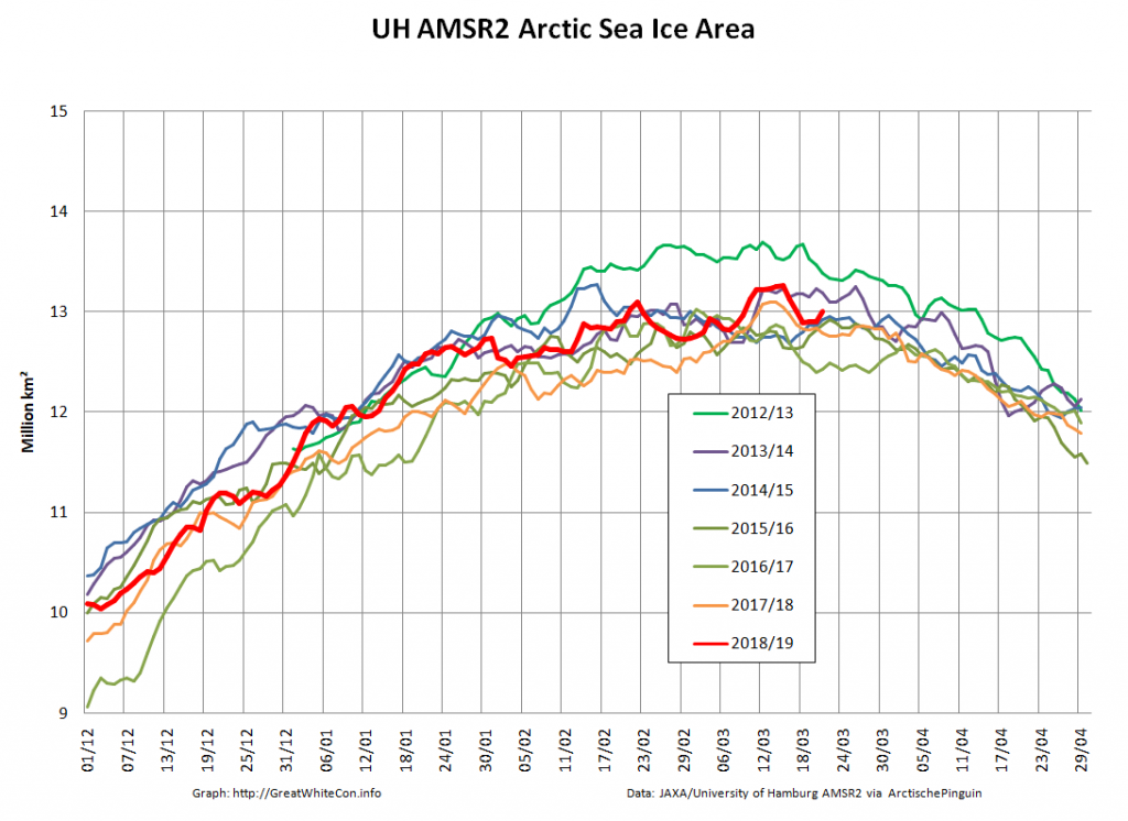
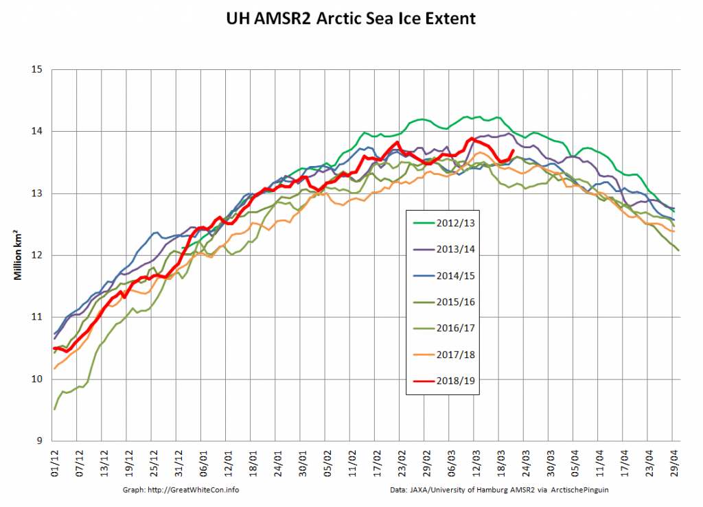
and taken the Arctic wide metrics with it:
Here’s the latest Sentinel 1 SAR image of the Lincoln Sea and northern Nares Strait:
The “rebound” has reversed:
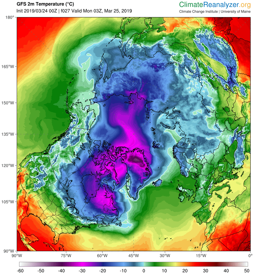
With temperatures above freezing point across the Bering and Chukchi Sea forecast for tomorrow morning expect the decline in Arctic sea ice extent to accelerate:
There was a 162k decline in high resolution extent yesterday:
Here also is the current state of the thick sea ice exiting the Lincoln Sea via the Nares Strait:
Here’s another week’s merged CryoSat-2/SMOS thickness data from the Finnish Meteorological Institute:
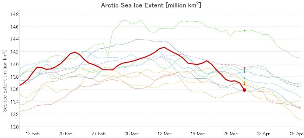
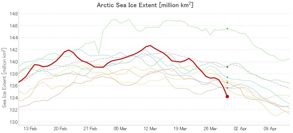
We’re still waiting for Wipneus’ Raspberry Pi to crunch the high resolution AMSR2 numbers, but here’s the latest from JAXA:
2019 currently in 3rd place by a whisker.
P.S. The high resolution AMSR2 numbers are out:
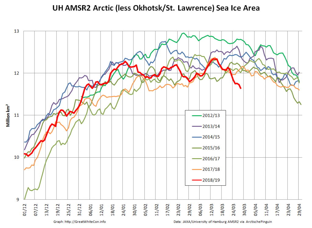
Area is certainly lowest for the date in the AMSR2 era. Extent will almost certainly achieve that status tomorrow. Excluding the two most peripheral seas reveals perhaps an even more worrying picture?
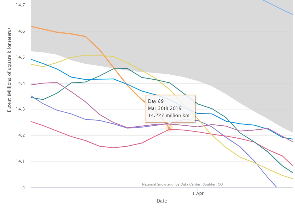
Arctic sea ice coverage is now firmly in the “lowest extent for the date in the satellite record” category, whichever metric you care to choose:
The NSIDC 5 day average is in a “statistical tie” for first place with 2017:
Hot off the TCD presses, a new paper on Arctic sea ice age from Mark Tschudi, Walt Meier, and Scott Stewart:
https://www.the-cryosphere-discuss.net/tc-2019-40/
“A new version of the sea ice motion and age products distributed at the National Snow and Ice Data Center’s NASA Snow and Ice Distributed Active Archive Center has been developed. The new version, 4.0, includes several significant upgrades in processing, corrects known issues with the previous version, and updates the time series through 2018, with regular updates planned for the future.”
Excellent, I have always been, as in, most heinously dood- interested in the multi-year-sea-ice as king of all indicators.
Still not sure if it is or not but it must be in the top ten!!
Oh, and MORE updates coming: what could be grander I ask ya?
This is getting to be a habit! Another >100k drop in both area and extent:
Currently the sea ice on the Atlantic periphery of the Arctic seem to be in a steady decline:
The swift decline continues, albeit with a “mere” 80k loss in extent today:
That makes a total of 425k over the last four days.
I was just calculating from the NSIDC site. The extent on March 27 shows 14.392 sq km. If we get the same loss as 2012 from March 27 to Sept 19 (11.763 sq km) We will arrive this year at 2.629 million sq km at minimum. That is quite realistic we already dropped by that amount in 2012, there seems no reason why this…and more…cannot happen this year.
I agree that there is no reason why your projection cannot happen this year.
However there is certainly no guarantee that it will happen this year!
If 2012 is parallel to this year, we will end, according to NSIDC data, with 2.629 million sq km. This is calculated from March 27 to Sept 19.
[I suspect this a duplicate due to our “moderation of all new commenters” policy? Mod]
The extent decline continues, albeit at a much reduced rate. The JAXA metric is closing in on 3rd place in the “lowest for the date in the satellite record” stakes:
Jim,
I published on Wednesday my speculation* that 2019 might be the earliest year on record to peak for Year–To–Date average sea ice extent. Then on Friday this came to fruition: The first ever such peak in March. The runners up are: 2007 (Apr 1), 2015 (Apr 3) and 2016 (Apr 3).
What does this mean? Well, it obviously means 2019 is having an explosive start to the Melt Season. The rest of the consequences, if any, I leave to more qualified experts!
*) https://frozen.earth/2019/03/year-to-date-average-sea-ice-extent-7/
Do you think that January 1st is a particularly significant point in the annual cycle of Arctic sea ice freeze and melt?
Wouldn’t it make more sense to start from the date of minimum extent for example, or if that strikes you as too variable how about the autumnal equinox?
Your question misses the point. It is a feat to peak before April in this particular graph, because it has never happened before.
And besides, January 1st is a natural break–off point for 2019 and similar calendar years. We often think about the year ending on December 31st, and the new year beginning on January 1st. At least that’s the conventional wisdom in Greenland.
If you don’t know what such a record early peak means, at least have the humility to say so, or ask other what it means. Suggesting that nothing starts on January 1st is just ludicrous!
Jim, are you (and Twitter) aware that NSIDC now shows Artic Sea Ice Extent to be below the 2 standard deviation mark?
Strangely enough, yes. Although Snow White phrased it rather differently:
Also, how rare is it to get a loss of 425k in four days at this time of year?
I must admit that I haven’t been through the long term records with the proverbial fine tooth comb as yet, but my ageing memory thinks it’s extremely rare.
If Jim said it I say, “……man the boats!!”