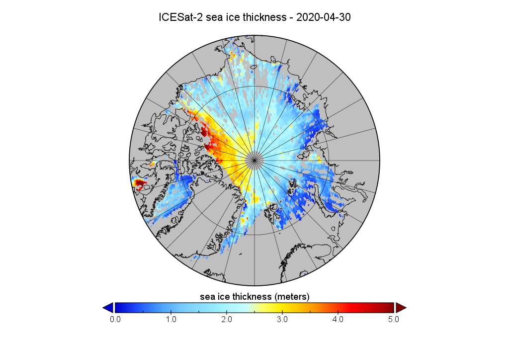
It’s been a long wait since NASA launched the ICESat-2 satellite in September 2018:
However some good news has arrived at long last! ICESat-2 level 4 monthly gridded Arctic sea ice thickness data is now available for download via the NSIDC:
https://nsidc.org/data/IS2SITMOGR4
Now for the bad news. Currently it’s only available from 1 November 2018 to 30 April 2020 . There also seems to be an absence of data in summer, just like CryoSat-2.
Here is my first visualisation of the most recent data, for April 2020:

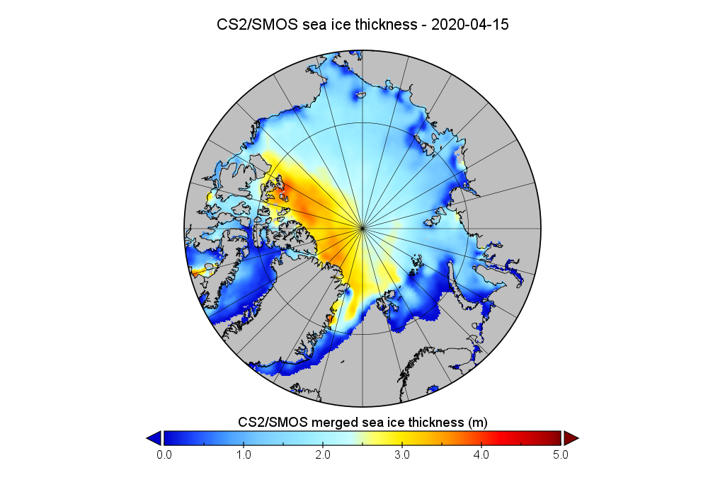
Here is the equivalent from AWI’s CryoSat-2/SMOS gridded thickness product for comparison purposes:

Dear Great White Contrarian,
I believe (as a matter of fact, I believe because there are plenty scientific papers about the following subjects),
but as a matter of fact, it may indeed be my myopic perception in this case
but a clue!
May it not be many measurements on ice thickness are not
automatically converted to `water’ readings?
There is enough evidence confirming that may be the case IMHO. Satellite measures, including photographs, are not to blame but human interference (a.k.a bias) with plain data.
Hello again Mountaineer,
I’m not sure that I understand what you’re getting at. What are the “water readings” that you mention?
You also seem to be implying that this sort of “satellite photograph” is a fabrication?
Or have I misunderstood something?
Mountaineer says:
“Satellite measures, including photographs, are not to blame but human interference (a.k.a bias) with plain data.”
It’s almost inevitable a science denier will broach the “dishonesty” excuse for doing nothing about AGW. But who knows? An alternative may be for the denier to actually acknowledge refutation of a statement they’ve made, but that is extremely rare.
Pigs might fly?