No is the obvious answer just at the moment, since the plucky little yacht is currently parked at a pontoon in Tuktoyaktuk. However actual facts aren’t sufficient to stop Tony Heller suggesting that Andrew Freedman suggested on Mashable that Mark Serreze of the NSIDC said that such a feat is feasible:
Mark “Arctic Is Screaming” Serreze says the Ship of Fools could sail to the North Pole.
Tony (AKA (m)Alice) attempts to justify his scurrilous allegation by referencing Andrew’s recent article entitled “After unusual Arctic storms, sea ice coverage in region is plummeting“. According to Andrew:
In an interview with Mashable, Serreze said sea ice coverage across the different regions of the Arctic has fallen dramatically in association with a series of unusually powerful summertime Arctic storms during August.
That much is certainly true, as we here at Great White Con have documented in detail. Mr. Heller however highlights this section of Mr. Freedman’s article:
In fact, if they want to, the Hempleman-Adams and the rest of the ship’s crew could actually sail nearly all the way to the North Pole, since sea ice cover is largely absent to about 86 degrees north, according to Mark Serreze, director of the National Snow and Ice Data Center (NSIDC) in Boulder, Colorado.
It’s not out of the question that the North Pole will become a geographical marker in open water, rather than ice cover, sometime in the next few weeks.
Serreze called this situation “pretty darned unusual.”
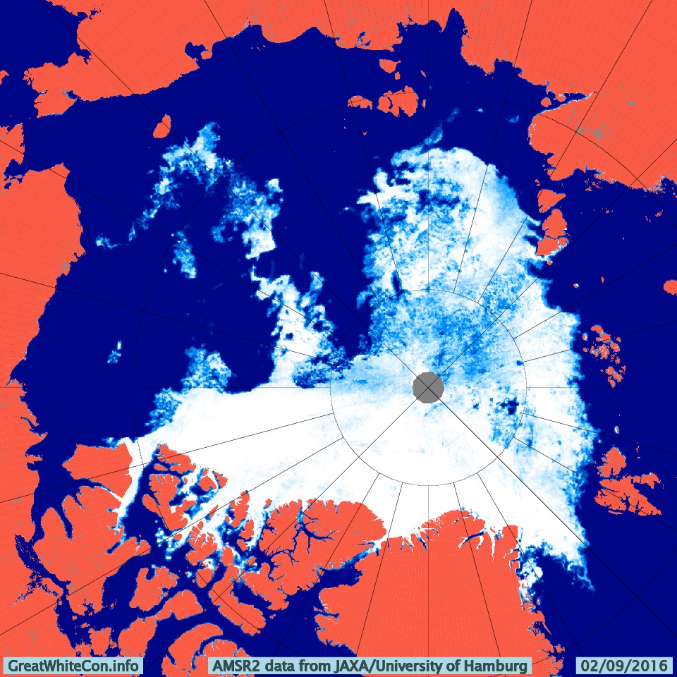
Let’s examine the facts about this “pretty darned unusual” situation shall we? Here is the latest high resolution AMSR2 visualisation of Arctic sea ice concentration:
Can you see the stretch of open water leading all the way from the East Siberian Sea, where Northabout was a couple of weeks ago, to 86 degrees north? Apparently Tony Heller and his faithful followers cannot! Not only that, but also supposedly:
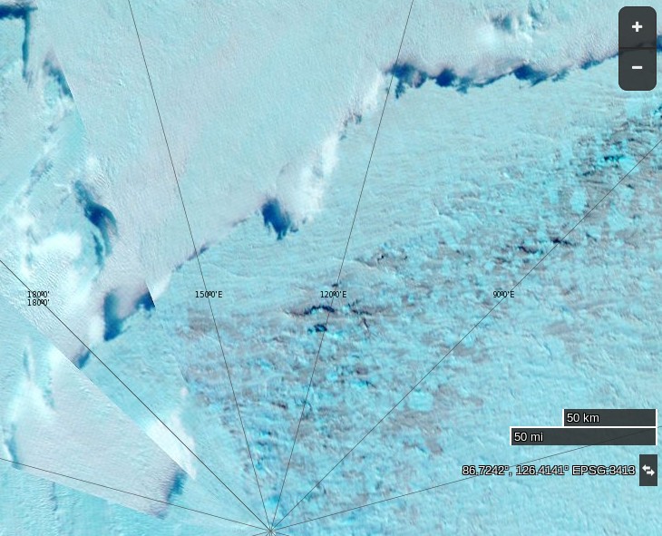
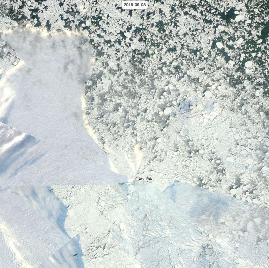
A NASA image [shows that] the North Pole is indeed encased in Thick ice right now.
Here’s a (somewhat foggy) NASA image of the North Pole right now:
and for good measure here’s a (somewhat foggy) NASA image from 86 degrees north in the Central Arctic Basin right now:
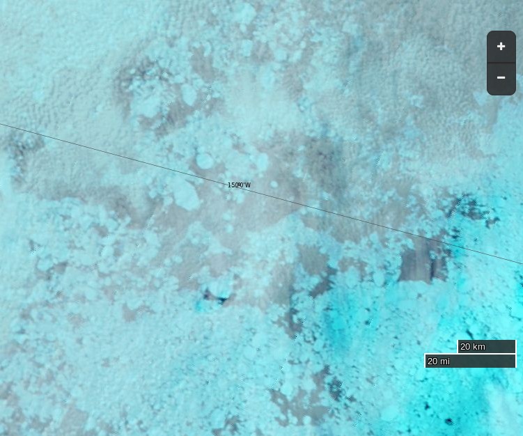
Need I say more?
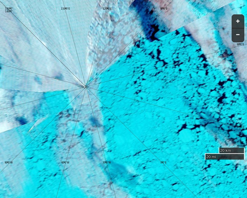
Today Terra offers a glimpse of the Greenland side of the North Pole:
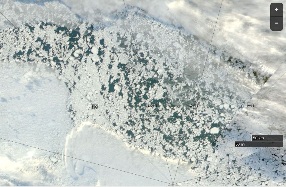
Today Aqua offers us a view of what’s left of the sea ice on the Siberian side of the North Pole:
SHOCK NEWS!!!
Tony Heller has just posted an accurate image of the state of the sea ice near the North Pole! Here it is:
The accompanying text is nonsense of course:
The Ship Of Fools is facing a -10C weather forecast in five days, which would be impassable. They better put their fossil fuel powered pedal to the metal and get out of there fast, so that they can go back to Bristol and lie about the ice.
Meanwhile, professional fraudster Mark Serreze said last week they could sail to the North Pole
Needless to say Tony doesn’t provide a link to his source. Try this one and then have a good look around on NASA Worldview.
Lord Soth on the Arctic Sea Ice Blog mentions this image of the 2016 version of Santa’s secret summer swimming pool:
Swedish icebreaker #Oden moored to ice floe at #NorthPole #CanArctic #LouisSStLaurent pic.twitter.com/5SDPbf0iTD
— Canadian Coast Guard (@CCG_GCC) August 28, 2016
you could actually swim at the north pole back in 1962.
http://navsource.org/archives/08/580/0858412u.jpg
Welcome Richard, but your point is what exactly?
Seadragon was a large nuclear powered submarine, not a small wind powered (+ diesel) yacht. Needless to say it travelled under the sea ice, not through it.
Perhaps some people live in a world in which neither polynyas nor submarine mounted upward looking sonar exist?
https://en.wikipedia.org/wiki/Polynya
Of possible interest in the above link is the following… “When submarines of the U.S. Navy made expeditions to the North Pole in the 1950s and 60s, there was a significant concern about surfacing through the thick pack ice of the Arctic Ocean. In 1962, both the USS Skate and USS Seadragon surfaced within the same, large polynya near the North Pole, for the first polar rendezvous of the U.S. Atlantic Fleet and the U.S. Pacific Fleet.”
Of course, there is also the following Journal of Geophysical Research publication…
http://onlinelibrary.wiley.com/doi/10.1029/2007JC004252/full
The opening sentence of this article reads as follows…
“Naval submarines have collected operational data of sea-ice draft (93% of thickness) in the Arctic Ocean since 1958.”
Needless to say, but I’ll say it anyway, the National Snow and Ice Data Centre also hold publicly available data sets. These can be accessed through the following portal…
http://nsidc.org/data/docs/noaa/g01360_upward_looking_sonar/
The summary on the above link begins as follows…
“This data set consists of upward looking sonar draft data collected by submarines in the Arctic Ocean. It includes data from both U.S. Navy and Royal Navy submarines. Maps showing submarine tracks are available. Data are provided as ice draft profiles and as statistics derived from the profile data. Statistics files include information concerning ice draft characteristics, keels, level ice, leads, undeformed and deformed ice.”
However, why bother with inconvenient facts?
The Northabout is heading east of Tuk as we speak for Cambridge Bay (the same route of the Crystal Serenity). Just how would it be possible for them to whip a huey and motor/sail back up and around at this late date? They’ve already noted the water temps are dropping. They’ll be fortunate not to get stranded. They’ve done yeoman’s works to make it this far and there’s much work to do. As they’ve noted “ice free” is not always “ice free”.
It’s not possible Gonzo. See the first word of the article above. It is in actual fact merely a straw man constructed by Mr. Heller.
However it will be very interesting, to me at least, to watch the race between the disintegrating ice near the Pole and the impending freeze up.
An interesting article from Runa Skarbø on the difficulties of steering the icebreaker Oden to the North Pole:
Here is Oden’s live tracking map at the moment: