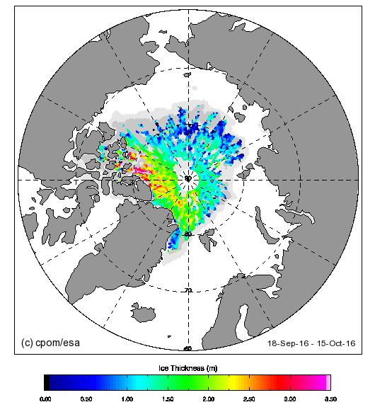
CryoSat-2 has burst back into life after its summer break. Here is what it reveals about Arctic sea ice thickness at the moment:
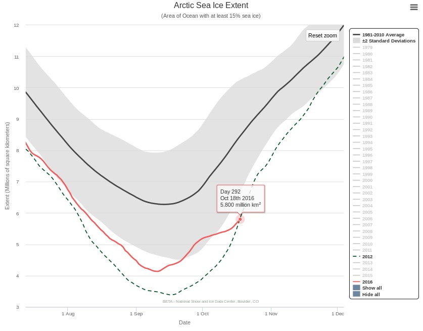
Perhaps not entirely coincidentally, the NSIDC 5 day average Arctic sea ice extent is once again less than on the same day of 2012, the year of the “record melt”:


JAXA’s AMSR2 based metric confirms that for this time of year 2016 Arctic sea ice extent is well below all previous years in the satellite record:
The October 24th 2016 JAXA extent is 6.6 million km². All previous years are over 7 million km².
Hey, Jim, in case you didn’t see this one, Wunderground’s Category 6™ has a relevant post:
Sea Ice Extent Is Near Record Lows–South as Well as North
https://www.wunderground.com/blog/JeffMasters/sea-ice-extent-is-near-record-lowssouth-as-well-as-north
Thanks Jim. I have been following the Antarctic too, and patiently waiting for an all time low for the date :
Whilst all the metrics are well below recent years, the NSIDC 5 day averaged Antarctic sea ice extent is tracking just above 1986 at the moment. However the raw daily number did hit an all time low for the date (since satellite records began!) on October 26th:
Daily NSIDC Antarctic sea ice extent is once again “lowest ever” for November 3rd, at 16.29 million km².
Meanwhile back in the Arctic sea ice area on both the Atlantic and Pacific sides is still remarkably low for the time of year: