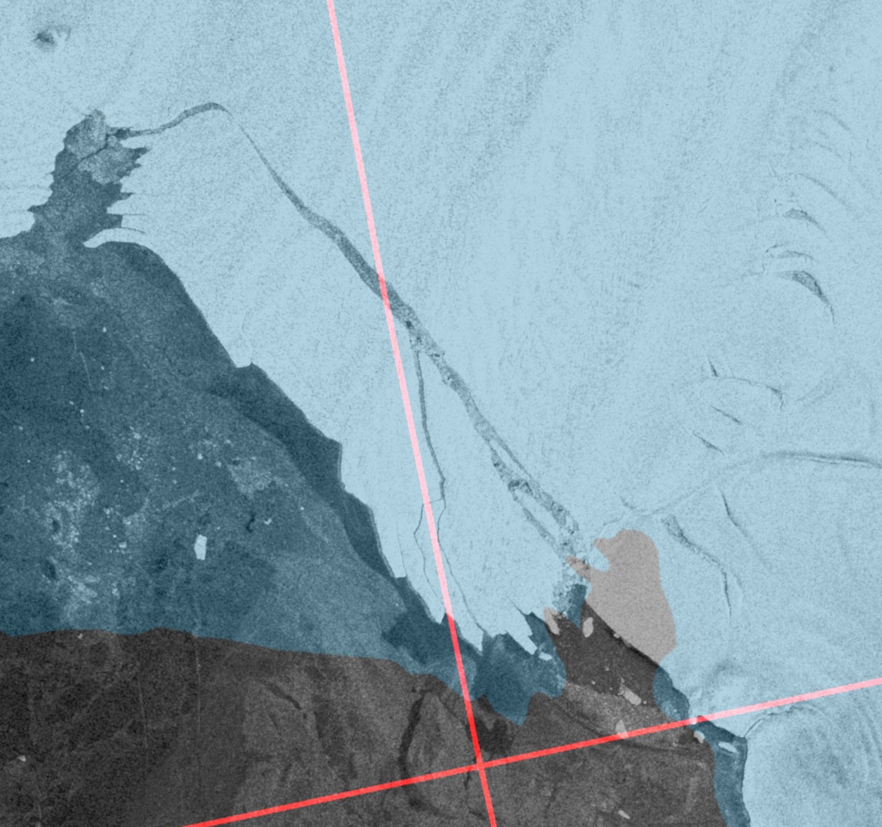
An image captured earlier this morning by the Sentinel 1A satellite’s synthetic aperture radar reveals that another huge chunk of the Pine Island Glacier in Antarctica has broken loose:
P.S. Here’s an animation of the calving courtesy of Wipneus:
Via Stef Lhermitte on Twitter:
.@NASAEarth 's MODIS satellite gives an overview of #PIG's glacier front location since 2009 + corresponding 3 major calving locations 7/n pic.twitter.com/miP1RAUCBF
— Stef Lhermitte (@StefLhermitte) September 24, 2017
The latest image from Sentinel 1A:
Click it for a much closer look.
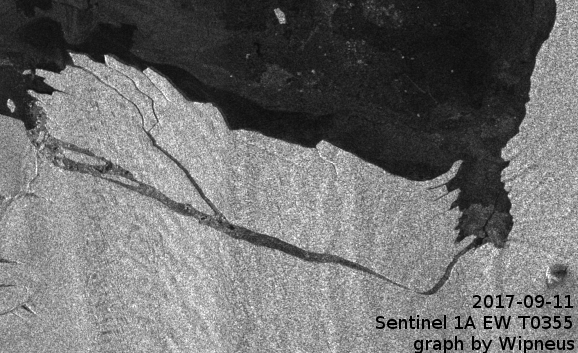
Another animation from Wipneus, showing the recently calved section of the Pine Island Glacier coming apart at the seams:
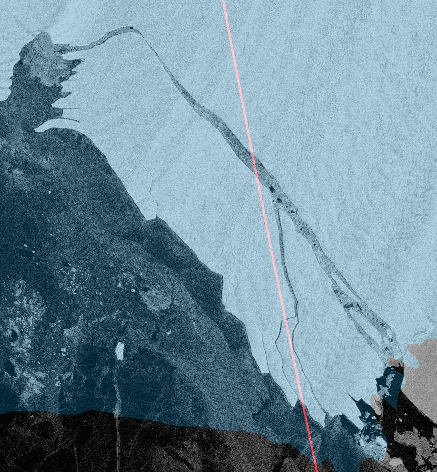
Another revealing image from Wipneus via the Arctic Sea Ice Forum:
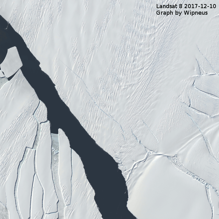
New cracks are opening on the Pine Island Ice Shelf.
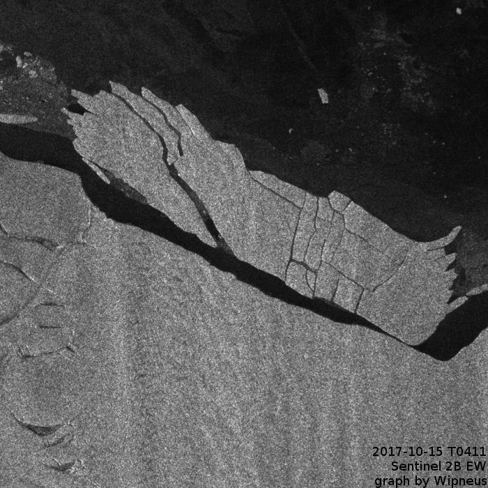
Via Susan Anderson at the Arctic Sea Ice Forum:
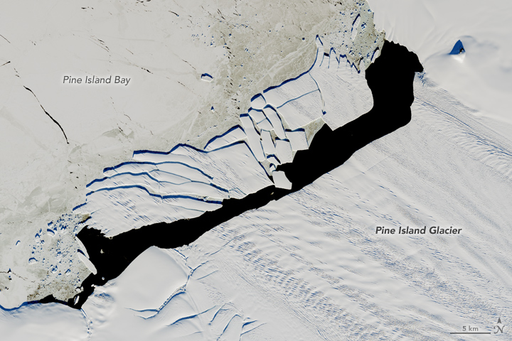
In September 2017, a new iceberg calved from Pine Island Glacier—one of the main outlets where the West Antarctic Ice Sheet flows into the ocean. Just weeks later, the berg named B-44 shattered into more than 20 fragments.
On December 15, 2017, the Operational Land Imager (OLI) on Landsat 8 acquired this natural-color image of the broken berg. An area of relatively warm water, known as a polyna, has kept the water ice free between the iceberg chunks and the glacier front. NASA glaciologist Chris Shuman thinks the polynya’s warm water could have caused the rapid breakup of B-44.
The image was acquired near midnight local time. Based on parameters including the azimuth of the Sun and its elevation above the horizon, as well as the length of the shadows, Shuman has estimated that the iceberg rises about 49 meters above the water line. That would put the total thickness of the berg—above and below the water surface—at about 315 meters.
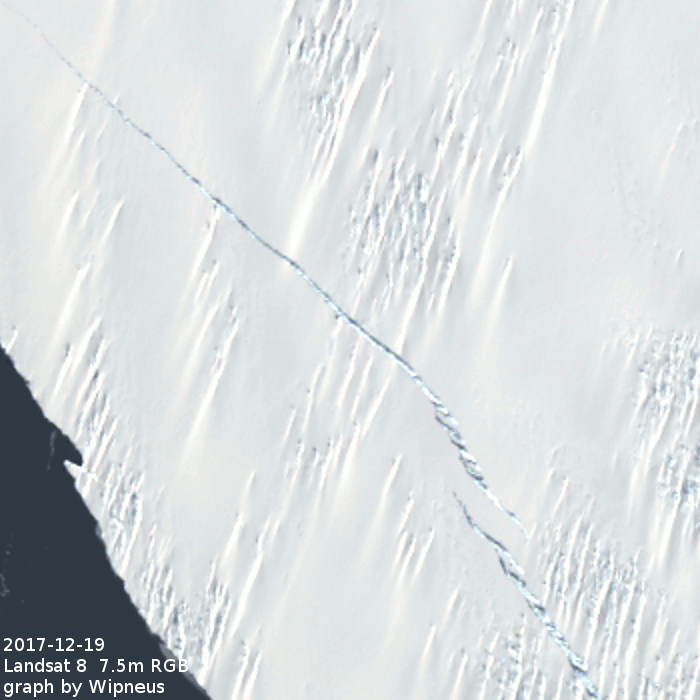
Another graphic Landsat PIG GIF from Wipneus on the ASIF:
So it was not a large calving when compared to 2015 and 2013?
The ready splintering of the PigBerg could be an indication of the fragility of the glacier stream adjacent to the grid break up area?
This one certainly seems to have fallen to bits with much greater alacrity than previous calvings!
What does alacrity mean?
http://www.dictionary.com/browse/alacrity
Much greater briskness?
Wow, now that sounds like my kind of word!
Merry Christmas, Jim, and to the others who post here!
Obviously as it fractures it will melt quicker….what is the projected direction of movement into the Arctic Ocean and how will it disturb the circular ocean current
Sorry uhum
The Anttartic
Circular current
My guess is it won’t disturb the current one bit!
The only way you could say it disturbs the current is if the air above it is disturbed!
Otherwise I say it will prove to have next to, if not exactly, nil effect on the current!
-20 in Michigan
Raining cats and dogs in Longyearbyen:
https://greatWhiteCon.info/2018/01/the-january-2018-fram-strait-cyclones/