We have gathered together a wide variety of images, videos, graphs and maps that are not easily available elsewhere. There’s also a section devoted to following the various buoys dotted across the Arctic ocean gathering scientific data. Together they help to “put the Arctic sea ice record straight”.
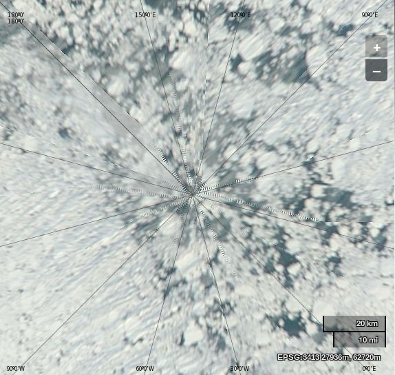
There are lots of satellite images so that you can see what has been happening in the Arctic with your own eyes. We recommend starting with this one:

If anyone can find a satellite image of the North Pole from any year before 2013 in which the sea ice is similarly fragmented please let us know straight away!
2010, Jim! 😉
I’ve added this great Resources section of your blog to the links at the top of the Arctic Sea Ice Graphs homepage.
Thanks very much for your kind words Neven, as well as for the link and the evidence from 2010. I’ve taken the liberty of reproducing your MODIS image:
I still reckon the sea ice near Santa’s Secret Summer Swimming Pool (and hence the Great White Con Ivory Towers) was more fragmented in 2013 than in 2010, but I am more than willing to discuss the matter further!
On the issue of the “jagged graph” of Barrow IMB temperature profile I have tried to contact UAF through the contact email adress on that page
http://seaice.alaska.edu/gi/observatories/barrow_sealevel
but the adress seems not to be opperational, do you know of a way to draw the issue to the attention of people (it says the graphs are generated automatically they may not be aware something is wrong)
I’ve communicated with the CRREL and ONR folks before, but never SIZONet. Based on the information on their home page I would try and get in touch with this guy.
I lived in Nome, Alaska until 1981. I’m interested in ice photos from the winter of 1970, thanks.
That’s before the “satellite era” Jim!
Do you have any suggestions about where to start looking for such images?
Uh, weather satellites were going up before 1970.
The TIROS-1 spacecraft, launched on April 1, 1960 as part of NASA’s TIROS (Television Infrared Observation Satellite) Program, sent back the first television footage of weather patterns to be taken from space.
Hi Wolfgang,
Jim Wilke’s query wasn’t very specific, but as far as we’re concerned the first satellite capable of “imaging” Arctic sea ice during the long winter night was Nimbus 5, which carried an Electrically Scanning Microwave Radiometer:
https://en.wikipedia.org/wiki/Electrically_scanning_microwave_radiometer
and launched in December 1972.